More like 'Interview with Josephine Chow by Denise Fong February 7, 2020'
Narrow Results By
Decade
- 2020s 148
- 2010s 111
- 2000s 1066
- 1990s 635
- 1980s 568
- 1970s 1373
- 1960s 427
- 1950s 621
- 1940s 595
- 1930s 523
- 1920s 542
- 1910s 543
- 1900s 262
- 1890s 46
- 1880s 52
- 1870s 6
- 1860s 3
- 1850s 1
- 1840s 1
- 1830s 2
- 1820s 1
- 1810s 1
- 1800s 1
- 1790s 1
- 1780s 1
- 1770s 1
- 1760s 1
- 1750s 1
- 1740s 1
- 1730s 1
- 1720s 1
- 1710s 1
- 1700s 1
- 1690s 1
- 1680s 1
- 1670s 1
- 1660s 1
- 1650s 1
- 1640s 1
- 1630s 1
- 1620s 1
- 1610s 1
- 1600s 1
Subject
- Academic Disciplines 1
- Accidents - Automobile Accidents 1
- Adornment 19
- Adornment - Jewelry 1
- Adornment - Lapel Pins 17
- Advertising Medium 14
- Advertising Medium - Business Cards 1
- Advertising Medium - Poster 1
- Advertising Medium - Signs and Signboards 106
- Aerial Photographs 28
- Agricultural Tools and Equipment 19
- Agricultural Tools and Equipment - Gardening Equipment 1
Creator
- Aero Surveys Limited 1
- Allan Studios 6
- Asbia, Cher 4
- Ashwell, Reg, 1921-2010 1
- Associated Factory Mutual Fire Insurance Cos 1
- Association for Living Historical Farms and Agricultural Museums, U.S.A. 1
- Association for Living History, Farm and Agricultural Museums 5
- Atkinson, J. 1
- Aujla, Kehar Singh 1
- Barman, Jean, 1939- 2
- Barrowclough, G.A. 1
- Barrowclough, George Alfred 1
![Survey and Subdivision plans in New Westminster District Group 1 & Group 2 - Burnaby, Port Moody, Coquitlam, Mission and Map of Port Simpson Harbour, [190-] thumbnail](/media/hpo/_Data/_BVM_Cartographic_Material/1977/1977_0093_0111_001.jpg?width=280)
Survey and Subdivision plans in New Westminster District Group 1 & Group 2 - Burnaby, Port Moody, Coquitlam, Mission and Map of Port Simpson Harbour
https://search.heritageburnaby.ca/link/museumdescription7080
- Repository
- Burnaby Village Museum
- Date
- [190-]
- Collection/Fonds
- Burnaby Village Museum Map collection
- Description Level
- File
- Physical Description
- 9 plans : 3 plans : blueprint ink on paper + 4 plans : black ink and graphite on linen + 2 plans : graphite on paper mounted on 2 sides of cardboard 76 x 102 cm
- Scope and Content
- File consists of a large board with five plans in New Westminster District, Group 1 mounted on one side and three plans in New Westminster District, Group 1 and a map of Port Simpson Harbour mounted on the other side. Side A: 1. Plan: blueprint on paper ; 30 x 20 cm. Title reads: "Plan of / Subdi…
- Repository
- Burnaby Village Museum
- Collection/Fonds
- Burnaby Village Museum Map collection
- Description Level
- File
- Physical Description
- 9 plans : 3 plans : blueprint ink on paper + 4 plans : black ink and graphite on linen + 2 plans : graphite on paper mounted on 2 sides of cardboard 76 x 102 cm
- Material Details
- Scales vary (One chain equals 792 inches)
- Indexed number on tape on edge of board reads "111"
- Scope and Content
- File consists of a large board with five plans in New Westminster District, Group 1 mounted on one side and three plans in New Westminster District, Group 1 and a map of Port Simpson Harbour mounted on the other side. Side A: 1. Plan: blueprint on paper ; 30 x 20 cm. Title reads: "Plan of / Subdivision of Part of D.L.172.GR.I.N.W.D." Scale: 200 feet = 1inch. dated, Feb.22, 1908, signed by land surveyor "Noel Humphreys" (Geographic location: District Lot 172, Burnaby) 2. Plan : graphite and blue crayon on paper ; 21.5 x 22 cm. Title in blue crayon reads: "N.E.1/4 & NW 1/4 Sec.25 / Tp 18". Scale: 10 chains=1 inch (Geographic location: Mission) 3. Plan : graphite on paper ; 31.5 x 16 cm. Title in blue crayon reads: "Lot 350_ Gr.1" with initials "RB". Scale : 3 chains = 1 inch. (Geographic location: Port Moody) 4. Plan ; graphite on linen ; 40 x 54 cm. Title in blue crayon reads: "Lot 190_Gr.1" with initials "RB". Plan covers area in Lot 190 including streets identified as; McInness Street, First Street, Second Street, Third Street, Fourth Street running through District Lot. (Geographic location: Port Moody) 5. Plan: blueprint on paper ; 50.5 x 57.5 cm. Title reads: "Plan of / T.F. Sinclair's Quarry Site. / SituateOnPittRiver.Sec.122T.P.40. / East of Coast Mer." Scale: 5 chains = 1inch. dated June 30 1908 [sic] Plan covers site of T.F. Sinclair's quarry in Section 22 of Township 40 on the shore of Pitt River. (Geographic location: Coquitlam ) Side B: 1. Map : blueprint on paper ; 50 x 38 cm. Scale: 40 chains - 1 inch. Title reads: "Map of Land on / Port Simpson Harbor". Scale : 40 chains = 1 inch Map covers subdivided land on the North Coast of British Columbia on the Tsimpsean Pennisula bordered by water identified as "Work Channel" to the west, "Port Simpson Harbour" to the east and land identified as "Indian Reserve" [Lax Kw'alaams] to the south. Names of property owners are identified in subdivided sections and area of land along the shore of "Work Channel" is identified as "Goverment Reserve". Blueprint includes inset "Key Map" with location of Port Simpson Harbour and Tsimpean Pennisula on the North Coast of British Columbia. 2. Plan : graphite on linen ; 24.5 x 46 cm. Title reads: "Portion of Lot 470 / Group 1" Scale : 2 chains = 1 inch. Plan covers a subdivided portion of District Lot 470, New Westminster District, Group 1 with streets identified as; "Pleasant Street", "Metta Street" and "Clarence Street". (Geographic location: Port Moody) 3. Plan : black ink on linen ; 40 x 30.5 cm. Title reads: "Plan / of / A Portion of the Foreshore / of / Lot 201 GR.2 / N.W.D. / Showing / Mill-Site". Scale : 100 feet = 1 inch. Plan is stamped in red ink: "Albert J. Hill, M.A., / Civil Engineer / And / Provincial Land Surveyor, / New Westminster, / B.C.". Survey notes in black ink read: "Surveyed Oct 9th 1908 for Messrs. / Roe & Abernathy and plan (duplicate / of this one) sent Oct. 8th / G.K. Burnett". (Geographic location : Port Moody) 4. Plan : black and red ink on line ; 63 x 29.5 cm. Title reads: "Port Moody / Butchard's Property". Scale : 200 feet = 1 inch. Plan covers subdivided lot into 16 parcels numbered I to XVI along the north shore of Burrard Inlet in Port Moody. Streets are identified as; George Street, Bruce Street, Norval Street, Nora Street, Elm Street, Pine Street, Orr Street and Orchard Street. Roads are identified as; West Road and East Road. (Geographic location : Port Moody)
- Creator
- Hill, Albert James
- Accession Code
- HV977.93.111
- Access Restriction
- No restrictions
- Reproduction Restriction
- No known restrictions
- Date
- [190-]
- Media Type
- Cartographic Material
- Scan Resolution
- 600
- Scan Date
- 2023-06-26
- Notes
- Title based on contents of file
Zoomable Images
![Survey and Subdivision plans in New Westminster District Group 1 & Group 2 - Burnaby, Port Moody, Coquitlam, Mission and Map of Port Simpson Harbour, [190-] thumbnail](/media/hpo/_Data/_BVM_Cartographic_Material/1977/1977_0093_0111_003_seadragon/1977_0093_0111_003.jpg?w=280)
Survey and Subdivision plans in New Westminster District Group 1 & Group 2 - Burnaby, Port Moody, Coquitlam, Mission and Map of Port Simpson Harbour, [190-]
Zoom into Image
![Survey and Subdivision plans in New Westminster District Group 1 & Group 2 - Maple Ridge, Surrey, ʷməθkʷəy̓əm (Musqueam), [190-] thumbnail](/media/hpo/_Data/_BVM_Cartographic_Material/1977/1977_0093_0082_001.jpg?width=280)
Survey and Subdivision plans in New Westminster District Group 1 & Group 2 - Maple Ridge, Surrey, ʷməθkʷəy̓əm (Musqueam)
https://search.heritageburnaby.ca/link/museumdescription7051
- Repository
- Burnaby Village Museum
- Date
- [190-]
- Collection/Fonds
- Burnaby Village Museum Map collection
- Description Level
- File
- Physical Description
- 10 plans : graphite and ink on paper and linen; various sizes mounted on 2 sides of cardboard 76 x 102 cm
- Scope and Content
- File consists of a large board with five plans in New Westminster District (Group 1 & Group 2) mounted on one side and five plans in New Westminster District (Group 2) mounted on the other side. Side A: 1.Plan : black ink on paper ; 48.5 x 33 cm. Title reads: "Plan of / The Subdivision of / The /…
- Repository
- Burnaby Village Museum
- Collection/Fonds
- Burnaby Village Museum Map collection
- Description Level
- File
- Physical Description
- 10 plans : graphite and ink on paper and linen; various sizes mounted on 2 sides of cardboard 76 x 102 cm
- Material Details
- Scales vary (One chain equals 792 inches)
- Indexed number on tape on edge of board reads "82"
- Scope and Content
- File consists of a large board with five plans in New Westminster District (Group 1 & Group 2) mounted on one side and five plans in New Westminster District (Group 2) mounted on the other side. Side A: 1.Plan : black ink on paper ; 48.5 x 33 cm. Title reads: "Plan of / The Subdivision of / The / S.E. 1/4 of S.W.1/4 / Sec.35, TP. 2 / N.W.DIST." Scale 200 feet = 1 inch Stamp in red ink on plan reads: "Albert J. Hill, M.A., / Civil Engineer / And / Provincial Land Surveyor, / New Westminster, / B.C." Annotation in blue crayon reads "RB_also Board 81" (Geographic location: Surrey) 2. Plan : black ink on linen ; 40 x 32 cm. Title reads: "Subdivision / of / N.W. 1/4 of Section 19, Group 2 (crossed out to read "Township 2) / New Westminster District , B.C." Sudivision includes lots in Section 19 to the east of Mud Bay Road. Stamp in red ink on plan reads: "Albert J. Hill, M.A., / Civil Engineer / And / Provincial Land Surveyor, / New Westminster, / B.C." Scale: 5 Chains = 1 Inch (Geographic location: Surrey) 3. Plan : graphite on paper ; 37.5 x 21.5 cm. Title reads:"Portion of Lot 51, Group 2, New Westminster District". Scale: 500 feet = 1 inch. (Geographic location: Surrey) 4. Plan : graphite on paper ; 24 x 17 cm. Title reads: "Lot 401, G1" Includes area identified as "Brickyard" Scale: 3 chains = 1 inch. Annotation in blue crayon reads: "Lot 401 GR. 1_RB" (Geographic location: Maple Ridge) 5. Plan : ink on paper ; 58.5 x 36.5 cm. Title reads: "Sketch plan / of / Cloverdale and Vicinity / from Nicomekl River / to McLellan Road". Plan identifies lot owners and land marks as; Robinson, Cloverdale Hotel and station, I.B. Fisher, D.W. McKenzie, A. Milton, T. Shannon, Johnson, O. Gummitt, F. Shannon, Murphy, D. McKenzie, J. Armstrong, W. Bell, R. Ludlow, J. Appel. Includes directional and natural flow of water in ditches and collecting basin. Annotation in blue pencil reads: "Sec. 5 Twp". (Geographic locaiton: Surrey) Side B: 1. Plan : black ink on linen ; 24 x 33 cm. Title reads: "Prop Outfall from River Road" (in blue crayon with initials RB). Plan refers to the proposed outfall of water from River Road to Fraser River and running through Lots 1, 2, B & A. Plan includes route of the proposed bridge approach on the south shore of the Fraser River. (Geographic location: Surrey) 2. Plan : black ink on linen ; 22.5 x 22.5 cm. Title reads: "Plan / of Proposed Outfall / from / River Road / to / Fraser River" Annotation in blue crayon reads: "Prop outfall from River Rd." and is initialed "RB". Scale: 132 feet = 1 inch. (Geographic location: Surrey) 3. Plan : black ink on paper ; 45 x 56 cm. Title reads: "Plan of South Half Sec.18, TP1 / Surrey Municipality". Plan includes subdivision of lots in Section 18, Township 1, bordered by Semiamu Bay [sic] (Semiahmoo Bay) to the west. (Geographic location: Surrey) 4. Plan : black ink on paper ; 45 x 30 cm. Title reads: "Plan of the / Subdivision of the / S.E. 1/4 Sec. 2, TP.7. / N.W.D." Subdivided lots north of the International Boundary are identified with names: "Rodgers, Fish & Hayward and Reid" Scale 5 chains = 1 inch. Stamp in blue ink reads: "I, ALBERT J. HILL / a British Columbia Land Surveyor, certify..." Signed by "Albert J. HIll. B.C.L.S." (Geographic location: Surrey) 5. Plan : black ink on linen ; 22.5 x 22.5 cm. Title reads: "ʷməθkʷəy̓əm (Musqueam) Ind. Res" (in blue crayon). Plan refers to an area of land on the south shore of the Fraser River in District Lot 1, identified as "ʷməθkʷəy̓əm (Musqueam) Indian Reserve" in Group 2, New Westminster District. Scale: I inch = 4 chains (Geographic location: Surrey)
- Creator
- Hill, Albert James
- Names
- ʷməθkʷəy̓əm (Musqueam)
- Accession Code
- HV977.93.82
- Access Restriction
- No restrictions
- Reproduction Restriction
- No known restrictions
- Date
- [190-]
- Media Type
- Cartographic Material
- Scan Resolution
- 600
- Scan Date
- 2023-06-26
- Notes
- Title based on contents of file
Zoomable Images
![Survey and Subdivision plans in New Westminster District Group 1 & Group 2 - Maple Ridge, Surrey, ʷməθkʷəy̓əm (Musqueam), [190-] thumbnail](/media/hpo/_Data/_BVM_Cartographic_Material/1977/1977_0093_0082_003_seadragon/1977_0093_0082_003.jpg?w=280)
Survey and Subdivision plans in New Westminster District Group 1 & Group 2 - Maple Ridge, Surrey, ʷməθkʷəy̓əm (Musqueam), [190-]
Zoom into Image
![Survey and Subdivision plans in New Westminster District Group 1 & Group 2 - Port Moody, Surrey
, [1898-1910] thumbnail](/media/hpo/_Data/_BVM_Cartographic_Material/1977/1977_0093_0073_001.jpg?width=280)
Survey and Subdivision plans in New Westminster District Group 1 & Group 2 - Port Moody, Surrey
https://search.heritageburnaby.ca/link/museumdescription7042
- Repository
- Burnaby Village Museum
- Date
- [1898-1910]
- Collection/Fonds
- Burnaby Village Museum Map collection
- Description Level
- File
- Physical Description
- 10 plans : graphite and ink on paper and linen; various sizes mounted on 2 sides of cardboard 76 x 102 cm
- Scope and Content
- File consists of a large board with four plans in New Westminster District mounted on one side and six plans mounted on the other side. Side A: 1. Plan : black ink and graphite on paper ; 46.5 x 37.5 cm. Title reads: "Bon Accord Hatchery / Sec 6 B5N R1W". Signed by Albert J. Hill P.L.S. August 1…
- Repository
- Burnaby Village Museum
- Collection/Fonds
- Burnaby Village Museum Map collection
- Description Level
- File
- Physical Description
- 10 plans : graphite and ink on paper and linen; various sizes mounted on 2 sides of cardboard 76 x 102 cm
- Material Details
- Scales vary (One chain equals 792 inches)
- Indexed number on tape on edge of board reads "73"
- Scope and Content
- File consists of a large board with four plans in New Westminster District mounted on one side and six plans mounted on the other side. Side A: 1. Plan : black ink and graphite on paper ; 46.5 x 37.5 cm. Title reads: "Bon Accord Hatchery / Sec 6 B5N R1W". Signed by Albert J. Hill P.L.S. August 12, 1903. Plan covers land identified as Section 6, Section 7, Located along the south shore of the Fraser River in Port Mann (Geographic location: Surrey). 2. Plan : black ink and graphite on paper ; 36 x 31 cm. Title reads: "Survey of Portions of Sec. 20 B5N R2W". Plan is stamped in red ink: "Albert J. Hill, Civil Engineer". Scale 4 chains = 1 inch. 3. Plan : black ink on linen ; 14 x 23 cm. Title reads:"Port Moody". Plan covers sections in Lot 191 (District Lot 191) bordered by Burrard Inlet to the west and Lot 235 and Lot 233 to the south. Streets identified include Water Street, Beauregard Street, Yonge Street, Clinton Street and Oxford Street. 4. Plan: graphite and ink on paper ; 43.5 x 64.5 cm. Title reads: "Sketch Plan Approved by Council [sic] / _[sic]1898". (No identifying geographic landmarks provided) Side B: 1. Plan : graphite on paper ; 53.5 x 31 cm. Title reads: "Plan of Lot 13, Gr. II, N.W. Dist". Sketch plan covers area along the Fraser River in District Lot 13, New Westminster District, Group 2. District Lot 13 is bordered by District Lot 14 (to the west) and Lot 12 (to the east). Natural geographic features within District Lot 13 are noted as "dense brush and fallen timber / sallal / rough spruce and cedar / swamp / fine alder / sallal / fine alder bottom land / fine brook". Scale: 3 chains = 1 inch (Geographic location: Surrey) 2. Plan : black ink on paper ; 50.5 x 34.5 cm. Title reads: "Indian Reserve / Opposite / New Westminster". Plan covers area on the south shore of the Fraser River in New Westminster District Group 2 in an area known as Brownsville. Lots are identified as District Lots 1, 2, 3, 4, 18, 17 and 8 and Sections A and B. Two areas of land are noted as "Indian Reserve"; one 6.3 acre parcel and one 104.25 acre parcel, both within District Lot 1. Note on plan reads: "N.B. this plan shows reserves and adjacent properties as they are on the ground". (Geographic location: Surrey) 3. Plan : black and col. ink on paper ; 19.5 x 31.5 cm. Title reads: "Bon Accord Road". Plan shows elevation. "Average section 10 feet = 1 inch". Plan is stamped in red ink: "Albert J. Hill, Civil Engineer and Provincial Land Surveyor, New Westminster, B.C." (Geographic location: Surrey) 4. Plan : black and col. ink on linen ; 16.5 x 25.5 cm. (no formal title) Plan covers area of Section 35, south of Yale Wagon Road and east of Quible Road. Plan is signed by "Albert J. Hill / B.C.L.S." (Geographic location: Surrey) 5. Plan: black and col. ink on linen ; 22.5 x 22.5 cm. (no formal title) Plan covers area between Yale Road and Townline Road in Surrey. Scale: 4 chains = 1 inch. Plan is signed by Albert J. Hill B.C.L.S. [190-] (Geographic location: Surrey) 6. Plan : graphite on paper ; 24 x 54 cm. (no formal title) Plan covers sectioned areas along Bon Accord Road. Sections are identified as " Sec. 8 / T.F. Patterson"; "Sec. 9 / Russell"; "Elliott_Burnett_Crean / Sec. 16"; "Dom. Govt. / Sec. 17". (Geographic location: Surrey, beneath the Port Mann bridge)
- Names
- ʷməθkʷəy̓əm (Musqueam)
- Accession Code
- HV977.93.73
- Access Restriction
- No restrictions
- Reproduction Restriction
- No known restrictions
- Date
- [1898-1910]
- Media Type
- Cartographic Material
- Scan Resolution
- 600
- Scan Date
- 2023-06-26
- Notes
- Title based on contents of file
- Note re plan 2B: The sight of Brownsville was also the former site of the Qayqayt First Nation and one of the main summer villages of the Kwantlen and ʷməθkʷəy̓əm (Musqueam) peoples
Zoomable Images
![Survey and Subdivision plans in New Westminster District Group 1 & Group 2 - Port Moody, Surrey
, [1898-1910] thumbnail](/media/hpo/_Data/_BVM_Cartographic_Material/1977/1977_0093_0073_003_seadragon/1977_0093_0073_003.jpg?w=280)
Survey and Subdivision plans in New Westminster District Group 1 & Group 2 - Port Moody, Surrey , [1898-1910]
Zoom into Image
![Survey and Subdivision plans in New Westminster District Group 2 - Surrey and Map of Surrey Municipality, [190-] thumbnail](/media/hpo/_Data/_BVM_Cartographic_Material/1977/1977_0093_0094_003.jpg?width=280)
Survey and Subdivision plans in New Westminster District Group 2 - Surrey and Map of Surrey Municipality
https://search.heritageburnaby.ca/link/museumdescription7063
- Repository
- Burnaby Village Museum
- Date
- [190-]
- Collection/Fonds
- Burnaby Village Museum Map collection
- Description Level
- File
- Physical Description
- 5 plans : blueprints on paper ; various sizes mounted on 2 sides of cardboard 76 x 102 cm
- Scope and Content
- File consists of a large board with two plans in New Westminster District (Group 2) mounted on one side and three plans in New Westminster District (Group 2) mounted on the other side. Side A: 1. Plan : blueprint on paper ; 75.5 x 64.5 cm. Title reads: "South Westminster / Plan/ of Subdivision of…
- Repository
- Burnaby Village Museum
- Collection/Fonds
- Burnaby Village Museum Map collection
- Description Level
- File
- Physical Description
- 5 plans : blueprints on paper ; various sizes mounted on 2 sides of cardboard 76 x 102 cm
- Material Details
- Scales vary (One chain equals 792 inches)
- Indexed number on tape on edge of board reads 94"
- Scope and Content
- File consists of a large board with two plans in New Westminster District (Group 2) mounted on one side and three plans in New Westminster District (Group 2) mounted on the other side. Side A: 1. Plan : blueprint on paper ; 75.5 x 64.5 cm. Title reads: "South Westminster / Plan/ of Subdivision of / Lot 440, G2, E1/2Sec36, NE1/4Sec25, N1/2ofSE1/4Sec25, T4.NW1/4S31,T2.". Subdivision plan covers subdivided property in Lot 440 and Section 36, Section 25 in New Westminster, Group 2, Township 4 (Delta) and Section 31 in Township 2 (Surrey). Includes inset map noting property in "South Westminster". Map is bordered by Burrard Inlet to the north and Mud Bay to the south. (Geographic locations: North Delta and Surrey) 2. Plan : blueprint on paper ; 22.5 x 59.5 cm. Title reads: "Plan / Shewing part of / Section 10 Block 5 North R.I.W. / New Westminster District / Lying North of B.C.S.Railway". Scale: 2 chains = 1 inch. Signed by A.S. Colton, District Land Surveyor. March 1, 1900. Plan covers property in Section 10, Block 5 North in New Westminster District, Group 2, along the south shore of the Fraser River with the Great Northern Railway running through. (Geographic location: Surrey) Side B: 1. Map : blueprint on paper ; 69 x 53 cm. Title reads: "Map / of / Surrey Municipality". Scale: 5 chains = 1 inch. Creator and surveyor of map is identified as "Albert J. Hill, M.A., Civil Engineer / And / Provincial Land Surveyor, / New Westminster, / B.C.". Map identifies property divisions including lots with names of property owners, Sections, Townships, Wards, waterways, major roads, railways and the Semiahmoo Indian Reserve on the shore of "Semiahmoo Bay" and an indian reserve (I.R.) located in Lot 1 along the south shore of the Fraser River. 2. Plan : blueprint on paper ; 21 x 40.5 cm. Title reads: "Plan / of / Sudivision of / Section 32, / Block 5 North Range 1 West, / District of New Westminster, B.C.". Scale: 4 chains = 1 inch. Sudivision plan is signed by Albert J. Hill, B.C. Land Surveyor. Plan covers Section 32, subdivided into 28 parcels. Section 32 is bordered by Section 29 (north), Section 33, Johnston Road (east), Section 34, Township 2, Town Line Road (south) and Section 31 (west). (Geographic location: Surrey) 3. Plan : blueprint on paper ; 49.5 x 37 cm. Title reads: "Traverse of the Waterline / in front of / Lots 3 and 4 Group 2 / N.W.D. / with G.N. Railway Rt of Way". Scale: 100 feet = 1 inch. Annotation on board below plan reads: "also see Boards 87 & 93 & 110". Location south of the Fraser River with old wharf identified and Great Northern Railway running east to west along the river. (Geographic location: Surrey)
- Names
- Great Northern Railway
- Accession Code
- HV977.93.94
- Access Restriction
- No restrictions
- Reproduction Restriction
- No known restrictions
- Date
- [190-]
- Media Type
- Cartographic Material
- Scan Resolution
- 600
- Scan Date
- 2023-06-26
- Notes
- Title based on contents of file
Zoomable Images
![Survey and Subdivision plans in New Westminster District Group 2 - Surrey and Map of Surrey Municipality, [190-] thumbnail](/media/hpo/_Data/_BVM_Cartographic_Material/1977/1977_0093_0094_003_seadragon/1977_0093_0094_003.jpg?w=280)
Survey and Subdivision plans in New Westminster District Group 2 - Surrey and Map of Surrey Municipality, [190-]
Zoom into Image
![Survey and Subdivision plans in New Westminster District Group 2 - Surrey, Delta
, [1898-1910] thumbnail](/media/hpo/_Data/_BVM_Cartographic_Material/1977/1977_0093_0078_001.jpg?width=280)
Survey and Subdivision plans in New Westminster District Group 2 - Surrey, Delta
https://search.heritageburnaby.ca/link/museumdescription7047
- Repository
- Burnaby Village Museum
- Date
- [1898-1910]
- Collection/Fonds
- Burnaby Village Museum Map collection
- Description Level
- File
- Physical Description
- 10 plans : graphite and ink on paper and linen; various sizes mounted on 2 sides of cardboard 76 x 102 cm
- Scope and Content
- File consists of a large board with four plans in New Westminster District mounted on one side and six plans mounted on the other side. Side A: 1. Plan : black ink on paper with colour (no formal title). Plan covers area in New Westminster District, Group 2 situated along the south shore of the …
- Repository
- Burnaby Village Museum
- Collection/Fonds
- Burnaby Village Museum Map collection
- Description Level
- File
- Physical Description
- 10 plans : graphite and ink on paper and linen; various sizes mounted on 2 sides of cardboard 76 x 102 cm
- Material Details
- Scales vary
- Indexed number on tape on edge of board reads "78"
- Scope and Content
- File consists of a large board with four plans in New Westminster District mounted on one side and six plans mounted on the other side. Side A: 1. Plan : black ink on paper with colour (no formal title). Plan covers area in New Westminster District, Group 2 situated along the south shore of the Fraser River identified as "Indian Reserve / Turner 1868" situated in District Lot 1 between District Lot 2 identified as "Mohun's Line" and "Herring's Line" bordered by lots B and A. Includes note "see plan of subdivision of Lots 3 & 4 Gr. 2". (Geographic location: Surrey) 2. Plan : graphite on paper ; Title reads: "B5N R2W, Sec.26_Sec. 28 / Sec. 35_Sec.36". Plan covers a 60 acre parcel in Sec. 35 with Yale wagon road to the south. Scale: 6 chains = 1 inch (Geographic location: Surrey) 3. Plan : black ink on paper ; Title reads: "Survey for Proposed Highway in Indian Reserve Surrey". Plan covers area of land to the northwest of Lot 2 along the shore of the Fraser River and identfies route of proposed highway, proposed tramway as well at the Great Northern Railway and bridge. Scale: 2 chains = 1 inch 4. Plan : black ink on red lined graphing paper ; Title reads: "Sketch Plan Showing Section of Great Northern R. of W. at Point of Crossing of Proposed Ditch". Plan covers area of Lot 2 in New Westminster District, Group 2. (Surrey) Scale: 1 inch = 5 feet. (Geographic location: Surrey) Side B: 1. Plan : black ink on paper ; Title reads: "Plan of Subdivision of a Portion of Section 13, TP2, Surrey Municipality, New Westminster District, B.C.". Plan covers land bordered by Coast Meridian Road (to the east), Bose Road (to the south) and Pike Road (to the west). Surveyed for D.S. Bayners, Nov. 24, 1908. Scale: 5 chains= 1 inch 2. Plan : black ink on linen with colour ; Title reads: "Traverse of the Waterline in front of Lots 3 and 4, Group 2, New Westminster District with G.N. Railway Right of Way". Plan covers area along the southern shore of the Fraser River with a road crossing the Great Northern Railway and leading to a wharf. Scale: 100 feet = 1 inch (Geographic location: Surrey) 3. Plan : black ink on paper ; Title reads: "Survey of the South Boundary of Sec. 12, Township 2, New Westminster District". Plan covers area south of Bose Road and west of Coast Meridean Road and north of McClellen Road. Scale: 400 feet = 1 inch. Sec.12 (Geographic location: Surrey) 4. Plan : graphite on paper ; Title reads: "Plan of Subdivisioin of a part of S.E. 1/4 of Sec. 7, TP 8". Plan covers area of Section 7 in New Westminster District, Group 2, Township 8. Streets are identified running through lot including, Langley Ave., Robinson Ave, Melrose Ave., Hawthorne Ave., Broadway, Bond Ave., Mable Ave., Breene Ave. and McLelland Ave. and Clover Valley Road. Scale: 200 feet = 1 inch. Note in black ink reads: See Bd. 166 for blue print. (Geographic location: Surrey) 5. Plan : graphite on linen ; Title reads: "Sec.20, B5N R2W". Plan covers area north of Yale Road and is subdivided into parts identified as A, B, C, D, E, and unknown. (Geographic location: Surrey) 6. Plan : black ink and graphite on paper ; (no formal title) Plan covers lots surveyed along Ladner Road identified as A, B and Lots 13, 12 and 11. [Geographic location: Delta]
- Accession Code
- HV977.93.78
- Access Restriction
- No restrictions
- Reproduction Restriction
- No known restrictions
- Date
- [1898-1910]
- Media Type
- Cartographic Material
- Scan Resolution
- 600
- Scan Date
- 2023-06-26
- Notes
- Title based on contents of file
- Note re plans 1A & 3A: The sight of Brownsville was also the former site of the Qayqayt First Nation and one of the main summer villages of the Kwantlen and ʷməθkʷəy̓əm (Musqueam) peoples
- Scale is measured in chains and feet. (One chain equals 792 inches)
Zoomable Images
![Survey and Subdivision plans in New Westminster District Group 2 - Surrey, Delta
, [1898-1910] thumbnail](/media/hpo/_Data/_BVM_Cartographic_Material/1977/1977_0093_0078_003_seadragon/1977_0093_0078_003.jpg?w=280)
Survey and Subdivision plans in New Westminster District Group 2 - Surrey, Delta , [1898-1910]
Zoom into Image
![Survey and Subdivision plans in New Westminster District Group 2 - Surrey, ʷməθkʷəy̓əm (Musqueam) Indian Reserve, [190-] thumbnail](/media/hpo/_Data/_BVM_Cartographic_Material/1977/1977_0093_0086_001.jpg?width=280)
Survey and Subdivision plans in New Westminster District Group 2 - Surrey, ʷməθkʷəy̓əm (Musqueam) Indian Reserve
https://search.heritageburnaby.ca/link/museumdescription7055
- Repository
- Burnaby Village Museum
- Date
- [190-]
- Collection/Fonds
- Burnaby Village Museum Map collection
- Description Level
- File
- Physical Description
- 12 plans : graphite and ink on paper and linen; various sizes mounted on 2 sides of cardboard 76 x 102 cm
- Scope and Content
- File consists of a large board with twelve plans (six plans mounted on each side). All plans are located in New Westminster District, Group 2, covering geographic areas within Surrey. Side A: 1. Plan : black ink on paper ; 20.5 x 57.5 cm. Title reads: "Extension of Tram Line / Hospital to Distill…
- Repository
- Burnaby Village Museum
- Collection/Fonds
- Burnaby Village Museum Map collection
- Description Level
- File
- Physical Description
- 12 plans : graphite and ink on paper and linen; various sizes mounted on 2 sides of cardboard 76 x 102 cm
- Scope and Content
- File consists of a large board with twelve plans (six plans mounted on each side). All plans are located in New Westminster District, Group 2, covering geographic areas within Surrey. Side A: 1. Plan : black ink on paper ; 20.5 x 57.5 cm. Title reads: "Extension of Tram Line / Hospital to Distillery St." Scales: Hor: 100 feet = 1 inch; Vert: 20 feet = 1 inch. tram line, hospital to distillery street; 2. Plan : black ink on linen ; 55 x 46.5 cm. (no title). Plan covers New Westminster District, Group 2, Lots 1,2, 3,4, A and B and the ʷməθkʷəy̓əm (Musqueam) Indian Reserve (1868).along the south shore of the Fraser River opposite City of New Westminster. Portion of land is highlighted in blue along the west border of the "ʷməθkʷəy̓əm (Musqueam) Indian Reserve" and between Lot 2 and Lot 1 and survey lines identified as "Mohun's Line" and Hill's Line. Stamp in red ink on plan reads: "Albert J. HIll, M.A. / Civil Engineer / and Provincial Land Surveyor / New Westminster / B.C." (Geographic location: Surrey also formerly known as Brownsville) 3. Plan : black ink on paper ; 34.5 x 23 cm. Title reads: "Lot 51, Gr.2" (in blue crayon). Plan covers area in New Westminster, Group 2, District Lot 51, north of Mud Bay with the Victoria Terminal Railway and Great Northern Railway lines identified. (Geographic location: Surrey) 4. Plan : graphite on paper ; 16.5 x 18 cm. Title reads: "Sec.20, B5N R2W" (underlined in blue crayon). Sketch plan covers and area in New Westmninster District, Group 2. Plan includes initials "RB" in blue crayon. Scale: 5 chains = 1 inch (Geographic location: Surrey) 5. Plan : graphite on paper with annotations in black ink ; 17 x 21 cm. Title reads: "N.W.1/4 Sec.12 TP2" (in blue crayon). Plan covers an area in New Westminster District Group 2 in Section 12, south of Bose Road. Identifying land marks include names: "Bose", "Smith" and "Church Land" Scale: 8 chains = 1 inch (Geographic location: Surrey) 6. Plan : graphite on paper ; 38 x 26.5 cm. (no title) Sketch plan covers areas in Lot 1 and Lot 2 with land identified as "Dominion Government". (could be survey for ʷməθkʷəy̓əm (Musqueam) Indian Reserve) (Geographic location: Surrey also formerly known as Brownsville) Side B: 1. Plan: black ink on paper ; 53.5 x 38 cm. Title reads:"Plan of Subdivision / of / Section 27, / Block 5 North, Range 2 West / New Westminster District". Scale: 4 chains = 1 inch. Includes area subdivided into 18 lots, south of Hjorth Road (104th Avenue) and west of Quible Road with Yale Road running through. Note in blue crayon reads: See also Bd.93) (Geographic location: Surrey) 2. Plan : black ink on paper ; 35 x 28 cm. Title reads: "Plan / of / Block A - L387A / Surrey". Scale: 2 chains = 1 inch. Annotaion in blue crayon reads: "Blk A / Lot 387a_Gr. 2". Plan covers New Westminster District Group 2, Block A, Lot 387 A, south of Parsons Slough and east of Latimer Road (192nd Street). Stamp in red ink on plan reads: "Albert J. HIll, M.A. / Civil Engineer / and Provincial Land Surveyor / New Westminster / B.C." (Geographic location: Surrey) 3. Plan : black ink on linen ; 50 x 42 cm. Title reads: Plan / of part of / Campbell River / running through / the South portion / of N.E. 1/4, Section 8, / Tp. 7, East of Coast Meridian / also / Showing location / of Shingle Mill and Dam". Scale: 100 feet = 1 inch. Plan covers the area in New Westminster District, Township 7, Section 8 with Hall's Prairie Road (184th Street) running through and intersecting with Campbell River. Vegetation, buildings, bridge, shingle mill are identified. (Geographic location: Surrey) 5. Plan : black ink on linen ; 21.5 x 16.5 cm. Title reads: "Sec.32, B5N R2W". Scale: 10 chains = 1 inch. Signed by "Albert J. Hill / B.C.L.S. / Dec. 23, 1908". Note on survey reads: "No actual survey / 40 ac. surveyed". (Geographic location: Surrey) 6. Plan : graphite on paper ; 22 x 15.5 cm. Title reads: "Position 'A5' Subjects / by _McKenzie" [Geographic location: Surrey]
- Creator
- Hill, Albert James
- Names
- ʷməθkʷəy̓əm (Musqueam)
- Accession Code
- HV977.93.86
- Access Restriction
- No restrictions
- Reproduction Restriction
- No known restrictions
- Date
- [190-]
- Media Type
- Cartographic Material
- Scan Resolution
- 600
- Scan Date
- 2023-06-26
- Notes
- Title based on contents of file
- Numeric stamp on edge of board reads: "86"
Zoomable Images
![Survey and Subdivision plans in New Westminster District Group 2 - Surrey, ʷməθkʷəy̓əm (Musqueam) Indian Reserve, [190-] thumbnail](/media/hpo/_Data/_BVM_Cartographic_Material/1977/1977_0093_0086_003_seadragon/1977_0093_0086_003.jpg?w=280)
Survey and Subdivision plans in New Westminster District Group 2 - Surrey, ʷməθkʷəy̓əm (Musqueam) Indian Reserve, [190-]
Zoom into Image
![Survey and Subdivision plans in New Westminster District, Group 2 - Surrey, ʷməθkʷəy̓əm (Musqueam) Indian Reserve, [190-] thumbnail](/media/hpo/_Data/_BVM_Cartographic_Material/1977/1977_0093_0099_003.jpg?width=280)
Survey and Subdivision plans in New Westminster District, Group 2 - Surrey, ʷməθkʷəy̓əm (Musqueam) Indian Reserve
https://search.heritageburnaby.ca/link/museumdescription7068
- Repository
- Burnaby Village Museum
- Date
- [190-]
- Collection/Fonds
- Burnaby Village Museum Map collection
- Description Level
- File
- Physical Description
- 11 plans : graphite and ink on paper and linen + blueprint ; various sizes mounted on 2 sides of cardboard 76 x 102 cm
- Scope and Content
- File consists of a large board with eleven plans in New Westminster District (Group 2) mounted on one side and five plans in New Westminster District (Group 2) mounted on the other side. Side A: 1. Plan : black ink on linen ; 19.5 x 32 cm. Title reads: "Yale Road / Sec.9 & 10 / B5N R2W" (in blue …
- Repository
- Burnaby Village Museum
- Collection/Fonds
- Burnaby Village Museum Map collection
- Description Level
- File
- Physical Description
- 11 plans : graphite and ink on paper and linen + blueprint ; various sizes mounted on 2 sides of cardboard 76 x 102 cm
- Material Details
- Scales vary (One chain equals 792 inches)
- Indexed number on tape on edge of board reads "99"
- Scope and Content
- File consists of a large board with eleven plans in New Westminster District (Group 2) mounted on one side and five plans in New Westminster District (Group 2) mounted on the other side. Side A: 1. Plan : black ink on linen ; 19.5 x 32 cm. Title reads: "Yale Road / Sec.9 & 10 / B5N R2W" (in blue crayon). Scale: 400 chains = 1 inch. Initals in blue crayon: "RB". Survey plan of Yale Road running through Sections 9 and 10 in New Westminster District, Group 2. (Geographic location: Surrey) 2. Plan : blueprint on paper ; 35.5 x 77.5 cm. Title reads: "Victoria Terminal Railway & Ferry Co. / Plan showing / Proposed Change of Wagon Road through White Rock, B.C" Scale: 400 feet = 1 inch. "H.C. Brice / Engineer in charge / New Westminster, B.C.". February 1906. Signed by "Walter Wilkie B.C.L.S.". Annotation in blue crayon reads: "Sub. of Parts of Sec. 10 & 11 / Tp. 1". Semiahmoo Indian Reserve, Washington Ave., Feb. 1906; 2. Yale Road, Sec.9, 10, B5N R2W, River Rd.; (Geographic location: White Rock) 3. Plan : graphite on paper ; 34 x 94 cm. Title reads: "Tp 7 / NW District" (in graphite) and "Campbell River / in Twp. 7" (in blue crayon). TP7, New Westminster District, Campbell R. in TP4, Coast Meridian, Bamford; (Geographic location: Surrey) Side B: 1. Plan : black ink and col. ink on paper ; 28 x 38.5 cm. Title reads: "G.N.R. / South approach to Wests bridge" (in blue crayon). Scale: 2 chains = 1 inch. Signed by Albert J. Hill, B.C.L.S. Plan covers land in Lot 2, Group 2 and ʷməθkʷəy̓əm (Musqueam) Indian Reserve with approach to bridge running through. (Geographic location: Surrey) 2. Plan : black ink and col. ink on paper ; 26.5 x 44.5 cm. Title reads: "Plan / of / River Frontage / across / Lot 1 BI.N.R.2W. and Lot 6, B.I.N.R.I.W. / N.W.D." Scale: 6 chains = 1 inch. Stamp in red ink reads: "Albert J. Hill, M.A., / Civil Engineer / and / Provincial Land Surveyor, / New Westminster, / B.C." (Geographic location: Surrey) 3. Plan : graphite and ink on paper ; 27 x 44.5 cm. (no formal title) Plan covers area between Yale Road, (north), Quible Road (west) and Townline Road (south). Scale: 4 chains = 1 inch. Signed by Albert J. Hill, B.C.L.S. Annotations in blue crayon read: "also Board 83 / Cancelled" (Geographic location: Surrey) 4. Plan : graphite on paper ; 35.5 x 21.5 cm. Title reads: "Sec 33 B.5N. R2W / see finished drawing Board 125". Initials in blue crayon "RB". Plan certifified by B.C. Provincial Land Surveyor in blue ink "Albert J. Hill". 5. Plan : black ink and col. ink on linen ; 15.5 x 22 cm. Title reads: " Lot 167 Gr. 2" (blue crayon). Scale: 200 feet = 1 inch. Signed by Albert J. Hill, Provincial Land Surveyor. Survey of aarea north of Cloverdale & Guichon Railway with area identified as "Gravel Pit". "Cancelled" in upper left corner of plan. (Geographic location: Surrey) 6. Plan : graphite on paper ; 27 x 27.5 cm. Title reads: "South Half / of / S.W.1/4 Sec.31 TP7 / N.W.D.". Scale: 5 chains = 1 inch. Other title at top of plan reads; "Edward Parr [sic] / Cloverdale". Covers area east of Coast Meridian Road in Section 36. (Geographic location: Surrey) 7. Plan : graphite on paper ; 20.5 x 16 cm. Title reads: "Survey of [sic] Sec. 16, Tp 1[sic] / ..." Other title in blue crayon reads: "N.E. 1/4 Sec. 16 / Twp. 1". (Geographic location: Surrey) 8. Plan : graphite on paper. ; 26.5 x 35 cm. (title is illegible) Plan covers are in New Westminster District, Group 2 along the south shore of the Fraser River. (Geographic location: Surrey)
- Creator
- Hill, Albert James
- Accession Code
- HV977.93.99
- Access Restriction
- No restrictions
- Reproduction Restriction
- No known restrictions
- Date
- [190-]
- Media Type
- Cartographic Material
- Scan Resolution
- 600
- Scan Date
- 2023-06-26
- Notes
- Title based on contents of file
Zoomable Images
![Survey and Subdivision plans in New Westminster District, Group 2 - Surrey, ʷməθkʷəy̓əm (Musqueam) Indian Reserve, [190-] thumbnail](/media/hpo/_Data/_BVM_Cartographic_Material/1977/1977_0093_0099_003_seadragon/1977_0093_0099_003.jpg?w=280)
Survey and Subdivision plans in New Westminster District, Group 2 - Surrey, ʷməθkʷəy̓əm (Musqueam) Indian Reserve, [190-]
Zoom into Image
![Survey plans in New Westminster District Group 1 - Maple Ridge, Pitt Meadows, [190-] thumbnail](/media/hpo/_Data/_BVM_Cartographic_Material/1977/1977_0093_0105_001.jpg?width=280)
Survey plans in New Westminster District Group 1 - Maple Ridge, Pitt Meadows
https://search.heritageburnaby.ca/link/museumdescription7074
- Repository
- Burnaby Village Museum
- Date
- [190-]
- Collection/Fonds
- Burnaby Village Museum Map collection
- Description Level
- File
- Physical Description
- 6 plans : graphite and ink on paper and linen; various sizes mounted on 2 sides of cardboard 76 x 102 cm
- Scope and Content
- File consists of a large board with three plans mounted on one side and two on the other side. All plans are located in New Westminster District, Group 2, covering geographic areas within Maple Ridge and Pitt Meadows. Side A: 1. Plan : black ink on linen ; 34 x 86 cm. Title reads: "Survey / of / …
- Repository
- Burnaby Village Museum
- Collection/Fonds
- Burnaby Village Museum Map collection
- Description Level
- File
- Physical Description
- 6 plans : graphite and ink on paper and linen; various sizes mounted on 2 sides of cardboard 76 x 102 cm
- Material Details
- Scales vary (One chain equals 792 inches)
- Indexed number on tape on edge of board reads "105"
- Scope and Content
- File consists of a large board with three plans mounted on one side and two on the other side. All plans are located in New Westminster District, Group 2, covering geographic areas within Maple Ridge and Pitt Meadows. Side A: 1. Plan : black ink on linen ; 34 x 86 cm. Title reads: "Survey / of / Dyke and Waterfront / Sec's 9, 10, 11, 13 & 14 / B5N R1E". Scale: 400 feet = 1 inch. Stamp in red ink on plan reads: "Albert J. Hill, M.A., / Civil Engineer / And / Provincial Land Surveyor, / New Westminster, / B.C." (Geographic location: Pitt Meadows) 2. 2 plans : black ink and graphite on paper ; 34.5 x 51 cm. Titles read: "Survey / For Highway / in / Section 4, Township 15, / New Westminster District. / For Maple Ridge Council." and "Survey / for Highway / in / Section 5, Tp. 15, / New Westminster Dist. / For Maple Ridge Council." Survey plan in Section 5, Township 15, covers SW quarter of Sec. 5, Tp. 15 with "Indian Reserve" (Whonnock Indian Reserve No. 1 - Kwantlen First Nation) identified. Stamp in red ink on plan reads: "Albert J. Hill, M.A., / Civil Engineer / And / Provincial Land Surveyor, / New Westminster, / B.C." Scales vary per drawing: 4 chains = 1 inch and 2 chains = 1 inch. (Geographic location: Maple Ridge) 3. Plan, black ink and graphite on paper ; 41 x 34 cm. Title reads: "Plan / of Subdivision / of / Fractional S.E. Quarter / of Sec. 6, TP. 15 / New Westminster District". Scale: 4 chains = 1 inch tamp in red ink on plan reads: "Albert J. Hill, M.A., / Civil Engineer / And / Provincial Land Surveyor, / New Westminster, / B.C." . Annotation in blue crayon reads: "also Board 122. (Geographic location: Maple Ridge) Side B: 1. Plan : black ink and col. red ink on linen ; 25.5 x 16 cm. Title reads: "Plan of Survey in Lot 398 Gr. 1 / For Lougheed & Abernathy". Scale: 3 chains = 1 inch. Plan is signed by "G.K. Burnett" September 25, 1907. (Geographic location: Maple Ridge) 2. Plan : graphite on paper with annotations in blue ; 91 x 67 cm. Title on survey plan reads: "Lot 441, 439, 438, 440, Gr. 1 / Showing bank of Stave River" (in blue crayon). Survey plan includes lot numbers and identifies "Indian Reserve" (Whonnock Indian Reserve No. 1 - Kwantlen First Nation) (Geographic location: Maple Ridge)
- Accession Code
- HV977.93.105
- Access Restriction
- No restrictions
- Reproduction Restriction
- No known restrictions
- Date
- [190-]
- Media Type
- Cartographic Material
- Scan Resolution
- 600
- Scan Date
- 2023-06-26
- Notes
- Title based on contents of file
Zoomable Images
![Survey plans in New Westminster District Group 1 - Maple Ridge, Pitt Meadows, [190-] thumbnail](/media/hpo/_Data/_BVM_Cartographic_Material/1977/1977_0093_0105_003_seadragon/1977_0093_0105_003.jpg?w=280)
Survey plans in New Westminster District Group 1 - Maple Ridge, Pitt Meadows, [190-]
Zoom into Image
![Interview with Julie Lee by Denise Fong February 6, 2020, [1920-1992] (interview content), interviewed Feb. 6, 2020 thumbnail](/media/hpo/_Data/_BVM_Images/2017/2017_0024_0027_001.jpg?width=280)
Interview with Julie Lee by Denise Fong February 6, 2020
https://search.heritageburnaby.ca/link/museumdescription12338
- Repository
- Burnaby Village Museum
- Date
- [1920-1992] (interview content), interviewed Feb. 6, 2020
- Collection/Fonds
- Burnaby Village Museum fonds
- Description Level
- Item
- Physical Description
- 1 sound recording (mp3) (00:53:46 min.)
- Scope and Content
- Recording consists of an interview with Julie Lee conducted by Burnaby Village Museum researcher Denise Fong. Julie Lee shares information about her mother, Suey Ying Jung's (Laura's) experiences growing up as a Chinese Canadian on a farm in Burnaby during the 1920s and 1930s. She also shares some …
- Repository
- Burnaby Village Museum
- Collection/Fonds
- Burnaby Village Museum fonds
- Series
- Museum Oral Histories series
- Subseries
- Chinese Canadians in Burnaby subseries
- Description Level
- Item
- Physical Description
- 1 sound recording (mp3) (00:53:46 min.)
- Material Details
- Interviewer: Denise Fong Interviewee: Julie Lee Location of Interview: Home of Julie and Cecil Lee Interview Date: February 6, 2020 Total Number of Tracks: 1 Total Length of all Tracks: 00:53:46
- Scope and Content
- Recording consists of an interview with Julie Lee conducted by Burnaby Village Museum researcher Denise Fong. Julie Lee shares information about her mother, Suey Ying Jung's (Laura's) experiences growing up as a Chinese Canadian on a farm in Burnaby during the 1920s and 1930s. She also shares some information about her father Puy Yuen Chan. 0:00- 01:47 Julie Lee provides background information on her families’ connection to Burnaby and conveys how her maternal grandparents farmed a five acre lot at Still Creek and Douglas Road. Her grandparents grew vegetable produce and operated a piggery at this location. Her mother, Suey Ying Jung (Laura) was the middle child between two older sisters, Maida and Annie and her two younger brothers Gordon and Harry. They were all born at home and educated at Edmonds Elementary School. 01:48- 11:47 Julie provides some background information about her mother, the friendships she made growing up, when she got married and places that she lived. She tells of her mother marrying in 1942 at age 30 years, moving to Fraser Mills and then onto Maillardville in 1958. There was easy access to the Interurban tram so her mother was able to have a social life with others in Vancouver’s Chinatown. She says that many of the only existing photographs of the family living on the farm at Still Creek and Douglas Road can be attributed to her mother’s friend Lil Mau [sic] who owned a camera. The farm was sold around 1949 when her grandparents moved to East Vancouver. While operating the farm, her grandparents only hired Chinese workers who spoke the same language and ate the same foods as them. Despite this, her grandparents made friends with the Collin’s family who assisted them in adjusting to the Canadian way of life. Julie tells that her mother’s sister Maida and brother in law lived with them at Fraser Mills. Her mother’s sister Maida had nine children so Julie’s mother helped her in raising them. 11:48 – 16:53 - Julie talks about racial prejudice towards the Chinese in Burnaby during the 1920s and 1930s. She says that for the most part, her mother’s family had a very insular life on the farm and mainly socialized only within the Chinese community. Julie tells of how she recently became aware of a memoir “The Way it Was”, written by Burnaby resident, Fannie Waplington. The memoir is held as part of the Burnaby Village Museum collection. In the memoir, Fannie Waplington tells of how she was forbidden from visiting Julie’s mother on their farm due to her ethnic background. Julie conveys that it seems like it was a missed friendship for both her mother and Fannie. 16:54 – 22:30 Julie describes what school life was like for her mother and what she may have done outside of school. Her mother attended Edmonds School in the 1920s up to Grade 7 or Grade 8. Julie explains that Asian girls were never offered the opportunity to pursue higher education while her mother’s brothers continued with their education attending Vancouver Technical School. Her mother continued to work on the farm until she was married cooking for workers and helping her mother. Outside of school, she may have helped with looking after nieces and nephews, played cards and mahjong. She says that her mother continued to play cards with her own children and was a skilled knitter into her 80s. 22:31 – 30: 53 Julie tells of what she knows about the Chinese workers on the farm and Fraser Mills and what they did on the weekends. She figures that many may have played card games to pass the time and at Fraser Mills gambling occurred. Fishing was a highlight for her father and she recalls him fishing sturgeon. Single workers may have gone into Vancouver on the weekends. Julie says that her parents had a hobby farm while living at Fraser Mills and that they grew enough garlic to sell in Chinatown. She thinks that before living at Fraser Mills, her mother must have went to Chinatown quite a bit, assisting with banking and enjoying a social life. Julie shares that her father, Puy Yuen Chan came to Canada from China at twelve years of age but working as a shingle packer, he never learned to speak English. She figures that her parents must have met at Fraser Mills while her mother was visiting her sister Maida. 30:54 – 37:33 Julie describes her mother as the cook, caregiver and the “one man show”. She says that her mother enjoyed cooking traditional Chinese recipes. Julie talks of her own cooking and gardening skills which she may have inherited from her parents including her large patch of garlic. 37:34- 40:23- Julie is asked as to whether her mother attended Chinese school and says that she had some Chinese schooling. She could read and write a little but didn’t attend a formal school as far as she knows. Julie shares some background information on her own husband Cecil, who grew up in East Vancouver. She shares that Cecil’s family went back to China from 1931 until 1939 when they returned to Queensborough. Cecil attended Chinese school in New Westminster. 40:24 – 42:19 Julie speaks briefly about what type of medical care her mother and her family had. She relates that all births took place at home and they accessed a Chinese herbalist in Chinatown. Hospitals were accessed in 1950s—1960s. The family did use Western doctors that were insured under the medical system. She recalls growing up and having to drink a particular herbal brew at least once a month to stay well. 42:20- 46:47 Julie describes how her parents stayed connected with their families in China. She says that her mother’s family didn’t stay in touch with relatives in China and that her uncles rejected anything to do with the past. On her father’s side they maintained a connection with cousins. She recalls that her father, Puy Yuen Chan supported some of his relatives back home in China and stayed in touch with some. Her mother, Laura travelled to China in 1991 and 1992 and connected with some relations on Julie’s father’s side. 46:48- 53:46 In this segment, Julie speaks of her mother’s character being very self-assured, independent and goal oriented. She feels that her mother valued being surrounded by her family and friends and felt very comfortable growing up in Burnaby and with the relationships that she had. She feels that her mother adapted to her roles being the last of four children on the farm and that she was very self-sufficient and determined.
- History
- Interviewee biography: Julie Lee (nee Chan) is the daughter of Suey Ying Jung (Laura) and Puy Yuen Chan. Her mother's family owned and operated a vegetable and piggery farm on Douglas Road near Still Creek in the early 1900s. Their farm was located in front of the Douglas Road interurban tram station. Her mother had two older sisters named Maida and Annie and two younger brothers Harry and Gordon. Her mother was born in 1912 and left the farm for Fraser Mills when she was married in 1942. Julie grew up with her parents and siblings on the Fraser Mills site during the 1940s and 1950s. Interviewer biography: Denise Fong is a historical researcher at Burnaby Village Museum. She has degrees in Anthropology (BA) and Archaeology (MA), and is completing her doctoral degree at UBC in Interdisciplinary Studies. Her primary research interests are in Chinese Canadian history and critical heritage studies. She is the co-curator of BVM’s “Across the Pacific” exhibition, and the Museum of Vancouver’s “A Seat at the Table – Chinese Immigration and British Columbia”.
- Creator
- Burnaby Village Museum
- Names
- Lee, Julie Cho Chan
- Chan, Puy Yuen
- Jung, Suey Ying "Laura"
- Wong, Suey Fong "Maida" Jung
- Jung, Suey Cheung "Harry"
- Jung, Suey Yook "Gordon"
- Jung, Gee Shee
- Jung, Chung Chong
- Jong, Suey Kin "Annie" Jung
- Responsibility
- Fong, Denise
- Geographic Access
- Douglas Road
- Accession Code
- BV020.6.2
- Access Restriction
- No restrictions
- Reproduction Restriction
- No known restrictions
- Date
- [1920-1992] (interview content), interviewed Feb. 6, 2020
- Media Type
- Sound Recording
- Historic Neighbourhood
- Burnaby Lake (Historic Neighbourhood)
- Planning Study Area
- Douglas-Gilpin Area
- Related Material
- See also BV018.16.1
- Scan Resolution
- 1000
- Scan Date
- 01-Oct-2017
- Scale
- 96
- Notes
- Title based on contents of interview
- Photograph info: Suey Ying (Laura) with produce baskets [between 1940 and 1942]. BV017.24.27
Images
![Interview with Julie Lee by Denise Fong February 6, 2020, [1920-1992] (interview content), interviewed Feb. 6, 2020 thumbnail](/media/hpo/_Data/_BVM_Images/2017/2017_0024_0027_001.jpg)
Audio Tracks
Interview with Julie Lee by Denise Fong February 6, 2020, [1920-1992] (interview content), interviewed Feb. 6, 2020
Interview with Julie Lee by Denise Fong February 6, 2020, [1920-1992] (interview content), interviewed Feb. 6, 2020
https://search.heritageburnaby.ca/media/hpo/_Data/_BVM_Sound_Recordings/Oral_Histories/2020_0006_0002_001.mp3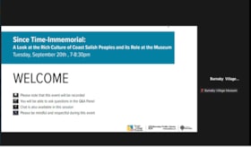
Since Time-Immemorial: A Look at the Rich Culture of Coast Salish Peoples and its Role at the Museum
https://search.heritageburnaby.ca/link/museumdescription18876
- Repository
- Burnaby Village Museum
- Date
- 20 Sep. 2022
- Collection/Fonds
- Burnaby Village Museum fonds
- Description Level
- Item
- Physical Description
- 1 video recording (mp4) (97 min., 15 sec.) : digital, col., sd., stereo ; 29 fps
- Scope and Content
- Item consists of a video recording of a live Zoom webinar hosted by Burnaby Village Museum Indigenous Education Programmer, Nicole Preissl. The webinar is titled "Since Time-Immemorial: A Look at the Rich Culture of Coast Salish Peoples and its Role at the Museum". The webinar is the third in a ser…
- Repository
- Burnaby Village Museum
- Collection/Fonds
- Burnaby Village Museum fonds
- Description Level
- Item
- Physical Description
- 1 video recording (mp4) (97 min., 15 sec.) : digital, col., sd., stereo ; 29 fps
- Material Details
- Host: Nicole Preissl
- Presenters: Carleen Thomas
- Date of Presentation: Tuesday, September 20, 2022. 7:00 pm - 8:00 pm
- Total Number of tracks: 1
- Total Length of all tracks: 97 min., 15 sec.
- Recording Device: Zoom video communication platform
- Original recording of 97 min., 15 sec. was edited to 88 min., 50 sec. for viewing on Heritage Burnaby
- Scope and Content
- Item consists of a video recording of a live Zoom webinar hosted by Burnaby Village Museum Indigenous Education Programmer, Nicole Preissl. The webinar is titled "Since Time-Immemorial: A Look at the Rich Culture of Coast Salish Peoples and its Role at the Museum". The webinar is the third in a series of six webinars presented in partnership by Burnaby Village Museum and Burnaby Public Library. The live webinar was also made available on the Burnaby Village Museum's facebook page. Community members were invited to participate by bringing questions during the interactive online sessions. In this webinar both Nicole Preissl and guest Carleeen Thomas make presentations. The webinar opens with an introduction by Nicole Preissl. Nicole shares her own Indigenous lineage and background; her educational background and experiences while a student at Emily Carr University; her interest in Indigenous materials practices and her role and experiences as Indigenous Education Programmer at the Burnaby Village Museum along with her ideas and goals for the future. Nicole supports her presentation with a slide show presentation regarding the evolution of the Indigenous Learning House on the site of the Burnaby Village Museum and the many transformations that it has gone through. Nicole shares her vision that is helping to transform the space further into a more inviting, learning and creative space for visitors and Indigenous peoples. Nicole also highlights the work that she’s been involved with to further develop educational programming and partnerships on site and her work to further develop the Indigenous Matriarch’s garden and the cedar grove area to include more Indigenous plants. Carleen provides information on the history of the Tsleil-Waututh Nation “People of the Inlet” and highlights information on land mapping that was created by the Nation during the Land Treaty process in 1980s; the many negative impacts to the Tsleil-Waututh Nation from contact and colonization; findings from archaeological investigations done in the Tsleil-Waututh territory that record village sites, seasonal camps and pictographs; stories associated with the Tsleil-Waututh Nation’s oral histories including the double-headed serpent; the impacts of contact and development including industrial logging; the many other challenges that the Tsleil-Waututh Nation have faced and the vision and goals for the future. Carleen describes many photographs of people and places in the presentation and provides important stories and oral histories that have been passed down through her family and nation for generations. Following the presentations Nicole and Carleen answer questions from the attendees and comment further on the information that they've shared.
- History
- Nicole Preissl is Stó:lo from Leq'á:mel First Nation as well as having ancestry from the Sḵwx̱wú7mesh First Nation and sq̓əc̓iy̓aɁɬ təməxʷ (Katzie) First Nation. On her mother's side she is third generation Canadian Settler with European Heritage. Nicole has a Bachelor of Arts Degree from Emily Carr University with a Major in Design and has been the Burnaby Village Museum Indigenous Education Programmer since 2022. Carleen Thomas is a Tsleil-Waututh Nation (TWN) member, elder, and current Special Projects Manager for the Treaty, Lands, and Resources department. She is the first Indigenous chancellor at Emily Carr University of Art and Design; educator; former TWN council member of 16 years; has chaired and been a representative on countless committees; and most significantly, grandmother of five amazing grandchildren. Carleen Thomas plays a vital role in her community and is a highly motivated and hardworking individual. Thomas obtained a Bachelors of Education from UBC and has deeply rooted knowledge of her culture and people. Carleen sites her grandparents: Hereditary Chief John L. George & Lillian “Dolly” George and her maternal Grandmother Caroline Thomas (nee: Joseph) as some of her key influences in life. Their teachings, unconditional love, and most of all, patience in guiding and preparing Carleen will last a lifetime. She has created a lasting mark for her family, community and for future generations of Indigenous, Coast Salish and Tsleil-Waututh families.
- Creator
- Burnaby Village Museum
- Subjects
- Indigenous peoples - British Columbia
- Indigenous peoples - British Columbia - Food
- Indigenous peoples - British Columbia - First contact with Europeans
- Indigenous peoples - British Columbia - Social life and customs
- Indigenous peoples - British Columbia - Art
- Indigenous peoples - British Columbia - Languages
- Indigenous peoples - Canada - , Treatment of
- Indigenous peoples - Indian Territory
- Plants
- Indigenous peoples - British Columbia - Rites and ceremonies
- Indigenous peoples - Canada - Government relations
- Indigenous peoples
- Names
- Burnaby Village Museum
- Preissl, Nicole
- Thomas, Carleen
- Sḵwx̱wú7mesh Nation
- Tsleil-Waututh Nation
- Accession Code
- BV022.27.3
- Date
- 20 Sep. 2022
- Media Type
- Moving Images
- Notes
- Title based on contents of item
Images

Video
Since Time-Immemorial: A Look at the Rich Culture of Coast Salish Peoples and its Role at the Museum, 20 Sep. 2022
Since Time-Immemorial: A Look at the Rich Culture of Coast Salish Peoples and its Role at the Museum, 20 Sep. 2022
https://search.heritageburnaby.ca/media/hpo/_Data/_BVM_Moving_Images/2022_0027_0003_002.mp4
Bringing Visibility to the Land: A Tsleil-Waututh Perspective on Community Building
https://search.heritageburnaby.ca/link/museumdescription15665
- Repository
- Burnaby Village Museum
- Date
- 27 Apr. 2021
- Collection/Fonds
- Burnaby Village Museum fonds
- Description Level
- Item
- Physical Description
- 1 video recording (mp4) (47 min., 39 sec.) : digital, col., sd., stereo ; 29 fps
- Scope and Content
- Item consists of a video recording of a live Zoom webinar hosted by Burnaby Village Museum Curator, Jane Lemke. The webinar is titled "Bringing Visibility to the Land: A Tsleil-Waututh Perspective on Community Building" and is presented by Michelle George, Tsleil-Waututh Nation Cultural and Technic…
- Repository
- Burnaby Village Museum
- Collection/Fonds
- Burnaby Village Museum fonds
- Description Level
- Item
- Physical Description
- 1 video recording (mp4) (47 min., 39 sec.) : digital, col., sd., stereo ; 29 fps
- Material Details
- Presenters: Michelle George
- Host: Jane Lemke
- Date of Presentation: Tuesday, April 27, 7:00 pm - 8:00 pm
- Total Number of tracks: 1
- Total Length of all tracks: 47 min., 39 sec.
- Recording Device: Zoom video communication platform
- Recording Note: Film was edited from it's original recorded version (63 min., 29 sec.) to edited version (47 min., 39 sec.) for public viewing on Heritage Burnaby
- Scope and Content
- Item consists of a video recording of a live Zoom webinar hosted by Burnaby Village Museum Curator, Jane Lemke. The webinar is titled "Bringing Visibility to the Land: A Tsleil-Waututh Perspective on Community Building" and is presented by Michelle George, Tsleil-Waututh Nation Cultural and Technical Specialist. The Zoom webinar is the first in a series of six "Neighbourhood Speaker series" webinars exploring a range of topics shared by Indigenous speakers and knowledge keepers that were presented and made available to the public between April 27 and May 12, 2021. The live webinar was also made available on the Burnaby Village Museum's facebook page. Community members were invited to participate by bringing questions during the interactive online sessions. In this webinar, Michelle George explores the importance of bringing Tsleil-Waututh ways of knowing/knowledge of the land to Burnaby. She grounds her talk with her experience of working with the Burnaby Village Museum on producing the Indigenous History of Burnaby Resource Guide, an award-winning illustrated educational guide. Michelle also speaks to some of the devastating experiences that the Tsleil-Waututh Nation and Indigenous Peoples have suffered since Colonial Settlement and how her Nation has begun to grow in a changing environment. In segments of her talk, Michelle refers to a map titled "Tsleil-Waututh Nation Consultation Area". Following the presentation, Michelle George answers questions from the audience that are moderated by the host, Jane Lemke.
- History
- Michelle George is a member of the Tsleil-Waututh Nation (TWN) and currently works as a Tsleil-Waututh Nation Cultural and Technical Specialist for the Treaty, Lands and Resources (TLR) Department. She participates in various projects for the TWN government and community, focusing on Tsleil-Waututh Governance and Community. The goals that she carries in her work are to make sure Tsleil-Waututh culture is included and considered in these Nation-level projects, as well as within the reviews done on external projects within the TWN Consultation area. She has been a member of both the Tsleil-Waututh Land Code Committee and Land Use Planning group. Michelle is also a First Nations Health Authority Traditional Knowledge Keeper, and a past-Elected Councilor for Tsleil-Waututh Nation. Michelle also provides guest lectures at Simon Fraser University, Langara College, and the BC Institute of Technology.
- Creator
- Burnaby Village Museum
- Subjects
- Indigenous peoples - British Columbia
- Indigenous peoples - Canada - Government relations
- Indigenous peoples - British Columbia - Languages
- Indigenous peoples - Canada - , Treatment of
- Indigenous peoples - British Columbia - First contact with Europeans
- Names
- Burnaby Village Museum
- Burnaby Public Library
- George, Michelle
- Tsleil-Waututh Nation
- George, Chief Daniel "Dan"
- Responsibility
- Lemke, Jane
- Geographic Access
- Burrard Inlet
- Accession Code
- BV021.17.1
- Access Restriction
- No restrictions
- Reproduction Restriction
- No known restrictions
- Date
- 27 Apr. 2021
- Media Type
- Moving Images
- Notes
- Title based on contents of video recording
Images

Video
Bringing Visibility to the Land: A Tsleil-Waututh Perspective on Community Building, 27 Apr. 2021
Bringing Visibility to the Land: A Tsleil-Waututh Perspective on Community Building, 27 Apr. 2021
https://search.heritageburnaby.ca/media/hpo/_Data/_BVM_Moving_Images/2021_0017_0001_002.mp4A Taste of History Video series - 2020 subseries
https://search.heritageburnaby.ca/link/museumdescription14272
- Repository
- Burnaby Village Museum
- Date
- 2020
- Collection/Fonds
- Burnaby Village Museum fonds
- Description Level
- Subseries
- Physical Description
- 6 video recordings (mp4)
- Scope and Content
- Subseries consists of a two part video series "A Taste of History". Part one is titled "A Taste of History - Scraps and Dragons" and part two is titled " A Taste of History - A Pig's Tale". The films were created by Debbie Liang and Joty Gill, University of British Columbia alumni and graduates fro…
- Repository
- Burnaby Village Museum
- Collection/Fonds
- Burnaby Village Museum fonds
- Series
- UBC Partnership series
- Description Level
- Subseries
- Physical Description
- 6 video recordings (mp4)
- Scope and Content
- Subseries consists of a two part video series "A Taste of History". Part one is titled "A Taste of History - Scraps and Dragons" and part two is titled " A Taste of History - A Pig's Tale". The films were created by Debbie Liang and Joty Gill, University of British Columbia alumni and graduates from the Asian Canadian & Asian Migration Studies program (ACAM). "Scraps and Dragons" provides information on the origins of the Chinese-Canadian culinary dish "chop suey" and tells the story of Chinese Canadian Chop Suey restaurants, highlighting the history of the "Dragon Inn" chop suey restaurant owned by Larry Lee. "A Pig's Tale" shares informaton on the history of Chinese pig farms also known as "Piggeries" in Burnaby, highlighting the experiences of Chinese Pig farmers along Douglas Road. Films include versions with English, Traditional Chinese and Simplified Chinese subtitles.
- History
- In 2020, due to the restrictions of COVID-19, UBC interns were asked to create virtual experiences to reimagine Burnaby Village Museum's historical Chinese Canadian programming in remote online spaces. Debbie Liang and Joty Gill (UBC alumni and graduates of Dr. Henry Yu's 2019 summer ACAM 390A Global Seminar to Asia) returned to work with Burnaby Village Museum to create two short films showcasing the history of Chinese Canadian Chop Suey restaurants and piggeries in Burnaby
- Subjects
- Persons - Chinese Canadians
- Social Issues - Racism
- Social Issues - Discrimination
- Buildings - Commercial - Restaurants
- Agriculture - Farms
- Agriculture - Ranches
- Animals - Pigs
- Regulations
- Accession Code
- BV020.28
- Reproduction Restriction
- No known restrictions
- Date
- 2020
- Media Type
- Moving Images
- Notes
- Title based on contents of subseries
The Fecundity of Food and Family: A Natural Niche for Chinese Canadians in Burnaby
https://search.heritageburnaby.ca/link/museumdescription14760
- Repository
- Burnaby Village Museum
- Date
- 20 Oct. 2020
- Collection/Fonds
- Burnaby Village Museum fonds
- Description Level
- Item
- Physical Description
- 1 video recording (mp4) (62 min., 01 sec.) : digital, col., sd., stereo ; 29 fps
- Scope and Content
- Item consists of a video recording of a live Zoom webinar hosted by Burnaby Village Museum's Kate Petrusa. The webinar is titled "The Fecundity of Food and Family: A Natural Niche for Chinese Canadians in Burnaby" and is presented by UBC students, Debbie Liang; Joty Gill; Rose Wu and Wei Yan Yeong.…
- Repository
- Burnaby Village Museum
- Collection/Fonds
- Burnaby Village Museum fonds
- Description Level
- Item
- Physical Description
- 1 video recording (mp4) (62 min., 01 sec.) : digital, col., sd., stereo ; 29 fps
- Material Details
- Presenters: Debbie Liang; Joty Gill; Rose Wu; Wei Yan Yeong
- Host: Kate Petrusa
- Date of Presentation: October 20 7:00 pm - 8:00 pm
- Total Number of tracks: 1
- Total Length of all tracks:62 min., 01 sec.
- Recording Device: Zoom video communication platform
- Scope and Content
- Item consists of a video recording of a live Zoom webinar hosted by Burnaby Village Museum's Kate Petrusa. The webinar is titled "The Fecundity of Food and Family: A Natural Niche for Chinese Canadians in Burnaby" and is presented by UBC students, Debbie Liang; Joty Gill; Rose Wu and Wei Yan Yeong. The zoom webinar is the fifth in a collection of seven "Burnaby Neighbourhood Speaker series" webinars that were presented and made available to the public between September 29 and October 27, 2020. The live webinar and recording was also made available on the Burnaby Village Museum's facebook page. In this webinar, the four UBC students, present their research on Chinese Canadian involvement in food and farming in early Burnaby. The students were participants in a joint partnership between Burnaby Village Museum and the UBC iniative for student teaching and research in Chinese Canadian Studies (INSTRCC), the UBC Asian Canadian & Asian Migration Studies program (ACAM), the UBC Centre for Community Engaged Learning (CCEL), the UBC Faculty of Land and Food Systems, UBC Go Global and UBC St. John's College (SJC). In 2020, due to the restrictions of COVID-19, the interns were asked to create virtual experiences to reimagine Burnaby Village Museum's historical Chinese Canadian programming in remote online spaces. Debbie Liang and Joty Gill (UBC alumni and graduates of Dr. Henry Yu's 2019 summer ACAM 390A Global Seminar to Asia) returned to work with Burnaby Village Museum to create two short films showcasing the history of Chinese Canadian Chop Suey restaurants and Piggeries in Burnaby. Rose Wu and Wei Yan Yeong (students in the UBC Faculty of Land and Food Systems) created a three episode podcast series "Back to the Roots" which delved into the topics of family-operated farming businesses, Chinese contributions to early local and alternative food systems, and Traditional Chinese Medicine and herbalism. The webinar begins with Joty Gill and Debbie Liang talking about their project, “A Taste of History Film Series”. They describe their research and challenges in the development of their two films “Scraps and Dragons” and “A Pig's Tale”. Debbie and Joty support their presentation with slides including excerpts from their films. Rose Wu and Wei Yan Yeong talk about their project which consisted of a three episode podcast series titled "Back to the Roots" which delved into the topics of family-operated farming businesses, Chinese contributions to early local and alternative food systems, and Traditional Chinese Medicine and herbalism. They describe their research, challenges and highlights which resulted in the three podcasts “A Family Farm”; “Where is your food from?” and “Chinese Herbalist Shops and TCM”. Rose and Wei Yan support their presentation with slides including excerpts from their podcasts. At the close of their presentation the students reflect on the importance of sharing personal aspects of Chinese Canadian History and answer questions from webinar participants.
- Creator
- Burnaby Village Museum
- Subjects
- Persons - Chinese Canadians
- Agriculture - Farms
- Agriculture
- Gardens - Market Gardens
- Social Issues - Discrimination
- Social Issues - Racism
- Buildings - Commercial - Restaurants
- Responsibility
- Petrusa, Kate
- Accession Code
- BV020.29.5
- Access Restriction
- No restrictions
- Reproduction Restriction
- No known restrictions
- Date
- 20 Oct. 2020
- Media Type
- Moving Images
- Notes
- Title based on contents of video recording
- Video recording was edited for publication on Heritage Burnaby. Original mp4 video recording (BV020.29.5.1) is 72 min., 25 sec.
Images

Video
The Fecundity of Food and Family: A Natural Niche for Chinese Canadians in Burnaby, 20 Oct. 2020
The Fecundity of Food and Family: A Natural Niche for Chinese Canadians in Burnaby, 20 Oct. 2020
https://search.heritageburnaby.ca/media/hpo/_Data/_BVM_Moving_Images/2020_0029_0005_002.mp4
Louis Claude Hill's Strawberry Farm, Burnaby BC
https://search.heritageburnaby.ca/link/museumdescription991
- Repository
- Burnaby Village Museum
- Date
- 1902
- Collection/Fonds
- Burnaby Village Museum Photograph collection
- Description Level
- Item
- Physical Description
- 1 photograph : sepia ; 12.8 x 17.7 cm mounted on grey card 15.0 x 20.0 cm
- Scope and Content
- Photograph of immigrant workers in the field picking strawberries on the farm belonging to Claude Hill. On the left, the Hill family home, Brookfield, can be seen. Claude Hill's daughter, Kitty Hill, is sitting on the steps of the house. The property is the current site of the Burnaby Village Muse…
- Repository
- Burnaby Village Museum
- Collection/Fonds
- Burnaby Village Museum Photograph collection
- Description Level
- Item
- Physical Description
- 1 photograph : sepia ; 12.8 x 17.7 cm mounted on grey card 15.0 x 20.0 cm
- Scope and Content
- Photograph of immigrant workers in the field picking strawberries on the farm belonging to Claude Hill. On the left, the Hill family home, Brookfield, can be seen. Claude Hill's daughter, Kitty Hill, is sitting on the steps of the house. The property is the current site of the Burnaby Village Museum.
- Subjects
- Agriculture - Farms
- Occupations - Agricultural Labourers
- Agriculture - Fruit and Berries
- Buildings - Residential - Houses
- Persons - Chinese Canadians
- Accession Code
- HV973.40.5
- Access Restriction
- No restrictions
- Reproduction Restriction
- No known restrictions
- Date
- 1902
- Media Type
- Photograph
- Historic Neighbourhood
- Burnaby Lake (Historic Neighbourhood)
- Planning Study Area
- Morley-Buckingham Area
- Scan Resolution
- 600
- Scan Date
- 2023-05-09
- Scale
- 100
- Photographer
- Cooksley, William Thomas
- Notes
- Title based on caption accompanying photograph
- Inscribed on the negative and (therefore) printed on recto of photograph reads: "L.C. Hill's Strawberry Farm, Burnaby, B.C." and "W.T. Cooksley, New Westminster, B.C."
- Note written in red pencil on the card reads: "1902 - Grandview H.WAY"
Images


Rooted : Chinese Canadian stories in Burnaby
https://search.heritageburnaby.ca/link/museumlibrary7646
- Repository
- Burnaby Village Museum
- Publication Date
- 2023
- Call Number
- 971.133 ROO
- Repository
- Burnaby Village Museum
- Collection
- Digital Reference Collection
- Material Type
- Digital Resource
- ISBN
- 978-0-9689849-2-5
- Call Number
- 971.133 ROO
- Contributor
- Fong, Denise
- Lemke, Jane
- Codd, Lisa
- Place of Publication
- Burnaby
- Publisher
- City of Burnaby
- Publication Date
- 2023
- Printer
- Metropolitan Fine Printers
- Physical Description
- 203 p. : ill. ; 30.5 cm
- Library Subject (LOC)
- Chinese Canadians--British Columbia--Burnaby--History
- Race discrimination -- Canada
- Subjects
- Persons - Chinese Canadians
- Agriculture
- Agriculture - Farms
- Persons - Families
- Rights
- Rights - Human Rights
- Social Issues
- Social Issues - Racism
- Notes
- There are two versions of the book: English and Simplified Chinese (left, below) and the other in English and Traditional Chinese (right, below).
- From the late 1800s to the present day, Chinese Canadians have made Burnaby into a more vibrant and livable city. Rooted: Chinese Canadian Stories in Burnaby brings together a collection of diverse stories and photographs from the community, celebrating the legacy and contributions of Burnaby’s Chinese Canadian community spanning over a century. This coffee-table book features oral histories and interviews with descendants of multigenerational family farms, green grocers, corner stores, restaurants, and places of worship. Also included are archival research and community perspectives on anti-Asian racism, community activism, courage, and resilience.
- The publication has been timed to coincide with the 100th anniversary of the introduction of the Chinese Exclusion Act by the Government of Canada in 1923. This federal legislation followed decades of discriminatory legislation by Canada’s federal, provincial and municipal governments that targeted Chinese Canadians by limiting opportunities to live, work and raise families in Canada. The Chinese Exclusion Act banned almost all migration from China and remained in place until 1947. Publishing this book in 2023 is an effort by the City of Burnaby to recognize the impact of discriminatory legislation on Chinese Canadians in our community, including discriminatory bylaws and practices implemented by Burnaby’s early municipal government.
- Edited by Denise Fong (Lead Researcher), Jane Lemke (Burnaby Village Museum Curator) and Lisa Codd (City of Burnaby Heritage Planner).
Images

Digital Books

A Pig's Tale
https://search.heritageburnaby.ca/link/museumdescription14365
- Repository
- Burnaby Village Museum
- Date
- Oct. 2020
- Collection/Fonds
- Burnaby Village Museum fonds
- Description Level
- Item
- Physical Description
- 3 video recordings (mp4) (5 min., 28 sec.) : digital, col., sd., stereo, subtitles
- Scope and Content
- Item consists of part two in a two part video series "A Taste of History" created by Debbie Liang and Joty Gill, University of British Columbia alumni and graduates from the Asian Canadian & Asian Migration Studies program (ACAM). Part two is titled "A Pig's Tale". The film highlights the history o…
- Repository
- Burnaby Village Museum
- Collection/Fonds
- Burnaby Village Museum fonds
- Series
- UBC Partnership series
- Description Level
- Item
- Physical Description
- 3 video recordings (mp4) (5 min., 28 sec.) : digital, col., sd., stereo, subtitles
- Material Details
- Script: Debbie Liang; Joty Gill Narration: Joty Gill Editor: Debbie Liang Subtitles: English; Simplified Chinese; Traditional Chinese Video Appearances: Kathy Lee; Eleanor Lee Illustrations and Animations: Debbie Liang Photos, Images & B-roll: Piggery photo, image courtesy of Elwin Xie; Douglas Road: City of Burnaby Archives, 477-841; Canada Way, City of Burnaby Archives, 556-522, photo by Peg Campbell; Red pig by Debbie Liang; Piglets sleeping, image courtesy of RoyBuri from pixabay, free to use; Chinese Zodiac, image courtesy of RoofOfAllLight from wikimedia, Creative Commons Attribution-Share Alike 4.0 International license; Pictograph for Home by Debbie Liang; Pigs lying down, image courtesy of Elwin Xie; Council minutes all from heritageburnaby.com; Cleanliness illustration set by Debbie Liang; "The Heathen Chinese in British Columbia" from Library and Archives Canada; Laundryman spitting from Daily News, Prince Rupert in 1911; Slicer on counter at Way Sang Yuen Wat Kee & Co., Burnaby Village Museum BV017.7.290; Way Sang Yuen Wat Kee & Co. Store front, Burnaby Village Museum BV017.7.191; Medical Practices Disagreement illustration by Debbie Liang; Butchering pig, image courtesy of Elwin Xie; Chinatown brolls, courtesy of Food2 group from UBC's 2019 ACAM 390 Class; Black Rotary telephone beside ball pen on white printed paper, image courtesy of Pixabay from pexels.com, free to use; Burnaby Lake on a cloudy day, image courtesy of Flying Pegunin from wikipedia; The Vancouver Sun May 4, 1921 from newspapers.com; Vancouver Daily May 3, 1921 from newspapers.com; Reduce number of pigs illustration by Debbie Liang; Black and white photo of piggery, image courtesy of Elwin Xie; 2019 Piggery illustration by Debbie Liang Music and Sound Effects: "Acoustic Mediation 2" from audionautix; Pig Grunting sounds from Kiddopedia Animasl, Creative Commons 0; "Piano moment" & "November" from bensound.com; "Ding sound effect" from freesoundlibrary; Wuxia2_Guzheng_Pipa by PeriTune http://peritune.com; Music promoted by https://www.free-stock-music.com; Attribution 4.0 International (CC BY 4.0) https://creativecommons.org/licenses/by/4.0/ Video adapted from 2019 BVM intern project by Debbie Liang and Marcela Gomez Special thanks to: UBC: Joanna Yang, Jenny Lu, Denise Fong, Henry Yu; BVM: Kate Petrusa, Amy Wilson Changes to music may have been made for the purposes of this video
- Scope and Content
- Item consists of part two in a two part video series "A Taste of History" created by Debbie Liang and Joty Gill, University of British Columbia alumni and graduates from the Asian Canadian & Asian Migration Studies program (ACAM). Part two is titled "A Pig's Tale". The film highlights the history of Chinese pig farms also known as "Piggeries" in Burnaby. The film tells the story of how many of these farms were established by Chinese immigrants along Douglas Road (now Canada Way) between the 1890s and 1920s; the importance of the pig in the Chinese Culture as well as a way for Chinese immigrants to make a living and the racism and discriminatory bylaws that the Chinese pig farmers suffered that finally led to the closure of many of these farms. Content references three documented piggery ranches along Douglas Road: Ah Sam; Young Chung and Hop Hin Yen. The films are supported with voice over in english, subtitles, animation along with historical photographs. One version of the film is supported with subtitles in English while two other versions of the film are supported with subtitles in Simplified Chinese and Traditional Chinese.
- History
- In 2020, due to the restrictions of COVID-19, University of British Columbia student interns with the Burnaby Village Museum Chinese Canadian History in Burnaby project were asked to create virtual experiences to reimagine Burnaby Village Museum's historical Chinese Canadian programming in remote online spaces. Debbie Liang and Joty Gill (UBC alumni and graduates of Dr. Henry Yu's 2019 summer ACAM 390A Global Seminar to Aisa) returned to work with Burnaby Village Museum to create two short films showcasing the history of Chinese Canadian Chop Suey restaurants and piggeries in Burnaby.
- Creator
- Liang, Debbie
- Debbie Liang
- Subjects
- Persons - Chinese Canadians
- Social Issues - Discrimination
- Social Issues - Racism
- Regulations
- Agriculture
- Agriculture - Farms
- Agriculture - Ranches
- Animals - Pigs
- Names
- Liang, Debbie
- Gill, Joty
- Burnaby Village Museum
- University of British Columbia
- Xie, Elwin
- Way Sang Yuen Wat Kee & Company
- Ah Sam
- Young Chung
- Hop Hin Yen
- Responsibility
- University of British Columbia
- UBC Initiative for Student Teaching and Research in Chinese Canadian Studies
- Burnaby Village Museum
- Geographic Access
- Douglas Road
- Canada Way
- Accession Code
- BV020.28.7
- Access Restriction
- No restrictions
- Reproduction Restriction
- No known restrictions
- Date
- Oct. 2020
- Media Type
- Moving Images
- Historic Neighbourhood
- Burnaby Lake (Historic Neighbourhood)
- Planning Study Area
- Douglas-Gilpin Area
- Notes
- Transcribed title
Images


Video
A Pig's Tale, Oct. 2020
A Pig's Tale, Oct. 2020
https://search.heritageburnaby.ca/media/hpo/_Data/_BVM_Moving_Images/2020_0028_0007_001.mp4
Interview with Denise Fong by Rose Wu and Wei Yan Yeong
https://search.heritageburnaby.ca/link/museumdescription14276
- Repository
- Burnaby Village Museum
- Date
- 2020
- Collection/Fonds
- Burnaby Village Museum fonds
- Description Level
- Item
- Physical Description
- 1 sound recording (mp3) (00:60:38 min.)
- Scope and Content
- Item consists of an audio recording of a Zoom interview with Denise Fong conducted by Rose Wu and Wei Yan Yeong, in the Faculty of Land and Food Systems at UBC. The interview was conducted with Denise Fong as part of the students' research for their podcast "Where is your food from?". This podcast…
- Repository
- Burnaby Village Museum
- Collection/Fonds
- Burnaby Village Museum fonds
- Series
- UBC Partnership series
- Description Level
- Item
- Physical Description
- 1 sound recording (mp3) (00:60:38 min.)
- Material Details
- Interviewers: Rose Wu; Wei Yan Yeong Interviewee: Denise Fong Interview Date: September 2020 Total Number of tracks: 1 Total Length of all tracks: 00:60:38 Recording device: Zoom video communication platform Photograph info: Store front of Way Sang Yuen Wat Kee & Co in Victoria, B.C., 1975. BV017.7.191
- Scope and Content
- Item consists of an audio recording of a Zoom interview with Denise Fong conducted by Rose Wu and Wei Yan Yeong, in the Faculty of Land and Food Systems at UBC. The interview was conducted with Denise Fong as part of the students' research for their podcast "Where is your food from?". This podcast was part two in a series of three "Back to the Roots" podcasts about the history of Chinese-Canadian farming in Burnaby and the lower mainland. In this series the students connected their knowledge of food systems to their shared Chinese heritage in order to discover how Chinese Canadian history is rooted in their local food systems. "Where is your food from?" explores contemporary versus historical alternative food movements and how early Chinese farmers in the lower mainland had to be creative in their business tactics in order to survive in a local food system that discriminated against their race. 00:00 - 4:51 Denise Fong introduces herself and provides a summary of the work that she has done while working as a researcher on the Chinese Canadian History Research project for the Burnaby Village Museum. Denise explains how much of her research has focused on the history of Chinese Canadian market gardeners and green grocers and their presence in Burnaby. Denise tells of how many Chinese immigrants found it hard to find work due to racial discrimination which led many Chinese men to work in agriculture and farming. Her research has shown that many of the Chinese farms were located in the Big Bend area of Burnaby. 04:52 – 08:24 In this segment, Denise elaborates on the “truck” or “market” farming industry for Chinese farmers in Burnaby. Denise explains how “truck” farming was a mode for distributing produce from Chinese farms and some of the challenges the Chinese farmers faced. 08:25 – 14:10 In this segment Denise talks about peddling as another mode to distribute farm produce and how this was often dominated by Chinese Canadians since they were restricted from accessing other jobs. Denise explains how the Chinese peddlers would have their own routes with customers who depended on them to bring the produce to them. Denise provides an example of racial discrimination whereby a Burnaby Bylaw prevented people of Chinese descent from working for the city. 14:11 – 22: 39 In this segment, Denise describes how in the 1950s and 1960s, produce distribution networks for Chinese Canadian farmers in Burnaby expanded to larger stores and wholesalers including Woodward’s, Safeway in Burnaby, MacDonald’s Consolidated and Kelly Douglas. Denise provides specific examples of Burnaby families and tells the story of Chinese Canadian Cecil Lee, a produce buyer for Kelly Douglas. In the mid 1970s Lee, was asked to oversee the import of Chinese mandarin oranges into Canada and was responsible for the design of a new cardboard box to replace the wooden crates that held the mandarin oranges. 22:40 – 33:28 In this segment, Denise provides information on Chinese farming methods and practices that she gathered through her research. Information gathered from interviews, research papers and an article in Harrowsmith magazine suggest that many of the Big Bend farms in Burnaby relied on crop rotation, companion planting and intercropping along with traditional organic fertilizers that were available. Denise also tells of how Chinese farmers often relied on traditional methods that they brought from Southern China including the creation of raised beds to avoid damage due to flooding. Wei Yan comments that many of these traditional methods are being reintroduced as a new sustainable way of farming. Research done by Wei Yan found that when chemical fertilizers were introduced informational brochures included Chinese translations. 33:29 – 38:30 In this segment Rose and Wei Yan speak to Denise about the cultural demographic of farmers in the Big Bend area of Burnaby and what types of crops were grown. Denise comments that to her knowledge there were mostly Chinese farmers in this area but there were some European farmers as well. Produce that was grown on the farms was mostly market driven by the local consumers and it wasn’t until the 1970s that there was a bigger demand to grow Chinese vegetables to supply the growing Chinese population. Denise shares personal experience of what she learned after a visit to a local farm and the different methods that the farmer used for growing crops. The three discuss the importance of innovation and adaptability in growing techniques that Chinese farmers have used. 38:31 – 46:23 In this segment, Rose and Wei Yan speak to Denise about the discrimination barriers that Chinese farmers had to face. Denise speaks about discriminatory bylaws and regulations that targeted Chinese farmers including the Peddling tax. She tells of how this tax, persecution to peddlers and restrictions resulted in the emergence of a new industry of Chinese green grocers. Denise names Chinese trade organizations that were formed in response to the social and economic segregation and marginalization that Chinese farmers and retailers faced. Denise references research done by Natalie Gibb and Hannah Wittman from their article “Parallel Alternatives: Chinese-Canadian farmers and the Metro Vancouver local food movement” as well as research by Harry Con and Edgar Wickberg. Denise also provides information that she has gathered from Chinese farmers in Burnaby including the Yip family who were able to purchase land after World War II through the Veterans Land Act and how prior to World War II it was very difficult for Chinese immigrants to purchase land. 46:24 – 1:00:38 In this segment the group discusses how Chinese farmers have adapted in the market garden farm distribution system and the introduction of retail spaces on their farms as part of the new local food movement. Denise, Rose and Wei Yan reflect on how their interview with Denise Fong and research resources will support their podcast series and exhibits at Burnaby Village Museum.
- History
- Interviewer biographies: Rose Wu and Wei Yan Yeong are University of British Columbia students in the Faculty of Land and Food Systems and student interns at Burnaby Village Museum. Interviewee biography: Denise Fong is a historical researcher at Burnaby Village Museum. She has degrees in Anthropology (BA) and Archaeology (MA), and is completing her doctoral degree at UBC in Interdisciplinary Studies. Her primary research interests are in Chinese Canadian history and critical heritage studies. She is the co-curator of the Burnaby Village Museum “Across the Pacific” exhibition, and the Museum of Vancouver’s “A Seat at the Table – Chinese Immigration and British Columbia”.
- Creator
- Burnaby Village Museum
- Subjects
- Persons - Chinese Canadians
- Social Issues - Discrimination
- Social Issues - Racism
- Agriculture
- Agriculture - Crops
- Agriculture - Farms
- Gardens - Market Gardens
- Foods
- Names
- Fong, Denise
- Responsibility
- Wu, Rose
- Yeong, Wei Yan
- Accession Code
- BV020.28.2
- Access Restriction
- No restrictions
- Reproduction Restriction
- No known restrictions
- Date
- 2020
- Media Type
- Sound Recording
- Related Material
- BV020.28.4
- Notes
- Title based on contents of recording
- Item was originally recorded as an mp4 video and converted to an mp3 sound recording for public access on Heritage Burnaby. To access the video recording, contact Burnaby Village Museum.
- For recording of podcast "Where is your food from?" see BV020.28.4
Images
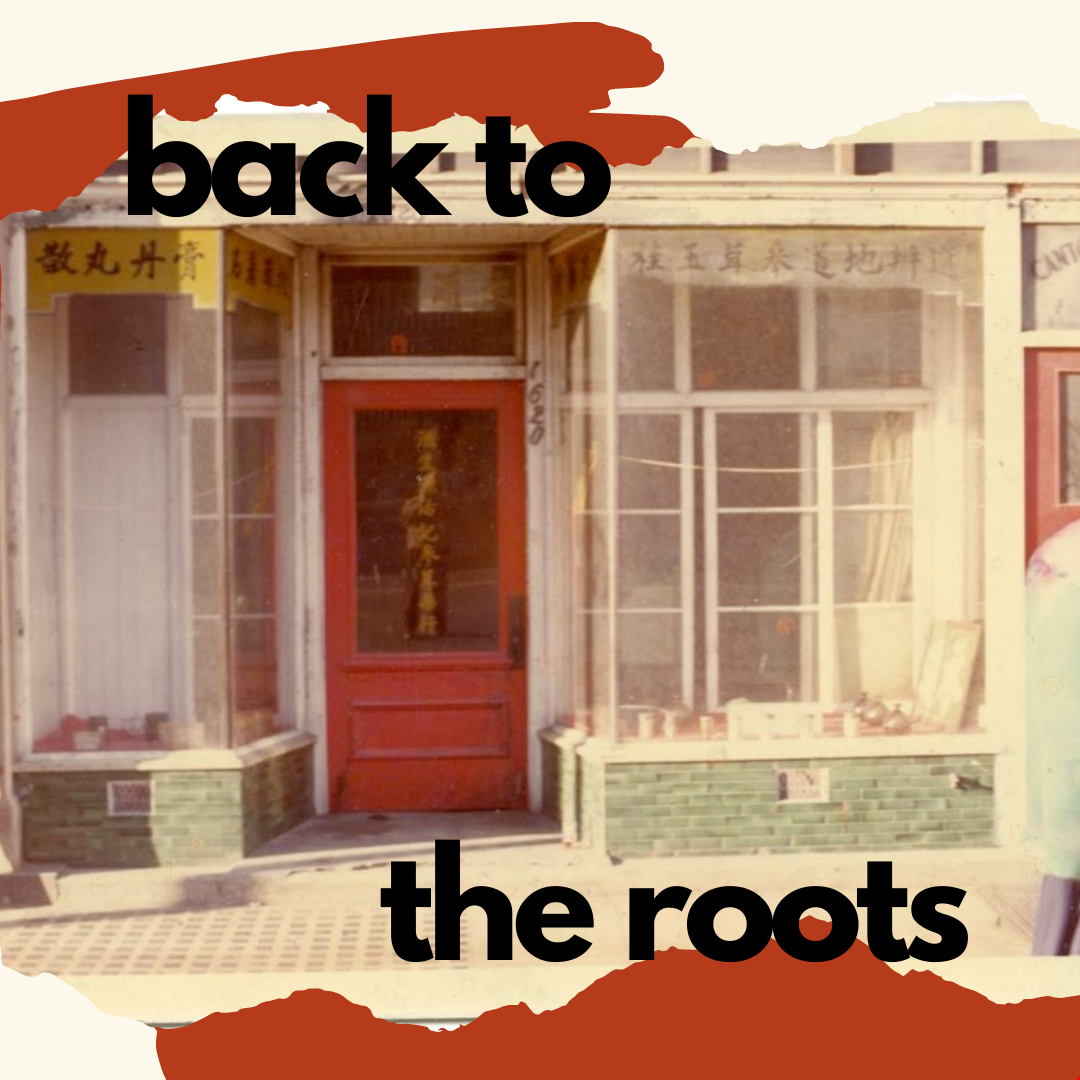
Audio Tracks
Interview with Denise Fong by Rose Wu and Wei Yan Yeong, 2020
Interview with Denise Fong by Rose Wu and Wei Yan Yeong, 2020
https://search.heritageburnaby.ca/media/hpo/_Data/_BVM_Sound_Recordings/Sound_Recordings/2020_0028_0002_002.mp3![Aerial View of Chinese Market Gardens on Marine Drive, [between 1950 and 1959] (date of original), 2017 (date of duplication) thumbnail](/media/hpo/_Data/_BVM_Images/2017/2017_0040_0001_001.jpg?width=280)
Aerial View of Chinese Market Gardens on Marine Drive
https://search.heritageburnaby.ca/link/museumdescription4296
- Repository
- Burnaby Village Museum
- Date
- [between 1950 and 1959] (date of original), 2017 (date of duplication)
- Collection/Fonds
- Herbert Yee Law family fonds
- Description Level
- Item
- Physical Description
- 1 photograph (jpg) : b&w
- Scope and Content
- Photograph is an aerial view looking south over the Chinese Market Gardens along Marine Drive in the Big Bend area of Burnaby.
- Repository
- Burnaby Village Museum
- Collection/Fonds
- Herbert Yee Law family fonds
- Description Level
- Item
- Physical Description
- 1 photograph (jpg) : b&w
- Scope and Content
- Photograph is an aerial view looking south over the Chinese Market Gardens along Marine Drive in the Big Bend area of Burnaby.
- Names
- Chinese Market Gardens
- Geographic Access
- Marine Drive
- Accession Code
- BV017.40.1
- Access Restriction
- No restrictions
- Reproduction Restriction
- May be restricted by third party rights
- Date
- [between 1950 and 1959] (date of original), 2017 (date of duplication)
- Media Type
- Photograph
- Historic Neighbourhood
- Fraser Arm (Historic Neighbourhood)
- Planning Study Area
- Big Bend Area
- Scan Resolution
- 600
- Scan Date
- 11/19/2017
- Scale
- 100
- Notes
- Title based on contents of photograph.
Images
![Aerial View of Chinese Market Gardens on Marine Drive, [between 1950 and 1959] (date of original), 2017 (date of duplication) thumbnail](/media/hpo/_Data/_BVM_Images/2017/2017_0040_0001_001.jpg)

A Family Farm
https://search.heritageburnaby.ca/link/museumdescription14268
- Repository
- Burnaby Village Museum
- Date
- 2020
- Collection/Fonds
- Burnaby Village Museum fonds
- Description Level
- Item
- Physical Description
- 1 sound recording (mp3) (00:13:57 min)
- Scope and Content
- Item consists of a recording of part one in a series of three “Back to the Roots” podcasts about the history of Chinese-Canadian farming in Burnaby and the lower mainland. Part one is titled “A Family Farm”. The podcasts were created by students Rose Wu and Wei Yan Yeong from the Faculty of Land an…
- Repository
- Burnaby Village Museum
- Collection/Fonds
- Burnaby Village Museum fonds
- Series
- UBC Partnership series
- Description Level
- Item
- Physical Description
- 1 sound recording (mp3) (00:13:57 min)
- Material Details
- Podcasts hosts: Rose Wu; Wei Yan Yeong Persons from recorded extracts: Denise Fong; Josephine Chow Music: prod. riddiman Podcast Date: October 2020 Total Number of tracks: 1 Total Length of all tracks: 00:13:57 min Photograph info: Store front of Way Sang Yuen Wat Kee & Co in Victoria, B.C., 1975. BV017.7.191
- Scope and Content
- Item consists of a recording of part one in a series of three “Back to the Roots” podcasts about the history of Chinese-Canadian farming in Burnaby and the lower mainland. Part one is titled “A Family Farm”. The podcasts were created by students Rose Wu and Wei Yan Yeong from the Faculty of Land and Food Systems at the University of British Columbia Faculty and while student interns at Burnaby Village Museum. In this series the students connect their knowledge of food systems to their shared Chinese heritage in order to discover how Chinese Canadian history is rooted in their local food systems. 00:00-02:21 The podcast opens with Wei Yan Yeong and Rose Wu introducing themselves and their topic- the Chinese Canadian experience in Burnaby and the people who have made important contributions to the city’s development. “A Family Farm” talks about Chinese-owned businesses which are family run. “The family-oriented nature of Chinese-owned businesses also extend to many of the early (and current) Chinese-owned farms in the Burnaby Big Bend area. When Chinese men first began farming in BC in the 1860s, a lot of them worked as labourers because they weren’t allowed to own land. After World War II many of these farmers were allowed to purchase lots, thanks to the Veterans Land Grant. These grants allowed returning veterans to purchase small parcels of land with government loans. Eventually, these men would start families on the farm, and many Chinese-owned farms became family-operated businesses where every member, male, female, child, and extended relatives were enlisted to work the grounds. And it was hard work, often from dawn to dusk, 6-7 days a week.” 02:23 – 07:50 This portion includes excerpts from Oral History interview with Josephine Chow (nee Hong) of Hop On Farms in the Burnaby Big Bend area. The interview was conducted by Burnaby Village Museum researcher Denise Fong. Josephine recalls growing up on the family farm with her six siblings. She tells of how the family pulled together money to purchase twelve acres along Marine Drive in 1951, her family’s background, daily life on the farm , responsibilities on the farm for her and her siblings and of how her mother had to balance working on the farm and providing for a family of ten to twelve people. 07:51 – 08:10 In this portion, hosts comment and reflect on their own experiences. “While it’s likely that a lot of this was done out of necessity and not being able to afford additional paid labourers, having grown up in Chinese households ourselves, we can definitely understand the rationale for these family-operated businesses and how it connects back to the Chinese understanding of family and kinship.” 08:11 – 09:06 In this portion, Rose and Wei provide information on the roots of the Chinese character for family “jia” in mandarin or “gah” in Cantonese. They explain that the term family is composed of two parts: the upper element is like a roof, symbolizing shelter, and the bottom part represents a pig which symbolizes food, whereby the Chinese character for family represents that of a farm. They provide a quote from the writings of Francois de Martin-Donos “In ancient China, the farm is an enterprise, a shelter that insures one food and work. The farm is a place to rely on, but in return, needs to be maintained, including a set of responsibilities. In other words, “family” is the insurance of a stable life.” 09:07 – 10:27 In this portion, the hosts speak about how traditional Chinese thought is heavily influenced by the teachings of Confucius and Confucius philosophy. They explain how Confucius emphasized five sets of human relationships that form the basis for society: ruler and minister, husband and wife, parents and child, sibling and sibling, friend and friend. Of these five, three are familial relationships also known as Filial piety – the respect and care for one’s familial superiors (such as parents, elders, and ancestors). They speak of how this is one of Confucianism’s main teachings and in this respect caring for family members is seen as a moral obligation. In China housing arrangements are in the form of siheyuan”s — a type of residence that featured a courtyard surrounded on all four sides with buildings. These traditionally housed one large extended family if they were wealthy enough. 10:28 – 13:08 In this portion, hosts provide further information on Josephine Chow’s family experience working and living on the “Hop On” family farm through the decades. An excerpt from the interview with Josephine Chow conducted by Denise Fong is included. In this excerpt, Josephine reflects on her past experiences on the farm and her present day experiences of her siblings running the farm. 13:09 -13:56 Final summary, credits and acknowledgements.
- History
- Podcast hosts, Rose Wu and Wei Yan Yeong are University of British Columbia students in the Faculty of Land and Food Systems and student interns at Burnaby Village Museum.
- Creator
- Burnaby Village Museum
- Subjects
- Persons - Chinese Canadians
- Agriculture - Farms
- Agriculture
- Gardens - Market Gardens
- Social Issues - Discrimination
- Social Issues - Racism
- Names
- Fong, Denise
- Responsibility
- Wu, Rose
- Yeong, Wei Yan
- Geographic Access
- Marine Drive
- Accession Code
- BV020.28.3
- Access Restriction
- No restrictions
- Reproduction Restriction
- No known restrictions
- Date
- 2020
- Media Type
- Sound Recording
- Historic Neighbourhood
- Fraser Arm (Historic Neighbourhood)
- Planning Study Area
- Big Bend Area
- Related Material
- BV020.28.4; BV020.28.5
- Notes
- Title based contents of sound recording
- See also Interview with Josephine Chow by Denise Fong February 7, 2020 - BV020.6.1
- Compilation of Research Resources used by authors Rose Wu and Wei Yan Yeong include:
- Why is family important in China? https://medium.com/@francois_dmd/why-is-family-so-important-in-china-1617b13a67
- Burnaby Village Museum - Interview with Josephine Chow by Denise Fong Feb. 7, 2020. BV020.6.1 https://search.heritageburnaby.ca/permalink/museumsoundrecording12337
- Covered Roots: The History of Vancouver's Chinese Farms https://www.youtube.com/watch?v=M4WHS2Uf3JU
- Burnaby Village Museum Shares Chinese-Canadian Farming History This Summer https://westcoastfood.ca/burnaby-village-museum-shares-chinese-canadian-farming-history-this-summer/
- Chinese Market Gardeners in the City of Burnaby BC Continue to Practice Urban Agriculture https://cityfarmer.info/chinese-market-gardeners-in-the-city-of-burnaby-bc-continue-to-practice-urban-agriculture/
- Chinese Market Gardening in BC https://www.bcfoodhistory.ca/chinese-market-gardening-bc/
Images

Audio Tracks
A Family Farm, 2020
Back to the Roots Podcast series - 2020 subseries
https://search.heritageburnaby.ca/link/museumdescription14271
- Repository
- Burnaby Village Museum
- Date
- 2020
- Collection/Fonds
- Burnaby Village Museum fonds
- Description Level
- Subseries
- Physical Description
- 4 sound recordings (mp3) + 1 video recording (mp4)
- Scope and Content
- Subseries consists of a three episode podcast series "Back to the Roots" and two research interviews conducted using the video communication platform, "Zoom". The three podcasts which delve into the topics of Chinese family operated businesses, Chinese contributions to early local and alternative …
- Repository
- Burnaby Village Museum
- Collection/Fonds
- Burnaby Village Museum fonds
- Series
- UBC Partnership series
- Description Level
- Subseries
- Physical Description
- 4 sound recordings (mp3) + 1 video recording (mp4)
- Scope and Content
- Subseries consists of a three episode podcast series "Back to the Roots" and two research interviews conducted using the video communication platform, "Zoom". The three podcasts which delve into the topics of Chinese family operated businesses, Chinese contributions to early local and alternative food systems, and Traditional Chinese Medicine and herbalism. The three podcasts are titled "A Family Farm"; "Where is your food from?" and "Chinese Herbalist Shops & TCM". The podcasts were created by students Rose Wu and Wei Yan Yeong from the Facutly of Land and Food Systems at the University of British Columbia Faculty and while student interns at Burnaby Village Museum. The two interviews were conducted by students Rose Wu and Wei Yan Yeong from the Facutly of Land and Food Systems at the University of British Columbia, while student interns at Burnaby Village Museum. The recorded interviews include Dr. John Yang (doctor of Traditional Chinese Medicine) and Denise Fong (Burnaby Village Museum's Chinese-Canadian History researcher, co curator of the Accross the Pacific exhibit and UBC PHD candidate). The interviews were conducted as part of Rose and Wei Yan's research in support of a three episode podcast series "Back to the Roots" which delves into the topics of Chinese family operated businesses, Chinese contributions to early local and alternative food systems, and Traditional Chinese Medicine and herbalism.
- Accession Code
- BV020.28
- Date
- 2020
- Media Type
- Sound Recording
- Moving Images
- Notes
- Title based on contents of subseries
- Interviews were originally recorded as mp4 videos on zoom. One of the interviews is made available for public access on Heritage Burnaby as an mp3 sound recording. Contact the Burnaby Village Museum to access the recording of the other interview.