Narrow Results By
Subject
- Advertising Medium - Signs and Signboards 2
- Agriculture - Crops 1
- Agriculture - Farms 1
- Building Components 1
- Buildings - Agricultural 4
- Buildings - Agricultural - Greenhouses 2
- Buildings - Agricultural - Stables 1
- Buildings - Civic 1
- Buildings - Civic - Community Centres 1
- Buildings - Civic - Museums 1
- Buildings - Commercial - Restaurants 1
- Buildings - Commercial - Stores 1
Creator
- Adams, John 2
- Albert F. Arnold 1
- Albert F. Arnold McCarter & Nairne 1
- Alphonse J. Toebaert 1
- Associated Factory Mutual Fire Insurance Cos 1
- Bancroft, Rose 1
- Bekins Moving and Storage Company Limited 1
- Bernard R. Hill 1
- Bowman and Cullerne 2
- Bowman & Cullerne 5
- British Columbia Underwriters' Association 13
- Bureau of Post War Rehabilitation and Reconstruction Regional Planning Division 1
Byrne Creek Secondary School
https://search.heritageburnaby.ca/link/landmark849
- Repository
- Burnaby Heritage Planning
- Geographic Access
- 18th Street
- Associated Dates
- 2005
- Heritage Value
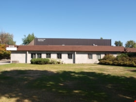
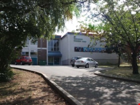
- Byrne Creek School opened in 2005 and accommodates students from grades 8 through 12. When built, the school was created to house as many as 1200 students, but by 2009, plans have been prepared to increase that capacity to 1500.
- Historic Neighbourhood
- Edmonds (Historic Neighbourhood)
- Planning Study Area
- Stride Avenue Area
- Street Address
- 7777 18th Street
- Street View URL
- Google Maps Street View
Images
City of Burnaby Orthophoto Map
https://search.heritageburnaby.ca/link/archivedescription91896
- Repository
- City of Burnaby Archives
- Date
- 2004
- Collection/Fonds
- Fire Department fonds
- Description Level
- File
- Physical Description
- 1 orthophoto map on 63 sheets ; 61 x 86 cm
- Scope and Content
- File consists of 1 orthophoto map of the City of Burnaby, printed on 63 sheets.
- Repository
- City of Burnaby Archives
- Date
- 2004
- Collection/Fonds
- Fire Department fonds
- Physical Description
- 1 orthophoto map on 63 sheets ; 61 x 86 cm
- Material Details
- Scale 1:2000
- Description Level
- File
- Record No.
- 62613
- File Class
- 22000-2
- Access Restriction
- Open access
- Reproduction Restriction
- May be restricted by third party rights
- Accession Number
- 2017-54
- Scope and Content
- File consists of 1 orthophoto map of the City of Burnaby, printed on 63 sheets.
- Media Type
- Cartographic Material
- Notes
- Title based on content of file
Taylor Park Elementary School
https://search.heritageburnaby.ca/link/landmark847
- Repository
- Burnaby Heritage Planning
- Geographic Access
- Mission Avenue
- Associated Dates
- 2004
- Heritage Value
- Taylor Park Elementary School was opened in 2004 with 240 students from kindergarten to grade three (with older students attending Stride Avenue Community School). By 2006, Taylor Park had been designated as its own school and extended its classes from kindergarten through grade six.
- Historic Neighbourhood
- Edmonds (Historic Neighbourhood)
- Planning Study Area
- Stride Hill Area
- Street Address
- 7590 Mission Avenue
- Street View URL
- Google Maps Street View
Images
City of Burnaby Archives
https://search.heritageburnaby.ca/link/landmark783
- Repository
- Burnaby Heritage Planning
- Geographic Access
- Albert Street
- Associated Dates
- 2001
- Heritage Value
- The City of Burnaby Archives officially opened on Saturday, November 10, 2001. The Archives is Burnaby's first municipal archives, and is located in the McGill Branch Library. The City Archives functions as a branch of the Office of the City Clerk and operates as the official repository of Burnaby's municipal records, containing records dating back to Burnaby's incorporation in 1892. In 2007, the City of Burnaby Archives expanded its collection mandate to include private as well as public records. On February 14, 2007 an agreement was signed with the Burnaby Historical Society and, as a result, the Archives accepted into its custody the collection of community records that had been maintained and managed by the Historical Society since the 1950s. In the Spring of 2007, these records were transferred from the Burnaby Village Museum to their permanent home in the Archives facility.
- Historic Neighbourhood
- Capitol Hill (Historic Neighbourhood)
- Planning Study Area
- Capitol Hill Area
- Street Address
- 4595 Albert Street
- Street View URL
- Google Maps Street View
Images
Burnaby Mountain Secondary School
https://search.heritageburnaby.ca/link/landmark831
- Repository
- Burnaby Heritage Planning
- Geographic Access
- Eastlake Drive
- Associated Dates
- 2000
- Heritage Value
- Burnaby Mountain Secondary School is one of the more recent schools in Burnaby, having opened in 2000 and it serves neighbourhoods in northeast Burnaby and northwest Coquitlam.
- Historic Neighbourhood
- Burquitlam (Historic Neighbourhood)
- Planning Study Area
- Lyndhurst Area
- Street Address
- 8800 Eastlake Drive
- Street View URL
- Google Maps Street View
Images
Lougheed Town Centre Plan Map
https://search.heritageburnaby.ca/link/archivedescription56654
- Repository
- City of Burnaby Archives
- Date
- 1997
- Collection/Fonds
- Planning Department fonds
- Description Level
- Item
- Physical Description
- 1 map
- Scope and Content
- Map shows the land use concept and design plan for the Lougheed Town Centre.
- Repository
- City of Burnaby Archives
- Date
- 1997
- Collection/Fonds
- Planning Department fonds
- Physical Description
- 1 map
- Description Level
- Item
- Record No.
- 40080
- Accession Number
- 2008-16
- Scope and Content
- Map shows the land use concept and design plan for the Lougheed Town Centre.
- Media Type
- Textual Record
- Cartographic Material
Shadbolt Centre for the Arts
https://search.heritageburnaby.ca/link/landmark820
- Repository
- Burnaby Heritage Planning
- Geographic Access
- Deer Lake Avenue
- Associated Dates
- 1995
- Heritage Value
- The Shadbolt Centre for the Arts opened in 1995. The Shadbolt Centre was named after two Burnaby residents who dedicated a lifetime of support and cultivation of the arts locally, nationally and internationally. Doris and Jack Shadbolt resided in Burnaby for over 50 years until Jack's death in November 1998. Doris Shadbolt spent her life's work bringing the artist and the audience closer together through her writing and curatorial work. Jack Shadbolt was an internationally recognized Canadian painter. He was also an author and both received many awards including the Order of Canada. In keeping with the Shadbolts' generosity the arts, Jack Shadbolt donated two of his paintings to the Centre for permanent display.
- Historic Neighbourhood
- Burnaby Lake (Historic Neighbourhood)
- Planning Study Area
- Douglas-Gilpin Area
- Street Address
- 6450 Deer Lake Avenue
- Street View URL
- Google Maps Street View
Images
Burnaby South Secondary School and The B.C. Provincial School for the Deaf
https://search.heritageburnaby.ca/link/landmark844
- Repository
- Burnaby Heritage Planning
- Geographic Access
- Rumble Street
- Associated Dates
- 1993
- Heritage Value
- The original Burnaby South High School was replaced in 1993 and the new Burnaby South Secondary School and BC Provincial School for the Deaf was built at this location. This school was built with the latest technology and modern equipment to ensure it was fully accessible and offers integrated academic, social and recreational activities for its students.
- Historic Neighbourhood
- Alta Vista (Historic Neighbourhood)
- Planning Study Area
- Clinton-Glenwood Area
- Street Address
- 5455 Rumble Street
- Street View URL
- Google Maps Street View
Images
Committee projects
https://search.heritageburnaby.ca/link/archivedescription88257
- Repository
- City of Burnaby Archives
- Date
- 1992-1994
- Collection/Fonds
- SFU/Burnaby Centennial Committee fonds
- Description Level
- File
- Physical Description
- 1 cm of textual records and cartographic material
- Scope and Content
- File consists of records pertaining to committee projects including; minutes of meetings; the map project, titled, "Burnaby Unfolding" which includes correspondence, colour maps illustrating the patterns of growth and research notes; a draft outline for "Burnaby at 100: Images and Voices"; a progra…
- Repository
- City of Burnaby Archives
- Date
- 1992-1994
- Collection/Fonds
- SFU/Burnaby Centennial Committee fonds
- Physical Description
- 1 cm of textual records and cartographic material
- Description Level
- File
- Record No.
- MSS187-006
- Access Restriction
- Subject to FOIPPA
- Reproduction Restriction
- Reproductions subject to FOIPPA
- Accession Number
- 2014-28
- Scope and Content
- File consists of records pertaining to committee projects including; minutes of meetings; the map project, titled, "Burnaby Unfolding" which includes correspondence, colour maps illustrating the patterns of growth and research notes; a draft outline for "Burnaby at 100: Images and Voices"; a program for the opening ceremony of "Burnaby's Centennial 1892-1992" ; an outline providing some background history of the committee,it's many projects and correspondence regarding the status of the committee's projects.
- Media Type
- Textual Record
- Cartographic Material
- Notes
- Title based on contents of file
South Slope Elementary School & The B.C. Provincial School for the Deaf
https://search.heritageburnaby.ca/link/landmark843
- Repository
- Burnaby Heritage Planning
- Geographic Access
- Watling Street
- Associated Dates
- 1992
- Heritage Value
- South Slope/B.C. School for the Deaf opened in 1992 and is one of the newer elementary schools in the City. The 2009 School Growth Plan notes that South Slope/BC School for the Deaf replaced the former Jericho Hill School for the Deaf in Vancouver.
- Historic Neighbourhood
- Alta Vista (Historic Neighbourhood)
- Planning Study Area
- Sussex-Nelson Area
- Street Address
- 4446 Watling Street
- Street View URL
- Google Maps Street View
Images
1892 Burnaby Centennial
https://search.heritageburnaby.ca/link/museumdescription8704
- Repository
- Burnaby Village Museum
- Date
- [1992]
- Collection/Fonds
- Burnaby Village Museum Map collection
- Description Level
- Item
- Physical Description
- 1 map : blueline print ; 71 cm x 119 cm
- Scope and Content
- A birds eye view map of Burnaby, drawn by Mark Lewis, Parks staff, as a Parks-Maintenance Centennial Project for the 1892 - 1992 Burnaby Centennial. It features wildlife found in Burnaby and highlights civic buildings, parks and other prominent structures of the time. This is not a scale map.
- Repository
- Burnaby Village Museum
- Collection/Fonds
- Burnaby Village Museum Map collection
- Description Level
- Item
- Physical Description
- 1 map : blueline print ; 71 cm x 119 cm
- Material Details
- "1892 BURNABY/ CENTENNIAL 1992" printed in a banner across the top of the map Burnaby Centennial logo is located in the lower right side. "ALL WILDLIFE SHOWN CAN STILL / BE FOUND IN THE BURNABY AREA" printed in lower right corner "DRAWN BY / MARK LEWIS / A PARKS-MAINTENANCE / CENTENNIAL PROJECT" printed in the very lower right corner.
- The map is dark blue ink, there is no colour.
- Scope and Content
- A birds eye view map of Burnaby, drawn by Mark Lewis, Parks staff, as a Parks-Maintenance Centennial Project for the 1892 - 1992 Burnaby Centennial. It features wildlife found in Burnaby and highlights civic buildings, parks and other prominent structures of the time. This is not a scale map.
- History
- Drawn by Mark Lewis of the Parks-Maintenance Dept for the 1882 - 1992 Centennial of Burnaby. Mark always loved birds-eye maps, and showed this map to his supervisors while the work was still in progress. They suggested the map could be a Parks Maintenance Centennial Project. Mark agreed, and completed the map, including Burnaby landmarks and sketches of wildlife. Several copies of the map were given to schools so students could colour them.
- Creator
- Lewis, Mark
- Accession Code
- BV013.8.1
- Access Restriction
- No restrictions
- Reproduction Restriction
- No known restrictions
- Date
- [1992]
- Media Type
- Cartographic Material
- Scan Resolution
- 300
- Scan Date
- 05-Jun-2013
- Scale
- 96
- Notes
- Transcribed title
Images
Correspondence and reports for SFU/Burnaby Centennial Committee Projects
https://search.heritageburnaby.ca/link/archivedescription88268
- Repository
- City of Burnaby Archives
- Date
- 1991-1993
- Collection/Fonds
- SFU/Burnaby Centennial Committee fonds
- Description Level
- File
- Physical Description
- 1 cm of textual records and cartographic material
- Scope and Content
- File consists of the SFU (Simon Fraser University)/Burnaby Centennial Committee project documents and correspondence including; final project documentation for the Burnaby Image Bank and a S.F.U./Burnaby Centennial Committee, "Project Proposals" document for official endorsements and assistance, ma…
- Repository
- City of Burnaby Archives
- Date
- 1991-1993
- Collection/Fonds
- SFU/Burnaby Centennial Committee fonds
- Physical Description
- 1 cm of textual records and cartographic material
- Description Level
- File
- Record No.
- MSS187-008
- Access Restriction
- Subject to FOIPPA
- Reproduction Restriction
- Reproductions subject to FOIPPA
- Accession Number
- 2014-28
- Scope and Content
- File consists of the SFU (Simon Fraser University)/Burnaby Centennial Committee project documents and correspondence including; final project documentation for the Burnaby Image Bank and a S.F.U./Burnaby Centennial Committee, "Project Proposals" document for official endorsements and assistance, map project proposal documents and a list of committee members positions and their contact information.
- Media Type
- Textual Record
- Cartographic Material
- Notes
- Title based on contents of file
Burnaby Map Project proposal and other projects
https://search.heritageburnaby.ca/link/archivedescription88269
- Repository
- City of Burnaby Archives
- Date
- 1991-1993
- Collection/Fonds
- SFU/Burnaby Centennial Committee fonds
- Description Level
- File
- Physical Description
- 0.5 cm of textual records
- Scope and Content
- File consists of the SFU (Simon Fraser University)/Burnaby Centennial Committee project documents including; correspondence and indexing for the "Burnaby Unfolding" map project, final project documentation and correspondence for the Burnaby Image Bank and other projects. (The Burnaby map project n…
- Repository
- City of Burnaby Archives
- Date
- 1991-1993
- Collection/Fonds
- SFU/Burnaby Centennial Committee fonds
- Physical Description
- 0.5 cm of textual records
- Description Level
- File
- Record No.
- MSS187-009
- Access Restriction
- Subject to FOIPPA
- Reproduction Restriction
- Reproductions subject to FOIPPA
- Accession Number
- 2014-28
- Scope and Content
- File consists of the SFU (Simon Fraser University)/Burnaby Centennial Committee project documents including; correspondence and indexing for the "Burnaby Unfolding" map project, final project documentation and correspondence for the Burnaby Image Bank and other projects. (The Burnaby map project never came to fruition, being surpassed by the "Suburb of Happy Homes..." book).
- Media Type
- Textual Record
- Cartographic Material
- Notes
- Title based on contents of file
South Burnaby Cenotaph
https://search.heritageburnaby.ca/link/landmark860
- Repository
- Burnaby Heritage Planning
- Description
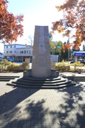
- The South Burnaby Cenotaph is located in Bonsor Park at the corner of Nelson Avenue and Imperial Street. The cenotaph commemorates those lost in the First World War, Second World War and the Korean War.
- Associated Dates
- 1988
- Other Names
- Bonsor Park Cenotaph
- Street View URL
- Google Maps Street View
- Repository
- Burnaby Heritage Planning
- Other Names
- Bonsor Park Cenotaph
- Geographic Access
- Nelson Avenue
- Associated Dates
- 1988
- Description
- The South Burnaby Cenotaph is located in Bonsor Park at the corner of Nelson Avenue and Imperial Street. The cenotaph commemorates those lost in the First World War, Second World War and the Korean War.
- Historic Neighbourhood
- Central Park (Historic Neighbourhood)
- Planning Study Area
- Marlborough Area
- Community
- Burnaby
- Cadastral Identifier
- P.I.D. No. 027-719-375
- Boundaries
- The property (Bonsor Park) is comprised of a single municipally-owned property located at 6749 Nelson Avenue.
- Area
- 3570.00
- Contributing Resource
- Landscape Feature
- Structure
- Ownership
- Public (local)
- Street Address
- 6749 Nelson Avenue
- Street View URL
- Google Maps Street View
Images
Forest Grove School
https://search.heritageburnaby.ca/link/landmark795
- Repository
- Burnaby Heritage Planning
- Geographic Access
- Forest Grove Drive
- Associated Dates
- 1986
- Heritage Value
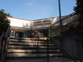
- The Forest Grove subdivision in Burnaby was developed during the early 1980s and resulted in a rapidly growing population that required a school facility to support this "instant" community. Forest Grove Elementary was the second largest elementary school in the city when it opened and 374 pupils were recorded in its first year.
- Planning Study Area
- Lake City Area
- Street Address
- 8525 Forest Grove Drive
- Street View URL
- Google Maps Street View
Images
Metrotown
https://search.heritageburnaby.ca/link/landmark817
- Repository
- Burnaby Heritage Planning
- Geographic Access
- Kingsway
- Associated Dates
- 1986
- Heritage Value
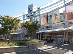
- Although the idea for Metrotown was first expressed in the 1970s, the building itself opened in 1986 and was soon served by the Expo Line of the new SkyTrain system. In the ensuing twenty years, the complex developed into three distinct but adjoining malls - Metropolis at Metrotown, Metrotown Centre, and Station Square. Today, Metrotown serves as the city’s commercial and retail anchor. The mall also includes two large office towers, which by 2001 were home to the head offices for Shaw Cable and TransLink.
- Historic Neighbourhood
- Central Park (Historic Neighbourhood)
- Planning Study Area
- Maywood Area
- Street Address
- 4700 Kingsway
- Street View URL
- Google Maps Street View
Images
Walking Tour Project for South Burnaby
https://search.heritageburnaby.ca/link/archivedescription87824
- Repository
- City of Burnaby Archives
- Date
- 1982-1986
- Collection/Fonds
- Mary Forsyth fonds
- Description Level
- File
- Physical Description
- 2 cm of textual records + 1 map : col. on paper ; 65.5 x 70 cm
- Scope and Content
- File consists of Mary Forsyth's proposal "A Walking Environment for South Burnaby" which includes, a City of Burnaby Director's Report (No. 21 1986-Oct-01) from the Parks and Recreation Committee, various notes and articles, correspondence, feedback and comment sheets from her presentation, an essa…
- Repository
- City of Burnaby Archives
- Date
- 1982-1986
- Collection/Fonds
- Mary Forsyth fonds
- Physical Description
- 2 cm of textual records + 1 map : col. on paper ; 65.5 x 70 cm
- Description Level
- File
- Record No.
- MSS185-001
- Access Restriction
- Open access
- Accession Number
- 2014-27
- Scope and Content
- File consists of Mary Forsyth's proposal "A Walking Environment for South Burnaby" which includes, a City of Burnaby Director's Report (No. 21 1986-Oct-01) from the Parks and Recreation Committee, various notes and articles, correspondence, feedback and comment sheets from her presentation, an essay submitted for her Environmental Education course at Simon Fraser University (draft copy and final), an anotated map of various routes of South Burnaby walks and trails and a recognition letter for a Commission Award from the North Fraser Harbour Commission.
- Media Type
- Textual Record
- Cartographic Material
- Notes
- Transcribed title
Burnaby
https://search.heritageburnaby.ca/link/archivedescription65839
- Repository
- City of Burnaby Archives
- Date
- June 1977
- Collection/Fonds
- Burnaby Historical Society fonds
- Description Level
- Item
- Physical Description
- 1 map : col. ink on paper ; 77 x 55 cm folded to 28 x 19 cm
- Scope and Content
- Item is a map of Burnaby District Municipality, British Columbia, compiled by the Burnaby Planning Department. The map indicates locations of schools, parks, cemeteries, improved streets and private roads, etc.
- Repository
- City of Burnaby Archives
- Date
- June 1977
- Collection/Fonds
- Burnaby Historical Society fonds
- Subseries
- Municipal record subseries
- Physical Description
- 1 map : col. ink on paper ; 77 x 55 cm folded to 28 x 19 cm
- Material Details
- Scale : 1 cm = 1/8 of a mile
- Description Level
- Item
- Record No.
- 42694
- Accession Number
- BHS2007-04
- Scope and Content
- Item is a map of Burnaby District Municipality, British Columbia, compiled by the Burnaby Planning Department. The map indicates locations of schools, parks, cemeteries, improved streets and private roads, etc.
- Media Type
- Cartographic Material
Bird's Eye View of the Burnaby Lake Area
https://search.heritageburnaby.ca/link/museumdescription15144
- Repository
- Burnaby Village Museum
- Date
- 1977
- Collection/Fonds
- Century Park Museum Association fonds
- Description Level
- Item
- Physical Description
- 1 map : b&w print on paper ; 43 x 63.5 cm
- Scope and Content
- Item consists of a map titled "Birds Eye View of the Burnaby Lake Area Circa 1910". The overview of the Burnaby Lake area was compiled and drawn at Heritage Village by curator John Adams and artist, Carol Swan. The map identifies the Burnaby Lake inter-urban tram line; roads including: Sperling Ave…
- Repository
- Burnaby Village Museum
- Collection/Fonds
- Century Park Museum Association fonds
- Description Level
- Item
- Physical Description
- 1 map : b&w print on paper ; 43 x 63.5 cm
- Material Details
- Scale indeterminable
- Scope and Content
- Item consists of a map titled "Birds Eye View of the Burnaby Lake Area Circa 1910". The overview of the Burnaby Lake area was compiled and drawn at Heritage Village by curator John Adams and artist, Carol Swan. The map identifies the Burnaby Lake inter-urban tram line; roads including: Sperling Avenue (Pole Line Road); Gilpin Avenue; Douglas Road; trail to Vancouver Westminster Road (Kingsway); Buckingham Avenue; Haszard Street; various farms and residences including: Charles Sprott "Norland"; H.T. Ceperley "Fairacres"; Claude Hill's "Brookfield farm" and "Broadview"; F.J. Hart's "Avalon"; Miss Woodward's former and new home, school and post office; Councillor Edgar's hunting cabin; Edgar Sprott's "Mayfield farm" and "Mayfield Lodge"; F.J. Peers "Greyfriars"; Arthur de Windt Haszard; Bernard Hill's boathouse as well as other landmarks including: Doran's Mill; tram stations; Burnaby Lake Store; logging camps; wood cutter's shacks; ice houses; cranberry bog; Still Creek; Deer Lake; Burnaby Lake; Deer Lake Creek; Provincial Government Reserve Proposed Hospital (later Oakalla Prison).
- Creator
- Adams, John
- Swan, Carol
- Names
- Hill, Arthur Claude
- Sprott, Charles Frederick
- Sprott, Louis "Edgar"
- Hart, Frederick John, 1884-1945
- Ceperley, H.T.
- Woodward, Maude
- Woodward, Harriet
- Peers, Francis J.
- Haszard, Arthur de Windt
- Hill, Bernard R.
- Geographic Access
- Deer Lake Avenue
- Sperling Avenue
- Haszard Street
- Buckingham Avenue
- Accession Code
- BV021.1.3
- Access Restriction
- No restrictions
- Reproduction Restriction
- No known restrictions
- Date
- 1977
- Media Type
- Cartographic Material
- Historic Neighbourhood
- Burnaby Lake (Historic Neighbourhood)
- Planning Study Area
- Burnaby Lake Area
- Related Material
- See also: Life with the Moores of Hart House : pioneer days on Burnaby's Deer Lake
- Scan Resolution
- 600
- Scan Date
- 2021-11-12
- Scale
- 100
- Notes
- Transcribed title
- Compiled by John Adams; illustration by Carol Swan
- The map depicts the Burnaby Lake Tram Line as being double tracked, whereas in reality it was single tracked.
- Map is part of the book "Life with the Moores of Hart House : pioneer days on Burnaby's Deer Lake https://search.heritageburnaby.ca/permalink/museumlibrary6314-102
Images
Bird's Eye View of the Burnaby Lake Area
https://search.heritageburnaby.ca/link/museumdescription17543
- Repository
- Burnaby Village Museum
- Date
- 1977
- Collection/Fonds
- Century Park Museum Association fonds
- Description Level
- Item
- Physical Description
- 1 map : b&w print with watercolour ; 43 x 63.5 cm
- Scope and Content
- Item consists of a map titled "Birds Eye View of the Burnaby Lake Area Circa 1910". The overview of the Burnaby Lake area was compiled and drawn at Heritage Village by curator John Adams and artist, Carol Swan. The map identifies the Burnaby Lake inter-urban tram line; roads including: Sperling Ave…
- Repository
- Burnaby Village Museum
- Collection/Fonds
- Century Park Museum Association fonds
- Description Level
- Item
- Physical Description
- 1 map : b&w print with watercolour ; 43 x 63.5 cm
- Material Details
- Scale indeterminable
- Scope and Content
- Item consists of a map titled "Birds Eye View of the Burnaby Lake Area Circa 1910". The overview of the Burnaby Lake area was compiled and drawn at Heritage Village by curator John Adams and artist, Carol Swan. The map identifies the Burnaby Lake inter-urban tram line; roads including: Sperling Avenue (Pole Line Road); Gilpin Avenue; Douglas Road; trail to Vancouver Westminster Road (Kingsway); Buckingham Avenue; Haszard Street; various farms and residences including: Charles Sprott "Norland"; H.T. Ceperley "Fairacres"; Claude Hill's "Brookfield farm" and "Broadview"; F.J. Hart's "Avalon"; Miss Woodward's former and new home, school and post office; Councillor Edgar's hunting cabin; Edgar Sprott's "Mayfield farm" and "Mayfield Lodge"; F.J. Peers "Greyfriars"; Arthur de Windt Haszard; Bernard Hill's boathouse as well as other landmarks including: Doran's Mill; tram stations; Burnaby Lake Store; logging camps; wood cutter's shacks; ice houses; cranberry bog; Still Creek; Deer Lake; Burnaby Lake; Deer Lake Creek; Provincial Government Reserve Proposed Hospital (later Oakalla Prison).
- Creator
- Adams, John
- Swan, Carol
- Names
- Hill, Arthur Claude
- Sprott, Charles Frederick
- Sprott, Louis "Edgar"
- Hart, Frederick John, 1884-1945
- Ceperley, H.T.
- Woodward, Maude
- Woodward, Harriet
- Peers, Francis J.
- Haszard, Arthur de Windt
- Hill, Bernard R.
- Geographic Access
- Deer Lake Avenue
- Sperling Avenue
- Haszard Street
- Buckingham Avenue
- Accession Code
- BV021.1.4
- Access Restriction
- No restrictions
- Reproduction Restriction
- No known restrictions
- Date
- 1977
- Media Type
- Cartographic Material
- Historic Neighbourhood
- Burnaby Lake (Historic Neighbourhood)
- Planning Study Area
- Burnaby Lake Area
- Related Material
- See also: Life with the Moores of Hart House : pioneer days on Burnaby's Deer Lake
- Scan Resolution
- 600
- Scan Date
- 2021-11-12
- Scale
- 100
- Notes
- Transcribed title
- Compiled by John Adams; illustration by Carol Swan
- The map depicts the Burnaby Lake Tram Line as being double tracked, whereas in reality it was single tracked.
- Map is part of the book "Life with the Moores of Hart House : pioneer days on Burnaby's Deer Lake https://search.heritageburnaby.ca/permalink/museumlibrary6314-102
- This is a print made from original illustration and appears to be hand-coloured with watercolour at a later date.
Images
Stoney Creek Elementary School
https://search.heritageburnaby.ca/link/landmark836
- Repository
- Burnaby Heritage Planning
- Geographic Access
- Beaverbrook Crescent
- Associated Dates
- 1974
- Heritage Value
- Overcrowding at both Lyndhurst and Cameron Road schools in the early 1970s prompted the construction of the Stoney Creek Community School in 1974. Opening with 101 students, the school was expanded with the addition of six classrooms, a library and activity room in 1976.
- Historic Neighbourhood
- Burquitlam (Historic Neighbourhood)
- Planning Study Area
- Lyndhurst Area
- Street Address
- 2740 Beaverbrook Crescent
- Street View URL
- Google Maps Street View
Images
Burnaby Zoning Map
https://search.heritageburnaby.ca/link/archivedescription58303
- Repository
- City of Burnaby Archives
- Date
- 1973
- Collection/Fonds
- Burnaby Historical Society fonds
- Description Level
- Item
- Physical Description
- 1 map
- Scope and Content
- Item is a Burnaby Zoning Map describing Bylaw no. 4742 (collected by Evelyn Salisbury).
- Repository
- City of Burnaby Archives
- Date
- 1973
- Collection/Fonds
- Burnaby Historical Society fonds
- Subseries
- Evelyn Salisbury subseries
- Physical Description
- 1 map
- Description Level
- Item
- Record No.
- MSS061-100
- Access Restriction
- No restrictions
- Accession Number
- BHS1991-24
- Scope and Content
- Item is a Burnaby Zoning Map describing Bylaw no. 4742 (collected by Evelyn Salisbury).
- Media Type
- Cartographic Material
Kensington Arena
https://search.heritageburnaby.ca/link/landmark787
- Repository
- Burnaby Heritage Planning
- Geographic Access
- Curtis Street
- Associated Dates
- 1973
- Heritage Value
- In 1972, the Burnaby Parks Commission considered numerous requests from the community to increase the available ice rink surfaces in the city and voted to build a new full-sized rink instead of adding to the existing municipal rink facility. The new arena was to be situated in North Burnaby and was opened in 1973 adjacent to Kensington Park.
- Planning Study Area
- Parkcrest-Aubrey Area
- Street Address
- 6159 Curtis Street
- Street View URL
- Google Maps Street View
Images
Montecito Elementary School
https://search.heritageburnaby.ca/link/landmark796
- Repository
- Burnaby Heritage Planning
- Geographic Access
- Duthie Avenue
- Associated Dates
- 1972
- Heritage Value
- The neighbourhood between Sperling Avenue and Burnaby Golf course was beginning to see a rapid development during the late 1960s causing the School Board to determine the need for a school to be built there. This was one of the last schools to be built in Burnaby before school enrolments in general began declining in the late 1970s.
- Planning Study Area
- Sperling-Broadway Area
- Street Address
- 2176 Duthie Avenue
- Street View URL
- Google Maps Street View
Images
Burnaby Advisory Planning Commission records
https://search.heritageburnaby.ca/link/archivedescription82740
- Repository
- City of Burnaby Archives
- Date
- [1971-1996]
- Collection/Fonds
- Hazel Simnett collection
- Description Level
- File
- Physical Description
- 1 file of textual records ; 1 map ; 1 pin
- Scope and Content
- File consists of three letters, one envelope, a booklet, a map, a pin and a business card. The first letter found in the envelope from the Department of the Municipal Clerk is addressed to Hazel Simnett and approves her appointment to the Advisory Planning Commission in 1993. The second letter date…
- Repository
- City of Burnaby Archives
- Date
- [1971-1996]
- Collection/Fonds
- Hazel Simnett collection
- Physical Description
- 1 file of textual records ; 1 map ; 1 pin
- Description Level
- File
- Record No.
- MSS167-010
- Accession Number
- 2013-22
- Scope and Content
- File consists of three letters, one envelope, a booklet, a map, a pin and a business card. The first letter found in the envelope from the Department of the Municipal Clerk is addressed to Hazel Simnett and approves her appointment to the Advisory Planning Commission in 1993. The second letter dated March 17, 1995 is addressed to Hazel Simnett and approves her reappointment to the Advisory Planning Commission. The booklet is of the Burnaby Procedure Bylaw 1971 (bylaw number 6023 to regulate the proceedings of the Municipal Council of The Corporation of the District of Burnaby). The map is a street map of the Burnaby Planning & Building Department from 1992. The second letter is typewritten by Hazel Simnett to Mayor W. Copeland in 1996 regarding her resignation from the Advisory Planning Commission. The pin reads: "Burnaby Advisory Planning Commission". The business card is of Donald G. Stenson, Director Planning and Building of the Burnaby Planning and Building Department.
- Media Type
- Textual Record
- Cartographic Material
- Notes
- Title based on note accompanying file
- Simnett political papers series
Burnaby Village Museum
https://search.heritageburnaby.ca/link/landmark808
- Repository
- Burnaby Heritage Planning
- Geographic Access
- Deer Lake Avenue
- Associated Dates
- 1971
- Heritage Value
- The Burnaby Village Museum is a ten-acre heritage site located adjacent to Deer Lake. The site was originally created as a B.C. Centennial Project in 1971. The official sod turning for was April 11, 1971 by the then Governor General of Canada Roland Mitchener. The Village was initially managed by the Century Park Museum Association, a volunteer society of Burnaby citizens. Over the years many heritage building which could not be maintained in their original locations have been moved to the museum. Today half of the buildings in the village are heritage structures and the remainder are reproductions. In 1990 the City of Burnaby assumed direct management of the Village, and the museum became part of the Parks, Recreation and Culture Department. Visitors can enjoy the shops on Hill Street, ride the Parker 119 Carousel, and climb aboard the Interurban 1223 tram.
- Historic Neighbourhood
- Burnaby Lake (Historic Neighbourhood)
- Planning Study Area
- Douglas-Gilpin Area
- Morley-Buckingham Area
- Street Address
- 6501 Deer Lake Avenue
- Street View URL
- Google Maps Street View
Images
Century Park Museum Association fonds
https://search.heritageburnaby.ca/link/museumdescription3781
- Repository
- Burnaby Village Museum
- Date
- 1971-1989
- Collection/Fonds
- Century Park Museum Association fonds
- Description Level
- Fonds
- Physical Description
- 1814 photographs + 219 architectural drawings + 17 technical drawings + 4 videocassettes + 3 audio reels + 17 audio cassettes + 1.6 m of textual records + 2 maps
- Scope and Content
- Fonds consists of records created and collected by the Century Park Museum Association (renamed Burnaby Village Museum Association after 1984), which managed Heritage Village (later named Burnaby Village Museum) from its opening in 1971 until it's dissolution in December 1989. Records include archi…
- Repository
- Burnaby Village Museum
- Collection/Fonds
- Century Park Museum Association fonds
- Description Level
- Fonds
- Physical Description
- 1814 photographs + 219 architectural drawings + 17 technical drawings + 4 videocassettes + 3 audio reels + 17 audio cassettes + 1.6 m of textual records + 2 maps
- Scope and Content
- Fonds consists of records created and collected by the Century Park Museum Association (renamed Burnaby Village Museum Association after 1984), which managed Heritage Village (later named Burnaby Village Museum) from its opening in 1971 until it's dissolution in December 1989. Records include architectural drawings and proposals; photographs and films of the site; documentation of exhibits and artifacts, special events and programs; oral history interviews and other sound recordings; association meeting minutes; constitutions and bylaws; financial records; reports; correspondence; publications and research materials. Fonds has been arranged into the following series: 1) Century Park Museum Association photograph collection series 2) Century Park Museum Association film collection series 3) Century Park Museum Association architectural records and reports series 4) Heritage Village Museum oral history Interviews series 5) Heritage Village Museum presentations and Programming series 6) Century Park Museum Association reports series 7) Century Park Museum Association constitution, bylaws and agreements series 8) Century Park Museum Association minutes of meetings series 9) Century Park Museum association Board of Directors' administrative files series 10) Century Park Museum membership series 11) Heritage Village Museum exhibits and artifacts series 12) Century Park Museum Association committees' minutes and reports series 13) Museum staff adminstrative files series 14) Century Park Museum Association financial records series
- History
- The Heritage Village Museum was originally created as a British Columbia Centennial Project in 1971 through funding from the Federal, Provincial and Municipal governments. A sub-committee of the Burnaby Centennial '71 Committee was responsible for the creation of a permanent commemorative project. The concept for an open-air museum was developed with the location to be in Burnaby on lots 8,9, 10 and 11 of District Lot 79 and Lots 2 and 5, Block "R" of Districts Lots 79 and 85. The official sod turning for Heritage Village took place on April 11, 1971. In the spring of 1971, a museum director and curator were hired to oversee the development of the project and the acquisition of artifacts with funding from the Parks and Recreation Commission. The Century Park Museum Association (CPMA) was founded under the auspices of the Burnaby Centennial '71 Committee to govern Burnaby's Centennial '71 Commemorative Project, Heritage Village. The CPMA Board of directors were elected on October 26, 1971 with Donald (Don) Copan as the founding president (Don continued to serve on the Board until 1989). The Board of Directors reported directly to the Municipal Council. The association had an overall objective of providing a museum that was a historical resource for Burnaby and the region. The museum mandate was to collect, preserve, research, document and interpret artifacts and historical buildings that illustrated the history and lifestyle of the Lower Mainland in B.C. and Burnaby. The Museum focused on the period between 1890 and 1925 depicting a village lifestyle of a small community. This was achieved through the use of exhibits and displays within historic buildings and built reconstructions along with costumed museum interpreters. Many people contributed to the construction and design of the village. Architect, Rudy Kovach created the initial concept drawings and architecture designs were created by architectural design consultants Hopping, Kovach and Grinnell. Many carpenters and tradespeople worked on the construction of the buildings including Mr. Angelo Giacometti who was respsonible for much of the final decorative elements. The official opening of Heritage Village took place on November 19, 1971 with Burnaby Mayor Bob Prittie and Canada’s Governor General Roland Michener. Heritage Village was opened up to the public for a few days between November 19 and 21 with approximately 15,000 visitors. On July 1st, 1972 Heritage Village re-opened for the summer season with CPMA president, Don Copan and Mayor Bob Prittie officiating. This opening showcased further development of the site with more buildings and exhibits added. In 1984, Heritage Village Museum changed its name to “Burnaby Village Museum” and in turn, the Century Park Museum Association changed its name to the “Burnaby Village Museum Association”. Burnaby Village Museum continued to be governed by the Burnaby Village Museum Association until the end of 1989. In 1990, the Corporation of the District of Burnaby assumed the operation and management of Burnaby Village Museum under the Parks, Recreation and Cultural Services Department and the Burnaby Village Museum Association was dissolved.
- Responsibility
- Century Park Museum Association
- Accession Code
- BV985.6028
- BV005.14
- BV000.18
- BV011.44
- BV011.50
- BV014.30
- BV016.56
- BV017.46
- BV018.21
- BV019.52
- BV020.4
- BV020.5
- BV021.5
- BV022.9
- Date
- 1971-1989
- Media Type
- Photograph
- Sound Recording
- Textual Record
- Architectural Drawing
- Moving Images
- Cartographic Material
- Technical Drawing
- Related Material
- Donald Copan fonds
- Burnaby Centennial '71 Committee collection
- Royal Bank exhibit collection
- Bell's Dry Goods exhibit collection
- Jesse Love farmhouse fonds
- Burnaby Village Museum fonds
- Arrangement
- Records are arranged by types and functions of the Century Park Museum Association. The series reflects how they were maintained by the associaton, it's members and staff of Heritage Village (Burnaby Village Museum) while under the governance of the association.
- Notes
- Title based on contents of fonds
- Further accruals are expected
- Some records within this fonds are Closed - contact Burnaby Village Museum for access
Heritage Village Museum exhibits and artifacts series
https://search.heritageburnaby.ca/link/museumdescription14281
- Repository
- Burnaby Village Museum
- Date
- 1971-1989
- Collection/Fonds
- Century Park Museum Association fonds
- Description Level
- Series
- Physical Description
- 707 photographs + 1 audio reel + 3 audio cassettes + 2 maps
- Scope and Content
- Series consists of records documenting Heritage Village (1971-1983) and Burnaby Village Museum (1984-1989) exhibits and artifacts while it was under the governance and administration of the Century Park Museum Association (Burnaby Village Museum Association) between November 1971 and December 1989.…
- Repository
- Burnaby Village Museum
- Collection/Fonds
- Century Park Museum Association fonds
- Description Level
- Series
- Physical Description
- 707 photographs + 1 audio reel + 3 audio cassettes + 2 maps
- Scope and Content
- Series consists of records documenting Heritage Village (1971-1983) and Burnaby Village Museum (1984-1989) exhibits and artifacts while it was under the governance and administration of the Century Park Museum Association (Burnaby Village Museum Association) between November 1971 and December 1989. Series includes photographs and textual records pertaining to exhibits and artifacts including buildings that form part of the museum's collection along with interpretive maps, audio recordings of samplings from the collection and registers from the Village Church.
- Accession Code
- BV985.6028
- BV005.14
- BV016.56
- BV017.46
- BV020.4
- BV020.5
- BV021.5
- Date
- 1971-1989
- Media Type
- Photograph
- Sound Recording
- Cartographic Material
- Related Material
- See also Don Copan fonds; Burnaby Centennial '71 Committee collection
- Arrangement
- Item level descriptions available
- Notes
- Title based on contents of series
- Further accruals are expected
Community Archives Collection series
https://search.heritageburnaby.ca/link/archivedescription97126
- Repository
- City of Burnaby Archives
- Date
- [188-]-2010
- Collection/Fonds
- Burnaby Historical Society fonds
- Description Level
- Series
- Physical Description
- Textual records and other materials
- Scope and Content
- Series consists of the Burnaby Historical Society's Community Archives collection. The Society's collection includes photographs, documents, ephemera, oral histories, and other records from a myriad of sources and donors, compiled to document the history of Burnaby.
- Repository
- City of Burnaby Archives
- Date
- [188-]-2010
- Collection/Fonds
- Burnaby Historical Society fonds
- Physical Description
- Textual records and other materials
- Description Level
- Series
- Scope and Content
- Series consists of the Burnaby Historical Society's Community Archives collection. The Society's collection includes photographs, documents, ephemera, oral histories, and other records from a myriad of sources and donors, compiled to document the history of Burnaby.
- History
- The Burnaby Historical was founded in 1957. The Historical Society developed its Community Archives by collecting, compiling, and preserving records with historic value to the City of Burnaby. It gathered documents, photographs, and other items while also soliciting and acquiring entire collections or groups of archival records. In 1991, the Society was provided a permanent space to house their growing collection at the Burnaby Village Museum and they continued to grow their holdings. Following the creation of the City of Burnaby Archives in 2001, the Society and the City of Burnaby began discussing the possibility of uniting the two collections. In February 2007, an agreement was signed between the two institutions which resulted in the merger of the Society's Community Archives with the City Archives. All records collected by the Society were transferred into the custody of the City and moved from the Burnaby Village Museum to the City Archives in the McGill branch of the Burnaby Public Library.
- Notes
- Title based on contents of series
Railways
https://search.heritageburnaby.ca/link/archivedescription98236
- Repository
- City of Burnaby Archives
- Date
- [date unknown]
- Collection/Fonds
- Burnaby Historical Society fonds
- Description Level
- File
- Physical Description
- 2 maps : col. ; 89 cm x 76 cm
- Scope and Content
- File contains sheet 7 and 8 of a map of Canadian railways. Sheets depict British Columbia, Yukon, and the eastern portions of Albert and Northwest Territories. Sheet 7 includes an index of railways.
- Repository
- City of Burnaby Archives
- Date
- [date unknown]
- Collection/Fonds
- Burnaby Historical Society fonds
- Subseries
- Ephemera subseries
- Physical Description
- 2 maps : col. ; 89 cm x 76 cm
- Description Level
- File
- Record No.
- 64999
- Accession Number
- BHS2007-04
- Scope and Content
- File contains sheet 7 and 8 of a map of Canadian railways. Sheets depict British Columbia, Yukon, and the eastern portions of Albert and Northwest Territories. Sheet 7 includes an index of railways.
- Media Type
- Cartographic Material
- Notes
- Title based on contents of files
Mortimer-Lamb House
https://search.heritageburnaby.ca/link/landmark494
- Repository
- Burnaby Heritage Planning
- Description
- The Mortimer-Lamb House is a one and one half-storey, Arts and Crafts-style residence with a steeply pitched, side-gabled roof. The original cottage form has been enlarged with a later addition on the west side of the house. Located next to the Burnaby Lake Regional Park Wildlife Rescue Care Centre…
- Associated Dates
- c.1922
- Formal Recognition
- Community Heritage Register
- Other Names
- Harold & Katherine Mortimer-Lamb Residence
- Street View URL
- Google Maps Street View
- Repository
- Burnaby Heritage Planning
- Other Names
- Harold & Katherine Mortimer-Lamb Residence
- Geographic Access
- Glencarin Drive
- Associated Dates
- c.1922
- Formal Recognition
- Community Heritage Register
- Enactment Type
- Council Resolution
- Enactment Date
- 26/05/2003
- Description
- The Mortimer-Lamb House is a one and one half-storey, Arts and Crafts-style residence with a steeply pitched, side-gabled roof. The original cottage form has been enlarged with a later addition on the west side of the house. Located next to the Burnaby Lake Regional Park Wildlife Rescue Care Centre, the house has picturesque views of Burnaby Lake.
- Heritage Value
- Built circa 1922, the Mortimer-Lamb House is valued for its association with first owners, Harold Mortimer-Lamb (1872-1970), and his wife, Katherine Mary Mortimer-Lamb (1873-1939). Born in Leatherhead, Surrey, England, Harold Mortimer-Lamb immigrated to Canada in 1889. Seven years later in Vancouver, he married Katherine Mary Lindsay, a native of Winnipeg. Mortimer-Lamb was a key figure in the B.C. mining industry, serving as Secretary of the Mining Association of B.C. between 1900 and 1945, and also as the Secretary of the Canadian Institute of Mining and Metallurgy. In addition to his professional life, Mortimer-Lamb was a pioneer art photographer and was among Canada's leading art critics, and this house served as a central gathering place for renowned Canadian artists of the day. Mortimer-Lamb’s daughter, Molly Lamb Bobak (born 1922), became a renowned watercolourist, and was the only woman ever hired as an official Canadian war artist. The Mortimer-Lamb House is a significant example of the work of noted architect, Samuel Maclure (1860-1929) and his partner, Ross Lort (1889-1969). Maclure, who was a close friend of the Mortimer-Lamb family, was British Columbia's leading residential architect, and was renowned for his high quality designs for prominent citizens in both Vancouver and Victoria. Maclure was a leading exponent of the Art and Crafts design movement in B.C., and established a sophisticated local variation of residential architecture. The Mortimer-Lamb House was designed at the time when Maclure was in partnership with Ross Lort. In 1907, Lort began working for Maclure's firm as a draftsman, and by 1920 was in charge of Maclure's Vancouver office. Lort's architectural career spanned some sixty-years, and he designed some of the province's most familiar houses, apartments, institutions and places of worship. The Mortimer-Lamb House is also a significant local example of the Arts and Crafts style, and incorporates elements such as board-and-batten siding on the ground floor, shingled gables and leaded casement windows. It is a testament to the domestic architecture built outside of established suburbs during the post-First World War era, typically modest in scale and representative of middle-class residential ideals.
- Defining Elements
- Key elements that define the heritage character of the Mortimer-Lamb House include its: - treed setting with views of Burnaby Lake - residential form, scale and massing as expressed by its one and one-half storey height, rectangular plan and steeply pitched side-gabled roof - wood-frame construction - Arts and Crafts elements such as board-and-batten siding on the ground floor, cedar shingles in the gables and open soffits - original straight-leaded casement windows in single and multiple-assembly - internal red-brick chimney with corbelled cap
- Historic Neighbourhood
- Burnaby Lake (Historic Neighbourhood)
- Planning Study Area
- Burnaby Lake Area
- Organization
- Mining Association of B.C.
- G.F. and J. Galt Limited
- Architect
- Samuel Maclure
- Ross Lort
- Function
- Primary Historic--Single Dwelling
- Primary Current--Single Dwelling
- Community
- Burnaby Lake
- Cadastral Identifier
- P.I.D.002-977-788
- Boundaries
- The Mortimer-Lamb House is comprised of a single residential lot located at 5180 Glencairn Drive, Burnaby.
- Area
- 5652.78
- Contributing Resource
- Building
- Ownership
- Private
- Documentation
- City of Burnaby Planning and Building Department, Heritage Site Files
- Street Address
- 5180 Glencarin Drive
- Street View URL
- Google Maps Street View
Images
Johnson & Mary Skinner Residence
https://search.heritageburnaby.ca/link/landmark551
- Repository
- Burnaby Heritage Planning
- Description
- Residential building.
- Associated Dates
- c.1912
- Other Names
- Timms House
- Street View URL
- Google Maps Street View
- Repository
- Burnaby Heritage Planning
- Other Names
- Timms House
- Geographic Access
- Marine Drive
- Associated Dates
- c.1912
- Description
- Residential building.
- Heritage Value
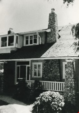
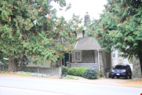
- This house was originally built by Fraser Arm pioneer and postmaster Johnson Alfred Skinner (1864-1941) and his wife, Mary Emma Skinner (née Bailey, 1862-1929). Johnson, who was from Sussex, worked as a horticulturalist. This is an unusual variation on the Craftsman style, with a side gabled roof and a half-width front verandah. Local mason John Pickard completed the distinctive battered cobblestone masonry, including the foundation, chimney, verandah columns and the porte-cochère. The house was later occupied and remodeled by the Timms family.
- Locality
- Fraser Arm
- Historic Neighbourhood
- Fraser Arm (Historic Neighbourhood)
- Planning Study Area
- Big Bend Area
- Ownership
- Private
- Street Address
- 5634 Marine Drive
- Street View URL
- Google Maps Street View
Images
Agnes & Elizabeth Michie Residence
https://search.heritageburnaby.ca/link/landmark554
- Repository
- Burnaby Heritage Planning
- Description
- Residential building.
- Associated Dates
- c.1935
- Street View URL
- Google Maps Street View
- Repository
- Burnaby Heritage Planning
- Geographic Access
- Yale Street
- Associated Dates
- c.1935
- Description
- Residential building.
- Heritage Value
- This interwar bungalow is beautifully preserved and retains many original features. Symmetrical in design, with two steeply-pitched front gables that flank a central arched gable over the front entrance, it also retains its narrow arched windows and projecting purlins in the front gables. Narrow sidelights flank the front door. The matching front elevation windows are typical of the period, with double-hung sash flanking a plate glass “picture window” with a curved transom; the upper panes are cross-leaded. This house was built by Agnes Michie and Elizabeth D. Michie.
- Locality
- Vancouver Heights
- Historic Neighbourhood
- Vancouver Heights (Historic Neighbourhood)
- Planning Study Area
- Burnaby Heights Area
- Ownership
- Private
- Street Address
- 3894 Yale Street
- Street View URL
- Google Maps Street View
Images
Greenwood Residence
https://search.heritageburnaby.ca/link/landmark555
- Repository
- Burnaby Heritage Planning
- Description
- Residential building.
- Associated Dates
- c.1911
- Other Names
- Albert & Emma Greenwood Residence
- Street View URL
- Google Maps Street View
- Repository
- Burnaby Heritage Planning
- Other Names
- Albert & Emma Greenwood Residence
- Geographic Access
- Victory Street
- Associated Dates
- c.1911
- Description
- Residential building.
- Heritage Value
- Typical of the Arts and Crafts style, this house has a front gabled roof with triangular eave brackets and a front verandah with twinned square columns on tapered piers. It is notable for its stained glass windows and early ‘ripple’ float glass. Asbestos shingles were at one point added over the original siding, but are being removed by the owner, exposing the cedar shingles. The house is believed to have been built and occupied by Albert and Emma Greenwood.
- Locality
- Alta Vista
- Historic Neighbourhood
- Alta Vista (Historic Neighbourhood)
- Planning Study Area
- Sussex-Nelson Area
- Ownership
- Private
- Street Address
- 4569 Victory Street
- Street View URL
- Google Maps Street View
Images
Annie Barrett-Lennard Residence
https://search.heritageburnaby.ca/link/landmark559
- Repository
- Burnaby Heritage Planning
- Description
- Residential building.
- Associated Dates
- c.1935
- Street View URL
- Google Maps Street View
- Repository
- Burnaby Heritage Planning
- Geographic Access
- Parker Street
- Associated Dates
- c.1935
- Description
- Residential building.
- Heritage Value
- Built for Annie Barrett-Lennard, this British Arts and Crafts residence has retained many of its original features, such as its stucco and half-timbering exterior with a cat’s slide roof over the front entrance. The steeply-pitched gables, asymmetrical half-massing, leaded windows and pegged joinery are all references to traditional British antecedents.
- Locality
- Capitol Hill
- Historic Neighbourhood
- Capitol Hill (Historic Neighbourhood)
- Planning Study Area
- Parkcrest-Aubrey Area
- Area
- 1227.44
- Contributing Resource
- Building
- Ownership
- Private
- Street Address
- 5450 Parker Street
- Street View URL
- Google Maps Street View
Images
Captain William Eyres Residence
https://search.heritageburnaby.ca/link/landmark565
- Repository
- Burnaby Heritage Planning
- Description
- Residential building.
- Associated Dates
- c.1910
- Street View URL
- Google Maps Street View
- Repository
- Burnaby Heritage Planning
- Geographic Access
- Canada Way
- Associated Dates
- c.1910
- Description
- Residential building.
- Heritage Value
- This home was built by Captain William J. Eyres. In 1912, it was reported in The British Columbian: “Captain Eyres of Seattle is remodelling the front of his house on Douglas Road and otherwise improving it.” The house was later sold to William A. Mawhinney, who subsequently built houses at 6011 Buckingham Avenue and 7616 Burris Avenue. This spacious, high-quality Craftsman bungalow remains in excellent condition. It features a cross-gabled roof with multiple half-timbered front gables with large exposed purlins, in contrast to the shingle cladding on the rest of the house. At the front corner is a glazed sun-room. The entrance porch features tripled square columns. The property still has a beautiful garden, but once included large vegetable gardens, an orchard, and a large chicken house.
- Locality
- Burnaby Lake
- Historic Neighbourhood
- Burnaby Lake (Historic Neighbourhood)
- Planning Study Area
- Morley-Buckingham Area
- Area
- 1709.65
- Contributing Resource
- Building
- Ownership
- Private
- Street Address
- 6079 Canada Way
- Street View URL
- Google Maps Street View
Images
Colonial Finance Company House
https://search.heritageburnaby.ca/link/landmark568
- Repository
- Burnaby Heritage Planning
- Description
- Residential building.
- Associated Dates
- c.1912
- Street View URL
- Google Maps Street View
- Repository
- Burnaby Heritage Planning
- Geographic Access
- Cambridge Street
- Associated Dates
- c.1912
- Description
- Residential building.
- Heritage Value
- 3890 Cambridge Street and 3896 Cambridge Street are nearly identical twins. These modestly-sized pattern book residences each feature a side gabled roof with a central dormer and a central entrance, as well as interesting Craftsman-style detailing such as the bracketed verandah columns, triangular eave brackets and exposed rafter tails. Though the original exterior siding has been covered by a later stucco cladding, the house maintains its original double-hung windows with elaborate multi-paned upper sashes. Built as a revenue property, it was owned by the Colonial Finance Company in 1915.
- Locality
- Vancouver Heights
- Historic Neighbourhood
- Vancouver Heights (Historic Neighbourhood)
- Planning Study Area
- Burnaby Heights Area
- Ownership
- Private
- Street Address
- 3890 Cambridge Street
- Street View URL
- Google Maps Street View
Images
Colonial Finance Company House
https://search.heritageburnaby.ca/link/landmark569
- Repository
- Burnaby Heritage Planning
- Description
- Residential building.
- Associated Dates
- c.1912
- Street View URL
- Google Maps Street View
- Repository
- Burnaby Heritage Planning
- Geographic Access
- Cambridge Street
- Associated Dates
- c.1912
- Description
- Residential building.
- Heritage Value
- 3890 Cambridge Street and 3896 Cambridge Street are nearly identical twins. These modestly-sized pattern book residences each feature a side gabled roof with a central dormer and a central entrance, and an open front verandah. Both houses have later coverings over their original siding; 3890 Cambridge was stuccoed, and this house received more recent vinyl siding, indicating the periodic pressure on homeowners to “upgrade” through the use of new, applied products. Built as a revenue property by the Colonial Finance Company, this house was owned by David Caldwell, the manager of the Caldwell & Carson real estate company in 1915.
- Locality
- Vancouver Heights
- Historic Neighbourhood
- Vancouver Heights (Historic Neighbourhood)
- Planning Study Area
- Burnaby Heights Area
- Street Address
- 3896 Cambridge Street
- Street View URL
- Google Maps Street View
Images
François & Cezarie Comeau Residence
https://search.heritageburnaby.ca/link/landmark580
- Repository
- Burnaby Heritage Planning
- Description
- Residential building.
- Associated Dates
- c.1925
- Street View URL
- Google Maps Street View
- Repository
- Burnaby Heritage Planning
- Geographic Access
- Esmond Avenue
- Associated Dates
- c.1925
- Description
- Residential building.
- Heritage Value
- This home was built for Francois Xavier “Frank” Comeau (1863-1943), a blacksmith who moved from Quebec to Vancouver in about 1890, and his wife Cezarie Marie (née Fortin, 1860-1950), also from Quebec, whom he married in 1903. Featuring a front gabled roof with decorative triangular eave brackets, this comfortable Craftsman bungalow displays other characteristics typical of the style such as lapped siding at the foundation, a shingle-clad main floor, casement windows and stained glass transoms on the front elevation. The most notable feature of the plan is the inset verandah with subtle segmental-arched openings and tapered square columns.
- Locality
- Vancouver Heights
- Historic Neighbourhood
- Vancouver Heights (Historic Neighbourhood)
- Planning Study Area
- Burnaby Heights Area
- Area
- 566.71
- Contributing Resource
- Building
- Ownership
- Private
- Street Address
- 306 Esmond Avenue
- Street View URL
- Google Maps Street View
Images
George & Mary Buxton Residence
https://search.heritageburnaby.ca/link/landmark583
- Repository
- Burnaby Heritage Planning
- Description
- Residential building.
- Associated Dates
- c.1912
- Street View URL
- Google Maps Street View
- Repository
- Burnaby Heritage Planning
- Geographic Access
- Buxton Street
- Associated Dates
- c.1912
- Description
- Residential building.
- Heritage Value
- George Searby Buxton (1867-1955), an English-born carpenter, built this Arts and Crafts dwelling and resided here with his wife and local teacher Mary Isabel Buxton (née Nattriss, 1865-1941). George and Mary are both buried in the picturesque St. Helen’s Anglican Church cemetery in Surrey. The house retains this style’s characteristic elements such as half-timbering, an oriel window and turned verandah supports, as well as its distinctive windows, which are casements in the lower portion of the frame and a fixed multi-paned sash in the upper. The original siding has been covered with a later coat of stucco. The house survives in well-maintained condition.
- Locality
- Central Park
- Historic Neighbourhood
- Central Park (Historic Neighbourhood)
- Planning Study Area
- Marlborough Area
- Area
- 868.85
- Contributing Resource
- Building
- Ownership
- Private
- Street Address
- 4807 Buxton Street
- Street View URL
- Google Maps Street View
Images
Hans & Anna Hau Residence
https://search.heritageburnaby.ca/link/landmark588
- Repository
- Burnaby Heritage Planning
- Description
- Residential building.
- Associated Dates
- c.1935
- Street View URL
- Google Maps Street View
- Repository
- Burnaby Heritage Planning
- Geographic Access
- Canada Way
- Associated Dates
- c.1935
- Description
- Residential building.
- Heritage Value
- Danish builder Hans Jorgensen Hau (1878-1944) and his wife Anna (née Sorenson, 1874-1956), constructed this highly-distinctive Tudor Revival residence circa 1935. This was a time of entrenched traditionalism, and most domestic architecture reflected period revival styles. Tudor elements have been compressed here into a cottage form, including a distinctive front façade with half timbering and brick noggin; on the sides the nogging is rock-dash stucco. Casement windows contribute to the cottage appearance. The rear façade is clad with more utilitarian shingles. A prominent brick chimney exhibits angled and corbelled brickwork. Hau worked as a bricklayer and stonemason, and this house has common elements with the Moore Residence at 5165 Sperling Avenue, which Hau designed and constructed in 1943.
- Locality
- Burnaby Lake
- Historic Neighbourhood
- Burnaby Lake (Historic Neighbourhood)
- Planning Study Area
- Morley-Buckingham Area
- Area
- 2010.52
- Contributing Resource
- Building
- Ownership
- Private
- Street Address
- 5070 Canada Way
- Street View URL
- Google Maps Street View
Images
Henry Adams Residence
https://search.heritageburnaby.ca/link/landmark593
- Repository
- Burnaby Heritage Planning
- Description
- Residential building.
- Associated Dates
- c.1913
- Street View URL
- Google Maps Street View
- Repository
- Burnaby Heritage Planning
- Geographic Access
- Buxton Street
- Associated Dates
- c.1913
- Description
- Residential building.
- Heritage Value
- Carpenter Henry J. Adams constructed this side-gabled, shingle-clad bungalow circa 1913, with his neighbour, George S. Buxton (1867-1955), who was also a carpenter. The house is distinguished by its beautifully-detailed wraparound verandah, which is supported by square, tapered columns, and its distinctive semicircular window in the projecting front gable. Other details include a subtly flattened arched opening under the gable, leading to the central front entry.
- Historic Neighbourhood
- Central Park (Historic Neighbourhood)
- Planning Study Area
- Marlborough Area
- Area
- 864.56
- Contributing Resource
- Building
- Ownership
- Private
- Street Address
- 4826 Buxton Street
- Street View URL
- Google Maps Street View
Images
Hugh & Mary McCallum Residence
https://search.heritageburnaby.ca/link/landmark595
- Repository
- Burnaby Heritage Planning
- Description
- Residential building.
- Associated Dates
- c.1912
- Street View URL
- Google Maps Street View
- Repository
- Burnaby Heritage Planning
- Geographic Access
- Regent Street
- Associated Dates
- c.1912
- Description
- Residential building.
- Heritage Value
- Typical of the Arts and Crafts style, the house has its original front gabled roof, triangular eave brackets, full open front verandah and pointed bargeboards. The house has received some alterations, including the addition of asbestos shingles over the original siding. It is one of the few surviving early homes of the Broadview subdivision which was established in 1911. This was the long-term home of Hugh McCallum Senior (1873-1960), a steam engineer from Scotland, and his wife Mary (née Baxter, 1875-1958). Hugh continued to live in the house after Mary’s death.
- Locality
- Broadview
- Historic Neighbourhood
- Broadview (Historic Neighbourhood)
- Planning Study Area
- West Central Valley Area
- Area
- 623.09
- Contributing Resource
- Building
- Ownership
- Private
- Street Address
- 3838 Regent Street
- Street View URL
- Google Maps Street View
Images
Isak & Lilly Gronning Residence
https://search.heritageburnaby.ca/link/landmark598
- Repository
- Burnaby Heritage Planning
- Description
- Residential building.
- Associated Dates
- c.1938
- Street View URL
- Google Maps Street View
- Repository
- Burnaby Heritage Planning
- Geographic Access
- Eton Street
- Associated Dates
- c.1938
- Description
- Residential building.
- Heritage Value
- This house was built for Isac Hartvig Peterson “Harry” Gronning (1880-1955), a Norwegian-born butcher, and his wife Lilly Geneva (née Hatton, 1889-1978). The Gronnings married in Vancouver in 1913, and lived in this home until at least Harry’s death in 1955. Designed to simulate a Norman-style cottage, the most distinctive feature of this eclectic bungalow is its round entry tower with a conical roof. Other distinctive features include its rolled roof edges that simulate a thatched roof, and its rounded arch windows surrounded with imitation voussoirs. It retains its original wooden-sash windows with leaded panes.
- Locality
- Vancouver Heights
- Historic Neighbourhood
- Vancouver Heights (Historic Neighbourhood)
- Planning Study Area
- Burnaby Heights Area
- Area
- 566.71
- Contributing Resource
- Building
- Ownership
- Private
- Street Address
- 3766 Eton Street
- Street View URL
- Google Maps Street View
Images
J.R. & Frances Dawson Residence
https://search.heritageburnaby.ca/link/landmark599
- Repository
- Burnaby Heritage Planning
- Description
- Residential building.
- Associated Dates
- c.1912
- Street View URL
- Google Maps Street View
- Repository
- Burnaby Heritage Planning
- Geographic Access
- Cambridge Street
- Associated Dates
- c.1912
- Description
- Residential building.
- Heritage Value
- This beautifully-detailed house displays a highly sophisticated mix of fashionable Arts and Crafts elements. The asymmetrical design has stacked inset verandahs on one side, with the ground floor verandah wrapping around the side of the house. The second floor verandah has an arched opening, supported by short versions of the ground floor columns and accessed by French doors with geometric patterned, multi-paned glazing. A semi-circular lunette window lights the attic, and banked windows with leaded transoms are used on the front façade. Decorative details include triangular eave brackets and square verandah columns with distinctive bracketted capitals. The house has survived in original condition except for a later asbestos siding that was applied over the original shingle siding, and the enclosure of the side verandah. The home was owned by J.R. Dawson and Frances Abigail Dawson (née Thompson, 1853-1938) from 1915 until Frances’ death in 1938.
- Locality
- Vancouver Heights
- Historic Neighbourhood
- Vancouver Heights (Historic Neighbourhood)
- Planning Study Area
- Burnaby Heights Area
- Area
- 566.71
- Contributing Resource
- Building
- Ownership
- Private
- Street Address
- 3746 Cambridge Street
- Street View URL
- Google Maps Street View
Images
J.S. & Mina Reid Residence
https://search.heritageburnaby.ca/link/landmark600
- Repository
- Burnaby Heritage Planning
- Description
- Residential building.
- Associated Dates
- c.1913
- Street View URL
- Google Maps Street View
- Repository
- Burnaby Heritage Planning
- Geographic Access
- Frances Street
- Associated Dates
- c.1913
- Description
- Residential building.
- Heritage Value
- The gable-on-hipped roofline is this house’s most unique feature. The home is a typical plan of the Foursquare type with the addition of an inset second-storey verandah. The full open front verandah has square columns and closed balustrades. A coloured glass transom was used above the living room window assembly. By 1915, the house was owned by J.S. and Mina Reid (1874-1969).
- Locality
- Vancouver Heights
- Historic Neighbourhood
- Vancouver Heights (Historic Neighbourhood)
- Planning Study Area
- Burnaby Heights Area
- Area
- 377.10
- Contributing Resource
- Building
- Ownership
- Private
- Street Address
- 3851 Frances Street
- Street View URL
- Google Maps Street View
Images
John & Hattie Standish Residence
https://search.heritageburnaby.ca/link/landmark607
- Repository
- Burnaby Heritage Planning
- Description
- Residential building.
- Associated Dates
- c.1912
- Street View URL
- Google Maps Street View
- Repository
- Burnaby Heritage Planning
- Geographic Access
- Edmonds Street
- Associated Dates
- c.1912
- Description
- Residential building.
- Heritage Value
- This square, two-storey house displays vertical proportions, with a pyramidal roof and central dormer. It features narrow double-hung windows, lapped siding on the first storey, and shingle siding on the second divided by a belt course, and has retained a high degree of original integrity. It was built for John Albert Standish (1862-1913), a farmer who left this home to his wife, Hattie and their children after his death.
- Locality
- Edmonds
- Historic Neighbourhood
- Edmonds (Historic Neighbourhood)
- Planning Study Area
- Edmonds Area
- Area
- 367.94
- Contributing Resource
- Building
- Ownership
- Private
- Street Address
- 7408 Edmonds Street
- Street View URL
- Google Maps Street View
Images
John & Jessie MacLean Residence
https://search.heritageburnaby.ca/link/landmark608
- Repository
- Burnaby Heritage Planning
- Description
- Residential building.
- Associated Dates
- c.1926
- Street View URL
- Google Maps Street View
- Repository
- Burnaby Heritage Planning
- Geographic Access
- Pandora Street
- Associated Dates
- c.1926
- Description
- Residential building.
- Heritage Value
- This cottage illustrates the traditionalism of the interwar years, when domestic ideals were expressed through modest homes displaying period revival influences. Reflecting the influence of the British Arts and Crafts movement, it features a symmetrical plan, a side jerkin-headed roof, a gabled front dormer and twin-coursed shingle siding, and retains its original wooden-sash windows with unusual multi-paned upper sash. It was built for John R. and Jessie MacLean. The house was recently restored by the owners.
- Locality
- Vancouver Heights
- Historic Neighbourhood
- Vancouver Heights (Historic Neighbourhood)
- Planning Study Area
- Burnaby Heights Area
- Area
- 566.71
- Contributing Resource
- Building
- Ownership
- Private
- Street Address
- 3827 Pandora Street
- Street View URL
- Google Maps Street View
Images
John Houston Residence
https://search.heritageburnaby.ca/link/landmark610
- Repository
- Burnaby Heritage Planning
- Description
- Residential building.
- Associated Dates
- c.1908
- Street View URL
- Google Maps Street View
- Repository
- Burnaby Heritage Planning
- Geographic Access
- Burris Street
- Associated Dates
- c.1908
- Description
- Residential building.
- Heritage Value
- The original resident of this house was John Houston, listed in the 1909 City Directory as a ‘rancher’, but is known as the long-time home of barrister Wrathman Sheridan Turner (1889-1974) and his wife Gertrude Helena (née Whealhouse) Turner. Stucco now covers the original exterior siding, though the house maintains its wide, overhanging eaves with exposed rafter tails and triangular eave brackets, indicative of the influence of the newly-emerging Arts and Crafts style.
- Locality
- Burnaby Lake
- Historic Neighbourhood
- Burnaby Lake (Historic Neighbourhood)
- Planning Study Area
- Morley-Buckingham Area
- Area
- 1312.47
- Contributing Resource
- Building
- Ownership
- Private
- Street Address
- 7668 Burris Street
- Street View URL
- Google Maps Street View
Images
Joseph & Anne Gartlan Residence
https://search.heritageburnaby.ca/link/landmark612
- Repository
- Burnaby Heritage Planning
- Description
- Residential building.
- Associated Dates
- c.1913
- Street View URL
- Google Maps Street View
- Repository
- Burnaby Heritage Planning
- Geographic Access
- Oxford Street
- Associated Dates
- c.1913
- Description
- Residential building.
- Heritage Value
- This house was owned by Joseph Paul Gartlan (1877-1967), a steam shovel engineer for the B.C. Electric Company from 1906 to 1943, and his wife, Annie Claudia Gartlan (née Wood, 1891-1933). Joseph was a long-time resident of the house, remaining until his death in 1967. Typical of the Edwardian era, this bungalow has a side gabled roof with a large front gable over the balcony, an open front verandah with square tapered columns, and a mix of narrow lapped wooden siding, square shingles and diamond shingles in the gable peak.
- Locality
- Vancouver Heights
- Historic Neighbourhood
- Vancouver Heights (Historic Neighbourhood)
- Planning Study Area
- Burnaby Heights Area
- Area
- 374.03
- Contributing Resource
- Building
- Ownership
- Private
- Street Address
- 4111 Oxford Street
- Street View URL
- Google Maps Street View
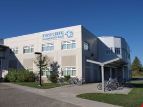
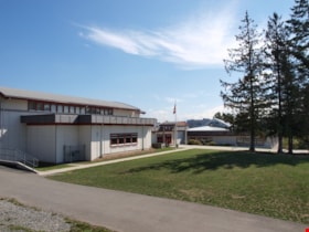
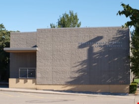
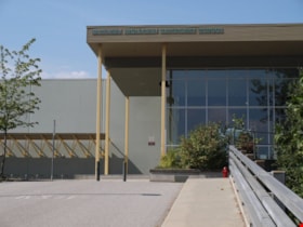
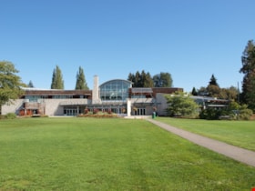
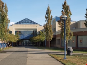
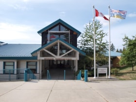
![1892 Burnaby Centennial, [1992] thumbnail](/media/hpo/_Data/_BVM_Cartographic_Material/2013/2013_0008_0001_001.jpg?width=280)
