Narrow Results By
Subject
- Advertising Medium - Signs and Signboards 1
- Buildings - Agricultural 1
- Buildings - Civic 1
- Buildings - Civic - Community Centres 1
- Buildings - Commercial - Stores 1
- Buildings - Heritage 6
- Buildings - Religious 1
- Buildings - Religious - Churches 1
- Buildings - Residential 2
- Buildings - Residential - Houses 2
- Buildings - Schools 1
- Structures - Fences 1
Person / Organization
- Allen, James Charles 1
- Barnet Lumber Company 1
- British Columbia Electric Railway 2
- British Columbia Electric Railway Company 1
- British Columbia Mills Timber and Trading Company 1
- Burnaby Monumental Works 1
- Burnaby School Board 1
- Burnaby Village Museum 2
- Canadian Institute of Mining and Metallurgy 1
- Capitol Hill Community Hall 1
- Central Park Provincial Park Board 1
- Ceperley, Grace 2
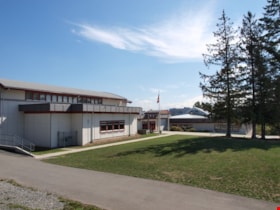
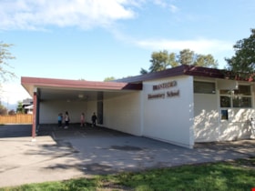
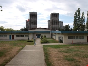
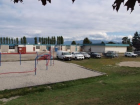
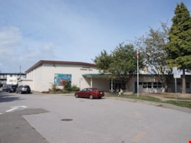
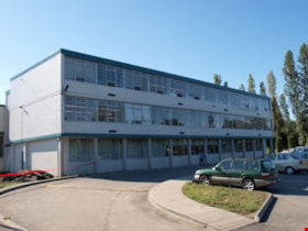
Taylor Park Elementary School
https://search.heritageburnaby.ca/link/landmark847
- Repository
- Burnaby Heritage Planning
- Geographic Access
- Mission Avenue
- Associated Dates
- 2004
- Heritage Value
- Taylor Park Elementary School was opened in 2004 with 240 students from kindergarten to grade three (with older students attending Stride Avenue Community School). By 2006, Taylor Park had been designated as its own school and extended its classes from kindergarten through grade six.
- Historic Neighbourhood
- Edmonds (Historic Neighbourhood)
- Planning Study Area
- Stride Hill Area
- Street Address
- 7590 Mission Avenue
- Street View URL
- Google Maps Street View
Images
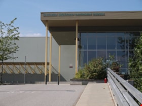
Burnaby Mountain Secondary School
https://search.heritageburnaby.ca/link/landmark831
- Repository
- Burnaby Heritage Planning
- Geographic Access
- Eastlake Drive
- Associated Dates
- 2000
- Heritage Value
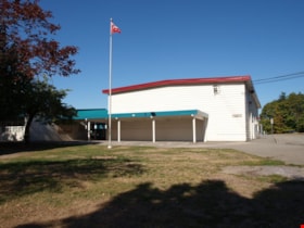
- Burnaby Mountain Secondary School is one of the more recent schools in Burnaby, having opened in 2000 and it serves neighbourhoods in northeast Burnaby and northwest Coquitlam.
- Historic Neighbourhood
- Burquitlam (Historic Neighbourhood)
- Planning Study Area
- Lyndhurst Area
- Street Address
- 8800 Eastlake Drive
- Street View URL
- Google Maps Street View
Images
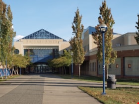
Burnaby South Secondary School and The B.C. Provincial School for the Deaf
https://search.heritageburnaby.ca/link/landmark844
- Repository
- Burnaby Heritage Planning
- Geographic Access
- Rumble Street
- Associated Dates
- 1993
- Heritage Value
- The original Burnaby South High School was replaced in 1993 and the new Burnaby South Secondary School and BC Provincial School for the Deaf was built at this location. This school was built with the latest technology and modern equipment to ensure it was fully accessible and offers integrated academic, social and recreational activities for its students.
- Historic Neighbourhood
- Alta Vista (Historic Neighbourhood)
- Planning Study Area
- Clinton-Glenwood Area
- Street Address
- 5455 Rumble Street
- Street View URL
- Google Maps Street View
Images
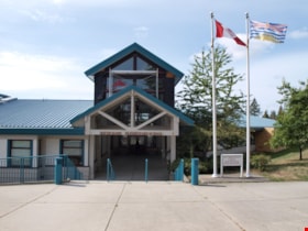
South Slope Elementary School & The B.C. Provincial School for the Deaf
https://search.heritageburnaby.ca/link/landmark843
- Repository
- Burnaby Heritage Planning
- Geographic Access
- Watling Street
- Associated Dates
- 1992
- Heritage Value
- South Slope/B.C. School for the Deaf opened in 1992 and is one of the newer elementary schools in the City. The 2009 School Growth Plan notes that South Slope/BC School for the Deaf replaced the former Jericho Hill School for the Deaf in Vancouver.
- Historic Neighbourhood
- Alta Vista (Historic Neighbourhood)
- Planning Study Area
- Sussex-Nelson Area
- Street Address
- 4446 Watling Street
- Street View URL
- Google Maps Street View
Images
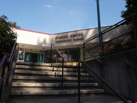
Forest Grove School
https://search.heritageburnaby.ca/link/landmark795
- Repository
- Burnaby Heritage Planning
- Geographic Access
- Forest Grove Drive
- Associated Dates
- 1986
- Heritage Value
- The Forest Grove subdivision in Burnaby was developed during the early 1980s and resulted in a rapidly growing population that required a school facility to support this "instant" community. Forest Grove Elementary was the second largest elementary school in the city when it opened and 374 pupils were recorded in its first year.
- Planning Study Area
- Lake City Area
- Street Address
- 8525 Forest Grove Drive
- Street View URL
- Google Maps Street View
Images
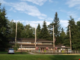
Burnaby Village Museum
https://search.heritageburnaby.ca/link/landmark808
- Repository
- Burnaby Heritage Planning
- Geographic Access
- Deer Lake Avenue
- Associated Dates
- 1971
- Heritage Value
- The Burnaby Village Museum is a ten-acre heritage site located adjacent to Deer Lake. The site was originally created as a B.C. Centennial Project in 1971. The official sod turning for was April 11, 1971 by the then Governor General of Canada Roland Mitchener. The Village was initially managed by the Century Park Museum Association, a volunteer society of Burnaby citizens. Over the years many heritage building which could not be maintained in their original locations have been moved to the museum. Today half of the buildings in the village are heritage structures and the remainder are reproductions. In 1990 the City of Burnaby assumed direct management of the Village, and the museum became part of the Parks, Recreation and Culture Department. Visitors can enjoy the shops on Hill Street, ride the Parker 119 Carousel, and climb aboard the Interurban 1223 tram.
- Historic Neighbourhood
- Burnaby Lake (Historic Neighbourhood)
- Planning Study Area
- Douglas-Gilpin Area
- Morley-Buckingham Area
- Street Address
- 6501 Deer Lake Avenue
- Street View URL
- Google Maps Street View
Images
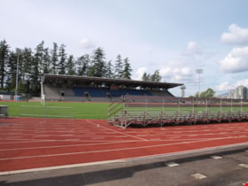
Swangard Stadium
https://search.heritageburnaby.ca/link/landmark818
- Repository
- Burnaby Heritage Planning
- Geographic Access
- Imperial Street
- Associated Dates
- 1969
- Heritage Value
- On 26 April 1969 Swangard Stadium held its official opening. Named after Vancouver Sun former Managing Editor, Erwin Swangard, the stadium was funded entirely from private donations and civic and provincial grants.
- Historic Neighbourhood
- Central Park (Historic Neighbourhood)
- Planning Study Area
- Maywood Area
- Street Address
- 3883 Imperial Street
Images
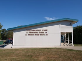
Confederation Park Elementary School
https://search.heritageburnaby.ca/link/landmark786
- Repository
- Burnaby Heritage Planning
- Geographic Access
- Pandora Street
- Associated Dates
- 1965
- Heritage Value
- Confederation Park school was built in 1965 to alleviate increased enrolments in Rosser Avenue and Capitol Hill schools. All elementary schools built in Burnaby in the post-war period share similar features and Confederation Park is no exception. Built low to the ground with no basement, no second stories and no high stairways, the structures could be easily added to as needed as the classrooms were built in a line.
- Historic Neighbourhood
- Capitol Hill (Historic Neighbourhood)
- Planning Study Area
- Capitol Hill Area
- Street Address
- 4715 Pandora Street
- Street View URL
- Google Maps Street View
Images
Brantford Elementary School
https://search.heritageburnaby.ca/link/landmark809
- Repository
- Burnaby Heritage Planning
- Geographic Access
- Brantford Avenue
- Associated Dates
- 1965
- Heritage Value
- As housing developments extended north from Kingsway, pupil enrolments grew at Windsor and at Morley Schools so Brantford was built equidistant from the two to help ease enrolment problems. Brantford Elementary school opened in 1965 and was similar in structure to other schools built in Burnaby during this period - no basements, no second stories and no high stairways. Classrooms were built in a line and could easily be added to as enrolments increased. Brantford had room additions in 1969.
- Historic Neighbourhood
- Edmonds (Historic Neighbourhood)
- Planning Study Area
- Kingsway-Beresford Area
- Street Address
- 6512 Brantford Avenue
- Street View URL
- Google Maps Street View
Images
Cameron Elementary School
https://search.heritageburnaby.ca/link/landmark833
- Repository
- Burnaby Heritage Planning
- Geographic Access
- Erickson Drive
- Associated Dates
- 1965
- Heritage Value
- The increasing density of housing around the Lougheed Shopping Centre area resulted in a spike in enrolment at Lyndhurst Elementary School. As a result, in 1965, Cameron Road Elementary was built to alleviate overcrowding issues. The school opened with 151 pupils. The school was expanded in 1969 when three classrooms were added and again in 1971 when eights more rooms and a library were built.
- Historic Neighbourhood
- Burquitlam (Historic Neighbourhood)
- Planning Study Area
- Cameron Area
- Street Address
- 9540 Erickson Drive
- Street View URL
- Google Maps Street View
Images
Chaffey-Burke Elementary School
https://search.heritageburnaby.ca/link/landmark810
- Repository
- Burnaby Heritage Planning
- Geographic Access
- Sardis Street
- Associated Dates
- 1963
- Heritage Value
- Chaffey-Burke Elementary School was built in 1963 and deviated slightly from the typical one-storey buildings that had been the standard for elementary schools in Burnaby since World War Two. At Chaffey-Burke, the restriction of space resulted in a second story level because of the slope. Additions to the building were made in 1964, 1968 and 1969.
- Historic Neighbourhood
- Central Park (Historic Neighbourhood)
- Planning Study Area
- Garden Village Area
- Street Address
- 4404 Sardis Street
- Street View URL
- Google Maps Street View
Images
Maywood Elementary School
https://search.heritageburnaby.ca/link/landmark812
- Repository
- Burnaby Heritage Planning
- Geographic Access
- Imperial Street
- Associated Dates
- 1962
- Heritage Value
- Located between Nelson and Suncrest Schools, Maywood Elementary School was built in 1962 and helped eased the increasing enrolments at these other schools. Like other schools of this period, Maywood was built on one level with no basement and no high stairs. The classrooms were built in a line which could be easily added to as required. Additions to the original structure were completed in 1964, 1966, 1967, 1971, 1972. Fires at the school in 1979 and 1989 caused extensive damage and required partial reconstruction of the building.
- Historic Neighbourhood
- Central Park (Historic Neighbourhood)
- Planning Study Area
- Maywood Area
- Street Address
- 4567 Imperial Street
- Street View URL
- Google Maps Street View
Images
Cariboo Hill Secondary School
https://search.heritageburnaby.ca/link/landmark837
- Repository
- Burnaby Heritage Planning
- Geographic Access
- 16th Avenue
- Associated Dates
- 1961
- Heritage Value
- By 1961, three new elementary schools had been built in the northeast section of Burnaby - Armstrong, Seaforth, and Lyndhurst. With growing enrolment at each, too many students were required to travel a farther distance to attend Edmonds Junior High School. As a result, the Cariboo Hill Secondary School was built in 1961 and opened with 410 students. Its peak enrolment was during the 1974 school year when over 1100 students attended. Additions to the school were made in 1969, 1971 and 1974.
- Historic Neighbourhood
- East Burnaby (Historic Neighbourhood)
- Planning Study Area
- Cariboo-Armstrong Area
- Street Address
- 8580 16th Avenue
- Street View URL
- Google Maps Street View
Images
Aubrey Elementary School
https://search.heritageburnaby.ca/link/landmark785
- Repository
- Burnaby Heritage Planning
- Geographic Access
- Stratford Avenue
- Associated Dates
- 1959
- Heritage Value
- Aubrey Avenue School was built in 1959 to help alleviate the increased enrolment at other North Burnaby schools due to the development of new subdivisions such as Brentwood, Capitol Hill and Westridge. Additions to the original structure were made in 1962, 1963, 1964, 1967 and 1972.
- Planning Study Area
- Parkcrest-Aubrey Area
- Street Address
- 1075 Stratford Avenue
- Street View URL
- Google Maps Street View
Images
Helen 'The Swinging Girl' Neon Sign
https://search.heritageburnaby.ca/link/landmark591
- Repository
- Burnaby Heritage Planning
- Description
- Commercial building.
- Associated Dates
- 1956
- Formal Recognition
- Heritage Designation, Community Heritage Register
- Other Names
- Helen's Childrens Wear Sign
- Street View URL
- Google Maps Street View
- Repository
- Burnaby Heritage Planning
- Other Names
- Helen's Childrens Wear Sign
- Geographic Access
- Hastings Street
- Associated Dates
- 1956
- Formal Recognition
- Heritage Designation, Community Heritage Register
- Enactment Type
- Bylaw No. 12771
- Enactment Date
- 19/04/2010
- Description
- Commercial building.
- Heritage Value
- While the building here is of some importance as the former North Burnaby municipal office, its primary importance is its delightful neon sign that has become a North Burnaby landmark. Helen Arnold opened Helen’s Childrens Wear shop in the building next door to the old Municipal offices in 1948. In 1955, when North Burnaby moved out, she moved into the vacated building. As part of the renovations, Helen enlisted the assistance of her good friend Jimmy Wallace, owner of Vancouver’s Wallace Neon Company, to create a new sign for her expanded business. One of the company’s designers, Reeve Lehman, created the swinging neon girl that was installed in 1956. Designed in two parts, one section of the sign is cloud shaped and reads ‘Helen’s’ while the other section is a moving representation of a little girl on a swing. The sign is nine feet six inches high and nine feet wide, and the lower section is animated with an internal motor and gears. It immediately became a landmark on Hastings Street, and recently the sign’s design fame has spread far and wide as one of the best surviving examples of kinetic neon art in North America.
- Locality
- Vancouver Heights
- Historic Neighbourhood
- Vancouver Heights (Historic Neighbourhood)
- Planning Study Area
- Willingdon Heights Area
- Community
- Burnaby
- Names
- Helen's Childrens Wear
- Street Address
- 4142 Hastings Street
- Street View URL
- Google Maps Street View
Images
Burnaby Municipal Hall
https://search.heritageburnaby.ca/link/landmark807
- Repository
- Burnaby Heritage Planning
- Geographic Access
- Canada Way
- Associated Dates
- 1956
- Heritage Value
- When staff outgrew the municipal buildings at Edmonds and Kingsway, a debate erupted over where to build a new municipal hall. North Burnaby residents argued against the Kingsway and Edmonds site as it was too removed for their needs, but South Burnaby residents were not prepared to accept a hall in North Burnaby. The debate was finally resolved when it was suggested that the new civic centre for the municipality be in the exact geographic centre of Burnaby. Fortunately, this meant that the new hall was to be built near Deer Lake, in the beautiful Central Valley setting. Burnaby voters accepted this decision and approved the $625,000.00 it would take to build the new structure and the official opening ceremony was held June 22, 1956 when then Reeve Charles MacSorley received the keys to the hall from the contractor.
- Historic Neighbourhood
- Burnaby Lake (Historic Neighbourhood)
- Planning Study Area
- Douglas-Gilpin Area
- Street Address
- 4949 Canada Way
- Street View URL
- Google Maps Street View
Images
Burnaby Winter Club
https://search.heritageburnaby.ca/link/landmark816
- Repository
- Burnaby Heritage Planning
- Geographic Access
- Canada Way
- Associated Dates
- 1956
- Heritage Value
- Skating on Deer Lake and Burnaby Lake was the inspiration to form the Burnaby Winter Club in the 1950s. In 1958, the volunteer group opened an indoor ice facility, still operating today at 4990 Canada Way. Originally, the facility boasted 8 sheets of curling ice, that were used to capacity by the more than 500 family and individual members in the heyday of the Club. The Winter Club was a social centre: in addition to curling, it was a popular place for banquets and dances, and a place for families to spend time together. In the 1960s, the eight sheets of curling ice were reduced to five, to make room for a sheet of hockey ice for the members’ children. Volunteer coaches were committed to excellence, and the Club produced many professional hockey players. By 1964, the Club’s first future NHL player was playing: Pee Wee player Jack McIlhargey.
- Historic Neighbourhood
- Burnaby Lake (Historic Neighbourhood)
- Planning Study Area
- Douglas-Gilpin Area
- Street Address
- 4990 Canada Way
- Street View URL
- Google Maps Street View
Images
Glenwood School
https://search.heritageburnaby.ca/link/landmark842
- Repository
- Burnaby Heritage Planning
- Geographic Access
- Marine Drive
- Associated Dates
- 1956
- Heritage Value
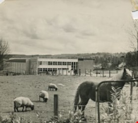
- Glenwood Elementary School was built in 1956 to replace Riverway East School. Additions to the school were made in 1966 and 1969. Decreasing enrolment led to the school closure by 1980, but it was re-opened 1994.
- Historic Neighbourhood
- Fraser Arm (Historic Neighbourhood)
- Planning Study Area
- Clinton-Glenwood Area
- Street Address
- 5787 Marine Drive
- Street View URL
- Google Maps Street View
Images
Willingdon Heights United Church
https://search.heritageburnaby.ca/link/landmark658
- Repository
- Burnaby Heritage Planning
- Description
- Church building.
- Associated Dates
- 1951
- Street View URL
- Google Maps Street View
- Repository
- Burnaby Heritage Planning
- Geographic Access
- Parker Street
- Associated Dates
- 1951
- Description
- Church building.
- Heritage Value
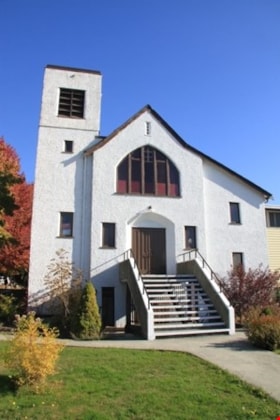
- This church was built to serve a 500-home subdivision known as Willingdon Heights–Canada’s largest single veteran’s housing project created by the Central Mortgage and Housing Corporation and constructed by the Whitsell Construction Company in 1948. The church building was designed as a simplified Gothic Revival church with a tall front tower and Gothic pointed-arch stained glass window and entrance. This church was designed by Vancouver architects Twizell & Twizell. Both Robert Twizell (1875-1964) and younger brother George Twizell (1885-1957) articled at Newcastle, England’s Hicks & Charlewood before arriving in Vancouver in late 1907 or early 1908, with George working for Robert until they established a partnership a few years later. Their firm lasted for nearly half a century and was well known for its numerous church designs.
- Locality
- Vancouver Heights
- Historic Neighbourhood
- Vancouver Heights (Historic Neighbourhood)
- Planning Study Area
- Willingdon Heights Area
- Architect
- Twizell & Twizell
- Area
- 1808.82
- Contributing Resource
- Building
- Ownership
- Private
- Street Address
- 4304 Parker Street
- Street View URL
- Google Maps Street View
Images
Deer Lake Park
https://search.heritageburnaby.ca/link/landmark692
- Repository
- Burnaby Heritage Planning
- Associated Dates
- 1949
- Heritage Value
- As Burnaby developed into a more urban suburb of Vancouver and New Westminster the Deer Lake area retained much of its rural character. In 1949 Deer Lake park was established on the lake's eastern shore. The relocation of the Municipal Hall in the mid-1950s to the Deer Lake area began the vision of developing an administrative and cultural centre for Burnaby. The opportunity for developing this centre began with the opening of the Arts Centre, Century Gardens and the Burnaby Art Gallery in 1967. This was followed by the development of the Deer Lake Park as Burnaby's primary urban park.
- Historic Neighbourhood
- Burnaby Lake (Historic Neighbourhood)
- Planning Study Area
- Morley-Buckingham Area
- Street View URL
- Google Maps Street View
