Narrow Results By
Creator
- Bartel, Mario 23
- British Columbia Underwriters' Association 3
- Burnaby Village Museum 1
- Burnett, Geoffrey K. 3
- Burnett & McGugan, Engineers and Surveyors 1
- Cheung, Nakita 2
- Cooksley, William Thomas 3
- Disney, John Harold "Jack" 4
- Finley, Martha, 1828-1909 9
- Garden, Hermon and Burwell 1
- Hodge, Craig 1
- Jones, Charles Spurgeon "Chuck" 1
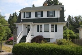
Alfred & Sarah Chrisp Residence
https://search.heritageburnaby.ca/link/landmark556
- Repository
- Burnaby Heritage Planning
- Description
- Rsidential building.
- Associated Dates
- 1913
- Street View URL
- Google Maps Street View
- Repository
- Burnaby Heritage Planning
- Geographic Access
- 11th Avenue
- Associated Dates
- 1913
- Description
- Rsidential building.
- Heritage Value
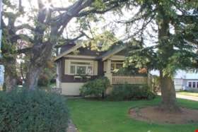
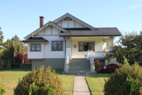
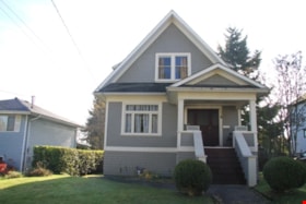
- This high-quality Craftsman bungalow was built for Alfred John Chrisp (1882-1944) and his wife Sarah Hannah Chrisp (née Hindmarch, 1883-1954). Starting in 1908, Alfred worked as an accountant for the CPR in New Westminster, and he and Sarah were married there in 1910. This house features a front gabled roof and gabled front porch, and is notable for its elaborate stained glass windows in the front door glazing, sidelights and the narrow transom over the front elevation window. Maintaining a very high degree of original integrity, the bungalow features lapped siding at the foundation level, a shingle clad main floor, a combination of casement and double-hung windows and square tapered porch columns.
- Locality
- East Burnaby
- Historic Neighbourhood
- East Burnaby (Historic Neighbourhood)
- Planning Study Area
- Edmonds Area
- Street Address
- 7349 11th Avenue
- Street View URL
- Google Maps Street View
Images
Armstrong Elementary School
https://search.heritageburnaby.ca/link/landmark762
- Repository
- Burnaby Heritage Planning
- Geographic Access
- Armstrong Avenue
- Associated Dates
- 1911
- Heritage Value
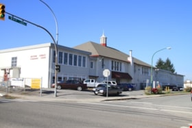
- The site for the Armstrong Avenue school was cleared in 1911. In 1955 the original structure was replaced by a new building and additions were constructed in 1962, 1964, 1967 and 1969. Armstrong Avenue was named after J.C. Armstrong, an early property owner of Burnaby who was involved in the effort to make Burnaby a municipality in 1892.
- Historic Neighbourhood
- East Burnaby (Historic Neighbourhood)
- Planning Study Area
- Cariboo-Armstrong Area
- Street Address
- 8757 Armstrong Avenue
- Street View URL
- Google Maps Street View
Images
Arrow Neon Sign
https://search.heritageburnaby.ca/link/landmark861
- Repository
- Burnaby Heritage Planning
- Description
- Commercial building.
- Associated Dates
- 1961
- Other Names
- Lost in the 50's Drive-in
- Street View URL
- Google Maps Street View
- Repository
- Burnaby Heritage Planning
- Other Names
- Lost in the 50's Drive-in
- Geographic Access
- Edmonds Street
- Associated Dates
- 1961
- Description
- Commercial building.
- Heritage Value
- The Arrow Neon Sign was built in 1961 by the Neonette Sign Company of New Westminster when this property was opened as the Tomahawk Drive-in Restaurant. The restaurant was later known as Lindy's Burger and in 1990, the business was renamed Lost in the 50's Drive-in. It stands 20-foot tall and is composed of a large double-sided hollow steel panel serpentine arrow mounted on a pole supporting a lexan sign panel measuring approximately 8 feet wide by 4 feet tall. The sign was designed with three illuminated features: a round lamp at the top of the pole, a double-sided rectangular fluorescent sign panel box, and two double-sided rows of orange neon arrows that follow the large serpentine arrow. The Arrow Neon Sign remains as a rare surviving example of neon sign art in the city and is the only historic neon sign in South Burnaby. The sign has gained prominence over the years as it has been associated with this small iconic drive-in which has also been utilized as a set for film production. Additionally, the drive-in has played a prominent role in the Edmonds community as a popular setting for recent "Show and Shine" participants to park their classic cars.
- Locality
- Edmonds
- Historic Neighbourhood
- East Burnaby (Historic Neighbourhood)
- Planning Study Area
- Lakeview-Mayfield Area
- Builder
- Neonette Sign Company
- Community
- Burnaby
- Contributing Resource
- Structure
- Ownership
- Public (local)
- Street Address
- 7741 Edmonds Street
- Street View URL
- Google Maps Street View
Images
Buena Vista Neighbourhood
https://search.heritageburnaby.ca/link/landmark759
- Repository
- Burnaby Heritage Planning
- Associated Dates
- 1905-1924
- Heritage Value
- The Buena Vista neighbourhood (so named for its wonderful views) grew out of its proximity to Edmonds and New Westminster and was developed in the period 1911-1912. By the 1950s, the area had been further subdivided and in 1986, Burnaby Municipal Council adopted the Cariboo Hills Development Plan for the neighbourhood to maintain its character as a residential area of the city.
- Historic Neighbourhood
- East Burnaby (Historic Neighbourhood)
- Planning Study Area
- Cariboo-Armstrong Area
Images
Buena Vista Subdivision Residence
https://search.heritageburnaby.ca/link/landmark661
- Repository
- Burnaby Heritage Planning
- Description
- Residential building.
- Associated Dates
- 1911
- Street View URL
- Google Maps Street View
- Repository
- Burnaby Heritage Planning
- Geographic Access
- Armstrong Avenue
- Associated Dates
- 1911
- Description
- Residential building.
- Heritage Value
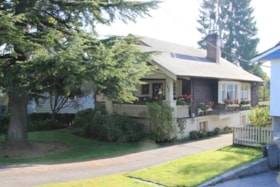
- This modest, hipped roof, cottage-style bungalow is distinguished by a full width front verandah. It was built as part of the Buena Vista subdivision in about 1911 by the Leibly & Blumer Real Estate Company. It was reported in The British Columbian in 1911: “Ten houses are now being erected by the company on the property, solid substantial five or six-room buildings that appeals to the homeseeker”. Retaining a high degree of integrity, this residence displays its original double-hung windows and lapped wooden siding. Houses of this type were often constructed from a complete package of materials offered by building supply companies, and were extremely popular due to their low cost and ease of construction.
- Locality
- East Burnaby
- Historic Neighbourhood
- East Burnaby (Historic Neighbourhood)
- Planning Study Area
- Cariboo-Armstrong Area
- Area
- 413.72
- Contributing Resource
- Building
- Ownership
- Private
- Street Address
- 8941 Armstrong Avenue
- Street View URL
- Google Maps Street View
Images
Cariboo-Armstrong Neighbourhood
https://search.heritageburnaby.ca/link/landmark825
- Repository
- Burnaby Heritage Planning
- Associated Dates
- 1955-2008
- Heritage Value
- The Cariboo-Armstrong Neighbourhood was mainly subdivided in the 1950s during the major building boom in Burnaby throughout the post-war years. Considered a primarily residential area, the neighbourhood has quick and convenient access to major highways and roads as well as being bordered to the north by the George Derby Conservation area.
- Historic Neighbourhood
- East Burnaby (Historic Neighbourhood)
- Planning Study Area
- Cariboo-Armstrong Area
Images
Cariboo Hill Secondary School
https://search.heritageburnaby.ca/link/landmark837
- Repository
- Burnaby Heritage Planning
- Geographic Access
- 16th Avenue
- Associated Dates
- 1961
- Heritage Value
- By 1961, three new elementary schools had been built in the northeast section of Burnaby - Armstrong, Seaforth, and Lyndhurst. With growing enrolment at each, too many students were required to travel a farther distance to attend Edmonds Junior High School. As a result, the Cariboo Hill Secondary School was built in 1961 and opened with 410 students. Its peak enrolment was during the 1974 school year when over 1100 students attended. Additions to the school were made in 1969, 1971 and 1974.
- Historic Neighbourhood
- East Burnaby (Historic Neighbourhood)
- Planning Study Area
- Cariboo-Armstrong Area
- Street Address
- 8580 16th Avenue
- Street View URL
- Google Maps Street View
Images
Charles R. Shaw House
https://search.heritageburnaby.ca/link/landmark525
- Repository
- Burnaby Heritage Planning
- Description
- The Charles R. Shaw House is a one and one-half storey plus basement wood-frame late Victorian era residence, located on the grounds of the Normanna Rest Home development in East Burnaby, near its original location on this site. Originally a modest vernacular Victorian structure, it has been enlarg…
- Associated Dates
- 1891
- Formal Recognition
- Heritage Designation, Community Heritage Register
- Other Names
- Charles R. & Mary Shaw House
- Street View URL
- Google Maps Street View
- Repository
- Burnaby Heritage Planning
- Other Names
- Charles R. & Mary Shaw House
- Geographic Access
- 12th Avenue
- 4th Street
- 13th Avenue
- Associated Dates
- 1891
- Formal Recognition
- Heritage Designation, Community Heritage Register
- Enactment Type
- Bylaw No. 10739
- Enactment Date
- 06/04/1998
- Description
- The Charles R. Shaw House is a one and one-half storey plus basement wood-frame late Victorian era residence, located on the grounds of the Normanna Rest Home development in East Burnaby, near its original location on this site. Originally a modest vernacular Victorian structure, it has been enlarged and embellished through later additions.
- Heritage Value
- The Shaw House is one of the oldest surviving houses in Burnaby, and is valued as a representation of a typical vernacular pioneer house in Burnaby, and a rare survivor from the late Victorian era. The original portion of the house displays a simplicity of form and detail consistent with early local construction, while the later additions display a more sophisticated approach. Originally built in 1891, this house is valued for its association with first owner, Charles R. Shaw (1834-1916) and Mary D. Shaw (1848-1897), one of Burnaby’s earliest settlers. Born in England, Shaw immigrated to Toronto in 1869, and relocated to New Westminster in 1889, where he worked as an employee of the Mechanic's Mill Company, an early woodworking plant. After moving to Burnaby, he was unanimously elected by acclamation as first reeve (mayor) of the new municipality in 1892. In 1894, Shaw sold his house and farm and moved his family to Kamloops due to his wife Mary's failing health. After Mary died in 1897, the Shaw family returned to Toronto. The Shaw House is additionally valued for its association with a later owner, James Brookes (1884-1953), founder of James Brookes Woodworking Ltd., a mill that was a major employer in East Burnaby. Brookes bought and renovated the house in 1917. In 1927, he built a much larger house on the property (now demolished), and the original house was moved to the corner of the property to serve as a gardener's cottage for Brookes' estate. The additions made to the house at this time employed sash and milled products produced by the Brookes plant. Although altered, this Victorian era residence remains largely intact, with Brookes’s later additions.
- Defining Elements
- Key elements that define the heritage character of the Shaw House include its: - modest vernacular residential form, scale and massing, as exemplified by its one and one-half storey plus basement height, front gabled roof, shed roofed verandah and asymmetrical plan - asymmetrical front entrance - cladding: horizontal wooden drop siding on the original portion of the house; cedar shingles on additions; decorative octagonal cedar shingles in the front gable; original decorated bargeboards at front, with cut-out details - later renovations to the front verandah and side addition which resulted in a partially glazed porch entrance and addition with large window assemblies - square verandah columns - irregular fenestration: double-hung wooden-sash windows in a variety of configurations such as 6-over-1 and 4-over-1 windows in the original portion of the house, 12-over-1 windows, and one 24-over-1 window in the front addition - small window at front entry - fifteen-pane French front entry door - internal red brick chimney with corbelled cap
- Historic Neighbourhood
- East Burnaby (Historic Neighbourhood)
- Planning Study Area
- Edmonds Area
- Function
- Primary Historic--Single Dwelling
- Primary Current--Single Dwelling
- Community
- Burnaby
- Cadastral Identifier
- 003-253-848
- Boundaries
- The Shaw House is comprised of a single residential lot located at 7725 Fourth Street (legal address), Burnaby
- Area
- 9199.27
- Contributing Resource
- Building
- Ownership
- Private
- Names
- Shaw, Charles R
- Street Address
- 7725 4th Street
- Street View URL
- Google Maps Street View
Images
East Burnaby Neighbourhood
https://search.heritageburnaby.ca/link/landmark773
- Repository
- Burnaby Heritage Planning
- Associated Dates
- 1905-1924
- Heritage Value
- According to the 1911 December 26 edition of The British Columbian: Optimism is the word that applies to the whole community of East Burnaby. The many improvements carried out by the council during the past two years had been the means of making East Burnaby a thriving settlement, and hence one and all are optimistic as to its future. In the clearing and building line, many fine new homes are being erected...Real estate values have advanced with the times, and a notable feature is the number of better-class houses that are being built in this locality, which proves that East Burnaby is becoming very much alive and elevated.
- Historic Neighbourhood
- East Burnaby (Historic Neighbourhood)
- Planning Study Area
- Edmonds Area
Images
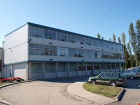
Floden House
https://search.heritageburnaby.ca/link/landmark524
- Repository
- Burnaby Heritage Planning
- Description
- The Floden House is a gambrel roofed, one and one-half storey plus basement wood-frame Dutch Colonial Revival residence, located at the head of the T-intersection of Fourth Street and Edmonds Street in a residential area of East Burnaby.
- Associated Dates
- 1929
- Formal Recognition
- Heritage Designation, Community Heritage Register
- Other Names
- Eric B. & Carrie Floden House
- Street View URL
- Google Maps Street View
- Repository
- Burnaby Heritage Planning
- Other Names
- Eric B. & Carrie Floden House
- Geographic Access
- 4th Street
- Associated Dates
- 1929
- Formal Recognition
- Heritage Designation, Community Heritage Register
- Enactment Type
- Bylaw No. 11358
- Enactment Date
- 27/05/2002
- Description
- The Floden House is a gambrel roofed, one and one-half storey plus basement wood-frame Dutch Colonial Revival residence, located at the head of the T-intersection of Fourth Street and Edmonds Street in a residential area of East Burnaby.
- Heritage Value
- Built in 1929 for Swedish emigrant Eric Birger Floden (1896-1971) and his Norwegian wife, Carrie (1899-1943), the Floden House is a valued representation of local middle-class housing from the 1920s, at a time of increasing prosperity just prior to the onset of the Great Depression. Eric Birger Floden was the head sawyer at Shook Mills in New Westminster, and his family occupied the house until 1964. Additionally, the Floden House is significant as an example of a residential pattern book design from the 1920s. With a reviving economy after the First World War, pattern books were widely used to expedite residential design and construction. It was built by Floden's brother in-law, Nels Olund, a talented contractor of the Fraser Valley who was experienced in building gambrel roof barns. The Floden House is also valued as an example of the Dutch Colonial Revival style, and is typical of period revival houses built in the 1920s that reflected the modern ideals of economy and good design as well as an ongoing pride in past traditions. It was presumed at the time that a well-built house would display a traditional and readily-identifiable style as a hallmark of good taste. The use of the various Colonial Revival styles had gained new popularity during the late 1920s at the time of the American Sesquicentennial. A local landmark, the house originally stood at 7997 18th Avenue and was moved two blocks to its current location by the City of Burnaby when it purchased and rehabilitated the house to save it from demolition, indicating the City's commitment to heritage conservation.
- Defining Elements
- Key elements that define the heritage character of the Floden House include its: - residential form, scale and massing as expressed by its one and one-half storey plus basement height, rectangular plan and distinctive roof form - Dutch Colonial Revival style details such as its side gambrel roof, front and rear shed dormers, attic fanlights, decorative shutters and regular fenestration - roof configuration, with overhanging eaves on the front facade with returns on the side facades, and clipped eaves on the side facades - asymmetrical front entry with small entry porch with lattice surrounds - front projecting bay window - wide lapped horizontal cedar siding - irregular fenestration, with original double-hung 6-over-1 wooden-sash windows - secondary side entry with balcony over - internal red brick chimney with concrete chimney caps
- Historic Neighbourhood
- East Burnaby (Historic Neighbourhood)
- Planning Study Area
- Edmonds Area
- Builder
- Nels Olund
- Function
- Primary Historic--Single Dwelling
- Primary Current--Single Dwelling
- Community
- Burnaby
- Cadastral Identifier
- 009-931-490
- Boundaries
- The Floden House is comprised of a single residential lot located at 7244 Fourth Street, Burnaby.
- Area
- 804.13
- Contributing Resource
- Building
- Ownership
- Private
- Street Address
- 7244 4th Street
- Street View URL
- Google Maps Street View
Images
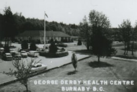
George Derby Centre
https://search.heritageburnaby.ca/link/landmark705
- Repository
- Burnaby Heritage Planning
- Geographic Access
- Cumberland Street
- Associated Dates
- 1947
- Heritage Value
- The George Derby Centre was opened in 1947 as a rehabilitation Centre for young disabled veterans returning from the war. The centre was named after George Cleveland Derby, a World War I veteran who was injured in the Battle of Vimy Ridge and later went on to become a District Administrator in the Department of Solders’ Civil Re-establishment, the forerunner of the Department of Veterans Affairs. His work took him to wartime England where he was awarded the Order of the British Empire in 1943 for patriotic and philanthropic work.
- Historic Neighbourhood
- East Burnaby (Historic Neighbourhood)
- Planning Study Area
- Cariboo-Armstrong Area
- Street Address
- 7550 Cumberland Street
- Street View URL
- Google Maps Street View
Images
George S. Vickers Residence
https://search.heritageburnaby.ca/link/landmark586
- Repository
- Burnaby Heritage Planning
- Description
- Residential building.
- Associated Dates
- 1911
- Street View URL
- Google Maps Street View
- Repository
- Burnaby Heritage Planning
- Geographic Access
- 1st Street
- Associated Dates
- 1911
- Description
- Residential building.
- Heritage Value
- George S. Vickers, a compositor with The British Columbian newspaper, was a prominent Burnaby resident who became involved with real estate during the boom prior to the First World War. In December 1910, The British Columbian reported that “Mr. Vickers has commenced to build a commodious residence on Fourth Avenue between 1st and 2nd streets.” This high quality Craftsman style bungalow, completed in 1911, was originally situated on one acre of property, which contained a large kitchen garden, an orchard of 40 trees of various types and houses and runs for chickens, ducks and turkeys. In 1919, the property was advertised for $5,000 and likely sold easily because of its location (three blocks from the electric streetcar line on Sixth Street), its many amenities and property improvements. Some of its selling points included its panelled living and dining room with 3-ply veneer, beamed ceilings and an open fireplace. Craftsman-style features include battered porch piers, unusual double bargeboards, triangular eave brackets and exposed purlins. The house survives in excellent original condition, with only minor alterations.
- Locality
- East Burnaby
- Historic Neighbourhood
- East Burnaby (Historic Neighbourhood)
- Planning Study Area
- Cariboo-Armstrong Area
- Area
- 819.46
- Contributing Resource
- Building
- Ownership
- Private
- Street Address
- 7686 1st Street
- Street View URL
- Google Maps Street View
Images
Second Street Neighbourhood
https://search.heritageburnaby.ca/link/landmark826
- Repository
- Burnaby Heritage Planning
- Associated Dates
- 1955-2008
- Heritage Value
- Second Street had its origins in the 1910-1920 era and the Second Street Elementary School was built in 1928. Substantial new housing was built in the late 1940s and 1950s and infilling occurred during the 1960s and 1970s. By the 1980s, the neighbourhood was primarily a single family area with a small number of multi-family buildings.
- Historic Neighbourhood
- East Burnaby (Historic Neighbourhood)
- Planning Study Area
- Second Street Area
Images
Second Street School
https://search.heritageburnaby.ca/link/landmark638
- Repository
- Burnaby Heritage Planning
- Description
- School building.
- Associated Dates
- 1928
- Street View URL
- Google Maps Street View
- Repository
- Burnaby Heritage Planning
- Geographic Access
- 2nd Street
- Associated Dates
- 1928
- Description
- School building.
- Heritage Value
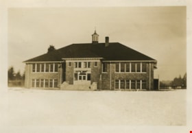
- The Second Street School was originally established at this location as a two-room schoolhouse in 1913 to relieve the overcrowding of Edmonds School during the pre-First World War building boom. The old school was converted into an auditorium when this handsome school building was constructed in 1928. The new school, built by local contractors Ward-Leverington Ltd., included four classrooms, a library, a room for the principal, and a room for the teachers. The original brick façade has been retained although it has been painted; other intact original features include the bellcast octagonal roof ventilator and the protruding front entrance. The Burnaby School Board architect at this time was the talented firm of McCarter & Nairne, who also designed the Douglas Road School. John Y. McCarter (1886-1981) and George Nairne (1884-1953) formed their partnership in 1921 after serving overseas during the First World War. The partners began designing houses and small apartment buildings, and larger commissions soon followed, including Vancouver’s first skyscraper, the Marine Building (1928-30).
- Locality
- East Burnaby
- Historic Neighbourhood
- East Burnaby (Historic Neighbourhood)
- Planning Study Area
- Second Street Area
- Architect
- McCarter & Nairne
- Area
- 15777.66
- Contributing Resource
- Building
- Street Address
- 7502 2nd Street
- Street View URL
- Google Maps Street View
Images
Thomas & Margaret Coldicutt Residence
https://search.heritageburnaby.ca/link/landmark647
- Repository
- Burnaby Heritage Planning
- Description
- Residential building.
- Associated Dates
- 1911
- Street View URL
- Google Maps Street View
- Repository
- Burnaby Heritage Planning
- Geographic Access
- 6th Street
- Associated Dates
- 1911
- Description
- Residential building.
- Heritage Value
- This house was built by Thomas Davis Coldicutt (1879-1970) and Margaret Jane Coldicutt, pre-eminent local citizens. Thomas Coldicutt was born in Birmingham and arrived in Canada in 1900, finding success in the steamboat industry. In 1902, he married Margaret Jane Styler who had been born in Redditch, Worcester, England, and in 1908 they settled in East Burnaby–some of the first pioneers to the area–and established a fruit farm. Thomas had a successful real estate, insurance and brokerage business, and was elected as a councillor for East Burnaby in 1909. He was also active in civic, political and social circles in Burnaby and became president of the Burnaby Board of Trade. "East Burnaby is booming and the signs of prosperity that may be seen on every hand. Most of these are substantial dwellings, such as effect a permanent improvement to the countryside. Among those whose homes have been completed, or on the point of completion may be mentioned. Councillor Coldicutt, who has built himself a habitation on Second Avenue at a cost of $4,000. (The British Columbian, 1911). In 1913, Coldicutt sold his original farm described as “the show place of Burnaby” to the Burnaby School Board for the development of Second Street School and this house was moved from Second Street and Sixteenth Avenue to this site. It has been extensively altered, but retains its original form, scale and massing.
- Locality
- East Burnaby
- Historic Neighbourhood
- East Burnaby (Historic Neighbourhood)
- Planning Study Area
- Edmonds Area
- Area
- 557.42
- Contributing Resource
- Building
- Ownership
- Private
- Street Address
- 7510 6th Street
- Street View URL
- Google Maps Street View
Images
William & Rachael Karman Residence
https://search.heritageburnaby.ca/link/landmark657
- Repository
- Burnaby Heritage Planning
- Description
- Residential building.
- Associated Dates
- 1911
- Street View URL
- Google Maps Street View
- Repository
- Burnaby Heritage Planning
- Geographic Access
- 14th Avenue
- Associated Dates
- 1911
- Description
- Residential building.
- Heritage Value
- This house was built by East Burnaby pioneers William Karman (1866-1948) and Rachael Karman (1865-1933), both born in Scotland. The Karmans originally farmed a “fruit ranch” on Cumberland Road in the 1890s but retired to this home after selling their former farm for a residential subdivision. Rachel died in 1933, and William was remarried to Mary Selkirk (1904-1981). In pristine condition, this Edwardian-era home has a front gabled roof, with symmetrical saddlebag dormers and a gabled front porch. Cedar shingle cladding is used at the foundation level and in the gable ends, and lapped wooden siding on the main level.
- Locality
- East Burnaby
- Historic Neighbourhood
- East Burnaby (Historic Neighbourhood)
- Planning Study Area
- Edmonds Area
- Area
- 696.46
- Contributing Resource
- Building
- Ownership
- Private
- Street Address
- 8088 14th Avenue
- Street View URL
- Google Maps Street View
Images
14th Avenue neighbourhood friends
https://search.heritageburnaby.ca/link/archivedescription35348
- Repository
- City of Burnaby Archives
- Date
- [1925] (date of original), copied 1986
- Collection/Fonds
- Burnaby Historical Society fonds
- Description Level
- Item
- Physical Description
- 1 photograph : b&w ; 12.7 x 17.8 cm print
- Scope and Content
- Photograph of the 14th Avenue neighbourhood friends. Back row, left to right: Pearl Scott, Frances Bryson, Alice Salt, and Dorothy Hutchins (holding baby). Middle row, left to right: Hazel Butler, Doris Bamber, Frances Salt, and Jessica Scott. Front row, left to right: Evelyn Salt, Gladys Butler, a…
- Repository
- City of Burnaby Archives
- Date
- [1925] (date of original), copied 1986
- Collection/Fonds
- Burnaby Historical Society fonds
- Subseries
- Pioneer Tales subseries
- Physical Description
- 1 photograph : b&w ; 12.7 x 17.8 cm print
- Description Level
- Item
- Record No.
- 204-205
- Access Restriction
- No restrictions
- Reproduction Restriction
- No known restrictions
- Accession Number
- BHS1988-03
- Scope and Content
- Photograph of the 14th Avenue neighbourhood friends. Back row, left to right: Pearl Scott, Frances Bryson, Alice Salt, and Dorothy Hutchins (holding baby). Middle row, left to right: Hazel Butler, Doris Bamber, Frances Salt, and Jessica Scott. Front row, left to right: Evelyn Salt, Gladys Butler, and Isabel Scott.
- Names
- Bamber, Doris
- Bryson, Frances
- Butler, Gladys
- Hutchins, Dorothy
- Kemp, Hazel Butler
- Salt, Alice
- Salt, Evelyn
- Salt, Frances
- Salt, Isabel
- Scott, Jessica
- Scott, Pearl
- Media Type
- Photograph
- Notes
- Title based on contents of photograph
- Geographic Access
- 14th Avenue
- Historic Neighbourhood
- East Burnaby (Historic Neighbourhood)
Images
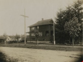
335 16th Avenue
https://search.heritageburnaby.ca/link/archivedescription37842
- Repository
- City of Burnaby Archives
- Date
- [between 1950 and 1954] (date of original), copied 1991
- Collection/Fonds
- Burnaby Historical Society fonds
- Description Level
- Item
- Physical Description
- 1 photograph : b&w ; 2.6 x 4.6 cm print on contact sheet 20.6 x 26.7 cm
- Scope and Content
- Photograph of 335 16th Avenue (later renumbered 8029 16th Avenue), the home of Mel and Lois Coutts from 1948 to 1955.
- Repository
- City of Burnaby Archives
- Date
- [between 1950 and 1954] (date of original), copied 1991
- Collection/Fonds
- Burnaby Historical Society fonds
- Subseries
- Burnaby Image Bank subseries
- Physical Description
- 1 photograph : b&w ; 2.6 x 4.6 cm print on contact sheet 20.6 x 26.7 cm
- Description Level
- Item
- Record No.
- 370-430
- Access Restriction
- No restrictions
- Reproduction Restriction
- No restrictions
- Accession Number
- BHS1999-03
- Scope and Content
- Photograph of 335 16th Avenue (later renumbered 8029 16th Avenue), the home of Mel and Lois Coutts from 1948 to 1955.
- Subjects
- Buildings - Residential - Houses
- Media Type
- Photograph
- Notes
- Title based on contents of photograph
- 1 b&w copy negative accompanying
- Negative has a pink cast
- Geographic Access
- 16th Avenue
- Street Address
- 8029 16th Avenue
- Historic Neighbourhood
- East Burnaby (Historic Neighbourhood)
- Planning Study Area
- Second Street Area
Images
1796 1st Street
https://search.heritageburnaby.ca/link/archivedescription37677
- Repository
- City of Burnaby Archives
- Date
- [1940] (date of original), copied 1991
- Collection/Fonds
- Burnaby Historical Society fonds
- Description Level
- Item
- Physical Description
- 1 photograph : b&w ; 3.9 x 2.3 cm print on contact sheet 20.2 x 25.3 cm
- Scope and Content
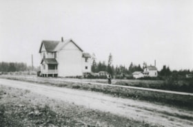
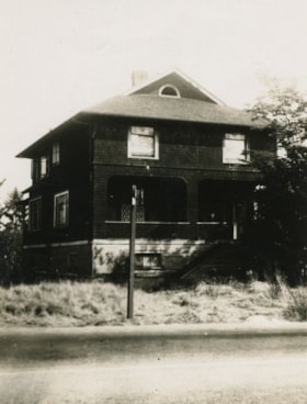
- Photograph of the back view of 1796 1st Street taken from a distance (later renumbered 7419 1st Street). The house was built before 1918.
- Repository
- City of Burnaby Archives
- Date
- [1940] (date of original), copied 1991
- Collection/Fonds
- Burnaby Historical Society fonds
- Subseries
- Burnaby Image Bank subseries
- Physical Description
- 1 photograph : b&w ; 3.9 x 2.3 cm print on contact sheet 20.2 x 25.3 cm
- Description Level
- Item
- Record No.
- 370-265
- Access Restriction
- No restrictions
- Reproduction Restriction
- No known restrictions
- Accession Number
- BHS1999-03
- Scope and Content
- Photograph of the back view of 1796 1st Street taken from a distance (later renumbered 7419 1st Street). The house was built before 1918.
- Subjects
- Buildings - Residential - Houses
- Media Type
- Photograph
- Notes
- Title based on contents of photograph
- 1 b&w copy negative accompanying
- Negative has a pink cast
- Geographic Access
- 1st Street
- Street Address
- 7149 1st Street
- Historic Neighbourhood
- East Burnaby (Historic Neighbourhood)
- Planning Study Area
- Second Street Area
Images
1796 1st Street
https://search.heritageburnaby.ca/link/archivedescription37678
- Repository
- City of Burnaby Archives
- Date
- [1940] (date of original), copied 1991
- Collection/Fonds
- Burnaby Historical Society fonds
- Description Level
- Item
- Physical Description
- 1 photograph : b&w ; 4.5 x 3.0 cm print on contact sheet 20.2 x 25.3 cm
- Scope and Content
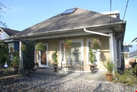
- Photograph of the front view of 1796 1st Street (later renumbered 7149 1st Street). The house was built before 1918.
- Repository
- City of Burnaby Archives
- Date
- [1940] (date of original), copied 1991
- Collection/Fonds
- Burnaby Historical Society fonds
- Subseries
- Burnaby Image Bank subseries
- Physical Description
- 1 photograph : b&w ; 4.5 x 3.0 cm print on contact sheet 20.2 x 25.3 cm
- Description Level
- Item
- Record No.
- 370-266
- Access Restriction
- No restrictions
- Reproduction Restriction
- No known restrictions
- Accession Number
- BHS1999-03
- Scope and Content
- Photograph of the front view of 1796 1st Street (later renumbered 7149 1st Street). The house was built before 1918.
- Subjects
- Buildings - Residential - Houses
- Media Type
- Photograph
- Notes
- Title based on contents of photograph
- 1 b&w copy negative accompanying
- Negative has a pink cast
- Geographic Access
- 1st Street
- Street Address
- 7149 1st Street
- Historic Neighbourhood
- East Burnaby (Historic Neighbourhood)
- Planning Study Area
- Second Street Area






![14th Avenue neighbourhood friends, [1925] (date of original), copied 1986 thumbnail](/media/hpo/_Data/_Archives_Images/_Unrestricted/204/204-205.jpg?width=280)
![335 16th Avenue, [between 1950 and 1954] (date of original), copied 1991 thumbnail](/media/hpo/_Data/_Archives_Images/_Unrestricted/370/370-430.jpg?width=280)
![1796 1st Street, [1940] (date of original), copied 1991 thumbnail](/media/hpo/_Data/_Archives_Images/_Unrestricted/370/370-265.jpg?width=280)
![1796 1st Street, [1940] (date of original), copied 1991 thumbnail](/media/hpo/_Data/_Archives_Images/_Unrestricted/370/370-266.jpg?width=280)