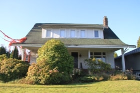
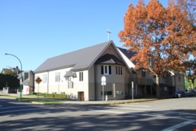
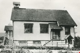
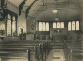
BCER Burnaby Lake Line
https://search.heritageburnaby.ca/link/landmark760
- Repository
- Burnaby Heritage Planning
- Associated Dates
- 1911
- Heritage Value
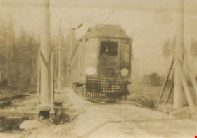
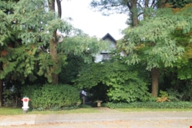
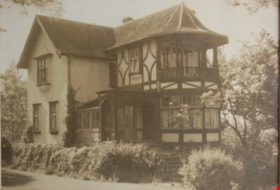
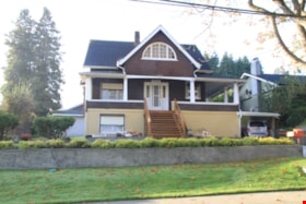
- The Burnaby Lake Line was constructed due to the advocacy of Burnaby residents and the Municipality of Burnaby to build the line. A petition was circulated by residents in 1907, and eventually substantial land bonuses were given to the company to induce them to build the line. Property owners in the area hoped the construction of the line would increase their land values. Construction of the 15-mile line was announced in 1909, and the line opened in 1911. The line travelled from Vancouver to New Westminister through central Burnaby.The last day of service was October 23, 1953. When the Trans Canada highway was constructed in the 1960s, it followed the right of way of the Burnaby Lake Line through Burnaby.
- Historic Neighbourhood
- Burnaby Lake (Historic Neighbourhood)
- Planning Study Area
- Burnaby Lake Area
Images
George S. Vickers Residence
https://search.heritageburnaby.ca/link/landmark586
- Repository
- Burnaby Heritage Planning
- Description
- Residential building.
- Associated Dates
- 1911
- Street View URL
- Google Maps Street View
- Repository
- Burnaby Heritage Planning
- Geographic Access
- 1st Street
- Associated Dates
- 1911
- Description
- Residential building.
- Heritage Value
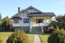
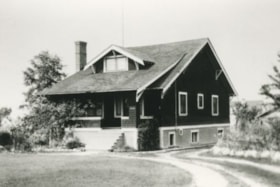
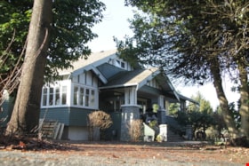
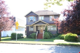
- George S. Vickers, a compositor with The British Columbian newspaper, was a prominent Burnaby resident who became involved with real estate during the boom prior to the First World War. In December 1910, The British Columbian reported that “Mr. Vickers has commenced to build a commodious residence on Fourth Avenue between 1st and 2nd streets.” This high quality Craftsman style bungalow, completed in 1911, was originally situated on one acre of property, which contained a large kitchen garden, an orchard of 40 trees of various types and houses and runs for chickens, ducks and turkeys. In 1919, the property was advertised for $5,000 and likely sold easily because of its location (three blocks from the electric streetcar line on Sixth Street), its many amenities and property improvements. Some of its selling points included its panelled living and dining room with 3-ply veneer, beamed ceilings and an open fireplace. Craftsman-style features include battered porch piers, unusual double bargeboards, triangular eave brackets and exposed purlins. The house survives in excellent original condition, with only minor alterations.
- Locality
- East Burnaby
- Historic Neighbourhood
- East Burnaby (Historic Neighbourhood)
- Planning Study Area
- Cariboo-Armstrong Area
- Area
- 819.46
- Contributing Resource
- Building
- Ownership
- Private
- Street Address
- 7686 1st Street
- Street View URL
- Google Maps Street View
Images
Horne-Payne Receiving Station
https://search.heritageburnaby.ca/link/landmark594
- Repository
- Burnaby Heritage Planning
- Description
- Industrial building.
- Associated Dates
- 1913
- Street View URL
- Google Maps Street View
- Repository
- Burnaby Heritage Planning
- Geographic Access
- 2nd Avenue
- Associated Dates
- 1913
- Description
- Industrial building.
- Heritage Value
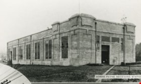
- Constructed as an electrical grid substation by the B.C. Electric Railway Company, the Horne-Payne substation was part of the expansion of this utility company to central Burnaby that occurred as a result of the opening of the Burnaby Lake Interurban line in 1911. The Receiving Station is intended to rearrange the company’s system of distributing power over the whole of the Burrard Peninsula. Power will come to the transformers there and be converted and distributed to the various substations in Vancouver, New Westminster and the suburbs...Work has already been started at the foundation for the new plant. (Vancouver Daily Province, April 29, 1913) When constructed the substation was situated within a forest clearing in a largely undeveloped section of northwest Burnaby. The area now surrounding the substation is heavily developed for semi-industrial purposes. This steel-frame and poured concrete structure was designed to be utilitarian, but with decorative detailing. The south-facing front of the structure features massed corners detailed with decorative relief panels at the roofline. Additionally, this well-balanced building displayed symmetrical fenestration with blind, and tall multi-paned steel-sash windows, some crowned with keystones. A tower added to the east side of the building’s front is the most substantial change made to the appearance of the Horne-Payne substation. This industrial structure was designed by prominent British Columbian architect, Robert Lyon (1879-1963). Born in Edinburgh, Lyon apprenticed and worked as an architect in Scotland until 1908 before moving to New York in 1909. In 1911, he began his career in Vancouver as an “architectural engineer,” with the B.C. Electric Company that lasted until 1918. After a short tenure in the lumber industry, Lyon returned to architecture, this time with his own firm in Penticton. Active in municipal politics, he was instrumental in the incorporation of Penticton as a city, and became its first mayor from 1948-1949. Lyon retired from architecture in 1958 and died in 1963. Lyon also designed the Central Park Gate in Burnaby.
- Locality
- Vancouver Heights
- Historic Neighbourhood
- Vancouver Heights (Historic Neighbourhood)
- Planning Study Area
- West Central Valley Area
- Architect
- Robert Lyon
- Area
- 47400.00
- Contributing Resource
- Building
- Ownership
- Private
- Street Address
- 3700 2nd Street
- Street View URL
- Google Maps Street View
Images
Richard & Ada Neville Residence
https://search.heritageburnaby.ca/link/landmark633
- Repository
- Burnaby Heritage Planning
- Description
- Residential building.
- Associated Dates
- c.1918
- Street View URL
- Google Maps Street View
- Repository
- Burnaby Heritage Planning
- Geographic Access
- Nelson Avenue
- Associated Dates
- c.1918
- Description
- Residential building.
- Heritage Value
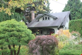
- This Craftsman bungalow was built for the Neville family. Richard Neville (1884-1950) served as a Burnaby councillor in 1924 and is remembered as the man who gave the CCF party (now the NDP) land on Maple Avenue on which to build Jubilee Labour Hall. He worked as a tile layer for the O’Neill Company and was married to Ada Neville (née Cook, 1885-1970). Ada Neville still lived in this house at the time of her death. Typical of the Craftsman style, the house has a side gabled roof with large front gable dormer, triangular eave brackets, an open arched front verandah and a textural mix of siding including cedar shingle on the main floor and lapped siding at the foundation.
- Locality
- Alta Vista
- Historic Neighbourhood
- Alta Vista (Historic Neighbourhood)
- Planning Study Area
- Sussex-Nelson Area
- Area
- 936.00
- Contributing Resource
- Building
- Ownership
- Private
- Street Address
- 6935 Nelson Avenue
- Street View URL
- Google Maps Street View
Images
Andy Johnson House
https://search.heritageburnaby.ca/link/landmark515
- Repository
- Burnaby Heritage Planning
- Description
- The Andy Johnson House is a large, one and one-half storey plus above-ground basement wood-frame mansion on a rubble-stone granite foundation with a red terra cotta pantile roof and an octagonal corner turret. The building stands in a prominent location on a corner lot on Kingsway, one of Burnaby’s…
- Associated Dates
- 1912
- Formal Recognition
- Community Heritage Register
- Other Names
- Andrew M. & Margaret Johnson House 'Glenedward'
- Street View URL
- Google Maps Street View
- Repository
- Burnaby Heritage Planning
- Other Names
- Andrew M. & Margaret Johnson House 'Glenedward'
- Geographic Access
- Kingsway
- Associated Dates
- 1912
- Formal Recognition
- Community Heritage Register
- Enactment Type
- Council Resolution
- Enactment Date
- 26/05/2003
- Description
- The Andy Johnson House is a large, one and one-half storey plus above-ground basement wood-frame mansion on a rubble-stone granite foundation with a red terra cotta pantile roof and an octagonal corner turret. The building stands in a prominent location on a corner lot on Kingsway, one of Burnaby’s main transportation and commercial corridors, and stands adjacent to the Burlington Square Development.
- Heritage Value
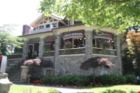
- The Andy Johnson House 'Glenedward' is a valued representation of a prominent upper middle-class family dwelling from the pre-First World War era. Andrew M. Johnson (1861-1934), an early Vancouver pioneer, and his wife Margaret built this house in 1912, in an imposing style favoured by the newly wealthy of the prewar boom period. Born in Norway, Andrew Johnson arrived in Vancouver just months after the Great Fire of 1886 and went into partnership with J. (Ollie) Atkins in a transportation company that became the Mainland Transfer Company, eventually the largest of its kind in Vancouver. Johnson also operated Burnaby's historic Royal Oak Hotel, once located on the opposite corner from his estate. Additionally, the Andy Johnson House is significant for the high-quality design and construction of both the house and its landscaped setting. Designed in the British Arts and Crafts style, the house exhibits a rare degree of opulence in building materials, including imported terra cotta roof tiles, oak and walnut interior millwork, and stained glass manufactured by the Royal City Glass Company. The rubble-stone foundations and perimeter walls were obtained from two massive granite glacial erratic boulders found on the property. The house has been relocated closer to the corner, but the encircling stone walls, the gate posts and gates manufactured by the Westminster Iron Works and some of the original plantings have been retained. A grouping of three giant Sequoias, other mature deciduous trees and massings of shrubbery indicate the type of landscape setting considered appropriate for an estate house in the early years of the twentieth century.
- Defining Elements
- Key elements that define the heritage character of the Andy Johnson House include its: - corner location on Kingsway at Royal Oak Avenue - residential form, scale and massing as expressed by the one and one-half storey height, above-ground basement, octagonal corner turret and rectangular plan - British Arts and Crafts details such as the use of natural indigenous materials, half-timbering in the gables and dormers, picturesque roofline, cedar shingle siding, extended eaves, native granite rubble-stone foundation with red-coloured mortar, and granite piers and chimneys - additional exterior features such as the central front entrance, elaborate wrap-around verandah, porte-cochere and balcony at second storey lighted with original cast iron electric lanterns - red terra cotta pantile roof cladding - fenestration, such as double-hung 1-over-1 wooden-sash windows with stained glass and leaded lights in the upper sash - original interior features such as fireplaces, wainscoting finished with oak and walnut millwork, and three-quarter sawn oak flooring - associated landscape features including three giant Sequoias. granite walls, granite gate posts and wrought iron gates
- Historic Neighbourhood
- Central Park (Historic Neighbourhood)
- Planning Study Area
- Marlborough Area
- Builder
- J.C. Allen
- Function
- Primary Historic--Single Dwelling
- Primary Current--Eating or Drinking Establishment
- Community
- Burnaby
- Cadastral Identifier
- 003-004-538
- Boundaries
- The Andy Johnson House is comprised of a single residential lot located at 5152 Kingsway, Burnaby
- Area
- 1424.21
- Contributing Resource
- Building
- Ownership
- Private
- Street Address
- 5152 Kingsway
- Street View URL
- Google Maps Street View
Images
Burnaby Municipal Hall
https://search.heritageburnaby.ca/link/landmark763
- Repository
- Burnaby Heritage Planning
- Geographic Access
- Kingsway
- Associated Dates
- 1911
- Heritage Value
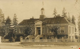
- In 1911, a brick building was built to replace the smaller wooden structure that had served as Burnaby's Municipal Hall since 1899. This new, larger structure was built to reflect Burnaby's growth into a large suburban municipality and remained in use for over 40 years. The old Municipal Hall became a public hall which was demolished upon the construction of the Edmonds Branch of the Burnaby Public Library in 1962. The second Municipal Hall was renovated in 1956 (when the current City Hall was built at Canada Way), and was used as a Police building. In 1966 after the construction of the new Justice Building, the old 1911 Municipal Hall was left vacant and in 1970 it was demolished. The site was redeveloped as a senior citizens residential centre with Edmonds House built on the old hall location.
- Historic Neighbourhood
- Edmonds (Historic Neighbourhood)
- Planning Study Area
- Stride Avenue Area
- Street Address
- 7282 Kingsway
Images
F.J. Hart Estate 'Avalon'
https://search.heritageburnaby.ca/link/landmark542
- Repository
- Burnaby Heritage Planning
- Description
- The F.J. Hart Estate, 'Avalon,' is comprised of 5.26 hectares of lakefront property now located within Deer Lake Park, an Arts and Crafts/Tudor Revival styled mansion and an associated later outbuilding. The mansion is now operated as the Hart House Restaurant.
- Associated Dates
- 1912
- Formal Recognition
- Heritage Designation, Community Heritage Register
- Other Names
- Hart House, Rosedale Gardens, Frederick John & Alice Hart Estate
- Street View URL
- Google Maps Street View
- Repository
- Burnaby Heritage Planning
- Other Names
- Hart House, Rosedale Gardens, Frederick John & Alice Hart Estate
- Geographic Access
- Deer Lake Avenue
- Associated Dates
- 1912
- Formal Recognition
- Heritage Designation, Community Heritage Register
- Enactment Type
- Bylaw No. 9807
- Enactment Date
- 23/11/1992
- Description
- The F.J. Hart Estate, 'Avalon,' is comprised of 5.26 hectares of lakefront property now located within Deer Lake Park, an Arts and Crafts/Tudor Revival styled mansion and an associated later outbuilding. The mansion is now operated as the Hart House Restaurant.
- Heritage Value
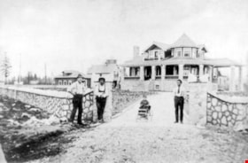
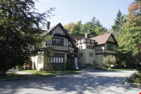
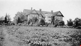
- 'Avalon' and its estate grounds are important as an illustration of the cultural, aesthetic, and lifestyle values of the wealthy families that settled in the Deer Lake area early in the twentieth century. These values were predominantly those of elegant country living and leisure pursuits. The estate is important for its connection with wealthy land developer Frederick John Hart (1868-1945), who was not only instrumental in the creation of subdivisions which promoted Deer Lake as an exclusive residential development for successful families in the New Westminster and Vancouver area, but was also an influential member of this new suburban community and of the emerging municipality of Burnaby. Hart had a wide range of business, civic, and political interests: his real-estate company managed many of the land sales in the area and numerous other large developments throughout the region; he was an entrepreneurial businessman associated with a number of companies important to the economic development of the area and British Columbia; and he was a 'public spirited citizen' and an alderman for the City of New Westminster. The architectural style of ‘Avalon’ set the tone for many of the grand mansions in the adjacent residential development - British Arts and Crafts in derivation, with eclectic details, particularly Tudor precedents. Designed for Hart and his wife Alice Chapman Hart (1867-1935) by Burnaby architect Frank William Macey (1863-1935), the use of references to Tudor England illustrates the relevance and importance to the residents of the area of a strong and visible connection with Britain. The first resident architect in Burnaby, Macey was born and trained in England where he was well-respected for having published two standard texts for the architectural profession. He settled in Burnaby in the first decade of the twentieth century and obtained a number of commissions from prominent businessmen who were building grand homes in the new community of Deer Lake. He designed mostly in the British Arts and Crafts style and introduced the use of rough-cast stucco for building exteriors, a characteristic for which he was renowned, and of which ‘Avalon’ is an excellent example.
- Defining Elements
- Key elements that define the heritage character of 'Avalon' include its: - estate in its entirety: house, grounds, landscape features and garage outbuilding - complex asymmetrical massing - side gable roof punctuated with massive cross gables at the front and rear and open gable ends - exterior features of the house such as the rough-cast stucco with mock-Tudor timbering; cobble-stone facings; square tower with mock battlements - multiple-assemblies of wooden-sash casement windows - tall, prominent corbelled brick chimneys - grand interior spaces and fittings: particularly the entrance hall with its carved stone fireplace; the main staircase; panelled wainscotting; Tudor-arched windows; and fireplaces with original tile surrounds
- Locality
- Deer Lake Park
- Historic Neighbourhood
- Burnaby Lake (Historic Neighbourhood)
- Planning Study Area
- Morley-Buckingham Area
- Architect
- Frank William Macey
- Function
- Primary Current--Eating or Drinking Establishment
- Primary Historic--Estate
- Community
- Burnaby
- Cadastral Identifier
- P.I.D. No. 002-764-431 Legal Description: Lot 6 Except: Firstly: Part on Reference Plan 14874 and Secondly: Part subdivided by Plan 77594, District Lot 85, Group 1, New Westminster District, Plan 11109
- Boundaries
- 'Avalon' is comprised of a single municipally-owned property located at 6664 Deer Lake Avenue, Burnaby.
- Area
- 18,792.29
- Contributing Resource
- Building
- Landscape Feature
- Ownership
- Public (local)
- Other Collection
- Burnaby Village Museum, Collection: Hart Photograph Albums
- Documentation
- Heritage Site Files: PC77000 20. City of Burnaby Planning and Building Department, 4949 Canada Way, Burnaby, B.C., V5G 1M2
- Street Address
- 6664 Deer Lake Avenue
- Street View URL
- Google Maps Street View
Images
Harrison & Beatrice Morrison Residence
https://search.heritageburnaby.ca/link/landmark589
- Repository
- Burnaby Heritage Planning
- Description
- Residential building.
- Associated Dates
- 1911
- Street View URL
- Google Maps Street View
- Repository
- Burnaby Heritage Planning
- Geographic Access
- Dundas Street
- Associated Dates
- 1911
- Description
- Residential building.
- Heritage Value
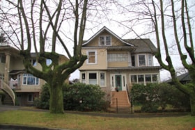
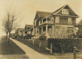
- In 1911, the Vancouver Daily Province reported that “Mr. Harrison D. Morrison is building a twelve-room house of two stories and an attic, with stone basement, on Dundas Street, at a cost of about $4,500.” Harrison Donald Morrison (1864-1944) was a life-long contractor who lived in Burnaby with his wife Beatrice Amanda (née Smith, 1875-1954), until his death in 1944. This Edwardian-era house displays many holdover elements of the Queen Anne Revival style, particularly the elaboration of wall surfaces. In this example, the use of bay and cutaway bay windows, and integral first and second storey verandahs–now removed or altered–add visual interest. The distinct dual pitch of the roof is also a transitional characteristic, used in the late days of the Queen Anne Revival style. A later coat of stucco now covers the original ground floor siding.
- Locality
- Vancouver Heights
- Historic Neighbourhood
- Vancouver Heights (Historic Neighbourhood)
- Planning Study Area
- Burnaby Heights Area
- Area
- 566.71
- Contributing Resource
- Building
- Ownership
- Private
- Street Address
- 3738 Dundas Street
- Street View URL
- Google Maps Street View
Images
Lonsdale Guardhouse Residence
https://search.heritageburnaby.ca/link/landmark617
- Repository
- Burnaby Heritage Planning
- Description
- Residential building.
- Associated Dates
- 1914
- Street View URL
- Google Maps Street View
- Repository
- Burnaby Heritage Planning
- Geographic Access
- Canada Way
- Associated Dates
- 1914
- Description
- Residential building.
- Heritage Value
- The house was built by Lonsdale L. Guardhouse, who was employed with the real estate company of Merithew & Ramsay in 1912. The British Columbian reported in November 1913 that: "Mr. L.L. Guardhouse, a well-known New Westminster man has recently let the contract for a home on Douglas Road near Edmonds Street. This Building is to be erected after the bungalow style and will cost when completed about $4,000." This Craftsman style pattern-book residence is notable for its unusual roofline, which features gently curved eaves. The house remains in excellent original condition and retains its lapped and shingled siding. Other notable features of the house include its pre-cast concrete block foundation–simulated to look like cut stone–and a rustic red-brick chimney. The front verandah has been altered through the removal of its floor structure. Many houses at the time were built from Craftsman-style pattern book designs, which were readily available in magazines and brochures. This house has a twin located in New Westminster at 315 Fifth Avenue.
- Locality
- Edmonds
- Historic Neighbourhood
- Edmonds (Historic Neighbourhood)
- Planning Study Area
- Richmond Park Area
- Area
- 828.85
- Contributing Resource
- Building
- Ownership
- Private
- Street Address
- 6985 Canada Way
- Street View URL
- Google Maps Street View
Images
St. Nicholas Anglican Church
https://search.heritageburnaby.ca/link/landmark641
- Repository
- Burnaby Heritage Planning
- Description
- Church building.
- Associated Dates
- 1912
- Street View URL
- Google Maps Street View
- Repository
- Burnaby Heritage Planning
- Geographic Access
- Triumph Street
- Associated Dates
- 1912
- Description
- Church building.
- Heritage Value
- This church was one of the first built in North Burnaby to serve the new community of Vancouver Heights. Designed by architect Frank Barrs and constructed by local builders, Arthur England and Mr. Scott, it reflected the English roots of the Anglican Church with its fine Arts and Crafts style. It was officially opened in an impressive ceremony by the Bishop of New Westminster and could accommodate 200 worshippers. It was named after Saint Nicholas, the patron saint of sailors. The adjoining parish hall was completed in 1920. The church building features a gabled roof, triangular eave brackets and a semi-octagonal apse. Stucco has been applied to the exterior, but it retains its original form, scale and massing. It now houses the Burnaby Pacific Grace Church. English-born Frank Barrs (1871-1963) arrived in Vancouver in 1907 and established an office for about one year before he began working for the Vancouver Exhibition Association. He briefly established a partnership (1912-1913) with Samuel Shewbrooks (1877-1957), and was active as an architect until about 1933.
- Locality
- Vancouver Heights
- Historic Neighbourhood
- Vancouver Heights (Historic Neighbourhood)
- Planning Study Area
- Burnaby Heights Area
- Architect
- Frank A.A. Barrs
- Area
- 1695.45
- Contributing Resource
- Building
- Ownership
- Private
- Street Address
- 3883 Triumph Street
- Street View URL
- Google Maps Street View
Images
Angus & Mabel MacDonald Residence
https://search.heritageburnaby.ca/link/landmark558
- Repository
- Burnaby Heritage Planning
- Description
- Residential building.
- Associated Dates
- 1913
- Other Names
- The Pillars
- Street View URL
- Google Maps Street View
- Repository
- Burnaby Heritage Planning
- Other Names
- The Pillars
- Geographic Access
- Dundas Street
- Associated Dates
- 1913
- Description
- Residential building.
- Heritage Value
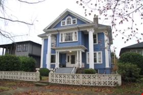
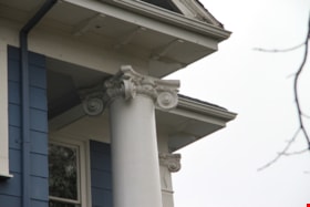
- With its two monumental, double height columns terminating in elaborate Ionic capitals, this Neoclassical Revival style house is aptly named The Pillars. Other Neoclassical embellishments include a Palladian pediment window, pilasters with Ionic capitals applied to the front corners of the house and lathe-turned porch columns. Though it has been re-clad with a later covering of asbestos shingles over the original siding, it otherwise retains a high degree of exterior integrity with most of its double-hung windows and decorative elements still in place. This home was constructed for Angus John MacDonald (née Cummins, 1878-1955), Vice-President of A. Linton & Company Ltd., and his wife Mabel Jessie MacDonald (1884-1971). Linton & Company was a shipbuilding firm; MacDonald retired in 1942 after thirty years in the industry. A photograph of this grand house was often featured in the promotional material for the Vancouver Heights subdivision by realtors and titled “A typical Vancouver Heights home.”
- Locality
- Vancouver Heights
- Historic Neighbourhood
- Vancouver Heights (Historic Neighbourhood)
- Planning Study Area
- Burnaby Heights Area
- Area
- 566.71
- Contributing Resource
- Building
- Ownership
- Private
- Street Address
- 3815 Dundas Street
- Street View URL
- Google Maps Street View
Images
Captain William Eyres Residence
https://search.heritageburnaby.ca/link/landmark565
- Repository
- Burnaby Heritage Planning
- Description
- Residential building.
- Associated Dates
- c.1910
- Street View URL
- Google Maps Street View
- Repository
- Burnaby Heritage Planning
- Geographic Access
- Canada Way
- Associated Dates
- c.1910
- Description
- Residential building.
- Heritage Value
- This home was built by Captain William J. Eyres. In 1912, it was reported in The British Columbian: “Captain Eyres of Seattle is remodelling the front of his house on Douglas Road and otherwise improving it.” The house was later sold to William A. Mawhinney, who subsequently built houses at 6011 Buckingham Avenue and 7616 Burris Avenue. This spacious, high-quality Craftsman bungalow remains in excellent condition. It features a cross-gabled roof with multiple half-timbered front gables with large exposed purlins, in contrast to the shingle cladding on the rest of the house. At the front corner is a glazed sun-room. The entrance porch features tripled square columns. The property still has a beautiful garden, but once included large vegetable gardens, an orchard, and a large chicken house.
- Locality
- Burnaby Lake
- Historic Neighbourhood
- Burnaby Lake (Historic Neighbourhood)
- Planning Study Area
- Morley-Buckingham Area
- Area
- 1709.65
- Contributing Resource
- Building
- Ownership
- Private
- Street Address
- 6079 Canada Way
- Street View URL
- Google Maps Street View
Images
Crabtown
https://search.heritageburnaby.ca/link/landmark674
- Repository
- Burnaby Heritage Planning
- Associated Dates
- 1912-1957
- Heritage Value
- North Burnaby's waterfront was the location of a unique squatter's community known as Crabtown. Although its origins are obscure, it is believed that the first shacks were built before 1912. When the depression of 1913-1917 began, the shacks became permanent homes for impoverished workers. During the Great Depression of the 1930s, the community grew larger. Crabtown was not a slum, but a neighbourhood - the community even rallied together to build a water supply system and trails up the steep bluff with steps and banisters so children could go to school safely. In 1957, the National Harbours Board decided that Crabtown was encroaching on Federal property and evicted all 130 residents. Within a few months, residents were relocated and 114 homes were levelled.
- Historic Neighbourhood
- Vancouver Heights (Historic Neighbourhood)
- Planning Study Area
- Burnaby Heights Area
Images
Daniel & Amelia Mowat House
https://search.heritageburnaby.ca/link/landmark570
- Repository
- Burnaby Heritage Planning
- Description
- Residential building.
- Associated Dates
- 1913
- Formal Recognition
- Heritage Designation, Community Heritage Register
- Street View URL
- Google Maps Street View
- Repository
- Burnaby Heritage Planning
- Geographic Access
- Beresford Street
- McKay Avenue
- Associated Dates
- 1913
- Formal Recognition
- Heritage Designation, Community Heritage Register
- Enactment Type
- Bylaw No. 13058
- Enactment Date
- 12/03/2012
- Description
- Residential building.
- Heritage Value
- This home was built by Daniel Mowat (1848-1923) and Amelia Mary Mowat (née Hoy, 1848-1923). Daniel originally worked as a merchant, and was operating a chicken farm at this location as early as 1908, and later a goat ranch. It is one of Burnaby’s few two-storey Arts and Crafts residences. The generous proportions of the house, its broad, medium-pitched, front-gabled roof and symmetrical design serve as further features. Additionally, the house boasts a high degree of integrity, retaining its original shingle wall cladding, half-timbered gables and original windows – a combination of casement windows with stained glass transoms and double-hung windows with square, multi-paned upper sashes.This house is located adjacent to what was once the Central Park interurban rail line, operated by the B.C. Electric Company, which conveniently connected this area of Burnaby to Vancouver. The arrival of this commuter line in 1892 led to the suburban development of this area of Burnaby.
- Locality
- Central Park
- Historic Neighbourhood
- Central Park (Historic Neighbourhood)
- Planning Study Area
- Maywood Area
- Contributing Resource
- Building
- Ownership
- Private
- Street Address
- 6368 McKay Avenue
- Street View URL
- Google Maps Street View
Images
Dr. James Farish House
https://search.heritageburnaby.ca/link/landmark574
- Repository
- Burnaby Heritage Planning
- Description
- Residential building.
- Associated Dates
- 1912
- Street View URL
- Google Maps Street View
- Repository
- Burnaby Heritage Planning
- Geographic Access
- Cambridge Street
- Associated Dates
- 1912
- Description
- Residential building.
- Heritage Value
- This house was constructed as an investment rental property by Nova Scotia-born Dr. James Collins Farish (1866-1952). Farish was a Vancouver physician and surgeon and an eye, ear, nose & throat specialist; he retired in 1941 after fifty years of practice. In 1903, he married his first wife, Annie Gower Revely (died 1922). His second wife, Ella Jean Morrison (1887-1953) was originally from Winslow, Quebec. With its hipped roof and gabled projections, this house displays the typical elements of the Edwardian era domestic architecture. Features such as exposed rafter tails, paired square porch columns and bracketed bay windows display the emerging influence of the Arts and Crafts style. The ground floor windows are excellent examples of the multiple assemblies of casement, fixed and transom windows favoured during the era. A recent restoration project has extensively altered the original appearance and character of this impressive home.
- Locality
- Vancouver Heights
- Historic Neighbourhood
- Vancouver Heights (Historic Neighbourhood)
- Planning Study Area
- Burnaby Heights Area
- Area
- 566.71
- Contributing Resource
- Building
- Ownership
- Private
- Street Address
- 3774 Cambridge Street
- Street View URL
- Google Maps Street View
Images
Ernest & Katherine Hermon Residence
https://search.heritageburnaby.ca/link/landmark577
- Repository
- Burnaby Heritage Planning
- Description
- Residential building.
- Associated Dates
- 1911
- Street View URL
- Google Maps Street View
- Repository
- Burnaby Heritage Planning
- Geographic Access
- Yale Street
- Associated Dates
- 1911
- Description
- Residential building.
- Heritage Value
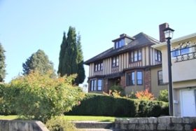
- Mr. Ernest Bolton Hermon, of the prominent engineering firm Hermon & Burwell, built this residence, and he and his wife, Katherine, lived here until 1935. The British Columbian described this home as “…a splendid mansion …which cost in the neighbourhood of $15,000.” Hermon was born into a Dutch family in Ontario in 1863, and moved to British Columbia in 1886. This is one of only three examples of the work of Samuel Maclure in Burnaby and is an outstanding example of his firm’s typical British Arts and Crafts style designs. Samuel Maclure (1860-1929) was known for his British Arts and Crafts style with meticulous attention paid to functional and beautiful interiors that utilized native wood combined with luxurious imported fittings. He was a leading exponent of the Art and Crafts design movement, and established a sophisticated local variation of residential architecture. Maclure’s Vancouver office, in association with his partner Cecil Croker Fox (1879-1916), received some sixty residential commissions between 1909-1915 as a result of the booming local economy and subsequent development of new residential districts. This partnership lasted until when Fox was killed overseas in active service during the First World War.The house has received some alterations, including stucco and brick being added to the lower floor, but it has retained its original form and massing including its symmetrical design, hipped roof and second floor half timbering.
- Locality
- Vancouver Heights
- Historic Neighbourhood
- Vancouver Heights (Historic Neighbourhood)
- Planning Study Area
- Burnaby Heights Area
- Architect
- Maclure & Fox
- Area
- 1133.42
- Contributing Resource
- Building
- Ownership
- Private
- Street Address
- 3870 Yale Street
- Street View URL
- Google Maps Street View
Images
Geoffrey & Kathleen Burnett Residence
https://search.heritageburnaby.ca/link/landmark582
- Repository
- Burnaby Heritage Planning
- Description
- Residential building.
- Associated Dates
- 1914
- Formal Recognition
- Heritage Designation, Community Heritage Register
- Street View URL
- Google Maps Street View
- Repository
- Burnaby Heritage Planning
- Geographic Access
- Canada Way
- Associated Dates
- 1914
- Formal Recognition
- Heritage Designation, Community Heritage Register
- Enactment Type
- Bylaw No. 13841
- Enactment Date
- 28/05/2018
- Description
- Residential building.
- Heritage Value
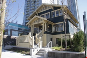
- With its long, narrow plan and hipped, cross-gabled roof, this impressive residence was designed for local surveyor and civil engineer Geoffrey Kirby Burnett, who married Kathleen Wallen (1888-1978) in 1916. It was designed by New Westminster architects R.W. Coventry Dick & Son. Beautifully conceived in the British Arts and Crafts style, it features a steeply-gabled roof over the side entry porch, with square timber columns. Other decorative details include half timbering in the gables, first storey casement windows with leaded transom lights and decorative window hoods on the side elevation.
- Locality
- Edmonds
- Historic Neighbourhood
- Edmonds (Historic Neighbourhood)
- Planning Study Area
- Richmond Park Area
- Architect
- R.W. Coventry Dick & Son
- Area
- 903.70
- Contributing Resource
- Building
- Ownership
- Private
- Street Address
- 7037 Canada Way
- Street View URL
- Google Maps Street View
Images
George & Mary Buxton Residence
https://search.heritageburnaby.ca/link/landmark583
- Repository
- Burnaby Heritage Planning
- Description
- Residential building.
- Associated Dates
- c.1912
- Street View URL
- Google Maps Street View
- Repository
- Burnaby Heritage Planning
- Geographic Access
- Buxton Street
- Associated Dates
- c.1912
- Description
- Residential building.
- Heritage Value
- George Searby Buxton (1867-1955), an English-born carpenter, built this Arts and Crafts dwelling and resided here with his wife and local teacher Mary Isabel Buxton (née Nattriss, 1865-1941). George and Mary are both buried in the picturesque St. Helen’s Anglican Church cemetery in Surrey. The house retains this style’s characteristic elements such as half-timbering, an oriel window and turned verandah supports, as well as its distinctive windows, which are casements in the lower portion of the frame and a fixed multi-paned sash in the upper. The original siding has been covered with a later coat of stucco. The house survives in well-maintained condition.
- Locality
- Central Park
- Historic Neighbourhood
- Central Park (Historic Neighbourhood)
- Planning Study Area
- Marlborough Area
- Area
- 868.85
- Contributing Resource
- Building
- Ownership
- Private
- Street Address
- 4807 Buxton Street
- Street View URL
- Google Maps Street View
Images
Hastings Grove Neighbourhood
https://search.heritageburnaby.ca/link/landmark746
- Repository
- Burnaby Heritage Planning
- Associated Dates
- 1905-1924
- Heritage Value
- During the height of the real estate boom between 1909 and 1913, Vancouver developer Frederick Munson plotted the subdivision of more than 150 acres of land on Curtis Street east of Sperling Avenue, on the newly logged slopes of remote Burnaby Mountain. Burnaby opened up Curtis Street to facilitate access to Hastings Grove and Munson agreed to pay one-third of the cost but never did. He also paid only $1000.00 down on the agreed price of the land. When he failed to make further payments, the mortgage holders foreclosed and re-sold the properties. People who had bought lots from Munson lost not only the land they though they owned, but also the money they had paid for it. Hastings Grove was a disaster. The converted automobile - which served as the bus - stopped running. The few houses and most of the lots reverted to the Municipality because of non-payment of taxes and are now part of Burnaby Mountain Park. The only remaining building is the old Hastings Grove Store which still stands as an apartment building.
- Historic Neighbourhood
- Lochdale (Historic Neighbourhood)
- Planning Study Area
- Lochdale Area
Images
Henry Adams Residence
https://search.heritageburnaby.ca/link/landmark593
- Repository
- Burnaby Heritage Planning
- Description
- Residential building.
- Associated Dates
- c.1913
- Street View URL
- Google Maps Street View
- Repository
- Burnaby Heritage Planning
- Geographic Access
- Buxton Street
- Associated Dates
- c.1913
- Description
- Residential building.
- Heritage Value
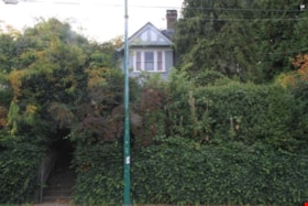
- Carpenter Henry J. Adams constructed this side-gabled, shingle-clad bungalow circa 1913, with his neighbour, George S. Buxton (1867-1955), who was also a carpenter. The house is distinguished by its beautifully-detailed wraparound verandah, which is supported by square, tapered columns, and its distinctive semicircular window in the projecting front gable. Other details include a subtly flattened arched opening under the gable, leading to the central front entry.
- Historic Neighbourhood
- Central Park (Historic Neighbourhood)
- Planning Study Area
- Marlborough Area
- Area
- 864.56
- Contributing Resource
- Building
- Ownership
- Private
- Street Address
- 4826 Buxton Street
- Street View URL
- Google Maps Street View
