Narrow Results By
Subject
- Advertising Medium - Signs and Signboards 1
- Agriculture 4
- Agriculture - Crops 1
- Agriculture - Farms 4
- Agriculture - Ranches 1
- Animals - Pigs 1
- Building Components 1
- Buildings - Agricultural 4
- Buildings - Agricultural - Greenhouses 2
- Buildings - Agricultural - Stables 1
- Buildings - Civic - Hospitals 1
- Buildings - Civic - Museums 2
Person / Organization
- Ah Sam 1
- Allen, James Charles 1
- Bateman, Edwin W. 1
- Bateman, Mary Dale 1
- Bell, Flora 1
- Bell, William 1
- Borstal School 2
- Bridge Studios 1
- British Columbia Electric Railway 3
- British Columbia Electric Railway Company 1
- British Columbia Mills Timber and Trading Company 1
- Burnaby Civic Employees Union 1

Floden House
https://search.heritageburnaby.ca/link/landmark524
- Repository
- Burnaby Heritage Planning
- Description
- The Floden House is a gambrel roofed, one and one-half storey plus basement wood-frame Dutch Colonial Revival residence, located at the head of the T-intersection of Fourth Street and Edmonds Street in a residential area of East Burnaby.
- Associated Dates
- 1929
- Formal Recognition
- Heritage Designation, Community Heritage Register
- Other Names
- Eric B. & Carrie Floden House
- Street View URL
- Google Maps Street View
- Repository
- Burnaby Heritage Planning
- Other Names
- Eric B. & Carrie Floden House
- Geographic Access
- 4th Street
- Associated Dates
- 1929
- Formal Recognition
- Heritage Designation, Community Heritage Register
- Enactment Type
- Bylaw No. 11358
- Enactment Date
- 27/05/2002
- Description
- The Floden House is a gambrel roofed, one and one-half storey plus basement wood-frame Dutch Colonial Revival residence, located at the head of the T-intersection of Fourth Street and Edmonds Street in a residential area of East Burnaby.
- Heritage Value
- Built in 1929 for Swedish emigrant Eric Birger Floden (1896-1971) and his Norwegian wife, Carrie (1899-1943), the Floden House is a valued representation of local middle-class housing from the 1920s, at a time of increasing prosperity just prior to the onset of the Great Depression. Eric Birger Floden was the head sawyer at Shook Mills in New Westminster, and his family occupied the house until 1964. Additionally, the Floden House is significant as an example of a residential pattern book design from the 1920s. With a reviving economy after the First World War, pattern books were widely used to expedite residential design and construction. It was built by Floden's brother in-law, Nels Olund, a talented contractor of the Fraser Valley who was experienced in building gambrel roof barns. The Floden House is also valued as an example of the Dutch Colonial Revival style, and is typical of period revival houses built in the 1920s that reflected the modern ideals of economy and good design as well as an ongoing pride in past traditions. It was presumed at the time that a well-built house would display a traditional and readily-identifiable style as a hallmark of good taste. The use of the various Colonial Revival styles had gained new popularity during the late 1920s at the time of the American Sesquicentennial. A local landmark, the house originally stood at 7997 18th Avenue and was moved two blocks to its current location by the City of Burnaby when it purchased and rehabilitated the house to save it from demolition, indicating the City's commitment to heritage conservation.
- Defining Elements
- Key elements that define the heritage character of the Floden House include its: - residential form, scale and massing as expressed by its one and one-half storey plus basement height, rectangular plan and distinctive roof form - Dutch Colonial Revival style details such as its side gambrel roof, front and rear shed dormers, attic fanlights, decorative shutters and regular fenestration - roof configuration, with overhanging eaves on the front facade with returns on the side facades, and clipped eaves on the side facades - asymmetrical front entry with small entry porch with lattice surrounds - front projecting bay window - wide lapped horizontal cedar siding - irregular fenestration, with original double-hung 6-over-1 wooden-sash windows - secondary side entry with balcony over - internal red brick chimney with concrete chimney caps
- Historic Neighbourhood
- East Burnaby (Historic Neighbourhood)
- Planning Study Area
- Edmonds Area
- Builder
- Nels Olund
- Function
- Primary Historic--Single Dwelling
- Primary Current--Single Dwelling
- Community
- Burnaby
- Cadastral Identifier
- 009-931-490
- Boundaries
- The Floden House is comprised of a single residential lot located at 7244 Fourth Street, Burnaby.
- Area
- 804.13
- Contributing Resource
- Building
- Ownership
- Private
- Street Address
- 7244 4th Street
- Street View URL
- Google Maps Street View
Images


Frederick & Edna Cunningham House
https://search.heritageburnaby.ca/link/landmark522
- Repository
- Burnaby Heritage Planning
- Description
- Set back from Douglas Road, the Frederick and Edna Cunningham House is a picturesque wood-frame one and one-half storey British Arts and Crafts-style residence, clad with rough-cast stucco and featuring half-timbering in the gable ends. Set far back on a large east-sloping site in a mature landscap…
- Associated Dates
- 1923
- Formal Recognition
- Heritage Designation, Community Heritage Register
- Street View URL
- Google Maps Street View
- Repository
- Burnaby Heritage Planning
- Geographic Access
- Douglas Road
- Associated Dates
- 1923
- Formal Recognition
- Heritage Designation, Community Heritage Register
- Enactment Type
- Bylaw No. 10470
- Enactment Date
- 04/11/1996
- Description
- Set back from Douglas Road, the Frederick and Edna Cunningham House is a picturesque wood-frame one and one-half storey British Arts and Crafts-style residence, clad with rough-cast stucco and featuring half-timbering in the gable ends. Set far back on a large east-sloping site in a mature landscape setting, it is located in the Douglas Road neighbourhood located in the central valley of Burnaby.
- Heritage Value
- Considered a landmark in the Douglas Road neighbourhood, the Cunningham House is valued as a good example of a British Arts and Crafts-style residence. The house blends into its surroundings, which are extensively landscaped with rockeries, lawns, shrubs, trees and perennial beds. The two majestic copper beech trees, over 60 years old, are among the best specimens of their type to be found in Greater Vancouver and are protected under covenant. The Cunningham property is significant as one of the last estate homes remaining on the old Douglas Road, at one time noted for its beautiful estates set within the rural character of Burnaby’s Central Valley. Insurance agent Frederick Woodman Cunningham (1882-1963) and his wife, Edna Elizabeth Cunningham (1884-1982), built this country residence in 1923. Fred was the only son of James Cunningham, a pioneer of New Westminster who arrived in 1862 and served as the City’s Mayor from 1872 to 1874. The landmark flagpole that once stood in the garden was moved to this site when Fred Cunningham's prestigious family home in New Westminster at Third Avenue and Seventh Street was demolished in 1938. Kept within the family until 1982 and largely maintained in its original condition, the Cunningham House is an excellent example of one of Burnaby's best estate homes from the 1920s and was designated by the City of Burnaby in 1996.
- Defining Elements
- Key elements that define the heritage character of the Cunningham House include its: - location on Douglas Road, in Burnaby’s Central Valley - views from the property to the east and towards the North Shore - residential form, scale and massing as exemplified by its one and one-half storey height and rectangular plan - side gabled roof with front gabled dormer and cedar shingle cladding - British Arts and Crafts elements such as its rough-cast stucco, tapered porch columns, large eave brackets, exposed purlins and half-timbering - irregular fenestration including double-hung 1-over-1 wooden-sash windows, multi-pane wooden-sash casement windows and multiple-assembly windows in the gable ends - front entrance porch with shed roof - two internal red brick chimneys - early cedar-shingled garage at side of house - associated landscape features, including two landmark Copper beech trees and landscaped rockeries at the front of the property
- Historic Neighbourhood
- Burnaby Lake (Historic Neighbourhood)
- Planning Study Area
- Douglas-Gilpin Area
- Function
- Primary Historic--Single Dwelling
- Primary Current--Single Dwelling
- Community
- Burnaby
- Cadastral Identifier
- 003-118-746
- Boundaries
- The Cunningham House is comprised of a single residential lot located at 3555 Douglas Road, Burnaby.
- Area
- 4446.5
- Contributing Resource
- Building
- Ownership
- Private
- Street Address
- 3555 Douglas Road
- Street View URL
- Google Maps Street View
Images


Geoffrey & Kathleen Burnett Residence
https://search.heritageburnaby.ca/link/landmark582
- Repository
- Burnaby Heritage Planning
- Description
- Residential building.
- Associated Dates
- 1914
- Formal Recognition
- Heritage Designation, Community Heritage Register
- Street View URL
- Google Maps Street View
- Repository
- Burnaby Heritage Planning
- Geographic Access
- Canada Way
- Associated Dates
- 1914
- Formal Recognition
- Heritage Designation, Community Heritage Register
- Enactment Type
- Bylaw No. 13841
- Enactment Date
- 28/05/2018
- Description
- Residential building.
- Heritage Value
- With its long, narrow plan and hipped, cross-gabled roof, this impressive residence was designed for local surveyor and civil engineer Geoffrey Kirby Burnett, who married Kathleen Wallen (1888-1978) in 1916. It was designed by New Westminster architects R.W. Coventry Dick & Son. Beautifully conceived in the British Arts and Crafts style, it features a steeply-gabled roof over the side entry porch, with square timber columns. Other decorative details include half timbering in the gables, first storey casement windows with leaded transom lights and decorative window hoods on the side elevation.
- Locality
- Edmonds
- Historic Neighbourhood
- Edmonds (Historic Neighbourhood)
- Planning Study Area
- Richmond Park Area
- Architect
- R.W. Coventry Dick & Son
- Area
- 903.70
- Contributing Resource
- Building
- Ownership
- Private
- Street Address
- 7037 Canada Way
- Street View URL
- Google Maps Street View
Images


George S. & Jessie Haddon House
https://search.heritageburnaby.ca/link/landmark508
- Repository
- Burnaby Heritage Planning
- Description
- The George and Jessie Haddon House is a symmetrical two-storey Dutch Colonial-style house with a side-gambrel roof and shed dormers. It is situated in the Burnaby Lake neighborhood in East Burnaby.
- Associated Dates
- 1922
- Formal Recognition
- Heritage Designation, Community Heritage Register
- Street View URL
- Google Maps Street View
- Repository
- Burnaby Heritage Planning
- Geographic Access
- Buckingham Avenue
- Associated Dates
- 1922
- Formal Recognition
- Heritage Designation, Community Heritage Register
- Enactment Type
- Bylaw No. 12064
- Enactment Date
- 19/06/2006
- Description
- The George and Jessie Haddon House is a symmetrical two-storey Dutch Colonial-style house with a side-gambrel roof and shed dormers. It is situated in the Burnaby Lake neighborhood in East Burnaby.
- Heritage Value
- Built in 1923, the George and Jessie Haddon House is a significant example of the romantic period revival styles that were popular during the period between the two World Wars. These traditionally styled homes reflected ongoing pride in past traditions but also recognized the modern ideals of economy and good design. At the time, houses displayed traditional and readily-identifiable historical styles as a hallmark of good taste. The use of the various Colonial Revival styles had gained new popularity during the 1920s, and this design could have originated in a residential pattern book, which were in wide circulation and used to expedite residential projects. This house displays the typical features of the Dutch Colonial style, imported from the eastern United States and relatively rare on the West Coast. The house originally featured an unusual porte-cochere with tapered supports, that indicated the growing importance of automobiles at the time. The house was built for George Samuel Haddon (1886-1971) and his wife Jessie (née Reade) Haddon, whom he married in 1915. George Haddon, who was born in British Columbia, was a prominent Vancouver figure and served as Secretary of the Vancouver General Hospital. Following Jessie's death, George Haddon was remarried to Alice Margaret Currie (1890-1951). The George and Jessie Haddon House is further valued for its connection with the continued development of the Burnaby Lake neighbourhood in the 1920s. The area was highly desirable to wealthy Vancouver and New Westminster residents because of its scenery, and easy access was provided by the British Columbia Electric Railway 'Burnaby Lake' interurban line, which opened in June 1911. The Haddon House illustrates the evolving nature of regional transportation and the growing communities made possible by increasing options for transportation. The house originally stood on a larger lot, and was relocated in 2006 to allow for subdivision and legal protection. The current owners restored the porte-cochere in 2014.
- Defining Elements
- Key elements that define the heritage character of the George and Jessie Haddon House include its: - location within the Burnaby Lake neighbourhood - residential form, scale and massing as expressed by its two-storey height and gambrel roof with shed dormers - rough-cast stucco cladding - Colonial Revival details such as the symmetrical façade and massing, and side-gambrel roof with shed dormers - additional exterior features such as an interior chimney, exposed purlins and window boxes supported on large projecting brackets - wooden front door with glazed insets - interior features including original staircase, and wooden door and window trim
- Historic Neighbourhood
- Burnaby Lake (Historic Neighbourhood)
- Planning Study Area
- Morley-Buckingham Area
- Builder
- William Dodson
- Function
- Primary Historic--Single Dwelling
- Cadastral Identifier
- P.I.D.026-745-127
- Boundaries
- The George and Jessie Haddon House is comprised of a single residential lot located at 5558 Buckingham Avenue, Burnaby.
- Area
- 1080
- Contributing Resource
- Building
- Ownership
- Private
- Documentation
- City of Burnaby Planning and Building Department, Heritage Site Files
- Street Address
- 5558 Buckingham Avenue
- Street View URL
- Google Maps Street View
Images


Gilmour Avenue School site
https://search.heritageburnaby.ca/link/museumdescription11129
- Repository
- Burnaby Village Museum
- Date
- May 27, 1915
- Collection/Fonds
- Ronald G. Scobbie collection
- Description Level
- Item
- Physical Description
- 1 survey plan : blueprint on paper ; 56 x 54 cm
- Scope and Content
- Survey plan of Gilmore Avenue School site. Title on plan reads: "Gilmour Avenue School Site / Burnaby Municipality / Being Lots 1-10 inc. & Lots 27-36 inc. of Block 9 / of Subdivision of a Portion of Lot 187, GP.1 / New Westminster District". "Note. School site is as shown below, the original...am…
- Repository
- Burnaby Village Museum
- Collection/Fonds
- Ronald G. Scobbie collection
- Description Level
- Item
- Physical Description
- 1 survey plan : blueprint on paper ; 56 x 54 cm
- Material Details
- Scale: 40 feet = 1 inch
- Scope and Content
- Survey plan of Gilmore Avenue School site. Title on plan reads: "Gilmour Avenue School Site / Burnaby Municipality / Being Lots 1-10 inc. & Lots 27-36 inc. of Block 9 / of Subdivision of a Portion of Lot 187, GP.1 / New Westminster District". "Note. School site is as shown below, the original...amended" "by cancelling Lots 1-10 & 27-30 inc....order of court filed No.4938".
- History
- The school was named after Hugh B. Gilmour, but an error by a municipal clerk in the Street Naming Bylaw in 1912 (Bylaw Number 135) changed the spelling to "Gilmore" Avenue and the school name was spelled "Gilmore" Avenue School hereafter.
- Creator
- McGugan, Donald Johnston
- Subjects
- Buildings - Schools
- Names
- Gilmore Avenue School
- Responsibility
- Burnett & McGugan, Engineers and Surveyors
- Geographic Access
- Gilmore Avenue
- Accession Code
- BV003.83.8
- Access Restriction
- No restrictions
- Reproduction Restriction
- No known restrictions
- Date
- May 27, 1915
- Media Type
- Cartographic Material
- Historic Neighbourhood
- Vancouver Heights (Historic Neighbourhood)
- Planning Study Area
- Willingdon Heights Area
- Scan Resolution
- 440
- Scan Date
- 22-Dec-2020
- Scale
- 100
- Notes
- Transcribed title taken from plan
- Oath in bottom left corner reads: "I, D.J. McGugan...did superintend the survey", "...completed on the 27th day of May 1915" and noterized by Walter Edmonds" "sworn...29th Day of May 1915"; "Burnett and McGugan. B.C. Land Surveyors Etc. New Westminster. B.C."
- Note in black ink on verso of plan reads: "1782"
Zoomable Images

![Hafez Tea House, [2005] thumbnail](/media/hpo/_Data/_Archives_Images/_Unrestricted/535/535-1855.jpg?width=280)
Hafez Tea House
https://search.heritageburnaby.ca/link/archivedescription96158
- Repository
- City of Burnaby Archives
- Date
- [2005]
- Collection/Fonds
- Burnaby NewsLeader photograph collection
- Description Level
- Item
- Physical Description
- 1 photograph (tiff) : col.
- Scope and Content
- Photograph of Abbas Adibi, owner of the Hafez Tea House on Hastings Street, seated at a table and smoking from a hookah.
- Repository
- City of Burnaby Archives
- Date
- [2005]
- Collection/Fonds
- Burnaby NewsLeader photograph collection
- Physical Description
- 1 photograph (tiff) : col.
- Description Level
- Item
- Record No.
- 535-1855
- Access Restriction
- No restrictions
- Reproduction Restriction
- No restrictions
- Accession Number
- 2018-12
- Scope and Content
- Photograph of Abbas Adibi, owner of the Hafez Tea House on Hastings Street, seated at a table and smoking from a hookah.
- Media Type
- Photograph
- Photographer
- Bartel, Mario
- Notes
- Title based on caption
- Collected by editorial for use in a January 2005 issue of the Burnaby NewsLeader
- Caption from metadata: "Abbas Adibi enjoys a smoke on a traditional Persian hookah water pipe at his North Burnaby cafe, The Hafez Tea House. He says his establishment should be exempt from smoking bylaws and Worker's Compensation Board regulations because socializing around a hookah is an integral part of Persian culture, and there are few carcinogens in the smoke."
- Geographic Access
- Hastings Street
- Street Address
- 6649 Hastings Street
- Historic Neighbourhood
- Lochdale (Historic Neighbourhood)
- Planning Study Area
- Westridge Area
Images
![Hafez Tea House, [2005] thumbnail](/media/hpo/_Data/_Archives_Images/_Unrestricted/535/535-1855.jpg)

H.D. Morrison House
https://search.heritageburnaby.ca/link/landmark521
- Repository
- Burnaby Heritage Planning
- Description
- The H.D. Morrison House is a tall, two and one-half storey plus basement wood-frame Edwardian era residence, with an eclectic combination of Arts and Crafts stylistic elements. It is now located adjacent to a large multi-family residential building in the Vancouver Heights neighbourhood of North Bu…
- Associated Dates
- 1912
- Formal Recognition
- Heritage Designation, Community Heritage Register
- Other Names
- Harrison D. Morrison House
- Street View URL
- Google Maps Street View
- Repository
- Burnaby Heritage Planning
- Other Names
- Harrison D. Morrison House
- Geographic Access
- Albert Street
- Associated Dates
- 1912
- Formal Recognition
- Heritage Designation, Community Heritage Register
- Enactment Type
- Bylaw No. 10626
- Enactment Date
- 22/09/1997
- Description
- The H.D. Morrison House is a tall, two and one-half storey plus basement wood-frame Edwardian era residence, with an eclectic combination of Arts and Crafts stylistic elements. It is now located adjacent to a large multi-family residential building in the Vancouver Heights neighbourhood of North Burnaby.
- Heritage Value
- The H.D. Morrison House is valued for its association with the initial speculative development phase of the Vancouver Heights neighbourhood, initiated during the Edwardian era as a high-class residential subdivision. Building contractor Harrison D. Morrison built this house as a rental property in 1912, at the height of the land speculation boom prior to the First World War. Buyers in the neighbourhood were obligated by the developer, G.F. and J. Galt Limited, to build houses worth a minimum of $3,500 at a time when the average house price was $1,000. Additionally, the H.D. Morrison House is a typical example of builders' houses of the time period, distinguished by the unique stacked balconies on the front facade. It was one of the surviving landmark residences built between 1909 and 1914 during the first development boom in Vancouver Heights.
- Defining Elements
- Key elements that define the heritage character of the H.D. Morrison House include its: - location on a south-facing slope in the Vancouver Heights neighbourhood of North Burnaby - residential form, scale and massing as exemplified by its symmetrical two and one-half storey plus basement height, front gabled roof and rectangular plan - vernacular Arts and Crafts style elements such as the exposed roof beams and rafter tails, decorative scalloped shingles in the front gable and decorative brackets - main floor full open front verandah on the front facade with two stacked balconies above, all detailed with square columns, scroll-cut brackets and overhanging roof eaves - bowed balustrade on main floor verandah - boxed eaves with scroll-cut brackets - recessed top floor gable treatment - cladding, including lapped wooden siding at the main floor and cedar shingles on the second floor and in the gable ends, with decorative diamond-cut shingles in the front gable end - front entry door with incised design, dentil detail and rectangular glass inset, with glassed sidelights - irregular fenestration: double-hung 1-over-1 wooden-sash windows; and three part casement window on main floor front facade, with diamond-shaped leaded lights in double transom above - corbelled red brick internal chimney
- Historic Neighbourhood
- Vancouver Heights (Historic Neighbourhood)
- Planning Study Area
- Burnaby Heights Area
- Function
- Primary Historic--Single Dwelling
- Primary Current--Multiple Dwelling
- Community
- Burnaby
- Cadastral Identifier
- 003-318-371
- Boundaries
- The H.D. Morrison House is comprised of a single residential lot located at 3765 Albert Street, Burnaby.
- Area
- 2263
- Contributing Resource
- Building
- Ownership
- Private
- Street Address
- 3765 Albert Street
- Street View URL
- Google Maps Street View
Images


Helen 'The Swinging Girl' Neon Sign
https://search.heritageburnaby.ca/link/landmark591
- Repository
- Burnaby Heritage Planning
- Description
- Commercial building.
- Associated Dates
- 1956
- Formal Recognition
- Heritage Designation, Community Heritage Register
- Other Names
- Helen's Childrens Wear Sign
- Street View URL
- Google Maps Street View
- Repository
- Burnaby Heritage Planning
- Other Names
- Helen's Childrens Wear Sign
- Geographic Access
- Hastings Street
- Associated Dates
- 1956
- Formal Recognition
- Heritage Designation, Community Heritage Register
- Enactment Type
- Bylaw No. 12771
- Enactment Date
- 19/04/2010
- Description
- Commercial building.
- Heritage Value
- While the building here is of some importance as the former North Burnaby municipal office, its primary importance is its delightful neon sign that has become a North Burnaby landmark. Helen Arnold opened Helen’s Childrens Wear shop in the building next door to the old Municipal offices in 1948. In 1955, when North Burnaby moved out, she moved into the vacated building. As part of the renovations, Helen enlisted the assistance of her good friend Jimmy Wallace, owner of Vancouver’s Wallace Neon Company, to create a new sign for her expanded business. One of the company’s designers, Reeve Lehman, created the swinging neon girl that was installed in 1956. Designed in two parts, one section of the sign is cloud shaped and reads ‘Helen’s’ while the other section is a moving representation of a little girl on a swing. The sign is nine feet six inches high and nine feet wide, and the lower section is animated with an internal motor and gears. It immediately became a landmark on Hastings Street, and recently the sign’s design fame has spread far and wide as one of the best surviving examples of kinetic neon art in North America.
- Locality
- Vancouver Heights
- Historic Neighbourhood
- Vancouver Heights (Historic Neighbourhood)
- Planning Study Area
- Willingdon Heights Area
- Community
- Burnaby
- Names
- Helen's Childrens Wear
- Street Address
- 4142 Hastings Street
- Street View URL
- Google Maps Street View
Images


History of Burnaby Resource Guide
https://search.heritageburnaby.ca/link/museumlibrary7492
- Repository
- Burnaby Village Museum
- Author
- Burnaby Village Museum
- Publication Date
- 2019
in fast retreat, although new bylaws in the 1960s
recognized and protected areas in Fraser Arm and east of Burnaby Lake for
agricultural use. New shopping centres at Brentwood and Lougheed added
to the prosperity of small businesses during the 1960s, creating a new sort of
business class that sought
- Repository
- Burnaby Village Museum
- Collection
- Digital Reference Collection
- Material Type
- Digital Resource
- Accession Code
- BV019.63.1
- Author
- Burnaby Village Museum
- Place of Publication
- Burnaby, BC
- Publisher
- City of Burnaby
- Publication Date
- 2019
- Physical Description
- 21 p. : ill.
- Library Subject (LOC)
- Burnaby (B.C.)--History
- Directories
- Object History
- Created from research gathered by Burnaby Village Museum staff into the diverse History of Burnaby.
Images

Digital Books

H.T. Ceperley Estate 'Fairacres' Chauffeur's Cottage
https://search.heritageburnaby.ca/link/landmark529
- Repository
- Burnaby Heritage Planning
- Description
- Designed in the British Arts and Crafts style, the Chauffeur's Cottage is situated across from the main entrance to the Ceperley Mansion, and adjacent to the Garage and Stables. A long, narrow single-storey building, it was constructed by joining together two modest estate cottages.
- Associated Dates
- 1911
- Formal Recognition
- Heritage Designation, Community Heritage Register
- Repository
- Burnaby Heritage Planning
- Geographic Access
- Deer Lake Avenue
- Associated Dates
- 1911
- Formal Recognition
- Heritage Designation, Community Heritage Register
- Enactment Type
- Bylaw No. 9807
- Enactment Date
- 23/11/1992
- Description
- Designed in the British Arts and Crafts style, the Chauffeur's Cottage is situated across from the main entrance to the Ceperley Mansion, and adjacent to the Garage and Stables. A long, narrow single-storey building, it was constructed by joining together two modest estate cottages.
- Heritage Value
- The outbuildings at 'Fairacres' are a rare surviving architecturally designed ensemble of agricultural structures that exist in complementary harmony with the main estate house. Architect Robert Mackay Fripp (1858-1917) was retained by the Ceperleys to design several original outbuildings on their estate at the same time as the main house was constructed. The Chauffeur's Cottage illustrates the increasing importance of the automobile in the lives of the wealthy of the early twentieth century. It also demonstrates Grace and Henry Tracy Ceperley's social aspirations and grand-country-estate pretension in having a chauffeur. The cottage's location - close to the garage and convenient, but not adjacent, to the main house - enhances the grand country house landscape design and contributes to the overall composition of the estate's plan. The Arts and Crafts styled Chauffeur's Cottage is important as an indicator of the aesthetic and social sensibilities of the Ceperley family in retaining an architect to design a modest building for staff accommodation.
- Defining Elements
- Key elements that define the heritage character of the 'Fairacres' Chauffeur's Cottage include its: - location, in relation to the main house and in close proximity to the Garage and Stables buildings - side gable roof with cedar shingle cladding - Arts and Crafts architectural features such as the jerkin-headed door hood, a reference to the thatched-roofed cottages of southern England; eight-paned wooden-sash casement windows; and cedar-shingled exterior - two internal brick chimneys - modest, functional interior, with simple trim and lack of pretension
- Locality
- Deer Lake Park
- Historic Neighbourhood
- Burnaby Lake (Historic Neighbourhood)
- Planning Study Area
- Douglas-Gilpin Area
- Architect
- Robert Mackay Fripp
- Function
- Primary Historic--Outbuilding
- Community
- Burnaby
- Cadastral Identifier
- P.I.D. No. 004-493-311 Legal Description: Block 3 Except: Part subdivided by Plan 26865, District Lot 79, Group 1, New Westminster District, Plan 536
- Boundaries
- ‘Fairacres’ is comprised of a single municipally-owned property located at 6344 Deer Lake Avenue, Burnaby.
- Area
- 17,065.00
- Contributing Resource
- Building
- Landscape Feature
- Ownership
- Public (local)
- Other Collection
- Burnaby Historical Society, Community Archives: Ceperley Photograph Album Burnaby Village Museum, Collection: Chinese ‘Tiger Whiskey’ and opium bottles found during restoration
- Documentation
- Heritage Site Files: PC77000 20. City of Burnaby Planning and Building Department, 4949 Canada Way, Burnaby, B.C., V5G 1M2
- Street Address
- 6344 Deer Lake Avenue
Images


H.T. Ceperley Estate 'Fairacres' Estate Gate
https://search.heritageburnaby.ca/link/landmark863
- Repository
- Burnaby Heritage Planning
- Description
- The 'Fairacres Estate Gate' marks the location of one of the original driveway entrances to the estate.
- Associated Dates
- 1911
- Formal Recognition
- Heritage Designation, Community Heritage Register
- Street View URL
- Google Maps Street View
- Repository
- Burnaby Heritage Planning
- Geographic Access
- Deer Lake Avenue
- Associated Dates
- 1911
- Formal Recognition
- Heritage Designation, Community Heritage Register
- Enactment Type
- Bylaw No. 140665
- Enactment Date
- 23/11/1992
- Description
- The 'Fairacres Estate Gate' marks the location of one of the original driveway entrances to the estate.
- Heritage Value
- Fairacres was designed as a country estate with a working farm that included over 10 acres of productive berry and vegetable fields, with a large kitchen garden, a root house to store food, and greenhouses heated by steam. The agricultural potential ofthe Deer Lake area made it one of the first parts of the municipality to attract settlement. Construction of the Fairacres Estate represented a shift toward wealthy country estates over more modest farms, and the Ceperleys employed a large staff to manage the estate's agricultural production. Agricultural use of the estate continued when a Catholic order of Benedictine monks purchased the estate as part of the Priory of St. Joseph and the Seminary of Christ the King, and continued to farm the land until 1953. The overall architectural intention of the estate's architect was to reflect the ideals of the Arts & Crafts movement to showcase craftsmanship, and to incorporate high quality materials, including many local materials, such as wood and stone from the site. On the mansion exterior, the rustic style is seen in the use of natural materials such as cedar shingles and siding, cobblestone foundations and chimneys and the half-timbering in gable ends. The estate's remaining gate pillar features the same rustic field and cobblestones used on the mansion. The original estate driveway had two entrances constructed in 1910, each marked by a pair of entry gate pillars which supported iron gates. The main entrance gate pillars which marked the lower driveway and the east pillar of the upper entrance were demolished many years ago and the iron gates removed. A single gate pillar remains marking the upper driveway, adjacent to the Garage and Stables. This gate pillar is a significant site feature and incorporates cobble stone and a carved sandstone capstone.
- Defining Elements
- Key elements that define the heritage character of the ‘Fairacres Estate Gate' include: - setting in relation to the estate boundary and estate buildings - Cobble stone and sandstone construction, which represents a typical Arts and Crafts use of local materials, and matches the extensive use of cobblestone as chimneys and foundations on the Fairacres mansion, as well as the use of sandstone on the mansion's exterior.
- Locality
- Deer Lake Park
- Historic Neighbourhood
- Burnaby Lake (Historic Neighbourhood)
- Planning Study Area
- Douglas-Gilpin Area
- Function
- Primary Historic--Estate
- Community
- Burnaby
- Cadastral Identifier
- P.I.D. No. 004-493-311 Legal Description: Block 3 Except: Part subdivided by Plan 26865, District Lot 79, Group 1, New Westminster District, Plan 536
- Boundaries
- ‘Fairacres’ is comprised of a single municipally-owned property located at 6344 Deer Lake Avenue, Burnaby.
- Area
- 17,065.00
- Contributing Resource
- Landscape Feature
- Ownership
- Public (local)
- Other Collection
- Burnaby Historical Society, Community Archives: Ceperley Photograph Album
- Documentation
- Heritage Site Files: PC77000 20. City of Burnaby Planning and Building Department, 4949 Canada Way, Burnaby, B.C., V5G 1M2
- Subjects
- Structures - Fences
- Street Address
- 6344 Deer Lake Avenue
- Street View URL
- Google Maps Street View
Images


H.T. Ceperley Estate 'Fairacres' Garage & Stables
https://search.heritageburnaby.ca/link/landmark530
- Repository
- Burnaby Heritage Planning
- Description
- Designed in the British Arts and Crafts style, the ‘Fairacres’ Garage and Stables is a two-storey wood frame building located on the 'Fairacres' estate, situated to the north of the Chauffeur's Cottage; at the south end of the structure is a single vehicle garage and to the north are several stable…
- Associated Dates
- 1911
- Formal Recognition
- Heritage Designation, Community Heritage Register
- Street View URL
- Google Maps Street View
- Repository
- Burnaby Heritage Planning
- Geographic Access
- Deer Lake Avenue
- Associated Dates
- 1911
- Formal Recognition
- Heritage Designation, Community Heritage Register
- Enactment Type
- Bylaw No. 9807
- Enactment Date
- 23/11/1992
- Description
- Designed in the British Arts and Crafts style, the ‘Fairacres’ Garage and Stables is a two-storey wood frame building located on the 'Fairacres' estate, situated to the north of the Chauffeur's Cottage; at the south end of the structure is a single vehicle garage and to the north are several stables for carriage, riding, and draught horses, a coach house, and tack room; the upper floor was originally a hay loft.
- Heritage Value
- The outbuildings at 'Fairacres' are a rare surviving architecturally designed ensemble of agricultural structures that exist in complementary harmony with the main estate house. Architect Robert Mackay Fripp (1858-1917) was retained by the Ceperleys to design several original outbuildings on their estate at the same time as the main house was constructed. The Garage and Stables building is important as a record of its era when transportation modes were in transition and the horse-drawn carriage, while still in use, was giving way to the automobile. The relative spatial arrangements within the building are a valuable indication of the economy of space associated with the automobile, as compared to the horse. The extent of the stabling arrangements signifies not only the use of carriage horses but also the continued reliance on draught horses in farming activities in this era. As well, it is an indication of the fashionable nature of equestrianism for wealthy families during this time. The building is important as a demonstration of the aesthetics of the Ceperley family in having an architect-designed outbuilding and obtaining craftsmanship and materials of the highest quality for each structure on their estate.
- Defining Elements
- Key elements that define the heritage character of the 'Fairacres' Garage and Stables include its: - location within easy reach of the main house and in close proximity to the Chauffeur's Cottage - floor plan with the garage at one end, close to the Chauffeur's Cottage, and stables and equine facilities at the other - variety and complexity of the roofline, including gable wall dormers, gable-on-hip roof ends, and half-hip extensions - Arts and Crafts architectural features of the exterior such as the shingle wall cladding articulated with a chevron-patterned course of shingles at the first floor level; casement windows; and deep eaves with additional purlins to support the overhang - original stable doors with hand-made forged-iron door hardware - multi-paned wooden-sash windows, some retaining original wire glass
- Locality
- Deer Lake Park
- Historic Neighbourhood
- Burnaby Lake (Historic Neighbourhood)
- Planning Study Area
- Douglas-Gilpin Area
- Architect
- Robert Mackay Fripp
- Function
- Primary Historic--Outbuilding
- Community
- Burnaby
- Cadastral Identifier
- P.I.D. No. 004-493-311 Legal Description: Block 3 Except: Part subdivided by Plan 26865, District Lot 79, Group 1, New Westminster District, Plan 536
- Boundaries
- ‘Fairacres’ is comprised of a single municipally-owned property located at 6344 Deer Lake Avenue, Burnaby.
- Area
- 17,065.00
- Contributing Resource
- Building
- Landscape Feature
- Ownership
- Public (local)
- Other Collection
- Burnaby Historical Society, Community Archives: Ceperley Photograph Album
- Documentation
- Heritage Site Files: PC77000 20. City of Burnaby Planning and Building Department, 4949 Canada Way, Burnaby, B.C., V5G 1M2
- Street Address
- 6344 Deer Lake Avenue
- Street View URL
- Google Maps Street View
Images


H.T. Ceperley Estate 'Fairacres' Greenhouse Foundation Wall
https://search.heritageburnaby.ca/link/landmark862
- Repository
- Burnaby Heritage Planning
- Description
- The original rubble stone walls that formed the foundation for a greenhouses adjacent to the Steam Plant Building provided heat to several greenhouses on the estate propoerty. The Root House, which is to the north of the Greenhouse Foundation Wall, provided storage for the farm operation.
- Associated Dates
- 1908
- Formal Recognition
- Heritage Designation, Community Heritage Register
- Repository
- Burnaby Heritage Planning
- Geographic Access
- Deer Lake Avenue
- Associated Dates
- 1908
- Formal Recognition
- Heritage Designation, Community Heritage Register
- Enactment Type
- Bylaw No. 140665
- Enactment Date
- 23/11/1992
- Description
- The original rubble stone walls that formed the foundation for a greenhouses adjacent to the Steam Plant Building provided heat to several greenhouses on the estate propoerty. The Root House, which is to the north of the Greenhouse Foundation Wall, provided storage for the farm operation.
- Heritage Value
- The outbuildings at 'Fairacres' are a rare surviving architecturally-designed ensemble of agricultural structures that exist in complementary harmony with the main estate house. Architect Robert Mackay Fripp (1858-1917), an outspoken advocate of Arts and Crafts design, was retained by the Ceperleys to design several original outbuildings on their estate, which was designed as a country estate with a working farm that included over 10 acres of productive berry and vegetable fields, with a large kitchen garden, a root house to store food, an orchard, and greenhouses heated by steam. The agricultural potential of the Deer Lake area made it one of the first parts of the municipality to attract settlement. In 1909, the Ceperleys built three large greenhouses heated by an adjacent steam plant (Fairacres Steam Plant). The greenhouses featured granite foundation walls, including this one which remains intact. The Ceperleys employed a large staff to manage the estate's agricultural production, including Chinese farm labourers. Produce was grown for use at the estate, and for sale at local markets. Agricultural use of the estate continued when a Catholic order of Benedictine monks purchased the estate as part of the Priory of St. Joseph and the Seminary of Christ the King, and continued to farm the land until 1953.
- Defining Elements
- Key elements that define the heritage character of the ‘Fairacres’ Steam Plant Building include its: - overall spatial arrangement of the Greenhouse Foundation Wall in relation to the Steam Plant Building and the Root House - original rubble stone walls reflecting the Arts and Crafts design aesthetic of the estate buildings.
- Locality
- Deer Lake Park
- Historic Neighbourhood
- Burnaby Lake (Historic Neighbourhood)
- Planning Study Area
- Douglas-Gilpin Area
- Architect
- Robert Mackay Fripp
- Function
- Primary Historic--Outbuilding
- Community
- Burnaby
- Cadastral Identifier
- P.I.D. No. 004-493-311 Legal Description: Block 3 Except: Part subdivided by Plan 26865, District Lot 79, Group 1, New Westminster District, Plan 536
- Boundaries
- ‘Fairacres’ is comprised of a single municipally-owned property located at 6344 Deer Lake Avenue, Burnaby.
- Area
- 17,065.00
- Contributing Resource
- Landscape Feature
- Remains
- Ownership
- Public (local)
- Other Collection
- Burnaby Historical Society, Community Archives: Ceperley Photograph Album
- Documentation
- Heritage Site Files: PC77000 20. City of Burnaby Planning and Building Department, 4949 Canada Way, Burnaby, B.C., V5G 1M2
- Street Address
- 6344 Deer Lake Avenue
Images


H.T. Ceperley Estate 'Fairacres' Mansion
https://search.heritageburnaby.ca/link/landmark526
- Repository
- Burnaby Heritage Planning
- Description
- 'Fairacres' is a large, two-and-one-half storey estate house in the British Arts and Crafts style, located in Deer Lake Park, with four associated original outbuildings.
- Associated Dates
- 1911
- Formal Recognition
- Heritage Designation, Community Heritage Register
- Other Names
- Henry Tracy & Grace Ceperley Estate
- Burnaby Art Gallery
- Street View URL
- Google Maps Street View
- Repository
- Burnaby Heritage Planning
- Other Names
- Henry Tracy & Grace Ceperley Estate
- Burnaby Art Gallery
- Geographic Access
- Deer Lake Avenue
- Associated Dates
- 1911
- Formal Recognition
- Heritage Designation, Community Heritage Register
- Enactment Type
- Bylaw No. 9807
- Enactment Date
- 23/11/1992
- Description
- 'Fairacres' is a large, two-and-one-half storey estate house in the British Arts and Crafts style, located in Deer Lake Park, with four associated original outbuildings.
- Heritage Value
- 'Fairacres' is important as a record of the early years of Burnaby, specifically the Deer Lake area, as a place of tranquility and beautiful scenery in which the wealthy and successful in the burgeoning cities of New Westminster and Vancouver chose to retire or to make their family homes. The main house, which anchors in style and setting the outbuildings on the estate, demonstrates the social, cultural, and aesthetic values of local wealthy businessmen and women of the early twentieth century - values such as appreciation of architectural elegance and grand interior spaces, leisure and recreation, formal landscaped gardens and scenic views. Also important is the association with the English-born and trained architect Robert Mackay Fripp (1858-1917), as this was one of his grandest residential commissions. Steeped in the current architectural trends in Great Britain, Fripp designed this sprawling mansion in the Arts and Crafts style, reflected in the architectural detailing and proportions. The style was common at the time and was often used for estate mansions as a symbol of affluence and good, modern taste as well as an affinity for all things British. Quality is displayed inside and out in the finishes and materials, orchestrated by prominent local contractor, James Charles Allen, including imported English materials of specific value such as imported Medmenham tiles in the fireplace surrounds, one of the earliest documented use of these tiles outside the United Kingdom. Detailed features of the interior woodwork were carved by Scottish-born master wood carver George Selkirk Gibson (1867-1942), who was best known for his many commissions for prominent British Columbia architect Samuel Maclure. The outbuildings at 'Fairacres' are an important record of the functioning of a large estate of the time. The Garage and Stables and the Chauffeur’s Cottage accommodated the use of automobiles, horses and carriages, and in concert with the estate's location near the new British Columbia Electric Railway 'Burnaby Lake' interurban line, illustrate the evolving nature of regional transportation and the growing bedroom communities and estates made possible by increasing options for transportation. Other outbuildings accommodated the agricultural activities that helped support the Ceperley estate. The estate was conceived and funded by American-born Grace E. Dixon Ceperley (1863-1917), who had achieved significant wealth through a bequest from her brother-in-law, Vancouver pioneer Arthur Ferguson. Her husband, Henry Tracy Ceperley (1850-1929), also American-born, was a successful and well-respected businessman who made a significant contribution to the development of the City of Vancouver. The construction of 'Fairacres' spawned the transformation of the Deer Lake area from a farming community into a preferred location for elite suburban homes. 'Fairacres' is significant to the City of Burnaby as its first civic heritage conservation project. Acquired in 1966 for conversion to Burnaby’s first art gallery, it was dedicated in 1967 to mark Canada’s Centennial of Confederation.
- Defining Elements
- Key elements that define the heritage character of the ‘Fairacres’ mansion include its: - setting in relation to the gardens, its former market garden, and the vistas to Deer Lake and other grand homes in the area - side gable roof with prominent dormers and cedar shingle cladding - verandah across the eastern (garden) facade, with its view over the landscaped gardens and the distant mountains - porte cochere with its side steps for those arriving by automobile, and central raised step for those alighting from horse-drawn carriages - rich variety of exterior elements that demonstrate the typical Arts and Crafts use of local materials such as cobble stone chimneys and foundations, wide wooden siding and half-timbering - mixture of double-hung and casement wooden-sash windows, many with multi-paned sash - lavish interior spaces, designed for entertaining on a grand scale, including a billiard room with a beamed ceiling and an inglenook fireplace, and generous living and dining rooms arranged off a central hall - quality of the interior materials such as imported Medmenham tiles in fireplace surrounds, window hardware by Hope and Sons, and leaded stained glass - interior wood work including the staircase, and carvings by George Selkirk Gibson - remaining formal Edwardian garden landscape elements, including the cross-axial plan that reflects the relationship of the mansion to its 'outdoor rooms'
- Locality
- Deer Lake Park
- Historic Neighbourhood
- Burnaby Lake (Historic Neighbourhood)
- Planning Study Area
- Douglas-Gilpin Area
- Architect
- Robert Mackay Fripp
- Function
- Primary Current--Museum
- Primary Historic--Estate
- Community
- Burnaby
- Cadastral Identifier
- P.I.D. No. 004-493-311 Legal Description: Block 3 Except: Part subdivided by Plan 26865, District Lot 79, Group 1, New Westminster District, Plan 536
- Boundaries
- ‘Fairacres’ is comprised of a single municipally-owned property located at 6344 Deer Lake Avenue, Burnaby.
- Area
- 17,065.00
- Contributing Resource
- Building
- Landscape Feature
- Ownership
- Public (local)
- Other Collection
- City of Burnaby, Visual Art Collection: Original rendering by R.P.S. Twizell Burnaby Historical Society, Community Archives: Ceperley Photograph Album Burnaby Village Museum, Collection: Carved dining room panels by G.S. Gibson and other hardware items
- Documentation
- Heritage Site Files: PC77000 20. City of Burnaby Planning and Building Department, 4949 Canada Way, Burnaby, B.C., V5G 1M2
- Names
- Ceperley, Grace
- Ceperley, H.T.
- Fripp, Robert Mackay
- Allen, James Charles
- Gibson, George Selkirk
- Street Address
- 6344 Deer Lake Avenue
- Street View URL
- Google Maps Street View
Images


H.T. Ceperley Estate 'Fairacres' Root House
https://search.heritageburnaby.ca/link/landmark527
- Repository
- Burnaby Heritage Planning
- Description
- The ‘Fairacres’ Root House is a long, low one-storey masonry building, measuring 4.6 metres by 9.1 metres, with massively buttressed concrete walls and foundations. Built into sloping ground adjacent to the location of the former greenhouses, the surviving orchard and the kitchen entrance of the ma…
- Associated Dates
- 1908
- Formal Recognition
- Heritage Designation, Community Heritage Register
- Repository
- Burnaby Heritage Planning
- Geographic Access
- Deer Lake Avenue
- Associated Dates
- 1908
- Formal Recognition
- Heritage Designation, Community Heritage Register
- Enactment Type
- Bylaw No. 9807
- Enactment Date
- 23/11/1992
- Description
- The ‘Fairacres’ Root House is a long, low one-storey masonry building, measuring 4.6 metres by 9.1 metres, with massively buttressed concrete walls and foundations. Built into sloping ground adjacent to the location of the former greenhouses, the surviving orchard and the kitchen entrance of the main house, 'Fairacres,' this functional structure was used as a frost-free store for fruit and vegetables for the family's use.
- Heritage Value
- The outbuildings at 'Fairacres' are a rare surviving architecturally-designed ensemble of agricultural structures that exist in complementary harmony with the main estate house. Architect Robert Mackay Fripp (1858-1917), an outspoken advocate of Arts and Crafts design, was retained by the Ceperleys to design several original outbuildings on their estate. The Root House is important as a rare surviving, and exceptionally large, example of this building type in the Vancouver region. Unusual in the fact that an architect designed a building of such modest aspirations, it is also remarkable in its method of construction. The use of concrete as a structural material is one of the earliest in the region and extraordinary for its use on such a modest vernacular outbuilding; root cellars were typically built of loose stone. Built in 1908, the Root House was significantly altered in the 1960s and restored to its original design in 2000. The building is significant as an indicator of the market gardening activity in the area around Deer Lake and of the country-house self-sufficiency practiced by the Ceperley family. The Root House illustrates the cultural, aesthetic, and lifestyle values of the Ceperleys in constructing such a large building for storing their own produce.
- Defining Elements
- The outbuildings at 'Fairacres' are a rare surviving architecturally-designed ensemble of agricultural structures that exist in complementary harmony with the main estate house. Architect Robert Mackay Fripp (1858-1917), an outspoken advocate of Arts and Crafts design, was retained by the Ceperleys to design several original outbuildings on their estate. The Root House is important as a rare surviving, and exceptionally large, example of this building type in the Vancouver region. Unusual in the fact that an architect designed a building of such modest aspirations, it is also remarkable in its method of construction. The use of concrete as a structural material is one of the earliest in the region and extraordinary for its use on such a modest vernacular outbuilding; root cellars were typically built of loose stone. Built in 1908, the Root House was significantly altered in the 1960s and restored to its original design in 2000. The building is significant as an indicator of the market gardening activity in the area around Deer Lake and of the country-house self-sufficiency practiced by the Ceperley family. The Root House illustrates the cultural, aesthetic, and lifestyle values of the Ceperleys in constructing such a large building for storing their own produce.
- Locality
- Deer Lake Park
- Historic Neighbourhood
- Burnaby Lake (Historic Neighbourhood)
- Planning Study Area
- Douglas-Gilpin Area
- Architect
- Robert Mackay Fripp
- Function
- Primary Historic--Outbuilding
- Secondary Historic--Food Storage
- Community
- Burnaby
- Cadastral Identifier
- P.I.D. No. 004-493-311 Legal Description: Block 3 Except: Part subdivided by Plan 26865, District Lot 79, Group 1, New Westminster District, Plan 536
- Boundaries
- ‘Fairacres’ is comprised of a single municipally-owned property located at 6344 Deer Lake Avenue, Burnaby.
- Area
- 17,065.00
- Contributing Resource
- Building
- Landscape Feature
- Ownership
- Public (local)
- Other Collection
- Burnaby Historical Society, Community Archives: Ceperley Photograph Album
- Documentation
- Heritage Site Files: PC77000 20. City of Burnaby Planning and Building Department, 4949 Canada Way, Burnaby, B.C., V5G 1M2
- Street Address
- 6344 Deer Lake Avenue
Images


H.T. Ceperley Estate 'Fairacres' Steam Plant Building
https://search.heritageburnaby.ca/link/landmark528
- Repository
- Burnaby Heritage Planning
- Description
- Designed in the British Arts and Crafts style, the ‘Fairacres’ Steam Plant Buiding is a single-storey wood frame building with a gabled roof that originally housed the apparatus for climate control in the greenhouses, formerly located to its north. The original rubble stone walls that formed the fo…
- Associated Dates
- 1908
- Formal Recognition
- Heritage Designation, Community Heritage Register
- Repository
- Burnaby Heritage Planning
- Geographic Access
- Deer Lake Avenue
- Associated Dates
- 1908
- Formal Recognition
- Heritage Designation, Community Heritage Register
- Enactment Type
- Bylaw No. 9807
- Enactment Date
- 23/11/1992
- Description
- Designed in the British Arts and Crafts style, the ‘Fairacres’ Steam Plant Buiding is a single-storey wood frame building with a gabled roof that originally housed the apparatus for climate control in the greenhouses, formerly located to its north. The original rubble stone walls that formed the foundation for the greenhouses stand adjacent. The Steam Plant Building stands as a pendant to the Root House, which is to the north of the former greenhouses.
- Heritage Value
- The outbuildings at 'Fairacres' are a rare surviving architecturally-designed ensemble of agricultural structures that exist in complementary harmony with the main estate house. Architect Robert Mackay Fripp (1858-1917), an outspoken advocate of Arts and Crafts design, was retained by the Ceperleys to design several original outbuildings on their estate. The Ceperleys operated 'Fairacres' with staff, a farm manager and workers, including Chinese, to grow produce for themselves and for sale at local markets. The Steam Plant Building illustrates the market gardening activity of the area around Deer Lake and its importance to the Ceperley family, which valued a year-round supply of fresh fruit and vegetables for the kitchen and flowers for the house. It also illustrates the cultural and aesthetic values of the Ceperleys in retaining an architect to design a functional outbuilding using an accepted and contemporary architectural style. Built in 1908, the Steam Plant Building was significantly altered in the 1960s and restored to its original design in 2000.
- Defining Elements
- Key elements that define the heritage character of the ‘Fairacres’ Steam Plant Building include its: - overall spatial arrangement of the Steam Plant Building in relation to the former greenhouses and the Root House - side gable roof with cedar shingle cladding. - tall brick chimney indicitive of the building's original function. - distinctive Arts and Crafts architectural features such as the shingle wall cladding with decorative shingling under window sills, deep eaves, and pebble-dashed concrete foundation walls - six-paned wooden-sash casement windows - simple functional interior features - rubble stone walls that formed the foundation for the greenhouses
- Locality
- Deer Lake Park
- Historic Neighbourhood
- Burnaby Lake (Historic Neighbourhood)
- Planning Study Area
- Douglas-Gilpin Area
- Architect
- Robert Mackay Fripp
- Function
- Primary Historic--Outbuilding
- Community
- Burnaby
- Cadastral Identifier
- P.I.D. No. 004-493-311 Legal Description: Block 3 Except: Part subdivided by Plan 26865, District Lot 79, Group 1, New Westminster District, Plan 536
- Boundaries
- ‘Fairacres’ is comprised of a single municipally-owned property located at 6344 Deer Lake Avenue, Burnaby.
- Area
- 17,065.00
- Contributing Resource
- Building
- Landscape Feature
- Ownership
- Public (local)
- Other Collection
- Burnaby Historical Society, Community Archives: Ceperley Photograph Album
- Documentation
- Heritage Site Files: PC77000 20. City of Burnaby Planning and Building Department, 4949 Canada Way, Burnaby, B.C., V5G 1M2
- Street Address
- 6344 Deer Lake Avenue
Images


Inkwells to Internet: A History of Burnaby Schools
https://search.heritageburnaby.ca/link/museumlibrary7551
- Repository
- Burnaby Village Museum
- Collection
- Reference Collection
- Digital Reference Collection
- Material Type
- Book
- ISBN
- 978-0-9781979-2-6
- Call Number
- 371 CAR
- Place of Publication
- Burnaby
- Publisher
- City of Burnaby
- Publication Date
- 2020
- Physical Description
- vii, 35 p. : ill. ; 29 cm.
- Library Subject (LOC)
- Burnaby (B.C.)--History
- Schools--British Columbia--Burnaby
- Subjects
- Education
- Notes
- "Includes index"
- A history of the Burnaby school district and individual school buildings in Burnaby, BC, between 1893 and 2013.
- The “First Nations cemetery” described on page 109 in Mary Johnson’s recollections was originally written as “Indian” and may refer to the Khalsa Diwan Society’s Sikh cremations at the Vancouver Cemetery.
Images

Digital Books
Interview with Denise Fong by Rose Wu and Wei Yan Yeong
https://search.heritageburnaby.ca/link/museumdescription14276
- Repository
- Burnaby Village Museum
- Date
- 2020
- Collection/Fonds
- Burnaby Village Museum fonds
- Description Level
- Item
- Physical Description
- 1 sound recording (mp3) (00:60:38 min.)
- Scope and Content
- Item consists of an audio recording of a Zoom interview with Denise Fong conducted by Rose Wu and Wei Yan Yeong, in the Faculty of Land and Food Systems at UBC. The interview was conducted with Denise Fong as part of the students' research for their podcast "Where is your food from?". This podcast…
- Repository
- Burnaby Village Museum
- Collection/Fonds
- Burnaby Village Museum fonds
- Series
- UBC Partnership series
- Description Level
- Item
- Physical Description
- 1 sound recording (mp3) (00:60:38 min.)
- Material Details
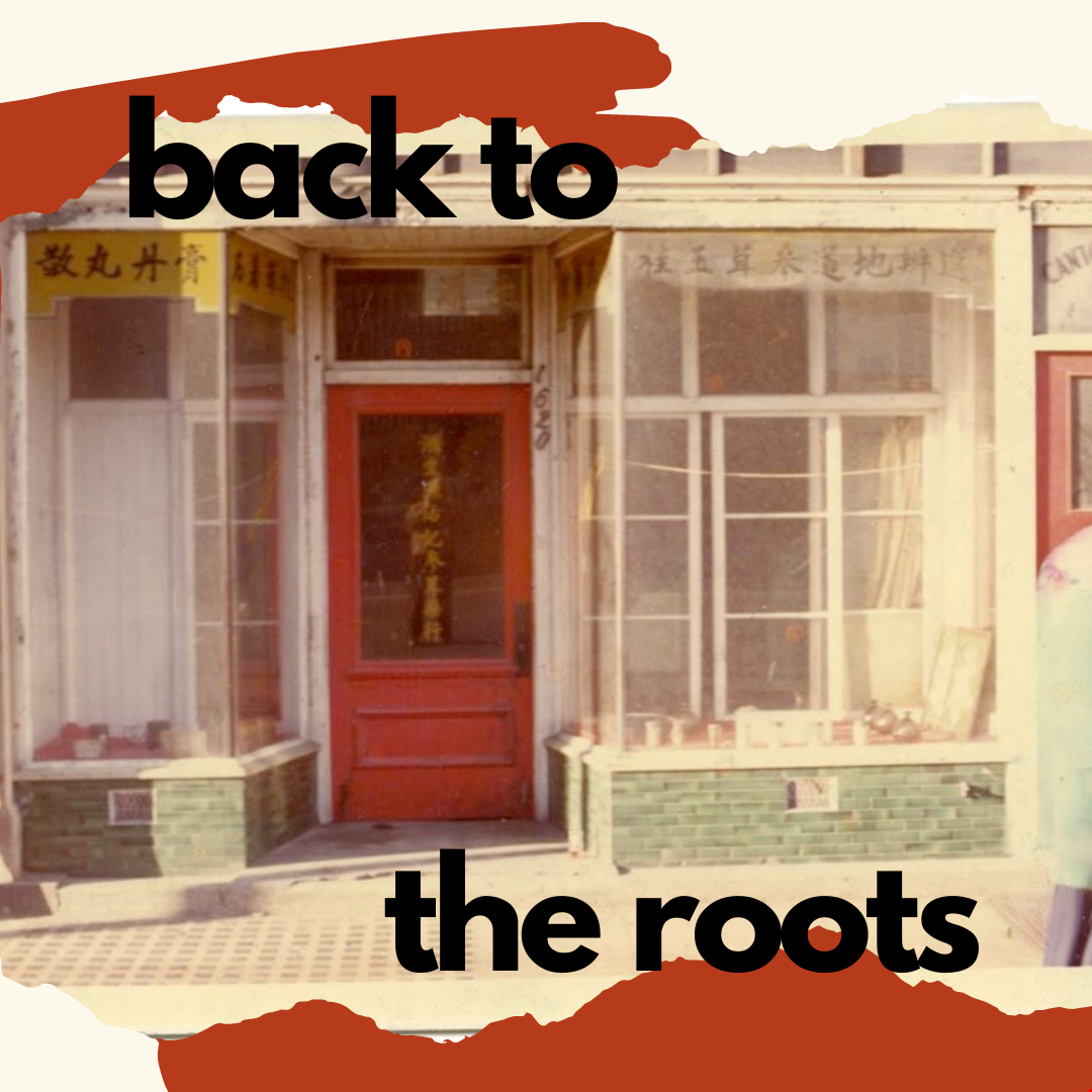
- Interviewers: Rose Wu; Wei Yan Yeong Interviewee: Denise Fong Interview Date: September 2020 Total Number of tracks: 1 Total Length of all tracks: 00:60:38 Recording device: Zoom video communication platform Photograph info: Store front of Way Sang Yuen Wat Kee & Co in Victoria, B.C., 1975. BV017.7.191
- Scope and Content
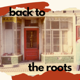
- Item consists of an audio recording of a Zoom interview with Denise Fong conducted by Rose Wu and Wei Yan Yeong, in the Faculty of Land and Food Systems at UBC. The interview was conducted with Denise Fong as part of the students' research for their podcast "Where is your food from?". This podcast was part two in a series of three "Back to the Roots" podcasts about the history of Chinese-Canadian farming in Burnaby and the lower mainland. In this series the students connected their knowledge of food systems to their shared Chinese heritage in order to discover how Chinese Canadian history is rooted in their local food systems. "Where is your food from?" explores contemporary versus historical alternative food movements and how early Chinese farmers in the lower mainland had to be creative in their business tactics in order to survive in a local food system that discriminated against their race. 00:00 - 4:51 Denise Fong introduces herself and provides a summary of the work that she has done while working as a researcher on the Chinese Canadian History Research project for the Burnaby Village Museum. Denise explains how much of her research has focused on the history of Chinese Canadian market gardeners and green grocers and their presence in Burnaby. Denise tells of how many Chinese immigrants found it hard to find work due to racial discrimination which led many Chinese men to work in agriculture and farming. Her research has shown that many of the Chinese farms were located in the Big Bend area of Burnaby. 04:52 – 08:24 In this segment, Denise elaborates on the “truck” or “market” farming industry for Chinese farmers in Burnaby. Denise explains how “truck” farming was a mode for distributing produce from Chinese farms and some of the challenges the Chinese farmers faced. 08:25 – 14:10 In this segment Denise talks about peddling as another mode to distribute farm produce and how this was often dominated by Chinese Canadians since they were restricted from accessing other jobs. Denise explains how the Chinese peddlers would have their own routes with customers who depended on them to bring the produce to them. Denise provides an example of racial discrimination whereby a Burnaby Bylaw prevented people of Chinese descent from working for the city. 14:11 – 22: 39 In this segment, Denise describes how in the 1950s and 1960s, produce distribution networks for Chinese Canadian farmers in Burnaby expanded to larger stores and wholesalers including Woodward’s, Safeway in Burnaby, MacDonald’s Consolidated and Kelly Douglas. Denise provides specific examples of Burnaby families and tells the story of Chinese Canadian Cecil Lee, a produce buyer for Kelly Douglas. In the mid 1970s Lee, was asked to oversee the import of Chinese mandarin oranges into Canada and was responsible for the design of a new cardboard box to replace the wooden crates that held the mandarin oranges. 22:40 – 33:28 In this segment, Denise provides information on Chinese farming methods and practices that she gathered through her research. Information gathered from interviews, research papers and an article in Harrowsmith magazine suggest that many of the Big Bend farms in Burnaby relied on crop rotation, companion planting and intercropping along with traditional organic fertilizers that were available. Denise also tells of how Chinese farmers often relied on traditional methods that they brought from Southern China including the creation of raised beds to avoid damage due to flooding. Wei Yan comments that many of these traditional methods are being reintroduced as a new sustainable way of farming. Research done by Wei Yan found that when chemical fertilizers were introduced informational brochures included Chinese translations. 33:29 – 38:30 In this segment Rose and Wei Yan speak to Denise about the cultural demographic of farmers in the Big Bend area of Burnaby and what types of crops were grown. Denise comments that to her knowledge there were mostly Chinese farmers in this area but there were some European farmers as well. Produce that was grown on the farms was mostly market driven by the local consumers and it wasn’t until the 1970s that there was a bigger demand to grow Chinese vegetables to supply the growing Chinese population. Denise shares personal experience of what she learned after a visit to a local farm and the different methods that the farmer used for growing crops. The three discuss the importance of innovation and adaptability in growing techniques that Chinese farmers have used. 38:31 – 46:23 In this segment, Rose and Wei Yan speak to Denise about the discrimination barriers that Chinese farmers had to face. Denise speaks about discriminatory bylaws and regulations that targeted Chinese farmers including the Peddling tax. She tells of how this tax, persecution to peddlers and restrictions resulted in the emergence of a new industry of Chinese green grocers. Denise names Chinese trade organizations that were formed in response to the social and economic segregation and marginalization that Chinese farmers and retailers faced. Denise references research done by Natalie Gibb and Hannah Wittman from their article “Parallel Alternatives: Chinese-Canadian farmers and the Metro Vancouver local food movement” as well as research by Harry Con and Edgar Wickberg. Denise also provides information that she has gathered from Chinese farmers in Burnaby including the Yip family who were able to purchase land after World War II through the Veterans Land Act and how prior to World War II it was very difficult for Chinese immigrants to purchase land. 46:24 – 1:00:38 In this segment the group discusses how Chinese farmers have adapted in the market garden farm distribution system and the introduction of retail spaces on their farms as part of the new local food movement. Denise, Rose and Wei Yan reflect on how their interview with Denise Fong and research resources will support their podcast series and exhibits at Burnaby Village Museum.
- History
- Interviewer biographies: Rose Wu and Wei Yan Yeong are University of British Columbia students in the Faculty of Land and Food Systems and student interns at Burnaby Village Museum. Interviewee biography: Denise Fong is a historical researcher at Burnaby Village Museum. She has degrees in Anthropology (BA) and Archaeology (MA), and is completing her doctoral degree at UBC in Interdisciplinary Studies. Her primary research interests are in Chinese Canadian history and critical heritage studies. She is the co-curator of the Burnaby Village Museum “Across the Pacific” exhibition, and the Museum of Vancouver’s “A Seat at the Table – Chinese Immigration and British Columbia”.
- Creator
- Burnaby Village Museum
- Subjects
- Persons - Chinese Canadians
- Social Issues - Discrimination
- Social Issues - Racism
- Agriculture
- Agriculture - Crops
- Agriculture - Farms
- Gardens - Market Gardens
- Foods
- Names
- Fong, Denise
- Responsibility
- Wu, Rose
- Yeong, Wei Yan
- Accession Code
- BV020.28.2
- Access Restriction
- No restrictions
- Reproduction Restriction
- No known restrictions
- Date
- 2020
- Media Type
- Sound Recording
- Related Material
- BV020.28.4
- Notes
- Title based on contents of recording
- Item was originally recorded as an mp4 video and converted to an mp3 sound recording for public access on Heritage Burnaby. To access the video recording, contact Burnaby Village Museum.
- For recording of podcast "Where is your food from?" see BV020.28.4
Images
Audio Tracks
Interview with Denise Fong by Rose Wu and Wei Yan Yeong, 2020
Interview with Denise Fong by Rose Wu and Wei Yan Yeong, 2020
https://search.heritageburnaby.ca/media/hpo/_Data/_BVM_Sound_Recordings/Sound_Recordings/2020_0028_0002_002.mp3
J.A. Thurston House 'Altese'
https://search.heritageburnaby.ca/link/landmark511
- Repository
- Burnaby Heritage Planning
- Description
- The J.A. Thurston House is a very large, two and one-half storey plus basement wood-frame Arts and Crafts style house. It is located on the south side of Thurston Street, near Kingsway and the SkyTrain (formerly the interurban tramline route), within the Metrotown area of Burnaby and is now part of…
- Associated Dates
- 1912
- Formal Recognition
- Heritage Designation, Community Heritage Register
- Other Names
- John A. & Sarah Thurston House
- Street View URL
- Google Maps Street View
- Repository
- Burnaby Heritage Planning
- Other Names
- John A. & Sarah Thurston House
- Geographic Access
- Thurston Street
- Associated Dates
- 1912
- Formal Recognition
- Heritage Designation, Community Heritage Register
- Enactment Type
- Bylaw No. 9934
- Enactment Date
- 09/08/1993
- Description
- The J.A. Thurston House is a very large, two and one-half storey plus basement wood-frame Arts and Crafts style house. It is located on the south side of Thurston Street, near Kingsway and the SkyTrain (formerly the interurban tramline route), within the Metrotown area of Burnaby and is now part of a large apartment complex.
- Heritage Value
- The J.A. Thurston House demonstrates Burnaby's real estate and construction boom along the interurban tramline in 1911. The house was built for John Albert Thurston (1874-1944) and his wife Sarah Sedona Thurston (1879-1961). Typical of the entrepreneurial spirit of the age, John Thurston, a manager for the Leckie Shoe Company Limited in Vancouver, was also involved in real estate development, and purchased a twenty-one lot subdivision consisting of 3.2 hectares bound by the interurban tramline right-of-way to the south, Boundary Road to the west and Smith Street (now Thurston Street) to the north. Additionally, the J.A. Thurston House is an excellent, high quality example of an Arts and Crafts style dwelling, with numerous notable design elements such as the battered piers, the elaborate second storey dormer and stained glass windows with landscape and seascape motifs. The enormous scale of the house reflects a time when large families were common and domestic servants were needed to run the household. Indicative of the labour-saving devices and luxury features being introduced at the high end of the housing market, it was equipped with a built-in vacuum system, refrigeration, servant summoning devices and a round safe built into a fireplace mantle. The J.A. Thurston House also represents the proliferation during the Edwardian era of homes built from pattern books and standardized designs as a means to expedite the construction process and offer competitive costs.
- Defining Elements
- Key elements that define the heritage character of the J.A. Thurston House include its: - location on Thurston Street, in the old Central Park district - residential form, scale and massing as exemplified by its two and one-half storey plus above-ground basement height and regular, rectangular plan - Arts and Crafts style details such as the picturesque roofline, deep open eaves with exposed purlins, narrow lapped wooden siding on the first storey and cedar shingle siding on the upper storeys - broad and unusually steep side gabled roof, clad with cedar shingles - deeply-recessed full open front verandah with complementary recessed balcony in second storey dormer, incorporating both a gabled roof and shed roof - twinned and triple square bracketed columns on the verandahs and balcony - decorative battered verandah piers, supported on exposed beams - irregular fenestration, including: double-hung wooden-sash windows; picture windows; casement windows; and several stained glass windows with landscape and seascape motifs - tall brick external chimney on east facade - original interior features such as fireplaces, and wooden trim and floors
- Historic Neighbourhood
- Central Park (Historic Neighbourhood)
- Planning Study Area
- Garden Village Area
- Function
- Primary Historic--Single Dwelling
- Primary Current--Single Dwelling
- Community
- Burnaby
- Cadastral Identifier
- 018-224-113
- Boundaries
- The J.A. Thurston House is comprised of a single residential lot located at 3762 Thurston Street, Burnaby.
- Area
- 3880
- Contributing Resource
- Building
- Ownership
- Private
- Street Address
- 3762 Thurston Street
- Street View URL
- Google Maps Street View
Images


J.D. Shearer House
https://search.heritageburnaby.ca/link/landmark513
- Repository
- Burnaby Heritage Planning
- Description
- The J.D. Shearer House is a one and one-half storey British Arts and Crafts-style house distinguished by its picturesque roofline, half-timbered rough-cast stucco cladding on the upper floor and battered window casings. It is located on the south side of Buckingham Avenue at Haszard Street in Burna…
- Associated Dates
- 1912
- Formal Recognition
- Heritage Designation, Community Heritage Register
- Other Names
- John D. & Katherine Shearer House
- Street View URL
- Google Maps Street View
- Repository
- Burnaby Heritage Planning
- Other Names
- John D. & Katherine Shearer House
- Geographic Access
- Buckingham Avenue
- Associated Dates
- 1912
- Formal Recognition
- Heritage Designation, Community Heritage Register
- Enactment Type
- Bylaw No. 10423
- Enactment Date
- 26/08/1996
- Description
- The J.D. Shearer House is a one and one-half storey British Arts and Crafts-style house distinguished by its picturesque roofline, half-timbered rough-cast stucco cladding on the upper floor and battered window casings. It is located on the south side of Buckingham Avenue at Haszard Street in Burnaby's Deer Lake neighbourhood.
- Heritage Value
- Built in 1912, the J.D. Shearer House is an excellent example of the high quality residences constructed in the British Arts and Crafts style by affluent citizens in Burnaby's Deer Lake neighbourhood, promoted at the time as the equivalent of the prestigious Shaughnessy Heights development in Vancouver. The site of this house was part of Louis Claude Hill's Buckingham Estate subdivision. Development of these Edwardian era neighbourhoods in Burnaby was facilitated by the B.C. Electric Railway interurban line. In addition, the increasing availability of automobiles to the well-to-do families of the era sped up the process of urbanization in the outlying areas of Vancouver. Built for retired English military officer John D. Shearer and his wife, Katherine, the British Arts and Crafts design of the house represents associations with the Mother Country and the displays of patriotic loyalty considered desirable characteristics at the time. The picturesque charm and character of rural England is evoked in harmony with its woodland setting.
- Defining Elements
- Key elements that define the heritage character of the J.D. Shearer House include its: - location in the Buckingham Estate subdivision in the Deer Lake neighbourhood - residential form, scale and massing as exemplified by its one and one-half storey plus basement height, asymmetrical plan, front bay window and picturesque roofline - British Arts and Crafts details such as the half-timbering and rough-cast stucco on the upper storey, battered window casings, external clinker brick chimney on the east facade, deep overhanging closed eaves and bargeboards with distinctive lower returns - side gabled roof with gabled and shed dormers, clad in cedar - raised central entrance porch - irregular fenestration, including multi-paned transoms over casement windows - two internal red brick chimneys
- Historic Neighbourhood
- Burnaby Lake (Historic Neighbourhood)
- Planning Study Area
- Morley-Buckingham Area
- Function
- Primary Historic--Single Dwelling
- Primary Current--Single Dwelling
- Community
- Burnaby
- Cadastral Identifier
- 023-316-977
- Boundaries
- The J.D. Shearer House is comprised of a single residential lot located at 5573 Buckingham Avenue, Burnaby.
- Area
- 1044
- Contributing Resource
- Building
- Ownership
- Private
- Street Address
- 5573 Buckingham Avenue
- Street View URL
- Google Maps Street View
Images


Jesse Love House
https://search.heritageburnaby.ca/link/landmark540
- Repository
- Burnaby Heritage Planning
- Description
- The Jesse Love House is a vernacular example of a late Victorian-era wood-frame farmhouse with later Arts and Crafts alterations and additions, that has been relocated to the Burnaby Village Museum. This two-storey house has an L-shaped plan, with a compound gabled roof, overhanging eaves and a lar…
- Associated Dates
- 1893
- Formal Recognition
- Heritage Designation, Community Heritage Register
- Other Names
- Jesse & Martha Love Farmhouse
- Street View URL
- Google Maps Street View
- Repository
- Burnaby Heritage Planning
- Other Names
- Jesse & Martha Love Farmhouse
- Geographic Access
- Deer Lake Avenue
- Associated Dates
- 1893
- Formal Recognition
- Heritage Designation, Community Heritage Register
- Enactment Type
- Bylaw No. 9807
- Enactment Date
- 23/11/1992
- Description
- The Jesse Love House is a vernacular example of a late Victorian-era wood-frame farmhouse with later Arts and Crafts alterations and additions, that has been relocated to the Burnaby Village Museum. This two-storey house has an L-shaped plan, with a compound gabled roof, overhanging eaves and a large wraparound verandah.
- Heritage Value
- The value of the Jesse Love House lies in its comprehensive representation of an early Burnaby farmhouse, and the typical additive growth of a home as the resident family prospered. Jesse Love (1849-1928) and his wife Martha Love (1858-1920) moved to Burnaby in 1893 with their family to start a fruit ranch and market garden on Cumberland Road in the East Burnaby district. Jesse Love was actively involved in community affairs, serving on the Burnaby School Board and also as a District Councillor in 1901 and from 1904-07. The original house was constructed by local builder George Salt and consisted of an entrance hall, dining room, lean-to kitchen, master bedroom and several rooms upstairs. As the family grew and prospered, additions were made to the house including a parlour, more bedrooms upstairs, and a large permanent kitchen. Jesse Love was actively involved in community affairs, and the kitchen became a local gathering spot for political discussion and civic organizations. The verandah, exterior shingle cladding, large windows, running water and electricity were eventually added as well. The heritage value for this house also lies in its interpretive value within the Burnaby Village Museum. The site is an important cultural feature for the interpretation of Burnaby’s heritage to the public. The house was moved to the Burnaby Village Museum in 1988 and both the interior and exterior were restored and interpreted to their 1925 period, including reproduction wallpaper.
- Defining Elements
- The character defining features of the Jesse Love House include its: - irregular form and massing - compound gable roof with cedar shingle cladding - Craftsman-style exterior features such as a shingled exterior and triangular eave brackets - multi-paned double-hung 2-over-2 wooden-sash windows; casement window assemblies with transoms in the Living Room - large wrap-around verandah - interior features such as pressed tin ceilings, original wallpapers and cedar panelled kitchen - reproduction Arts and Crafts parlour document wallpaper and border
- Locality
- Deer Lake Park
- Historic Neighbourhood
- Burnaby Lake (Historic Neighbourhood)
- Planning Study Area
- Morley-Buckingham Area
- Organization
- Burnaby Village Museum
- Builder
- George Salt
- Function
- Primary Current--Museum
- Primary Historic--Single Dwelling
- Community
- Burnaby
- Cadastral Identifier
- P.I.D. No. 011-030-356 Legal Description: Parcel 1, District Lot 79 and District Lot 85, Group 1, New Westminster District, Reference Plan 77594
- Boundaries
- Burnaby Village Museum is comprised of a single municipally-owned property located at 6501 Deer Lake Avenue, Burnaby.
- Area
- 38,488.63
- Contributing Resource
- Building
- Landscape Feature
- Structure
- Ownership
- Public (local)
- Documentation
- Heritage Site Files: PC77000 20. City of Burnaby Planning and Building Department, 4949 Canada Way, Burnaby, B.C., V5G 1M2
- Street Address
- 6501 Deer Lake Avenue
- Street View URL
- Google Maps Street View
Images


John & Roseanna Clark House
https://search.heritageburnaby.ca/link/landmark567
- Repository
- Burnaby Heritage Planning
- Description
- Residential building.
- Associated Dates
- 1912
- Formal Recognition
- Heritage Designation, Community Heritage Register
- Street View URL
- Google Maps Street View
- Repository
- Burnaby Heritage Planning
- Geographic Access
- Dundas Street
- Associated Dates
- 1912
- Formal Recognition
- Heritage Designation, Community Heritage Register
- Enactment Type
- Bylaw No. 12640
- Enactment Date
- 22/06/2009
- Description
- Residential building.
- Heritage Value
- While simple in form, this sophisticated Edwardian-era house is finely detailed and maintains a high degree of its original integrity. The symmetrical home’s most distinct characteristic is its full width inset verandah with octagonal columns supporting second floor projection. This was the home of John William Clark (1886-1947), an English-born carpenter who retired in 1926, and his wife Roseanna Clark (1860-1933).
- Locality
- Vancouver Heights
- Historic Neighbourhood
- Vancouver Heights (Historic Neighbourhood)
- Planning Study Area
- Burnaby Heights Area
- Community
- Burnaby
- Contributing Resource
- Building
- Ownership
- Private
- Street Address
- 4115 Dundas Street
- Street View URL
- Google Maps Street View
Images


Joseph & Jane Wintemute House
https://search.heritageburnaby.ca/link/landmark523
- Repository
- Burnaby Heritage Planning
- Description
- The Wintemute House is a large two-storey wood-frame Victorian era country farm house with Victorian Italianate detailing. Designed in a symmetrical Foursquare form, it features a low-pitched hipped roof with deep eaves. Later additions to the rear of the house, and the extensive wraparound veranda…
- Associated Dates
- 1891
- Formal Recognition
- Heritage Designation, Community Heritage Register
- Other Names
- Burnett House
- Street View URL
- Google Maps Street View
- Repository
- Burnaby Heritage Planning
- Other Names
- Burnett House
- Geographic Access
- Berkley Street
- Associated Dates
- 1891
- Formal Recognition
- Heritage Designation, Community Heritage Register
- Enactment Type
- Bylaw No. 6889
- Enactment Date
- 07/03/1977
- Description
- The Wintemute House is a large two-storey wood-frame Victorian era country farm house with Victorian Italianate detailing. Designed in a symmetrical Foursquare form, it features a low-pitched hipped roof with deep eaves. Later additions to the rear of the house, and the extensive wraparound verandah and porte-cochere, were Edwardian era additions. It is located on its original site, in the modern subdivision of Buckingham Heights in southeast Burnaby. The Burnett House is one of the oldest surviving houses in Burnaby.
- Heritage Value
- Built circa 1891, the Joseph and Jane Wintemute House is valued as a representation of the early history of Burnaby and its agricultural origins. Built prior to the civic incorporation of Burnaby in 1892, the house was situated to face Douglas Road (now Canada Way), one of the first roads built to connect the rural farmlands of Burnaby to New Westminster. The original large property has been extensively subdivided and the house is now isolated in a modern subdivision. Designated in 1977, the Wintemute House is also significant as Burnaby's first protected municipal heritage site. The house is valued for its association with Joseph S. Wintemute (1832-1911) and Jane Wintemute (1832-1910), who came to British Columbia from Port Stanley, Ontario in 1865, traveling via the Isthmus of Panama. Joseph Wintemute, a skilled carpenter and contractor by trade, operated the Wintemute Furniture Factory in New Westminster, the first furniture plant established on the mainland of British Columbia. In 1891, he acquired this property, where he set up a cord wood sawmill to supply his factory. Wintemute was likely responsible for the design and construction of this commodious structure, as it was built in an Eastern Canadian style he would have been familiar with. After the lands were cleared of timber, the Wintemutes developed the property into a typical small-scale 'market garden,’ involved in the production of vegetables and fruits, such as strawberries, for sale at the New Westminster City Market. The Wintemute House is additionally significant for its association with the speculative land boom that occurred prior to the First World War, and ongoing suburban subdivision. Charles Gordon, a real estate agent, acquired the Wintemute farm and subdivided the acreage, which he marketed through the People’s Trust Company as 'Montrelynview' and offered this house as a draw prize to lot purchasers. With the collapse of the land boom, the house remained in Gordon’s possession until 1929 when it was purchased by his brother-in-law, Geoffrey Burnett, a local surveyor responsible for many of the original land surveys of Burnaby. David Burnett, Geoffrey's son, requested designation of the house when the family decided to subdivide the remaining 1.4 hectares of property in 1977. Furthermore, the Wintemute House is valued as an excellent example of a Victorian era country farm house, based loosely on the traditional farmhouses seen commonly in nineteenth century Ontario. Designed in a vernacular version of the Victorian Italianate style, the house displays restrained detailing, including several original multi-paned windows notable for their vertical proportions. The house retains many original exterior features, and the original interior layout, although modernized during the Edwardian era, is substantially intact, including finely crafted maple and cedar interior millwork that was produced by the Wintemute Furniture Factory. From 1904 to 1910, Charles Gordon, the second owner, made a number of alterations to the house including the addition of the wrap-around verandah, a porte-cochere and a 7.6 metre by 9 metre billiard room in the Arts and Crafts style, beamed and panelled in Douglas Fir. These later additions and alterations have value in demonstrating the evolution of the house and property and changing tastes at the turn of the nineteenth century.
- Defining Elements
- Key elements that define the heritage character of the Wintemute House include its: - picturesque original setting with views to the North Shore - residential form, scale and massing as expressed by its symmetrical cubic form and two-storey height, with later additions to the rear - Victorian Italianate architectural features such as the vertically-proportioned original windows with vestigial window hoods, low-pitched hipped roof and Classical Revival details such as the corner boards articulated as pilasters - hipped roof with deep boxed eaves - horizontal lapped narrow wooden siding - second storey balcony over front entry - wide wraparound columned verandah with porte-cochere, with square trimmed columns - irregular fenestration: original Victorian era double-hung 6-over-6 wood-sash windows with vertical proportions and segmental arched tops; Edwardian era double-hung 1-over-1 wooden-sash windows; and Edwardian era wooden-sash casement window assemblies with leaded transoms - central front entry with sidelights and transom - multi-paned French doors opening out to verandah - interior features such as its 3.7 metre ceiling height on the main and second floors; the coal grate fireplace with elaborate woodwork and glazed tile surround in the front parlour; five other fireplaces throughout the house; maple and cedar interior millwork; and the Douglas Fir panelled and beamed billiard room with hidden doors, seven-panelled doors, original light fixtures and mouldings - internal red brick chimneys with corbelled caps
- Historic Neighbourhood
- Burnaby Lake (Historic Neighbourhood)
- Planning Study Area
- Morley-Buckingham Area
- Function
- Primary Historic--Single Dwelling
- Primary Current--Single Dwelling
- Community
- Burnaby
- Cadastral Identifier
- 003-297-152
- Boundaries
- The Wintemute House is comprised of a single residential lot located at 7640 Berkley Street, Burnaby.
- Area
- 1566.73
- Contributing Resource
- Building
- Ownership
- Private
- Names
- Wintemute, Joseph
- Street Address
- 7640 Berkley Street
- Street View URL
- Google Maps Street View
Images


Jubilee Grove Arch
https://search.heritageburnaby.ca/link/landmark533
- Repository
- Burnaby Heritage Planning
- Description
- The Jubilee Grove Arch sits at the corner of Kingsway and Patterson Avenue. Located within Central Park, the ceremonial arch and its decorative plantings provide a visual anchor to the northeast corner and entry point to the park.
- Associated Dates
- 1939
- Formal Recognition
- Heritage Designation, Community Heritage Register
- Street View URL
- Google Maps Street View
- Repository
- Burnaby Heritage Planning
- Geographic Access
- Imperial Street
- Associated Dates
- 1939
- Formal Recognition
- Heritage Designation, Community Heritage Register
- Enactment Type
- Bylaw No. 9807
- Enactment Date
- 23/11/1992
- Description
- The Jubilee Grove Arch sits at the corner of Kingsway and Patterson Avenue. Located within Central Park, the ceremonial arch and its decorative plantings provide a visual anchor to the northeast corner and entry point to the park.
- Heritage Value
- Jubilee Grove Arch was dedicated as part of the municipality’s celebration of the Jubilee of the coronation of King George V and was dedicated during Burnaby’s annual May Day celebrations in 1935. Much of the construction work was carried out by local citizens under the direction of the Burnaby Engineering Department through a Depression era work relief program that provided a way for local residents to pay their taxes. The garden was also chosen as the site for the ceremonial planting of an oak tree from the Royal Forest at Windsor, in honor of the Coronation of King George VI and Queen Elizabeth in 1937. The original bronze garden dedication plaque and oak tree remain at the site today. The decorative stone arch was erected in 1939 as a symbol of Burnaby's, and the Lower Mainland of British Columbia’s, strong ties to the English monarchy at the time, and the arch’s unveiling during May Day ceremonies shows the social role that such a commemorative feature played both to the local government and people of Burnaby. It was erected just prior to the Royal Visit of 1939, the first time that reigning British monarchs had travelled to Canada. Built of Haddington Island sandstone, the arch itself was reconstructed from a salvaged architectural element of a historic Vancouver landmark. The arch originally framed the entrance door to the Vancouver Club building in Vancouver, built in 1893-94 on West Hastings Street and designed by architect C.O. Wickenden. The building was demolished in 1930, however the arch was stored and rebuilt as the focal point of the Jubilee Grove after being bought by the Municipality of Burnaby. The work was undertaken by Italian-born stone mason Rizieri Stefanini (1879-1954), the owner of Burnaby Monumental Works. The re-use of the arch symbolizes the close tie between Vancouver and Burnaby and the joint evolution of the neighbouring cities.
- Defining Elements
- The Jubilee Grove Arch has character-defining elements that recognize it both as a remnant of a past building and as a new and individual structure. These include its: - axial diagonal placement and prominent corner location marking one of the entries to Central Park - visibility and accessibility as a public monument - hand carved stone blocks of Haddington Island sandstone - decorative twisted-rope motif carved to outline the arch - supporting rusticated sidewalls with planting urns - original bronze dedication plaque - flanking ornamental gardens - Royal Oak tree and plaque
- Historic Neighbourhood
- Central Park (Historic Neighbourhood)
- Planning Study Area
- Maywood Area
- Organization
- City of Burnaby
- Architect
- C.O. Wickenden
- Function
- Primary Current--Park Fixture
- Primary Historic--Park Fixture
- Community
- Burnaby
- Cadastral Identifier
- P.I.D. No. 017-767-172 Legal Description: Block B of Lot 2 Except Firstly: Part on Plan 8669 and Secondly: Part on Plan LMP4689 District Lot 151, Group 1, New Westminster District, Plan 3443
- Boundaries
- The property (Central Park) is a municipally-owned park that lies at the western edge of Burnaby, between 49th Avenue to the south, Kingsway to the north, Boundary Road to the west and Patterson Avenue to the east.
- Area
- 853,403.82
- Contributing Resource
- Structure
- Landscape Feature
- Ownership
- Public (local)
- Documentation
- Heritage Site Files: PC77000 20. City of Burnaby Planning and Building Department, 4949 Canada Way, Burnaby, B.C., V5G 1M2
- Names
- Burnaby Monumental Works
- Street Address
- 3883 Imperial Street
- Street View URL
- Google Maps Street View
Images


Kingsway East School
https://search.heritageburnaby.ca/link/landmark546
- Repository
- Burnaby Heritage Planning
- Description
- The Kingsway East School is a two-storey wood-frame Arts and Crafts styled building. The school, and the adjacent cenotaph and memorial tennis courts, comprise Burnaby South Memorial Park.
- Associated Dates
- 1913
- Formal Recognition
- Heritage Designation, Community Heritage Register
- Other Names
- Alan Emmott Centre
- Street View URL
- Google Maps Street View
- Repository
- Burnaby Heritage Planning
- Other Names
- Alan Emmott Centre
- Geographic Access
- Southoaks Crescent
- Associated Dates
- 1913
- Formal Recognition
- Heritage Designation, Community Heritage Register
- Enactment Type
- Bylaw No. 9807
- Enactment Date
- 23/11/1992
- Description
- The Kingsway East School is a two-storey wood-frame Arts and Crafts styled building. The school, and the adjacent cenotaph and memorial tennis courts, comprise Burnaby South Memorial Park.
- Heritage Value
- This school structure completed in 1913, the oldest surviving public education building in the city, was intended to be the auditorium and gymnasium for Burnaby’s first high school. However, because of the 1913 recession and the outbreak of the First World War, it was utilized as the Kingsway East Elementary School for the Edmonds District until 1921. Burnaby South High School opened here in 1922, and after it relocated this building was used for a variety of school purposes until it became redundant. The school was rehabilitated for community purposes in 2002-03 and renamed the Alan Emmott Centre to honor a former Mayor of Burnaby. The impressive scale of the Kingsway East School is indicative of the relative size of the community and its growing demand for schooling at the time of construction, illustrating the value that early community residents placed on education. Built to plans of the Burnaby School Board architect, Joseph Henry Bowman (1864-1943), it also indicates the individual values and design control exercised by the school board during this era. It is also significant for its Arts and Crafts style, allied to the typical Craftsman residential vocabulary, which was employed locally for school buildings of the Edwardian era. By using a common architectural vocabulary, this allowed the institution to reflect the values and aspirations of the local community. The Arts and Crafts style also demonstrated an allegiance to British educational antecedents and a demonstration of loyalty to the Mother Country.
- Historic Neighbourhood
- Edmonds (Historic Neighbourhood)
- Planning Study Area
- Kingsway-Beresford Area
- Function
- Primary Historic--Primary School
- Community
- Burnaby
- Cadastral Identifier
- P.I.D. No. 016-367-154 Legal Description: Lot 1, District Lot 96, Group 1 New Westminster District, Plan 86581
- Boundaries
- The Kingsway East School is comprised of a single municipally-owned property located at 6650 Southoaks Crescent, Burnaby.
- Area
- 6,070.00
- Contributing Resource
- Building
- Landscape Feature
- Structure
- Ownership
- Public (local)
- Documentation
- Heritage Site Files: PC77000 20. City of Burnaby Planning and Building Department, 4949 Canada Way, Burnaby, B.C., V5G 1M2
- Street Address
- 6650 Southoaks Crescent
- Street View URL
- Google Maps Street View
Images

