Narrow Results By
Creator
- Adams, John 2
- Aitkenhead, May 1
- Armstrong, Sophie 1
- Beach, Chris 1
- Bekins Moving and Storage Company Limited 1
- Bowman, Carly 1
- British Columbia Underwriters' Association 10
- Burnett and McGugan B.C. Land Surveyors, New Westminster 5
- Burnett, David H. 1
- Burnett, Geoffrey K. 6
- Burnett & McGugan, Engineers and Surveyors 23
- City Map and White Print Co. 1
Person / Organization
- All Saints Anglican Church 1
- Armstrong Avenue School 1
- Atcheson, Jean 1
- Barnet School 1
- Bellinger, Marion 1
- British Columbia Electric Railway Company 1
- Broadview Presbyterian Church 1
- Brownlee, James Harrison 1
- Burnaby Village Museum 3
- Burnett, Geoffrey K. 2
- Ceperley, H.T. 2
- Chinese Market Gardens 1
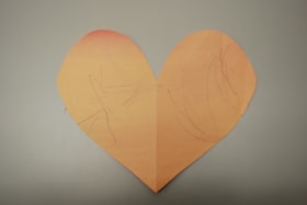
Paper heart by Sophie Armstrong
https://search.heritageburnaby.ca/link/museumdescription14749
- Repository
- Burnaby Village Museum
- Date
- March 2020
- Collection/Fonds
- Burnaby Village Museum COVID-19 collection
- Description Level
- Item
- Physical Description
- 1 drawing : wax crayon on pink construction paper ; 20 x 23.5 cm
- Scope and Content
- Item consists of a heart that has been cut out of pink coloured construction paper. One side of the heart has contains a child's drawing with markings in purple crayon while the other side is blank. The side with the markings is faded from exposure due to sunlight after being hung in a window.
- Repository
- Burnaby Village Museum
- Collection/Fonds
- Burnaby Village Museum COVID-19 collection
- Description Level
- Item
- Physical Description
- 1 drawing : wax crayon on pink construction paper ; 20 x 23.5 cm
- Scope and Content
- Item consists of a heart that has been cut out of pink coloured construction paper. One side of the heart has contains a child's drawing with markings in purple crayon while the other side is blank. The side with the markings is faded from exposure due to sunlight after being hung in a window.
- History
- This was a heart the Armstrong family made in the last week of March when things were starting to get very scary and they wanted to share their message of love and support to the world. The heart was decorated on one side by Sophie (age 1), Kimberly's youngest daughter (of two). The heart remained on the window until mid July 2020.
- Creator
- Armstrong, Sophie
- Subjects
- Arts - Drawings
- Crafts
- Pandemics - COVID-19
- Responsibility
- Paneloc Marketing Limited
- Accession Code
- BV020.24.1
- Access Restriction
- No restrictions
- Reproduction Restriction
- No known restrictions
- Date
- March 2020
- Media Type
- Graphic Material
- Notes
- Title based on contents of item
Images


![Oakalla Prison Farm, [2019] thumbnail](/media/hpo/_Data/_BVM_Images/2019/2019_0036_0001_001.jpg?width=280)
Oakalla Prison Farm
https://search.heritageburnaby.ca/link/museumdescription18849
- Repository
- Burnaby Village Museum
- Date
- [2019]
- Collection/Fonds
- Burnaby Village Museum fonds
- Description Level
- Item
- Physical Description
- 1 painting (tiff)
- Scope and Content
- Item consists of a digital copy of a painting of a view of Oakalla Prison farm with Deer Lake in the background. The original painting was created by Burnaby Village Museum preparator Carly Bowman as part of an exhibit.
- Repository
- Burnaby Village Museum
- Collection/Fonds
- Burnaby Village Museum fonds
- Series
- Museum exhibits series
- Subseries
- Museum materials for exhibits subseries
- Description Level
- Item
- Physical Description
- 1 painting (tiff)
- Scope and Content
- Item consists of a digital copy of a painting of a view of Oakalla Prison farm with Deer Lake in the background. The original painting was created by Burnaby Village Museum preparator Carly Bowman as part of an exhibit.
- Creator
- Bowman, Carly
- Names
- Oakalla Prison Farm
- Accession Code
- BV019.36.1
- Date
- [2019]
- Media Type
- Graphic Material
- Notes
- Title based on contents of item
Images
![Oakalla Prison Farm, [2019] thumbnail](/media/hpo/_Data/_BVM_Images/2019/2019_0036_0001_001.jpg)
![BFG bag prop concept plan, [2015] thumbnail](/media/hpo/_Data/_BVM_Images/2022/2022_0021_0100_001.jpg?width=280)
BFG bag prop concept plan
https://search.heritageburnaby.ca/link/museumdescription19155
- Repository
- Burnaby Village Museum
- Date
- [2015]
- Collection/Fonds
- Hipman "Jimmy" Chow and Donna Polos fonds
- Description Level
- Item
- Physical Description
- 1 photograph : col. laser print ; 28 x 43.5 cm with annotations
- Scope and Content
- Item consists of a concept plan created by concept illustrator Brian Cunningham for a leather bag to be used as a prop in the film "The BFG". Ovelay of tape with actual measurements on surface of print for the creation of the leather bag. Concept plan was used by property master, Jimmy Chow to crea…
- Repository
- Burnaby Village Museum
- Collection/Fonds
- Hipman "Jimmy" Chow and Donna Polos fonds
- Description Level
- Item
- Physical Description
- 1 photograph : col. laser print ; 28 x 43.5 cm with annotations
- Material Details
- Green masking tape and white duct tape adhered to surface of print
- Handwritten measurements in black ink written on surface of tape
- Scope and Content
- Item consists of a concept plan created by concept illustrator Brian Cunningham for a leather bag to be used as a prop in the film "The BFG". Ovelay of tape with actual measurements on surface of print for the creation of the leather bag. Concept plan was used by property master, Jimmy Chow to create the bag as a prop. The film was directed by Steven Spielberg and released in 2016.
- Creator
- Cunningham, Brian
- Subjects
- Industries - Film
- Responsibility
- Beach, Chris
- Accession Code
- BV022.21.100
- Access Restriction
- No restrictions
- Reproduction Restriction
- May be restricted by third party rights
- Date
- [2015]
- Media Type
- Graphic Material
- Notes
- Title based on contents of item
- Bottom right corner includes identifiers reading: "? / ...BFG 3 BAG_PROP CONCEPT / ... PROP BFG BAG CONCEPT / .../ Scale / 15:00:00 [sic] / ? / C_BEACH /? / B_CUNNINGHAM / ? / NONE [sic] / ? / PRP_C05 / ..."
- Drawing identifies, Brian Cunningham as concept illustrator and Chris Beach as [designer] (Art Director)
Images
![BFG bag prop concept plan, [2015] thumbnail](/media/hpo/_Data/_BVM_Images/2022/2022_0021_0100_001.jpg)

Property master designs for "X2: X-Men United"
https://search.heritageburnaby.ca/link/museumdescription19154
- Repository
- Burnaby Village Museum
- Date
- [2002]
- Collection/Fonds
- Hipman "Jimmy" Chow and Donna Polos fonds
- Description Level
- File
- Physical Description
- 1 portfolio : 15 photographs : col. prints + 12 col. laser prints
- Scope and Content
- File consists of a portfolio of prop concept design plans, prototypes and resource photographs for the Marvel film "X2: X-Men United". Concept designs were created by different designers and portfolio of collection was created by property master, Jimmy Chow. The portfolio was used as a communicatio…
- Repository
- Burnaby Village Museum
- Collection/Fonds
- Hipman "Jimmy" Chow and Donna Polos fonds
- Description Level
- File
- Physical Description
- 1 portfolio : 15 photographs : col. prints + 12 col. laser prints
- Scope and Content
- File consists of a portfolio of prop concept design plans, prototypes and resource photographs for the Marvel film "X2: X-Men United". Concept designs were created by different designers and portfolio of collection was created by property master, Jimmy Chow. The portfolio was used as a communication tool for sharing prototypes and plans with Jimmy's team who worked with him on the film. The film was directed by Bryan Singer and was released in 2003. Some of the concept designs within the portfolio were created by assistant art director, Brenton Harron, signed "Harron" and illustrator Dean Sherriff , signed "Sheriff".
- Accession Code
- BV022.21.107
- Access Restriction
- Restricted access
- Reproduction Restriction
- May be restricted by third party rights
- Date
- [2002]
- Media Type
- Photograph
- Graphic Material
- Scan Resolution
- 600
- Scan Date
- 2023-03-10
- Notes
- Title based on contents of file
- Title on spine of cover of portfolio reads: "X2 / PROPS"
- Chinese seal in red ink on spine of cover of portfolio identifying Jimmy Chow as the owner or creator
Images

![1892 Burnaby Centennial, [1992] thumbnail](/media/hpo/_Data/_BVM_Cartographic_Material/2013/2013_0008_0001_001.jpg?width=280)
1892 Burnaby Centennial
https://search.heritageburnaby.ca/link/museumdescription8704
- Repository
- Burnaby Village Museum
- Date
- [1992]
- Collection/Fonds
- Burnaby Village Museum Map collection
- Description Level
- Item
- Physical Description
- 1 map : blueline print ; 71 cm x 119 cm
- Scope and Content
- A birds eye view map of Burnaby, drawn by Mark Lewis, Parks staff, as a Parks-Maintenance Centennial Project for the 1892 - 1992 Burnaby Centennial. It features wildlife found in Burnaby and highlights civic buildings, parks and other prominent structures of the time. This is not a scale map.
- Repository
- Burnaby Village Museum
- Collection/Fonds
- Burnaby Village Museum Map collection
- Description Level
- Item
- Physical Description
- 1 map : blueline print ; 71 cm x 119 cm
- Material Details
- "1892 BURNABY/ CENTENNIAL 1992" printed in a banner across the top of the map Burnaby Centennial logo is located in the lower right side. "ALL WILDLIFE SHOWN CAN STILL / BE FOUND IN THE BURNABY AREA" printed in lower right corner "DRAWN BY / MARK LEWIS / A PARKS-MAINTENANCE / CENTENNIAL PROJECT" printed in the very lower right corner.
- The map is dark blue ink, there is no colour.
- Scope and Content
- A birds eye view map of Burnaby, drawn by Mark Lewis, Parks staff, as a Parks-Maintenance Centennial Project for the 1892 - 1992 Burnaby Centennial. It features wildlife found in Burnaby and highlights civic buildings, parks and other prominent structures of the time. This is not a scale map.
- History
- Drawn by Mark Lewis of the Parks-Maintenance Dept for the 1882 - 1992 Centennial of Burnaby. Mark always loved birds-eye maps, and showed this map to his supervisors while the work was still in progress. They suggested the map could be a Parks Maintenance Centennial Project. Mark agreed, and completed the map, including Burnaby landmarks and sketches of wildlife. Several copies of the map were given to schools so students could colour them.
- Creator
- Lewis, Mark
- Accession Code
- BV013.8.1
- Access Restriction
- No restrictions
- Reproduction Restriction
- No known restrictions
- Date
- [1992]
- Media Type
- Cartographic Material
- Scan Resolution
- 300
- Scan Date
- 05-Jun-2013
- Scale
- 96
- Notes
- Transcribed title
Images
![1892 Burnaby Centennial, [1992] thumbnail](/media/hpo/_Data/_BVM_Cartographic_Material/2013/2013_0008_0001_001.jpg)
![Burnaby Village Museum - Entrance, [1985] thumbnail](/media/hpo/_Data/_BVM_Architectural_Drawings/2019_0052_0088_001.jpg?width=280)
Burnaby Village Museum - Entrance
https://search.heritageburnaby.ca/link/museumdescription11752
- Repository
- Burnaby Village Museum
- Date
- [1985]
- Collection/Fonds
- Century Park Museum Association fonds
- Description Level
- Item
- Physical Description
- 1 drawing : b&w print hand col. (pencil crayons) on paper 46 x 58 cm ; mounted on foamcore board 71 x 58 cm
- Scope and Content
- Item consists of a presentation drawing for the proposed Burnaby Village Museum Expansion. Title at bottom of drawing "Entrance to the walkway / from the west".
- Repository
- Burnaby Village Museum
- Collection/Fonds
- Century Park Museum Association fonds
- Description Level
- Item
- Physical Description
- 1 drawing : b&w print hand col. (pencil crayons) on paper 46 x 58 cm ; mounted on foamcore board 71 x 58 cm
- Scope and Content
- Item consists of a presentation drawing for the proposed Burnaby Village Museum Expansion. Title at bottom of drawing "Entrance to the walkway / from the west".
- Names
- Burnaby Village Museum
- Accession Code
- BV019.52.88
- Access Restriction
- No restrictions
- Reproduction Restriction
- May be restricted by third party rights
- Date
- [1985]
- Media Type
- Graphic Material
- Notes
- Title based on contents of drawing
Images
![Burnaby Village Museum - Entrance, [1985] thumbnail](/media/hpo/_Data/_BVM_Architectural_Drawings/2019_0052_0088_001.jpg)
![Burnaby Village Museum - Inside the museum, [1985] thumbnail](/media/hpo/_Data/_BVM_Architectural_Drawings/2019_0052_0089_001.jpg?width=280)
Burnaby Village Museum - Inside the museum
https://search.heritageburnaby.ca/link/museumdescription11753
- Repository
- Burnaby Village Museum
- Date
- [1985]
- Collection/Fonds
- Century Park Museum Association fonds
- Description Level
- Item
- Physical Description
- 1 drawing : b&w print hand col. (pencil crayons) on paper 46 x 58 cm ; mounted on foamcore board 71 x 58 cm
- Scope and Content
- Item consists of a presentation drawing for the proposed Burnaby Village Museum Expansion. Title at bottom of drawing "Inside the museum".
- Repository
- Burnaby Village Museum
- Collection/Fonds
- Century Park Museum Association fonds
- Description Level
- Item
- Physical Description
- 1 drawing : b&w print hand col. (pencil crayons) on paper 46 x 58 cm ; mounted on foamcore board 71 x 58 cm
- Scope and Content
- Item consists of a presentation drawing for the proposed Burnaby Village Museum Expansion. Title at bottom of drawing "Inside the museum".
- Subjects
- Buildings - Civic - Museums
- Names
- Burnaby Village Museum
- Accession Code
- BV019.52.89
- Access Restriction
- No restrictions
- Reproduction Restriction
- May be restricted by third party rights
- Date
- [1985]
- Media Type
- Graphic Material
- Notes
- Title based on contents of drawing
Images
![Burnaby Village Museum - Inside the museum, [1985] thumbnail](/media/hpo/_Data/_BVM_Architectural_Drawings/2019_0052_0089_001.jpg)
![Burnaby Village Museum - Looking east towards the Adminstration complex, [1985] thumbnail](/media/hpo/_Data/_BVM_Architectural_Drawings/2019_0052_0090_001.jpg?width=280)
Burnaby Village Museum - Looking east towards the Adminstration complex
https://search.heritageburnaby.ca/link/museumdescription11754
- Repository
- Burnaby Village Museum
- Date
- [1985]
- Collection/Fonds
- Century Park Museum Association fonds
- Description Level
- Item
- Physical Description
- 1 drawing : b&w print hand col. (pencil crayons) on paper 46 x 58 cm ; mounted on foamcore board 71 x 58 cm
- Scope and Content
- Item consists of a presentation drawing for the proposed Burnaby Village Museum Expansion. Title at bottom of drawing "Looking east towards / the Adminstration / complex"
- Repository
- Burnaby Village Museum
- Collection/Fonds
- Century Park Museum Association fonds
- Description Level
- Item
- Physical Description
- 1 drawing : b&w print hand col. (pencil crayons) on paper 46 x 58 cm ; mounted on foamcore board 71 x 58 cm
- Scope and Content
- Item consists of a presentation drawing for the proposed Burnaby Village Museum Expansion. Title at bottom of drawing "Looking east towards / the Adminstration / complex"
- Subjects
- Buildings - Civic - Museums
- Names
- Burnaby Village Museum
- Accession Code
- BV019.52.90
- Access Restriction
- No restrictions
- Reproduction Restriction
- May be restricted by third party rights
- Date
- [1985]
- Media Type
- Graphic Material
- Notes
- Title based on contents of drawing
Images
![Burnaby Village Museum - Looking east towards the Adminstration complex, [1985] thumbnail](/media/hpo/_Data/_BVM_Architectural_Drawings/2019_0052_0090_001.jpg)

Bird's Eye View of the Burnaby Lake Area
https://search.heritageburnaby.ca/link/museumdescription15144
- Repository
- Burnaby Village Museum
- Date
- 1977
- Collection/Fonds
- Century Park Museum Association fonds
- Description Level
- Item
- Physical Description
- 1 map : b&w print on paper ; 43 x 63.5 cm
- Scope and Content
- Item consists of a map titled "Birds Eye View of the Burnaby Lake Area Circa 1910". The overview of the Burnaby Lake area was compiled and drawn at Heritage Village by curator John Adams and artist, Carol Swan. The map identifies the Burnaby Lake inter-urban tram line; roads including: Sperling Ave…
- Repository
- Burnaby Village Museum
- Collection/Fonds
- Century Park Museum Association fonds
- Description Level
- Item
- Physical Description
- 1 map : b&w print on paper ; 43 x 63.5 cm
- Material Details
- Scale indeterminable
- Scope and Content
- Item consists of a map titled "Birds Eye View of the Burnaby Lake Area Circa 1910". The overview of the Burnaby Lake area was compiled and drawn at Heritage Village by curator John Adams and artist, Carol Swan. The map identifies the Burnaby Lake inter-urban tram line; roads including: Sperling Avenue (Pole Line Road); Gilpin Avenue; Douglas Road; trail to Vancouver Westminster Road (Kingsway); Buckingham Avenue; Haszard Street; various farms and residences including: Charles Sprott "Norland"; H.T. Ceperley "Fairacres"; Claude Hill's "Brookfield farm" and "Broadview"; F.J. Hart's "Avalon"; Miss Woodward's former and new home, school and post office; Councillor Edgar's hunting cabin; Edgar Sprott's "Mayfield farm" and "Mayfield Lodge"; F.J. Peers "Greyfriars"; Arthur de Windt Haszard; Bernard Hill's boathouse as well as other landmarks including: Doran's Mill; tram stations; Burnaby Lake Store; logging camps; wood cutter's shacks; ice houses; cranberry bog; Still Creek; Deer Lake; Burnaby Lake; Deer Lake Creek; Provincial Government Reserve Proposed Hospital (later Oakalla Prison).
- Creator
- Adams, John
- Swan, Carol
- Names
- Hill, Arthur Claude
- Sprott, Charles Frederick
- Sprott, Louis "Edgar"
- Hart, Frederick John, 1884-1945
- Ceperley, H.T.
- Woodward, Maude
- Woodward, Harriet
- Peers, Francis J.
- Haszard, Arthur de Windt
- Hill, Bernard R.
- Geographic Access
- Deer Lake Avenue
- Sperling Avenue
- Haszard Street
- Buckingham Avenue
- Accession Code
- BV021.1.3
- Access Restriction
- No restrictions
- Reproduction Restriction
- No known restrictions
- Date
- 1977
- Media Type
- Cartographic Material
- Historic Neighbourhood
- Burnaby Lake (Historic Neighbourhood)
- Planning Study Area
- Burnaby Lake Area
- Related Material
- See also: Life with the Moores of Hart House : pioneer days on Burnaby's Deer Lake
- Scan Resolution
- 600
- Scan Date
- 2021-11-12
- Scale
- 100
- Notes
- Transcribed title
- Compiled by John Adams; illustration by Carol Swan
- The map depicts the Burnaby Lake Tram Line as being double tracked, whereas in reality it was single tracked.
- Map is part of the book "Life with the Moores of Hart House : pioneer days on Burnaby's Deer Lake https://search.heritageburnaby.ca/permalink/museumlibrary6314-102
Images


Bird's Eye View of the Burnaby Lake Area
https://search.heritageburnaby.ca/link/museumdescription17543
- Repository
- Burnaby Village Museum
- Date
- 1977
- Collection/Fonds
- Century Park Museum Association fonds
- Description Level
- Item
- Physical Description
- 1 map : b&w print with watercolour ; 43 x 63.5 cm
- Scope and Content
- Item consists of a map titled "Birds Eye View of the Burnaby Lake Area Circa 1910". The overview of the Burnaby Lake area was compiled and drawn at Heritage Village by curator John Adams and artist, Carol Swan. The map identifies the Burnaby Lake inter-urban tram line; roads including: Sperling Ave…
- Repository
- Burnaby Village Museum
- Collection/Fonds
- Century Park Museum Association fonds
- Description Level
- Item
- Physical Description
- 1 map : b&w print with watercolour ; 43 x 63.5 cm
- Material Details
- Scale indeterminable
- Scope and Content
- Item consists of a map titled "Birds Eye View of the Burnaby Lake Area Circa 1910". The overview of the Burnaby Lake area was compiled and drawn at Heritage Village by curator John Adams and artist, Carol Swan. The map identifies the Burnaby Lake inter-urban tram line; roads including: Sperling Avenue (Pole Line Road); Gilpin Avenue; Douglas Road; trail to Vancouver Westminster Road (Kingsway); Buckingham Avenue; Haszard Street; various farms and residences including: Charles Sprott "Norland"; H.T. Ceperley "Fairacres"; Claude Hill's "Brookfield farm" and "Broadview"; F.J. Hart's "Avalon"; Miss Woodward's former and new home, school and post office; Councillor Edgar's hunting cabin; Edgar Sprott's "Mayfield farm" and "Mayfield Lodge"; F.J. Peers "Greyfriars"; Arthur de Windt Haszard; Bernard Hill's boathouse as well as other landmarks including: Doran's Mill; tram stations; Burnaby Lake Store; logging camps; wood cutter's shacks; ice houses; cranberry bog; Still Creek; Deer Lake; Burnaby Lake; Deer Lake Creek; Provincial Government Reserve Proposed Hospital (later Oakalla Prison).
- Creator
- Adams, John
- Swan, Carol
- Names
- Hill, Arthur Claude
- Sprott, Charles Frederick
- Sprott, Louis "Edgar"
- Hart, Frederick John, 1884-1945
- Ceperley, H.T.
- Woodward, Maude
- Woodward, Harriet
- Peers, Francis J.
- Haszard, Arthur de Windt
- Hill, Bernard R.
- Geographic Access
- Deer Lake Avenue
- Sperling Avenue
- Haszard Street
- Buckingham Avenue
- Accession Code
- BV021.1.4
- Access Restriction
- No restrictions
- Reproduction Restriction
- No known restrictions
- Date
- 1977
- Media Type
- Cartographic Material
- Historic Neighbourhood
- Burnaby Lake (Historic Neighbourhood)
- Planning Study Area
- Burnaby Lake Area
- Related Material
- See also: Life with the Moores of Hart House : pioneer days on Burnaby's Deer Lake
- Scan Resolution
- 600
- Scan Date
- 2021-11-12
- Scale
- 100
- Notes
- Transcribed title
- Compiled by John Adams; illustration by Carol Swan
- The map depicts the Burnaby Lake Tram Line as being double tracked, whereas in reality it was single tracked.
- Map is part of the book "Life with the Moores of Hart House : pioneer days on Burnaby's Deer Lake https://search.heritageburnaby.ca/permalink/museumlibrary6314-102
- This is a print made from original illustration and appears to be hand-coloured with watercolour at a later date.
Images

![Green-winged teal, [1957] thumbnail](/media/hpo/_Data/_Archives_Images/_Unrestricted/559/559-004.jpg?width=280)
Green-winged teal
https://search.heritageburnaby.ca/link/archivedescription82749
- Repository
- City of Burnaby Archives
- Date
- [1957]
- Collection/Fonds
- Hazel Simnett collection
- Description Level
- Item
- Physical Description
- 1 painting : colour print ; 37 x 28 cm
- Scope and Content
- Painting shows two green-winged teal.
- Repository
- City of Burnaby Archives
- Date
- [1957]
- Collection/Fonds
- Hazel Simnett collection
- Physical Description
- 1 painting : colour print ; 37 x 28 cm
- Description Level
- Item
- Record No.
- 559-004
- Access Restriction
- In Archives only
- Reproduction Restriction
- No reproduction permitted
- Accession Number
- 2013-22
- Scope and Content
- Painting shows two green-winged teal.
- Subjects
- Animals - Birds
- Arts - Paintings
- Media Type
- Graphic Material
- Creator
- Lansdowne, James Fenwick
- Notes
- Title transcribed from item
- Simnett personal papers series
Images
![Green-winged teal, [1957] thumbnail](/media/hpo/_Data/_Archives_Images/_Unrestricted/559/559-004.jpg)
![Red-winged blackbird, [1957] thumbnail](/media/hpo/_Data/_Archives_Images/_Unrestricted/559/559-007.jpg?width=280)
Red-winged blackbird
https://search.heritageburnaby.ca/link/archivedescription82752
- Repository
- City of Burnaby Archives
- Date
- [1957]
- Collection/Fonds
- Hazel Simnett collection
- Description Level
- Item
- Physical Description
- 1 painting : colour print ; 28 x 18.5 cm
- Scope and Content
- Painting shows two red-winged blackbirds.
- Repository
- City of Burnaby Archives
- Date
- [1957]
- Collection/Fonds
- Hazel Simnett collection
- Physical Description
- 1 painting : colour print ; 28 x 18.5 cm
- Description Level
- Item
- Record No.
- 559-007
- Access Restriction
- In Archives only
- Reproduction Restriction
- No reproduction permitted
- Accession Number
- 2013-22
- Scope and Content
- Painting shows two red-winged blackbirds.
- Subjects
- Animals - Birds
- Arts - Paintings
- Media Type
- Graphic Material
- Creator
- Lansdowne, James Fenwick
- Notes
- Title transcribed from item
- Simnett personal papers series
Images
![Red-winged blackbird, [1957] thumbnail](/media/hpo/_Data/_Archives_Images/_Unrestricted/559/559-007.jpg)
![Bullock's oriole, [1957] thumbnail](/media/hpo/_Data/_Archives_Images/_Unrestricted/559/559-008.jpg?width=280)
Bullock's oriole
https://search.heritageburnaby.ca/link/archivedescription82753
- Repository
- City of Burnaby Archives
- Date
- [1957]
- Collection/Fonds
- Hazel Simnett collection
- Description Level
- Item
- Physical Description
- 1 paintings : colour print ; 28 x 18.5 cm
- Scope and Content
- Painting shows two Bullock's orioles.
- Repository
- City of Burnaby Archives
- Date
- [1957]
- Collection/Fonds
- Hazel Simnett collection
- Physical Description
- 1 paintings : colour print ; 28 x 18.5 cm
- Description Level
- Item
- Record No.
- 559-008
- Access Restriction
- In Archives only
- Reproduction Restriction
- No reproduction permitted
- Accession Number
- 2013-22
- Scope and Content
- Painting shows two Bullock's orioles.
- Subjects
- Animals - Birds
- Arts - Paintings
- Media Type
- Graphic Material
- Creator
- Lansdowne, James Fenwick
- Notes
- Title transcribed from item
- Simnett personal papers series
Images
![Bullock's oriole, [1957] thumbnail](/media/hpo/_Data/_Archives_Images/_Unrestricted/559/559-008.jpg)
![Belted kingfisher, [1957] thumbnail](/media/hpo/_Data/_Archives_Images/_Unrestricted/559/559-009.jpg?width=280)
Belted kingfisher
https://search.heritageburnaby.ca/link/archivedescription82754
- Repository
- City of Burnaby Archives
- Date
- [1957]
- Collection/Fonds
- Hazel Simnett collection
- Description Level
- Item
- Physical Description
- 1 paintings : colour print ; 28 x 18.5 cm
- Scope and Content
- Painting shows a belted kingfisher.
- Repository
- City of Burnaby Archives
- Date
- [1957]
- Collection/Fonds
- Hazel Simnett collection
- Physical Description
- 1 paintings : colour print ; 28 x 18.5 cm
- Description Level
- Item
- Record No.
- 559-009
- Access Restriction
- In Archives only
- Reproduction Restriction
- No reproduction permitted
- Accession Number
- 2013-22
- Scope and Content
- Painting shows a belted kingfisher.
- Subjects
- Animals - Birds
- Arts - Paintings
- Media Type
- Graphic Material
- Creator
- Lansdowne, James Fenwick
- Notes
- Title transcribed from item
- Simnett personal papers series
Images
![Belted kingfisher, [1957] thumbnail](/media/hpo/_Data/_Archives_Images/_Unrestricted/559/559-009.jpg)
![Mourning dove, [1957] thumbnail](/media/hpo/_Data/_Archives_Images/_Unrestricted/559/559-010.jpg?width=280)
Mourning dove
https://search.heritageburnaby.ca/link/archivedescription82755
- Repository
- City of Burnaby Archives
- Date
- [1957]
- Collection/Fonds
- Hazel Simnett collection
- Description Level
- Item
- Physical Description
- 1 paintings : colour print ; 28 x 18.5 cm
- Scope and Content
- Painting shows a mourning dove.
- Repository
- City of Burnaby Archives
- Date
- [1957]
- Collection/Fonds
- Hazel Simnett collection
- Physical Description
- 1 paintings : colour print ; 28 x 18.5 cm
- Description Level
- Item
- Record No.
- 559-010
- Access Restriction
- In Archives only
- Reproduction Restriction
- No reproduction permitted
- Accession Number
- 2013-22
- Scope and Content
- Painting shows a mourning dove.
- Subjects
- Animals - Birds
- Arts - Paintings
- Media Type
- Graphic Material
- Creator
- Lansdowne, James Fenwick
- Notes
- Title transcribed from item
- Simnett personal papers series
Images
![Mourning dove, [1957] thumbnail](/media/hpo/_Data/_Archives_Images/_Unrestricted/559/559-010.jpg)
![Sparrow hawk, [1957] thumbnail](/media/hpo/_Data/_Archives_Images/_Unrestricted/559/559-011.jpg?width=280)
Sparrow hawk
https://search.heritageburnaby.ca/link/archivedescription82756
- Repository
- City of Burnaby Archives
- Date
- [1957]
- Collection/Fonds
- Hazel Simnett collection
- Description Level
- Item
- Physical Description
- 1 paintings : colour print ; 28 x 18.5 cm
- Scope and Content
- Painting shows a sparrow hawk.
- Repository
- City of Burnaby Archives
- Date
- [1957]
- Collection/Fonds
- Hazel Simnett collection
- Physical Description
- 1 paintings : colour print ; 28 x 18.5 cm
- Description Level
- Item
- Record No.
- 559-011
- Access Restriction
- In Archives only
- Reproduction Restriction
- No reproduction permitted
- Accession Number
- 2013-22
- Scope and Content
- Painting shows a sparrow hawk.
- Subjects
- Animals - Birds
- Arts - Paintings
- Media Type
- Graphic Material
- Creator
- Lansdowne, James Fenwick
- Notes
- Title transcribed from item
- Simnett personal papers series
Images
![Sparrow hawk, [1957] thumbnail](/media/hpo/_Data/_Archives_Images/_Unrestricted/559/559-011.jpg)

Plan of Survey Lot A of Block 1 District Lot 42
https://search.heritageburnaby.ca/link/museumdescription18823
- Repository
- Burnaby Village Museum
- Date
- June 1957
- Collection/Fonds
- Seaforth School fonds
- Description Level
- Item
- Physical Description
- 1 survey plan : blueline print ; 42.5 x 47 cm
- Scope and Content
- Item consists of a survey plan of Lot A, of Block 1, District Lot 42, Group 1, New Westminster District. According to Explanatory Plan 5421 Burnaby, B.C. Seaforth School and grounds are noted on plan on the corner of Piper Avenue and Government Street.
- Repository
- Burnaby Village Museum
- Collection/Fonds
- Seaforth School fonds
- Description Level
- Item
- Physical Description
- 1 survey plan : blueline print ; 42.5 x 47 cm
- Material Details
- Scale: 1 inch = 50 feet
- Scope and Content
- Item consists of a survey plan of Lot A, of Block 1, District Lot 42, Group 1, New Westminster District. According to Explanatory Plan 5421 Burnaby, B.C. Seaforth School and grounds are noted on plan on the corner of Piper Avenue and Government Street.
- Creator
- Burnett, David H.
- Names
- Seaforth School
- Accession Code
- BV987.2.3
- Access Restriction
- No restrictions
- Reproduction Restriction
- No known restrictions
- Date
- June 1957
- Media Type
- Cartographic Material
- Scan Resolution
- 600
- Scan Date
- 2022-07-07
- Notes
- Title based on contents of item
- Title reads: "PLAN OF SURVEY / LOT "A", OF BLOCK 1 / DISTRICT LOT 42, 'GROUP 1 , / NEW WESTMINSTER DISTRICT / ACCORDING TO EXPLANATORY PLAN 5421 / BURNABY, B.C."
Images

![California quail, [1956] thumbnail](/media/hpo/_Data/_Archives_Images/_Unrestricted/559/559-003.jpg?width=280)
California quail
https://search.heritageburnaby.ca/link/archivedescription82748
- Repository
- City of Burnaby Archives
- Date
- [1956]
- Collection/Fonds
- Hazel Simnett collection
- Description Level
- Item
- Physical Description
- 1 painting : colour print ; 37 x 28 cm
- Scope and Content
- Painting shows two California quail.
- Repository
- City of Burnaby Archives
- Date
- [1956]
- Collection/Fonds
- Hazel Simnett collection
- Physical Description
- 1 painting : colour print ; 37 x 28 cm
- Description Level
- Item
- Record No.
- 559-003
- Access Restriction
- In Archives only
- Reproduction Restriction
- No reproduction permitted
- Accession Number
- 2013-22
- Scope and Content
- Painting shows two California quail.
- Subjects
- Animals - Birds
- Arts - Paintings
- Media Type
- Graphic Material
- Creator
- Lansdowne, James Fenwick
- Notes
- Title transcribed from item
- Simnett personal papers series
Images
![California quail, [1956] thumbnail](/media/hpo/_Data/_Archives_Images/_Unrestricted/559/559-003.jpg)
![Western meadowlark, [1955] thumbnail](/media/hpo/_Data/_Archives_Images/_Unrestricted/559/559-005.jpg?width=280)
Western meadowlark
https://search.heritageburnaby.ca/link/archivedescription82750
- Repository
- City of Burnaby Archives
- Date
- [1955]
- Collection/Fonds
- Hazel Simnett collection
- Description Level
- Item
- Physical Description
- 1 painting : colour print ; 37 x 28 cm
- Scope and Content
- Painting shows a Western meadowlark.
- Repository
- City of Burnaby Archives
- Date
- [1955]
- Collection/Fonds
- Hazel Simnett collection
- Physical Description
- 1 painting : colour print ; 37 x 28 cm
- Description Level
- Item
- Record No.
- 559-005
- Access Restriction
- In Archives only
- Reproduction Restriction
- No reproduction permitted
- Accession Number
- 2013-22
- Scope and Content
- Painting shows a Western meadowlark.
- Subjects
- Animals - Birds
- Arts - Paintings
- Media Type
- Graphic Material
- Creator
- Lansdowne, James Fenwick
- Notes
- Title transcribed from item
- Simnett personal papers series
Images
![Western meadowlark, [1955] thumbnail](/media/hpo/_Data/_Archives_Images/_Unrestricted/559/559-005.jpg)
![Macgillivray's warbler, [1955] thumbnail](/media/hpo/_Data/_Archives_Images/_Unrestricted/559/559-006.jpg?width=280)
Macgillivray's warbler
https://search.heritageburnaby.ca/link/archivedescription82751
- Repository
- City of Burnaby Archives
- Date
- [1955]
- Collection/Fonds
- Hazel Simnett collection
- Description Level
- Item
- Physical Description
- 1 painting : colour print ; 37 x 28 cm
- Scope and Content
- Painting shows two Macgillvray's warblers.
- Repository
- City of Burnaby Archives
- Date
- [1955]
- Collection/Fonds
- Hazel Simnett collection
- Physical Description
- 1 painting : colour print ; 37 x 28 cm
- Description Level
- Item
- Record No.
- 559-006
- Access Restriction
- In Archives only
- Reproduction Restriction
- No reproduction permitted
- Accession Number
- 2013-22
- Scope and Content
- Painting shows two Macgillvray's warblers.
- Subjects
- Animals - Birds
- Arts - Paintings
- Media Type
- Graphic Material
- Creator
- Lansdowne, James Fenwick
- Notes
- Title transcribed from item
- Simnett personal papers series
Images
![Macgillivray's warbler, [1955] thumbnail](/media/hpo/_Data/_Archives_Images/_Unrestricted/559/559-006.jpg)
![Planning Map of Chinese Market Gardens on Marine Drive, [between 1950 and 1959] (date of original), 2017 (date of duplication) thumbnail](/media/hpo/_Data/_BVM_Images/2017/2017_0040_0002_001.jpg?width=280)
Planning Map of Chinese Market Gardens on Marine Drive
https://search.heritageburnaby.ca/link/museumdescription4297
- Repository
- Burnaby Village Museum
- Date
- [between 1950 and 1959] (date of original), 2017 (date of duplication)
- Collection/Fonds
- Herbert Yee Law family fonds
- Description Level
- Item
- Physical Description
- 1 photograph (tiff) : col. ; 300 dpi
- Scope and Content
- Scanned copy of a survey plan of district lots 163, 162, 157, 158, and 165, near the Chinese Market Gardens along Marine Drive.
- Repository
- Burnaby Village Museum
- Collection/Fonds
- Herbert Yee Law family fonds
- Description Level
- Item
- Physical Description
- 1 photograph (tiff) : col. ; 300 dpi
- Scope and Content
- Scanned copy of a survey plan of district lots 163, 162, 157, 158, and 165, near the Chinese Market Gardens along Marine Drive.
- History
- Survey plan of district lots 163, 162, 157, 158, and 165, which is primarily the area farmed by Chinese and Chinese-Canadian market gardeners around Marine Drive between Royal Oak and Mandeville (present-day Nelson). Two Chinese/Chinese Canadian land owners can be seen on the map: N.G. Wah Sing (or Ng Wah Sing) and Yee Law (or Herbert Law).
- Geographic Access
- Marine Drive
- Accession Code
- BV017.40.2
- Access Restriction
- No restrictions
- Reproduction Restriction
- No known restrictions
- Date
- [between 1950 and 1959] (date of original), 2017 (date of duplication)
- Media Type
- Cartographic Material
- Historic Neighbourhood
- Fraser Arm (Historic Neighbourhood)
- Planning Study Area
- Big Bend Area
- Scan Resolution
- 300
- Scan Date
- 11/19/2017
- Scale
- 100
- Notes
- Title based on contents of copy scan of map
- Herbert Yee Law was donor's father and this map may have originally been his copy of the city planning/engineering documents.
Images
![Planning Map of Chinese Market Gardens on Marine Drive, [between 1950 and 1959] (date of original), 2017 (date of duplication) thumbnail](/media/hpo/_Data/_BVM_Images/2017/2017_0040_0002_001.jpg)
![Sectional map and street directory of Vancouver : Dial map of greater Vancouver including adjacent municipalities, [ca. 1950] thumbnail](/media/hpo/_Data/_BVM_Cartographic_Material/2000/2000_0003_0011_001%20WEB.jpg?width=280)
Sectional map and street directory of Vancouver : Dial map of greater Vancouver including adjacent municipalities
https://search.heritageburnaby.ca/link/museumdescription8697
- Repository
- Burnaby Village Museum
- Date
- [ca. 1950]
- Collection/Fonds
- Burnaby Village Museum Map collection
- Description Level
- Item
- Physical Description
- 2 maps and 1 p. of textual records on 1 sheet : lithographic prints, col. ; 55.5 x 75 cm + 2 dials and 25 x 72 cm + directory on sheet 55.5 x 75 cm, folded to 28.5 x 12.5 cm
- Scope and Content
- Item is a sectional map and street directory titled "Dial Map of Greater Vancouver and adjacent Municipalities" with a map on one side titled "Dial Map of Greater Vancouver and Suburbs" including Vancouver, West Vancouver, North Vancouver and Burnaby and includes street car and bus lines, railways,…
- Repository
- Burnaby Village Museum
- Collection/Fonds
- Burnaby Village Museum Map collection
- Description Level
- Item
- Physical Description
- 2 maps and 1 p. of textual records on 1 sheet : lithographic prints, col. ; 55.5 x 75 cm + 2 dials and 25 x 72 cm + directory on sheet 55.5 x 75 cm, folded to 28.5 x 12.5 cm
- Material Details
- Scales 1:42240, 1:144823
- 2 alphabetic dials on narrow strips of paper attached to map by grommets
- Scope and Content
- Item is a sectional map and street directory titled "Dial Map of Greater Vancouver and adjacent Municipalities" with a map on one side titled "Dial Map of Greater Vancouver and Suburbs" including Vancouver, West Vancouver, North Vancouver and Burnaby and includes street car and bus lines, railways, hospitals, parks, block nos. and street indexes with two alphabetic dials, one for Vancouver, the other for New Westminster. The other side of the map includes a map of "Fraser Valley" along with a directory of Vancouver street car and bus routes, business blocks, public buildings, hospitals, bathing beaches, locations of Vancouver fire halls and Vancouver city schools.
- Creator
- Dominion Map and Blueprint Co.
- Publisher
- Sectional Map and Street Directory Company
- Geographic Access
- Vancouver
- Accession Code
- BV000.3.11
- Access Restriction
- No restrictions
- Reproduction Restriction
- No known restrictions
- Date
- [ca. 1950]
- Media Type
- Cartographic Material
- Scan Resolution
- 380
- Scan Date
- 22-Dec-2020
- Scale
- 100
- Notes
- Title based on contents of map
Images
![Sectional map and street directory of Vancouver : Dial map of greater Vancouver including adjacent municipalities, [ca. 1950] thumbnail](/media/hpo/_Data/_BVM_Cartographic_Material/2000/2000_0003_0011_001%20WEB.jpg)


Okanagan Fishing Guide
https://search.heritageburnaby.ca/link/museumdescription11398
- Repository
- Burnaby Village Museum
- Date
- 1948
- Collection/Fonds
- Burnaby Village Museum Map collection
- Description Level
- Item
- Physical Description
- 1 map : col. ink on paper handcol. ; 24 x 35 cm
- Scope and Content
- Item consists of map titled "Okanagan Fishing Guide / Showing / Major Roads / and the / Best Fish Lakes". Hand drawn map compiled and drawn by W.C. Rueber, Kelowna B.C. of Okanagan Lake area. Advertisement at bottom of page indicates that it may have been produced by "OK USED FURNITURE STORE / 239 …
- Repository
- Burnaby Village Museum
- Collection/Fonds
- Burnaby Village Museum Map collection
- Description Level
- Item
- Physical Description
- 1 map : col. ink on paper handcol. ; 24 x 35 cm
- Scope and Content
- Item consists of map titled "Okanagan Fishing Guide / Showing / Major Roads / and the / Best Fish Lakes". Hand drawn map compiled and drawn by W.C. Rueber, Kelowna B.C. of Okanagan Lake area. Advertisement at bottom of page indicates that it may have been produced by "OK USED FURNITURE STORE / 239 BERNARD AVE., KELOWNA, B.C....". The map was copyrighted in Canada on July 20, 1948, No. 79416.
- Creator
- Rueber, W.C.
- Publisher
- OK Used Furniture Store
- Accession Code
- BV006.24.116
- Access Restriction
- No restrictions
- Reproduction Restriction
- May be restricted by third party rights
- Date
- 1948
- Media Type
- Cartographic Material
- Scan Resolution
- 600
- Scan Date
- 2021-11-23
- Notes
- Transcribed title
- Staining on map with creases from being folded and handcoloured markings with blue pencil
Images


RCAF Flying Log Book and navigation maps
https://search.heritageburnaby.ca/link/museumdescription20321
- Repository
- Burnaby Village Museum
- Date
- 1943-1945
- Collection/Fonds
- Joseph H.C. Corsbie fonds
- Description Level
- File
- Physical Description
- 1 book (hardcover) + 1 map : b&w lithograph on paper with annotations in col. ink ; 34.5 x 40.5 cm + 7 maps : b&w lithograph on paper with annotations in col. ink ; 41.5 x 33.5 cm
- Scope and Content
- File consists of a "Royal Canadian Air Force Flying Log Book for Aircrew other than Pilot" assigned to J.H. Corsbie along with eight aircraft navigation maps for flying at night titled; "Newcastle to Prague" and "Hull to Venice" with navigational markings created by Joseph H. Corsbie. Entries in lo…
- Repository
- Burnaby Village Museum
- Collection/Fonds
- Joseph H.C. Corsbie fonds
- Description Level
- File
- Physical Description
- 1 book (hardcover) + 1 map : b&w lithograph on paper with annotations in col. ink ; 34.5 x 40.5 cm + 7 maps : b&w lithograph on paper with annotations in col. ink ; 41.5 x 33.5 cm
- Material Details
- Scale : 1:2,890,000 (approx.)
- Scope and Content
- File consists of a "Royal Canadian Air Force Flying Log Book for Aircrew other than Pilot" assigned to J.H. Corsbie along with eight aircraft navigation maps for flying at night titled; "Newcastle to Prague" and "Hull to Venice" with navigational markings created by Joseph H. Corsbie. Entries in log book provide detailed records of Corsbie's training and flights undertaken on RCAF service aircraft between March 1943 and July 1945 along with units which Corsbie served as observer or air gunner and the aircraft in which he's flown (1943-1944).
- Other Title Information
- Full title of book "Royal Canadian Air Force Flying Log Book for aircrew other than Pilot"
- Responsibility
- Royal Canadian Air Force
- Accession Code
- BV020.31.44
- Access Restriction
- No restrictions
- Reproduction Restriction
- No known restrictions
- Date
- 1943-1945
- Media Type
- Textual Record
- Cartographic Material
- Scan Resolution
- 600
- Scan Date
- 19-09-2023
- Notes
- Title based on contents of file
- 7 maps titled "Hull to Venice / Heights in Feet" include identifier below bottom border reading: "O.R.1373 / Spot-Height Corrections, 1944"_"Compiled and drawn at H.Q./G.S.G.S.-1943"
- 1 map titled "Newcastle to Prague / Heights in Feet" include identifier below bottom border reading: "O.R.1373 / Spot-Height Corrections, 1944"_" H.Q./G.S.G.S.-1943"
Images

Documents

Municipality of Burnaby
https://search.heritageburnaby.ca/link/museumdescription13096
- Repository
- Burnaby Village Museum
- Date
- 1936
- Collection/Fonds
- Burnaby Village Museum Map collection
- Description Level
- Item
- Physical Description
- 1 map : b&w print on paper ; 59 x 43 cm
- Scope and Content
- Map of the Municipality of Burnaby compiled and published by City Map and White Print Co.
- Repository
- Burnaby Village Museum
- Collection/Fonds
- Burnaby Village Museum Map collection
- Description Level
- Item
- Physical Description
- 1 map : b&w print on paper ; 59 x 43 cm
- Scope and Content
- Map of the Municipality of Burnaby compiled and published by City Map and White Print Co.
- Creator
- City Map and White Print Co.
- Publisher
- City Map and White Print Co.
- Accession Code
- HV976.158.7
- Access Restriction
- No restrictions
- Reproduction Restriction
- No known restrictions
- Date
- 1936
- Media Type
- Cartographic Material
- Scan Resolution
- 600
- Scan Date
- 2022-04-06
- Scale
- 100
- Notes
- Title based on content of map
- Title on map reads: "MUNICIPALITY / OF / BURNABY / BRITISH COLUMBIA / Compiled and Published by / CITY MAP AND WHITE PRINT CO."
- Stamp on map reads: "SFU LIBRARY / SEP 1974 / G. 3514 / B87 / 1936"
- Stamp on map reads: "SFU LIBRARY / AUG 1973 / G. 3514 / B87 / 1936"
- Cirular seal stamp on map reads: "The University of / Library / British Columbia"
Zoomable Images


First Burnaby Company
https://search.heritageburnaby.ca/link/museumdescription4590
- Repository
- Burnaby Village Museum
- Date
- 1934-1939
- Collection/Fonds
- Burnaby Girl Guides fonds
- Description Level
- File
- Physical Description
- 1 scrapbook (2 photographs + illustrations + textual records)
- Scope and Content
- File consists of a scrapbook with sixteeen double sided pages with handwritten journal notations, poems, hand drawn illustrations and photographs documenting 1st Burnaby Girl Guide activities including meetings, hiking, camping and various outings. Many of the journal entries describe hiking around…
- Repository
- Burnaby Village Museum
- Collection/Fonds
- Burnaby Girl Guides fonds
- Description Level
- File
- Physical Description
- 1 scrapbook (2 photographs + illustrations + textual records)
- Scope and Content
- File consists of a scrapbook with sixteeen double sided pages with handwritten journal notations, poems, hand drawn illustrations and photographs documenting 1st Burnaby Girl Guide activities including meetings, hiking, camping and various outings. Many of the journal entries describe hiking around Burnaby including areas such as Deer Lake, Brunette River, Willingdon and the Gilley Avenue Ravine while photographs document a garden party at the Municipal Hall at Edmonds in 1936. Photograph BV015.35.162.1 is titled "Garden Party / 1936" with Brown Owls identified L to R as: Mrs. Gowan, Miss May Dumas and Miss Kay Crossfield. Photograph BV015.35.162.2 is titled " Folk-dancing team / 1936 / Garden Party, Municipal Hall, Edmonds" with people identified in the top row L to R as: Phyllis Lockhart, Margaret Wilson, Marion Bellinger, Betty Martin and Peggy Urquhart and bottom row L to R as: Joan Warburton, Kay Lambert and Joan Mortimer. The scrapbook may have been a collective project by Marion Bellinger, Jean Atcheson, Margaret Wilson and Connie Benning.
- Names
- Atcheson, Jean
- Wilson, Margaret
- Bellinger, Marion
- Dumas, May
- Crossfield, Kay
- Lockhart, Phyllis
- Martin, Betty
- Urquhart, Peggy
- Warburton, Joan
- Lambert, Kay
- Mortimer, Joan
- Girl Guides of Canada
- Accession Code
- BV015.35.162
- Access Restriction
- No restrictions
- Reproduction Restriction
- May be restricted by third party rights
- Date
- 1934-1939
- Media Type
- Photograph
- Textual Record
- Graphic Material
- Notes
- Title based on contents of scrapbook
- Two photographs are described at item level (BV015.35.162.1 & BV015.35.162.2)
Images

Documents
![Sketch of Frances L. Waplington and newspaper editorial, [1934] thumbnail](/media/hpo/_Data/_BVM_Textual_Records/2016/2016_0046_0170_003.jpg?width=280)
Sketch of Frances L. Waplington and newspaper editorial
https://search.heritageburnaby.ca/link/museumdescription19009
- Repository
- Burnaby Village Museum
- Date
- [1934]
- Collection/Fonds
- Waplington family fonds
- Description Level
- File
- Physical Description
- 1 illustration : black ink on card ; 15.5 x 8.5 cm + 1 newspaper clipping
- Scope and Content
- File consists of an original caricature sketch of Frances L. Waplington Fleming created by Fraser Wilson and a newspaper clipping. Sketch was used in an editorial titled "Versatile Lady", "Pertinent Portraits / by Idle Roomer" published in The Commonwealth newspaper .
- Repository
- Burnaby Village Museum
- Collection/Fonds
- Waplington family fonds
- Description Level
- File
- Physical Description
- 1 illustration : black ink on card ; 15.5 x 8.5 cm + 1 newspaper clipping
- Scope and Content
- File consists of an original caricature sketch of Frances L. Waplington Fleming created by Fraser Wilson and a newspaper clipping. Sketch was used in an editorial titled "Versatile Lady", "Pertinent Portraits / by Idle Roomer" published in The Commonwealth newspaper .
- Creator
- Wilson, Fraser
- Accession Code
- BV016.46.170
- Access Restriction
- No restrictions
- Reproduction Restriction
- May be restricted by third party rights
- Date
- [1934]
- Media Type
- Graphic Material
- Textual Record
- Scan Resolution
- 600
- Scan Date
- 2023-01-06
- Notes
- Title based on contents of item
- Document is part of Photograph album BV016.46.52
Images
![Sketch of Frances L. Waplington and newspaper editorial, [1934] thumbnail](/media/hpo/_Data/_BVM_Textual_Records/2016/2016_0046_0170_003.jpg)

Proposed sidewalk on grounds of Kingsway West School
https://search.heritageburnaby.ca/link/museumdescription11917
- Repository
- Burnaby Village Museum
- Date
- March 24, 1932
- Collection/Fonds
- Ronald G. Scobbie collection
- Description Level
- Item
- Physical Description
- 1 survey plan : ink on waxed linen sheet ; 55 x 25 cm
- Scope and Content
- Item consists of a survey plan titled “Plan Showing Proposed / Sidewalk on Grounds of / Kingsway West School”
- Repository
- Burnaby Village Museum
- Collection/Fonds
- Ronald G. Scobbie collection
- Description Level
- Item
- Physical Description
- 1 survey plan : ink on waxed linen sheet ; 55 x 25 cm
- Material Details
- Scale 20’=1”
- Scope and Content
- Item consists of a survey plan titled “Plan Showing Proposed / Sidewalk on Grounds of / Kingsway West School”
- Creator
- McGugan, Donald Johnston
- Names
- Kingsway West School
- Accession Code
- BV003.83.40
- Access Restriction
- No restrictions
- Reproduction Restriction
- No known restrictions
- Date
- March 24, 1932
- Media Type
- Cartographic Material
- Scan Resolution
- 600
- Scan Date
- 15-Jan-2021
- Scale
- 100
- Notes
- Transcribed title
- Note in pencil reads: ‘4222”
Images


Burnaby Park track
https://search.heritageburnaby.ca/link/museumdescription11918
- Repository
- Burnaby Village Museum
- Date
- June 30, 1932
- Collection/Fonds
- Ronald G. Scobbie collection
- Description Level
- Item
- Physical Description
- 1 survey plan : ink on waxed linen sheet ; 27 x 39 cm
- Scope and Content
- Item consists of a survey plan titled “Burnaby Park Track”.
- Repository
- Burnaby Village Museum
- Collection/Fonds
- Ronald G. Scobbie collection
- Description Level
- Item
- Physical Description
- 1 survey plan : ink on waxed linen sheet ; 27 x 39 cm
- Scope and Content
- Item consists of a survey plan titled “Burnaby Park Track”.
- Accession Code
- BV003.83.41
- Access Restriction
- No restrictions
- Reproduction Restriction
- No known restrictions
- Date
- June 30, 1932
- Media Type
- Cartographic Material
- Notes
- Transcribed title
- Note in pencil reads: ‘4222”
Images

![Pages from May Aikenhead scrapbook, [1930-1935] thumbnail](/media/hpo/_Data/_BVM_Images/2015/2015_0035_0168_all_pages.jpg?width=280)
Pages from May Aikenhead scrapbook
https://search.heritageburnaby.ca/link/museumdescription5245
- Repository
- Burnaby Village Museum
- Date
- [1930-1935]
- Collection/Fonds
- Burnaby Girl Guides fonds
- Description Level
- File
- Physical Description
- 1 file of textual records : 1 p. + 1 illustration : col. ; graphite and watercolour + 1 digital file : col. (pdf) + 10 photographs : col. (tiffs)
- Scope and Content
- File consists of pages from a scrapbook created by May Aitkenhead. Pages include an illustration of a Girl Guide in uniform done in pencil and watercolour along with two pages (double sided) of clippings from newspapers, magazines and a programme. The illustration page includes the name "Mabel McIn…
- Repository
- Burnaby Village Museum
- Collection/Fonds
- Burnaby Girl Guides fonds
- Description Level
- File
- Physical Description
- 1 file of textual records : 1 p. + 1 illustration : col. ; graphite and watercolour + 1 digital file : col. (pdf) + 10 photographs : col. (tiffs)
- Scope and Content
- File consists of pages from a scrapbook created by May Aitkenhead. Pages include an illustration of a Girl Guide in uniform done in pencil and watercolour along with two pages (double sided) of clippings from newspapers, magazines and a programme. The illustration page includes the name "Mabel McIntyre / Cl. 16" handwritten in pencil at the top of the page along with a sticker of a wreath. The newspaper clippings page is titled "Guide News" and includes selected clippings about the 5th Burnaby Girl Guides, while two other pages include information titled "Patrol Portfolio Chart No. 9 _ Digging"; "The Aims of the Girl Guides" and "Girl Guiding" with photographic images of Mrs. Alan Morkill (Provincial Commissioner for British Columbia); Countess Bessborough (Honourary President of the Canadian Girl Guide Association); His Excellency Rt. Hon. the Earl of Bessborough (Governor General and Commander in Chief of the Dominion of Canada- Chief Scout of Canada) as well as Lady and Lord Baden Powell. The last page is clipped and pasted from a programme and/or poster "Grand Rally / Scouts / and / Guides / April 15th 1935 / Hastings Park / Vancouver BC" and includes a page of the programme.
- Creator
- Aitkenhead, May
- Names
- Girl Guides of Canada
- Accession Code
- BV015.35.168
- Access Restriction
- No restrictions
- Reproduction Restriction
- May be restricted by third party rights
- Date
- [1930-1935]
- Media Type
- Textual Record
- Graphic Material
- Notes
- Title based on contents of file
- Digital images were created of the scrapbook prior to selective retention of original records
- Selected pages were removed from original scrapbook and were retained under BV015.35.168
- Selected photographs were removed from scrapbook prior and are described at item level (BV015.35.292 to BV015.35.300)
Images
![Pages from May Aikenhead scrapbook, [1930-1935] thumbnail](/media/hpo/_Data/_BVM_Images/2015/2015_0035_0168_all_pages.jpg)
Documents
![Indexed map of Greater Vancouver, [193-] thumbnail](/media/hpo/_Data/_BVM_Cartographic_Material/1976/1976_0026_0001_001.jpg?width=280)
Indexed map of Greater Vancouver
https://search.heritageburnaby.ca/link/museumdescription8201
- Repository
- Burnaby Village Museum
- Date
- [193-]
- Collection/Fonds
- Burnaby Village Museum Map collection
- Description Level
- Item
- Physical Description
- 1 map + 1 p. textual records : b&w lithographic print on 1 sheet ; 46 x 41 cm folded to 23 x 10 cm
- Scope and Content
- Item consists of a promotional brochure for Bekins Moving and Storage, with an indexed map of Greater Vancouver showing distances from the Bekins building located at Pender Street and Beatty Street on one side, and text and images advertising the company's services and facilities on the other side.…
- Repository
- Burnaby Village Museum
- Collection/Fonds
- Burnaby Village Museum Map collection
- Description Level
- Item
- Physical Description
- 1 map + 1 p. textual records : b&w lithographic print on 1 sheet ; 46 x 41 cm folded to 23 x 10 cm
- Material Details
- Scale not defined
- Printing on two sides of sheet
- Folded into eight sections
- Scope and Content
- Item consists of a promotional brochure for Bekins Moving and Storage, with an indexed map of Greater Vancouver showing distances from the Bekins building located at Pender Street and Beatty Street on one side, and text and images advertising the company's services and facilities on the other side. Cover of folded map reads "Indexed Map of Greater Vancouver / The Great Northwest for Opportunity / Compliments of / Bekins Moving and / Storage Co.".
- Responsibility
- Bekins Moving and Storage Company Limited
- Accession Code
- HV976.26.1
- Access Restriction
- No restrictions
- Reproduction Restriction
- No known restrictions
- Date
- [193-]
- Media Type
- Cartographic Material
- Textual Record
- Scan Resolution
- 600
- Scan Date
- 2023-08-17
- Notes
- Title based on contents of map
Zoomable Images
![Indexed map of Greater Vancouver, [193-] thumbnail](/media/hpo/_Data/_BVM_Cartographic_Material/1976/1976_0026_0001_001_seadragon/1976_0026_0001_001.jpg?w=280)
![Highways map of British Columbia, Alberta and adjacent states, [1930] thumbnail](/media/hpo/_Data/_BVM_Cartographic_Material/1977/1977_0037_0187_001.jpg?width=280)
Highways map of British Columbia, Alberta and adjacent states
https://search.heritageburnaby.ca/link/museumdescription9668
- Repository
- Burnaby Village Museum
- Date
- [1930]
- Collection/Fonds
- Burnaby Village Museum Map collection
- Description Level
- Item
- Physical Description
- 1 map : col. lithographic print ; both sides ; 89.5 x 58 cm, folded to 11.5 x 20 cm
- Scope and Content
- Double sided road map published by Imperial Oil, Ltd. and featuring the main travelled highway routes of British Columbia, Alberta and the Northwestern-most states of the United States of America. The map is a colour lithograph. The main map is green, with the highways highlighted in red. The litho…
- Repository
- Burnaby Village Museum
- Collection/Fonds
- Burnaby Village Museum Map collection
- Description Level
- Item
- Physical Description
- 1 map : col. lithographic print ; both sides ; 89.5 x 58 cm, folded to 11.5 x 20 cm
- Material Details
- Scale 1 inch = 20 miles
- A.R. THOMSON / CHIEF CARTOGRAPHER
- Scope and Content
- Double sided road map published by Imperial Oil, Ltd. and featuring the main travelled highway routes of British Columbia, Alberta and the Northwestern-most states of the United States of America. The map is a colour lithograph. The main map is green, with the highways highlighted in red. The lithograph was created in Canada by Rolph Clark Stone Ltd in Toronto. The opposite side of the map features inset maps of the following: the Trans-Canada Highway, the highway between Prince Rupert and Prince George, the highway through the Canadian Rockies, and the highway through the Peace River District. Small city plan maps of highways through major cities, as well as advertisements for Imperial Oil products, are also found on the opposite side of the main map. This map is one of four produced by Imperial Oil that covered the most populated areas of Canada from coast to coast and paralleled Imperial Oil's distribution service.
- Creator
- Thomson, A.R.
- Publisher
- Imperial Oil Limited
- Accession Code
- HV977.37.187
- Access Restriction
- No restrictions
- Reproduction Restriction
- No known restrictions
- Date
- [1930]
- Media Type
- Cartographic Material
- Scan Resolution
- 600
- Scan Date
- 2023-11-10
- Notes
- Title based on content of map
Zoomable Images
![Highways map of British Columbia, Alberta and adjacent states, [1930] thumbnail](/media/hpo/_Data/_BVM_Cartographic_Material/1977/1977_0037_0187_003_seadragon/1977_0037_0187_003.jpg?w=280)

![Copy of Official British Columbia Road Maps, [193-] thumbnail](/media/hpo/_Data/_BVM_Cartographic_Material/1972/1972_0179_0001_001.jpg?width=280)
Copy of Official British Columbia Road Maps
https://search.heritageburnaby.ca/link/museumdescription18945
- Repository
- Burnaby Village Museum
- Date
- [193-]
- Collection/Fonds
- Burnaby Village Museum Map collection
- Physical Description
- 1 map : lithographic print on sheet ; 43 x 56 cm folded to 22 x 11 cm
- Scope and Content
- Item consists of Road maps of British Columbia presented by Union Oil Company of Canada Limited. Includes seventeen maps printed on both sides of sheet. One side of sheet includes ten separate road maps titled "Cariboo"; "Chilcotin Plateau"; "150 Mile House to Prince George"; "Prince George - Burns…
- Repository
- Burnaby Village Museum
- Collection/Fonds
- Burnaby Village Museum Map collection
- Physical Description
- 1 map : lithographic print on sheet ; 43 x 56 cm folded to 22 x 11 cm
- Material Details
- Scale not defined
- Scope and Content
- Item consists of Road maps of British Columbia presented by Union Oil Company of Canada Limited. Includes seventeen maps printed on both sides of sheet. One side of sheet includes ten separate road maps titled "Cariboo"; "Chilcotin Plateau"; "150 Mile House to Prince George"; "Prince George - Burns Lake"; "Burns Lake - Hazelton"; "Similkameen - Nicola"; "Salmon Arm to Revelstoke"; "Ashcroft to Salmon Arm / Kamloops to Vernon"; "Okanagan Valley"; "Boundary District". Other side of sheet includes seven road maps titled "Vancouver Island"; "Vancouver to Yale"' "Fraser Canyon Section Cariboo Road"; "Lytton to 150 Mile House"; "Arrow and Kootenay Lakes"; "The Kootenays"; "Columbia Valley". When folded, cover of maps reads "COPY OF / OFFICIAL / BRITISH COLUMBIA / ROAD-MAPS" / Presented by / UNION OIL / COMPANY / of Canada Ltd."; verso of cover includes advertisement for Union Motor oil "MOTORITE"; inside cover includes advertisement for Union Gasoline with title reading "See Canada's Evergreen Playground".
- Responsibility
- Union Oil Company of Canada Limited
- Accession Code
- HV972.179.1
- Access Restriction
- No restrictions
- Reproduction Restriction
- No known restrictions
- Date
- [193-]
- Media Type
- Cartographic Material
- Scan Resolution
- 600
- Scan Date
- 2023-08-17
- Notes
- Title based on contents of map
Images
![Copy of Official British Columbia Road Maps, [193-] thumbnail](/media/hpo/_Data/_BVM_Cartographic_Material/1972/1972_0179_0001_001.jpg)

![Map of proposed provincial exhibition site at Burnaby Lake, [between 1929 and 1931] thumbnail](/media/hpo/_Data/_BVM_Cartographic_Material/2017/2017_0002_0009_005.jpg?width=280)
Map of proposed provincial exhibition site at Burnaby Lake
https://search.heritageburnaby.ca/link/museumdescription8703
- Repository
- Burnaby Village Museum
- Date
- [between 1929 and 1931]
- Collection/Fonds
- Burnaby Village Museum Map collection
- Description Level
- Item
- Physical Description
- 1 map : photostat print ; 3 parts 45 x 33.7 cm totalling 45 x 101 cm
- Scope and Content
- Item consists of a tri-part folding map of a proposed Provincial Exhibition site located along the southern and western shore of Burnaby Lake. Exhibtion site on map identifies proposed locations for a golf course, pier, hydroplane landing ramp, sports ground, one-mile horse racing track and various…
- Repository
- Burnaby Village Museum
- Collection/Fonds
- Burnaby Village Museum Map collection
- Description Level
- Item
- Physical Description
- 1 map : photostat print ; 3 parts 45 x 33.7 cm totalling 45 x 101 cm
- Material Details
- Scale [1:1800]
- Scope and Content
- Item consists of a tri-part folding map of a proposed Provincial Exhibition site located along the southern and western shore of Burnaby Lake. Exhibtion site on map identifies proposed locations for a golf course, pier, hydroplane landing ramp, sports ground, one-mile horse racing track and various buildings for mechanical, agricultural and botanical displays.
- Subjects
- Exhibitions
- Accession Code
- BV017.2.9
- Access Restriction
- No restrictions
- Reproduction Restriction
- No known restrictions
- Date
- [between 1929 and 1931]
- Media Type
- Cartographic Material
- Historic Neighbourhood
- Burnaby Lake (Historic Neighbourhood)
- Planning Study Area
- Burnaby Lake Area
- Scan Resolution
- 400
- Scan Date
- 2021-11-18
- Notes
- Title based on contents of map
- Scale on map reads: "150 feet to 1 inch"
- Overall measurements when fully opened: L: 98.0 cm x H: 45.3 cm ; Individual map parts: L: 32.7 cm x H: 45.0 cm
- Commercially printed label on front of portfolio card reads "PLOWRIGHT PRINTING COMPANY / TELEPHONE N.W. 1942 / 39 McKENZIE STREET NEW WESTMINSTER, B.C. / TO: [illegible writing in pencil]" in blue ink. Red typewritten text reads: "PHOTOSTAT OF BURNABY LAKE".
Images
![Map of proposed provincial exhibition site at Burnaby Lake, [between 1929 and 1931] thumbnail](/media/hpo/_Data/_BVM_Cartographic_Material/2017/2017_0002_0009_005.jpg)


![St. Margaret's Anglican Mission, [1929] thumbnail](/media/hpo/_Data/_BVM_Cartographic_Material/2003/2003_0083_0050_001.jpg?width=280)
St. Margaret's Anglican Mission
https://search.heritageburnaby.ca/link/museumdescription11928
- Repository
- Burnaby Village Museum
- Date
- [1929]
- Collection/Fonds
- Ronald G. Scobbie collection
- Description Level
- Item
- Physical Description
- 1 plan : black ink and watercol. on paper ; 30.45 x 30.5 cm
- Scope and Content
- Item consists of building insurance plan for St. Margaret of Scotland Anglican Church. Title of plan reads: "St. Margaret's Anglican Mission (note:"Church" has been crossed out and corrected with "Mission") / Lot 10, DL 132 / GP1 N.W.D." . Curtis Street is identified to the north and Sperling Av…
- Repository
- Burnaby Village Museum
- Collection/Fonds
- Ronald G. Scobbie collection
- Description Level
- Item
- Physical Description
- 1 plan : black ink and watercol. on paper ; 30.45 x 30.5 cm
- Material Details
- Scale 1 inch = 40 feet
- Scope and Content
- Item consists of building insurance plan for St. Margaret of Scotland Anglican Church. Title of plan reads: "St. Margaret's Anglican Mission (note:"Church" has been crossed out and corrected with "Mission") / Lot 10, DL 132 / GP1 N.W.D." . Curtis Street is identified to the north and Sperling Ave. to the west.
- Subjects
- Buildings - Religious - Churches
- Geographic Access
- Sperling Avenue
- Curtis Street
- Accession Code
- BV003.83.50
- Access Restriction
- No restrictions
- Reproduction Restriction
- No known restrictions
- Date
- [1929]
- Media Type
- Cartographic Material
- Scan Resolution
- 600
- Scan Date
- 15-Jan-2021
- Scale
- 100
- Notes
- Transcribed title
- Note in pencil on verso reads: "St. Margaret's Anglican Mission / Lot 10, DL 132 / 1" = 40' "
- Note in balck in on verso reads: "3704"
Images
![St. Margaret's Anglican Mission, [1929] thumbnail](/media/hpo/_Data/_BVM_Cartographic_Material/2003/2003_0083_0050_001.jpg)

Municipality of Burnaby - Volume XV and Volume XVIII
https://search.heritageburnaby.ca/link/museumdescription8680
- Repository
- Burnaby Village Museum
- Date
- May 1927
- Collection/Fonds
- Burnaby Village Museum Map collection
- Description Level
- File
- Physical Description
- 4 plans on 4 sheets : col. lithographic prints ; 63.5 x 53.5 cm folded to 53 x 31.5 cm
- Scope and Content
- File consists of four pages of plans removed from a bound book containing a series of fire insurance plans of the Municipality of Burnaby. The first two pages are numbered "A" and "B" and are key plans from "GREATER VANCOUVER B.C. / VOLUME XV / Surveyed _ May 1927 / MUNICIPALITY OF / BURNABY", "PLA…
- Repository
- Burnaby Village Museum
- Collection/Fonds
- Burnaby Village Museum Map collection
- Description Level
- File
- Physical Description
- 4 plans on 4 sheets : col. lithographic prints ; 63.5 x 53.5 cm folded to 53 x 31.5 cm
- Material Details
- Scales [1:1200] and [1:6000]
- Scope and Content
- File consists of four pages of plans removed from a bound book containing a series of fire insurance plans of the Municipality of Burnaby. The first two pages are numbered "A" and "B" and are key plans from "GREATER VANCOUVER B.C. / VOLUME XV / Surveyed _ May 1927 / MUNICIPALITY OF / BURNABY", "PLAN DEPT. FIRE BRANCH _ B.C. INSURANCE UNDERWRITERS ASSN.". Key Plan "B" covers plans: 1505; 1506; 1512 to 1516; 1540 to 1544; 1550 to 1557 and District Lots: 129 to 132; 135 to 138; 205 to 208 and 215 to 218. Key Plan "A" covers plans: 1501 to 1504; 1507 to 1511; 1517 to 1525; 1531 to 1539; 1545 to 1550 and District Lots: 116 to 127 and 186 to 189. Plan "1806" is part of "GREATER VANCOUVER B.C. / VOLUME XVIII / Municipality of Burnaby / May, 1927" and covers District Lot 153. Plan "1807" is from "GREATER VANCOUVER B.C. / VOLUME XVIII / Municipality of Burnaby / May, 1927" and covers District Lots: 99,149 and 152.
- Responsibility
- British Columbia Underwriters' Association
- Accession Code
- HV972.111.2
- Access Restriction
- No restrictions
- Reproduction Restriction
- May be restricted by third party rights
- Date
- May 1927
- Media Type
- Cartographic Material
- Historic Neighbourhood
- Vancouver Heights (Historic Neighbourhood)
- Lochdale (Historic Neighbourhood)
- Capitol Hill (Historic Neighbourhood)
- Central Park (Historic Neighbourhood)
- Alta Vista (Historic Neighbourhood)
- Planning Study Area
- Burnaby Heights Area
- Sperling-Broadway Area
- Lochdale Area
- Parkcrest-Aubrey Area
- Westridge Area
- Willingdon Heights Area
- Capitol Hill Area
- Maywood Area
- Marlborough Area
- Scan Resolution
- 400
- Scan Date
- 2021-11-18
- Notes
- Title based on content of plans
- Scales are measured 1 inch = 100 feet and 1 inch = 500 feet
- See also BV987.1.70d for revised versions of plans
Zoomable Images


Municipality of Burnaby - Volume XV and Volume XVIII
https://search.heritageburnaby.ca/link/museumdescription8681
- Repository
- Burnaby Village Museum
- Date
- May 1927
- Collection/Fonds
- Burnaby Village Museum Map collection
- Description Level
- File
- Physical Description
- 4 plans on 4 sheets : col. lithographic prints, ms. annotations in blue ink ; 63.5 x 53.5 cm folded to 53 x 31.5 cm
- Scope and Content
- File consists of four pages of plans removed from a bound book containing a series of fire insurance plans of the Municipality of Burnaby. Plan "1507" and plan "1517" are from "GREATER VANCOUVER B.C. / VOLUME XV / Municipality of Burnaby / May, 1927". Plan "1507" covers District Lot 186 and plan "1…
- Repository
- Burnaby Village Museum
- Collection/Fonds
- Burnaby Village Museum Map collection
- Description Level
- File
- Physical Description
- 4 plans on 4 sheets : col. lithographic prints, ms. annotations in blue ink ; 63.5 x 53.5 cm folded to 53 x 31.5 cm
- Material Details
- Scale [1:600] and [1:1200]
- Scope and Content
- File consists of four pages of plans removed from a bound book containing a series of fire insurance plans of the Municipality of Burnaby. Plan "1507" and plan "1517" are from "GREATER VANCOUVER B.C. / VOLUME XV / Municipality of Burnaby / May, 1927". Plan "1507" covers District Lot 186 and plan "1517" covers District Lot 116. Plan "1804" and plan "1805" are from "GREATER VANCOUVER B.C. / VOLUME XVIII / Municipality of Burnaby / May, 1927". Plans "1804" and "1805" cover District Lot 153.
- Responsibility
- British Columbia Underwriters' Association
- Accession Code
- HV972.111.3
- Access Restriction
- No restrictions
- Reproduction Restriction
- May be restricted by third party rights
- Date
- May 1927
- Media Type
- Cartographic Material
- Historic Neighbourhood
- Central Park (Historic Neighbourhood)
- Vancouver Heights (Historic Neighbourhood)
- Planning Study Area
- Maywood Area
- Willingdon Heights Area
- Scan Resolution
- 400
- Scan Date
- 2021-11-18
- Notes
- Title based on content of plans
- See also BV987.1.70d for revised versions of plans
- Scale is measured 1 inch = 100 feet
Images


![Municipality of Burnaby - Volume XV and Volume XVIII, 1927-[1940] thumbnail](/media/hpo/_Data/_BVM_Artifacts/1972/1972_0111_0004_003.jpg?width=280)
Municipality of Burnaby - Volume XV and Volume XVIII
https://search.heritageburnaby.ca/link/museumdescription8682
- Repository
- Burnaby Village Museum
- Date
- 1927-[1940]
- Collection/Fonds
- Burnaby Village Museum Map collection
- Description Level
- File
- Physical Description
- 4 plans on 4 sheets: col. lithographic prints ; 63.5 x 53.5 cm folded to 53 x 31.5 cm
- Scope and Content
- File consists of four pages of plans removed from a bound book containing a series of fire insurance plans of the Municipality of Burnaby. Plan "1518" and "1519" are from "GREATER VANCOUVER B.C. / VOLUME XV / Municipality of Burnaby / May, 1927". Plan "1518" covers District Lot 116 and Plan "1519"…
- Repository
- Burnaby Village Museum
- Collection/Fonds
- Burnaby Village Museum Map collection
- Description Level
- File
- Physical Description
- 4 plans on 4 sheets: col. lithographic prints ; 63.5 x 53.5 cm folded to 53 x 31.5 cm
- Material Details
- Scale [1:600]
- Scope and Content
- File consists of four pages of plans removed from a bound book containing a series of fire insurance plans of the Municipality of Burnaby. Plan "1518" and "1519" are from "GREATER VANCOUVER B.C. / VOLUME XV / Municipality of Burnaby / May, 1927". Plan "1518" covers District Lot 116 and Plan "1519" covers District Lot 121. Plan "1802" and plan "1803" are from "GREATER VANCOUVER B.C. / VOLUME XVIII / Municipality of Burnaby / May, 1927". Both plans "1802" and "1803" cover District Lot 153.
- Responsibility
- British Columbia Underwriters' Association
- Accession Code
- HV972.111.4
- Access Restriction
- No restrictions
- Reproduction Restriction
- May be restricted by third party rights
- Date
- 1927-[1940]
- Media Type
- Cartographic Material
- Historic Neighbourhood
- Vancouver Heights (Historic Neighbourhood)
- Central Park (Historic Neighbourhood)
- Planning Study Area
- Willingdon Heights Area
- Marlborough Area
- Scan Resolution
- 400
- Scan Date
- 2021-11-18
- Notes
- Title based on content of plans
- See also BV987.1.70d for revised versions of plans
- Scale is measured 1 inch = 50 feet
- Contact Burnaby Village Museum to access plans 1518 and 1519 (these plans have revisions on top - date of revisions is uncertain)
Images
![Municipality of Burnaby - Volume XV and Volume XVIII, 1927-[1940] thumbnail](/media/hpo/_Data/_BVM_Artifacts/1972/1972_0111_0004_003.jpg)


Municipality of Burnaby - Volume XVIII and Volume XIX
https://search.heritageburnaby.ca/link/museumdescription8683
- Repository
- Burnaby Village Museum
- Date
- May 1927
- Collection/Fonds
- Burnaby Village Museum Map collection
- Description Level
- File
- Physical Description
- 2 plans on 2 sheets : col. lithographic prints ; 63.5 x 53.5 cm folded to 53 x 31.5 cm
- Scope and Content
- File consists of two pages of plans removed from a bound book containing a series of fire insurance plans of the Municipality of Burnaby. Plan "1832" is from "GREATER VANCOUVER B.C. / VOLUME XVIII / Municipality of Burnaby / May, 1927" and covers District Lots: 98 and 28. Plan "K" is part of a key …
- Repository
- Burnaby Village Museum
- Collection/Fonds
- Burnaby Village Museum Map collection
- Description Level
- File
- Physical Description
- 2 plans on 2 sheets : col. lithographic prints ; 63.5 x 53.5 cm folded to 53 x 31.5 cm
- Material Details
- Scale [1:1200] to [1:6000]
- Scope and Content
- File consists of two pages of plans removed from a bound book containing a series of fire insurance plans of the Municipality of Burnaby. Plan "1832" is from "GREATER VANCOUVER B.C. / VOLUME XVIII / Municipality of Burnaby / May, 1927" and covers District Lots: 98 and 28. Plan "K" is part of a key plan "GREATER VANCOUVER B.C. / Surveyed VOLUME XIX May 1927 / MUNICIPALITY OF / BURNABY / PLAN DEPT. British Columbia Ins. Underwriters Association / FIRE BRANCH / KEY PLAN", "Scale 500 FT = 1 INCH / FOR REPORT SEE VOL. XV" covering plans: 1901 to 1914 and District Lots: 161; 164 to 167; 155c; 155; 172 and 173.
- Responsibility
- British Columbia Underwriters' Association
- Accession Code
- HV972.111.5
- Access Restriction
- No restrictions
- Reproduction Restriction
- May be restricted by third party rights
- Date
- May 1927
- Media Type
- Cartographic Material
- Historic Neighbourhood
- East Burnaby (Historic Neighbourhood)
- Central Park (Historic Neighbourhood)
- Fraser Arm (Historic Neighbourhood)
- Alta Vista (Historic Neighbourhood)
- Planning Study Area
- Windsor Area
- Marlborough Area
- Second Street Area
- Big Bend Area
- Sussex-Nelson Area
- Scan Resolution
- 400
- Scan Date
- 2021-11-18
- Notes
- Title based on content of plans
- See also BV987.1.70d for revised versions of plans
- Scale is measured 1 inch = 500 feet
Zoomable Images


Municipality of Burnaby - Volume XVI and Volume XVII
https://search.heritageburnaby.ca/link/museumdescription8684
- Repository
- Burnaby Village Museum
- Date
- May 1927
- Collection/Fonds
- Burnaby Village Museum Map collection
- Description Level
- File
- Physical Description
- 4 plans on 4 sheets : col. lithographic prints ; 63.5 x 53.5 cm folded to 53 x 31.5 cm
- Scope and Content
- File consists of four pages of plans removed from a bound book containing a series of fire insurance plans of the Municipality of Burnaby. Page "D" is titled: "GREATER VANCOUVER B.C. / VOLUME XVI / Surveyed _ May 1927 / MUNICIPALITY OF / BURNABY / PLAN DEPT. FIRE BRANCH _ B.C. INSURANCE UNDERWRITE…
- Repository
- Burnaby Village Museum
- Collection/Fonds
- Burnaby Village Museum Map collection
- Description Level
- File
- Physical Description
- 4 plans on 4 sheets : col. lithographic prints ; 63.5 x 53.5 cm folded to 53 x 31.5 cm
- Material Details
- Scale [1:1200] and [1:6000]
- Scope and Content
- File consists of four pages of plans removed from a bound book containing a series of fire insurance plans of the Municipality of Burnaby. Page "D" is titled: "GREATER VANCOUVER B.C. / VOLUME XVI / Surveyed _ May 1927 / MUNICIPALITY OF / BURNABY / PLAN DEPT. FIRE BRANCH _ B.C. INSURANCE UNDERWRITERS ASSN." / KEY PLAN". Plans covered in this "Key Plan" are numbered 1601 to 1626, 1632 and 1651 covering District Lots: 15; 31; 100 to 102; 114; 141 to 144; 147 and 148; 209 to 214. Plan "E" is part of "GREATER VANCOUVER B.C. / VOLUME XVII / Municipality of Burnaby / May 1927" and covers plans: 1701 to 1705; 1711 to 1715; 1723 to 1727; 1729 to 1733; 1737 to 1742 and District Lots: 68 to 74; 80 to 84; 32 to 35 and 38 to 39. Plan marked "F" is a key plan titled: "GREATER VANCOUVER B.C. / VOLUME XVII / Surveyed _ May 1927 / MUNICIPALITY OF / BURNABY and covers plans: 1706 to 1710; 1716 to 1722; 1734 and 1735; 1743 to 1752 and District Lots: 42 to 44; 59; 75 to 80; 83 to 87; 89 to 93 and 130. Plan "1729" is part of "GREATER VANCOUVER B.C. / VOLUME XVII / Municipality of Burnaby / May 1927" and covers District Lots 34 and 35.
- Responsibility
- British Columbia Underwriters' Association
- Accession Code
- HV972.111.6
- Access Restriction
- No restrictions
- Reproduction Restriction
- May be restricted by third party rights
- Date
- May 1927
- Media Type
- Cartographic Material
- Historic Neighbourhood
- Barnet (Historic Neighbourhood)
- Burquitlam (Historic Neighbourhood)
- Central Park (Historic Neighbourhood)
- Burnaby Lake (Historic Neighbourhood)
- Broadview (Historic Neighbourhood)
- Planning Study Area
- Burnaby Mountain Area
- Lyndhurst Area
- Lake City Area
- Cascade-Schou Area
- Garden Village Area
- Douglas-Gilpin Area
- Oakalla Area
- Scan Resolution
- 400
- Scan Date
- 2021-11-18
- Notes
- Title based on content of plans
- See also BV987.1.70d for revised versions of plans
- Scale is measured 1 inch = 500 feet
Zoomable Images


Municipality of Burnaby - Volume XV, Volume XVI, Volume XVII, Volume XVIII
https://search.heritageburnaby.ca/link/museumdescription8685
- Repository
- Burnaby Village Museum
- Date
- May 1927
- Collection/Fonds
- Burnaby Village Museum Map collection
- Description Level
- File
- Physical Description
- 4 plans on 4 sheets : col. lithographic prints ; 63.5 x 53.5 cm folded to 53 x 31.5 cm
- Scope and Content
- File consists of four pages of plans removed from a bound book containing a series of fire insurance plans of the Municipality of Burnaby. Plan "1531" is part of "GREATER VANCOUVER B.C. / VOLUME XV / Municipality of Burnaby / May 1927" and covers District Lots: 116 and 117. Key Plan "C" is part of …
- Repository
- Burnaby Village Museum
- Collection/Fonds
- Burnaby Village Museum Map collection
- Description Level
- File
- Physical Description
- 4 plans on 4 sheets : col. lithographic prints ; 63.5 x 53.5 cm folded to 53 x 31.5 cm
- Material Details
- Scale [1:600] and [1:1200]
- Scope and Content
- File consists of four pages of plans removed from a bound book containing a series of fire insurance plans of the Municipality of Burnaby. Plan "1531" is part of "GREATER VANCOUVER B.C. / VOLUME XV / Municipality of Burnaby / May 1927" and covers District Lots: 116 and 117. Key Plan "C" is part of "GREATER VANCOUVER B.C. / VOLUME XVI / Municipality of Burnaby / May 1927" and covers plans 1623 to 1651 and District Lots: 1 and 2; 4; 6; 8; 10 to 14; 25; 27; 40; 56 to 58; 88 and 89. Plan "1738" is part of "GREATER VANCOUVER B.C. / VOLUME XVII / Municipality of Burnaby / May 1927" and covers District Lots: 34 and 35. Key plan "G" is part of "GREATER VANCOUVER B.C. / VOLUME XVIII / Municipality of Burnaby / May 1927" and covers plans: 1801 to 1813; 1823; 1824; 1833 to 1838; 1841 to 1853 and District Lots: 32; 93; 94; 97 to 99; 149; 150; 152; 155 to 159; 161 to 164.
- Responsibility
- British Columbia Underwriters' Association
- Accession Code
- HV972.111.7
- Access Restriction
- No restrictions
- Reproduction Restriction
- May be restricted by third party rights
- Date
- May 1927
- Media Type
- Cartographic Material
- Historic Neighbourhood
- Central Park (Historic Neighbourhood)
- Fraser Arm (Historic Neighbourhood)
- Alta Vista (Historic Neighbourhood)
- Broadview (Historic Neighbourhood)
- Vancouver Heights (Historic Neighbourhood)
- Burquitlam (Historic Neighbourhood)
- East Burnaby (Historic Neighbourhood)
- Edmonds (Historic Neighbourhood)
- Lozells (Historic Neighbourhood)
- Planning Study Area
- Clinton-Glenwood Area
- Marlborough Area
- Maywood Area
- Windsor Area
- Big Bend Area
- Garden Village Area
- Willingdon Heights Area
- West Central Valley Area
- Cariboo-Armstrong Area
- Lyndhurst Area
- Cameron Area
- Lake City Area
- Edmonds Area
- Second Street Area
- Sperling-Broadway Area
- Lakeview-Mayfield Area
- Scan Resolution
- 400
- Scan Date
- 2021-11-18
- Notes
- Title based on content of plans
- See also BV987.1.70d for revised versions of plans
- Scale is measured 1 inch = 500 feet
Zoomable Images

Municipality of Burnaby - Volume XV, Volume XVI, Volume XVII, Volume XVIII, May 1927
Zoom into Image

Municipality of Burnaby- Volume XV and Volume XVIII
https://search.heritageburnaby.ca/link/museumdescription8686
- Repository
- Burnaby Village Museum
- Date
- May 1927
- Collection/Fonds
- Burnaby Village Museum Map collection
- Description Level
- File
- Physical Description
- 4 plans on 4 sheets : col. lithographic prints ; 63.5 x 53.5 cm folded to 53 x 31.5 cm
- Scope and Content
- File consists of four pages of plans removed from a bound book containing a series of fire insurance plans of the Municipality of Burnaby. Plan "1520" is part of "GREATER VANCOUVER B.C. / VOLUME XV / Municipality of Burnaby / May 1927" and covers District Lots: 121 and 187. Plann "1521" is part of …
- Repository
- Burnaby Village Museum
- Collection/Fonds
- Burnaby Village Museum Map collection
- Description Level
- File
- Physical Description
- 4 plans on 4 sheets : col. lithographic prints ; 63.5 x 53.5 cm folded to 53 x 31.5 cm
- Material Details
- Scale [1:600] and [1:1200]
- Scope and Content
- File consists of four pages of plans removed from a bound book containing a series of fire insurance plans of the Municipality of Burnaby. Plan "1520" is part of "GREATER VANCOUVER B.C. / VOLUME XV / Municipality of Burnaby / May 1927" and covers District Lots: 121 and 187. Plann "1521" is part of "GREATER VANCOUVER B.C. / VOLUME XV / Municipality of Burnaby / May 1927" and covers District Lots: 121 and 187. Key plan "H" reads: "GREATER VANCOUVER B.C. / VOLUME XVIII / Surveyed _ May 1927 / MUNICIPALITY OF / BURNABY" and covers plans: 1813 to 1822; 1824 to 1832; 1839; 1840; 1853 to 1865 and District Lots: 28; 30; 53; 90 to 93; 95 to 97; 155a; 155b; 155c; 159; 160; 171 to 173. Plan "1801" is part of "GREATER VANCOUVER B.C. / VOLUME XVIII / Municipality of Burnaby / May 1927" and covers District Lot 153.
- Responsibility
- British Columbia Underwriters' Association
- Accession Code
- HV972.111.8
- Access Restriction
- No restrictions
- Reproduction Restriction
- May be restricted by third party rights
- Date
- May 1927
- Media Type
- Cartographic Material
- Historic Neighbourhood
- Fraser Arm (Historic Neighbourhood)
- Vancouver Heights (Historic Neighbourhood)
- East Burnaby (Historic Neighbourhood)
- Edmonds (Historic Neighbourhood)
- Planning Study Area
- Marlborough Area
- Kingsway-Beresford Area
- Windsor Area
- Big Bend Area
- Clinton-Glenwood Area
- Burnaby Heights Area
- Edmonds Area
- Stride Avenue Area
- Scan Resolution
- 400
- Scan Date
- 2021-11-18
- Notes
- Title based on content of plans
- See also BV987.1.70d for revised versions of plans
- Scale is measured 1 inch = 500 feet
Zoomable Images


Municipality of Burnaby - Volume XVIII
https://search.heritageburnaby.ca/link/museumdescription8687
- Repository
- Burnaby Village Museum
- Date
- May 1927
- Collection/Fonds
- Burnaby Village Museum Map collection
- Description Level
- File
- Physical Description
- 2 plans on 2 sheets : col. lithographic prints; 63.5 x 53.5 cm folded to 53 x 31.5 cm
- Scope and Content
- File consists of two pages of plans removed from a bound book containing a series of fire insurance plans of the Municipality of Burnaby. Plan "1819" and Plan "1820 are part of "GREATER VANCOUVER B.C. / VOLUME XVIII / Municipality of Burnaby / May 1927. Plan "1819" covers District Lot 95 and plan …
- Repository
- Burnaby Village Museum
- Collection/Fonds
- Burnaby Village Museum Map collection
- Description Level
- File
- Physical Description
- 2 plans on 2 sheets : col. lithographic prints; 63.5 x 53.5 cm folded to 53 x 31.5 cm
- Material Details
- Scales [1:600]
- Scope and Content
- File consists of two pages of plans removed from a bound book containing a series of fire insurance plans of the Municipality of Burnaby. Plan "1819" and Plan "1820 are part of "GREATER VANCOUVER B.C. / VOLUME XVIII / Municipality of Burnaby / May 1927. Plan "1819" covers District Lot 95 and plan "1820" covers District Lots 30 and 95.
- Responsibility
- British Columbia Underwriters' Association
- Accession Code
- HV972.111.38
- Access Restriction
- No restrictions
- Reproduction Restriction
- May be restricted by third party rights
- Date
- May 1927
- Media Type
- Cartographic Material
- Historic Neighbourhood
- Edmonds (Historic Neighbourhood)
- Highland Park (Historic Neighbourhood)
- Planning Study Area
- Stride Hill Area
- Kingsway-Beresford Area
- Scan Resolution
- 400
- Scan Date
- 2021-11-18
- Notes
- Title based on content of plans
- Scales are measured 1 inch = 50 feet
- See also BV987.1.70d for revised versions of plans
Images


Fire insurance key plan - Greater Vancouver - Volume XVI - Municipality of Burnaby
https://search.heritageburnaby.ca/link/museumdescription17796
- Repository
- Burnaby Village Museum
- Date
- 1927
- Collection/Fonds
- Burnaby Village Museum Map collection
- Description Level
- Item
- Physical Description
- 2 plans on 2 sheets: col. lithographic print ; 64 x 54 cm
- Scope and Content
- Item consists of a two page fire insurance key plan titled "Greater Vancouver / Volume XVI / Municipality / of Burnaby / Key Plan" surveyed May 1927. Volume XVI includes a two page Key Plan (C and D). .
- Repository
- Burnaby Village Museum
- Collection/Fonds
- Burnaby Village Museum Map collection
- Description Level
- Item
- Physical Description
- 2 plans on 2 sheets: col. lithographic print ; 64 x 54 cm
- Scope and Content
- Item consists of a two page fire insurance key plan titled "Greater Vancouver / Volume XVI / Municipality / of Burnaby / Key Plan" surveyed May 1927. Volume XVI includes a two page Key Plan (C and D). .
- Publisher
- Plan Department of Fire Branch of British Columbia Underwriters Association
- Accession Code
- BV987.1.70
- Access Restriction
- No restrictions
- Reproduction Restriction
- May be restricted by third party rights
- Date
- 1927
- Media Type
- Cartographic Material
- Scan Resolution
- 400
- Scan Date
- 11/17/2021
- Notes
- Title based on contents of item
- Item "GREATER VANCOUVER / VOLUME XVI / MUNICIPALITY OF / BURNABY / KEY PLAN" does not include associated numbered plans (1601 to 1651)
- These plans were removed from a bound book with labels on cover page reading: "Plan No. 90 / THIS INSURANCE PLAN / of / Vancouver VOLUME "8" / IN THE PROPERTY OF THE / British Columbia Insurance Underwriter's Association / Vancouver B.C. / AND IS LOANED / MELVILLE F. THOMSON CO. .../ Date May 26th, 1934"; / "Plan No. 74 / THIS INSURANCE PLAN / OF / VANCOUVER VOLUME "9"" / Plan No. 11 / THIS INSURANCE PLAN / OF / BURNABY VOLUMES 15-19" / "THIS PLAN IS THE PROPERTY OF / THE / BRITISH LAW INSURANCE COMPANY / LIMITED"
Zoomable Images

Fire insurance key plan - Greater Vancouver - Volume XVI - Municipality of Burnaby, 1927
Zoom into Image

Fire insurance key plan - Greater Vancouver - Volume XIX - Municipality of Burnaby
https://search.heritageburnaby.ca/link/museumdescription17799
- Repository
- Burnaby Village Museum
- Date
- 1927
- Collection/Fonds
- Burnaby Village Museum Map collection
- Description Level
- Item
- Physical Description
- 1 plan on 1 sheet : col. lithographic print ; 64 x 54 cm
- Scope and Content
- Item consists of a one page fire insurance key plan titled "Greater Vancouver / Volume XIX / Municipality / of Burnaby / Key Plan" surveyed May 1927. Key plan from compilation, "Insurance Plans of Greater Vancouver Plan No. 11, Volumes 15 to 19 Burnaby".
- Repository
- Burnaby Village Museum
- Collection/Fonds
- Burnaby Village Museum Map collection
- Description Level
- Item
- Physical Description
- 1 plan on 1 sheet : col. lithographic print ; 64 x 54 cm
- Material Details
- Scale [1:6000]
- Scope and Content
- Item consists of a one page fire insurance key plan titled "Greater Vancouver / Volume XIX / Municipality / of Burnaby / Key Plan" surveyed May 1927. Key plan from compilation, "Insurance Plans of Greater Vancouver Plan No. 11, Volumes 15 to 19 Burnaby".
- Publisher
- Plan Department of Fire Branch of British Columbia Underwriters' Association
- Accession Code
- BV987.1.70
- Access Restriction
- No restrictions
- Reproduction Restriction
- May be restricted by third party rights
- Date
- 1927
- Media Type
- Cartographic Material
- Historic Neighbourhood
- Fraser Arm (Historic Neighbourhood)
- Planning Study Area
- Big Bend Area
- Scan Resolution
- 400
- Scan Date
- 2021-11-17
- Notes
- Title based on contents of item
- Scale 500 feet = 1 inch
- These plans were removed from a bound book with labels on cover page reading: "Plan No. 90 / THIS INSURANCE PLAN / of / Vancouver VOLUME "8" / IN THE PROPERTY OF THE / British Columbia Insurance Underwriter's Association / Vancouver B.C. / AND IS LOANED / MELVILLE F. THOMSON CO. .../ Date May 26th, 1934"; / "Plan No. 74 / THIS INSURANCE PLAN / OF / VANCOUVER VOLUME "9"" / Plan No. 11 / THIS INSURANCE PLAN / OF / BURNABY VOLUMES 15-19" / "THIS PLAN IS THE PROPERTY OF / THE / BRITISH LAW INSURANCE COMPANY / LIMITED"
- Does not include the corresponding key plan page or associated plans numbered 1901 to 1914
- Contact Burnaby Village Museum to view associated fire insurance plans
Zoomable Images

Fire insurance key plan - Greater Vancouver - Volume XIX - Municipality of Burnaby, 1927
Zoom into Image![East Burnaby United Church, [ca.1925] thumbnail](/media/hpo/_Data/_BVM_Cartographic_Material/2003/2003_0083_0054_001.jpg?width=280)
East Burnaby United Church
https://search.heritageburnaby.ca/link/museumdescription11932
- Repository
- Burnaby Village Museum
- Date
- [ca.1925]
- Collection/Fonds
- Ronald G. Scobbie collection
- Description Level
- Item
- Physical Description
- 1 plan : black ink and watercol. on paper ; 30.45 x 30.5 cm
- Scope and Content
- Item consists of a building insurance plan of "East Burnaby United Church / Lot 1 BK 2 south Part DL 28 GP 1 N.W.D.". Twelfth Avenue is identified to the north and Douglas Road to the west.
- Repository
- Burnaby Village Museum
- Collection/Fonds
- Ronald G. Scobbie collection
- Description Level
- Item
- Physical Description
- 1 plan : black ink and watercol. on paper ; 30.45 x 30.5 cm
- Material Details
- Scale 1 inch = 20 feet
- Scope and Content
- Item consists of a building insurance plan of "East Burnaby United Church / Lot 1 BK 2 south Part DL 28 GP 1 N.W.D.". Twelfth Avenue is identified to the north and Douglas Road to the west.
- Subjects
- Buildings - Religious - Churches
- Accession Code
- BV003.83.54
- Access Restriction
- No restrictions
- Reproduction Restriction
- No known restrictions
- Date
- [ca.1925]
- Media Type
- Cartographic Material
- Scan Resolution
- 600
- Scan Date
- 15-Jan-2021
- Scale
- 100
- Notes
- Transcribed title
- Note in pencil on verso reads: "East Burnaby United Church / Lot 1 BK 2 south Part DL 28 / 1" = 20' "
- Note in black ink on verso reads: "3704"
Images
![East Burnaby United Church, [ca.1925] thumbnail](/media/hpo/_Data/_BVM_Cartographic_Material/2003/2003_0083_0054_001.jpg)
How your dollar is spent
https://search.heritageburnaby.ca/link/museumdescription11158
- Repository
- Burnaby Village Museum
- Date
- 1924
- Collection/Fonds
- Ronald G. Scobbie collection
- Description Level
- Item
- Physical Description
- 1 graph : ink on waxed linen ; 31 x 23 cm
- Scope and Content
- Item consists of a drawing of a circular graph re: Burnaby tax information, "How Your Dollar is Spent" / “Municipal Loans” / General / Schools”.
- Repository
- Burnaby Village Museum
- Collection/Fonds
- Ronald G. Scobbie collection
- Description Level
- Item
- Physical Description
- 1 graph : ink on waxed linen ; 31 x 23 cm
- Scope and Content
- Item consists of a drawing of a circular graph re: Burnaby tax information, "How Your Dollar is Spent" / “Municipal Loans” / General / Schools”.
- Accession Code
- BV003.83.37
- Access Restriction
- No restrictions
- Reproduction Restriction
- No known restrictions
- Date
- 1924
- Media Type
- Graphic Material
- Scan Resolution
- 600
- Scan Date
- 15-Jan-2021
- Scale
- 100
- Notes
- Transcribed title
Images

Map of Municipality of Burnaby
https://search.heritageburnaby.ca/link/museumdescription8200
- Repository
- Burnaby Village Museum
- Date
- 1921
- Collection/Fonds
- Burnaby Village Museum Map collection
- Description Level
- Item
- Physical Description
- 1 map : lithographic print, b&w ; 83 x 56 cm
- Scope and Content
- Item consists of a map of the Municipality of Burnaby compiled and published by Dominion Blueprint & Map Company.
- Repository
- Burnaby Village Museum
- Collection/Fonds
- Burnaby Village Museum Map collection
- Description Level
- Item
- Physical Description
- 1 map : lithographic print, b&w ; 83 x 56 cm
- Material Details
- Scale : 1:24,000 inches
- Scope and Content
- Item consists of a map of the Municipality of Burnaby compiled and published by Dominion Blueprint & Map Company.
- Creator
- Dominion Map and Blueprint Co.
- Publisher
- Blue Printers, Map Publishers and Draughtsmen
- Accession Code
- HV976.11.1
- Access Restriction
- No restrictions
- Reproduction Restriction
- No known restrictions
- Date
- 1921
- Media Type
- Cartographic Material
- Scan Resolution
- 340
- Scan Date
- 22 Dec. 2020
- Scale
- 100
- Notes
- Title based on contents of map
- Cardstock map cover reads: "Map / of the / Municipality of / Burnaby / Published by / Dominion Map & Blue Print Co. / Arts and Crafts Bldg /576 Seymour St., Vancouver, B.C. / Blue Printers, Map Publishers and Draughtsmen / Phone Sey 4670 / Price, 50 c."
- Title on map reads: "Burnaby / Municipality."
Zoomable Images


Commercial Map of Greater Vancouver and District
https://search.heritageburnaby.ca/link/museumdescription9552
- Repository
- Burnaby Village Museum
- Date
- July 1921
- Collection/Fonds
- Burnaby Village Museum Map collection
- Description Level
- Item
- Physical Description
- 1 map : col. lithograph mounted on linen ; 107 x 138 cm
- Scope and Content
- Commercial map of Greater Vancouver and District. Map depicts district lots, railroads, electric railways, streets, street car stops, schools, buildings, postal block numbers, parks and First Nations reserves. Map covers the geographcial areas of Vancouver, Burnaby, New Westminster, portions of Ric…
- Repository
- Burnaby Village Museum
- Collection/Fonds
- Burnaby Village Museum Map collection
- Description Level
- Item
- Physical Description
- 1 map : col. lithograph mounted on linen ; 107 x 138 cm
- Material Details
- Includes Legend and Index
- Scope and Content
- Commercial map of Greater Vancouver and District. Map depicts district lots, railroads, electric railways, streets, street car stops, schools, buildings, postal block numbers, parks and First Nations reserves. Map covers the geographcial areas of Vancouver, Burnaby, New Westminster, portions of Richmond, West Vancouver, North Vancouver, and Surrey with half mile circles that radiate from Vancouver City Hall on the corner of Main and Hastings. Bottom of map includes an index of street names, along with their corresponding map grid locations. The map is bordered by Marine Drive to the west, North Road to the east, Dempsey Street to the north and 20th Road to the south.
- History
- Bought by donor at thrift store years ago. No known provenance.
- Publisher
- Produced by Photo - Lithography, Colonist , Victoria, B.C.
- Geographic Access
- Vancouver
- Accession Code
- BV018.24.1
- Access Restriction
- No restrictions
- Reproduction Restriction
- No known restrictions
- Date
- July 1921
- Media Type
- Cartographic Material
- Scan Resolution
- 300
- Scan Date
- 16-Jun-20
- Scale
- 100
- Notes
- Transcribed title
- Title on map reads: "COMMERCIAL MAP / OF / GREATER VANCOUVER / AND / DISTRICT / Compiled and Published by / The Vancouver Map & Blueprint Co. Ltd. / 441 Seymour St. Vancouver B.C. / July, 1921".
Images

![Indexed guide map of the City of Vancouver and suburbs, [1920] thumbnail](/media/hpo/_Data/_BVM_Cartographic_Material/1975/1975_0061_0013_001.jpg?width=280)
Indexed guide map of the City of Vancouver and suburbs
https://search.heritageburnaby.ca/link/museumdescription8678
- Repository
- Burnaby Village Museum
- Date
- [1920]
- Collection/Fonds
- Burnaby Village Museum Map collection
- Description Level
- Item
- Physical Description
- 1 map + textual record : col. lithographic print on paper ; 51.5 x 71 cm folded to 21 x 10 cm
- Scope and Content
- Item consists of a fold out map entitled "Indexed Guide Map of Vancouver and Suburbs" with index. Map includes concentric circles raditating out from Vancouver City Hall on corner of Hastings Street and Main Street; electric railways are indicated by heavy red lines in centres of streets. Includes …
- Repository
- Burnaby Village Museum
- Collection/Fonds
- Burnaby Village Museum Map collection
- Description Level
- Item
- Physical Description
- 1 map + textual record : col. lithographic print on paper ; 51.5 x 71 cm folded to 21 x 10 cm
- Material Details
- Scale [1:47520]
- Index on 4 pages within cardstock cover with advertisements on verso
- Scope and Content
- Item consists of a fold out map entitled "Indexed Guide Map of Vancouver and Suburbs" with index. Map includes concentric circles raditating out from Vancouver City Hall on corner of Hastings Street and Main Street; electric railways are indicated by heavy red lines in centres of streets. Includes old and new street names. Index includes a District Lot Index and Street Index.
- Publisher
- Vancouver Map and Blue Print Company
- Accession Code
- HV975.61.13
- Access Restriction
- No restrictions
- Reproduction Restriction
- No known restrictions
- Date
- [1920]
- Media Type
- Cartographic Material
- Textual Record
- Publisher Series
- 6th edition revised June 1920
- Scan Resolution
- 600
- Scan Date
- 2023-11-10
- Notes
- Title based on contents of map
- Cover of booklet reads: "INDEXED / Guide Map / of the CITY of / VANCOUVER / and / SUBURBS / Compiled and Published by / The Vancouver Map & Blue Print Co. / ...."INTERNATIONAL / BOOK SHOP / Cor. Columbia and Hastings Sts._Vancouver, B.C.".
![Indexed guide map of the City of Vancouver and suburbs, [1920] thumbnail](/media/hpo/_Data/_BVM_Cartographic_Material/1975/1975_0061_0013_002_seadragon/1975_0061_0013_002.jpg?w=280)