Narrow Results By
Decade
- 2020s 223
- 2010s 148
- 2000s 1821
- 1990s 2867
- 1980s 1363
- 1970s 3510
- 1960s 1351
- 1950s 1669
- 1940s 2009
- 1930s 2066
- 1920s 2344
- 1910s
- 1900s 846
- 1890s 248
- 1880s 165
- 1870s 72
- 1860s 123
- 1850s 14
- 1840s 5
- 1830s 3
- 1820s 2
- 1810s 3
- 1800s 3
- 1790s 2
- 1780s 2
- 1770s 2
- 1760s 2
- 1750s 2
- 1740s 2
- 1730s 2
- 1720s 2
- 1710s 2
- 1700s 2
- 1690s 2
- 1680s 2
- 1670s 1
- 1660s 1
- 1650s 1
- 1640s 1
- 1630s 1
- 1620s 1
- 1610s 1
- 1600s 1
- 1590s 1
- 1580s 1
- 1570s 1
- 1560s 1
- 1550s 1
- 1540s 1
- 1530s 1
- 1520s 2
- 1510s 1
- 1500s 1
- 1490s 1
- 1480s 1
Subject
- Accidents - Train Accidents 1
- Advertising Medium 1
- Advertising Medium - Signs and Signboards 8
- Agricultural Tools and Equipment 1
- Agricultural Tools and Equipment - Gardening Equipment 3
- Agricultural Tools and Equipment - Plows 3
- Agriculture - Crops 5
- Agriculture - Farms 20
- Agriculture - Fruit and Berries 5
- Agriculture - Orchards 1
- Animals 3
- Animals - Birds 6
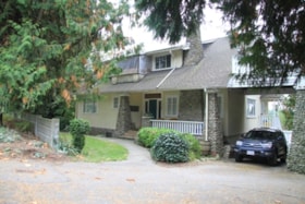
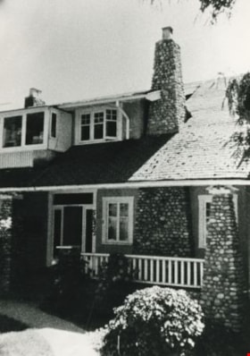
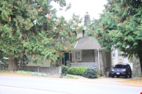
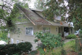
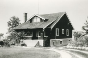
Johnson & Mary Skinner Residence
https://search.heritageburnaby.ca/link/landmark551
- Repository
- Burnaby Heritage Planning
- Description
- Residential building.
- Associated Dates
- c.1912
- Other Names
- Timms House
- Street View URL
- Google Maps Street View
- Repository
- Burnaby Heritage Planning
- Other Names
- Timms House
- Geographic Access
- Marine Drive
- Associated Dates
- c.1912
- Description
- Residential building.
- Heritage Value
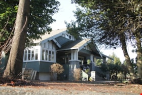
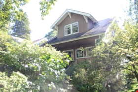
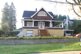
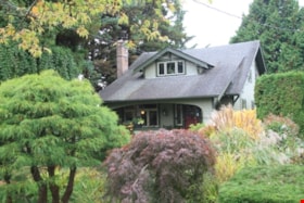
- This house was originally built by Fraser Arm pioneer and postmaster Johnson Alfred Skinner (1864-1941) and his wife, Mary Emma Skinner (née Bailey, 1862-1929). Johnson, who was from Sussex, worked as a horticulturalist. This is an unusual variation on the Craftsman style, with a side gabled roof and a half-width front verandah. Local mason John Pickard completed the distinctive battered cobblestone masonry, including the foundation, chimney, verandah columns and the porte-cochère. The house was later occupied and remodeled by the Timms family.
- Locality
- Fraser Arm
- Historic Neighbourhood
- Fraser Arm (Historic Neighbourhood)
- Planning Study Area
- Big Bend Area
- Ownership
- Private
- Street Address
- 5634 Marine Drive
- Street View URL
- Google Maps Street View
Images
Greenwood Residence
https://search.heritageburnaby.ca/link/landmark555
- Repository
- Burnaby Heritage Planning
- Description
- Residential building.
- Associated Dates
- c.1911
- Other Names
- Albert & Emma Greenwood Residence
- Street View URL
- Google Maps Street View
- Repository
- Burnaby Heritage Planning
- Other Names
- Albert & Emma Greenwood Residence
- Geographic Access
- Victory Street
- Associated Dates
- c.1911
- Description
- Residential building.
- Heritage Value
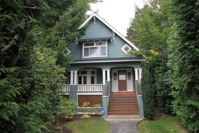
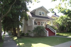
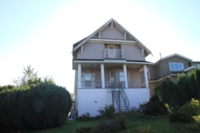
- Typical of the Arts and Crafts style, this house has a front gabled roof with triangular eave brackets and a front verandah with twinned square columns on tapered piers. It is notable for its stained glass windows and early ‘ripple’ float glass. Asbestos shingles were at one point added over the original siding, but are being removed by the owner, exposing the cedar shingles. The house is believed to have been built and occupied by Albert and Emma Greenwood.
- Locality
- Alta Vista
- Historic Neighbourhood
- Alta Vista (Historic Neighbourhood)
- Planning Study Area
- Sussex-Nelson Area
- Ownership
- Private
- Street Address
- 4569 Victory Street
- Street View URL
- Google Maps Street View
Images
Captain William Eyres Residence
https://search.heritageburnaby.ca/link/landmark565
- Repository
- Burnaby Heritage Planning
- Description
- Residential building.
- Associated Dates
- c.1910
- Street View URL
- Google Maps Street View
- Repository
- Burnaby Heritage Planning
- Geographic Access
- Canada Way
- Associated Dates
- c.1910
- Description
- Residential building.
- Heritage Value
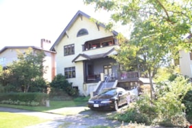
- This home was built by Captain William J. Eyres. In 1912, it was reported in The British Columbian: “Captain Eyres of Seattle is remodelling the front of his house on Douglas Road and otherwise improving it.” The house was later sold to William A. Mawhinney, who subsequently built houses at 6011 Buckingham Avenue and 7616 Burris Avenue. This spacious, high-quality Craftsman bungalow remains in excellent condition. It features a cross-gabled roof with multiple half-timbered front gables with large exposed purlins, in contrast to the shingle cladding on the rest of the house. At the front corner is a glazed sun-room. The entrance porch features tripled square columns. The property still has a beautiful garden, but once included large vegetable gardens, an orchard, and a large chicken house.
- Locality
- Burnaby Lake
- Historic Neighbourhood
- Burnaby Lake (Historic Neighbourhood)
- Planning Study Area
- Morley-Buckingham Area
- Area
- 1709.65
- Contributing Resource
- Building
- Ownership
- Private
- Street Address
- 6079 Canada Way
- Street View URL
- Google Maps Street View
Images
Colonial Finance Company House
https://search.heritageburnaby.ca/link/landmark568
- Repository
- Burnaby Heritage Planning
- Description
- Residential building.
- Associated Dates
- c.1912
- Street View URL
- Google Maps Street View
- Repository
- Burnaby Heritage Planning
- Geographic Access
- Cambridge Street
- Associated Dates
- c.1912
- Description
- Residential building.
- Heritage Value
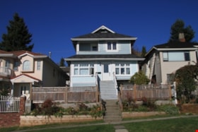
- 3890 Cambridge Street and 3896 Cambridge Street are nearly identical twins. These modestly-sized pattern book residences each feature a side gabled roof with a central dormer and a central entrance, as well as interesting Craftsman-style detailing such as the bracketed verandah columns, triangular eave brackets and exposed rafter tails. Though the original exterior siding has been covered by a later stucco cladding, the house maintains its original double-hung windows with elaborate multi-paned upper sashes. Built as a revenue property, it was owned by the Colonial Finance Company in 1915.
- Locality
- Vancouver Heights
- Historic Neighbourhood
- Vancouver Heights (Historic Neighbourhood)
- Planning Study Area
- Burnaby Heights Area
- Ownership
- Private
- Street Address
- 3890 Cambridge Street
- Street View URL
- Google Maps Street View
Images
Colonial Finance Company House
https://search.heritageburnaby.ca/link/landmark569
- Repository
- Burnaby Heritage Planning
- Description
- Residential building.
- Associated Dates
- c.1912
- Street View URL
- Google Maps Street View
- Repository
- Burnaby Heritage Planning
- Geographic Access
- Cambridge Street
- Associated Dates
- c.1912
- Description
- Residential building.
- Heritage Value
- 3890 Cambridge Street and 3896 Cambridge Street are nearly identical twins. These modestly-sized pattern book residences each feature a side gabled roof with a central dormer and a central entrance, and an open front verandah. Both houses have later coverings over their original siding; 3890 Cambridge was stuccoed, and this house received more recent vinyl siding, indicating the periodic pressure on homeowners to “upgrade” through the use of new, applied products. Built as a revenue property by the Colonial Finance Company, this house was owned by David Caldwell, the manager of the Caldwell & Carson real estate company in 1915.
- Locality
- Vancouver Heights
- Historic Neighbourhood
- Vancouver Heights (Historic Neighbourhood)
- Planning Study Area
- Burnaby Heights Area
- Street Address
- 3896 Cambridge Street
- Street View URL
- Google Maps Street View
Images
George & Mary Buxton Residence
https://search.heritageburnaby.ca/link/landmark583
- Repository
- Burnaby Heritage Planning
- Description
- Residential building.
- Associated Dates
- c.1912
- Street View URL
- Google Maps Street View
- Repository
- Burnaby Heritage Planning
- Geographic Access
- Buxton Street
- Associated Dates
- c.1912
- Description
- Residential building.
- Heritage Value
- George Searby Buxton (1867-1955), an English-born carpenter, built this Arts and Crafts dwelling and resided here with his wife and local teacher Mary Isabel Buxton (née Nattriss, 1865-1941). George and Mary are both buried in the picturesque St. Helen’s Anglican Church cemetery in Surrey. The house retains this style’s characteristic elements such as half-timbering, an oriel window and turned verandah supports, as well as its distinctive windows, which are casements in the lower portion of the frame and a fixed multi-paned sash in the upper. The original siding has been covered with a later coat of stucco. The house survives in well-maintained condition.
- Locality
- Central Park
- Historic Neighbourhood
- Central Park (Historic Neighbourhood)
- Planning Study Area
- Marlborough Area
- Area
- 868.85
- Contributing Resource
- Building
- Ownership
- Private
- Street Address
- 4807 Buxton Street
- Street View URL
- Google Maps Street View
Images
Henry Adams Residence
https://search.heritageburnaby.ca/link/landmark593
- Repository
- Burnaby Heritage Planning
- Description
- Residential building.
- Associated Dates
- c.1913
- Street View URL
- Google Maps Street View
- Repository
- Burnaby Heritage Planning
- Geographic Access
- Buxton Street
- Associated Dates
- c.1913
- Description
- Residential building.
- Heritage Value
- Carpenter Henry J. Adams constructed this side-gabled, shingle-clad bungalow circa 1913, with his neighbour, George S. Buxton (1867-1955), who was also a carpenter. The house is distinguished by its beautifully-detailed wraparound verandah, which is supported by square, tapered columns, and its distinctive semicircular window in the projecting front gable. Other details include a subtly flattened arched opening under the gable, leading to the central front entry.
- Historic Neighbourhood
- Central Park (Historic Neighbourhood)
- Planning Study Area
- Marlborough Area
- Area
- 864.56
- Contributing Resource
- Building
- Ownership
- Private
- Street Address
- 4826 Buxton Street
- Street View URL
- Google Maps Street View
Images
Hugh & Mary McCallum Residence
https://search.heritageburnaby.ca/link/landmark595
- Repository
- Burnaby Heritage Planning
- Description
- Residential building.
- Associated Dates
- c.1912
- Street View URL
- Google Maps Street View
- Repository
- Burnaby Heritage Planning
- Geographic Access
- Regent Street
- Associated Dates
- c.1912
- Description
- Residential building.
- Heritage Value
- Typical of the Arts and Crafts style, the house has its original front gabled roof, triangular eave brackets, full open front verandah and pointed bargeboards. The house has received some alterations, including the addition of asbestos shingles over the original siding. It is one of the few surviving early homes of the Broadview subdivision which was established in 1911. This was the long-term home of Hugh McCallum Senior (1873-1960), a steam engineer from Scotland, and his wife Mary (née Baxter, 1875-1958). Hugh continued to live in the house after Mary’s death.
- Locality
- Broadview
- Historic Neighbourhood
- Broadview (Historic Neighbourhood)
- Planning Study Area
- West Central Valley Area
- Area
- 623.09
- Contributing Resource
- Building
- Ownership
- Private
- Street Address
- 3838 Regent Street
- Street View URL
- Google Maps Street View
Images
J.R. & Frances Dawson Residence
https://search.heritageburnaby.ca/link/landmark599
- Repository
- Burnaby Heritage Planning
- Description
- Residential building.
- Associated Dates
- c.1912
- Street View URL
- Google Maps Street View
- Repository
- Burnaby Heritage Planning
- Geographic Access
- Cambridge Street
- Associated Dates
- c.1912
- Description
- Residential building.
- Heritage Value
- This beautifully-detailed house displays a highly sophisticated mix of fashionable Arts and Crafts elements. The asymmetrical design has stacked inset verandahs on one side, with the ground floor verandah wrapping around the side of the house. The second floor verandah has an arched opening, supported by short versions of the ground floor columns and accessed by French doors with geometric patterned, multi-paned glazing. A semi-circular lunette window lights the attic, and banked windows with leaded transoms are used on the front façade. Decorative details include triangular eave brackets and square verandah columns with distinctive bracketted capitals. The house has survived in original condition except for a later asbestos siding that was applied over the original shingle siding, and the enclosure of the side verandah. The home was owned by J.R. Dawson and Frances Abigail Dawson (née Thompson, 1853-1938) from 1915 until Frances’ death in 1938.
- Locality
- Vancouver Heights
- Historic Neighbourhood
- Vancouver Heights (Historic Neighbourhood)
- Planning Study Area
- Burnaby Heights Area
- Area
- 566.71
- Contributing Resource
- Building
- Ownership
- Private
- Street Address
- 3746 Cambridge Street
- Street View URL
- Google Maps Street View
Images
J.S. & Mina Reid Residence
https://search.heritageburnaby.ca/link/landmark600
- Repository
- Burnaby Heritage Planning
- Description
- Residential building.
- Associated Dates
- c.1913
- Street View URL
- Google Maps Street View
- Repository
- Burnaby Heritage Planning
- Geographic Access
- Frances Street
- Associated Dates
- c.1913
- Description
- Residential building.
- Heritage Value
- The gable-on-hipped roofline is this house’s most unique feature. The home is a typical plan of the Foursquare type with the addition of an inset second-storey verandah. The full open front verandah has square columns and closed balustrades. A coloured glass transom was used above the living room window assembly. By 1915, the house was owned by J.S. and Mina Reid (1874-1969).
- Locality
- Vancouver Heights
- Historic Neighbourhood
- Vancouver Heights (Historic Neighbourhood)
- Planning Study Area
- Burnaby Heights Area
- Area
- 377.10
- Contributing Resource
- Building
- Ownership
- Private
- Street Address
- 3851 Frances Street
- Street View URL
- Google Maps Street View
Images
John & Hattie Standish Residence
https://search.heritageburnaby.ca/link/landmark607
- Repository
- Burnaby Heritage Planning
- Description
- Residential building.
- Associated Dates
- c.1912
- Street View URL
- Google Maps Street View
- Repository
- Burnaby Heritage Planning
- Geographic Access
- Edmonds Street
- Associated Dates
- c.1912
- Description
- Residential building.
- Heritage Value
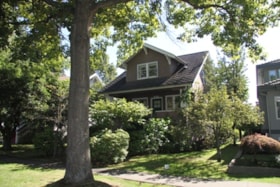
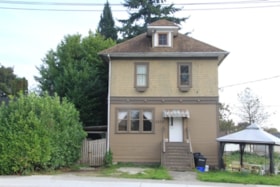
- This square, two-storey house displays vertical proportions, with a pyramidal roof and central dormer. It features narrow double-hung windows, lapped siding on the first storey, and shingle siding on the second divided by a belt course, and has retained a high degree of original integrity. It was built for John Albert Standish (1862-1913), a farmer who left this home to his wife, Hattie and their children after his death.
- Locality
- Edmonds
- Historic Neighbourhood
- Edmonds (Historic Neighbourhood)
- Planning Study Area
- Edmonds Area
- Area
- 367.94
- Contributing Resource
- Building
- Ownership
- Private
- Street Address
- 7408 Edmonds Street
- Street View URL
- Google Maps Street View
Images
Joseph & Anne Gartlan Residence
https://search.heritageburnaby.ca/link/landmark612
- Repository
- Burnaby Heritage Planning
- Description
- Residential building.
- Associated Dates
- c.1913
- Street View URL
- Google Maps Street View
- Repository
- Burnaby Heritage Planning
- Geographic Access
- Oxford Street
- Associated Dates
- c.1913
- Description
- Residential building.
- Heritage Value
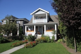
- This house was owned by Joseph Paul Gartlan (1877-1967), a steam shovel engineer for the B.C. Electric Company from 1906 to 1943, and his wife, Annie Claudia Gartlan (née Wood, 1891-1933). Joseph was a long-time resident of the house, remaining until his death in 1967. Typical of the Edwardian era, this bungalow has a side gabled roof with a large front gable over the balcony, an open front verandah with square tapered columns, and a mix of narrow lapped wooden siding, square shingles and diamond shingles in the gable peak.
- Locality
- Vancouver Heights
- Historic Neighbourhood
- Vancouver Heights (Historic Neighbourhood)
- Planning Study Area
- Burnaby Heights Area
- Area
- 374.03
- Contributing Resource
- Building
- Ownership
- Private
- Street Address
- 4111 Oxford Street
- Street View URL
- Google Maps Street View
Images
Peter & Alma Newstrom Residence
https://search.heritageburnaby.ca/link/landmark631
- Repository
- Burnaby Heritage Planning
- Description
- Residential building.
- Associated Dates
- c.1915
- Street View URL
- Google Maps Street View
- Repository
- Burnaby Heritage Planning
- Geographic Access
- Oxford Street
- Associated Dates
- c.1915
- Description
- Residential building.
- Heritage Value
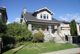
- This bungalow was built and owned by Peter John Newstrom (1861-1947), who later worked as a bricklayer, and his wife Alma Mary (1865-1935). The Newstroms arrived in Canada from Sweden about 1912 and were long-term residents of this home; Peter lived in the house after the death of his wife, until his own death in 1947. Typical of the Craftsman style, the house has a side gabled roof with large front gabled dormer, scroll-cut bargeboards, open front verandah and granite rubble-stone foundation and tapered piers. It retains its original glazed front door assembly.
- Locality
- Vancouver Heights
- Historic Neighbourhood
- Vancouver Heights (Historic Neighbourhood)
- Planning Study Area
- Burnaby Heights Area
- Area
- 566.71
- Contributing Resource
- Building
- Ownership
- Private
- Street Address
- 3865 Oxford Street
- Street View URL
- Google Maps Street View
Images
Richard & Ada Neville Residence
https://search.heritageburnaby.ca/link/landmark633
- Repository
- Burnaby Heritage Planning
- Description
- Residential building.
- Associated Dates
- c.1918
- Street View URL
- Google Maps Street View
- Repository
- Burnaby Heritage Planning
- Geographic Access
- Nelson Avenue
- Associated Dates
- c.1918
- Description
- Residential building.
- Heritage Value
- This Craftsman bungalow was built for the Neville family. Richard Neville (1884-1950) served as a Burnaby councillor in 1924 and is remembered as the man who gave the CCF party (now the NDP) land on Maple Avenue on which to build Jubilee Labour Hall. He worked as a tile layer for the O’Neill Company and was married to Ada Neville (née Cook, 1885-1970). Ada Neville still lived in this house at the time of her death. Typical of the Craftsman style, the house has a side gabled roof with large front gable dormer, triangular eave brackets, an open arched front verandah and a textural mix of siding including cedar shingle on the main floor and lapped siding at the foundation.
- Locality
- Alta Vista
- Historic Neighbourhood
- Alta Vista (Historic Neighbourhood)
- Planning Study Area
- Sussex-Nelson Area
- Area
- 936.00
- Contributing Resource
- Building
- Ownership
- Private
- Street Address
- 6935 Nelson Avenue
- Street View URL
- Google Maps Street View
Images
Crabtown
https://search.heritageburnaby.ca/link/landmark674
- Repository
- Burnaby Heritage Planning
- Associated Dates
- 1912-1957
- Heritage Value
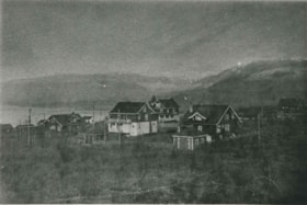
- North Burnaby's waterfront was the location of a unique squatter's community known as Crabtown. Although its origins are obscure, it is believed that the first shacks were built before 1912. When the depression of 1913-1917 began, the shacks became permanent homes for impoverished workers. During the Great Depression of the 1930s, the community grew larger. Crabtown was not a slum, but a neighbourhood - the community even rallied together to build a water supply system and trails up the steep bluff with steps and banisters so children could go to school safely. In 1957, the National Harbours Board decided that Crabtown was encroaching on Federal property and evicted all 130 residents. Within a few months, residents were relocated and 114 homes were levelled.
- Historic Neighbourhood
- Vancouver Heights (Historic Neighbourhood)
- Planning Study Area
- Burnaby Heights Area
Images
Vancouver Heights Neighbourhood
https://search.heritageburnaby.ca/link/landmark741
- Repository
- Burnaby Heritage Planning
- Associated Dates
- 1905-1924
- Heritage Value
- On December 13, 1912, The British Columbian Weekly described the Vancouver Heights neighbourhood as follows: "The northern portion of the municipality in the vicinity of Boundary Road has during the past three years made tremendous strides towards settlement. At that time Mr. James Herd and Mr. Peters were the only residents of the district...Soon, however, the timber was removed, streets laid out and other conveniences such as water, light and transportation provided... The school population of the district has increased so rapidly that the school has been enlarged twice this year and is at the present time inadequate. About 200 children are attending now. There are three churches in the district and one mission...At present time there are two large blocks containing six stores..."
- Historic Neighbourhood
- Vancouver Heights (Historic Neighbourhood)
- Planning Study Area
- Burnaby Heights Area
Images
Capitol Hill Neighbourhood
https://search.heritageburnaby.ca/link/landmark742
- Repository
- Burnaby Heritage Planning
- Associated Dates
- 1905-1924
- Heritage Value
- Real estate ventures became quite active in the Vancouver Heights and Capitol Hill areas of Burnaby by 1908. Brokerage firms and agents who bought large tracts, subdivided and sold them off in parcels and by 1909 had adopted the name "Capitol Hill" to describe Burnaby's newest neighbourhood. In his book, History of Burnaby and Vicinity," historian George Green explains that the term "Capitol Hill" was taken from ancient Rome where the civic centre was built upon the Capitoline Hill, one of the seven hills of the eternal city. In 1909, the Scott Brokerage Company advertised the sale of lots on Capitol Hill, calling it "one of Vancouver's swellest suburbs."
- Historic Neighbourhood
- Capitol Hill (Historic Neighbourhood)
- Planning Study Area
- Capitol Hill Area
Images
Lochdale Neighbourhood
https://search.heritageburnaby.ca/link/landmark743
- Repository
- Burnaby Heritage Planning
- Associated Dates
- 1905-1924
- Heritage Value
- "Picturesquely situated on the south-westerly slope of the highest hill on the Burrard Peninsula is a district that in many ways resembles the early pioneer settlements…its centre is at the intersection of east Hastings Street and Sperling Avenue. Only a few years ago a dense forest covered this area and the settlers were few and some distance apart. After the war working men began to enter the Lochdale woods in quest of cheap home-sites. Today there are more than 400 residents in the district who combine to make a happy contented industrious community living on the edge of a big city yet enjoying the life offered by the country...The Community Hall is the centre of all social activities. Dances, concerts and other forms of entertainment are all there...Curtis Street runs from Sperling Avenue up to the hill, locally known as Hastings Grove. From the top on a clear day there is a view for miles around." ~ From the Sunday Province, March 8, 1925.
- Historic Neighbourhood
- Lochdale (Historic Neighbourhood)
- Planning Study Area
- Lochdale Area
Images
Hastings Grove Neighbourhood
https://search.heritageburnaby.ca/link/landmark746
- Repository
- Burnaby Heritage Planning
- Associated Dates
- 1905-1924
- Heritage Value
- During the height of the real estate boom between 1909 and 1913, Vancouver developer Frederick Munson plotted the subdivision of more than 150 acres of land on Curtis Street east of Sperling Avenue, on the newly logged slopes of remote Burnaby Mountain. Burnaby opened up Curtis Street to facilitate access to Hastings Grove and Munson agreed to pay one-third of the cost but never did. He also paid only $1000.00 down on the agreed price of the land. When he failed to make further payments, the mortgage holders foreclosed and re-sold the properties. People who had bought lots from Munson lost not only the land they though they owned, but also the money they had paid for it. Hastings Grove was a disaster. The converted automobile - which served as the bus - stopped running. The few houses and most of the lots reverted to the Municipality because of non-payment of taxes and are now part of Burnaby Mountain Park. The only remaining building is the old Hastings Grove Store which still stands as an apartment building.
- Historic Neighbourhood
- Lochdale (Historic Neighbourhood)
- Planning Study Area
- Lochdale Area
Images
Barnet Neighbourhood
https://search.heritageburnaby.ca/link/landmark747
- Repository
- Burnaby Heritage Planning
- Associated Dates
- 1905-1924
- Heritage Value
- The original Barnet mill burned down in 1909 after a dramatic explosion in the boiler house. The company rebuilt a new plant, considered a model of mill construction. The company's timber was towed down the Pacific in huge rafts containing about 400,000 to 500,000 board feet. Mill capacity during a 10-hour day was 150,000 board feet with an amazing annual output of 50 million feet.
- Historic Neighbourhood
- Barnet (Historic Neighbourhood)
- Planning Study Area
- Burnaby Mountain Area
Images
Russian Submarines at Barnet
https://search.heritageburnaby.ca/link/landmark748
- Repository
- Burnaby Heritage Planning
- Associated Dates
- 1915-1917
- Heritage Value
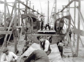
- This site was a top secret site where 460 men worked on the assembly of five submarines for the Russian Navy during World War I. The Seattle contractor was forbidden from doing the work in the US because of American neutrality regulations and he set up the secret plant here without the knowledge of the Canadian Government.
- Historic Neighbourhood
- Barnet (Historic Neighbourhood)
- Planning Study Area
- Burnaby Mountain Area
Images
Broadview Neighbourhood
https://search.heritageburnaby.ca/link/landmark750
- Repository
- Burnaby Heritage Planning
- Associated Dates
- 1905-1924
- Heritage Value
- Between 1905 and 1924, the Broadview neighbourhood in Burnaby was settled by almost 100 families who saw the advantage of living in an area that was served by two railway lines - the B.C. Electric Railway and the Great Northern Railway. Touted as being only a 20 minute car ride to the city centre, this neighbourhood expanded during the early 1920s with the promise of a new direct access road to the city being built by the Great Northern Railway company and new blocks being opened up on two government reserves adjoining it.
- Historic Neighbourhood
- Broadview (Historic Neighbourhood)
- Planning Study Area
- Cascade-Schou Area
Images
Central Park Neighbourhood
https://search.heritageburnaby.ca/link/landmark751
- Repository
- Burnaby Heritage Planning
- Associated Dates
- 1905-1924
- Heritage Value
- In 1906, Maxwell Smith, President of the Central Park Farmer's Institute gave a speech in which he commented on the growth of this district and its ideal location during the boom years after 1905. He said: "Central Park is destined to become the epicentre of a great commercial metropolis, when Vancouver and New Westminster will have both expanded and prospered until they meet and fill up the intervening distances with residences of a new city, greater than few can now imagine, even in their wildest flights of fancy...we are proud of the two cities that lie on either side of us but they are, but mere hamlets compared with the great city that is to be on this peninsula. The time is coming when there will be one vast city, one commercial metropolis, and Central Park will be the heart of it."
- Historic Neighbourhood
- Central Park (Historic Neighbourhood)
- Planning Study Area
- Maywood Area
Images
Burnaby Lake Neighbourhood
https://search.heritageburnaby.ca/link/landmark755
- Repository
- Burnaby Heritage Planning
- Associated Dates
- 1905-1924
- Heritage Value
- Along with logging and sawmills, Burnaby became known as a prime agricultural area and the Burnaby Lake Neighbourhood saw the development of many vegetable and fruit farms. Growers in the Burnaby and Deer Lake districts took their produce to the tram line on Edmonds Street and shipped it to markets in New Westminster and Vancouver on a specially designed interurban freight car that was open-sided for easy loading. The car's canvas curtains which sometimes came loose and flapped like wings in the wind led people to dub it "the flying dutchman." Most Burnaby fruit and vegetable growers depended on seasonal Chinese work forces and other local Chinese farm residents to oversee operations; these workers being recruited from New Westminsters' Asian community. Besides being good farmers, Burnaby Lake's early residents fostered a strong sense of community. Both L. Claude Hill and his brother Bernard were elected to Burnaby Municipal council and Bernard was the one who knocked on doors to find enough children to meet the qualifications for establishing a school in the district.
- Historic Neighbourhood
- Burnaby Lake (Historic Neighbourhood)
- Planning Study Area
- Morley-Buckingham Area
- Lakeview-Mayfield Area
Images
Lozells Neighbourhood
https://search.heritageburnaby.ca/link/landmark756
- Repository
- Burnaby Heritage Planning
- Associated Dates
- 1905-1924
- Heritage Value
- In 1906 C.T. Piper and Alfred Wiggs built a sawmill at the foot of what is now Piper Avenue along the north shore of Burnaby Lake. These operations and the proximity of the Great Northern Railway encourage settlers to move into this area and among them were Colonel and Mrs. James Ward. They were authorized to open a post office here and Mrs. Ward named it 'Lozells' after the Anglican parish to which she had been a member in Birmingham, England.
- Historic Neighbourhood
- Lozells (Historic Neighbourhood)
- Planning Study Area
- Government Road Area
Images
Burquitlam Neighbourhood
https://search.heritageburnaby.ca/link/landmark757
- Repository
- Burnaby Heritage Planning
- Associated Dates
- 1905-1924
- Heritage Value
- In 1921, the pamphlet "Beautiful Burnaby" was produced and it described the Burquitlam neighbourhood as such: "No part of Burnaby has more consistently laboured to advance its prosperity than Burquitlam. Enterprise and intelligence has hewn homes from the forest and developed land into highly productive gardens and poultry ranches. Burquitlam is the growing suburb to the north of the City of New Westminster. It is reached by the Sapperton carline direct from Edmonds being only a few minutes ride from New Westminster market. It is also served by the B.C.E.R. Burnaby Lake line and adjoins on the best golf links in Greater Vancouver."
- Historic Neighbourhood
- Burquitlam (Historic Neighbourhood)
- Planning Study Area
- Cameron Area
- Lyndhurst Area
Images
Edmonds Neighbourhood
https://search.heritageburnaby.ca/link/landmark758
- Repository
- Burnaby Heritage Planning
- Associated Dates
- 1905-1924
- Heritage Value
- From The British Columbian, March 19, 1912: "On the fringe of New Westminster there is…a suburban townsite in Edmonds. During the past eighteen months it has grown and prospered quite phenomenally. It is ideally situated, is in easy communication with New Westminster by two car lines. Its climate is clear and bracing, being exceptionally free from the fogs that are more or less prevalent along the river section and gulf shore...Edmonds, in fact, is one of the finest residential parts of the province. This is fast becoming known and appreciated beyond its borders. Elegant and substantial residences are being erected in various parts, and stores are being put up in convenient localities. The new municipal building is one of the finest in British Columbia for so young a municipality."
- Historic Neighbourhood
- Edmonds (Historic Neighbourhood)
- Planning Study Area
- Edmonds Area
Images
Buena Vista Neighbourhood
https://search.heritageburnaby.ca/link/landmark759
- Repository
- Burnaby Heritage Planning
- Associated Dates
- 1905-1924
- Heritage Value
- The Buena Vista neighbourhood (so named for its wonderful views) grew out of its proximity to Edmonds and New Westminster and was developed in the period 1911-1912. By the 1950s, the area had been further subdivided and in 1986, Burnaby Municipal Council adopted the Cariboo Hills Development Plan for the neighbourhood to maintain its character as a residential area of the city.
- Historic Neighbourhood
- East Burnaby (Historic Neighbourhood)
- Planning Study Area
- Cariboo-Armstrong Area
Images
Alta Vista Neighbourhood
https://search.heritageburnaby.ca/link/landmark766
- Repository
- Burnaby Heritage Planning
- Associated Dates
- 1905-1924
- Heritage Value
- Alta Vista, named for its high views of the Fraser Valley, rapidly grew during the period 1910-1912, seeing its settlement jump from about a dozen buildings in 1910 to about four hundred by the end of 1912. Home-seekers were attracted to its location just a short walk from the B.C.E.R. line at Royal Oak and Highland Park and easily accessible to both New Westminster and Vancouver.
- Historic Neighbourhood
- Alta Vista (Historic Neighbourhood)
- Planning Study Area
- Sussex-Nelson Area
Images
Fraser Arm Neighbourhood
https://search.heritageburnaby.ca/link/landmark767
- Repository
- Burnaby Heritage Planning
- Associated Dates
- 1905-1924
- Heritage Value
- Fraser Arm - so named because there the tram crossed Gilley Avenue, running down to the North Arm of the Fraser River - was served by the River Road [Marine Drive] which traversed the municipality of Burnaby, leading to both New Westminster and Vancouver. This area did not experience a real estate boom during the 1909-1913 as did many other Burnaby neighbourhoods - in fact, by 1912, only three homes had been built along Riverway as it remained a predominantly agricultural area.
- Historic Neighbourhood
- Fraser Arm (Historic Neighbourhood)
- Planning Study Area
- Big Bend Area
Images
East Burnaby Neighbourhood
https://search.heritageburnaby.ca/link/landmark773
- Repository
- Burnaby Heritage Planning
- Associated Dates
- 1905-1924
- Heritage Value
- According to the 1911 December 26 edition of The British Columbian: Optimism is the word that applies to the whole community of East Burnaby. The many improvements carried out by the council during the past two years had been the means of making East Burnaby a thriving settlement, and hence one and all are optimistic as to its future. In the clearing and building line, many fine new homes are being erected...Real estate values have advanced with the times, and a notable feature is the number of better-class houses that are being built in this locality, which proves that East Burnaby is becoming very much alive and elevated.
- Historic Neighbourhood
- East Burnaby (Historic Neighbourhood)
- Planning Study Area
- Edmonds Area
Images
The book of knowledge : the children's encyclopaedia, volume i
https://search.heritageburnaby.ca/link/museumlibrary668
- Repository
- Burnaby Village Museum
- Collection
- Special Collection
- Material Type
- Book
- Accession Code
- BV985.3668.1
- Call Number
- 032 MEE v. 1 1918
- Contributor
- Mee, Arthur, 1875-1943
- Thompson, Holland, 1873-1940
- Finley, John H. (John Huston), 1863-1940
- Place of Publication
- New York
- Publisher
- The Grolier Society
- Publication Date
- c1918
- Series
- The Book of Knowledge, v. 1
- Physical Description
- x, 334 p. : ill. : 25 cm.
- Library Subject (LOC)
- Encyclopedias and dictionaries
- Children's encyclopædias and dictionaries
- Notes
- "Editors-in-chief Arthur Mee...Holland Thompson..." -- Title page
- "With an introduction by John H. Finley..." -- Title page
- Contributor's full name and dates: Finley, John H. (John Huston), 1863-1940
- page 1-334
- Volume 1 of 20
Images
The book of knowledge : the children's encyclopaedia, volume ii
https://search.heritageburnaby.ca/link/museumlibrary669
- Repository
- Burnaby Village Museum
- Collection
- Special Collection
- Material Type
- Book
- Accession Code
- BV985.3668.2
- Call Number
- 032 MEE v.2 1918
- Contributor
- Mee, Arthur, 1875-1943
- Thompson, Holland, 1873-1940
- Finley, John H. (John Huston), 1863-1940
- Place of Publication
- New York
- Publisher
- The Grolier Society
- Publication Date
- c1918
- Series
- The Book of Knowledge, v. 2
- Physical Description
- 335-660 p. : ill. : 25 cm.
- Library Subject (LOC)
- Encyclopedias and dictionaries
- Children's encyclopædias and dictionaries
- Notes
- "Editors-in-chief Arthur Mee...Holland Thompson..." -- Title page
- "With an introduction b John H. Findley..." -- Title page
- Contributor's full name and dates: Finley, John H. (John Huston), 1863-1940
- pages 335-660
- volume 2 of 20
Images
The book of knowledge : the children's encyclopaedia, volume iii
https://search.heritageburnaby.ca/link/museumlibrary670
- Repository
- Burnaby Village Museum
- Collection
- Special Collection
- Material Type
- Book
- Accession Code
- BV985.3668.3
- Call Number
- 032 MEE v. 3 1918
- Contributor
- Mee, Arthur, 1875-1943
- Thompson, Holland, 1873-1940
- Finley, John H. (John Huston), 1863-1940
- Place of Publication
- New York
- Publisher
- The Grolier Society
- Publication Date
- c1918
- Series
- The Book of Knowledge, v. 3
- Physical Description
- 662-992 p. : ill.(some col.) : 25 cm.
- Inscription
- "Gross 1955 3 on R Gross" [Handwritten in blue ink on back flyleaf]
- Library Subject (LOC)
- Encyclopedias and dictionaries
- Children's encyclopædias and dictionaries
- Notes
- "Editors-in-chief Arthur Mee...Holland Thompson..." -- Title page
- "With an introduction by John H. Finley..." -- Title page
- Contributor's full name and dates: Finley, John H. (John Huston), 1863-1940
- pages 662-992
- volume 3 of 20
Images
The book of knowledge : the children's encyclopaedia, volume iv
https://search.heritageburnaby.ca/link/museumlibrary671
- Repository
- Burnaby Village Museum
- Collection
- Special Collection
- Material Type
- Book
- Accession Code
- BV985.3668.4
- Call Number
- 032 MEE v.4 1918
- Contributor
- Mee, Arthur, 1875-1943
- Thompson, Holland, 1873-1940
- Finley, John H. (John Huston), 1863-1940
- Place of Publication
- New York
- Publisher
- The Grolier Society
- Publication Date
- c1918
- Series
- The Book of Knowledge, v. 4
- Physical Description
- 993-1312 : ill. : 25 cm.
- Library Subject (LOC)
- Encyclopedias and dictionaries
- Children's encyclopædias and dictionaries
- Notes
- "Editors-in-chief Arthur Mee...Holland Thompson..." -- Title page
- "With an introduction by John H. Finley..." -- Title page
- Contributor's full name and dates: Finley, John H. (John Huston), 1863-1940
- pages 993-1312
- volume 4 of 20
Images
The book of knowledge : the children's encyclopaedia, volume v
https://search.heritageburnaby.ca/link/museumlibrary672
- Repository
- Burnaby Village Museum
- Collection
- Special Collection
- Material Type
- Book
- Accession Code
- BV985.3668.5
- Call Number
- 032 MEE v.5 1918
- Contributor
- Mee, Arthur, 1875-1943
- Thompson, Holland, 1873-1940
- Finley, John H. (John Huston), 1863-1940
- Place of Publication
- New York
- Publisher
- The Grolier Society
- Publication Date
- c1918
- Series
- The Book of Knowledge, v. 5
- Physical Description
- 1313-1638 p. : ill. : 25 cm.
- Library Subject (LOC)
- Encyclopedias and dictionaries
- Children's encyclopædias and dictionaries
- Notes
- "Editors-in-chief Arthur Mee...Holland Thompson..." -- Title page
- "With and introduction by John H. Finley..." -- Title page
- Contributor's full name and dates: Finley, John H. (John Huston), 1863-1940
- pages 1313-1638
- volume 5 of 20
Images
The book of knowledge : the children's encyclopaedia, volume vi
https://search.heritageburnaby.ca/link/museumlibrary673
- Repository
- Burnaby Village Museum
- Collection
- Special Collection
- Material Type
- Book
- Accession Code
- BV985.3668.6
- Call Number
- 032 MEE v. 6 1918
- Contributor
- Mee, Arthur, 1875-1943
- Thompson, Holland, 1873-1940
- Finley, John H. (John Huston), 1863-1940
- Place of Publication
- New York
- Publisher
- The Grolier Society
- Publication Date
- c1918
- Series
- The Book of Knowledge, v. 6
- Physical Description
- iv, 1639-1958, : ill. : 25 cm.
- Library Subject (LOC)
- Encyclopedias and dictionaries
- Children's encyclopædias and dictionaries
- Notes
- "Editors-in-chief Arthur Mee...Holland Thompson..." -- Title page
- "With an introduction by John H. Finley..." -- Title page
- Contributor's full name and dates: Finley, John H. (John Huston), 1863-1940
- pages 1639-1958
- volume 6 of 20
Images
The book of knowledge : the children's encyclopaedia, volume vii
https://search.heritageburnaby.ca/link/museumlibrary674
- Repository
- Burnaby Village Museum
- Collection
- Special Collection
- Material Type
- Book
- Accession Code
- BV985.3668.7
- Call Number
- 032 MEE v. 7 1918
- Place of Publication
- New York
- Publisher
- The Grolier Society
- Publication Date
- c1918
- 1919
- Series
- The Book of Knowledge, v. 7
- Physical Description
- iv, 1959-2278 : ill. : 25 cm.
- Library Subject (LOC)
- Encyclopedias and dictionaries
- Children's encyclopædias and dictionaries
- Notes
- "Editors-in-chief Arthur Mee...Holland Thompson..." -- Title page
- "With an introduction by John H. Finley..." -- Title page
- Contributor's full name and dates: Finley, John H. (John Huston), 1863-1940
- pages 1959-2278
- volume 7 of 20
Images
The book of knowledge : the children's encyclopaedia, volume viii
https://search.heritageburnaby.ca/link/museumlibrary675
- Repository
- Burnaby Village Museum
- Collection
- Special Collection
- Material Type
- Book
- Accession Code
- BV985.3668.8
- Call Number
- 032 MEE v.8 1918
- Place of Publication
- New York
- Publisher
- The Grolier Society
- Publication Date
- c1918
- Series
- The Book of Knowledge, v. 8
- Physical Description
- iv, 2279-2610 : ill. : 26 cm.
- Library Subject (LOC)
- Encyclopedias and dictionaries
- Children's encyclopædias and dictionaries
- Notes
- "Editors-in-chief Arthur Mee...Holland Thompson..." -- Title page
- "With an introduction by John H. Finley..." -- Title page
- Contributor's full name and dates: Finley, John H. (John Huston), 1863-1940
- page 2279-2610
- volume 8 of 20
Images
The book of knowledge : the children's encyclopædia, vol. 17
https://search.heritageburnaby.ca/link/museumlibrary682
- Repository
- Burnaby Village Museum
- Collection
- Special Collection
- Material Type
- Book
- Accession Code
- BV985.3668.15
- Call Number
- 032 MEE v.17
- Contributor
- Mee, Arthur, 1875-1943
- Thompson, Holland, 1873-1940
- Finley, John H. (John Huston), 1863-1940
- Place of Publication
- New York
- Publisher
- The Grolier Society
- Publication Date
- c1918
- Series
- The Book of Knowledge
- Physical Description
- 322 p. : ill
- Library Subject (LOC)
- Children's encyclopædias and dictionaries
- Notes
- pages numbered 5228-5550
- Contributors' given names, dates and contribution:
- Mee, Arthur, 1875-1943. (editor-in-chief)
- Thompson, Holland, 1873-1940. (editor-in-chief)
- "with an introduction by John H. Finley, LLD Late President of the College of New York Commissioner of Education of the State of New York"
Images
The book of knowledge : the children's encyclopaedia : volume xviii
https://search.heritageburnaby.ca/link/museumlibrary683
- Repository
- Burnaby Village Museum
- Collection
- Special Collection
- Material Type
- Book
- Accession Code
- BV985.3668.16
- Call Number
- 032 MEE v.18 1918
- Place of Publication
- New York
- Publisher
- Grolier Society
- Publication Date
- c1918
- Series
- The book of knowledge
- Physical Description
- 323 p. : ill. ; 25 cm.
- Inscription
- "R Paul G" [handwritten in pencil onpage opposite front pastedown] "Paul Hofer" [handwritten in pencil on title page]
- Library Subject (LOC)
- Encyclopedias and dictionaries
- Children's encyclopædias and dictionaries
- Notes
- paged 5551 - 5874.
Images
The book of knowledge : the children's encyclopaedia : volume xix
https://search.heritageburnaby.ca/link/museumlibrary684
- Repository
- Burnaby Village Museum
- Collection
- Special Collection
- Material Type
- Book
- Accession Code
- BV985.3668.17
- Call Number
- 032 MEE v.19 1918
- Place of Publication
- New York
- Publisher
- Grolier Society
- Publication Date
- c1918
- Physical Description
- 327 p. : ill. ; 25 cm.
- Library Subject (LOC)
- Encyclopedias and dictionaries
- Children's encyclopædias and dictionaries
- Notes
- paged 5875 - 6202.
Images
The book of knowledge : the children's encyclopaedia : volume xx
https://search.heritageburnaby.ca/link/museumlibrary685
- Repository
- Burnaby Village Museum
- Collection
- Special Collection
- Material Type
- Book
- Accession Code
- BV985.3668.18
- Call Number
- 032 MEE v.20 1918
- Place of Publication
- New York
- Publisher
- Grolier Society
- Publication Date
- c1918
- Physical Description
- 379 p. : ill. ; 25 cm.
- Inscription
- Scribbles in pencil on back pastedown and opposing page
- Library Subject (LOC)
- Encyclopedias and dictionaries
- Children's encyclopædias and dictionaries
- Notes
- paged 6203 - 6582.
- Includes index.
Images
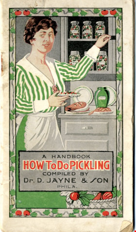
How to do pickling : a book of tested recipes
https://search.heritageburnaby.ca/link/museumlibrary3872
- Repository
- Burnaby Village Museum
- Author
- D. Jayne and Son
- Publication Date
- c1917
- Call Number
- 641.42 JAY
- Repository
- Burnaby Village Museum
- Collection
- Special Collection
- Material Type
- Book
- Accession Code
- BV005.11.2
- Call Number
- 641.42 JAY
- Author
- D. Jayne and Son
- Place of Publication
- Philadelphia, Pa.
- Publisher
- Dr. D. Jayne & Son
- Publication Date
- c1917
- Physical Description
- 16] leaves ; 16 cm.
- Inscription
- A Handbook / How to do Pickling / Compiled by / Dr. D. Jayne & Son / Phila. / Copyright, 1917 by..
- Library Subject (LOC)
- Canning and preserving
- Patent medicines
- Cookbooks--1910-1919
- Cooking
Images
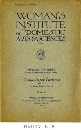
Tissue-paper patterns, part 1
https://search.heritageburnaby.ca/link/museumlibrary4994
- Repository
- Burnaby Village Museum
- Collection
- Special Collection
- Material Type
- Book
- Accession Code
- BV007.6.8
- Call Number
- 646 WOM pt. 1
- Place of Publication
- Scranton, Pa.
- Publisher
- Woman's Institute of Domestic Arts and Sciences
- Publication Date
- 1923
- c1916
- Physical Description
- 32 p. : ill. : 23 cm.
- Library Subject (LOC)
- Dressmaking
- Woman's Institute of Domestic Arts and Sciences
- Subjects
- Documentary Artifacts - Booklets
- Object History
- Home sewing course used by Burnaby residents in the 1920's
- Notes
- Part 1 of 2
- "Department of dressmaking" -- coverXXX
- "Instruction paper with examination questions; 32A-2" -- Cover
Images
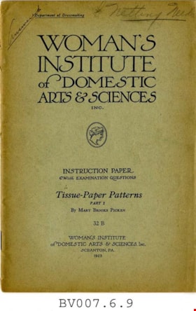
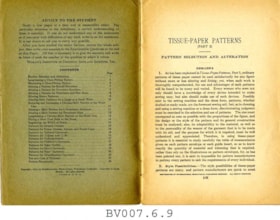
Tissue-paper patterns, part 2
https://search.heritageburnaby.ca/link/museumlibrary4995
- Repository
- Burnaby Village Museum
- Collection
- Special Collection
- Material Type
- Book
- Accession Code
- BV007.6.9
- Call Number
- 746.9 WOM pt. 2
- Place of Publication
- Scranton, Pa.
- Publisher
- Woman's Institute of Domestic Arts and Sciences
- Publication Date
- c1916
- 1923
- Physical Description
- 24 p. : ill. : 23 cm.
- Inscription
- "Answered" [Handwritten and underlined in pencil on front cover] "Netting Needle" [Handwritten, starred, and underlined in pencil on front cover] Some notes throughout.
- Library Subject (LOC)
- Dressmaking
- Woman's Institute of Domestic Arts and Sciences
- Subjects
- Documentary Artifacts - Booklets
- Object History
- Home sewing course used by Burnaby residents in the 1920's
- Notes
- Part 2 of 2
- "Department of dressmaking" -- cover
- "Instruction paper with examination questions" -- Cover
Images
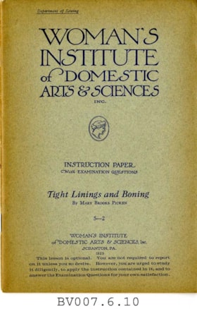
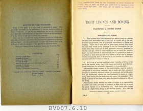
Tight linings and boning
https://search.heritageburnaby.ca/link/museumlibrary4996
- Repository
- Burnaby Village Museum
- Collection
- Special Collection
- Material Type
- Book
- Accession Code
- BV007.6.10
- Call Number
- 646 WOM
- Place of Publication
- Scranton, Pa.
- Publisher
- Education Corp. General
- Publication Date
- 1923
- c1915
- Physical Description
- 43 p. : ill. : 23 cm.
- Inscription
- "This instruction book is not included in your course of study, but is sent to show you just how to prepare your dress form for use. You will not be asked to report on this book." [Typed in purple ink and pasted to first page]
- Library Subject (LOC)
- Dressmaking
- Sewing
- Linings (Sewing)
- Woman's Institute of Domestic Arts and Sciences
- Subjects
- Documentary Artifacts - Booklets
- Object History
- Home sewing course used by Burnaby residents in the 1920's
- Notes
- "Department of sewing" -- cover
- "Instruction paper with examination questions ; 5-2" -- Cover
- "This lesson is optional. You are not required to report on it unless you so desire. However, you are urged to study it diligently, to apply the instruction contained in it, and to answer the Examination Questions for your own satisfaction." -- Cover
Images
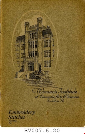
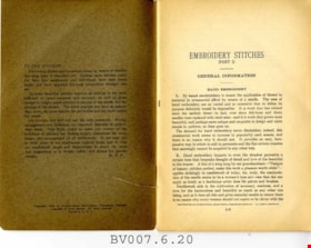
Embroidery stitches, part 1
https://search.heritageburnaby.ca/link/museumlibrary5006
- Repository
- Burnaby Village Museum
- Collection
- Special Collection
- Material Type
- Book
- Accession Code
- BV007.6.20
- Call Number
- 746.5 PIC
- Place of Publication
- Scranton, Pa.
- Publisher
- Woman's Institute of Domestic Arts and Sciences
- Publication Date
- 1921
- c1916
- Physical Description
- 44 p. : ill. : 23 cm.
- Library Subject (LOC)
- Embroidery--Study and teaching
- Stitches (Sewing)
- Subjects
- Documentary Artifacts - Booklets
- Object History
- Home sewing course used by Burnaby residents in the 1920's
- Notes
- Part 1 of 2
Images
Boys of the Bible
https://search.heritageburnaby.ca/link/museumlibrary5848
- Repository
- Burnaby Village Museum
- Collection
- Special Collection
- Material Type
- Book
- Accession Code
- BV007.31.5
- Call Number
- 220.9 BOY
- Contributor
- Turner, A. M.
- Place of Publication
- New York
- Publisher
- Sam'l Gabriel Sons & Co.
- Publication Date
- c1916
- Physical Description
- 32 p. : ill. : 28 cm.
- Inscription
- "Presented to Nina Atkinson for Proficiency in bible study and general aptitude: from The East Burnaby Methodist Sunday School August 1917" [Handwritten in pencil on front flyleaf]
- Library Subject (LOC)
- Bible
- Bible. Old Testament
- Juvenile literature
- Notes
- "Illustrated by A. M. Turner" -- Title page
Images
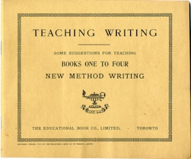
Teaching writing : some suggestions for teaching books one to four ; new method writing
https://search.heritageburnaby.ca/link/museumlibrary6452
- Repository
- Burnaby Village Museum
- Collection
- Special Collection
- Material Type
- Book
- Accession Code
- HV973.70.7
- Call Number
- 372.634 EDU
- Place of Publication
- Toronto
- Publisher
- The Educational Book Co., Limited
- Publication Date
- c1913
- Physical Description
- 63 p. : ill. ; 19 x 23 cm.
- Library Subject (LOC)
- Penmanship
- Penmanship--Study and teaching
