Narrow Results By
Subject
- Advertising Medium - Signs and Signboards 2
- Animals - Birds 9
- Arts - Drawings 1
- Arts - Paintings 11
- Building Components 1
- Buildings - Agricultural 4
- Buildings - Agricultural - Greenhouses 2
- Buildings - Agricultural - Stables 1
- Buildings - Civic 1
- Buildings - Civic - Community Centres 1
- Buildings - Civic - Museums 3
- Buildings - Commercial - Restaurants 1
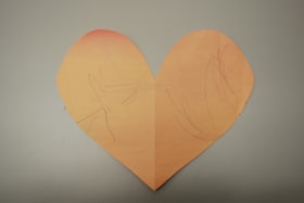
Paper heart by Sophie Armstrong
https://search.heritageburnaby.ca/link/museumdescription14749
- Repository
- Burnaby Village Museum
- Date
- March 2020
- Collection/Fonds
- Burnaby Village Museum COVID-19 collection
- Description Level
- Item
- Physical Description
- 1 drawing : wax crayon on pink construction paper ; 20 x 23.5 cm
- Scope and Content
- Item consists of a heart that has been cut out of pink coloured construction paper. One side of the heart has contains a child's drawing with markings in purple crayon while the other side is blank. The side with the markings is faded from exposure due to sunlight after being hung in a window.
- Repository
- Burnaby Village Museum
- Collection/Fonds
- Burnaby Village Museum COVID-19 collection
- Description Level
- Item
- Physical Description
- 1 drawing : wax crayon on pink construction paper ; 20 x 23.5 cm
- Scope and Content
- Item consists of a heart that has been cut out of pink coloured construction paper. One side of the heart has contains a child's drawing with markings in purple crayon while the other side is blank. The side with the markings is faded from exposure due to sunlight after being hung in a window.
- History
- This was a heart the Armstrong family made in the last week of March when things were starting to get very scary and they wanted to share their message of love and support to the world. The heart was decorated on one side by Sophie (age 1), Kimberly's youngest daughter (of two). The heart remained on the window until mid July 2020.
- Creator
- Armstrong, Sophie
- Subjects
- Arts - Drawings
- Crafts
- Pandemics - COVID-19
- Responsibility
- Paneloc Marketing Limited
- Accession Code
- BV020.24.1
- Access Restriction
- No restrictions
- Reproduction Restriction
- No known restrictions
- Date
- March 2020
- Media Type
- Graphic Material
- Notes
- Title based on contents of item
Images


Museum materials for exhibits subseries
https://search.heritageburnaby.ca/link/museumdescription18848
- Repository
- Burnaby Village Museum
- Date
- 2019
- Collection/Fonds
- Burnaby Village Museum fonds
- Description Level
- Subseries
- Physical Description
- 2 digital files (tiff, pdf)
- Scope and Content
- Subseries consists of discrete items and records pertaining to various permanent and temporary exhibits created by Burnaby Village Museum.
- Repository
- Burnaby Village Museum
- Collection/Fonds
- Burnaby Village Museum fonds
- Series
- Museum exhibits series
- Subseries
- Museum materials for exhibits subseries
- Description Level
- Subseries
- Physical Description
- 2 digital files (tiff, pdf)
- Scope and Content
- Subseries consists of discrete items and records pertaining to various permanent and temporary exhibits created by Burnaby Village Museum.
- Accession Code
- BV019.36.1
- BV019.61.1
- Date
- 2019
- Media Type
- Graphic Material
- Notes
- Title based on contents of subseries
- further accruals are expected
![Oakalla Prison Farm, [2019] thumbnail](/media/hpo/_Data/_BVM_Images/2019/2019_0036_0001_001.jpg?width=280)
Oakalla Prison Farm
https://search.heritageburnaby.ca/link/museumdescription18849
- Repository
- Burnaby Village Museum
- Date
- [2019]
- Collection/Fonds
- Burnaby Village Museum fonds
- Description Level
- Item
- Physical Description
- 1 painting (tiff)
- Scope and Content
- Item consists of a digital copy of a painting of a view of Oakalla Prison farm with Deer Lake in the background. The original painting was created by Burnaby Village Museum preparator Carly Bowman as part of an exhibit.
- Repository
- Burnaby Village Museum
- Collection/Fonds
- Burnaby Village Museum fonds
- Series
- Museum exhibits series
- Subseries
- Museum materials for exhibits subseries
- Description Level
- Item
- Physical Description
- 1 painting (tiff)
- Scope and Content
- Item consists of a digital copy of a painting of a view of Oakalla Prison farm with Deer Lake in the background. The original painting was created by Burnaby Village Museum preparator Carly Bowman as part of an exhibit.
- Creator
- Bowman, Carly
- Names
- Oakalla Prison Farm
- Accession Code
- BV019.36.1
- Date
- [2019]
- Media Type
- Graphic Material
- Notes
- Title based on contents of item
Images
![Oakalla Prison Farm, [2019] thumbnail](/media/hpo/_Data/_BVM_Images/2019/2019_0036_0001_001.jpg)
![BFG bag prop concept plan, [2015] thumbnail](/media/hpo/_Data/_BVM_Images/2022/2022_0021_0100_001.jpg?width=280)
BFG bag prop concept plan
https://search.heritageburnaby.ca/link/museumdescription19155
- Repository
- Burnaby Village Museum
- Date
- [2015]
- Collection/Fonds
- Hipman "Jimmy" Chow and Donna Polos fonds
- Description Level
- Item
- Physical Description
- 1 photograph : col. laser print ; 28 x 43.5 cm with annotations
- Scope and Content
- Item consists of a concept plan created by concept illustrator Brian Cunningham for a leather bag to be used as a prop in the film "The BFG". Ovelay of tape with actual measurements on surface of print for the creation of the leather bag. Concept plan was used by property master, Jimmy Chow to crea…
- Repository
- Burnaby Village Museum
- Collection/Fonds
- Hipman "Jimmy" Chow and Donna Polos fonds
- Description Level
- Item
- Physical Description
- 1 photograph : col. laser print ; 28 x 43.5 cm with annotations
- Material Details
- Green masking tape and white duct tape adhered to surface of print
- Handwritten measurements in black ink written on surface of tape
- Scope and Content
- Item consists of a concept plan created by concept illustrator Brian Cunningham for a leather bag to be used as a prop in the film "The BFG". Ovelay of tape with actual measurements on surface of print for the creation of the leather bag. Concept plan was used by property master, Jimmy Chow to create the bag as a prop. The film was directed by Steven Spielberg and released in 2016.
- Creator
- Cunningham, Brian
- Subjects
- Industries - Film
- Responsibility
- Beach, Chris
- Accession Code
- BV022.21.100
- Access Restriction
- No restrictions
- Reproduction Restriction
- May be restricted by third party rights
- Date
- [2015]
- Media Type
- Graphic Material
- Notes
- Title based on contents of item
- Bottom right corner includes identifiers reading: "? / ...BFG 3 BAG_PROP CONCEPT / ... PROP BFG BAG CONCEPT / .../ Scale / 15:00:00 [sic] / ? / C_BEACH /? / B_CUNNINGHAM / ? / NONE [sic] / ? / PRP_C05 / ..."
- Drawing identifies, Brian Cunningham as concept illustrator and Chris Beach as [designer] (Art Director)
Images
![BFG bag prop concept plan, [2015] thumbnail](/media/hpo/_Data/_BVM_Images/2022/2022_0021_0100_001.jpg)
Mayor's Task Force on Graffiti subseries
https://search.heritageburnaby.ca/link/archivedescription96466
- Repository
- City of Burnaby Archives
- Date
- 2006-2012
- Collection/Fonds
- City Council and Office of the City Clerk fonds
- Description Level
- Subseries
- Physical Description
- 15 folders of textual records + 1 photograph
- Scope and Content
- Subseries consists of committee records for the Mayor's Task Force on Graffiti including agendas, minutes, committee reports, and a commissioned portrait.
- Repository
- City of Burnaby Archives
- Date
- 2006-2012
- Collection/Fonds
- City Council and Office of the City Clerk fonds
- Series
- Council Committee series
- Subseries
- Mayor's Task Force on Graffiti subseries
- Physical Description
- 15 folders of textual records + 1 photograph
- Description Level
- Subseries
- Scope and Content
- Subseries consists of committee records for the Mayor's Task Force on Graffiti including agendas, minutes, committee reports, and a commissioned portrait.
- History
- The Mayor's Task Force on Graffiti was appointed May 8, 2006. The purpose of this committee was to develop anti-graffiti strategies and programs, promote mural programs. On January 26, 2015, the responsibilities for the Mayor’s Task Force on Graffiti were transferred to the Public Safety Committee.
- Media Type
- Textual Record
- Photograph
- Graphic Material

Byrne Creek Secondary School
https://search.heritageburnaby.ca/link/landmark849
- Repository
- Burnaby Heritage Planning
- Geographic Access
- 18th Street
- Associated Dates
- 2005
- Heritage Value
- Byrne Creek School opened in 2005 and accommodates students from grades 8 through 12. When built, the school was created to house as many as 1200 students, but by 2009, plans have been prepared to increase that capacity to 1500.
- Historic Neighbourhood
- Edmonds (Historic Neighbourhood)
- Planning Study Area
- Stride Avenue Area
- Street Address
- 7777 18th Street
- Street View URL
- Google Maps Street View
Images


Taylor Park Elementary School
https://search.heritageburnaby.ca/link/landmark847
- Repository
- Burnaby Heritage Planning
- Geographic Access
- Mission Avenue
- Associated Dates
- 2004
- Heritage Value
- Taylor Park Elementary School was opened in 2004 with 240 students from kindergarten to grade three (with older students attending Stride Avenue Community School). By 2006, Taylor Park had been designated as its own school and extended its classes from kindergarten through grade six.
- Historic Neighbourhood
- Edmonds (Historic Neighbourhood)
- Planning Study Area
- Stride Hill Area
- Street Address
- 7590 Mission Avenue
- Street View URL
- Google Maps Street View
Images

Environment Committee subseries
https://search.heritageburnaby.ca/link/archivedescription96447
- Repository
- City of Burnaby Archives
- Date
- 2003-2012
- Collection/Fonds
- City Council and Office of the City Clerk fonds
- Description Level
- Subseries
- Physical Description
- 32 folders of textual records + 1 photograph
- Scope and Content
- Subseries consists of committee records for the Environment Committee including agendas, minutes, correspondence, committee reports, and a comissioned portrait.
- Repository
- City of Burnaby Archives
- Date
- 2003-2012
- Collection/Fonds
- City Council and Office of the City Clerk fonds
- Series
- Council Committee series
- Subseries
- Environment Committee subseries
- Physical Description
- 32 folders of textual records + 1 photograph
- Description Level
- Subseries
- Scope and Content
- Subseries consists of committee records for the Environment Committee including agendas, minutes, correspondence, committee reports, and a comissioned portrait.
- History
- The Environment Committee (formerly the Environment and Waste Management Committee) was established on January 13, 2003. The Committee advises on issues such as minimizing environmental pollution, conserving and enhancing Burnaby’s natural landscape, and ensuring that new developments respect their natural surroundings. The Environment Committee and Social Planning Committee were integrated into the Sustainable City Advisory Committee in 2017. The Environment Committee was struck again in January of 2020.
- Media Type
- Textual Record
- Photograph
- Graphic Material
Social Issues Committee subseries
https://search.heritageburnaby.ca/link/archivedescription96472
- Repository
- City of Burnaby Archives
- Date
- 2003-2012
- Collection/Fonds
- City Council and Office of the City Clerk fonds
- Description Level
- Subseries
- Physical Description
- 35 folders of textual records + 1 photograph
- Scope and Content
- Subseries consists of committee records for the Social Issues Committee including agendas, minutes, committee reports, and a commissioned portrait.
- Repository
- City of Burnaby Archives
- Date
- 2003-2012
- Collection/Fonds
- City Council and Office of the City Clerk fonds
- Series
- Council Committee series
- Subseries
- Social Issues Committee subseries
- Physical Description
- 35 folders of textual records + 1 photograph
- Description Level
- Subseries
- Scope and Content
- Subseries consists of committee records for the Social Issues Committee including agendas, minutes, committee reports, and a commissioned portrait.
- History
- The Social Issues Committee was established January 13, 2003 to replace the Community Issues and Social Planning Committee. The Social Issues Committee advised on a variety of social issues including crime prevention, leasing space at Burnaby’s Community Resource Centres, and the needs of seniors, youth, families, ethnic groups and persons with disabilities. On January 26, 2015, the Social Issues Committee changed its name to the Social Planning Committee.
- Media Type
- Textual Record
- Photograph
- Graphic Material
Property master designs for "X2: X-Men United"
https://search.heritageburnaby.ca/link/museumdescription19154
- Repository
- Burnaby Village Museum
- Date
- [2002]
- Collection/Fonds
- Hipman "Jimmy" Chow and Donna Polos fonds
- Description Level
- File
- Physical Description
- 1 portfolio : 15 photographs : col. prints + 12 col. laser prints
- Scope and Content
- File consists of a portfolio of prop concept design plans, prototypes and resource photographs for the Marvel film "X2: X-Men United". Concept designs were created by different designers and portfolio of collection was created by property master, Jimmy Chow. The portfolio was used as a communicatio…
- Repository
- Burnaby Village Museum
- Collection/Fonds
- Hipman "Jimmy" Chow and Donna Polos fonds
- Description Level
- File
- Physical Description
- 1 portfolio : 15 photographs : col. prints + 12 col. laser prints
- Scope and Content
- File consists of a portfolio of prop concept design plans, prototypes and resource photographs for the Marvel film "X2: X-Men United". Concept designs were created by different designers and portfolio of collection was created by property master, Jimmy Chow. The portfolio was used as a communication tool for sharing prototypes and plans with Jimmy's team who worked with him on the film. The film was directed by Bryan Singer and was released in 2003. Some of the concept designs within the portfolio were created by assistant art director, Brenton Harron, signed "Harron" and illustrator Dean Sherriff , signed "Sheriff".
- Accession Code
- BV022.21.107
- Access Restriction
- Restricted access
- Reproduction Restriction
- May be restricted by third party rights
- Date
- [2002]
- Media Type
- Photograph
- Graphic Material
- Scan Resolution
- 600
- Scan Date
- 2023-03-10
- Notes
- Title based on contents of file
- Title on spine of cover of portfolio reads: "X2 / PROPS"
- Chinese seal in red ink on spine of cover of portfolio identifying Jimmy Chow as the owner or creator
Images

Parks, Recreation and Culture Commission subseries
https://search.heritageburnaby.ca/link/archivedescription96468
- Repository
- City of Burnaby Archives
- Date
- 2001-2007
- Collection/Fonds
- City Council and Office of the City Clerk fonds
- Description Level
- Subseries
- Physical Description
- 3 folders of textual records + 1 photograph
- Scope and Content
- Subseries consists of committee records for the Parks, Recreation and Culture Commission including an annual report, general records, and a commissioned portrait.
- Repository
- City of Burnaby Archives
- Date
- 2001-2007
- Collection/Fonds
- City Council and Office of the City Clerk fonds
- Series
- Council Committee series
- Physical Description
- 3 folders of textual records + 1 photograph
- Description Level
- Subseries
- Scope and Content
- Subseries consists of committee records for the Parks, Recreation and Culture Commission including an annual report, general records, and a commissioned portrait.
- History
- On December 20, 1999 the name Parks and Recreation Commission (struck December 30, 1957) was changed to Parks, Recreation and Culture Commission. The Parks, Recreation and Culture Commission is the administrative power of Council relating to the Parks, Recreation and Cultural Services Department, which is responsible for ensuring Burnaby residents have access to beautiful outdoor spaces and recreation programs and facilities, as well as cultural and fine art facilities.
- Media Type
- Textual Record
- Photograph
- Graphic Material
Annual Concerto Concert poster
https://search.heritageburnaby.ca/link/archivedescription97574
- Repository
- City of Burnaby Archives
- Date
- 2001
- Collection/Fonds
- Burnaby Historical Society fonds
- Description Level
- File
- Physical Description
- 1 poster
- Scope and Content
- Poster for the Annual Concerto Concert presented by the Clef Society of Burnaby. The concert was held on Sunday, June 3, 2001 at the Michael J. Fox Theatre in Burnaby, BC. An inkjet photograph of an orchestra on stage is adhered to the top of the poster with adhesive tape.
- Repository
- City of Burnaby Archives
- Date
- 2001
- Collection/Fonds
- Burnaby Historical Society fonds
- Subseries
- Burnaby Clef Society subseries
- Physical Description
- 1 poster
- Description Level
- File
- Record No.
- MSS020-039
- Accession Number
- BHS2007-04
- Scope and Content
- Poster for the Annual Concerto Concert presented by the Clef Society of Burnaby. The concert was held on Sunday, June 3, 2001 at the Michael J. Fox Theatre in Burnaby, BC. An inkjet photograph of an orchestra on stage is adhered to the top of the poster with adhesive tape.
- Media Type
- Graphic Material
- Notes
- Title based on contents of file

City of Burnaby Archives
https://search.heritageburnaby.ca/link/landmark783
- Repository
- Burnaby Heritage Planning
- Geographic Access
- Albert Street
- Associated Dates
- 2001
- Heritage Value
- The City of Burnaby Archives officially opened on Saturday, November 10, 2001. The Archives is Burnaby's first municipal archives, and is located in the McGill Branch Library. The City Archives functions as a branch of the Office of the City Clerk and operates as the official repository of Burnaby's municipal records, containing records dating back to Burnaby's incorporation in 1892. In 2007, the City of Burnaby Archives expanded its collection mandate to include private as well as public records. On February 14, 2007 an agreement was signed with the Burnaby Historical Society and, as a result, the Archives accepted into its custody the collection of community records that had been maintained and managed by the Historical Society since the 1950s. In the Spring of 2007, these records were transferred from the Burnaby Village Museum to their permanent home in the Archives facility.
- Historic Neighbourhood
- Capitol Hill (Historic Neighbourhood)
- Planning Study Area
- Capitol Hill Area
- Street Address
- 4595 Albert Street
- Street View URL
- Google Maps Street View
Images


Burnaby Mountain Secondary School
https://search.heritageburnaby.ca/link/landmark831
- Repository
- Burnaby Heritage Planning
- Geographic Access
- Eastlake Drive
- Associated Dates
- 2000
- Heritage Value
- Burnaby Mountain Secondary School is one of the more recent schools in Burnaby, having opened in 2000 and it serves neighbourhoods in northeast Burnaby and northwest Coquitlam.
- Historic Neighbourhood
- Burquitlam (Historic Neighbourhood)
- Planning Study Area
- Lyndhurst Area
- Street Address
- 8800 Eastlake Drive
- Street View URL
- Google Maps Street View
Images

Kushiro Cup Selection Committee subseries
https://search.heritageburnaby.ca/link/archivedescription96463
- Repository
- City of Burnaby Archives
- Date
- 1997-2012
- Collection/Fonds
- City Council and Office of the City Clerk fonds
- Description Level
- Subseries
- Physical Description
- 13 folders of textual records + 2 photographs + 2 floppy discs
- Scope and Content
- Subseries consists of committee records for the Kushiro Cup Selection Committee including agendas, minutes, and committee reports.
- Repository
- City of Burnaby Archives
- Date
- 1997-2012
- Collection/Fonds
- City Council and Office of the City Clerk fonds
- Series
- Council Committee series
- Physical Description
- 13 folders of textual records + 2 photographs + 2 floppy discs
- Description Level
- Subseries
- Scope and Content
- Subseries consists of committee records for the Kushiro Cup Selection Committee including agendas, minutes, and committee reports.
- History
- This committee has been annually struck in order to choose an outstanding Burnaby citizen as the Kushiro Cup Award Citizen of the Year.
- Media Type
- Textual Record
- Photograph
- Graphic Material

Shadbolt Centre for the Arts
https://search.heritageburnaby.ca/link/landmark820
- Repository
- Burnaby Heritage Planning
- Geographic Access
- Deer Lake Avenue
- Associated Dates
- 1995
- Heritage Value
- The Shadbolt Centre for the Arts opened in 1995. The Shadbolt Centre was named after two Burnaby residents who dedicated a lifetime of support and cultivation of the arts locally, nationally and internationally. Doris and Jack Shadbolt resided in Burnaby for over 50 years until Jack's death in November 1998. Doris Shadbolt spent her life's work bringing the artist and the audience closer together through her writing and curatorial work. Jack Shadbolt was an internationally recognized Canadian painter. He was also an author and both received many awards including the Order of Canada. In keeping with the Shadbolts' generosity the arts, Jack Shadbolt donated two of his paintings to the Centre for permanent display.
- Historic Neighbourhood
- Burnaby Lake (Historic Neighbourhood)
- Planning Study Area
- Douglas-Gilpin Area
- Street Address
- 6450 Deer Lake Avenue
- Street View URL
- Google Maps Street View
Images

Community Policing Committee subseries
https://search.heritageburnaby.ca/link/archivedescription96425
- Repository
- City of Burnaby Archives
- Date
- 1994-2012
- Collection/Fonds
- City Council and Office of the City Clerk fonds
- Description Level
- Subseries
- Physical Description
- 44 folders of textual records + 1 photograph
- Scope and Content
- Subseries consists of committee records for the Community Policing Committee including agendas, minutes, correspondence, committee reports, and a commissioned portrait.
- Repository
- City of Burnaby Archives
- Date
- 1994-2012
- Collection/Fonds
- City Council and Office of the City Clerk fonds
- Series
- Council Committee series
- Subseries
- Community Policing Committee subseries
- Physical Description
- 44 folders of textual records + 1 photograph
- Description Level
- Subseries
- Scope and Content
- Subseries consists of committee records for the Community Policing Committee including agendas, minutes, correspondence, committee reports, and a commissioned portrait.
- History
- The Community Policing Committee was established on March 21, 1994. The purpose of this committee was to advise Council on directions and strategies for community policing and crime prevention strategies; to serve as a liaison between Council, district community consultative committees, and the RCMP; and to serve as a link between those groups and the broader community. On January 26, 2015, the Committee’s name was changed from the Community Policing Committee to the Public Safety Committee.
- Media Type
- Textual Record
- Photograph
- Graphic Material

Burnaby South Secondary School and The B.C. Provincial School for the Deaf
https://search.heritageburnaby.ca/link/landmark844
- Repository
- Burnaby Heritage Planning
- Geographic Access
- Rumble Street
- Associated Dates
- 1993
- Heritage Value
- The original Burnaby South High School was replaced in 1993 and the new Burnaby South Secondary School and BC Provincial School for the Deaf was built at this location. This school was built with the latest technology and modern equipment to ensure it was fully accessible and offers integrated academic, social and recreational activities for its students.
- Historic Neighbourhood
- Alta Vista (Historic Neighbourhood)
- Planning Study Area
- Clinton-Glenwood Area
- Street Address
- 5455 Rumble Street
- Street View URL
- Google Maps Street View
Images


South Slope Elementary School & The B.C. Provincial School for the Deaf
https://search.heritageburnaby.ca/link/landmark843
- Repository
- Burnaby Heritage Planning
- Geographic Access
- Watling Street
- Associated Dates
- 1992
- Heritage Value
- South Slope/B.C. School for the Deaf opened in 1992 and is one of the newer elementary schools in the City. The 2009 School Growth Plan notes that South Slope/BC School for the Deaf replaced the former Jericho Hill School for the Deaf in Vancouver.
- Historic Neighbourhood
- Alta Vista (Historic Neighbourhood)
- Planning Study Area
- Sussex-Nelson Area
- Street Address
- 4446 Watling Street
- Street View URL
- Google Maps Street View
Images

Museum exhibits series
https://search.heritageburnaby.ca/link/museumdescription16037
- Repository
- Burnaby Village Museum
- Date
- 1990-2021
- Collection/Fonds
- Burnaby Village Museum fonds
- Description Level
- Series
- Physical Description
- 1 digital illustration (pdf) + 1 painting (tiff) + 9 sound recordings (mp3) + 2 video recordings (mp4) + 6.5 cm of textual records
- Scope and Content
- Series consists of photographs, graphic materials and other records pertaining to Burnaby Village Museum temporary and permanent exhibits. A selection of temporary exihibits are described by title and year. Series have been arranged by exhibit title into the following subseries: 1) Burnaby's Best …
- Repository
- Burnaby Village Museum
- Collection/Fonds
- Burnaby Village Museum fonds
- Series
- Museum exhibits series
- Description Level
- Series
- Physical Description
- 1 digital illustration (pdf) + 1 painting (tiff) + 9 sound recordings (mp3) + 2 video recordings (mp4) + 6.5 cm of textual records
- Scope and Content
- Series consists of photographs, graphic materials and other records pertaining to Burnaby Village Museum temporary and permanent exhibits. A selection of temporary exihibits are described by title and year. Series have been arranged by exhibit title into the following subseries: 1) Burnaby's Best Baby contest subseries 2) Across the Pacific subseries 3) Agents of Change subseries 4) Museum materials for exhibits subseries
- Names
- Burnaby Village Museum
- Accession Code
- BV020.5
- BV019.36.1
- BV019.61.1
- BV020.42
- BV021.14
- Date
- 1990-2021
- Arrangement
- Series are arranged by subseries by exhibit title and year.
- Notes
- Title based on contents of series
- Further accruals expected
Burnaby Centennial Committee subseries
https://search.heritageburnaby.ca/link/archivedescription96371
- Repository
- City of Burnaby Archives
- Date
- 1989-1993
- Collection/Fonds
- City Council and Office of the City Clerk fonds
- Description Level
- Subseries
- Physical Description
- 15 folders of textual records + 2 audio tape recordings + 6 photograph albums of newspaper clippings + 1 videocassette tape
- Scope and Content
- Subseries consists of committee records for the Burnaby Centennial Committee including minutes, correspondence, news clippings, a recording of the Burnaby anthem, and video of the Burnaby Centennial Dinner.
- Repository
- City of Burnaby Archives
- Date
- 1989-1993
- Collection/Fonds
- City Council and Office of the City Clerk fonds
- Series
- Council Committee series
- Subseries
- Burnaby Centennial Committee subseries
- Physical Description
- 15 folders of textual records + 2 audio tape recordings + 6 photograph albums of newspaper clippings + 1 videocassette tape
- Description Level
- Subseries
- Scope and Content
- Subseries consists of committee records for the Burnaby Centennial Committee including minutes, correspondence, news clippings, a recording of the Burnaby anthem, and video of the Burnaby Centennial Dinner.
- History
- The Burnaby Centennial Committee was established June 5, 1989. The Committee was responsible for overseeing the celebration of Burnaby's centennial anniversary in 1992. This committee disbanded in 1993.
Community Heritage Commission subseries
https://search.heritageburnaby.ca/link/archivedescription96378
- Repository
- City of Burnaby Archives
- Date
- 1989-2012
- Collection/Fonds
- City Council and Office of the City Clerk fonds
- Description Level
- Subseries
- Physical Description
- 46 folders of textual records + 2 photographs + 1 portrait
- Scope and Content
- Subseries consists of committee records for the Community Heritage Commission including agendas, minutes, correspondence, committee reports, and heritage sites.
- Repository
- City of Burnaby Archives
- Date
- 1989-2012
- Collection/Fonds
- City Council and Office of the City Clerk fonds
- Series
- Council Committee series
- Subseries
- Community Heritage Commission subseries
- Physical Description
- 46 folders of textual records + 2 photographs + 1 portrait
- Description Level
- Subseries
- Scope and Content
- Subseries consists of committee records for the Community Heritage Commission including agendas, minutes, correspondence, committee reports, and heritage sites.
- History
- The Community Heritage Commission was established December of 1994. This committee was formerly known as the Heritage Advisory Committee. The Community Heritage Commission supports efforts to increase public awareness of and provide management for constructed and natural heritage in the City of Burnaby.
- Media Type
- Textual Record
- Photograph
- Graphic Material
Traffic and Transportation Committee (Traffic Safety Division) subseries
https://search.heritageburnaby.ca/link/archivedescription96474
- Repository
- City of Burnaby Archives
- Date
- 1989-2002
- Collection/Fonds
- City Council and Office of the City Clerk fonds
- Description Level
- Subseries
- Physical Description
- 46 folders of textual records + 1 photograph
- Scope and Content
- Subseries consists of committee records for the Traffic and Transportation Committee (Traffic Safety Division) including agendas, minutes, correspondence, committee reports, and the Forest Grove Drive petition.
- Repository
- City of Burnaby Archives
- Date
- 1989-2002
- Collection/Fonds
- City Council and Office of the City Clerk fonds
- Series
- Council Committee series
- Physical Description
- 46 folders of textual records + 1 photograph
- Description Level
- Subseries
- Scope and Content
- Subseries consists of committee records for the Traffic and Transportation Committee (Traffic Safety Division) including agendas, minutes, correspondence, committee reports, and the Forest Grove Drive petition.
- History
- The Traffic and Transportation Committee was established on November 20, 1989. The Committee was immediately divided in two, creating the Traffic and Transportation Committee (Traffic Safety Division) and the Traffic and Transportation Committee (Transportation and Transit Division). The Traffic and Transportation Committee (Traffic Safety Division) was concerned with matters of traffic safety including the installation of crosswalks, parking bans, traffic safety at playgrounds, and producing reports on the safety in Burnaby neighbourhoods and at schools. On January 13, 2003 these committees returned to their previously known names; the Traffic Safety Committee and Transportation Committee.
- Media Type
- Textual Record
- Photograph
- Graphic Material

South Burnaby Cenotaph
https://search.heritageburnaby.ca/link/landmark860
- Repository
- Burnaby Heritage Planning
- Description
- The South Burnaby Cenotaph is located in Bonsor Park at the corner of Nelson Avenue and Imperial Street. The cenotaph commemorates those lost in the First World War, Second World War and the Korean War.
- Associated Dates
- 1988
- Other Names
- Bonsor Park Cenotaph
- Street View URL
- Google Maps Street View
- Repository
- Burnaby Heritage Planning
- Other Names
- Bonsor Park Cenotaph
- Geographic Access
- Nelson Avenue
- Associated Dates
- 1988
- Description
- The South Burnaby Cenotaph is located in Bonsor Park at the corner of Nelson Avenue and Imperial Street. The cenotaph commemorates those lost in the First World War, Second World War and the Korean War.
- Historic Neighbourhood
- Central Park (Historic Neighbourhood)
- Planning Study Area
- Marlborough Area
- Community
- Burnaby
- Cadastral Identifier
- P.I.D. No. 027-719-375
- Boundaries
- The property (Bonsor Park) is comprised of a single municipally-owned property located at 6749 Nelson Avenue.
- Area
- 3570.00
- Contributing Resource
- Landscape Feature
- Structure
- Ownership
- Public (local)
- Street Address
- 6749 Nelson Avenue
- Street View URL
- Google Maps Street View
Images


Forest Grove School
https://search.heritageburnaby.ca/link/landmark795
- Repository
- Burnaby Heritage Planning
- Geographic Access
- Forest Grove Drive
- Associated Dates
- 1986
- Heritage Value
- The Forest Grove subdivision in Burnaby was developed during the early 1980s and resulted in a rapidly growing population that required a school facility to support this "instant" community. Forest Grove Elementary was the second largest elementary school in the city when it opened and 374 pupils were recorded in its first year.
- Planning Study Area
- Lake City Area
- Street Address
- 8525 Forest Grove Drive
- Street View URL
- Google Maps Street View
Images


Metrotown
https://search.heritageburnaby.ca/link/landmark817
- Repository
- Burnaby Heritage Planning
- Geographic Access
- Kingsway
- Associated Dates
- 1986
- Heritage Value
- Although the idea for Metrotown was first expressed in the 1970s, the building itself opened in 1986 and was soon served by the Expo Line of the new SkyTrain system. In the ensuing twenty years, the complex developed into three distinct but adjoining malls - Metropolis at Metrotown, Metrotown Centre, and Station Square. Today, Metrotown serves as the city’s commercial and retail anchor. The mall also includes two large office towers, which by 2001 were home to the head offices for Shaw Cable and TransLink.
- Historic Neighbourhood
- Central Park (Historic Neighbourhood)
- Planning Study Area
- Maywood Area
- Street Address
- 4700 Kingsway
- Street View URL
- Google Maps Street View
Images

![Burnaby Village Museum - Entrance, [1985] thumbnail](/media/hpo/_Data/_BVM_Architectural_Drawings/2019_0052_0088_001.jpg?width=280)
Burnaby Village Museum - Entrance
https://search.heritageburnaby.ca/link/museumdescription11752
- Repository
- Burnaby Village Museum
- Date
- [1985]
- Collection/Fonds
- Century Park Museum Association fonds
- Description Level
- Item
- Physical Description
- 1 drawing : b&w print hand col. (pencil crayons) on paper 46 x 58 cm ; mounted on foamcore board 71 x 58 cm
- Scope and Content
- Item consists of a presentation drawing for the proposed Burnaby Village Museum Expansion. Title at bottom of drawing "Entrance to the walkway / from the west".
- Repository
- Burnaby Village Museum
- Collection/Fonds
- Century Park Museum Association fonds
- Description Level
- Item
- Physical Description
- 1 drawing : b&w print hand col. (pencil crayons) on paper 46 x 58 cm ; mounted on foamcore board 71 x 58 cm
- Scope and Content
- Item consists of a presentation drawing for the proposed Burnaby Village Museum Expansion. Title at bottom of drawing "Entrance to the walkway / from the west".
- Names
- Burnaby Village Museum
- Accession Code
- BV019.52.88
- Access Restriction
- No restrictions
- Reproduction Restriction
- May be restricted by third party rights
- Date
- [1985]
- Media Type
- Graphic Material
- Notes
- Title based on contents of drawing
Images
![Burnaby Village Museum - Entrance, [1985] thumbnail](/media/hpo/_Data/_BVM_Architectural_Drawings/2019_0052_0088_001.jpg)
![Burnaby Village Museum - Inside the museum, [1985] thumbnail](/media/hpo/_Data/_BVM_Architectural_Drawings/2019_0052_0089_001.jpg?width=280)
Burnaby Village Museum - Inside the museum
https://search.heritageburnaby.ca/link/museumdescription11753
- Repository
- Burnaby Village Museum
- Date
- [1985]
- Collection/Fonds
- Century Park Museum Association fonds
- Description Level
- Item
- Physical Description
- 1 drawing : b&w print hand col. (pencil crayons) on paper 46 x 58 cm ; mounted on foamcore board 71 x 58 cm
- Scope and Content
- Item consists of a presentation drawing for the proposed Burnaby Village Museum Expansion. Title at bottom of drawing "Inside the museum".
- Repository
- Burnaby Village Museum
- Collection/Fonds
- Century Park Museum Association fonds
- Description Level
- Item
- Physical Description
- 1 drawing : b&w print hand col. (pencil crayons) on paper 46 x 58 cm ; mounted on foamcore board 71 x 58 cm
- Scope and Content
- Item consists of a presentation drawing for the proposed Burnaby Village Museum Expansion. Title at bottom of drawing "Inside the museum".
- Subjects
- Buildings - Civic - Museums
- Names
- Burnaby Village Museum
- Accession Code
- BV019.52.89
- Access Restriction
- No restrictions
- Reproduction Restriction
- May be restricted by third party rights
- Date
- [1985]
- Media Type
- Graphic Material
- Notes
- Title based on contents of drawing
Images
![Burnaby Village Museum - Inside the museum, [1985] thumbnail](/media/hpo/_Data/_BVM_Architectural_Drawings/2019_0052_0089_001.jpg)
![Burnaby Village Museum - Looking east towards the Adminstration complex, [1985] thumbnail](/media/hpo/_Data/_BVM_Architectural_Drawings/2019_0052_0090_001.jpg?width=280)
Burnaby Village Museum - Looking east towards the Adminstration complex
https://search.heritageburnaby.ca/link/museumdescription11754
- Repository
- Burnaby Village Museum
- Date
- [1985]
- Collection/Fonds
- Century Park Museum Association fonds
- Description Level
- Item
- Physical Description
- 1 drawing : b&w print hand col. (pencil crayons) on paper 46 x 58 cm ; mounted on foamcore board 71 x 58 cm
- Scope and Content
- Item consists of a presentation drawing for the proposed Burnaby Village Museum Expansion. Title at bottom of drawing "Looking east towards / the Adminstration / complex"
- Repository
- Burnaby Village Museum
- Collection/Fonds
- Century Park Museum Association fonds
- Description Level
- Item
- Physical Description
- 1 drawing : b&w print hand col. (pencil crayons) on paper 46 x 58 cm ; mounted on foamcore board 71 x 58 cm
- Scope and Content
- Item consists of a presentation drawing for the proposed Burnaby Village Museum Expansion. Title at bottom of drawing "Looking east towards / the Adminstration / complex"
- Subjects
- Buildings - Civic - Museums
- Names
- Burnaby Village Museum
- Accession Code
- BV019.52.90
- Access Restriction
- No restrictions
- Reproduction Restriction
- May be restricted by third party rights
- Date
- [1985]
- Media Type
- Graphic Material
- Notes
- Title based on contents of drawing
Images
![Burnaby Village Museum - Looking east towards the Adminstration complex, [1985] thumbnail](/media/hpo/_Data/_BVM_Architectural_Drawings/2019_0052_0090_001.jpg)

Stoney Creek Elementary School
https://search.heritageburnaby.ca/link/landmark836
- Repository
- Burnaby Heritage Planning
- Geographic Access
- Beaverbrook Crescent
- Associated Dates
- 1974
- Heritage Value
- Overcrowding at both Lyndhurst and Cameron Road schools in the early 1970s prompted the construction of the Stoney Creek Community School in 1974. Opening with 101 students, the school was expanded with the addition of six classrooms, a library and activity room in 1976.
- Historic Neighbourhood
- Burquitlam (Historic Neighbourhood)
- Planning Study Area
- Lyndhurst Area
- Street Address
- 2740 Beaverbrook Crescent
- Street View URL
- Google Maps Street View
Images


Kensington Arena
https://search.heritageburnaby.ca/link/landmark787
- Repository
- Burnaby Heritage Planning
- Geographic Access
- Curtis Street
- Associated Dates
- 1973
- Heritage Value
- In 1972, the Burnaby Parks Commission considered numerous requests from the community to increase the available ice rink surfaces in the city and voted to build a new full-sized rink instead of adding to the existing municipal rink facility. The new arena was to be situated in North Burnaby and was opened in 1973 adjacent to Kensington Park.
- Planning Study Area
- Parkcrest-Aubrey Area
- Street Address
- 6159 Curtis Street
- Street View URL
- Google Maps Street View
Images

Property master records series
https://search.heritageburnaby.ca/link/museumdescription19153
- Repository
- Burnaby Village Museum
- Date
- [1973-2022]
- Collection/Fonds
- Hipman "Jimmy" Chow and Donna Polos fonds
- Description Level
- Series
- Physical Description
- 1 portfolio : (15 photographs + 12 col. laser prints) + 1 col. laser print + 6 business cards + 1 identification card + 1 booklet
- Scope and Content
- Series consists of a small selection of prop concept design plans and prototypes for films that Jimmy Chow worked on as property master along with a collection of Jimmy Chow's identification cards and business cards while working in the film industry. Prop concept designs and prototypes include; …
- Repository
- Burnaby Village Museum
- Collection/Fonds
- Hipman "Jimmy" Chow and Donna Polos fonds
- Description Level
- Series
- Physical Description
- 1 portfolio : (15 photographs + 12 col. laser prints) + 1 col. laser print + 6 business cards + 1 identification card + 1 booklet
- Scope and Content
- Series consists of a small selection of prop concept design plans and prototypes for films that Jimmy Chow worked on as property master along with a collection of Jimmy Chow's identification cards and business cards while working in the film industry. Prop concept designs and prototypes include; "X2: X-Men United" and "The BFG".
- Accession Code
- BV022.21
- Date
- [1973-2022]
- Media Type
- Photograph
- Textual Record
- Graphic Material
- Notes
- Title based on contents of series

Montecito Elementary School
https://search.heritageburnaby.ca/link/landmark796
- Repository
- Burnaby Heritage Planning
- Geographic Access
- Duthie Avenue
- Associated Dates
- 1972
- Heritage Value
- The neighbourhood between Sperling Avenue and Burnaby Golf course was beginning to see a rapid development during the late 1960s causing the School Board to determine the need for a school to be built there. This was one of the last schools to be built in Burnaby before school enrolments in general began declining in the late 1970s.
- Planning Study Area
- Sperling-Broadway Area
- Street Address
- 2176 Duthie Avenue
- Street View URL
- Google Maps Street View
Images


Burnaby Village Museum
https://search.heritageburnaby.ca/link/landmark808
- Repository
- Burnaby Heritage Planning
- Geographic Access
- Deer Lake Avenue
- Associated Dates
- 1971
- Heritage Value
- The Burnaby Village Museum is a ten-acre heritage site located adjacent to Deer Lake. The site was originally created as a B.C. Centennial Project in 1971. The official sod turning for was April 11, 1971 by the then Governor General of Canada Roland Mitchener. The Village was initially managed by the Century Park Museum Association, a volunteer society of Burnaby citizens. Over the years many heritage building which could not be maintained in their original locations have been moved to the museum. Today half of the buildings in the village are heritage structures and the remainder are reproductions. In 1990 the City of Burnaby assumed direct management of the Village, and the museum became part of the Parks, Recreation and Culture Department. Visitors can enjoy the shops on Hill Street, ride the Parker 119 Carousel, and climb aboard the Interurban 1223 tram.
- Historic Neighbourhood
- Burnaby Lake (Historic Neighbourhood)
- Planning Study Area
- Douglas-Gilpin Area
- Morley-Buckingham Area
- Street Address
- 6501 Deer Lake Avenue
- Street View URL
- Google Maps Street View
Images


Swangard Stadium
https://search.heritageburnaby.ca/link/landmark818
- Repository
- Burnaby Heritage Planning
- Geographic Access
- Imperial Street
- Associated Dates
- 1969
- Heritage Value
- On 26 April 1969 Swangard Stadium held its official opening. Named after Vancouver Sun former Managing Editor, Erwin Swangard, the stadium was funded entirely from private donations and civic and provincial grants.
- Historic Neighbourhood
- Central Park (Historic Neighbourhood)
- Planning Study Area
- Maywood Area
- Street Address
- 3883 Imperial Street
Images

Traffic Safety Committee subseries
https://search.heritageburnaby.ca/link/archivedescription96476
- Repository
- City of Burnaby Archives
- Date
- 1968-2012
- Collection/Fonds
- City Council and Office of the City Clerk fonds
- Description Level
- Subseries
- Physical Description
- 365 folders of textual records + 1 roll of microfilm + 1 photograph + 1 optical disc
- Scope and Content
- Subseries consists of committee records for the Traffic Safety Committee including agendas, minutes, correspondence, committee reports, and various Burnaby streets.
- Repository
- City of Burnaby Archives
- Date
- 1968-2012
- Collection/Fonds
- City Council and Office of the City Clerk fonds
- Series
- Council Committee series
- Subseries
- Traffic Safety Committee subseries
- Physical Description
- 365 folders of textual records + 1 roll of microfilm + 1 photograph + 1 optical disc
- Description Level
- Subseries
- Scope and Content
- Subseries consists of committee records for the Traffic Safety Committee including agendas, minutes, correspondence, committee reports, and various Burnaby streets.
- History
- The Traffic Safety Committee was established on April 26, 1954. The Committee advises on ways to improve the safety of Burnaby roads and streets. On November 20, 1989 all matters relating to traffic safety became the responsibility of the Traffic and Transportation Committee (Traffic Safety Division). On January 13, 2003 the Committee returned to being known as the Traffic Safety Committee. The Traffic Safety Committee was integrated with the Public Safety Committee on February 20, 2017. On January 23, 2019 Council passed a report to once again create The Traffic Safety Committee as a stand-alone committee.
- Media Type
- Textual Record
- Photograph
- Graphic Material

Gilpin Elementary School
https://search.heritageburnaby.ca/link/landmark811
- Repository
- Burnaby Heritage Planning
- Geographic Access
- Eglinton Street
- Associated Dates
- 1966
- Heritage Value
- Gilpin Elementary School was built to serve a new housing development extending out from the Douglas Road school area towards the Oakalla Prison site and the Forest Lawn Cemetery. Built in 1966, the school, like other elementary schools of the era, was one-storey, without basement or high stairs. Additions to the building were made in 1969 and 1973.
- Historic Neighbourhood
- Burnaby Lake (Historic Neighbourhood)
- Planning Study Area
- Douglas-Gilpin Area
- Street Address
- 5490 Eglinton Street
- Street View URL
- Google Maps Street View
Images


Dr. William & Ruth Baldwin House
https://search.heritageburnaby.ca/link/landmark534
- Repository
- Burnaby Heritage Planning
- Description
- The Dr. William & Ruth Baldwin House is a two-storey modern post-and-beam structure, located on the southern shore of Deer Lake in Burnaby's Deer Lake Park. The site is steeply sloped, and the main entrance of the house is at the top of the slope facing onto Deer Lake Drive.
- Associated Dates
- 1965
- Formal Recognition
- Community Heritage Register
- Repository
- Burnaby Heritage Planning
- Geographic Access
- Deer Lake Drive
- Associated Dates
- 1965
- Formal Recognition
- Community Heritage Register
- Enactment Type
- Council Resolution
- Enactment Date
- 26/05/2003
- Description
- The Dr. William & Ruth Baldwin House is a two-storey modern post-and-beam structure, located on the southern shore of Deer Lake in Burnaby's Deer Lake Park. The site is steeply sloped, and the main entrance of the house is at the top of the slope facing onto Deer Lake Drive.
- Heritage Value
- The Baldwin House is valued as a prime example of Burnaby’s post-Second World War modern heritage and progressive architectural style, as well as for its personal connections to internationally-acclaimed architect, Arthur Erickson. Inspired by the modern domestic idiom established earlier in the twentieth century by Frank Lloyd Wright and Richard Neutra, Erickson conceived his architecture as responding directly to the site. A cohesive expression of simple orthogonal lines and ultimate transparency, this structure reduces the idea of post-and-beam West Coast modernism to its most refined elements. A fine example of the evolving talent of Erickson’s earlier work, this house is a landmark modern house in Burnaby and is unique in terms of siting and context. Having just won the 1963 competition for the new Simon Fraser University in Burnaby with his partner, Geoff Massey, and having built fewer than half a dozen homes previously, Erickson’s reputation was growing and his skill as a designer of modern buildings was in great demand. The same year that Erickson/Massey Architects designed SFU, Dr. William Baldwin and his wife, Ruth, personal friends of Erickson, commissioned him to design this house. Erickson was already familiar with the site; as a child he had spent time at this spot when his family visited friends who lived on Deer Lake. Both the Baldwin House and the university were completed in 1965. SFU became internationally famous; the Baldwin House was also considered an architectural success and was recognized in publications of the time. Only a single storey of this two-storey house is visible from the road, as it is built into the hillside in response to its steep site and proximity to Deer Lake. Like many other Erickson designs, this structure was conceived as a pavilion. Constructed of glass and wood, its transparency facilitates visual access to the lake’s edge, acting as an invitation, rather than a barrier, to the landscape. The house blends into the natural surroundings and the site includes other man-made landscape features such as a reflecting pool. As a reaction to the often grey quality of light in the region, Erickson exploits flat planes of water as a source of borrowed light. The refined and purposeful design, transparency, openness of plan and adjacency to the lake combine to give the house a floating appearance at the water's edge. The concept of a floating house set within an accompanying garden was inspired, in part, by the palaces and house boats of Dal Lake in Kashmir and the famed nearby Mughal Gardens. Although Erickson never visited Dal Lake, he travelled extensively throughout India, and specifically mentions the Kashmir reference in relation to this house. There is a rich complexity of other allusions worked into the fabric of the house, unified by a feeling for the conjunction of light, water and land at this special location. Widely renowned as Canada’s most brilliant modern architect, Erickson’s reputation is important to the development and growth of modern architecture in Canada and North America.
- Defining Elements
- The elements of the Baldwin House that define its character are those materials and details which respond to the location of the building and determine the relation between landscape and building, combining to create a single cohesive site. These include its: - close proximity to water - orthogonal plan and massing, with flat tar-and-gravel roof - stepped down massing orienting the house towards the water - post-and-beam construction, with the width of the beams matched to the width of the posts - wood and glass used as primary building materials - transparency and light achieved by the abundant use of glass - large undivided sheets of single glazing - butt glazed glass corners - abundant and generous balconies, which blur the transition from interior to exterior - horizontal flush cedar siding - use of salvaged brick for chimneys - use of chains as downspouts - built-in rooftop barbeque - built in furniture and fittings dating to the time of construction, such as original hardware, benches, bathroom vanities and kitchen cabinets - landscaped site including reflecting pool, plantings and a dock protruding into the lake
- Locality
- Deer Lake Park
- Historic Neighbourhood
- Burnaby Lake (Historic Neighbourhood)
- Planning Study Area
- Morley-Buckingham Area
- Function
- Primary Current--Single Dwelling
- Primary Historic--Single Dwelling
- Community
- Burnaby
- Cadastral Identifier
- P.I.D. No. 011-946-032 and P.I.D. No. 011-946-067
- Boundaries
- The Baldwin House is comprised of two municipally-owned lots located at 6543 and 6545 Deer Lake Drive, Burnaby.
- Area
- 6,070.20
- Contributing Resource
- Building
- Landscape Feature
- Ownership
- Public (local)
- Other Collection
- Canadian Architectural Archives, University of Calgary, Collection: Original Plans No. ERI 4A/76.13
- Documentation
- Heritage Site Files: PC77000 20. City of Burnaby Planning and Building Department, 4949 Canada Way, Burnaby, B.C., V5G 1M2
- Street Address
- 6543 Deer Lake Drive
Images


Simon Fraser University
https://search.heritageburnaby.ca/link/landmark639
- Repository
- Burnaby Heritage Planning
- Description
- The planning, design concept, design coordination, site development and landscaping for the original part of the campus were all under the control of Erickson/Massey. The complex was conceived as one building, with future growth occurring at the periphery. Tall buildings would have been out of scal…
- Associated Dates
- 1965
- Street View URL
- Google Maps Street View
- Repository
- Burnaby Heritage Planning
- Geographic Access
- University Drive
- Associated Dates
- 1965
- Description
- The planning, design concept, design coordination, site development and landscaping for the original part of the campus were all under the control of Erickson/Massey. The complex was conceived as one building, with future growth occurring at the periphery. Tall buildings would have been out of scale with the massive mountaintop ridge, so a series of horizontal terraced structures were designed that hugged the ridge and dissolve into the landscape. Following the linear peak of the mountain, the scheme organized various parts of the campus along an east/west line. The concept of a central academic quadrangle was conceived within the tradition of Oxford and Cambridge, and to enhance the sense of contemplative quiet, it was designed as a perfect square raised on massive pilotis, allowing stunning views through a landscaped courtyard. The connecting link was a gigantic space frame-developed in conjunction with Jeffrey Lindsay, a one-time associate of Buckminster Fuller-that provided shelter and a gathering-place for the students. Other architects who had placed among the top five in the competition were retained to design the individual components of the original plan: the Academic Quadrangle by Zoltan S. Kiss; the Theatre, Gymnasium & Swimming Pool by Duncan McNab & Associates; the Science Complex by Rhone & Iredale; and the Library by Robert F. Harrison.
- Heritage Value
- Following the end of the Second World War, there was unprecedented growth throughout the Lower Mainland. Many returning veterans had settled on the coast, and the loosening of wartime restrictions led to the creation of many new suburban developments throughout the region. The growing population strained existing facilities, and there was a recognition that new educational facilities had to be constructed to meet these growing demands. For many years, the only university in the province was the University of British Columbia. In the 1960s, new universities were planned for both Victoria and Burnaby to serve the wave of baby boomers just then going through high school. The dramatic site chosen for the Burnaby university was the top of Burnaby Mountain, with expansive views over mountain ranges and water. An architectural competition was held for a campus of 7,000 students that could eventually be expanded to 18,000. Of the many submissions, the judges reached unanimity on the winner, an outstanding scheme submitted by the firm of Erickson/Massey. The judges went even further, and recommended that every effort be made to ensure that the winning design be built as submitted. The new Chancellor, Gordon Shrum, agreed. The realization of this scheme won extensive recognition for the work of Arthur Erickson and Geoffrey Massey, and launched Erickson’s international career. In Erickson’s words: "Unlike any previous university, Simon Fraser is a direct translation into architecture of the expanding fields of knowledge that defy traditional boundaries, of the vital role of the university as both challenger and conservor of human culture, and of the university community as one in constant intellectual, spiritual and social interchange." The new school opened for classes in September 1965, nicknamed the “instant university,” and quickly gained a radical reputation. The startling futuristic architecture and open layout suited the explosive nature of the mid-1960s, when political and social traditions of all types were being questioned and student protests were common. Many of SFU’s programs were considered experimental, even controversial, and unrest and conflict on the campus continued for a number of years. Since this auspicious beginning 40 years ago, SFU has grown to house 25,000 students on three campuses. The core of the original campus, recognized world-wide as a profound work of architecture, remains essentially intact today.
- Locality
- Burnaby Mountain
- Historic Neighbourhood
- Barnet (Historic Neighbourhood)
- Planning Study Area
- Burnaby Mountain Area
- Architect
- Erickson/Massey
- Area
- 1360000.00
- Contributing Resource
- Building
- Ownership
- Private
- Street Address
- 8888 University Drive
- Street View URL
- Google Maps Street View
Images


Confederation Park Elementary School
https://search.heritageburnaby.ca/link/landmark786
- Repository
- Burnaby Heritage Planning
- Geographic Access
- Pandora Street
- Associated Dates
- 1965
- Heritage Value
- Confederation Park school was built in 1965 to alleviate increased enrolments in Rosser Avenue and Capitol Hill schools. All elementary schools built in Burnaby in the post-war period share similar features and Confederation Park is no exception. Built low to the ground with no basement, no second stories and no high stairways, the structures could be easily added to as needed as the classrooms were built in a line.
- Historic Neighbourhood
- Capitol Hill (Historic Neighbourhood)
- Planning Study Area
- Capitol Hill Area
- Street Address
- 4715 Pandora Street
- Street View URL
- Google Maps Street View
Images


Brantford Elementary School
https://search.heritageburnaby.ca/link/landmark809
- Repository
- Burnaby Heritage Planning
- Geographic Access
- Brantford Avenue
- Associated Dates
- 1965
- Heritage Value
- As housing developments extended north from Kingsway, pupil enrolments grew at Windsor and at Morley Schools so Brantford was built equidistant from the two to help ease enrolment problems. Brantford Elementary school opened in 1965 and was similar in structure to other schools built in Burnaby during this period - no basements, no second stories and no high stairways. Classrooms were built in a line and could easily be added to as enrolments increased. Brantford had room additions in 1969.
- Historic Neighbourhood
- Edmonds (Historic Neighbourhood)
- Planning Study Area
- Kingsway-Beresford Area
- Street Address
- 6512 Brantford Avenue
- Street View URL
- Google Maps Street View
Images


Bill Copeland Sports Centre & Burnaby Lake Arena
https://search.heritageburnaby.ca/link/landmark819
- Repository
- Burnaby Heritage Planning
- Geographic Access
- Kensington Avenue
- Associated Dates
- 1965
- Heritage Value
- In February 1965, the Planning Department presented to Burnaby Council a preliminary Development Plan entitled "Pacific Sports Centre," for the area immediately west of Burnaby Lake. This report proposed a conceptual plan for a comprehensive range of indoor and outdoor sporting facilities adjacent to Burnaby Lake. The idea was accepted by Council and led to the construction of the Burnaby Lake Rink beside the C.G. Brown Pool. In 1973, Burnaby and New Westminster jointly hosted the Canada Summer Games for which a rowing course and pavilion were built at Burnaby Lake and the success of the games and the sports facilities added within Burnaby Lake Park provided further stimulus for the creation of the sports and recreation facilities at this site.
- Historic Neighbourhood
- Burnaby Lake (Historic Neighbourhood)
- Planning Study Area
- Ardingley-Sprott Area
- Street Address
- 3676 Kensington Avenue
- Street View URL
- Google Maps Street View
Images


Cameron Elementary School
https://search.heritageburnaby.ca/link/landmark833
- Repository
- Burnaby Heritage Planning
- Geographic Access
- Erickson Drive
- Associated Dates
- 1965
- Heritage Value
- The increasing density of housing around the Lougheed Shopping Centre area resulted in a spike in enrolment at Lyndhurst Elementary School. As a result, in 1965, Cameron Road Elementary was built to alleviate overcrowding issues. The school opened with 151 pupils. The school was expanded in 1969 when three classrooms were added and again in 1971 when eights more rooms and a library were built.
- Historic Neighbourhood
- Burquitlam (Historic Neighbourhood)
- Planning Study Area
- Cameron Area
- Street Address
- 9540 Erickson Drive
- Street View URL
- Google Maps Street View
Images

Scrapbook of uniforms
https://search.heritageburnaby.ca/link/museumdescription5246
- Repository
- Burnaby Village Museum
- Date
- [1964]
- Collection/Fonds
- Burnaby Girl Guides fonds
- Description Level
- Item
- Physical Description
- 1 scrapbook (textual records + graphic material)
- Scope and Content
- Scrapbook consists of three pages of pasted copies of photographs of Lord and Lady Baden-Powell along with eight pages of colour cutouts of Girl Guide and Brownie uniforms from around the world including: Austria, Argentina, Australia, Burma, Belgium, Brazil, Ceylon, Chili, Costa Rica, Columbia, Cu…
- Repository
- Burnaby Village Museum
- Collection/Fonds
- Burnaby Girl Guides fonds
- Description Level
- Item
- Physical Description
- 1 scrapbook (textual records + graphic material)
- Material Details
- 11 p.
- Scope and Content
- Scrapbook consists of three pages of pasted copies of photographs of Lord and Lady Baden-Powell along with eight pages of colour cutouts of Girl Guide and Brownie uniforms from around the world including: Austria, Argentina, Australia, Burma, Belgium, Brazil, Ceylon, Chili, Costa Rica, Columbia, Cuba, Denmark, Egypt, France, Suomi-Finland, Greece, Guatemala, Germany, Great Britain, Haiti, Iceland, Israel, Ireland, Italy, Japan, Korea, India, Luxemberg, Lebanon, Leichtenstein, Mexico, New Zealand, Netherlands, Norway, Pakistan, Repubulic of Panama, Philippines, South Africa, Sweden, Sudan, Switzerland, Spain and U.S.A. The rest of the scrapbook contains blank pages.
- Names
- Girl Guides of Canada
- Accession Code
- BV015.35.317
- Access Restriction
- No restrictions
- Reproduction Restriction
- No known restrictions
- Date
- [1964]
- Media Type
- Textual Record
- Graphic Material
- Notes
- Title based on contents of scrapbook
- Front cover of scrapbook reads: “Centennial / SCRAPBOOK / 100 years / and / Onward”

Chaffey-Burke Elementary School
https://search.heritageburnaby.ca/link/landmark810
- Repository
- Burnaby Heritage Planning
- Geographic Access
- Sardis Street
- Associated Dates
- 1963
- Heritage Value
- Chaffey-Burke Elementary School was built in 1963 and deviated slightly from the typical one-storey buildings that had been the standard for elementary schools in Burnaby since World War Two. At Chaffey-Burke, the restriction of space resulted in a second story level because of the slope. Additions to the building were made in 1964, 1968 and 1969.
- Historic Neighbourhood
- Central Park (Historic Neighbourhood)
- Planning Study Area
- Garden Village Area
- Street Address
- 4404 Sardis Street
- Street View URL
- Google Maps Street View
Images


Maywood Elementary School
https://search.heritageburnaby.ca/link/landmark812
- Repository
- Burnaby Heritage Planning
- Geographic Access
- Imperial Street
- Associated Dates
- 1962
- Heritage Value
- Located between Nelson and Suncrest Schools, Maywood Elementary School was built in 1962 and helped eased the increasing enrolments at these other schools. Like other schools of this period, Maywood was built on one level with no basement and no high stairs. The classrooms were built in a line which could be easily added to as required. Additions to the original structure were completed in 1964, 1966, 1967, 1971, 1972. Fires at the school in 1979 and 1989 caused extensive damage and required partial reconstruction of the building.
- Historic Neighbourhood
- Central Park (Historic Neighbourhood)
- Planning Study Area
- Maywood Area
- Street Address
- 4567 Imperial Street
- Street View URL
- Google Maps Street View
Images


Buckingham Elementary School
https://search.heritageburnaby.ca/link/landmark832
- Repository
- Burnaby Heritage Planning
- Geographic Access
- Buckingham Avenue
- Associated Dates
- 1962
- Heritage Value
- Buckingham Elementary School opened in 1962 with 86 pupils. The school was intended to take some of the pressure off of both Lakeview and Morley Elementary Schools which saw large volumes of enrolments throughout the 1950s. In 1964, two additional rooms were built onto the school and in 1969 a library, staffroom and medical room were added.
- Historic Neighbourhood
- Burnaby Lake (Historic Neighbourhood)
- Planning Study Area
- Morley-Buckingham Area
- Street Address
- 6066 Buckingham Avenue
- Street View URL
- Google Maps Street View
Images


Burnaby North High School
https://search.heritageburnaby.ca/link/landmark788
- Repository
- Burnaby Heritage Planning
- Geographic Access
- Hammarskjold Drive
- Associated Dates
- 1961
- Heritage Value
- In 1961, Burnaby North High School moved from Willingdon Avenue to its new site on Hammarskjold Drive. The old school remained in use as a junior high school until 1982 at which point the junior high students also moved to the new Burnaby North High School.
- Planning Study Area
- Parkcrest-Aubrey Area
- Street Address
- 751 Hammarskjold Drive
- Street View URL
- Google Maps Street View
Images


Cariboo Hill Secondary School
https://search.heritageburnaby.ca/link/landmark837
- Repository
- Burnaby Heritage Planning
- Geographic Access
- 16th Avenue
- Associated Dates
- 1961
- Heritage Value
- By 1961, three new elementary schools had been built in the northeast section of Burnaby - Armstrong, Seaforth, and Lyndhurst. With growing enrolment at each, too many students were required to travel a farther distance to attend Edmonds Junior High School. As a result, the Cariboo Hill Secondary School was built in 1961 and opened with 410 students. Its peak enrolment was during the 1974 school year when over 1100 students attended. Additions to the school were made in 1969, 1971 and 1974.
- Historic Neighbourhood
- East Burnaby (Historic Neighbourhood)
- Planning Study Area
- Cariboo-Armstrong Area
- Street Address
- 8580 16th Avenue
- Street View URL
- Google Maps Street View
Images


Arrow Neon Sign
https://search.heritageburnaby.ca/link/landmark861
- Repository
- Burnaby Heritage Planning
- Description
- Commercial building.
- Associated Dates
- 1961
- Other Names
- Lost in the 50's Drive-in
- Street View URL
- Google Maps Street View
- Repository
- Burnaby Heritage Planning
- Other Names
- Lost in the 50's Drive-in
- Geographic Access
- Edmonds Street
- Associated Dates
- 1961
- Description
- Commercial building.
- Heritage Value
- The Arrow Neon Sign was built in 1961 by the Neonette Sign Company of New Westminster when this property was opened as the Tomahawk Drive-in Restaurant. The restaurant was later known as Lindy's Burger and in 1990, the business was renamed Lost in the 50's Drive-in. It stands 20-foot tall and is composed of a large double-sided hollow steel panel serpentine arrow mounted on a pole supporting a lexan sign panel measuring approximately 8 feet wide by 4 feet tall. The sign was designed with three illuminated features: a round lamp at the top of the pole, a double-sided rectangular fluorescent sign panel box, and two double-sided rows of orange neon arrows that follow the large serpentine arrow. The Arrow Neon Sign remains as a rare surviving example of neon sign art in the city and is the only historic neon sign in South Burnaby. The sign has gained prominence over the years as it has been associated with this small iconic drive-in which has also been utilized as a set for film production. Additionally, the drive-in has played a prominent role in the Edmonds community as a popular setting for recent "Show and Shine" participants to park their classic cars.
- Locality
- Edmonds
- Historic Neighbourhood
- East Burnaby (Historic Neighbourhood)
- Planning Study Area
- Lakeview-Mayfield Area
- Builder
- Neonette Sign Company
- Community
- Burnaby
- Contributing Resource
- Structure
- Ownership
- Public (local)
- Street Address
- 7741 Edmonds Street
- Street View URL
- Google Maps Street View
Images
