Narrow Results By
Subject
- Advertising Medium - Signs and Signboards 2
- Agriculture 1
- Agriculture - Farms 1
- Animals 1
- Animals - Birds 1
- Building Components 1
- Buildings 1
- Buildings - Agricultural 4
- Buildings - Agricultural - Greenhouses 2
- Buildings - Agricultural - Stables 1
- Buildings - Civic 1
- Buildings - Civic - Community Centres 1
Person / Organization
- Allen, James Charles 1
- Army, Navy and Air Force Veterans in Canada, Pompier Unit #314 1
- Barnet Lumber Company 2
- Bateman, Edwin W. 1
- Bateman, Mary Dale 1
- Bell, Flora 1
- Bell, William 1
- Borstal School 2
- Bowman & Cullerne 1
- Bowman, Joseph Henry 1
- British Columbia Electric Railway 3
- British Columbia Electric Railway Company 2

Byrne Creek Secondary School
https://search.heritageburnaby.ca/link/landmark849
- Repository
- Burnaby Heritage Planning
- Geographic Access
- 18th Street
- Associated Dates
- 2005
- Heritage Value
- Byrne Creek School opened in 2005 and accommodates students from grades 8 through 12. When built, the school was created to house as many as 1200 students, but by 2009, plans have been prepared to increase that capacity to 1500.
- Historic Neighbourhood
- Edmonds (Historic Neighbourhood)
- Planning Study Area
- Stride Avenue Area
- Street Address
- 7777 18th Street
- Street View URL
- Google Maps Street View
Images


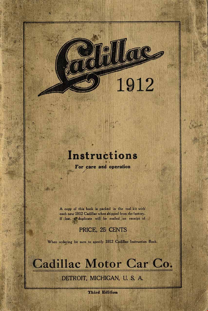
Cadillac 1912 : instructions for care and operation
https://search.heritageburnaby.ca/link/museumlibrary6416
- Repository
- Burnaby Village Museum
- Collection
- Special Collection
- Material Type
- Book
- Accession Code
- HV983.48.16
- Call Number
- 629.2 CAD
- Edition
- Third Edition
- Place of Publication
- Detroit
- Publisher
- Cadillac Motor Car Company
- Physical Description
- 70 p. : ill. ; 23 cm.
- Library Subject (LOC)
- Automobiles--Handbooks, manuals, etc.
Images
Documents

Cameron Elementary School
https://search.heritageburnaby.ca/link/landmark833
- Repository
- Burnaby Heritage Planning
- Geographic Access
- Erickson Drive
- Associated Dates
- 1965
- Heritage Value
- The increasing density of housing around the Lougheed Shopping Centre area resulted in a spike in enrolment at Lyndhurst Elementary School. As a result, in 1965, Cameron Road Elementary was built to alleviate overcrowding issues. The school opened with 151 pupils. The school was expanded in 1969 when three classrooms were added and again in 1971 when eights more rooms and a library were built.
- Historic Neighbourhood
- Burquitlam (Historic Neighbourhood)
- Planning Study Area
- Cameron Area
- Street Address
- 9540 Erickson Drive
- Street View URL
- Google Maps Street View
Images


Cameron Neighbourhood
https://search.heritageburnaby.ca/link/landmark824
- Repository
- Burnaby Heritage Planning
- Associated Dates
- 1955-2008
- Heritage Value
- The Cameron Neighbourhood falls within the Lougheed Town Centre area - one of four Town Centres in Burnaby. The Cameron Neighbourhood - while containing significant high-density residential components - is also home to the Town Centre's office and commercial core. The Lougheed Mall is situated in this neighbourhood, which is served by the Millennium Line SkyTrain.
- Historic Neighbourhood
- Burquitlam (Historic Neighbourhood)
- Planning Study Area
- Cameron Area
Images

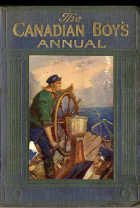
The Canadian boy's annual : 1920
https://search.heritageburnaby.ca/link/museumlibrary3611
- Repository
- Burnaby Village Museum
- Author
- Johnston, Harry H.
- Publication Date
- 1920
- Call Number
- 810.8 CAN
- Repository
- Burnaby Village Museum
- Collection
- Special Collection
- Material Type
- Book
- Accession Code
- BV998.18.1
- Call Number
- 810.8 CAN
- Author
- Johnston, Harry H.
- Place of Publication
- London
- Toronto
- Publisher
- Cassell
- Publication Date
- 1920
- Physical Description
- vii, 232 p., [4] leaves of plates : ill (some col.) ; 24 cm.
- Inscription
- Front endpaper: "Leonard G. Hornett Port Alberni" [written in black ink] "Christmas 1919-1920" [written in pencil underneath "Port Alberni"] "275" [written in pencil]
- Library Subject (LOC)
- Children's literature
- Children's stories
- Short stories
- Gift books
- Periodicals
- Object History
- Purchased by Colin Stevens from the seller.
- Notes
- "Containing stories and articles by Sir Harry H. Johnston, G.G.M.G., Frank H. Shaw, D.H. Parry, Richard Kearton, T.C. Bridges, Captain Gilson, S. Walkey, R.S. Warren Bell, Eric Wook, Percy F. Westerman, H. Mortimer Batten, Captain Oswald Dallas, and many others" -- t.p.
- "With a large number of Illustrations in Colour and Black-and-White" -- t.p.
Images


Capitol Hill Community Hall
https://search.heritageburnaby.ca/link/landmark563
- Repository
- Burnaby Heritage Planning
- Description
- Public building.
- Associated Dates
- 1948
- Street View URL
- Google Maps Street View
- Repository
- Burnaby Heritage Planning
- Geographic Access
- Howard Avenue
- Associated Dates
- 1948
- Description
- Public building.
- Heritage Value
- The Capitol Hill Community Hall was designed by local architect Harold Cullerne (1890-1976). After Cullerne returned from service during the First World War, he joined J.H. Bowman in a partnership that lasted from 1919 to 1934. After Bowman retired in 1934, Cullerne practiced on his own, continuing to work on schools and institutional buildings, such as the Art Deco Hollywood Theatre in Vancouver. In 1944, Cullerne designed a community hall for Capitol Hill; the scheme was delayed, and redesigned before it was finally built after the end of the Second World War. A simple front gabled roof hall structure, this hall is a monument to community spirit, erected by community members on a volunteer basis, and used for community events for over half a century. The hall replaced two earlier structures, both destroyed by fire, that had served the same purpose.
- Locality
- Capitol Hill
- Historic Neighbourhood
- Capitol Hill (Historic Neighbourhood)
- Planning Study Area
- Capitol Hill Area
- Architect
- Harold Cullerne
- Ownership
- Public (local)
- Street Address
- 361 Howard Avenue
- Street View URL
- Google Maps Street View
Images


Capitol Hill Neighbourhood
https://search.heritageburnaby.ca/link/landmark667
- Repository
- Burnaby Heritage Planning
- Associated Dates
- 1925-1954
- Heritage Value
- Although the Hastings street-car extension to Ellesmere opened in 1913 and there had been much speculation in the area during the real estate boom of 1909-1913, development in Capitol Hill did not really take off until after World War One when workers in Vancouver started to look to Burnaby for affordable but centrally-located neighbourhoods in which to build their homes. The 1913 one-room school had to be replaced in 1923 and in 1948, members of the community came together to build a new Community Hall.
- Historic Neighbourhood
- Capitol Hill (Historic Neighbourhood)
- Planning Study Area
- Capitol Hill Area
Images


Capitol Hill Neighbourhood
https://search.heritageburnaby.ca/link/landmark742
- Repository
- Burnaby Heritage Planning
- Associated Dates
- 1905-1924
- Heritage Value
- Real estate ventures became quite active in the Vancouver Heights and Capitol Hill areas of Burnaby by 1908. Brokerage firms and agents who bought large tracts, subdivided and sold them off in parcels and by 1909 had adopted the name "Capitol Hill" to describe Burnaby's newest neighbourhood. In his book, History of Burnaby and Vicinity," historian George Green explains that the term "Capitol Hill" was taken from ancient Rome where the civic centre was built upon the Capitoline Hill, one of the seven hills of the eternal city. In 1909, the Scott Brokerage Company advertised the sale of lots on Capitol Hill, calling it "one of Vancouver's swellest suburbs."
- Historic Neighbourhood
- Capitol Hill (Historic Neighbourhood)
- Planning Study Area
- Capitol Hill Area
Images


Capitol Hill Neighbourhood
https://search.heritageburnaby.ca/link/landmark781
- Repository
- Burnaby Heritage Planning
- Associated Dates
- 1955-2008
- Heritage Value
- The Capitol Hill Neighbourhood remained a primarily residential neighbourhood after the population boom of the 1950s and 1960s. The commercial focus remained the Hastings Street corridor, while the City of Burnaby moved to protect a conservation area on the north side of Capitol Hill and dedicated parkland throughout the 1970s and 1980s.
- Historic Neighbourhood
- Capitol Hill (Historic Neighbourhood)
- Planning Study Area
- Capitol Hill Area
Images


Capitol Hill School
https://search.heritageburnaby.ca/link/landmark564
- Repository
- Burnaby Heritage Planning
- Description
- School building.
- Associated Dates
- 1923
- Other Names
- Ecole Capitol Hill Elementary School
- Street View URL
- Google Maps Street View
- Repository
- Burnaby Heritage Planning
- Other Names
- Ecole Capitol Hill Elementary School
- Geographic Access
- Holdom Avenue
- Associated Dates
- 1923
- Description
- School building.
- Heritage Value
- This school was originally designed by Bowman & Cullerne as a two-storey, four-room school building in 1923, with a two-room addition completed in 1926 and another in 1927. Originally designed in the Arts and Crafts style, it has been altered, with the addition of stucco over the original siding and replacement windows, but has retained its original form and massing, as well as its roof-top ventilator and front gabled entrance with grouped columns. Bowman & Cullerne specialized in school design. After Harold Cullerne (1890-1976) returned from service during the First World War, he joined J.H. Bowman (1864-1943) in a partnership that lasted from 1919 to 1934. The firm’s other school designs included Seaforth School (1922, now relocated to Burnaby Village Museum), Burnaby North High School (1923), and Nelson Avenue School (1927).
- Locality
- Capitol Hill
- Historic Neighbourhood
- Capitol Hill (Historic Neighbourhood)
- Planning Study Area
- Capitol Hill Area
- Architect
- Bowman & Cullerne
- Ownership
- Public (local)
- Subjects
- Buildings - Heritage
- Buildings - Schools
- Street Address
- 350 Holdom Avenue
- Street View URL
- Google Maps Street View
Images


Captain William Eyres Residence
https://search.heritageburnaby.ca/link/landmark565
- Repository
- Burnaby Heritage Planning
- Description
- Residential building.
- Associated Dates
- c.1910
- Street View URL
- Google Maps Street View
- Repository
- Burnaby Heritage Planning
- Geographic Access
- Canada Way
- Associated Dates
- c.1910
- Description
- Residential building.
- Heritage Value
- This home was built by Captain William J. Eyres. In 1912, it was reported in The British Columbian: “Captain Eyres of Seattle is remodelling the front of his house on Douglas Road and otherwise improving it.” The house was later sold to William A. Mawhinney, who subsequently built houses at 6011 Buckingham Avenue and 7616 Burris Avenue. This spacious, high-quality Craftsman bungalow remains in excellent condition. It features a cross-gabled roof with multiple half-timbered front gables with large exposed purlins, in contrast to the shingle cladding on the rest of the house. At the front corner is a glazed sun-room. The entrance porch features tripled square columns. The property still has a beautiful garden, but once included large vegetable gardens, an orchard, and a large chicken house.
- Locality
- Burnaby Lake
- Historic Neighbourhood
- Burnaby Lake (Historic Neighbourhood)
- Planning Study Area
- Morley-Buckingham Area
- Area
- 1709.65
- Contributing Resource
- Building
- Ownership
- Private
- Street Address
- 6079 Canada Way
- Street View URL
- Google Maps Street View
Images

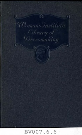
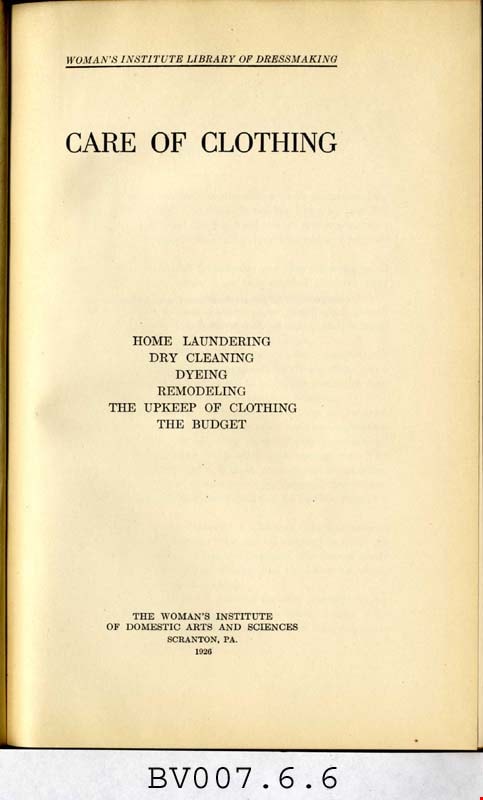
Care of clothing : home laundering, dry cleaning, dyeing, remodeling, the upkeep of clothes, the budget
https://search.heritageburnaby.ca/link/museumlibrary4992
- Repository
- Burnaby Village Museum
- Collection
- Special Collection
- Material Type
- Book
- Accession Code
- BV007.6.6
- Call Number
- 646.4 WOM
- Place of Publication
- Scranton, Pa.
- Publisher
- Woman's Institute of Domestic Arts and Sciences
- Publication Date
- 1926
- c1925
- Physical Description
- vi, xxiv, 262 p. : ill. : 23 cm.
- Library Subject (LOC)
- Clothing and dress
- Laundry
- Subjects
- Documentary Artifacts - Books
- Object History
- Home sewing course used by Burnaby residents in the 1920's
- Notes
- Includes index.
Images

Cariboo-Armstrong Neighbourhood
https://search.heritageburnaby.ca/link/landmark825
- Repository
- Burnaby Heritage Planning
- Associated Dates
- 1955-2008
- Heritage Value
- The Cariboo-Armstrong Neighbourhood was mainly subdivided in the 1950s during the major building boom in Burnaby throughout the post-war years. Considered a primarily residential area, the neighbourhood has quick and convenient access to major highways and roads as well as being bordered to the north by the George Derby Conservation area.
- Historic Neighbourhood
- East Burnaby (Historic Neighbourhood)
- Planning Study Area
- Cariboo-Armstrong Area
Images


Cariboo Hill Secondary School
https://search.heritageburnaby.ca/link/landmark837
- Repository
- Burnaby Heritage Planning
- Geographic Access
- 16th Avenue
- Associated Dates
- 1961
- Heritage Value
- By 1961, three new elementary schools had been built in the northeast section of Burnaby - Armstrong, Seaforth, and Lyndhurst. With growing enrolment at each, too many students were required to travel a farther distance to attend Edmonds Junior High School. As a result, the Cariboo Hill Secondary School was built in 1961 and opened with 410 students. Its peak enrolment was during the 1974 school year when over 1100 students attended. Additions to the school were made in 1969, 1971 and 1974.
- Historic Neighbourhood
- East Burnaby (Historic Neighbourhood)
- Planning Study Area
- Cariboo-Armstrong Area
- Street Address
- 8580 16th Avenue
- Street View URL
- Google Maps Street View
Images


Cascade Heights School
https://search.heritageburnaby.ca/link/landmark691
- Repository
- Burnaby Heritage Planning
- Geographic Access
- Smith Avenue
- Associated Dates
- 1953
- Heritage Value
- Among the first new elementary schools to be built during the post-World War Two housing boom in Burnaby, Cascade Heights opened in 1953. Additions to the school were made in 1954, 1963 and 1969.
- Planning Study Area
- Cascade-Schou Area
- Street Address
- 4343 Smith Avenue
- Street View URL
- Google Maps Street View
Images


Cascade-Schou Neighbourhood
https://search.heritageburnaby.ca/link/landmark798
- Repository
- Burnaby Heritage Planning
- Associated Dates
- 1955-2008
- Heritage Value
- The Cascade-Schou neighbourhood, sometimes referred to as the Cascade Heights area, includes both the Burnaby General Hospital site, the Discovery Park facilities and is bordered on its eastern boundary by BCIT. Despite these health and science developments, the neighbourhood can still be considered to be a residential community. The housing stock includes single family homes as well as newer multi-family residences that developed throughout the 1980s and 1990s.
- Historic Neighbourhood
- Broadview (Historic Neighbourhood)
- Planning Study Area
- Cascade-Schou Area
Images


Cascades Drive-In Theatre
https://search.heritageburnaby.ca/link/landmark689
- Repository
- Burnaby Heritage Planning
- Geographic Access
- Grandview Highway
- Associated Dates
- 1946
- Heritage Value
- The Cascades Drive-In Theatre was Canada's first drive-in and was started by George and William Steel and Joe and Art Johnson in 1946. Built along Grandview Highway (Canada Way) near Smith Street, the theatre opened on August 30, 1946. In 1977, the theatre was purchased by Don Soutar, Al Chappell and Norm Green and continued to operate until 1980. The property was then redeveloped as Cascades Village - a large condominium complex.
- Historic Neighbourhood
- Broadview (Historic Neighbourhood)
- Planning Study Area
- Cascade-Schou Area
- Street Address
- 4050 Grandview Highway
Images


Central Park
https://search.heritageburnaby.ca/link/landmark728
- Repository
- Burnaby Heritage Planning
- Geographic Access
- Imperial Street
- Associated Dates
- 1891
- Heritage Value
- In 1860, as the Royal Engineers constructed the road from New Westminster to Vancouver (now Kingsway), a military reserve was set aside at the trail's highest point along the ridge. This reserve provided a particularly good scenic look-out since the original forest had burned down prior to 1860, the remaining stumps offered unobstructed views. By the 1880s, the city council of both New Westminster and Vancouver eyed the reserve as potential recreation ground. As construction of the tram line was underway, the Provincial Government moved to designate the whole reserve as a park. On January 14, 1891, the Lieutenant Governor of British Columbia proclaimed it as a public recreation ground.
- Historic Neighbourhood
- Central Park (Historic Neighbourhood)
- Planning Study Area
- Maywood Area
- Street Address
- 3883 Imperial Street
- Street View URL
- Google Maps Street View
Images


Central Park Entrance Gate
https://search.heritageburnaby.ca/link/landmark544
- Repository
- Burnaby Heritage Planning
- Description
- The Central Park Entrance Gate is the ceremonial entrance to Burnaby’s historic Central Park from Kingsway, and consists of two massive stone pillars, approximately 7.5 metres high and 1.8 metres square, adjacent gate posts and a low flanking stone wall that curves into the park to the east.
- Associated Dates
- 1913
- Formal Recognition
- Heritage Designation, Community Heritage Register
- Street View URL
- Google Maps Street View
- Repository
- Burnaby Heritage Planning
- Geographic Access
- Imperial Street
- Associated Dates
- 1913
- Formal Recognition
- Heritage Designation, Community Heritage Register
- Enactment Type
- Bylaw No. 9807
- Enactment Date
- 23/11/1992
- Description
- The Central Park Entrance Gate is the ceremonial entrance to Burnaby’s historic Central Park from Kingsway, and consists of two massive stone pillars, approximately 7.5 metres high and 1.8 metres square, adjacent gate posts and a low flanking stone wall that curves into the park to the east.
- Heritage Value
- The Central Park Entrance Gate is significant as a ceremonial entry to a major park, for its connection with the early history of the British Columbia Electric Railway (BCER) and as an important design by an accomplished British Columbian architect. When the original interurban line between Vancouver and New Westminster was constructed in 1891, one of the first stations was located where the tramway crossed the Vancouver-Westminster Road (now Kingsway) within the newly-created Central Park. The interurban line ran through the park on a diagonal right-of-way (the current SkyTrain line, opened in 1986, follows this original alignment). In 1912 an agreement was reached between the successor interurban company, the BCER, and the Central Park Provincial Park Board, to deed additional land for an expanded right-of-way through the Park in exchange for improvements that included the construction of an ornamental stone wall and gate with an iron arch, with an illuminated 'Central Park' sign, adjacent to the interurban station on Kingsway. This was an early and rare example of an electric sign used for a public recreation facility. The Gate is also significant as a surviving early design by Robert Lyon (1879-1963), an Edinburgh-born and trained immigrant who was one of the most accomplished of British Columbia's early architects. After he moved to Vancouver, he was employed by the BCER from 1911 until 1918, and worked on a broad range of projects including some of the grandest and most innovative local industrial structures of the time. The arch was built by the Westminster Ironworks Company, one of the leading firms of its kind in Western Canada, operated by John Reid of New Westminster. The Gate was completed in 1914; in 1968 the decorative ironwork was removed due to corrosion and placed in storage.
- Defining Elements
- Key elements that define the heritage character of the Central Park Entrance Gate include its: - two subtly tapered massive stone pillars, which rise in stages from a larger base to a shaft with random coursed multi-coloured granite with roughly formed grey granite quoins, to a top formed of finely finished grey granite blocks with a coved and bracketed cap - adjacent gate posts with monolithic pyramidal granite caps - low flanking stone wall that curves into the park to the east, constructed of random coursed multi-coloured granite with a river rock triangular cap
- Historic Neighbourhood
- Central Park (Historic Neighbourhood)
- Planning Study Area
- Maywood Area
- Architect
- Robert Lyon
- Builder
- John Reid
- Westminster Iron Works Co.
- Function
- Primary Current--Park Fixture
- Primary Historic--Park Fixture
- Community
- Burnaby
- Cadastral Identifier
- P.I.D. No. 017-767-172 Legal Description: Block B of Lot 2 Except Firstly: Part on Plan 8669 and Secondly: Part on Plan LMP4689 District Lot 151, Group 1, New Westminster District, Plan 3443
- Boundaries
- The property (Central Park) is a municipally-owned park that lies at the western edge of Burnaby, between 49th Avenue to the south, Kingsway to the north, Boundary Road to the west and Patterson Avenue to the east.
- Area
- 853,403.82
- Contributing Resource
- Structure
- Landscape Feature
- Ownership
- Public (local)
- Names
- Lyon, Robert
- Reid, John
- Westminster Iron Works Company
- British Columbia Electric Railway Company
- Central Park Provincial Park Board
- Subjects
- Structures - Fences
- Street Address
- 3883 Imperial Street
- Street View URL
- Google Maps Street View
Images


Central Park Neighbourhood
https://search.heritageburnaby.ca/link/landmark688
- Repository
- Burnaby Heritage Planning
- Associated Dates
- 1925-1954
- Heritage Value
- Although still largely a rural area during the 1920s, subdivisions began appearing in the Central Park neighbourhood at this time. Development was slowed by the Great Depression of the 1930s but the influx of commercial buildings and new housing initiatives in the post-war boom led to a period of rapid growth especially in the Garden Village subdivision which was undertaken in 1953 with the plan to build 500 modern homes in the 140-acre site. Despite the closure of the interurban line in 1953, the neighbourhood remained an active commercial and residential centre.
- Historic Neighbourhood
- Central Park (Historic Neighbourhood)
- Planning Study Area
- Maywood Area
Images


Central Park Neighbourhood
https://search.heritageburnaby.ca/link/landmark723
- Repository
- Burnaby Heritage Planning
- Associated Dates
- 1891-1904
- Heritage Value
- Central Park was one of the first and fastest-growing communities in Burnaby. Located along the electric tram line and the Vancouver Road (Kingsway), it was also chosen for a government settlement project referred to as the Central Park Small Holdings. The lands held by the Provincial Government were subdivided and sold around 1894 and by 1899 the settlement was large enough to warrant the construction of an Anglican Church there.
- Historic Neighbourhood
- Central Park (Historic Neighbourhood)
- Planning Study Area
- Maywood Area
Images


Central Park Neighbourhood
https://search.heritageburnaby.ca/link/landmark751
- Repository
- Burnaby Heritage Planning
- Associated Dates
- 1905-1924
- Heritage Value
- In 1906, Maxwell Smith, President of the Central Park Farmer's Institute gave a speech in which he commented on the growth of this district and its ideal location during the boom years after 1905. He said: "Central Park is destined to become the epicentre of a great commercial metropolis, when Vancouver and New Westminster will have both expanded and prospered until they meet and fill up the intervening distances with residences of a new city, greater than few can now imagine, even in their wildest flights of fancy...we are proud of the two cities that lie on either side of us but they are, but mere hamlets compared with the great city that is to be on this peninsula. The time is coming when there will be one vast city, one commercial metropolis, and Central Park will be the heart of it."
- Historic Neighbourhood
- Central Park (Historic Neighbourhood)
- Planning Study Area
- Maywood Area
Images


Central Park Tramline
https://search.heritageburnaby.ca/link/landmark732
- Repository
- Burnaby Heritage Planning
- Associated Dates
- 1891
- Heritage Value
- In the 1890s, local entrepreneurs launched electric railways in Vancouver, New Westminster, and Victoria, eager to cash in on the promise of future growth in the major cities of the time. In the Lower Mainland, two companies started building electric rail in 1890: the Westminster and Vancouver Tramway Co., which undertook the ambitious project of building the first real interurban line from New Westminster to Vancouver, and the Westminster Street Railway, who eventually built streetcar service and installed electric lighting in New Westminster. By April 20, 1891, both companies merged to form the Westminster and Vancouver Tramway Company. Local entrepreneurs Henry V. Edmonds, David Oppenheimer, Benjamin Douglas, and Samuel McIntosh, were the directors, all of whom had extensive real estate holdings in the area. Interurban service launched on June 3, 1891, travelling along 12 miles of track from New Westminster to eastern Vancouver, running through Burnaby – which was then an unincorporated area. Installing the single-track line from Vancouver to New Westminster through uneven, forested terrain was a mammoth undertaking. The clearing of the 100-foot right of way and laying the track called for a large work force, some of whom were Chinese "gandy dancers" who had worked on the Canadian Pacific Railway lines. The line was eventually taken over by the B.C. Electric Railway Company in 1897, who remained the owners until the line was finally closed on October 23, 1953 and replaced with the modern bus system. The construction of the SkyTrain along the old route in 1986 reintroduced passenger rail to this historic transportation corridor.
- Historic Neighbourhood
- Central Park (Historic Neighbourhood)
- Planning Study Area
- Maywood Area
Images


Chaffey-Burke Elementary School
https://search.heritageburnaby.ca/link/landmark810
- Repository
- Burnaby Heritage Planning
- Geographic Access
- Sardis Street
- Associated Dates
- 1963
- Heritage Value
- Chaffey-Burke Elementary School was built in 1963 and deviated slightly from the typical one-storey buildings that had been the standard for elementary schools in Burnaby since World War Two. At Chaffey-Burke, the restriction of space resulted in a second story level because of the slope. Additions to the building were made in 1964, 1968 and 1969.
- Historic Neighbourhood
- Central Park (Historic Neighbourhood)
- Planning Study Area
- Garden Village Area
- Street Address
- 4404 Sardis Street
- Street View URL
- Google Maps Street View
Images


Chapel Of Peace
https://search.heritageburnaby.ca/link/landmark566
- Repository
- Burnaby Heritage Planning
- Description
- Church building.
- Associated Dates
- 1936
- Formal Recognition
- Heritage Designation, Community Heritage Register
- Other Names
- First United Spiritualist Church
- Street View URL
- Google Maps Street View
- Repository
- Burnaby Heritage Planning
- Other Names
- First United Spiritualist Church
- Geographic Access
- Kincaid Street
- Associated Dates
- 1936
- Formal Recognition
- Heritage Designation, Community Heritage Register
- Enactment Type
- Bylaw No. 13162
- Enactment Date
- 28/01/2013
- Description
- Church building.
- Heritage Value
- This church was built in 1936 as the Chapel of Peace for the Forest Lawn Cemetery. It was located outside the main entrance of the cemetery at the triangular parcel of land bounded by Sprott, Royal Oak and Canada Way. It served as the location for many memorial services, local community worship and weddings. The Anglican Church purchased and relocated the building to its present site in 1955. The church has been altered with the addition of wings and stucco, but retains its steep front gabled roof and some of its arched windows. It is now used as the First United Spiritualist Church.
- Locality
- Burnaby Lake
- Historic Neighbourhood
- Burnaby Lake (Historic Neighbourhood)
- Planning Study Area
- Douglas-Gilpin Area
- Contributing Resource
- Building
- Ownership
- Private
- Street Address
- 5584 Kincaid Street
- Street View URL
- Google Maps Street View
Images


