Narrow Results By
Format
- Architectural Drawing 14
- Book 119
- Bylaws - Adopted 828
- Bylaws - Other 1
- Bylaws - Repealed 206
- Cartographic Material 34
- Council - Committee Report 1863
- Council - Manager's Report 864
- Council - Mayor/Councillor/Staff Report 3955
- Council - Public Hearing Minutes 37
- Council - Regular Council Minutes 477
- Graphic Material 15
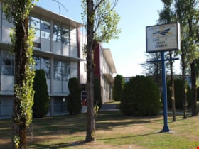
Alpha Secondary School
https://search.heritageburnaby.ca/link/landmark678
- Repository
- Burnaby Heritage Planning
- Geographic Access
- Parker Street
- Associated Dates
- 1950
- Heritage Value
- The unexpected period of growth in Burnaby during the first few years of the 1950s resulted in many overcrowded schools. As a result, the School Board decided it required a Junior High to alleviate enrolment issues at Gilmore Avenue Elementary-Junior school. Alpha opened in 1950 with 423 students. The new school had 12 rooms but added more in 1953. There were fires at the school in 1956 and 1964, resulting in the rebuilding of seven classrooms, library and administrative offices. There were additions made in 1968 and 1969 and in 1976 a gymnasium was built.
- Planning Study Area
- Brentwood Area
- Street Address
- 4600 Parker Street
- Street View URL
- Google Maps Street View
Images
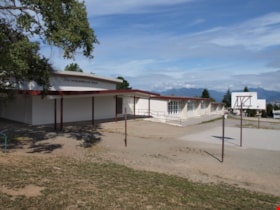
Marlborough Elementary School
https://search.heritageburnaby.ca/link/landmark695
- Repository
- Burnaby Heritage Planning
- Geographic Access
- Marlborough Avenue
- Associated Dates
- 1950
- Heritage Value
- Marlborough Elementary School was built in 1950 and was the second elementary school to be built in Burnaby after the start of the World War Two housing boom. Its design helped establish the general plans for future schools built in the city during this period - no basements, second stories or high stairways. Classrooms could easily be added, in line, as the need arose. There were additions made to Marlborough in 1952, 1961, 1967 and 1971.
- Historic Neighbourhood
- Central Park (Historic Neighbourhood)
- Planning Study Area
- Marlborough Area
- Street Address
- 6060 Marlborough Avenue
- Street View URL
- Google Maps Street View
Images
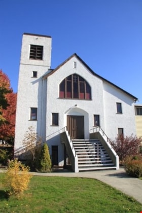
Willingdon Heights United Church
https://search.heritageburnaby.ca/link/landmark658
- Repository
- Burnaby Heritage Planning
- Description
- Church building.
- Associated Dates
- 1951
- Street View URL
- Google Maps Street View
- Repository
- Burnaby Heritage Planning
- Geographic Access
- Parker Street
- Associated Dates
- 1951
- Description
- Church building.
- Heritage Value
- This church was built to serve a 500-home subdivision known as Willingdon Heights–Canada’s largest single veteran’s housing project created by the Central Mortgage and Housing Corporation and constructed by the Whitsell Construction Company in 1948. The church building was designed as a simplified Gothic Revival church with a tall front tower and Gothic pointed-arch stained glass window and entrance. This church was designed by Vancouver architects Twizell & Twizell. Both Robert Twizell (1875-1964) and younger brother George Twizell (1885-1957) articled at Newcastle, England’s Hicks & Charlewood before arriving in Vancouver in late 1907 or early 1908, with George working for Robert until they established a partnership a few years later. Their firm lasted for nearly half a century and was well known for its numerous church designs.
- Locality
- Vancouver Heights
- Historic Neighbourhood
- Vancouver Heights (Historic Neighbourhood)
- Planning Study Area
- Willingdon Heights Area
- Architect
- Twizell & Twizell
- Area
- 1808.82
- Contributing Resource
- Building
- Ownership
- Private
- Street Address
- 4304 Parker Street
- Street View URL
- Google Maps Street View
Images
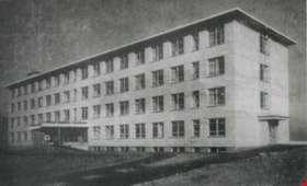
Burnaby General Hospital
https://search.heritageburnaby.ca/link/landmark690
- Repository
- Burnaby Heritage Planning
- Geographic Access
- Kincaid Street
- Associated Dates
- 1952
- Heritage Value
- Burnaby residents had long been asking for a hospital in their municipality so on July 14, 1943, the first meeting of the Burnaby Hospital Fund-raising Committee was held at the Canadian Legion Hall at Royal Oak and Kingsway. In 1947, the group was incorporated as the Burnaby Hospital Society and after extensive lobbying and fundraising, the Burnaby General Hospital opened its doors on October 30, 1952. The site was provided by the Municipality of Burnaby on 17.5 acres of parkland on a small hill in the Cascade Heights area. In its first year, the hospital admitted 5010 patients and delivered 944 babies.
- Historic Neighbourhood
- Broadview (Historic Neighbourhood)
- Planning Study Area
- Cascade-Schou Area
- Street Address
- 3935 Kincaid Street
- Street View URL
- Google Maps Street View
Images
North Burnaby Cenotaph
https://search.heritageburnaby.ca/link/landmark550
- Repository
- Burnaby Heritage Planning
- Description
- The North Burnaby Cenotaph is located in Confederation Park at the north end of the park on axis with the adjacent sports oval. The form of the memorial is of an obelisk atop a solid rectangular base, adorned with plaques commemorating those lost in the First World War, Second World War and the Kor…
- Associated Dates
- 1953
- Formal Recognition
- Heritage Designation, Community Heritage Register
- Repository
- Burnaby Heritage Planning
- Geographic Access
- Willingdon Avenue
- Associated Dates
- 1953
- Formal Recognition
- Heritage Designation, Community Heritage Register
- Enactment Type
- Bylaw No. 9807
- Enactment Date
- 23/11/1992
- Description
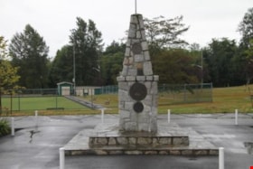
- The North Burnaby Cenotaph is located in Confederation Park at the north end of the park on axis with the adjacent sports oval. The form of the memorial is of an obelisk atop a solid rectangular base, adorned with plaques commemorating those lost in the First World War, Second World War and the Korean War.
- Heritage Value
- Built in 1953 by stonemason and First World War Veteran, Walter Holmes Morrice, the cenotaph was erected by the North Burnaby Legion Post #148 and is one of four memorials to citizens of Burnaby whose lives were lost at war. Strategically placed in an active and vibrant public park that was dedicated in 1927 and is used for sports, family outings and social gatherings, the cenotaph celebrates the freedoms that soldiers gave their lives to protect. The cenotaph is still used as a memorial site and bears witness to annual Remembrance Day ceremonies. Built of irregular granite blocks, the cenotaph is a solid structure of modest ornamentation that visually anchors the north end of the park. The site of the cenotaph and its adjacent gardens are surrounded by a simple barrier of continuous chain supported by low metal fence posts, providing a sense of solemnity and ceremony to the site.
- Defining Elements
- The character-defining elements of the North Burnaby Cenotaph include its: - axial location in the park and setting among active municipal facilities such as a school and library - strong symmetry of massing and design - obelisk form set atop a rectangular base - limited palette of materials - random coursed granite used as primary building material - bronze plaques commemorating the First and Second World Wars and the Korean War - surrounding pathways and flowerbeds
- Historic Neighbourhood
- Capitol Hill (Historic Neighbourhood)
- Planning Study Area
- Capitol Hill Area
- Organization
- North Burnaby Legion Post #148
- Builder
- Walter Holmes Morrice
- Function
- Primary Current--Park Fixture
- Primary Historic--Park Fixture
- Community
- Burnaby
- Cadastral Identifier
- P.I.D. No. 017-040-752 Legal Description: Parcel 1, District Lots 122 and 188, Group 1, New Westminster District, Plan NWP87902
- Boundaries
- The property (Confederation Park) is comprised of a single municipally-owned property located at 250 Willingdon Avenue, Burnaby.
- Area
- 184,160.00
- Contributing Resource
- Landscape Feature
- Structure
- Ownership
- Public (local)
- Documentation
- Heritage Site Files: PC77000 20. City of Burnaby Planning and Building Department, 4949 Canada Way, Burnaby, B.C., V5G 1M2
- Street Address
- 250 Willingdon Avenue
Images
Westridge School
https://search.heritageburnaby.ca/link/landmark676
- Repository
- Burnaby Heritage Planning
- Geographic Access
- Duncan Avenue
- Associated Dates
- 1953
- Heritage Value
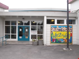
- The building boom in Burnaby during the first few years of the 1950s resulted in many new subdivisions being created in previously unoccupied areas of Burnaby. One such neighbourhood was the Westridge area. In 1951, the Inspector of Schools noted in a report that there were 475 new homes in Westridge with another 100 under development. As a result, enrolment pressures were particularly heavy in this area and the School Board opened the Westridge Elementary School in 1953.
- Historic Neighbourhood
- Lochdale (Historic Neighbourhood)
- Planning Study Area
- Westridge Area
- Street Address
- 510 Duncan Avenue
- Street View URL
- Google Maps Street View
Images
Lochdale School
https://search.heritageburnaby.ca/link/landmark677
- Repository
- Burnaby Heritage Planning
- Geographic Access
- Aubrey Street
- Associated Dates
- 1953
- Heritage Value
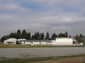
- Lochdale Community School was opened in 1953 to help alleviate the increased enrolment at Sperling Elementary School caused by the new subdivisions under construction in this section of Burnaby. Lochdale was typical of the schools built at the period with classrooms constructed in a line, as close as possible to ground level. As needed, new classrooms were extended in a line and there were additions to Lochdale in 1962, 1964, 1966, 1971 and 1976.
- Historic Neighbourhood
- Lochdale (Historic Neighbourhood)
- Planning Study Area
- Lochdale Area
- Street Address
- 6990 Aubrey Street
- Street View URL
- Google Maps Street View
Images
Trans Mountain Pipeline Company
https://search.heritageburnaby.ca/link/landmark685
- Repository
- Burnaby Heritage Planning
- Geographic Access
- Shellmont Street
- Associated Dates
- 1953
- Heritage Value
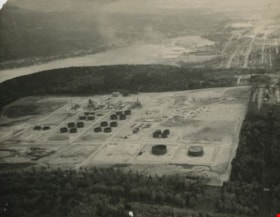
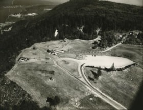
- On March 21, 1951 the Parliament of Canada granted the Trans Mountain Oil Pipe Line Company a charter. By May of the following year, the Corporation of Burnaby gave final reading to Bylaw No. 3203, which resulted in the conveyance of land in DL 142, 143 and 144 (Burnaby Mountain site) to the Trans Mountain Oil Pipe Line Company. Construction of the Burnaby Mountain tank farm was completed in October of 1953 and the site became operational as the first shipment of oil reached Trans Mountain’s Burnaby Terminal.
- Planning Study Area
- Lake City Area
- Street Address
- 8099 Shellmont Street
- Street View URL
- Google Maps Street View
Images
Cascade Heights School
https://search.heritageburnaby.ca/link/landmark691
- Repository
- Burnaby Heritage Planning
- Geographic Access
- Smith Avenue
- Associated Dates
- 1953
- Heritage Value
- Among the first new elementary schools to be built during the post-World War Two housing boom in Burnaby, Cascade Heights opened in 1953. Additions to the school were made in 1954, 1963 and 1969.
- Planning Study Area
- Cascade-Schou Area
- Street Address
- 4343 Smith Avenue
- Street View URL
- Google Maps Street View
Images
Suncrest School
https://search.heritageburnaby.ca/link/landmark694
- Repository
- Burnaby Heritage Planning
- Geographic Access
- Rumble Street
- Associated Dates
- 1953
- Heritage Value
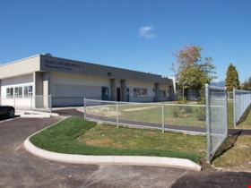
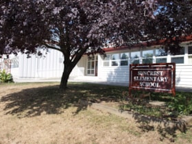
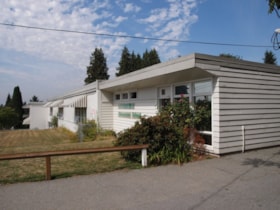
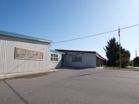
- The new Suncrest subdivision developed in the early 1950s, resulting in 312 new homes in 1951, with an additional 100 being planned. As a result, enrolment pressure resulted in the construction of Suncrest School in 1953. Additions to the original structure were made in 1954 and a library, change rooms and staffroom were added in 1969.
- Historic Neighbourhood
- Alta Vista (Historic Neighbourhood)
- Planning Study Area
- Suncrest Area
- Street Address
- 3883 Rumble Street
- Street View URL
- Google Maps Street View
Images
Lyndhurst Elementary School
https://search.heritageburnaby.ca/link/landmark706
- Repository
- Burnaby Heritage Planning
- Geographic Access
- Lyndhurst Street
- Associated Dates
- 1953
- Heritage Value
- The Lyndhurst Elementary School was built in 1953 to replace the previous school - the Hamilton Road School - which had served the community since 1910.
- Historic Neighbourhood
- Burquitlam (Historic Neighbourhood)
- Planning Study Area
- Lyndhurst Area
- Street Address
- 9847 Lyndhurst Street
- Street View URL
- Google Maps Street View
Images
Brentwood Park Elementary School
https://search.heritageburnaby.ca/link/landmark679
- Repository
- Burnaby Heritage Planning
- Geographic Access
- Delta Avenue
- Associated Dates
- 1954
- Heritage Value
- Brentwood Park Elementary School was built during the post-World War Two housing boom in Burnaby and like other schools at the time, was similar in design - no basements, no second stories and no high stairways. New classrooms could be added in line with the original structure as was the case when two additions were put on between 1956 and 1958, a new classroom and library added in 1965-1966 and two more classrooms in 1969.
- Planning Study Area
- Brentwood Area
- Street Address
- 1455 Delta Avenue
- Street View URL
- Google Maps Street View
Images
Simpson-Sears
https://search.heritageburnaby.ca/link/landmark696
- Repository
- Burnaby Heritage Planning
- Geographic Access
- Kingsway
- Associated Dates
- 1954
- Heritage Value
- The Simpson-Sears store on Kingsway opened in 1954 and was the second Simpson-Sears to be located in British Columbia. The store helped to solidify the neighbourhood's growing reputation as a major commercial centre in the Lower Mainland and became a prototype for the company's large format stores across Canada.
- Historic Neighbourhood
- Central Park (Historic Neighbourhood)
- Planning Study Area
- Maywood Area
- Street Address
- 4700 Kingsway
Images
Morley Elementary School
https://search.heritageburnaby.ca/link/landmark835
- Repository
- Burnaby Heritage Planning
- Geographic Access
- Morley Street
- Associated Dates
- 1955
- Heritage Value
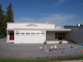
- In 1955 Morley Elementary School opened with 292 pupils, an indication of how quickly the residential areas around the Morley area were growing in the post-war period. Similar to other elementary schools built in Burnaby at the time, Morley was constructed on one level with classrooms in a line that could be added to as the need arose. Additions were made to the school in 1956, 1960 and 1969.
- Historic Neighbourhood
- Burnaby Lake (Historic Neighbourhood)
- Planning Study Area
- Morley-Buckingham Area
- Street Address
- 7355 Morley Street
- Street View URL
- Google Maps Street View
Images
Helen 'The Swinging Girl' Neon Sign
https://search.heritageburnaby.ca/link/landmark591
- Repository
- Burnaby Heritage Planning
- Description
- Commercial building.
- Associated Dates
- 1956
- Formal Recognition
- Heritage Designation, Community Heritage Register
- Other Names
- Helen's Childrens Wear Sign
- Street View URL
- Google Maps Street View
- Repository
- Burnaby Heritage Planning
- Other Names
- Helen's Childrens Wear Sign
- Geographic Access
- Hastings Street
- Associated Dates
- 1956
- Formal Recognition
- Heritage Designation, Community Heritage Register
- Enactment Type
- Bylaw No. 12771
- Enactment Date
- 19/04/2010
- Description
- Commercial building.
- Heritage Value
- While the building here is of some importance as the former North Burnaby municipal office, its primary importance is its delightful neon sign that has become a North Burnaby landmark. Helen Arnold opened Helen’s Childrens Wear shop in the building next door to the old Municipal offices in 1948. In 1955, when North Burnaby moved out, she moved into the vacated building. As part of the renovations, Helen enlisted the assistance of her good friend Jimmy Wallace, owner of Vancouver’s Wallace Neon Company, to create a new sign for her expanded business. One of the company’s designers, Reeve Lehman, created the swinging neon girl that was installed in 1956. Designed in two parts, one section of the sign is cloud shaped and reads ‘Helen’s’ while the other section is a moving representation of a little girl on a swing. The sign is nine feet six inches high and nine feet wide, and the lower section is animated with an internal motor and gears. It immediately became a landmark on Hastings Street, and recently the sign’s design fame has spread far and wide as one of the best surviving examples of kinetic neon art in North America.
- Locality
- Vancouver Heights
- Historic Neighbourhood
- Vancouver Heights (Historic Neighbourhood)
- Planning Study Area
- Willingdon Heights Area
- Community
- Burnaby
- Names
- Helen's Childrens Wear
- Street Address
- 4142 Hastings Street
- Street View URL
- Google Maps Street View
Images
Burnaby Municipal Hall
https://search.heritageburnaby.ca/link/landmark807
- Repository
- Burnaby Heritage Planning
- Geographic Access
- Canada Way
- Associated Dates
- 1956
- Heritage Value
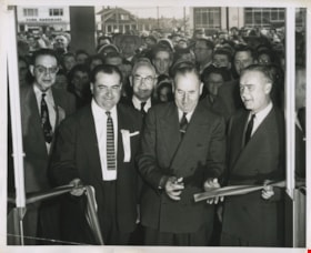
- When staff outgrew the municipal buildings at Edmonds and Kingsway, a debate erupted over where to build a new municipal hall. North Burnaby residents argued against the Kingsway and Edmonds site as it was too removed for their needs, but South Burnaby residents were not prepared to accept a hall in North Burnaby. The debate was finally resolved when it was suggested that the new civic centre for the municipality be in the exact geographic centre of Burnaby. Fortunately, this meant that the new hall was to be built near Deer Lake, in the beautiful Central Valley setting. Burnaby voters accepted this decision and approved the $625,000.00 it would take to build the new structure and the official opening ceremony was held June 22, 1956 when then Reeve Charles MacSorley received the keys to the hall from the contractor.
- Historic Neighbourhood
- Burnaby Lake (Historic Neighbourhood)
- Planning Study Area
- Douglas-Gilpin Area
- Street Address
- 4949 Canada Way
- Street View URL
- Google Maps Street View
Images
Moscrop Secondary School
https://search.heritageburnaby.ca/link/landmark813
- Repository
- Burnaby Heritage Planning
- Geographic Access
- Moscrop Street
- Associated Dates
- 1956
- Heritage Value
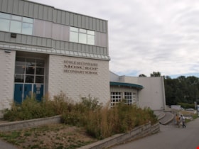
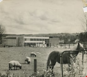
- By 1956, the rapidly increasing population in Burnaby necessitated the construction of many new schools, including Moscrop which opened with an enrolment of 636 students. The school was a two-storey block construction which was added to in 1965, 1971 and 1973.
- Planning Study Area
- Cascade-Schou Area
- Street Address
- 4433 Moscrop Street
- Street View URL
- Google Maps Street View
Images
Burnaby Winter Club
https://search.heritageburnaby.ca/link/landmark816
- Repository
- Burnaby Heritage Planning
- Geographic Access
- Canada Way
- Associated Dates
- 1956
- Heritage Value
- Skating on Deer Lake and Burnaby Lake was the inspiration to form the Burnaby Winter Club in the 1950s. In 1958, the volunteer group opened an indoor ice facility, still operating today at 4990 Canada Way. Originally, the facility boasted 8 sheets of curling ice, that were used to capacity by the more than 500 family and individual members in the heyday of the Club. The Winter Club was a social centre: in addition to curling, it was a popular place for banquets and dances, and a place for families to spend time together. In the 1960s, the eight sheets of curling ice were reduced to five, to make room for a sheet of hockey ice for the members’ children. Volunteer coaches were committed to excellence, and the Club produced many professional hockey players. By 1964, the Club’s first future NHL player was playing: Pee Wee player Jack McIlhargey.
- Historic Neighbourhood
- Burnaby Lake (Historic Neighbourhood)
- Planning Study Area
- Douglas-Gilpin Area
- Street Address
- 4990 Canada Way
- Street View URL
- Google Maps Street View
Images
Glenwood School
https://search.heritageburnaby.ca/link/landmark842
- Repository
- Burnaby Heritage Planning
- Geographic Access
- Marine Drive
- Associated Dates
- 1956
- Heritage Value
- Glenwood Elementary School was built in 1956 to replace Riverway East School. Additions to the school were made in 1966 and 1969. Decreasing enrolment led to the school closure by 1980, but it was re-opened 1994.
- Historic Neighbourhood
- Fraser Arm (Historic Neighbourhood)
- Planning Study Area
- Clinton-Glenwood Area
- Street Address
- 5787 Marine Drive
- Street View URL
- Google Maps Street View
Images
Burnaby Mountain Park & Centennial Pavilion
https://search.heritageburnaby.ca/link/landmark794
- Repository
- Burnaby Heritage Planning
- Geographic Access
- Centennial Way
- Associated Dates
- 1958
- Heritage Value
- The first formal park dedication bylaw covering Burnaby Mountain was passed in 1942, but the boundaries were re-adjusted in 1952 with the creation of the Trans Mountain Pipeline site. Significant portions of the mountain remained as dedicated park, however, and in 1957, the site was chosen to house Burnaby's contribution to the celebration of British Columbia's centennial - the Centennial Pavilion. The grounds around the pavilion became a favourite picnic site that provided for the first time a formal viewpoint and public access to other mountain trails. In the 1980s, the Pavilion underwent major renovations and opened in 1986 as Horizons restaurant.
- Historic Neighbourhood
- Barnet (Historic Neighbourhood)
- Planning Study Area
- Burnaby Mountain Area
- Street Address
- 100 Centennial Way
- Street View URL
- Google Maps Street View
