Narrow Results By
Format
- Architectural Drawing 229
- Book 832
- Bylaws - Adopted 2432
- Bylaws - Other 20
- Bylaws - Repealed 355
- Cartographic Material 182
- Catalogue 1
- Council - Committee Report 5809
- Council - Manager's Report 4292
- Council - Mayor/Councillor/Staff Report 6219
- Council - Public Hearing Minutes 153
- Council - Regular Council Minutes 1201
Decade
- 2020s 2390
- 2010s 6268
- 2000s
- 1990s 13495
- 1980s 12565
- 1970s 18312
- 1960s 12800
- 1950s
- 1940s 7248
- 1930s 7925
- 1920s 12034
- 1910s
- 1900s 4204
- 1890s 1860
- 1880s 298
- 1870s 125
- 1860s 176
- 1850s 45
- 1840s 24
- 1830s 14
- 1820s 11
- 1810s 8
- 1800s 11
- 1790s 6
- 1780s 5
- 1770s 5
- 1760s 5
- 1750s 5
- 1740s 5
- 1730s 5
- 1720s 5
- 1710s 7
- 1700s 6
- 1690s 5
- 1680s 6
- 1670s 4
- 1660s 4
- 1650s 4
- 1640s 4
- 1630s 4
- 1620s 4
- 1610s 4
- 1600s 4
- 1590s 1
- 1580s
- 1570s 1
- 1560s 1
- 1550s 1
- 1540s 1
- 1530s 1
- 1520s 2
- 1510s 1
- 1500s 1
- 1490s 1
- 1480s
Subject
- Accidents 5
- Accidents - Automobile Accidents 9
- Accidents - Train Accidents 1
- Adornment - Jewelry 2
- Adornment - Lapel Pins 1
- Advertising Medium 5
- Advertising Medium - Signs and Signboards 30
- Aerial Photographs 18
- Agricultural Tools and Equipment 5
- Agricultural Tools and Equipment - Gardening Equipment 4
- Agricultural Tools and Equipment - Plows 3
- Agriculture 20
Broadview Neighbourhood
https://search.heritageburnaby.ca/link/landmark750
- Repository
- Burnaby Heritage Planning
- Associated Dates
- 1905-1924
- Heritage Value
- Between 1905 and 1924, the Broadview neighbourhood in Burnaby was settled by almost 100 families who saw the advantage of living in an area that was served by two railway lines - the B.C. Electric Railway and the Great Northern Railway. Touted as being only a 20 minute car ride to the city centre, this neighbourhood expanded during the early 1920s with the promise of a new direct access road to the city being built by the Great Northern Railway company and new blocks being opened up on two government reserves adjoining it.
- Historic Neighbourhood
- Broadview (Historic Neighbourhood)
- Planning Study Area
- Cascade-Schou Area
Images
Buena Vista Neighbourhood
https://search.heritageburnaby.ca/link/landmark759
- Repository
- Burnaby Heritage Planning
- Associated Dates
- 1905-1924
- Heritage Value
- The Buena Vista neighbourhood (so named for its wonderful views) grew out of its proximity to Edmonds and New Westminster and was developed in the period 1911-1912. By the 1950s, the area had been further subdivided and in 1986, Burnaby Municipal Council adopted the Cariboo Hills Development Plan for the neighbourhood to maintain its character as a residential area of the city.
- Historic Neighbourhood
- East Burnaby (Historic Neighbourhood)
- Planning Study Area
- Cariboo-Armstrong Area
Images
Buena Vista Subdivision Residence
https://search.heritageburnaby.ca/link/landmark661
- Repository
- Burnaby Heritage Planning
- Description
- Residential building.
- Associated Dates
- 1911
- Street View URL
- Google Maps Street View
- Repository
- Burnaby Heritage Planning
- Geographic Access
- Armstrong Avenue
- Associated Dates
- 1911
- Description
- Residential building.
- Heritage Value
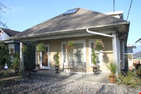
- This modest, hipped roof, cottage-style bungalow is distinguished by a full width front verandah. It was built as part of the Buena Vista subdivision in about 1911 by the Leibly & Blumer Real Estate Company. It was reported in The British Columbian in 1911: “Ten houses are now being erected by the company on the property, solid substantial five or six-room buildings that appeals to the homeseeker”. Retaining a high degree of integrity, this residence displays its original double-hung windows and lapped wooden siding. Houses of this type were often constructed from a complete package of materials offered by building supply companies, and were extremely popular due to their low cost and ease of construction.
- Locality
- East Burnaby
- Historic Neighbourhood
- East Burnaby (Historic Neighbourhood)
- Planning Study Area
- Cariboo-Armstrong Area
- Area
- 413.72
- Contributing Resource
- Building
- Ownership
- Private
- Street Address
- 8941 Armstrong Avenue
- Street View URL
- Google Maps Street View
Images
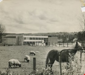
Burnaby Central School
https://search.heritageburnaby.ca/link/landmark814
- Repository
- Burnaby Heritage Planning
- Geographic Access
- Canada Way
- Associated Dates
- 1958
- Heritage Value
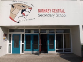
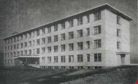
- Burnaby Central School became the third high school to be built in Burnaby (following Burnaby North and Burnaby South). The increased school enrolments due to the rapidly growing population in Burnaby meant that the School District required this third high school to be placed between the other two. In its first year, 719 students attended Burnaby Central.
- Historic Neighbourhood
- Burnaby Lake (Historic Neighbourhood)
- Planning Study Area
- Douglas-Gilpin Area
- Street Address
- 4939 Canada Way
- Street View URL
- Google Maps Street View
Images
Burnaby General Hospital
https://search.heritageburnaby.ca/link/landmark690
- Repository
- Burnaby Heritage Planning
- Geographic Access
- Kincaid Street
- Associated Dates
- 1952
- Heritage Value
- Burnaby residents had long been asking for a hospital in their municipality so on July 14, 1943, the first meeting of the Burnaby Hospital Fund-raising Committee was held at the Canadian Legion Hall at Royal Oak and Kingsway. In 1947, the group was incorporated as the Burnaby Hospital Society and after extensive lobbying and fundraising, the Burnaby General Hospital opened its doors on October 30, 1952. The site was provided by the Municipality of Burnaby on 17.5 acres of parkland on a small hill in the Cascade Heights area. In its first year, the hospital admitted 5010 patients and delivered 944 babies.
- Historic Neighbourhood
- Broadview (Historic Neighbourhood)
- Planning Study Area
- Cascade-Schou Area
- Street Address
- 3935 Kincaid Street
- Street View URL
- Google Maps Street View
Images
Burnaby Heights Neighbourhood
https://search.heritageburnaby.ca/link/landmark776
- Repository
- Burnaby Heritage Planning
- Associated Dates
- 1955-2008
- Heritage Value
- Up until the 1970s, this neighbourhood was known as Vancouver Heights. When a new park was created during that decade and named "Burnaby Heights Park," the name was gradually adopted by newcomers to the area. Today, you will hear residents refer to their neighbourhood as Burnaby Heights, Vancouver Heights, or just "The Heights." Throughout the 1960s and 1970s, the commercial district in this neighbourhood continued to grow and a Retail Merchants Association was formed which later became known as the Heights Merchants Association. The neighbourhood still retains a residential neighbourhood characteristic with an increasing number of apartment buildings and multi-family units being built over the past 20 years.
- Historic Neighbourhood
- Vancouver Heights (Historic Neighbourhood)
- Planning Study Area
- Burnaby Heights Area
Images
Burnaby Lake Neighbourhood
https://search.heritageburnaby.ca/link/landmark700
- Repository
- Burnaby Heritage Planning
- Associated Dates
- 1925-1954
- Heritage Value
- After World War I and the Great Depression of the 1930s, more homes were constructed and subdivisions created in the Burnaby Lake district. The area around Deer Lake gained a reputation for being an "artistic development of commodious homes with park-like grounds."
- Historic Neighbourhood
- Burnaby Lake (Historic Neighbourhood)
- Planning Study Area
- Burnaby Lake Area
Images
Burnaby Lake Neighbourhood
https://search.heritageburnaby.ca/link/landmark755
- Repository
- Burnaby Heritage Planning
- Associated Dates
- 1905-1924
- Heritage Value
- Along with logging and sawmills, Burnaby became known as a prime agricultural area and the Burnaby Lake Neighbourhood saw the development of many vegetable and fruit farms. Growers in the Burnaby and Deer Lake districts took their produce to the tram line on Edmonds Street and shipped it to markets in New Westminster and Vancouver on a specially designed interurban freight car that was open-sided for easy loading. The car's canvas curtains which sometimes came loose and flapped like wings in the wind led people to dub it "the flying dutchman." Most Burnaby fruit and vegetable growers depended on seasonal Chinese work forces and other local Chinese farm residents to oversee operations; these workers being recruited from New Westminsters' Asian community. Besides being good farmers, Burnaby Lake's early residents fostered a strong sense of community. Both L. Claude Hill and his brother Bernard were elected to Burnaby Municipal council and Bernard was the one who knocked on doors to find enough children to meet the qualifications for establishing a school in the district.
- Historic Neighbourhood
- Burnaby Lake (Historic Neighbourhood)
- Planning Study Area
- Morley-Buckingham Area
- Lakeview-Mayfield Area
Images
Burnaby Lake Neighbourhood
https://search.heritageburnaby.ca/link/landmark821
- Repository
- Burnaby Heritage Planning
- Associated Dates
- 1955-2008
- Heritage Value
- In 1966 Burnaby Lake was identified as a key potential regional park in the GVRD ’s Regional Park Plan for the Lower Mainland. The lake was to be developed for nature study, strolling, trail riding, canoeing, sightseeing and picnicking. It was formally recognized as a regional nature park in 1979, at which time the GVRD assumed management of the park through a lease agreement with the City of Burnaby. In 1993 Burnaby Lake was selected by the City of Burnaby to be included in Greater Vancouver ’s Green Zone, and was identified as a key component of the GVRD ’s Park and Outdoor Recreation System (PORS) for the Burrard/Peninsula/Richmond sector, which includes Burnaby, Vancouver, New Westminster, and Richmond.
- Historic Neighbourhood
- Burnaby Lake (Historic Neighbourhood)
- Planning Study Area
- Burnaby Lake Area
Images
Burnaby Mountain Neighbourhood
https://search.heritageburnaby.ca/link/landmark792
- Repository
- Burnaby Heritage Planning
- Associated Dates
- 1955-2008
- Heritage Value
- Burnaby Mountain had been dedicated as park in 1942, however the original park boundaries were reconsidered in 1952 with the development of the Trans Mountain Pipeline. Although the boundaries were adjusted to accommodate this project, significant conservation and park lands were left untouched. When, in 1962, the government of British Columbia determined the need for additional post-secondary facilities, Burnaby Mountain was chosen as the site for the new Simon Fraser University which opened in 1965. As early as 1964, the idea of establishing a townsite around the university had been discussed by Burnaby, but it was not until the mid-1990s that the idea came to fruition and by the early 2000s, a new housing development know as the UniverCity took shape on the mountain adjacent to the university.
- Historic Neighbourhood
- Barnet (Historic Neighbourhood)
- Planning Study Area
- Burnaby Mountain Area
Images
Burnaby Mountain Park & Centennial Pavilion
https://search.heritageburnaby.ca/link/landmark794
- Repository
- Burnaby Heritage Planning
- Geographic Access
- Centennial Way
- Associated Dates
- 1958
- Heritage Value
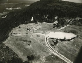
- The first formal park dedication bylaw covering Burnaby Mountain was passed in 1942, but the boundaries were re-adjusted in 1952 with the creation of the Trans Mountain Pipeline site. Significant portions of the mountain remained as dedicated park, however, and in 1957, the site was chosen to house Burnaby's contribution to the celebration of British Columbia's centennial - the Centennial Pavilion. The grounds around the pavilion became a favourite picnic site that provided for the first time a formal viewpoint and public access to other mountain trails. In the 1980s, the Pavilion underwent major renovations and opened in 1986 as Horizons restaurant.
- Historic Neighbourhood
- Barnet (Historic Neighbourhood)
- Planning Study Area
- Burnaby Mountain Area
- Street Address
- 100 Centennial Way
- Street View URL
- Google Maps Street View
Images
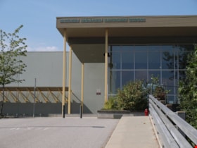
Burnaby Mountain Secondary School
https://search.heritageburnaby.ca/link/landmark831
- Repository
- Burnaby Heritage Planning
- Geographic Access
- Eastlake Drive
- Associated Dates
- 2000
- Heritage Value
- Burnaby Mountain Secondary School is one of the more recent schools in Burnaby, having opened in 2000 and it serves neighbourhoods in northeast Burnaby and northwest Coquitlam.
- Historic Neighbourhood
- Burquitlam (Historic Neighbourhood)
- Planning Study Area
- Lyndhurst Area
- Street Address
- 8800 Eastlake Drive
- Street View URL
- Google Maps Street View
Images
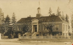
Burnaby Municipal Hall
https://search.heritageburnaby.ca/link/landmark763
- Repository
- Burnaby Heritage Planning
- Geographic Access
- Kingsway
- Associated Dates
- 1911
- Heritage Value
- In 1911, a brick building was built to replace the smaller wooden structure that had served as Burnaby's Municipal Hall since 1899. This new, larger structure was built to reflect Burnaby's growth into a large suburban municipality and remained in use for over 40 years. The old Municipal Hall became a public hall which was demolished upon the construction of the Edmonds Branch of the Burnaby Public Library in 1962. The second Municipal Hall was renovated in 1956 (when the current City Hall was built at Canada Way), and was used as a Police building. In 1966 after the construction of the new Justice Building, the old 1911 Municipal Hall was left vacant and in 1970 it was demolished. The site was redeveloped as a senior citizens residential centre with Edmonds House built on the old hall location.
- Historic Neighbourhood
- Edmonds (Historic Neighbourhood)
- Planning Study Area
- Stride Avenue Area
- Street Address
- 7282 Kingsway
Images
Burnaby Municipal Hall
https://search.heritageburnaby.ca/link/landmark807
- Repository
- Burnaby Heritage Planning
- Geographic Access
- Canada Way
- Associated Dates
- 1956
- Heritage Value
- When staff outgrew the municipal buildings at Edmonds and Kingsway, a debate erupted over where to build a new municipal hall. North Burnaby residents argued against the Kingsway and Edmonds site as it was too removed for their needs, but South Burnaby residents were not prepared to accept a hall in North Burnaby. The debate was finally resolved when it was suggested that the new civic centre for the municipality be in the exact geographic centre of Burnaby. Fortunately, this meant that the new hall was to be built near Deer Lake, in the beautiful Central Valley setting. Burnaby voters accepted this decision and approved the $625,000.00 it would take to build the new structure and the official opening ceremony was held June 22, 1956 when then Reeve Charles MacSorley received the keys to the hall from the contractor.
- Historic Neighbourhood
- Burnaby Lake (Historic Neighbourhood)
- Planning Study Area
- Douglas-Gilpin Area
- Street Address
- 4949 Canada Way
- Street View URL
- Google Maps Street View
Images
Burnaby North High School
https://search.heritageburnaby.ca/link/landmark745
- Repository
- Burnaby Heritage Planning
- Associated Dates
- 1923-1982
- Street View URL
- Google Maps Street View
- Repository
- Burnaby Heritage Planning
- Geographic Access
- Willingdon Avenue
- Associated Dates
- 1923-1982
- Heritage Value
- Burnaby North and Burnaby South were the first high schools built in the City. Before the high school opened, Burnaby students had to travel to Vancouver if they wished to pursue education beyond an elementary level. In 1921, arrangements were made to use the basement of the Presbyterian Church for instruction of local students. By 1922 the Burnaby North High School opened at its first permanent location (4375 Pandora Street - which is now Rosser Elementary). In 1945, the Willingdon Avenue site was built and was used until a new building was constructed in 1961 on Hammarskjold Drive. From 1962, the school was used as Burnaby Heights Junior High school, but it closed in 1982 and the junior high students went to the new Burnaby North on Hammarskjold.
- Historic Neighbourhood
- Capitol Hill (Historic Neighbourhood)
- Planning Study Area
- Capitol Hill Area
- Street Address
- 250 Willingdon Avenue
- Street View URL
- Google Maps Street View
Images
Burnaby South High School
https://search.heritageburnaby.ca/link/landmark770
- Repository
- Burnaby Heritage Planning
- Associated Dates
- 1922-1988
- Street View URL
- Google Maps Street View
- Repository
- Burnaby Heritage Planning
- Geographic Access
- Southoaks Crescent
- Associated Dates
- 1922-1988
- Heritage Value
- Burnaby South and Burnaby North were Burnaby's first high schools. The first rooms of the school were built in 1922 on the same grounds as the Kingsway East Elementary School. In 1940, a two-storey building was erected and additions were made in 1963, 1967 and 1972. Kingsway East closed in 1925 and its buildings were used by the high school for Industrial Arts and Home Economics. In the early 1990s, a new "urban education centre" (Burnaby South/B.C. School for the Deaf) was opened, replacing the old Burnaby South High School.
- Historic Neighbourhood
- Edmonds (Historic Neighbourhood)
- Planning Study Area
- Kingsway-Beresford Area
- Street Address
- 6650 Southoaks Crescent
- Street View URL
- Google Maps Street View
Images
Burnaby Winter Club
https://search.heritageburnaby.ca/link/landmark816
- Repository
- Burnaby Heritage Planning
- Geographic Access
- Canada Way
- Associated Dates
- 1956
- Heritage Value
- Skating on Deer Lake and Burnaby Lake was the inspiration to form the Burnaby Winter Club in the 1950s. In 1958, the volunteer group opened an indoor ice facility, still operating today at 4990 Canada Way. Originally, the facility boasted 8 sheets of curling ice, that were used to capacity by the more than 500 family and individual members in the heyday of the Club. The Winter Club was a social centre: in addition to curling, it was a popular place for banquets and dances, and a place for families to spend time together. In the 1960s, the eight sheets of curling ice were reduced to five, to make room for a sheet of hockey ice for the members’ children. Volunteer coaches were committed to excellence, and the Club produced many professional hockey players. By 1964, the Club’s first future NHL player was playing: Pee Wee player Jack McIlhargey.
- Historic Neighbourhood
- Burnaby Lake (Historic Neighbourhood)
- Planning Study Area
- Douglas-Gilpin Area
- Street Address
- 4990 Canada Way
- Street View URL
- Google Maps Street View
Images
Burquitlam Neighbourhood
https://search.heritageburnaby.ca/link/landmark703
- Repository
- Burnaby Heritage Planning
- Associated Dates
- 1925-1954
- Heritage Value
- By the 1950s, the Burquitlam Neighbourhood was becoming a residential and commercial centre for the northeast section of Burnaby. The Sullivan Heights area was developed as a single-family residential area with the Lyndhurst School opening in 1954. The completion of the Lougheed Highway in 1953 encouraged more commercial and retail development and fostered the growth of the neighbourhood throughout this period.
- Historic Neighbourhood
- Burquitlam (Historic Neighbourhood)
- Planning Study Area
- Lyndhurst Area
Images
Burquitlam Neighbourhood
https://search.heritageburnaby.ca/link/landmark757
- Repository
- Burnaby Heritage Planning
- Associated Dates
- 1905-1924
- Heritage Value
- In 1921, the pamphlet "Beautiful Burnaby" was produced and it described the Burquitlam neighbourhood as such: "No part of Burnaby has more consistently laboured to advance its prosperity than Burquitlam. Enterprise and intelligence has hewn homes from the forest and developed land into highly productive gardens and poultry ranches. Burquitlam is the growing suburb to the north of the City of New Westminster. It is reached by the Sapperton carline direct from Edmonds being only a few minutes ride from New Westminster market. It is also served by the B.C.E.R. Burnaby Lake line and adjoins on the best golf links in Greater Vancouver."
- Historic Neighbourhood
- Burquitlam (Historic Neighbourhood)
- Planning Study Area
- Cameron Area
- Lyndhurst Area
Images
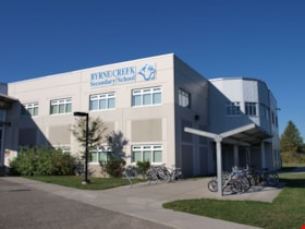
Byrne Creek Secondary School
https://search.heritageburnaby.ca/link/landmark849
- Repository
- Burnaby Heritage Planning
- Geographic Access
- 18th Street
- Associated Dates
- 2005
- Heritage Value
- Byrne Creek School opened in 2005 and accommodates students from grades 8 through 12. When built, the school was created to house as many as 1200 students, but by 2009, plans have been prepared to increase that capacity to 1500.
- Historic Neighbourhood
- Edmonds (Historic Neighbourhood)
- Planning Study Area
- Stride Avenue Area
- Street Address
- 7777 18th Street
- Street View URL
- Google Maps Street View


