Narrow Results By
Format
- Architectural Drawing 215
- Book 225
- Bylaws - Adopted 2338
- Bylaws - Other 1
- Bylaws - Repealed 303
- Cartographic Material 35
- Council - Committee Report 3305
- Council - Manager's Report 4292
- Council - Mayor/Councillor/Staff Report 4121
- Council - Public Hearing Minutes 153
- Council - Regular Council Minutes 797
- Graphic Material 31
Decade
- 2020s 2390
- 2010s 6269
- 2000s
- 1990s 13501
- 1980s 12569
- 1970s 18318
- 1960s 12807
- 1950s
- 1940s 7335
- 1930s 7961
- 1920s 12089
- 1910s 8836
- 1900s 4208
- 1890s 1864
- 1880s 301
- 1870s 128
- 1860s 179
- 1850s 45
- 1840s 24
- 1830s 14
- 1820s 11
- 1810s 8
- 1800s 11
- 1790s 6
- 1780s 5
- 1770s 5
- 1760s 5
- 1750s 5
- 1740s 5
- 1730s 5
- 1720s 5
- 1710s 7
- 1700s 6
- 1690s 5
- 1680s 6
- 1670s 4
- 1660s 4
- 1650s 4
- 1640s 4
- 1630s 4
- 1620s 4
- 1610s 4
- 1600s 4
- 1590s 1
- 1580s 1
- 1570s 1
- 1560s 1
- 1550s 1
- 1540s 1
- 1530s 1
- 1520s 2
- 1510s 1
- 1500s 1
- 1490s 1
- 1480s 1
Subject
- Accidents 4
- Accidents - Automobile Accidents 9
- Adornment - Jewelry 2
- Adornment - Lapel Pins 1
- Advertising Medium 4
- Advertising Medium - Signs and Signboards 22
- Aerial Photographs 18
- Agricultural Tools and Equipment 4
- Agricultural Tools and Equipment - Gardening Equipment 1
- Agriculture 15
- Agriculture - Crops 2
- Agriculture - Farms 39
Sussex-Nelson Neighbourhood
https://search.heritageburnaby.ca/link/landmark838
- Repository
- Burnaby Heritage Planning
- Associated Dates
- 1955-2008
- Heritage Value
- The Sussex-Nelson Neighbourhood is located just south of Metrotown and in 1980 was characterised as the most populated of all of Burnaby's Planning Study areas. The area immediately south of Metrotown was initially developed as post-war 1950s housing stock, while the sector south of Rumble was developed after the 1960s and 1970s as single-family housing.
- Historic Neighbourhood
- Alta Vista (Historic Neighbourhood)
- Planning Study Area
- Sussex-Nelson Area
Images
Suncrest Neighbourhood
https://search.heritageburnaby.ca/link/landmark839
- Repository
- Burnaby Heritage Planning
- Associated Dates
- 1955-2008
- Heritage Value
- The Suncrest Neighbourhood is a small residential area south of Burnaby's Central Park. The Ocean View Burial Park takes up a large area of land in the north-east corner of this neighbourhood and the majority of the housing was built during the 1930-1960 period.
- Historic Neighbourhood
- Alta Vista (Historic Neighbourhood)
- Planning Study Area
- Suncrest Area
Images
Big Bend Neighbourhood
https://search.heritageburnaby.ca/link/landmark840
- Repository
- Burnaby Heritage Planning
- Associated Dates
- 1955-2008
- Heritage Value
- The Big Bend Neighbourhood in Burnaby maintained its status as an important agricultural area in the City in the years following 1955 and it also solidified its role as a prime industrial and commercial district. In 1972, the Big Bend Development Plan was adopted by Council and soon thereafter, approximately 620 acres of land were incorporated into the Agricultural Land Reserve. These lands have been set aside for agricultural and limited recreation purposes. By the 2000s, 160 acres of land were considered highly productive agricultural areas, and over 400 acres of land had been secured as parkland, including the Fraser Foreshore Park. The area also developed large commercial and industrial districts including those at Marine Way/Boundary, the Glenlyon Estates, Riverfront Business Park, Burnaby Business Park, and Glenwood Industrial Estates.
- Historic Neighbourhood
- Fraser Arm (Historic Neighbourhood)
- Planning Study Area
- Big Bend Area
Images
Clinton-Glenwood Neighbourhood
https://search.heritageburnaby.ca/link/landmark841
- Repository
- Burnaby Heritage Planning
- Associated Dates
- 1955-2008
- Heritage Value
- The primarily single-family subdivision and development in the Clinton-Glenwood Neighbourhood occurred during the building boom of the 1950s. Later development fell under the guidelines established in the Royal Oak Community Plan (adopted in 1999) and resulted in an increase in the number of multi-family units.
- Historic Neighbourhood
- Alta Vista (Historic Neighbourhood)
- Planning Study Area
- Clinton-Glenwood Area
Images
Glenwood School
https://search.heritageburnaby.ca/link/landmark842
- Repository
- Burnaby Heritage Planning
- Geographic Access
- Marine Drive
- Associated Dates
- 1956
- Heritage Value
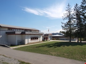
- Glenwood Elementary School was built in 1956 to replace Riverway East School. Additions to the school were made in 1966 and 1969. Decreasing enrolment led to the school closure by 1980, but it was re-opened 1994.
- Historic Neighbourhood
- Fraser Arm (Historic Neighbourhood)
- Planning Study Area
- Clinton-Glenwood Area
- Street Address
- 5787 Marine Drive
- Street View URL
- Google Maps Street View
Images
Stride Avenue Neighbourhood
https://search.heritageburnaby.ca/link/landmark845
- Repository
- Burnaby Heritage Planning
- Associated Dates
- 1955-2008
- Heritage Value
- The interurban link between New Westminster and Vancouver stimulated the early settlement of Stride Avenue. Infilling of the area took place in the early 1950s and the pace of development had slowed considerably by 1970. Duplexes became a popular feature in the decade between 1970 and 1980 and in the late 1980s, the neighbourhood was incorporated into the Edmonds Town Centre South plan.
- Historic Neighbourhood
- Edmonds (Historic Neighbourhood)
- Planning Study Area
- Stride Avenue Area
Images
Stride Hill Neighbourhood
https://search.heritageburnaby.ca/link/landmark846
- Repository
- Burnaby Heritage Planning
- Associated Dates
- 1955-2008
- Heritage Value
- The residential areas that are located within the Stride Hill Neighbourhood were primarily developed in the 1950s during Burnaby's post-war building boom. The area lying to the south of Byrne Creek Ravine Park was used as a municipal garbage dump until the 1960s and as a landfill site for yard waste disposal until the early 1990s at which point the area was incorporated into the Edmonds Town Centre Plan and the land was made into park and open space.
- Historic Neighbourhood
- Edmonds (Historic Neighbourhood)
- Planning Study Area
- Stride Hill Area
Images
Taylor Park Elementary School
https://search.heritageburnaby.ca/link/landmark847
- Repository
- Burnaby Heritage Planning
- Geographic Access
- Mission Avenue
- Associated Dates
- 2004
- Heritage Value
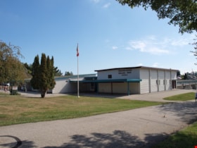
- Taylor Park Elementary School was opened in 2004 with 240 students from kindergarten to grade three (with older students attending Stride Avenue Community School). By 2006, Taylor Park had been designated as its own school and extended its classes from kindergarten through grade six.
- Historic Neighbourhood
- Edmonds (Historic Neighbourhood)
- Planning Study Area
- Stride Hill Area
- Street Address
- 7590 Mission Avenue
- Street View URL
- Google Maps Street View
Images
Twelfth Avenue Elementary School
https://search.heritageburnaby.ca/link/landmark848
- Repository
- Burnaby Heritage Planning
- Geographic Access
- 12th Avenue
- Associated Dates
- 1958
- Heritage Value
- Twelfth Avenue School was one of two schools built to relieve the overcrowding at Edmonds School resulting from the housing boom in Burnaby during the 1950s - Lakeview was the other. Built in 1958, the building was added to in 1962, 1964, 1967, 1969 and 1974.
- Historic Neighbourhood
- Edmonds (Historic Neighbourhood)
- Planning Study Area
- Edmonds Area
- Street Address
- 7622 12th Avenue
- Street View URL
- Google Maps Street View
Images
Byrne Creek Secondary School
https://search.heritageburnaby.ca/link/landmark849
- Repository
- Burnaby Heritage Planning
- Geographic Access
- 18th Street
- Associated Dates
- 2005
- Heritage Value
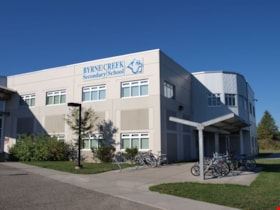
- Byrne Creek School opened in 2005 and accommodates students from grades 8 through 12. When built, the school was created to house as many as 1200 students, but by 2009, plans have been prepared to increase that capacity to 1500.
- Historic Neighbourhood
- Edmonds (Historic Neighbourhood)
- Planning Study Area
- Stride Avenue Area
- Street Address
- 7777 18th Street
- Street View URL
- Google Maps Street View
Images
Rezoning Reference # 06-64 - Phased Development of Two Auto Dealerships (4451 Still Creek Drive)
https://search.heritageburnaby.ca/link/councilreport3
- Repository
- City of Burnaby Archives
- Report ID
- 67143
- Meeting Date
- 17-Sep-2007
- Format
- Council - Manager's Report
- Item No.
- 5
- Collection/Fonds
- City Council and Office of the City Clerk fonds
- Repository
- City of Burnaby Archives
- Report ID
- 67143
- Meeting Date
- 17-Sep-2007
- Format
- Council - Manager's Report
- Item No.
- 5
- Collection/Fonds
- City Council and Office of the City Clerk fonds
Documents
Civic Acquisition of the "Swing Girl" - Neon Sign as Heights Landmark
https://search.heritageburnaby.ca/link/councilreport5
- Repository
- City of Burnaby Archives
- Report ID
- 67138
- Meeting Date
- 17-Sep-2007
- Format
- Council - Committee Report
- Collection/Fonds
- City Council and Office of the City Clerk fonds
- Repository
- City of Burnaby Archives
- Report ID
- 67138
- Meeting Date
- 17-Sep-2007
- Format
- Council - Committee Report
- Collection/Fonds
- City Council and Office of the City Clerk fonds
Documents
Business Licensing
https://search.heritageburnaby.ca/link/councilreport6
- Repository
- City of Burnaby Archives
- Report ID
- 67139
- Meeting Date
- 17-Sep-2007
- Format
- Council - Manager's Report
- Item No.
- 1
- Collection/Fonds
- City Council and Office of the City Clerk fonds
- Repository
- City of Burnaby Archives
- Report ID
- 67139
- Meeting Date
- 17-Sep-2007
- Format
- Council - Manager's Report
- Item No.
- 1
- Collection/Fonds
- City Council and Office of the City Clerk fonds
Documents
Exemptions From Taxation - 2008
https://search.heritageburnaby.ca/link/councilreport7
- Repository
- City of Burnaby Archives
- Report ID
- 67140
- Meeting Date
- 17-Sep-2007
- Format
- Council - Manager's Report
- Item No.
- 2
- Collection/Fonds
- City Council and Office of the City Clerk fonds
- Repository
- City of Burnaby Archives
- Report ID
- 67140
- Meeting Date
- 17-Sep-2007
- Format
- Council - Manager's Report
- Item No.
- 2
- Collection/Fonds
- City Council and Office of the City Clerk fonds
Documents
Rezoning Reference # 07-05 - Office Building, Big Bend Development Plan (Portion of 9500 Glenlyon Parkway)
https://search.heritageburnaby.ca/link/councilreport8
- Repository
- City of Burnaby Archives
- Report ID
- 67142
- Meeting Date
- 17-Sep-2007
- Format
- Council - Manager's Report
- Item No.
- 4
- Collection/Fonds
- City Council and Office of the City Clerk fonds
- Repository
- City of Burnaby Archives
- Report ID
- 67142
- Meeting Date
- 17-Sep-2007
- Format
- Council - Manager's Report
- Item No.
- 4
- Collection/Fonds
- City Council and Office of the City Clerk fonds
Documents
Rezoning Reference # 06-07 - Mixed-Use Parkade/Commercial/Childcare/Residential Development, UniverCity at SFU (9055 University High Street)
https://search.heritageburnaby.ca/link/councilreport10
- Repository
- City of Burnaby Archives
- Report ID
- 67144
- Meeting Date
- 17-Sep-2007
- Format
- Council - Manager's Report
- Item No.
- 6
- Collection/Fonds
- City Council and Office of the City Clerk fonds
- Repository
- City of Burnaby Archives
- Report ID
- 67144
- Meeting Date
- 17-Sep-2007
- Format
- Council - Manager's Report
- Item No.
- 6
- Collection/Fonds
- City Council and Office of the City Clerk fonds
Documents
7828 14th Avenue - Lot 3, Block 20, DL 28, Group 1, Plan 627
https://search.heritageburnaby.ca/link/councilreport11
- Repository
- City of Burnaby Archives
- Report ID
- 67145
- Meeting Date
- 17-Sep-2007
- Format
- Council - Manager's Report
- Item No.
- 7
- Collection/Fonds
- City Council and Office of the City Clerk fonds
- Repository
- City of Burnaby Archives
- Report ID
- 67145
- Meeting Date
- 17-Sep-2007
- Format
- Council - Manager's Report
- Item No.
- 7
- Collection/Fonds
- City Council and Office of the City Clerk fonds
Documents
Building Permit Tabulation Report No. 09 From 2007 August 06 to 2007 September 12
https://search.heritageburnaby.ca/link/councilreport12
- Repository
- City of Burnaby Archives
- Report ID
- 67146
- Meeting Date
- 17-Sep-2007
- Format
- Council - Manager's Report
- Item No.
- 8
- Collection/Fonds
- City Council and Office of the City Clerk fonds
- Repository
- City of Burnaby Archives
- Report ID
- 67146
- Meeting Date
- 17-Sep-2007
- Format
- Council - Manager's Report
- Item No.
- 8
- Collection/Fonds
- City Council and Office of the City Clerk fonds
Documents
Rezoning Applications
https://search.heritageburnaby.ca/link/councilreport13
- Repository
- City of Burnaby Archives
- Report ID
- 67147
- Meeting Date
- 17-Sep-2007
- Format
- Council - Manager's Report
- Item No.
- 9
- Collection/Fonds
- City Council and Office of the City Clerk fonds
- Repository
- City of Burnaby Archives
- Report ID
- 67147
- Meeting Date
- 17-Sep-2007
- Format
- Council - Manager's Report
- Item No.
- 9
- Collection/Fonds
- City Council and Office of the City Clerk fonds
Documents
Municipal Collector
https://search.heritageburnaby.ca/link/councilreport15
- Repository
- City of Burnaby Archives
- Report ID
- 67141
- Meeting Date
- 17-Sep-2007
- Format
- Council - Manager's Report
- Item No.
- 3
- Collection/Fonds
- City Council and Office of the City Clerk fonds
- Repository
- City of Burnaby Archives
- Report ID
- 67141
- Meeting Date
- 17-Sep-2007
- Format
- Council - Manager's Report
- Item No.
- 3
- Collection/Fonds
- City Council and Office of the City Clerk fonds


