Narrow Results By
Format
- Architectural Drawing 165
- Book 848
- Bylaws - Adopted 1560
- Bylaws - Other 19
- Bylaws - Repealed 200
- Cartographic Material 168
- Catalogue 1
- Council - Committee Report 3591
- Council - Manager's Report 9339
- Council - Mayor/Councillor/Staff Report 2406
- Council - Public Hearing Minutes 120
- Council - Regular Council Minutes 887
Decade
- 2020s 2390
- 2010s 6268
- 2000s 9728
- 1990s 13495
- 1980s 12565
- 1970s
- 1960s 12800
- 1950s 11063
- 1940s 7194
- 1930s 7911
- 1920s 12034
- 1910s
- 1900s 4204
- 1890s 1860
- 1880s 298
- 1870s 125
- 1860s 176
- 1850s 45
- 1840s 24
- 1830s 14
- 1820s 11
- 1810s 8
- 1800s 11
- 1790s 6
- 1780s 5
- 1770s 5
- 1760s 5
- 1750s 5
- 1740s 5
- 1730s 5
- 1720s 5
- 1710s 7
- 1700s 6
- 1690s 5
- 1680s 6
- 1670s 4
- 1660s 4
- 1650s 4
- 1640s 4
- 1630s 4
- 1620s 4
- 1610s 4
- 1600s 4
- 1590s 1
- 1580s 1
- 1570s 1
- 1560s 1
- 1550s 1
- 1540s 1
- 1530s 1
- 1520s 2
- 1510s 1
- 1500s 1
- 1490s 1
- 1480s 1
Subject
- Academic Disciplines 1
- Accidents 2
- Accidents - Train Accidents 7
- Adminstrative Groups - Committees 4
- Adornment - Jewelry 1
- Advertising Medium 2
- Advertising Medium - Flyer 4
- Advertising Medium - Poster 15
- Advertising Medium - Signs and Signboards 81
- Aerial Photographs 46
- Agricultural Tools and Equipment 1
- Agricultural Tools and Equipment - Gardening Equipment 3
Stride Avenue Neighbourhood
https://search.heritageburnaby.ca/link/landmark845
- Repository
- Burnaby Heritage Planning
- Associated Dates
- 1955-2008
- Heritage Value
- The interurban link between New Westminster and Vancouver stimulated the early settlement of Stride Avenue. Infilling of the area took place in the early 1950s and the pace of development had slowed considerably by 1970. Duplexes became a popular feature in the decade between 1970 and 1980 and in the late 1980s, the neighbourhood was incorporated into the Edmonds Town Centre South plan.
- Historic Neighbourhood
- Edmonds (Historic Neighbourhood)
- Planning Study Area
- Stride Avenue Area
Images
Stride Hill Neighbourhood
https://search.heritageburnaby.ca/link/landmark846
- Repository
- Burnaby Heritage Planning
- Associated Dates
- 1955-2008
- Heritage Value
- The residential areas that are located within the Stride Hill Neighbourhood were primarily developed in the 1950s during Burnaby's post-war building boom. The area lying to the south of Byrne Creek Ravine Park was used as a municipal garbage dump until the 1960s and as a landfill site for yard waste disposal until the early 1990s at which point the area was incorporated into the Edmonds Town Centre Plan and the land was made into park and open space.
- Historic Neighbourhood
- Edmonds (Historic Neighbourhood)
- Planning Study Area
- Stride Hill Area
Images
St. Stephen's Anglican Church
https://search.heritageburnaby.ca/link/landmark765
- Repository
- Burnaby Heritage Planning
- Geographic Access
- Cameron Street
- Associated Dates
- 1913
- Heritage Value
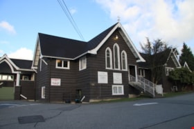
- The site of St. Stephen's Anglican Church is one of the historic landmarks of old Burquitlam. Originally this was part of the Alexander and Ethel Evans farm, Saint Phillians. Initial services for the church were held in the Evans home and later in the Burquitlam school. Alexander Evans donated this site to the Anglican Church in trust with the wish that it become a future church and consecrated ground for a family burial plot. In 1913, the parish raised the funds to build the first church. St. Stephen's was consecrated by Bishop de Pencier on September 28, 1913.
- Historic Neighbourhood
- Burquitlam (Historic Neighbourhood)
- Planning Study Area
- Lyndhurst Area
- Street Address
- 9887 Cameron Street
- Street View URL
- Google Maps Street View
Images
Suncrest Neighbourhood
https://search.heritageburnaby.ca/link/landmark839
- Repository
- Burnaby Heritage Planning
- Associated Dates
- 1955-2008
- Heritage Value
- The Suncrest Neighbourhood is a small residential area south of Burnaby's Central Park. The Ocean View Burial Park takes up a large area of land in the north-east corner of this neighbourhood and the majority of the housing was built during the 1930-1960 period.
- Historic Neighbourhood
- Alta Vista (Historic Neighbourhood)
- Planning Study Area
- Suncrest Area
Images
Sussex Avenue School
https://search.heritageburnaby.ca/link/landmark815
- Repository
- Burnaby Heritage Planning
- Geographic Access
- Irmin Street
- Associated Dates
- 1955-1982
- Heritage Value
- Sussex Avenue school was another school built during the peak expansion years of the 1950s and early 1960s. Burnaby's population was growing at such a fast pace during that decade that 10 new schools were built, and existing schools were expanded. Sussex Avenue School opened with 304 pupils. By the 1970s, student enrolment had slowed considerably from its peak and as a result, a number of schools - including Sussex - were closed.
- Historic Neighbourhood
- Alta Vista (Historic Neighbourhood)
- Planning Study Area
- Sussex-Nelson Area
- Street Address
- 4443 Irmin Street
Images
Sussex-Nelson Neighbourhood
https://search.heritageburnaby.ca/link/landmark838
- Repository
- Burnaby Heritage Planning
- Associated Dates
- 1955-2008
- Heritage Value
- The Sussex-Nelson Neighbourhood is located just south of Metrotown and in 1980 was characterised as the most populated of all of Burnaby's Planning Study areas. The area immediately south of Metrotown was initially developed as post-war 1950s housing stock, while the sector south of Rumble was developed after the 1960s and 1970s as single-family housing.
- Historic Neighbourhood
- Alta Vista (Historic Neighbourhood)
- Planning Study Area
- Sussex-Nelson Area
Images
Thomas Irvine House
https://search.heritageburnaby.ca/link/landmark536
- Repository
- Burnaby Heritage Planning
- Description
- The Thomas Irvine House is a very small, two room wood frame cottage, originally located on Laurel Street in Central Burnaby (now the site of the Burnaby Lake Sports Complex - West), and now relocated to the Burnaby Village Museum.
- Associated Dates
- 1911
- Formal Recognition
- Heritage Designation, Community Heritage Register
- Other Names
- Tommy Irvine House
- Repository
- Burnaby Heritage Planning
- Other Names
- Tommy Irvine House
- Geographic Access
- Deer Lake Avenue
- Associated Dates
- 1911
- Formal Recognition
- Heritage Designation, Community Heritage Register
- Enactment Type
- Bylaw No. 9807
- Enactment Date
- 23/11/1992
- Description
- The Thomas Irvine House is a very small, two room wood frame cottage, originally located on Laurel Street in Central Burnaby (now the site of the Burnaby Lake Sports Complex - West), and now relocated to the Burnaby Village Museum.
- Heritage Value
- The Thomas Irvine House is representative of an extremely modest, vernacular working-class cottage of the early twentieth century, once common but mostly now demolished. Irish-born Thomas Irvine (1864-1964) and his friend, Robert Moore, constructed the house in 1911 to suit the simple needs of a bachelor. Irvine worked on the construction of the British Columbia Electric Railway Burnaby Lake Interurban Line and was a pile driver by trade. The house consists of two rooms, a living room/kitchen and a bedroom. There were some improvements made throughout the fifty years Irvine lived there, such as running water in 1929, and electricity in the 1950s, but the essential character and form of the house remained intact. Irvine was a well-known local character and pioneer of Burnaby. The heritage value for this house also lies in its interpretive value within the Burnaby Village Museum. The site is an important cultural feature for the interpretation of Burnaby’s heritage to the public. The Thomas Irvine House was moved to the Burnaby Village Museum in 1975 and was restored to its 1920s appearance.
- Defining Elements
- The character defining elements of the Thomas Irvine House include its: - rectangular form and simple massing - bellcast hipped form with cedar shingle cladding - cedar shingle cladding stained dark brown - double-hung 1-over-1 wooden-sash window on front facade; simple double wooden-sash casement on west facade - interior layout of the house with 2 rooms, a living room/kitchen and bedroom - V-joint tongue-and-groove wood interior paneling
- Locality
- Deer Lake Park
- Historic Neighbourhood
- Burnaby Lake (Historic Neighbourhood)
- Planning Study Area
- Morley-Buckingham Area
- Organization
- British Columbia Electric Railway
- Burnaby Village Museum
- Builder
- Thomas Irvine (Owner)
- Robert Moore
- Function
- Primary Current--Museum
- Primary Historic--Single Dwelling
- Community
- Burnaby
- Cadastral Identifier
- P.I.D. No. 011-030-356 Legal Description: Parcel 1, District Lot 79 and District Lot 85, Group 1, New Westminster District, Reference Plan 77594
- Boundaries
- Burnaby Village Museum is comprised of a single municipally-owned property located at 6501 Deer Lake Avenue, Burnaby.
- Area
- 38,488.63
- Contributing Resource
- Building
- Landscape Feature
- Structure
- Ownership
- Public (local)
- Documentation
- Heritage Site Files: PC77000 20. City of Burnaby Planning and Building Department, 4949 Canada Way, Burnaby, B.C., V5G 1M2
- Names
- Irvine, Tom
- Street Address
- 6501 Deer Lake Avenue
Images
Thomas & Jane Sincock House
https://search.heritageburnaby.ca/link/landmark646
- Repository
- Burnaby Heritage Planning
- Description
- Residential building.
- Associated Dates
- 1912
- Street View URL
- Google Maps Street View
- Repository
- Burnaby Heritage Planning
- Geographic Access
- 11th Avenue
- Associated Dates
- 1912
- Description
- Residential building.
- Heritage Value
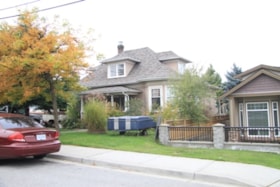
- This small Edwardian-era bungalow home was built and owned by Burnaby resident Jane Sincock (1848-1940) and her husband Thomas Sincock (1844-1916) as an investment rental property. By 1916, the couple was living in New Westminster, on Bole Street, where Jane, who was born in Cornwall, remained until her death. This substantial bungalow is distinguished by its bellcast hipped roof and dormers, an octagonal corner bay, and a small front verandah supported by square tapered columns. The house retains its original lapped wooden siding though the windows have been replaced.
- Locality
- Edmonds
- Historic Neighbourhood
- Edmonds (Historic Neighbourhood)
- Planning Study Area
- Stride Avenue Area
- Area
- 807.78
- Contributing Resource
- Building
- Ownership
- Private
- Street Address
- 7349 11th Avenue
- Street View URL
- Google Maps Street View
Images
Thomas & Margaret Coldicutt Residence
https://search.heritageburnaby.ca/link/landmark647
- Repository
- Burnaby Heritage Planning
- Description
- Residential building.
- Associated Dates
- 1911
- Street View URL
- Google Maps Street View
- Repository
- Burnaby Heritage Planning
- Geographic Access
- 6th Street
- Associated Dates
- 1911
- Description
- Residential building.
- Heritage Value
- This house was built by Thomas Davis Coldicutt (1879-1970) and Margaret Jane Coldicutt, pre-eminent local citizens. Thomas Coldicutt was born in Birmingham and arrived in Canada in 1900, finding success in the steamboat industry. In 1902, he married Margaret Jane Styler who had been born in Redditch, Worcester, England, and in 1908 they settled in East Burnaby–some of the first pioneers to the area–and established a fruit farm. Thomas had a successful real estate, insurance and brokerage business, and was elected as a councillor for East Burnaby in 1909. He was also active in civic, political and social circles in Burnaby and became president of the Burnaby Board of Trade. "East Burnaby is booming and the signs of prosperity that may be seen on every hand. Most of these are substantial dwellings, such as effect a permanent improvement to the countryside. Among those whose homes have been completed, or on the point of completion may be mentioned. Councillor Coldicutt, who has built himself a habitation on Second Avenue at a cost of $4,000. (The British Columbian, 1911). In 1913, Coldicutt sold his original farm described as “the show place of Burnaby” to the Burnaby School Board for the development of Second Street School and this house was moved from Second Street and Sixteenth Avenue to this site. It has been extensively altered, but retains its original form, scale and massing.
- Locality
- East Burnaby
- Historic Neighbourhood
- East Burnaby (Historic Neighbourhood)
- Planning Study Area
- Edmonds Area
- Area
- 557.42
- Contributing Resource
- Building
- Ownership
- Private
- Street Address
- 7510 6th Street
- Street View URL
- Google Maps Street View
Images
T.O. Townley Estate 'Deerholme'
https://search.heritageburnaby.ca/link/landmark545
- Repository
- Burnaby Heritage Planning
- Description
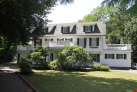
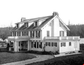
- The T.O. Townley Estate, 'Deerholme,' is located on a lake front property on the north shore of Deer Lake Park. The main house is a two-and-one-half storey symmetrical-massed wood-frame Colonial Revival structure, with flanking one-storey wings, a side gable roof and a central front entry.
- Associated Dates
- 1913
- Formal Recognition
- Heritage Designation, Community Heritage Register
- Other Names
- Thomas & Frances Townley Estate, Loftus House
- Street View URL
- Google Maps Street View
- Repository
- Burnaby Heritage Planning
- Other Names
- Thomas & Frances Townley Estate, Loftus House
- Geographic Access
- Price Street
- Associated Dates
- 1913
- Formal Recognition
- Heritage Designation, Community Heritage Register
- Enactment Type
- Bylaw No. 9807
- Enactment Date
- 23/11/1992
- Description
- The T.O. Townley Estate, 'Deerholme,' is located on a lake front property on the north shore of Deer Lake Park. The main house is a two-and-one-half storey symmetrical-massed wood-frame Colonial Revival structure, with flanking one-storey wings, a side gable roof and a central front entry.
- Heritage Value
- 'Deerholme' was built as the retirement estate of Lieutenant-Colonel Thomas Owen Townley (1862-1935) and his wife, Frances M. Townley. Townley was a pioneer resident of the Lower Mainland of British Columbia: he served as a lawyer, Registrar of Land Titles for New Westminster District and Mayor of Vancouver for one term in 1901. Built in 1913, this is one of the most significant of the Deer Lake estate houses and was the last of grand Edwardian era mansions built on the lots surrounding the lake. The area had been opened up for development two years earlier by the construction of the British Columbia Electric Railway Interurban Line. The estate speaks of a gracious way of life achieved by society's elite during the Edwardian era, supported by the use of domestic servants. Grand in scale, architecturally sophisticated and set in a bucolic landscape, this residence demonstrates the social status of the owner in the privileged classes of the rapidly developing social structure of Burnaby. The house is also significant as one of the earliest designs by the son of Thomas and Frances Townley, architect Fred Laughton Townley (1887-1966), who had graduated in architecture in 1911 from the University of Pennsylvania. In this house for his parents, he demonstrated his deft understanding of the American Period Revival styles learned during his schooling in the United States. The prevailing local taste for British-derived architecture dictated that this was a style he was rarely able to use until the Colonial Revival styles became more popular in the 1920s. F.L. Townley was a founding partner in Townley and Matheson, which achieved significant success as one of the most accomplished local architectural firms, culminating in their best-known commission, Vancouver City Hall, 1935-36.
- Defining Elements
- Key elements the define the heritage character of ‘Deerholme’ include its: - integration with its south-sloping lakefront site, which contains many original landscape features (extant rockeries, formal drive, tennis lawn, open fields, and specimen shrubs and trees) - two-and-one-half storey form with flanking one-storey wings - side gable roof with symmetrical shed dormers, three at the front and three at the rear - complex fenestration, including multi-paned wooden-sash double-hung windows, 6-over-1 on the ground floor and 6-over-9 on the second floor, and multi-paned wooden-sash casements in the dormers - pair of prominent exterior brick chimneys on each side elevation, clad with rough-cast stucco up to the roof level, and each with four chimney-pots - rough-cast stucco cladding - design elements typical of the Colonial Revival style, such as composed classical formality, side gable roof and balanced symmetrical massing - exterior architectural elements, such as classical columns, window shutters, fanlight feature window, multi-paned quarter-round windows flanking the chimneys, and projecting square brackets in the gables - superior level of design and craftsmanship throughout, including refined interior woodwork such as fireplaces, interior columned screen between hallway and living room and a staircase with Colonial Revival details - significant mature trees (such as Red Oaks, Silver Maples, and Copper Beech). - original guest house and stables, which survive on an adjacent property at 6176 Price Street
- Historic Neighbourhood
- Burnaby Lake (Historic Neighbourhood)
- Planning Study Area
- Douglas-Gilpin Area
- Architect
- Fred Laughton Townley
- Function
- Primary Current--Estate
- Primary Historic--Estate
- Community
- Burnaby
- Cadastral Identifier
- P.I.D. No. 002-652-111 Legal Description: Parcel 'C' (Explanatory Plan 12891) , Blocks 4 and 5, District Lot 79 Group 1, New Westminster District, Plan 536
- Boundaries
- ‘Deerholme’ is comprised of a single municipally-owned property located at 6110 Price Street, Burnaby.
- Area
- 14,099.52
- Contributing Resource
- Building
- Landscape Feature
- Ownership
- Public (local)
- Other Collection
- City of Vancouver Archives: T.O. Townley Residence, Original Plans, Add. MSS. 1399, Temporary No. 61, Location 920-D
- Documentation
- Heritage Site Files: PC77000 20. City of Burnaby Planning and Building Department, 4949 Canada Way, Burnaby, B.C., V5G 1M2
- Street Address
- 6110 Price Street
- Street View URL
- Google Maps Street View
Images
Vancouver Heights Neighbourhood
https://search.heritageburnaby.ca/link/landmark741
- Repository
- Burnaby Heritage Planning
- Associated Dates
- 1905-1924
- Heritage Value
- On December 13, 1912, The British Columbian Weekly described the Vancouver Heights neighbourhood as follows: "The northern portion of the municipality in the vicinity of Boundary Road has during the past three years made tremendous strides towards settlement. At that time Mr. James Herd and Mr. Peters were the only residents of the district...Soon, however, the timber was removed, streets laid out and other conveniences such as water, light and transportation provided... The school population of the district has increased so rapidly that the school has been enlarged twice this year and is at the present time inadequate. About 200 children are attending now. There are three churches in the district and one mission...At present time there are two large blocks containing six stores..."
- Historic Neighbourhood
- Vancouver Heights (Historic Neighbourhood)
- Planning Study Area
- Burnaby Heights Area
Images
Vorce Station
https://search.heritageburnaby.ca/link/landmark664
- Repository
- Burnaby Heritage Planning
- Description
- The Vorce Station is a modest utilitarian passenger tram shelter, originally constructed at the foot of Nursery Street as part of the British Columbia Electric Railway Company’s Burnaby Lake Interurban Line. In 1953, it was moved to a local farm by the Lubbock family, and in 1977 it was relocated t…
- Associated Dates
- 1911
- Formal Recognition
- Heritage Designation, Community Heritage Register
- Repository
- Burnaby Heritage Planning
- Geographic Access
- Deer Lake Avenue
- Associated Dates
- 1911
- Formal Recognition
- Heritage Designation, Community Heritage Register
- Enactment Type
- Bylaw No. 9807
- Enactment Date
- 23/11/1992
- Description
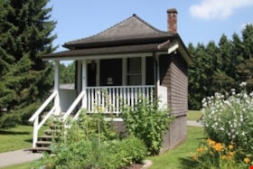
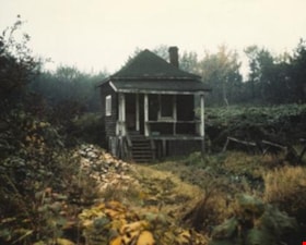
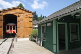
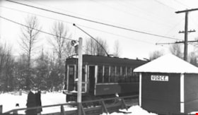
- The Vorce Station is a modest utilitarian passenger tram shelter, originally constructed at the foot of Nursery Street as part of the British Columbia Electric Railway Company’s Burnaby Lake Interurban Line. In 1953, it was moved to a local farm by the Lubbock family, and in 1977 it was relocated to Burnaby Village Museum. The wood-frame structure has a rectangular plan and hipped roof. It is enclosed on three sides, with an open side for access to the train platform and a single long built-in bench across the back of the station.
- Heritage Value
- The heritage value of the Vorce Station is as the last remaining interurban station in Burnaby and one of the few extant structures left in the Greater Vancouver region that were once part of the extensive British Columbia Electric Railway (BCER) interurban system. The Vorce Station was designed and built by the BCER, and is typical of the small local passenger stations on the Burnaby Lake and Chilliwack interurban lines. It was named after C.B. Vorce, the Chief Engineer for the company. The impact of the interurban line on local development was extremely significant, as it connected the cities of New Westminster and Vancouver, and enabled the residents of Burnaby to form a cohesive municipality from the mainly rural lands remaining between the two larger centres. Much of the early development in Burnaby was due to the growth of the interurban rail lines. The heritage significance for this station also lies in its interpretive value within the Burnaby Village Museum. The Vorce Station is an important cultural feature for the interpretation of Burnaby’s transportation history to the public, and is an important surviving feature of the BCER interurban system.
- Defining Elements
- The character defining features of the Vorce Station include its: - rectangular form and pyramidal roof with overhanging eaves - simple vernacular design and utilitarian nature - cedar shingle wall cladding - cedar shingle-clad roof with galvanized pressed tin roof ridges - interior vertical tongue-and-groove panelling - heritage graffiti: initials and messages carved and scrawled on the walls - identifying sign with large letters visible at a distance
- Locality
- Deer Lake Park
- Historic Neighbourhood
- Burnaby Lake (Historic Neighbourhood)
- Planning Study Area
- Morley-Buckingham Area
- Organization
- British Columbia Electric Railway
- Burnaby Village Museum
- Function
- Primary Current--Museum
- Primary Historic--Rail Station
- Community
- Burnaby
- Cadastral Identifier
- P.I.D. No. 011-030-356 Legal Description: Parcel 1, District Lot 79 and District Lot 85, Group 1, New Westminster District, Reference Plan 77594
- Boundaries
- Burnaby Village Museum is comprised of a single municipally-owned property located at 6501 Deer Lake Avenue, Burnaby.
- Area
- 38,488.63
- Contributing Resource
- Building
- Structure
- Landscape Feature
- Documentation
- Heritage Site Files: PC77000 20. City of Burnaby Planning and Building Department, 4949 Canada Way, Burnaby, B.C., V5G 1M2
- Street Address
- 6501 Deer Lake Avenue
Images
Wall Block
https://search.heritageburnaby.ca/link/landmark651
- Repository
- Burnaby Heritage Planning
- Description
- Commercial building.
- Associated Dates
- 1912
- Street View URL
- Google Maps Street View
- Repository
- Burnaby Heritage Planning
- Geographic Access
- Hastings Street
- Associated Dates
- 1912
- Description
- Commercial building.
- Heritage Value
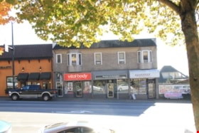
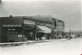
- One of the prominent buildings along Vancouver Height’s early commercial strip, this block has continuously served its original commercial/retail use, with apartments on the second floor. Alterations over the years have included a coat of stucco over the original lapped wooden siding, and the alteration of the roofline cornice. Notably, the building has retained its distinctive second storey bay windows and three ground floor commercial spaces with recessed entrances. It was financed and built by Arthur Wall, a director of Hill, Wall & Company Ltd. Real Estate, which was based in the Pacific Block in Vancouver.
- Locality
- Vancouver Heights
- Historic Neighbourhood
- Vancouver Heights (Historic Neighbourhood)
- Planning Study Area
- Willingdon Heights Area
- Area
- 473.81
- Contributing Resource
- Building
- Ownership
- Private
- Street Address
- 3722 Hastings Street
- Street View URL
- Google Maps Street View
Images
West Central Valley Neighbourhood
https://search.heritageburnaby.ca/link/landmark778
- Repository
- Burnaby Heritage Planning
- Associated Dates
- 1955-2008
- Heritage Value
- The West Central Valley Neighbourhood is home to the Bridge Business Park and is a primarily industrial neighbourhood. Similar to the adjacent Dawson-Delta Neighbourhood, West Central Valley offers businesses convenient access to major roads and highways.
- Historic Neighbourhood
- Broadview (Historic Neighbourhood)
- Planning Study Area
- West Central Valley Area
Images
Westridge Neighbourhood
https://search.heritageburnaby.ca/link/landmark791
- Repository
- Burnaby Heritage Planning
- Associated Dates
- 1955-2008
- Heritage Value
- The Westridge Neighbourhood is effectively separated into two areas by Inlet Drive. To the west of the highway lies a typical 1950s subdivision of single-family homes, while to the east is a newer (1970s) subdivision featuring larger lots and some low-rise units. In the 1980 Residential Neighbourhood Environment Study, Westridge was characterised as a stable community with little need for direct Municipal involvement in growth and development.
- Historic Neighbourhood
- Lochdale (Historic Neighbourhood)
- Planning Study Area
- Westridge Area
Images
William & Rachael Karman Residence
https://search.heritageburnaby.ca/link/landmark657
- Repository
- Burnaby Heritage Planning
- Description
- Residential building.
- Associated Dates
- 1911
- Street View URL
- Google Maps Street View
- Repository
- Burnaby Heritage Planning
- Geographic Access
- 14th Avenue
- Associated Dates
- 1911
- Description
- Residential building.
- Heritage Value
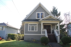
- This house was built by East Burnaby pioneers William Karman (1866-1948) and Rachael Karman (1865-1933), both born in Scotland. The Karmans originally farmed a “fruit ranch” on Cumberland Road in the 1890s but retired to this home after selling their former farm for a residential subdivision. Rachel died in 1933, and William was remarried to Mary Selkirk (1904-1981). In pristine condition, this Edwardian-era home has a front gabled roof, with symmetrical saddlebag dormers and a gabled front porch. Cedar shingle cladding is used at the foundation level and in the gable ends, and lapped wooden siding on the main level.
- Locality
- East Burnaby
- Historic Neighbourhood
- East Burnaby (Historic Neighbourhood)
- Planning Study Area
- Edmonds Area
- Area
- 696.46
- Contributing Resource
- Building
- Ownership
- Private
- Street Address
- 8088 14th Avenue
- Street View URL
- Google Maps Street View
Images
William Wilson House
https://search.heritageburnaby.ca/link/landmark512
- Repository
- Burnaby Heritage Planning
- Description
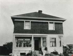
- The William Wilson House is a vernacular two-storey wood-frame Foursquare house with a hipped roof. It is situated at the corner of Wilson Avenue and Central Boulevard in the Metrotown area of Burnaby, adjacent to the SkyTrain line, and is now part of a multi-family residential complex.
- Associated Dates
- 1913
- Formal Recognition
- Heritage Designation, Community Heritage Register
- Other Names
- William & Annie Wilson House
- Street View URL
- Google Maps Street View
- Repository
- Burnaby Heritage Planning
- Other Names
- William & Annie Wilson House
- Geographic Access
- Wilson Avenue
- Associated Dates
- 1913
- Formal Recognition
- Heritage Designation, Community Heritage Register
- Enactment Type
- Bylaw No. 10350
- Enactment Date
- 22/04/1996
- Description
- The William Wilson House is a vernacular two-storey wood-frame Foursquare house with a hipped roof. It is situated at the corner of Wilson Avenue and Central Boulevard in the Metrotown area of Burnaby, adjacent to the SkyTrain line, and is now part of a multi-family residential complex.
- Heritage Value
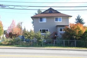
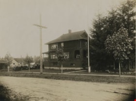
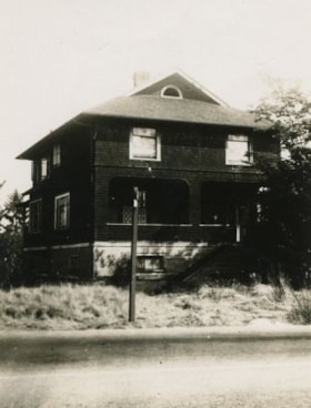
- The house is valued as the residence of William Wilson (1860-1935) and Annie Wilson (1868-1966) and demonstrates the development of Burnaby from a rural, farming community to an early commuter suburb, and is one of the few remaining early houses in the Metrotown area of Burnaby. Reflecting the area's early history, it was constructed on a subdivided piece of the Wilson’s 3.2 hectare farm that once bordered Kingsway, the primary road linking New Westminster to Vancouver. To develop his subdivided property, Wilson constructed a bisecting street, named it for himself and situated his new home on a large parcel adjacent to the interurban tramline. Constructed in 1913, the William Wilson House is additionally valued as a modest vernacular example of an Edwardian era Foursquare house. Although simple in form, it is distinguished by an inset front verandah, front bay window and clipped ground level corner. Once commonly found in Burnaby, this is a rare surviving example of the homes typically constructed for the working-class families enticed to Burnaby as a consequence of the interurban tramline.
- Defining Elements
- Key elements that define the heritage character of William Wilson House include its: - corner location, adjacent to the old interurban alignment - vernacular Foursquare style as exemplified by its symmetrical form, square floor plan and cubic massing with pyramidal roof - cladding, with narrow lapped wooden siding on the first storey and cedar shingles on the second storey - recessed front verandah, with square columns and ground floor cut-away bay window - regular fenestration, including double-hung 1-over-1 wooden-sash windows, and casement and transom assembly feature window in the living room
- Historic Neighbourhood
- Central Park (Historic Neighbourhood)
- Planning Study Area
- Maywood Area
- Function
- Primary Historic--Single Dwelling
- Primary Current--Single Dwelling
- Community
- Burnaby
- Cadastral Identifier
- 023-352-701
- Boundaries
- The William Wilson House is comprised of a single residential lot located at 6088 Wilson Avenue, Burnaby.
- Area
- 2824.9
- Contributing Resource
- Building
- Ownership
- Private
- Street Address
- 6088 Wilson Avenue
- Street View URL
- Google Maps Street View
Images
Willingdon Heights Neighbourhood
https://search.heritageburnaby.ca/link/landmark777
- Repository
- Burnaby Heritage Planning
- Associated Dates
- 1955-2008
- Heritage Value
- The convenient location of Willingdon Heights to the Trans Canada Highway, Lougheed Highway and Hastings Street has fostered its development as a primarily residential commuter neighbourhood. Characterised in the post-World War Two period by predominantly single-family developments, the neighbourhood has retained this identity despite some higher density apartment buildings now found there.
- Planning Study Area
- Willingdon Heights Area
Images
Windsor Neighbourhood
https://search.heritageburnaby.ca/link/landmark803
- Repository
- Burnaby Heritage Planning
- Associated Dates
- 1955-2008
- Heritage Value
- The Windsor Neighbourhood comprises a number of different districts with different characteristics. To the north, stretching to the border of the Deer Lake Park, is the primarily residential area that was developed after the building boom of the 1950s and now consists of a mix of single-family and multi-family housing. To the south, from Kingsway to the Skytrain line, an industrial area was maintained along with a significant commercial corridor along Kingsway. In recent years, the growth and development of this area has been guided by the Royal Oak Community Plan adopted by Council in 1999.
- Planning Study Area
- Windsor Area
Images
W.J. Mathers House 'Altnadene'
https://search.heritageburnaby.ca/link/landmark532
- Repository
- Burnaby Heritage Planning
- Description
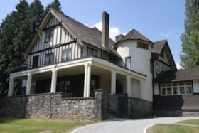
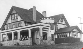
- The W.J. Mathers House 'Altnadene', is a two-and-one-half storey wood frame house set in a large terraced garden, now located in Deer Lake Park. Built as a family home, it is designed in the British Arts and Crafts style enriched by Tudor, Romanesque, and medieval details.
- Associated Dates
- 1912
- Formal Recognition
- Heritage Designation, Community Heritage Register
- Other Names
- William & Mary Mathers Residence
- Street View URL
- Google Maps Street View
- Repository
- Burnaby Heritage Planning
- Other Names
- William & Mary Mathers Residence
- Geographic Access
- Deer Lake Avenue
- Associated Dates
- 1912
- Formal Recognition
- Heritage Designation, Community Heritage Register
- Enactment Type
- Bylaw No. 9807
- Enactment Date
- 23/11/1992
- Description
- The W.J. Mathers House 'Altnadene', is a two-and-one-half storey wood frame house set in a large terraced garden, now located in Deer Lake Park. Built as a family home, it is designed in the British Arts and Crafts style enriched by Tudor, Romanesque, and medieval details.
- Heritage Value
- 'Altnadene' was constructed in the Deer Lake Crescent subdivision, which was originally promoted as an upper class neighbourhood. It represents one of the first residential developments in the City of Burnaby that required buildings to be of a specific value, thus demonstrating the desire for exclusivity among the successful businessmen who chose to settle in the area. The house and grounds illustrate the social, cultural, lifestyle and leisure sensibilities of the owners in the Deer Lake Crescent subdivision: such values as social aspiration, racial exclusivity, demonstration of architectural taste, importance of a landscaped garden, and the provision of facilities for fashionable pursuits such as lawn tennis. The estate is historically significant for its connection to William John Mathers (1859-1929), an early pioneer who arrived in New Westminster in 1876, an enterprising grain dealer, businessman, alderman, president of the Board of Trade and various other local organizations, and a 'public spirited and progressive citizen.' Designed for Mathers and his wife, Mary Elizabeth Jane (Whelan) Mathers (1869-1939), by Burnaby architect Frank William Macey (1863-1935), the Arts and Crafts style of the Mathers House contributes to the overall stylistic ambiance of the collection of homes now preserved in Deer Lake Park, displaying an eclectic array of details that give it a unique identity. The first resident architect in Burnaby, Macey was born and trained in England where he was well-respected for having published two standard texts for the architectural profession. He settled in Burnaby in the first decade of the twentieth century and obtained a number of commissions from prominent businessmen who were building grand homes in the new community of Deer Lake. He designed mostly in the British Arts and Crafts style and introduced the use of rough-cast stucco for building exteriors, a characteristic for which he was renowned. The house also has an important connection to Burnaby’s history as it later served as a convalescent home for soldiers wounded on the battlefront during the First World War. Indicative of the evolving functionality of the site, a classroom wing was added in 1939 after Benedictine Monks acquired the house and it was operated as the Seminary of Christ the King.
- Defining Elements
- Key elements that define the heritage character of 'Altnadene' include its: - prominent corner location within a park setting, in relation to the Anderson residence - irregular form and massing - irregular roof line, including a central pyramidal hipped section and open gable ends to front and sides, with cedar shingle cladding - exterior of rough-cast stucco and half-timbering - eclectic exterior details such as the Tudor arches of the verandah; and the medieval crenellations of the tower - mixture of double-hung and casement, with transom, wooden-sash windows - massive chimneys of Clayburn firebrick - surviving interior details such as fireplaces, doors and leaded glass - wrought iron gates, massive gate-posts inscribed with 'Altnadene' and granite walls at the corner entry of the property
- Locality
- Deer Lake Park
- Historic Neighbourhood
- Burnaby Lake (Historic Neighbourhood)
- Planning Study Area
- Douglas-Gilpin Area
- Function
- Primary Current--Recreation Centre
- Primary Historic--Estate
- Community
- Burnaby
- Cadastral Identifier
- P.I.D. No. 007-527-241 Legal Description: Lot 'B', District Lot 79, Group 1, New Westminster District, Plan 6642
- Boundaries
- 'Altnadene' is comprised of a single municipally-owned property located at 6490 Deer Lake Avenue, Burnaby.
- Area
- 17,065.00
- Contributing Resource
- Building
- Landscape Feature
- Ownership
- Public (local)
- Other Collection
- City of Burnaby: Salvaged original elements from the house, including fireplace surrounds, doors and hardware
- Street Address
- 6490 Deer Lake Avenue
- Street View URL
- Google Maps Street View


