More like 'Fernhurst Game Farm'
Narrow Results By
Subject
- Advertising Medium - Signs and Signboards 2
- Aerial Photographs 1
- Agricultural Tools and Equipment 16
- Agricultural Tools and Equipment - Plows 1
- Agriculture 55
- Agriculture - Beekeeping 3
- Agriculture - Crops 42
- Agriculture - Dairy 7
- Agriculture - Farms 220
- Agriculture - Fruit and Berries 50
- Agriculture - Orchards 6
- Agriculture - Poultry 7
Creator
- Association for Living Historical Farms and Agricultural Museums, U.S.A. 1
- Association for Living History, Farm and Agricultural Museums 5
- Atkinson, J. C. (John Christopher), 1814-1900 1
- Bartel, Mario 47
- Battistoni, Peter 4
- Beatty Bros Limited 1
- Bingham, Alfred "Alf" 2
- Blackwood, Paul E., 1913-1997 1
- Blissett, Rebecca 3
- Born, A. J. 4
- British Columbia Department of Education 1
- Brittain, John, 1849-1913 1
Boat being hauled
https://search.heritageburnaby.ca/link/archivedescription36046
- Repository
- City of Burnaby Archives
- Date
- [1955]
- Collection/Fonds
- Burnaby Historical Society fonds
- Description Level
- Item
- Physical Description
- 1 photograph : b&w negative ; 6.5 x 11 cm
- Scope and Content
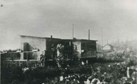
- Photograph of a Chriscraft powerboat being hauled by a truck across a farmers field. Barns are visible in the background.
- Repository
- City of Burnaby Archives
- Date
- [1955]
- Collection/Fonds
- Burnaby Historical Society fonds
- Subseries
- Grace Dickie subseries
- Physical Description
- 1 photograph : b&w negative ; 6.5 x 11 cm
- Description Level
- Item
- Record No.
- 215-004
- Access Restriction
- No restrictions
- Reproduction Restriction
- Reproduce for fair dealing purposes only
- Accession Number
- BHS1989-03
- Scope and Content
- Photograph of a Chriscraft powerboat being hauled by a truck across a farmers field. Barns are visible in the background.
- Media Type
- Photograph
- Notes
- Title based on contents of photograph
- 1 b&w copy print accompanying
Images
Boberg family home and farm
https://search.heritageburnaby.ca/link/archivedescription35772
- Repository
- City of Burnaby Archives
- Date
- 1924
- Collection/Fonds
- Burnaby Historical Society fonds
- Description Level
- Item
- Physical Description
- 1 photograph : b&w ; 12.7 x 17.8 cm print
- Scope and Content
- Photograph of the Boberg family home and farm on Douglas Road. Shown on the back porch, John Boberg (father) and Elin Boberg (mother) holding their only son, John, then 3 years old (born 1921).
- Repository
- City of Burnaby Archives
- Date
- 1924
- Collection/Fonds
- Burnaby Historical Society fonds
- Subseries
- Pioneer Tales subseries
- Physical Description
- 1 photograph : b&w ; 12.7 x 17.8 cm print
- Description Level
- Item
- Record No.
- 204-630
- Access Restriction
- No restrictions
- Reproduction Restriction
- No known restrictions
- Accession Number
- BHS1988-03
- Scope and Content
- Photograph of the Boberg family home and farm on Douglas Road. Shown on the back porch, John Boberg (father) and Elin Boberg (mother) holding their only son, John, then 3 years old (born 1921).
- Media Type
- Photograph
- Notes
- Title based on contents of photograph
- Historic Neighbourhood
- Burnaby Lake (Historic Neighbourhood)
- Planning Study Area
- Ardingley-Sprott Area
Images
Boundary Road Lumber Mill
https://search.heritageburnaby.ca/link/archivedescription38262
- Repository
- City of Burnaby Archives
- Date
- 1908
- Collection/Fonds
- Burnaby Historical Society fonds
- Description Level
- Item
- Physical Description
- 1 photograph : sepia ; 9 x 12 cm on 12.5 x 15 cm backing
- Scope and Content
- Photograph of an unidentified man standing in the forefront with a jersey cow to the right, while a row of cabins and cleared tress can be seen in the background. A caption written above the photograph reads: "Boundary Road Lumber Mill owned by E.W. Nicholson." Underneath the photograph is writte…
- Repository
- City of Burnaby Archives
- Date
- 1908
- Collection/Fonds
- Burnaby Historical Society fonds
- Subseries
- Margaret McCallum subseries
- Physical Description
- 1 photograph : sepia ; 9 x 12 cm on 12.5 x 15 cm backing
- Description Level
- Item
- Record No.
- 375-024
- Access Restriction
- No restrictions
- Reproduction Restriction
- No known restrictions
- Accession Number
- BHS1986-42
- Scope and Content
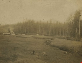
- Photograph of an unidentified man standing in the forefront with a jersey cow to the right, while a row of cabins and cleared tress can be seen in the background. A caption written above the photograph reads: "Boundary Road Lumber Mill owned by E.W. Nicholson." Underneath the photograph is written: "The first Jersey cow on the farm." On the back of the photograph it is noted that the buildings in the background were workmen's buildings.
- Media Type
- Photograph
- Notes
- Title based on caption
- Geographic Access
- Boundary Road
- Still Creek
- Street Address
- 2550 Boundary Road
- Historic Neighbourhood
- Broadview (Historic Neighbourhood)
- Planning Study Area
- West Central Valley Area
Images
Broadway Jersey Ranch
https://search.heritageburnaby.ca/link/archivedescription38259
- Repository
- City of Burnaby Archives
- Date
- 1931
- Collection/Fonds
- Burnaby Historical Society fonds
- Description Level
- Item
- Physical Description
- 1 photograph : b&w ; 10.5 x 15.4 cm
- Scope and Content
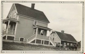
- Photograph of a house and barn identified as E.W. Nicholson's "Broadway Jersey Ranch." Three men and a team of horses can be seen to the right of the house. The men may be E.W. Nicholoson, John McCallum and George Dell.
- Repository
- City of Burnaby Archives
- Date
- 1931
- Collection/Fonds
- Burnaby Historical Society fonds
- Subseries
- Margaret McCallum subseries
- Physical Description
- 1 photograph : b&w ; 10.5 x 15.4 cm
- Description Level
- Item
- Record No.
- 375-021
- Access Restriction
- No restrictions
- Reproduction Restriction
- No known restrictions
- Accession Number
- BHS1986-42
- Scope and Content
- Photograph of a house and barn identified as E.W. Nicholson's "Broadway Jersey Ranch." Three men and a team of horses can be seen to the right of the house. The men may be E.W. Nicholoson, John McCallum and George Dell.
- Media Type
- Photograph
- Notes
- Title based on caption
- Geographic Access
- Boundary Road
- Street Address
- 2550 Boundary Road
- Historic Neighbourhood
- Broadview (Historic Neighbourhood)
- Planning Study Area
- West Central Valley Area
Images
building
https://search.heritageburnaby.ca/link/museumartifact3846
- Repository
- Burnaby Village Museum
- Accession Code
- BV988.33.1
- Description
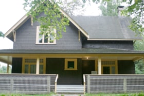
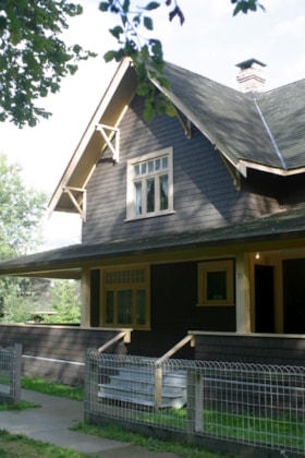
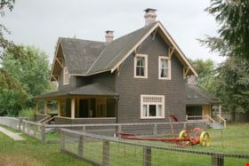
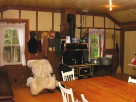
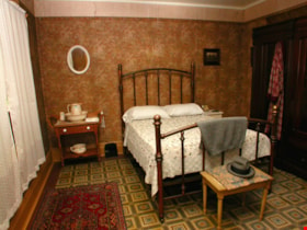
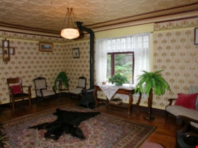
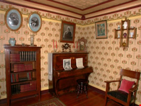
- The core of the Jessie Love farm house is a 1893 two story, pioneer tent style building. The home was added to over the years and became a large Craftsmen style farm house.
- Object History
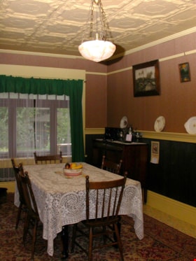
- Built on Cumberland Road in Burnaby in 1893. Music Room/Parlour/Living Room and bedrooms above added c.1898. Kitchen added c.1908. The home of Jesse and Martha Love and their eleven children. One of Burnaby's oldest structures. The home was moved to Burnaby Village Museum in the late 1980s and has been partially restored to its 1920s appearance.
- Category
- 01. Built Environment Objects
- Classification
- Structures - - Dwellings
- Object Term
- House
- Colour
- Brown
- Culture
- Canadian
- Geographic Access
- Cumberland Street
- Street Address
- 6501 Deer Lake Avenue
- Historic Neighbourhood
- East Burnaby (Historic Neighbourhood)
- Planning Study Area
- Cariboo-Armstrong Area
Images
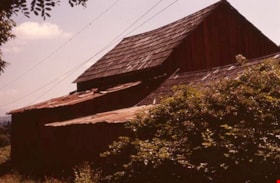
Buildings on Lubbock farm
https://search.heritageburnaby.ca/link/museumdescription12783
- Repository
- Burnaby Village Museum
- Date
- 1977
- Collection/Fonds
- Century Park Museum Association fonds
- Description Level
- Item
- Physical Description
- 1 photograph : col. slide ; 35 mm
- Scope and Content
- Photograph of the cedar shingled rooftops of the Lubbock barn and out buildings that were located at at 7803 Burris Street near Burnaby Lake. Bushes, trees and tall grasses surround the buildings.
- Repository
- Burnaby Village Museum
- Collection/Fonds
- Century Park Museum Association fonds
- Description Level
- Item
- Physical Description
- 1 photograph : col. slide ; 35 mm
- Scope and Content
- Photograph of the cedar shingled rooftops of the Lubbock barn and out buildings that were located at at 7803 Burris Street near Burnaby Lake. Bushes, trees and tall grasses surround the buildings.
- History
- In 1977, Century Park Museum was granted access to the Sprott-Lubbock farm to appraise the heritage buildings for preservation. Buildings that were saved included the old farrier shed (BV985.1240.2) which was also used as a blacksmith shop and the Vorce tram station building (BV985.1240.3) from the old Burnaby Lake Interurban line which was used as a grain storage shed on the property. Segments of the original farmhouse and other out buildings were retained. Other buildings on the site were demolished to make way for a new housing development.
- Subjects
- Agriculture - Farms
- Names
- Lubbock farm
- Geographic Access
- Grandview Highway
- Burris Street
- Street Address
- 7803 Burris Street
- Accession Code
- BV020.5.460
- Access Restriction
- No restrictions
- Reproduction Restriction
- No known restrictions
- Date
- 1977
- Media Type
- Photograph
- Historic Neighbourhood
- Burnaby Lake (Historic Neighbourhood)
- Planning Study Area
- Morley-Buckingham Area
- Scan Resolution
- 2400
- Scan Date
- 13-Mar-20
- Scale
- 100
- Notes
- Title based on contents of photograph
Images
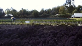
Burnaby’s Chinese Canadian Market Gardens
https://search.heritageburnaby.ca/link/museumdescription4484
- Repository
- Burnaby Village Museum
- Date
- 2018
- Collection/Fonds
- Burnaby Village Museum fonds
- Description Level
- Item
- Physical Description
- 1 video recording (mp4) (3 min., 15 sec.) : digital, 23 fps, col., sd., stereo
- Scope and Content
- This short film was produced by the City of Burnaby Community Heritage Commission to commemorate Burnaby's 125th anniversary. It features the story of market gardens operated by Chinese Canadian families in the Big Bend area.
- Repository
- Burnaby Village Museum
- Collection/Fonds
- Burnaby Village Museum fonds
- Description Level
- Item
- Physical Description
- 1 video recording (mp4) (3 min., 15 sec.) : digital, 23 fps, col., sd., stereo
- Scope and Content
- This short film was produced by the City of Burnaby Community Heritage Commission to commemorate Burnaby's 125th anniversary. It features the story of market gardens operated by Chinese Canadian families in the Big Bend area.
- Publisher
- City of Burnaby
- Other Title Information
- title given by film makers
- Subjects
- Agriculture - Farms
- Names
- Hop On Farms
- Accession Code
- BV018.12.2
- Access Restriction
- No restrictions
- Reproduction Restriction
- May be restricted by third party rights
- Date
- 2018
- Media Type
- Moving Images
- Historic Neighbourhood
- Fraser Arm (Historic Neighbourhood)
- Planning Study Area
- Big Bend Area
- Notes
- Transcribed title
- Reproduction of content is restricted
Images
Video
Burnaby’s Chinese Canadian Market Gardens, 2018
Burnaby’s Chinese Canadian Market Gardens, 2018
https://search.heritageburnaby.ca/media/hpo/_Data/_BVM_Moving_Images/2018_0012_0002_001.mp4Byrne farm
https://search.heritageburnaby.ca/link/archivedescription37102
- Repository
- City of Burnaby Archives
- Date
- [1903] (date of original), copied 1995
- Collection/Fonds
- Burnaby Historical Society fonds
- Description Level
- Item
- Physical Description
- 1 photograph : b&w ; 10 x 15 cm print
- Scope and Content
- Photograph of Peter Byrne and his children; son Ultan, and twin daughters; Norah and Mary outside of their house on the Byrne farm on River Road. Peter Byrne was Reeve of Burnaby from 1906 to 1910. Earlier, he also served as a member of Council from 1894 to 1895 and from 1898 to 1906.
- Repository
- City of Burnaby Archives
- Date
- [1903] (date of original), copied 1995
- Collection/Fonds
- Burnaby Historical Society fonds
- Subseries
- Byrne family subseries
- Physical Description
- 1 photograph : b&w ; 10 x 15 cm print
- Description Level
- Item
- Record No.
- 316-008
- Access Restriction
- No restrictions
- Reproduction Restriction
- No known restrictions
- Accession Number
- BHS1995-04
- Scope and Content
- Photograph of Peter Byrne and his children; son Ultan, and twin daughters; Norah and Mary outside of their house on the Byrne farm on River Road. Peter Byrne was Reeve of Burnaby from 1906 to 1910. Earlier, he also served as a member of Council from 1894 to 1895 and from 1898 to 1906.
- Media Type
- Photograph
- Notes
- Title based on contents of photograph
Images
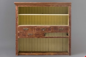
Cabinet
https://search.heritageburnaby.ca/link/museumartifact90896
- Repository
- Burnaby Village Museum
- Accession Code
- BV021.3.1
- Description
- Worn wooden cabinet made from Douglas Fir and cedar. The interior of the cabinet is painted a pale yellow. One third of the cabinet closest to the ground houses a large open shevling area with the back paneling visible. The middle of the cabinet has 5 slots for drawers with metal handles. One drawer is missing. The top third of the cabinet is split into 2 shelves with a yellow board bisecting the top shelf. Chinese characters are painted in black on the back of the shelving unit.
- Object History
- The cabinet was found in the Thrussell farmhouse on Marine Drive in Burnaby in the 1999.The Thrussell's land had been leased to Chinese tenant farmers by the Thrussell family and also previous owners. The City demolished the house, but they salvaged many items in the house before doing so. Of note are the Chinese characters and the joinery and construction of the cabinet. Chinese characters are painted in black on the back of the shelving unit The first two characters refer to pine wood and the last character is stem or branch.
- Category
- 02. Furnishings
- Classification
- Household Accessories - - Storage & Display Accessories
- Object Term
- Cabinet
- Colour
- Brown
- Yellow
- Measurements
- 42” high x 42” wide x 14” width
- Geographic Access
- Marine Drive
- Nelson Avenue
- Historic Neighbourhood
- Fraser Arm (Historic Neighbourhood)
- Planning Study Area
- Big Bend Area
Images
Calf Barn at Oakalla
https://search.heritageburnaby.ca/link/archivedescription38131
- Repository
- City of Burnaby Archives
- Date
- [195-] (date of original), copied 1991
- Collection/Fonds
- Burnaby Historical Society fonds
- Description Level
- Item
- Physical Description
- 1 photograph : b&w ; 3.0 x 4.3 cm print on contact sheet 19.8 x 26.2 cm
- Scope and Content
- Photograph of the exterior of the calf barn at Oakalla Prison Farm.
- Repository
- City of Burnaby Archives
- Date
- [195-] (date of original), copied 1991
- Collection/Fonds
- Burnaby Historical Society fonds
- Subseries
- Burnaby Image Bank subseries
- Physical Description
- 1 photograph : b&w ; 3.0 x 4.3 cm print on contact sheet 19.8 x 26.2 cm
- Description Level
- Item
- Record No.
- 370-718
- Access Restriction
- No restrictions
- Reproduction Restriction
- Reproduce for fair dealing purposes only
- Accession Number
- BHS1999-03
- Scope and Content
- Photograph of the exterior of the calf barn at Oakalla Prison Farm.
- Subjects
- Buildings - Agricultural - Barns
- Agriculture - Farms
- Buildings - Public - Detention Facilities
- Names
- Oakalla Prison Farm
- Media Type
- Photograph
- Notes
- Title based on contents of photograph
- 1 b&w copy negative accompanying
- Negative has a pink cast
- Geographic Access
- Oakmount Crescent
- Street Address
- 5220 Oakmount Crescent
- Historic Neighbourhood
- Burnaby Lake (Historic Neighbourhood)
- Planning Study Area
- Oakalla Area
Images
Canoe floating on flooded farm
https://search.heritageburnaby.ca/link/museumdescription4059
- Repository
- Burnaby Village Museum
- Date
- [1948]
- Collection/Fonds
- Julie Lee and Cecil Lee family fonds
- Description Level
- Item
- Physical Description
- 1 photograph (tiff) : sepia ; 1000 dpi
- Scope and Content
- Photograph of Suey Ying Jung (Laura) and Puy Yuen Chan in a canoe on the flooded family farm; background contains trees and a building.
- Repository
- Burnaby Village Museum
- Collection/Fonds
- Julie Lee and Cecil Lee family fonds
- Description Level
- Item
- Physical Description
- 1 photograph (tiff) : sepia ; 1000 dpi
- Scope and Content
- Photograph of Suey Ying Jung (Laura) and Puy Yuen Chan in a canoe on the flooded family farm; background contains trees and a building.
- Accession Code
- BV017.24.12
- Access Restriction
- No restrictions
- Reproduction Restriction
- No known restrictions
- Date
- [1948]
- Media Type
- Photograph
- Historic Neighbourhood
- Burnaby Lake (Historic Neighbourhood)
- Planning Study Area
- Douglas-Gilpin Area
- Scan Resolution
- 1000
- Scan Date
- 01-Oct-2017
- Scale
- 100
- Notes
- Title based on contents of photograph
Images
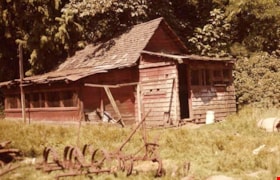
Chicken coop building
https://search.heritageburnaby.ca/link/museumdescription12796
- Repository
- Burnaby Village Museum
- Date
- 1977
- Collection/Fonds
- Century Park Museum Association fonds
- Description Level
- Item
- Physical Description
- 1 photograph : col. slide ; 35 mm
- Scope and Content
- Photograph of a building that was used as a chicken coop on the Lubbock farm located at 7803 Burris Street near Burnaby Lake.
- Repository
- Burnaby Village Museum
- Collection/Fonds
- Century Park Museum Association fonds
- Description Level
- Item
- Physical Description
- 1 photograph : col. slide ; 35 mm
- Scope and Content
- Photograph of a building that was used as a chicken coop on the Lubbock farm located at 7803 Burris Street near Burnaby Lake.
- History
- In 1977, Century Park Museum was granted access to the Sprott-Lubbock farm to appraise the heritage buildings for preservation. Buildings that were saved included the old farrier shed (BV985.1240.2) which was also used as a blacksmith shop and the Vorce tram station building (BV985.1240.3) from the old Burnaby Lake Interurban line which was used as a grain storage shed on the property. Segments of the original farmhouse and other out buildings were retained. Other buildings on the site were demolished to make way for a new housing development.
- Subjects
- Agriculture - Farms
- Names
- Lubbock farm
- Geographic Access
- Grandview Highway
- Burris Street
- Street Address
- 7803 Burris Street
- Accession Code
- BV020.5.473
- Access Restriction
- No restrictions
- Reproduction Restriction
- No known restrictions
- Date
- 1977
- Media Type
- Photograph
- Historic Neighbourhood
- Burnaby Lake (Historic Neighbourhood)
- Planning Study Area
- Morley-Buckingham Area
- Scan Resolution
- 2400
- Scan Date
- 13-Mar-20
- Scale
- 100
- Notes
- Title based on contents of photograph
Images
Child standing in front of farm house
https://search.heritageburnaby.ca/link/museumdescription19911
- Repository
- Burnaby Village Museum
- Date
- [1927 or 1928]
- Collection/Fonds
- Esther Love Stanley fonds
- Description Level
- Item
- Physical Description
- 1 photograph : b&w ; 6.5 x 11 cm
- Scope and Content
- Photograph of a child standing on snow covered ground in front of a farm house with windmill in Alberta. The child could be a member of the Sommers family.
- Repository
- Burnaby Village Museum
- Collection/Fonds
- Esther Love Stanley fonds
- Description Level
- Item
- Physical Description
- 1 photograph : b&w ; 6.5 x 11 cm
- Scope and Content
- Photograph of a child standing on snow covered ground in front of a farm house with windmill in Alberta. The child could be a member of the Sommers family.
- Subjects
- Agriculture - Farms
- Names
- Sommers Family
- Accession Code
- BV022.32.333
- Access Restriction
- No restrictions
- Reproduction Restriction
- No known restrictions
- Date
- [1927 or 1928]
- Media Type
- Photograph
- Scan Resolution
- 600
- Scan Date
- 2023-06-09
- Notes
- Title based on contents of photograph
- Photograph is part of Esther Love Stanley photograph album 1 (BV022.32.1)
- Note in black ink on verso of photograph reads: "1927-28"
Images
Claude Hill
https://search.heritageburnaby.ca/link/archivedescription39336
- Repository
- City of Burnaby Archives
- Date
- [1915]
- Collection/Fonds
- Peers Family and Hill Family fonds
- Description Level
- Item
- Physical Description
- 1 photograph : b&w ; 5.9 x 10.4 cm on page 24.5 x 32.5 cm (pasted in album)
- Scope and Content
- Photograph of Claude Hill in his fields, standing next to a row of bushes and fence posts.
- Repository
- City of Burnaby Archives
- Date
- [1915]
- Collection/Fonds
- Peers Family and Hill Family fonds
- Physical Description
- 1 photograph : b&w ; 5.9 x 10.4 cm on page 24.5 x 32.5 cm (pasted in album)
- Description Level
- Item
- Record No.
- 477-655
- Access Restriction
- No restrictions
- Reproduction Restriction
- No known restrictions
- Accession Number
- 2007-12
- Scope and Content
- Photograph of Claude Hill in his fields, standing next to a row of bushes and fence posts.
- Subjects
- Agriculture - Farms
- Media Type
- Photograph
- Notes
- Title based on contents of photograph
- Historic Neighbourhood
- Burnaby Lake (Historic Neighbourhood)
- Planning Study Area
- Morley-Buckingham Area
Images
Construction of dykes on Nicomen Island
https://search.heritageburnaby.ca/link/archivedescription34330
- Repository
- City of Burnaby Archives
- Date
- 1927
- Collection/Fonds
- Burnaby Historical Society fonds
- Description Level
- Item
- Physical Description
- 1 photograph : sepia ; 5 x 13.5 cm on page 17.5 x 22.7 cm
- Scope and Content
- Photograph of a farm and field along the Fraser River next to dykes that are being built on Nicomen Island.
- Repository
- City of Burnaby Archives
- Date
- 1927
- Collection/Fonds
- Burnaby Historical Society fonds
- Subseries
- Peers family subseries
- Physical Description
- 1 photograph : sepia ; 5 x 13.5 cm on page 17.5 x 22.7 cm
- Description Level
- Item
- Record No.
- 020-037
- Access Restriction
- No restrictions
- Reproduction Restriction
- No known restrictions
- Accession Number
- BHS2007-04
- Scope and Content
- Photograph of a farm and field along the Fraser River next to dykes that are being built on Nicomen Island.
- Media Type
- Photograph
- Notes
- Title based on caption accompanying photograph
Images
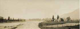
Dairy and Silos at Oakalla
https://search.heritageburnaby.ca/link/archivedescription38129
- Repository
- City of Burnaby Archives
- Date
- [195-] (date of original), copied 1991
- Collection/Fonds
- Burnaby Historical Society fonds
- Description Level
- Item
- Physical Description
- 1 photograph : b&w ; 3.0 x 4.3 cm print on contact sheet 19.8 x 26.2 cm
- Scope and Content
- Photograph of the exterior of the dairy and silos at Oakalla Prison Farm.
- Repository
- City of Burnaby Archives
- Date
- [195-] (date of original), copied 1991
- Collection/Fonds
- Burnaby Historical Society fonds
- Subseries
- Burnaby Image Bank subseries
- Physical Description
- 1 photograph : b&w ; 3.0 x 4.3 cm print on contact sheet 19.8 x 26.2 cm
- Description Level
- Item
- Record No.
- 370-716
- Access Restriction
- No restrictions
- Reproduction Restriction
- Reproduce for fair dealing purposes only
- Accession Number
- BHS1999-03
- Scope and Content
- Photograph of the exterior of the dairy and silos at Oakalla Prison Farm.
- Names
- Oakalla Prison Farm
- Media Type
- Photograph
- Notes
- Title based on contents of photograph
- 1 b&w copy negative accompanying
- Negative has a pink cast
- Geographic Access
- Oakmount Crescent
- Street Address
- 5220 Oakmount Crescent
- Historic Neighbourhood
- Burnaby Lake (Historic Neighbourhood)
- Planning Study Area
- Oakalla Area
Images
Deer Lake Drive
https://search.heritageburnaby.ca/link/museumdescription1085
- Repository
- Burnaby Village Museum
- Date
- [1918]
- Collection/Fonds
- Burnaby Village Museum Photograph collection
- Description Level
- Item
- Physical Description
- 1 photograph : b&w ; 12.9 x 32.9 cm
- Scope and Content
- Photograph is a panorama of Deer Lake Drive, including the Ceperley mansion and the surrounding grounds of the home to the left of the picture. The photograph, taken from the water tower, with Burnaby Lake in the background. In the midground, following the horizon line, power poles can be seen. Far…
- Repository
- Burnaby Village Museum
- Collection/Fonds
- Burnaby Village Museum Photograph collection
- Description Level
- Item
- Physical Description
- 1 photograph : b&w ; 12.9 x 32.9 cm
- Scope and Content
- Photograph is a panorama of Deer Lake Drive, including the Ceperley mansion and the surrounding grounds of the home to the left of the picture. The photograph, taken from the water tower, with Burnaby Lake in the background. In the midground, following the horizon line, power poles can be seen. Farm lands are visible leading down to the homes of the Andersons. An annotation on the back of the photo in pencil reads, "Deer Lake Dr." and an annotation in blue pen reads, "1918."
- Geographic Access
- Deer Lake Drive
- Deer Lake Avenue
- Street Address
- 6344 Deer Lake Avenue
- Accession Code
- HV972.51.12
- Access Restriction
- No restrictions
- Reproduction Restriction
- No known restrictions
- Date
- [1918]
- Media Type
- Photograph
- Historic Neighbourhood
- Burnaby Lake (Historic Neighbourhood)
- Planning Study Area
- Douglas-Gilpin Area
- Scan Resolution
- 600
- Scan Date
- 2023-04-04
Images
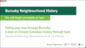
Eating your way through Burnaby: A look at Chinese Canadian history through food
https://search.heritageburnaby.ca/link/museumdescription14762
- Repository
- Burnaby Village Museum
- Date
- 27 Oct. 2020
- Collection/Fonds
- Burnaby Village Museum fonds
- Description Level
- Item
- Physical Description
- 1 video recording (mp4) (61 min., 56 sec.) : digital, col., sd., stereo ; 29 fps
- Scope and Content
- Item consists of a video recording of a live Zoom webinar hosted by Kate Petrusa, Burnaby Village Museum assistant curator. The webinar is titled "Eating your way through Burnaby: A look at Chinese Canadian history through food" and is presented by Denise Fong, Planning Assistant for the City of Bu…
- Repository
- Burnaby Village Museum
- Collection/Fonds
- Burnaby Village Museum fonds
- Description Level
- Item
- Physical Description
- 1 video recording (mp4) (61 min., 56 sec.) : digital, col., sd., stereo ; 29 fps
- Material Details
- Presenter: Denise Fong
- Host: Kate Petrusa
- Date of Presentation: October 27 7:00 pm - 8:00 pm
- Total Number of tracks: 1
- Total Length of all tracks:61 min., 56 sec.
- Recording Device: Zoom video communication platform
- Scope and Content
- Item consists of a video recording of a live Zoom webinar hosted by Kate Petrusa, Burnaby Village Museum assistant curator. The webinar is titled "Eating your way through Burnaby: A look at Chinese Canadian history through food" and is presented by Denise Fong, Planning Assistant for the City of Burnaby. The zoom webinar is the seventh in a collection of seven "Burnaby Neighbourhood Speaker series" webinars that were presented and made available to the public between September 29 and October 27, 2020. The live webinar and recording was also made available on the Burnaby Village Museum's facebook page. In this webinar, Denise Fong talks about how Chinese Canadians have played a key role in supplying food to Burnaby’s community through their participation in the local market gardening, green grocer, and restaurant industries. The presentation is supported with historical maps, photographs, documents, census records and stories from recent research on the 1960s-1970s period in Burnaby’s Big Bend and Capitol Hill neighborhoods. In her presentation, Denise also talks about the history of Chinese Immigration in Canada including the political circumstances and legal barriers that Chinese migrants faced in the late nineteenth to early twentieth century. Denise highlights specific Chinese Canadian family farms in Burnaby including; the Jung family farm located on 5460 Douglas Road operated by Jung Chong and his wife Jung Gee Shee; "Hop On Farms" located on Marine Drive, operated by Chan Kow Hong, Sui Ha Hong and family; the Tong Yip Farm located on Byrne Road operated by D.T. "George" Yip and his wife, Yip Chow Won Tai. Denise also highlights her recent research regarding Chinese Canadian corner stores and green grocers in Burnaby including; The Lee Kee grocery store located at 3824 East Hastings Street, owned and operated by Yow Lee Ko and his wife Say Jan Chan; the Burnaby Market located at 3942 East Hastings Street, owned and operated by Chin Yin Wong; the Quon Bros. located at 3702 East Hastings Street.; Y. Hoy Produce Co. located at 4092 East Hastings Street operated by Hoy Yen; Louie's Food Basket located at 5886 South East Marine Drive operated by Hoy Bew Louie, his wife Poy Yee and later by thier son Bing Louie and Tommy's Market located in Burnaby's Edmonds neighbourhood, operated by Tommy Chu. Denise also provides a detailed history of Tommy Chu and family who owned and operated Tommy's Market. Denise tells of how in the early 1970s, Chinese grocers in the lower mainland came together and formed the Lower Mainland Independent Grocers Association and Lower Mainland Grocers Co-Op. The organization was formed to protect the rights and promote businesses of independent grocers. In closing, Denise explains how her research of Chinese Canadian history in Burnaby continues and by the end of the project, the information will be made accessible in the form of a publication.
- Creator
- Burnaby Village Museum
- Subjects
- Persons - Chinese Canadians
- Social Issues - Discrimination
- Agriculture - Farms
- Social Issues - Racism
- Buildings - Commercial - Grocery Stores
- Names
- Fong, Denise
- Jung, Chung Chong
- Tommy's Produce
- Lee Kee Grocery
- Louie's Food Basket
- Louie, Hoy Bew
- Jung, Gee Shee
- Hong, Chan Kow
- Hong, Sui Ha
- Yip, D.T. "George"
- Yip, Chow Won Tai
- Ko, Yow Lee
- Ko, Chan Say Jan
- Burnaby Market
- Wong, Chin Yin
- Quon Bros.
- Y. Hoy Produce Co.
- Yen, Hoy
- Louie, Poy Yee
- Louie, Bing
- Chu, Tommy
- Chu, Sharon
- Chu, Calvin
- Responsibility
- Petrusa, Kate
- Geographic Access
- Hastings Street
- Accession Code
- BV020.29.7
- Access Restriction
- No restrictions
- Reproduction Restriction
- No known restrictions
- Date
- 27 Oct. 2020
- Media Type
- Moving Images
- Historic Neighbourhood
- Fraser Arm (Historic Neighbourhood)
- Vancouver Heights (Historic Neighbourhood)
- Planning Study Area
- Big Bend Area
- Burnaby Heights Area
- Notes
- Title based on contents of video recording
- Video recording was edited for publication on Heritage Burnaby. Original mp4 video recording (BV020.29.7.1) is 72 min., 14 sec.
Images
Video
Eating your way through Burnaby: A look at Chinese Canadian history through food, 27 Oct. 2020
Eating your way through Burnaby: A look at Chinese Canadian history through food, 27 Oct. 2020
https://search.heritageburnaby.ca/media/hpo/_Data/_BVM_Moving_Images/2020_0029_0007_002.mp4Elgin Avenue farmhouse
https://search.heritageburnaby.ca/link/archivedescription35034
- Repository
- City of Burnaby Archives
- Date
- [between 1920 and 1925] (date of original), copied 1986
- Collection/Fonds
- Burnaby Historical Society fonds
- Description Level
- Item
- Physical Description
- 1 photograph : b&w ; 8.7 x 12.7 cm print
- Scope and Content
- Photograph of the exterior of an Elgin Avenue farmhouse and surrounding property. The farmhouse is at the left side of the photograph, and a chicken barn is at the right side. This may be 6389 Elgin Avenue.
- Repository
- City of Burnaby Archives
- Date
- [between 1920 and 1925] (date of original), copied 1986
- Collection/Fonds
- Burnaby Historical Society fonds
- Subseries
- Chamberlain family subseries
- Physical Description
- 1 photograph : b&w ; 8.7 x 12.7 cm print
- Description Level
- Item
- Record No.
- 179-005
- Access Restriction
- No restrictions
- Reproduction Restriction
- No known restrictions
- Accession Number
- BHS1986-27
- Scope and Content
- Photograph of the exterior of an Elgin Avenue farmhouse and surrounding property. The farmhouse is at the left side of the photograph, and a chicken barn is at the right side. This may be 6389 Elgin Avenue.
- Media Type
- Photograph
- Notes
- Title based on contents of photograph
- Geographic Access
- Elgin Avenue
- Street Address
- 6389 Elgin Avenue
- Historic Neighbourhood
- Central Park (Historic Neighbourhood)
- Planning Study Area
- Windsor Area
Images
Farm building covered with brambles
https://search.heritageburnaby.ca/link/museumdescription12811
- Repository
- Burnaby Village Museum
- Date
- 1977
- Collection/Fonds
- Century Park Museum Association fonds
- Description Level
- Item
- Physical Description
- 1 photograph : col. slide ; 35 mm
- Scope and Content
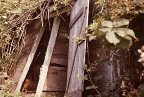
- Photograph of a wooden building on the Lubbock farm. The building is overgrown with blackberry bushes.
- Repository
- Burnaby Village Museum
- Collection/Fonds
- Century Park Museum Association fonds
- Description Level
- Item
- Physical Description
- 1 photograph : col. slide ; 35 mm
- Scope and Content
- Photograph of a wooden building on the Lubbock farm. The building is overgrown with blackberry bushes.
- History
- In 1977, Century Park Museum was granted access to the Sprott-Lubbock farm to appraise the heritage buildings for preservation. Buildings that were saved included the old farrier shed (BV985.1240.2) which was also used as a blacksmith shop and the Vorce tram station building (BV985.1240.3) from the old Burnaby Lake Interurban line which was used as a grain storage shed on the property. Segments of the original farmhouse and other out buildings were retained. Other buildings on the site were demolished to make way for a new housing development.
- Subjects
- Agriculture - Farms
- Names
- Lubbock farm
- Geographic Access
- Grandview Highway
- Burris Street
- Street Address
- 7803 Burris Street
- Accession Code
- BV020.5.478
- Access Restriction
- No restrictions
- Reproduction Restriction
- No known restrictions
- Date
- 1977
- Media Type
- Photograph
- Historic Neighbourhood
- Burnaby Lake (Historic Neighbourhood)
- Planning Study Area
- Morley-Buckingham Area
- Scan Resolution
- 2400
- Scan Date
- 13-Mar-20
- Scale
- 100
- Notes
- Title based on contents of photograph
![Boat being hauled, [1955] thumbnail](/media/Hpo/_Data/_Archives_Images/_Unrestricted/205/215-004.jpg?width=280)
![Byrne farm, [1903] (date of original), copied 1995 thumbnail](/media/hpo/_Data/_Archives_Images/_Unrestricted/316/316-008.jpg?width=280)

![Calf Barn at Oakalla, [195-] (date of original), copied 1991 thumbnail](/media/hpo/_Data/_Archives_Images/_Unrestricted/370/370-718.jpg?width=280)
![Canoe floating on flooded farm, [1948] thumbnail](/media/hpo/_Data/_BVM_Images/2017/2017_0024_0012_001.jpg?width=280)
![Child standing in front of farm house, [1927 or 1928] thumbnail](/media/hpo/_Data/_BVM_Images/2022/2022_0032_0333_001.jpg?width=280)
![Claude Hill, [1915] thumbnail](/media/hpo/_Data/_Archives_Images/_Unrestricted/477/477-655.jpg?width=280)
![Dairy and Silos at Oakalla, [195-] (date of original), copied 1991 thumbnail](/media/hpo/_Data/_Archives_Images/_Unrestricted/370/370-716.jpg?width=280)
![Deer Lake Drive, [1918] thumbnail](/media/hpo/_Data/_BVM_Images/1972/1972_0051_0012_001.jpg?width=280)
![Elgin Avenue farmhouse, [between 1920 and 1925] (date of original), copied 1986 thumbnail](/media/hpo/_Data/_Archives_Images/_Unrestricted/126/179-005.jpg?width=280)
