Narrow Results By
The 26 letters
https://search.heritageburnaby.ca/link/museumlibrary5978
- Repository
- Burnaby Village Museum
- Author
- Ogg, Oscar
- Publication Date
- c1961
- c1948
- Call Number
- 745.6 OGG
- Repository
- Burnaby Village Museum
- Collection
- Reference Collection
- Material Type
- Book
- Call Number
- 745.6 OGG
- Author
- Ogg, Oscar
- Place of Publication
- New York
- Publisher
- Thomas Y. Crowell Company
- Publication Date
- c1961
- c1948
- Physical Description
- 262 p. ; ill., maps ; 22 cm.
- Library Subject (LOC)
- Alphabets
- Writing
- Lettering
- Type and type-founding
- Notes
- Includes index.
- Includes pictures of different types
Apartment Study Maps
https://search.heritageburnaby.ca/link/councilreport35474
- Repository
- City of Burnaby Archives
- Report ID
- 31520
- Meeting Date
- 13-Jun-1966
- Format
- Council - Manager's Report
- Manager's Report No.
- 34
- Item No.
- 23
- Collection/Fonds
- City Council and Office of the City Clerk fonds
- Repository
- City of Burnaby Archives
- Report ID
- 31520
- Meeting Date
- 13-Jun-1966
- Format
- Council - Manager's Report
- Manager's Report No.
- 34
- Item No.
- 23
- Collection/Fonds
- City Council and Office of the City Clerk fonds
Apartment study notice addressed to A.G. Shore
https://search.heritageburnaby.ca/link/museumdescription17248
- Repository
- Burnaby Village Museum
- Date
- 8 Mar. 1966
- Collection/Fonds
- Burnaby Village Museum Document collection
- Description Level
- Item
- Physical Description
- 1 p.
- Scope and Content
- Item consists of a notice from the Corporation of the District of Burnaby, addressed to A.G. Shore, 1322 Gilmore Avenue, Burnaby regarding an Apartment Study for proposed apartment developments. The notice is dated March 8, 1966 and is signed by Burnaby Reeve, Alan H. Emmott. Notice is double sid…
- Repository
- Burnaby Village Museum
- Collection/Fonds
- Burnaby Village Museum Document collection
- Description Level
- Item
- Physical Description
- 1 p.
- Scope and Content
- Item consists of a notice from the Corporation of the District of Burnaby, addressed to A.G. Shore, 1322 Gilmore Avenue, Burnaby regarding an Apartment Study for proposed apartment developments. The notice is dated March 8, 1966 and is signed by Burnaby Reeve, Alan H. Emmott. Notice is double sided and includes a map of with locations of apartment development proposals.
- Accession Code
- BV999.10.1
- Access Restriction
- No restrictions
- Reproduction Restriction
- No known restrictions
- Date
- 8 Mar. 1966
- Media Type
- Textual Record
- Notes
- Title based on contents of item
Arrow Neon Sign
https://search.heritageburnaby.ca/link/landmark861
- Repository
- Burnaby Heritage Planning
- Description
- Commercial building.
- Associated Dates
- 1961
- Other Names
- Lost in the 50's Drive-in
- Street View URL
- Google Maps Street View
- Repository
- Burnaby Heritage Planning
- Other Names
- Lost in the 50's Drive-in
- Geographic Access
- Edmonds Street
- Associated Dates
- 1961
- Description
- Commercial building.
- Heritage Value
- The Arrow Neon Sign was built in 1961 by the Neonette Sign Company of New Westminster when this property was opened as the Tomahawk Drive-in Restaurant. The restaurant was later known as Lindy's Burger and in 1990, the business was renamed Lost in the 50's Drive-in. It stands 20-foot tall and is composed of a large double-sided hollow steel panel serpentine arrow mounted on a pole supporting a lexan sign panel measuring approximately 8 feet wide by 4 feet tall. The sign was designed with three illuminated features: a round lamp at the top of the pole, a double-sided rectangular fluorescent sign panel box, and two double-sided rows of orange neon arrows that follow the large serpentine arrow. The Arrow Neon Sign remains as a rare surviving example of neon sign art in the city and is the only historic neon sign in South Burnaby. The sign has gained prominence over the years as it has been associated with this small iconic drive-in which has also been utilized as a set for film production. Additionally, the drive-in has played a prominent role in the Edmonds community as a popular setting for recent "Show and Shine" participants to park their classic cars.
- Locality
- Edmonds
- Historic Neighbourhood
- East Burnaby (Historic Neighbourhood)
- Planning Study Area
- Lakeview-Mayfield Area
- Builder
- Neonette Sign Company
- Community
- Burnaby
- Contributing Resource
- Structure
- Ownership
- Public (local)
- Street Address
- 7741 Edmonds Street
- Street View URL
- Google Maps Street View
Images
The Automobile Association members handbook 1963
https://search.heritageburnaby.ca/link/museumlibrary6419
- Repository
- Burnaby Village Museum
- Collection
- Special Collection
- Material Type
- Book
- Accession Code
- BV014.17.67
- Call Number
- 914.2 AUT
- Place of Publication
- London
- Publisher
- The Automobile Association
- Publication Date
- c1963
- Series
- Members handbook series
- Physical Description
- 256 p. : col. maps ; 21 cm.
- Library Subject (LOC)
- Great Britain--Road maps
- Automobile driving
- Great Britain--Description and travel--Guidebooks
- Directories
Barnet Park papers
https://search.heritageburnaby.ca/link/archivedescription64451
- Repository
- City of Burnaby Archives
- Date
- 1942-1978
- Collection/Fonds
- Burnaby Historical Society fonds
- Description Level
- File
- Physical Description
- 1 file of textual records
- Scope and Content
- File consists of papers pertaining to the development of Barnet Park, including Engineering Department Reports to Council, correspondence between the North Burnaby Board of Trade and the Deputy Minister of Lands in Victoria, Burnaby Citizens' Committee for Access to Burrard Inlet at Barnet Park rec…
- Repository
- City of Burnaby Archives
- Date
- 1942-1978
- Collection/Fonds
- Burnaby Historical Society fonds
- Subseries
- North Burnaby Board of Trade subseries
- Physical Description
- 1 file of textual records
- Description Level
- File
- Record No.
- MSS118-002
- Accession Number
- BHS2005-8
- Scope and Content
- File consists of papers pertaining to the development of Barnet Park, including Engineering Department Reports to Council, correspondence between the North Burnaby Board of Trade and the Deputy Minister of Lands in Victoria, Burnaby Citizens' Committee for Access to Burrard Inlet at Barnet Park recommendations and a map of Burnaby from 1968 (to accompany Burnaby Zoning Bylaw 4742).
- Media Type
- Textual Record
- Notes
- Title based on contents of file
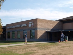
Bill Copeland Sports Centre & Burnaby Lake Arena
https://search.heritageburnaby.ca/link/landmark819
- Repository
- Burnaby Heritage Planning
- Geographic Access
- Kensington Avenue
- Associated Dates
- 1965
- Heritage Value
- In February 1965, the Planning Department presented to Burnaby Council a preliminary Development Plan entitled "Pacific Sports Centre," for the area immediately west of Burnaby Lake. This report proposed a conceptual plan for a comprehensive range of indoor and outdoor sporting facilities adjacent to Burnaby Lake. The idea was accepted by Council and led to the construction of the Burnaby Lake Rink beside the C.G. Brown Pool. In 1973, Burnaby and New Westminster jointly hosted the Canada Summer Games for which a rowing course and pavilion were built at Burnaby Lake and the success of the games and the sports facilities added within Burnaby Lake Park provided further stimulus for the creation of the sports and recreation facilities at this site.
- Historic Neighbourhood
- Burnaby Lake (Historic Neighbourhood)
- Planning Study Area
- Ardingley-Sprott Area
- Street Address
- 3676 Kensington Avenue
- Street View URL
- Google Maps Street View
Images
The Boy Scout series : map and compass, no. 7
https://search.heritageburnaby.ca/link/museumlibrary6366
- Repository
- Burnaby Village Museum
- Collection
- Special Collection
- Material Type
- Book
- Accession Code
- BV014.17.42
- Call Number
- 369.4 BOY No. 7
- Place of Publication
- Ottawa
- Publisher
- National Council, Scouts Canada
- Publication Date
- 1964
- Series
- The Boy Scout series ; no. 7
- Physical Description
- 32 p. : ill., maps ; 15 cm
- Library Subject (LOC)
- Orienteering
- Maps
- Compass
- Boys--Societies and clubs
- Scouting (youth activity)
- Names
- Boy Scouts of Canada
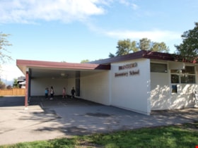
Brantford Elementary School
https://search.heritageburnaby.ca/link/landmark809
- Repository
- Burnaby Heritage Planning
- Geographic Access
- Brantford Avenue
- Associated Dates
- 1965
- Heritage Value
- As housing developments extended north from Kingsway, pupil enrolments grew at Windsor and at Morley Schools so Brantford was built equidistant from the two to help ease enrolment problems. Brantford Elementary school opened in 1965 and was similar in structure to other schools built in Burnaby during this period - no basements, no second stories and no high stairways. Classrooms were built in a line and could easily be added to as enrolments increased. Brantford had room additions in 1969.
- Historic Neighbourhood
- Edmonds (Historic Neighbourhood)
- Planning Study Area
- Kingsway-Beresford Area
- Street Address
- 6512 Brantford Avenue
- Street View URL
- Google Maps Street View
Images
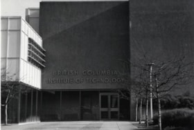
British Columbia Institute of Technology (BCIT)
https://search.heritageburnaby.ca/link/landmark806
- Repository
- Burnaby Heritage Planning
- Geographic Access
- Willingdon Avenue
- Associated Dates
- 1960
- Heritage Value
- The BC Vocational School was established in 1960 at Willingdon and Canada Way. By 1964, the British Columbia Insitute of Technology had opened and had 498 students enrolled. In the 1970s, the BC Vocational School had been renamed the Pacific Vocational Institute and in 1986 the two institutions merged. The school is a public post-secondary institution that is governed by a Board of Governors, under the authority of the Ministry of Advanced Education, Training and Technology. By 2004, the annual enrolment of part-time and full-time students reached 48,000.
- Planning Study Area
- Douglas-Gilpin Area
- Street Address
- 3700 Willingdon Avenue
- Street View URL
- Google Maps Street View
Images
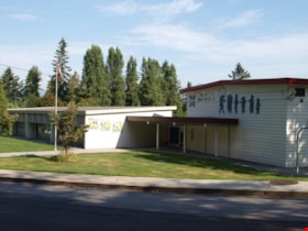
Buckingham Elementary School
https://search.heritageburnaby.ca/link/landmark832
- Repository
- Burnaby Heritage Planning
- Geographic Access
- Buckingham Avenue
- Associated Dates
- 1962
- Heritage Value
- Buckingham Elementary School opened in 1962 with 86 pupils. The school was intended to take some of the pressure off of both Lakeview and Morley Elementary Schools which saw large volumes of enrolments throughout the 1950s. In 1964, two additional rooms were built onto the school and in 1969 a library, staffroom and medical room were added.
- Historic Neighbourhood
- Burnaby Lake (Historic Neighbourhood)
- Planning Study Area
- Morley-Buckingham Area
- Street Address
- 6066 Buckingham Avenue
- Street View URL
- Google Maps Street View
Images
Burnaby North High School
https://search.heritageburnaby.ca/link/landmark745
- Repository
- Burnaby Heritage Planning
- Associated Dates
- 1923-1982
- Street View URL
- Google Maps Street View
- Repository
- Burnaby Heritage Planning
- Geographic Access
- Willingdon Avenue
- Associated Dates
- 1923-1982
- Heritage Value
- Burnaby North and Burnaby South were the first high schools built in the City. Before the high school opened, Burnaby students had to travel to Vancouver if they wished to pursue education beyond an elementary level. In 1921, arrangements were made to use the basement of the Presbyterian Church for instruction of local students. By 1922 the Burnaby North High School opened at its first permanent location (4375 Pandora Street - which is now Rosser Elementary). In 1945, the Willingdon Avenue site was built and was used until a new building was constructed in 1961 on Hammarskjold Drive. From 1962, the school was used as Burnaby Heights Junior High school, but it closed in 1982 and the junior high students went to the new Burnaby North on Hammarskjold.
- Historic Neighbourhood
- Capitol Hill (Historic Neighbourhood)
- Planning Study Area
- Capitol Hill Area
- Street Address
- 250 Willingdon Avenue
- Street View URL
- Google Maps Street View
Images
Burnaby North High School
https://search.heritageburnaby.ca/link/landmark788
- Repository
- Burnaby Heritage Planning
- Geographic Access
- Hammarskjold Drive
- Associated Dates
- 1961
- Heritage Value
- In 1961, Burnaby North High School moved from Willingdon Avenue to its new site on Hammarskjold Drive. The old school remained in use as a junior high school until 1982 at which point the junior high students also moved to the new Burnaby North High School.
- Planning Study Area
- Parkcrest-Aubrey Area
- Street Address
- 751 Hammarskjold Drive
- Street View URL
- Google Maps Street View
Images
Burnaby Sewer Division records
https://search.heritageburnaby.ca/link/archivedescription62792
- Repository
- City of Burnaby Archives
- Date
- [1959] -1964
- Collection/Fonds
- Burnaby Historical Society fonds
- Description Level
- File
- Physical Description
- 1 file of textual records
- Scope and Content
- File consists of a 1963 map of the sewer areas in Burnaby along with accompanying Schedules of Construction from the Burnaby Sewers Division for the years 1964 through 1966. Included in the file is an oversized street map of Burnaby produced between 1958 and 1964 which has names annotated in pencil…
- Repository
- City of Burnaby Archives
- Date
- [1959] -1964
- Collection/Fonds
- Burnaby Historical Society fonds
- Physical Description
- 1 file of textual records
- Description Level
- File
- Record No.
- MSS093-015
- Access Restriction
- Open access
- Accession Number
- BHS2000-01
- Scope and Content
- File consists of a 1963 map of the sewer areas in Burnaby along with accompanying Schedules of Construction from the Burnaby Sewers Division for the years 1964 through 1966. Included in the file is an oversized street map of Burnaby produced between 1958 and 1964 which has names annotated in pencil on properties west of Burnaby Lake (Broadview neighbourhood).
- Media Type
- Textual Record
- Cartographic Material
- Notes
- Title based on contents of file
Burnaby's history and location
https://search.heritageburnaby.ca/link/archivedescription57950
- Repository
- City of Burnaby Archives
- Date
- [1927]-1974
- Collection/Fonds
- Burnaby Historical Society fonds
- Description Level
- File
- Physical Description
- 1 file of textual records
- Scope and Content
- File contains newspaper clippings, maps and brochures explaining the history and importance of Burnaby.
- Repository
- City of Burnaby Archives
- Date
- [1927]-1974
- Collection/Fonds
- Burnaby Historical Society fonds
- Subseries
- Margaret McCallum subseries
- Physical Description
- 1 file of textual records
- Description Level
- File
- Record No.
- MSS029-002
- Accession Number
- BHS1986-42
- Scope and Content
- File contains newspaper clippings, maps and brochures explaining the history and importance of Burnaby.
- Media Type
- Textual Record
- Notes
- Title based on contents of file
Burnaby South High School
https://search.heritageburnaby.ca/link/landmark770
- Repository
- Burnaby Heritage Planning
- Associated Dates
- 1922-1988
- Street View URL
- Google Maps Street View
- Repository
- Burnaby Heritage Planning
- Geographic Access
- Southoaks Crescent
- Associated Dates
- 1922-1988
- Heritage Value
- Burnaby South and Burnaby North were Burnaby's first high schools. The first rooms of the school were built in 1922 on the same grounds as the Kingsway East Elementary School. In 1940, a two-storey building was erected and additions were made in 1963, 1967 and 1972. Kingsway East closed in 1925 and its buildings were used by the high school for Industrial Arts and Home Economics. In the early 1990s, a new "urban education centre" (Burnaby South/B.C. School for the Deaf) was opened, replacing the old Burnaby South High School.
- Historic Neighbourhood
- Edmonds (Historic Neighbourhood)
- Planning Study Area
- Kingsway-Beresford Area
- Street Address
- 6650 Southoaks Crescent
- Street View URL
- Google Maps Street View
Images
Burnaby Zoning Bylaw Maps # 1 - 18
https://search.heritageburnaby.ca/link/archivedescription10004
- Repository
- City of Burnaby Archives
- Date
- 1965
- Collection/Fonds
- City Council and Office of the City Clerk fonds
- Description Level
- Item
- Physical Description
- Architectural drawing ; 180cm x 44cm (18 pages)
- Scope and Content
- Burnaby Zoning maps for Zoning Bylaw 1965
- Repository
- City of Burnaby Archives
- Date
- 1965
- Collection/Fonds
- City Council and Office of the City Clerk fonds
- Series
- Zoning and Rezoning series
- Physical Description
- Architectural drawing ; 180cm x 44cm (18 pages)
- Description Level
- Item
- Record No.
- 12970
- Accession Number
- 2002-07
- Scope and Content
- Burnaby Zoning maps for Zoning Bylaw 1965
- Media Type
- Architectural Drawing
Bylaw Number: 4754 - Zoning Bylaw 1965, Amendment Bylaw No 1, 1965
https://search.heritageburnaby.ca/link/bylaw19615
- Repository
- Legislative Services
- Bylaw Number
- 4754
- Final Adoption
- 1965 Jul 09
- Format
- Bylaws - Adopted
- Collection/Fonds
- City Council and Office of the City Clerk fonds
- Repository
- Legislative Services
- Bylaw Number
- 4754
- Final Adoption
- 1965 Jul 09
- Format
- Bylaws - Adopted
- Collection/Fonds
- City Council and Office of the City Clerk fonds
Documents
Bylaw Number: 4787 - Zoning Bylaw 1965, Amendment Bylaw No 3, 1965
https://search.heritageburnaby.ca/link/bylaw19582
- Repository
- Legislative Services
- Bylaw Number
- 4787
- Final Adoption
- 1965 Sep 20
- Format
- Bylaws - Adopted
- Collection/Fonds
- City Council and Office of the City Clerk fonds
- Repository
- Legislative Services
- Bylaw Number
- 4787
- Final Adoption
- 1965 Sep 20
- Format
- Bylaws - Adopted
- Collection/Fonds
- City Council and Office of the City Clerk fonds
Documents
Bylaw Number: 4788 - Zoning Bylaw 1965, Amendment Bylaw No 4, 1965
https://search.heritageburnaby.ca/link/bylaw19581
- Repository
- Legislative Services
- Bylaw Number
- 4788
- Final Adoption
- 1965 Sep 20
- Format
- Bylaws - Adopted
- Collection/Fonds
- City Council and Office of the City Clerk fonds
- Repository
- Legislative Services
- Bylaw Number
- 4788
- Final Adoption
- 1965 Sep 20
- Format
- Bylaws - Adopted
- Collection/Fonds
- City Council and Office of the City Clerk fonds

