Narrow Results By
Subject
- Accidents 1
- Accidents - Automobile Accidents 6
- Advertising Medium 9
- Advertising Medium - Business Cards 1
- Advertising Medium - Signs and Signboards 41
- Aerial Photographs 16
- Agricultural Tools and Equipment - Gardening Equipment 1
- Agriculture 1
- Agriculture - Crops 1
- Agriculture - Farms 3
- Agriculture - Fruit and Berries 6
- Agriculture - Orchards 1
Kingsway East School
https://search.heritageburnaby.ca/link/landmark546
- Repository
- Burnaby Heritage Planning
- Description
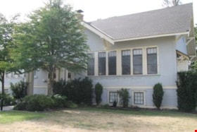
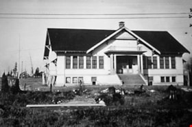
- The Kingsway East School is a two-storey wood-frame Arts and Crafts styled building. The school, and the adjacent cenotaph and memorial tennis courts, comprise Burnaby South Memorial Park.
- Associated Dates
- 1913
- Formal Recognition
- Heritage Designation, Community Heritage Register
- Other Names
- Alan Emmott Centre
- Street View URL
- Google Maps Street View
- Repository
- Burnaby Heritage Planning
- Other Names
- Alan Emmott Centre
- Geographic Access
- Southoaks Crescent
- Associated Dates
- 1913
- Formal Recognition
- Heritage Designation, Community Heritage Register
- Enactment Type
- Bylaw No. 9807
- Enactment Date
- 23/11/1992
- Description
- The Kingsway East School is a two-storey wood-frame Arts and Crafts styled building. The school, and the adjacent cenotaph and memorial tennis courts, comprise Burnaby South Memorial Park.
- Heritage Value
- This school structure completed in 1913, the oldest surviving public education building in the city, was intended to be the auditorium and gymnasium for Burnaby’s first high school. However, because of the 1913 recession and the outbreak of the First World War, it was utilized as the Kingsway East Elementary School for the Edmonds District until 1921. Burnaby South High School opened here in 1922, and after it relocated this building was used for a variety of school purposes until it became redundant. The school was rehabilitated for community purposes in 2002-03 and renamed the Alan Emmott Centre to honor a former Mayor of Burnaby. The impressive scale of the Kingsway East School is indicative of the relative size of the community and its growing demand for schooling at the time of construction, illustrating the value that early community residents placed on education. Built to plans of the Burnaby School Board architect, Joseph Henry Bowman (1864-1943), it also indicates the individual values and design control exercised by the school board during this era. It is also significant for its Arts and Crafts style, allied to the typical Craftsman residential vocabulary, which was employed locally for school buildings of the Edwardian era. By using a common architectural vocabulary, this allowed the institution to reflect the values and aspirations of the local community. The Arts and Crafts style also demonstrated an allegiance to British educational antecedents and a demonstration of loyalty to the Mother Country.
- Historic Neighbourhood
- Edmonds (Historic Neighbourhood)
- Planning Study Area
- Kingsway-Beresford Area
- Function
- Primary Historic--Primary School
- Community
- Burnaby
- Cadastral Identifier
- P.I.D. No. 016-367-154 Legal Description: Lot 1, District Lot 96, Group 1 New Westminster District, Plan 86581
- Boundaries
- The Kingsway East School is comprised of a single municipally-owned property located at 6650 Southoaks Crescent, Burnaby.
- Area
- 6,070.00
- Contributing Resource
- Building
- Landscape Feature
- Structure
- Ownership
- Public (local)
- Documentation
- Heritage Site Files: PC77000 20. City of Burnaby Planning and Building Department, 4949 Canada Way, Burnaby, B.C., V5G 1M2
- Street Address
- 6650 Southoaks Crescent
- Street View URL
- Google Maps Street View
Images
West Burnaby School (aka Kingsway West School)
https://search.heritageburnaby.ca/link/landmark727
- Repository
- Burnaby Heritage Planning
- Geographic Access
- Kingsway
- Associated Dates
- 1896
- Heritage Value
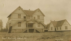
- West Burnaby School was to be Burnaby's second public school and it served the children who lived along the tram line and Vancouver Road (Kingsway).
- Historic Neighbourhood
- Central Park (Historic Neighbourhood)
- Planning Study Area
- Maywood Area
- Street View URL
- Google Maps Street View
Images
Vancouver Road (Kingsway)
https://search.heritageburnaby.ca/link/landmark729
- Repository
- Burnaby Heritage Planning
- Associated Dates
- 1860
- Heritage Value
- The street we know as Kingsway is one of the legacies of the Royal Engineers' military defences for New Westminster. The fear of an American attack prompted the construction of the False Creek trail - later known as Vancouver Road and now Kingsway - in 1860 to connect the capital city to the ice-free salt water harbour at English Bay.
- Historic Neighbourhood
- Central Park (Historic Neighbourhood)
- Edmonds (Historic Neighbourhood)
- Planning Study Area
- Maywood Area
- Marlborough Area
- Windsor Area
- Kingsway-Beresford Area
- Stride Avenue Area
- Edmonds Area
Images
Kingsway
https://search.heritageburnaby.ca/link/landmark775
- Repository
- Burnaby Heritage Planning
- Associated Dates
- 1913
- Heritage Value
- The years 1911-1912 saw great expansion and settlement in Burnaby and large public works projects were undertaken to service the growing community. One project that was determined to be a necessity was the construction of a proper highway between New Westminster and Vancouver. The Province and the Municipality agreed to share the costs of construction (with Burnaby paying 25% and the Province 75%) and so Kingsway was built to improve the current Vancouver Road. The road was named after the famous King's Way in London, England.
- Historic Neighbourhood
- Central Park (Historic Neighbourhood)
- Edmonds (Historic Neighbourhood)
- Planning Study Area
- Maywood Area
- Marlborough Area
- Windsor Area
- Kingsway-Beresford Area
- Stride Avenue Area
- Edmonds Area
Images
Kingsway-Beresford Neighbourhood
https://search.heritageburnaby.ca/link/landmark805
- Repository
- Burnaby Heritage Planning
- Associated Dates
- 1955-2008
- Heritage Value
- Since the building boom of the 1950s, the Kingsway-Beresford Neighbourhood has maintained a residential character with the exception of the Kingsway corridor, which has become a primary commercial and light industrial sector.
- Historic Neighbourhood
- Edmonds (Historic Neighbourhood)
- Planning Study Area
- Kingsway-Beresford Area
Images
Burnaby South High School Cenotaph & Memorial Tennis Courts
https://search.heritageburnaby.ca/link/landmark547
- Repository
- Burnaby Heritage Planning
- Description
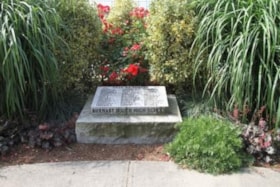
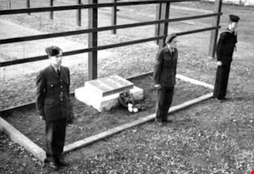
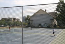
- This memorial comprises a cenotaph and three tennis courts: the former a monument of British Columbia granite inscribed with the names of fifty-one students of Burnaby South High School who lost their lives in the Second World War; and the latter a living memorial to these former students.
- Associated Dates
- 1948
- Formal Recognition
- Heritage Designation, Community Heritage Register
- Street View URL
- Google Maps Street View
- Repository
- Burnaby Heritage Planning
- Geographic Access
- Southoaks Crescent
- Associated Dates
- 1948
- Formal Recognition
- Heritage Designation, Community Heritage Register
- Enactment Type
- Bylaw No. 9807
- Enactment Date
- 23/11/1992
- Description
- This memorial comprises a cenotaph and three tennis courts: the former a monument of British Columbia granite inscribed with the names of fifty-one students of Burnaby South High School who lost their lives in the Second World War; and the latter a living memorial to these former students.
- Heritage Value
- This memorial is important for its spiritual, symbolic, and cultural associations for the former students of Burnaby South High School, and for all youth in the community. The cenotaph is of personal significance to the families of those who lost their lives. The unusual combination of cenotaph and living memorial - the tennis courts - represents a rare statement of a community's commitment to not allow the sacrifice of its youth to be forgotten by providing an active facility which draw people to the place on a regular basis rather than just on occasions of remembrance. As such it is an important symbol of a humanitarian ethic. In combination with the Kingsway East School, now rehabilitated as the Alan Emmott Centre, this memorial represents a valuable haven of green-space and recreation in the high-density urban development that now surrounds it.
- Defining Elements
- Key elements that define the heritage character of the Burnaby South High School Cenotaph & Memorial Tennis Courts include the: - location of the cenotaph adjacent to the living memorial - spatial association of this memorial and the remaining school building - physical fabric of both the granite monument and the tennis courts
- Historic Neighbourhood
- Edmonds (Historic Neighbourhood)
- Planning Study Area
- Kingsway-Beresford Area
- Function
- Primary Current--Public Feature
- Primary Historic--Public Feature
- Community
- Burnaby
- Cadastral Identifier
- P.I.D. No. 016-367-154 Legal Description: Lot 1, District Lot 96, Group 1 New Westminster District, Plan 86581
- Boundaries
- Burnaby South High School Cenotaph & Memorial Tennis Courts is comprised of a single municipally-owned property located at 6650 Southoaks Crescent, Burnaby.
- Area
- 6,070.00
- Contributing Resource
- Building
- Landscape Feature
- Structure
- Ownership
- Public (local)
- Documentation
- Heritage Site Files: PC77000 20. City of Burnaby Planning and Building Department, 4949 Canada Way, Burnaby, B.C., V5G 1M2
- Street Address
- 6650 Southoaks Crescent
- Street View URL
- Google Maps Street View
Images
24-hour Permits for the Sale of Gasoline in Burnaby - Lily Auto Court (2415 Kingsway); Decker's Garage (3306 Kingsway); and Maple Ridge Auto Court (1957 Kingsway)
https://search.heritageburnaby.ca/link/councilreport49568
- Repository
- City of Burnaby Archives
- Report ID
- 49185
- Meeting Date
- 14-Jan-1946
- Format
- Council - Mayor/Councillor/Staff Report
- Collection/Fonds
- City Council and Office of the City Clerk fonds
- Repository
- City of Burnaby Archives
- Report ID
- 49185
- Meeting Date
- 14-Jan-1946
- Format
- Council - Mayor/Councillor/Staff Report
- Collection/Fonds
- City Council and Office of the City Clerk fonds
Documents
(a) Kingsway and Imperial Street (b) Kingsway and Patterson Avenue (c) Kingsway and Willingdon Avenue
https://search.heritageburnaby.ca/link/councilreport37954
- Repository
- City of Burnaby Archives
- Report ID
- 34685
- Meeting Date
- 4-Nov-1963
- Format
- Council - Committee Report
- Collection/Fonds
- City Council and Office of the City Clerk fonds
- Repository
- City of Burnaby Archives
- Report ID
- 34685
- Meeting Date
- 4-Nov-1963
- Format
- Council - Committee Report
- Collection/Fonds
- City Council and Office of the City Clerk fonds
Documents
(a) Kingsway-Imperial Intersection (b) Kingsway-Patterson Intersection (c) Kingsway-Willingdon Intersection
https://search.heritageburnaby.ca/link/councilreport38291
- Repository
- City of Burnaby Archives
- Report ID
- 34338
- Meeting Date
- 10-Jun-1963
- Format
- Council - Committee Report
- Collection/Fonds
- City Council and Office of the City Clerk fonds
- Repository
- City of Burnaby Archives
- Report ID
- 34338
- Meeting Date
- 10-Jun-1963
- Format
- Council - Committee Report
- Collection/Fonds
- City Council and Office of the City Clerk fonds
Documents
Liquor Licence Application # 06-04: Proposed new Liquor Primary Establishment, O'Ryan's Bar and Grill 5507 Kingsway (Civic Address: 5501 Kingsway)
https://search.heritageburnaby.ca/link/councilreport205
- Repository
- City of Burnaby Archives
- Report ID
- 66963
- Meeting Date
- 23-Apr-2007
- Format
- Council - Manager's Report
- Item No.
- 11
- Collection/Fonds
- City Council and Office of the City Clerk fonds
- Repository
- City of Burnaby Archives
- Report ID
- 66963
- Meeting Date
- 23-Apr-2007
- Format
- Council - Manager's Report
- Item No.
- 11
- Collection/Fonds
- City Council and Office of the City Clerk fonds
Documents
Rezoning Reference # 05-64 - Proposed Relocated Kingsway Library (7311 Kingsway)
https://search.heritageburnaby.ca/link/councilreport441
- Repository
- City of Burnaby Archives
- Report ID
- 66721
- Meeting Date
- 30-Oct-2006
- Format
- Council - Manager's Report
- Item No.
- 2
- Collection/Fonds
- City Council and Office of the City Clerk fonds
- Repository
- City of Burnaby Archives
- Report ID
- 66721
- Meeting Date
- 30-Oct-2006
- Format
- Council - Manager's Report
- Item No.
- 2
- Collection/Fonds
- City Council and Office of the City Clerk fonds
Documents
Renovations to the Kingsway Branch Library 7152 Kingsway, Burnaby
https://search.heritageburnaby.ca/link/councilreport11684
- Repository
- City of Burnaby Archives
- Report ID
- 8130
- Meeting Date
- 9-Oct-1990
- Format
- Council - Manager's Report
- Manager's Report No.
- 61
- Item No.
- 5
- Collection/Fonds
- City Council and Office of the City Clerk fonds
- Repository
- City of Burnaby Archives
- Report ID
- 8130
- Meeting Date
- 9-Oct-1990
- Format
- Council - Manager's Report
- Manager's Report No.
- 61
- Item No.
- 5
- Collection/Fonds
- City Council and Office of the City Clerk fonds
Documents
Work Orders: 60-32-064 Byrne Creek Preloading and Utility Relocation 60-30-052 Smith Avenue at Kingsway - To Replace Unsatisfactory Sewer Service to 3823 and 3845 Kingsway
https://search.heritageburnaby.ca/link/councilreport15778
- Repository
- City of Burnaby Archives
- Report ID
- 10341
- Meeting Date
- 27-Jan-1986
- Format
- Council - Manager's Report
- Manager's Report No.
- 6
- Item No.
- 5
- Collection/Fonds
- City Council and Office of the City Clerk fonds
- Repository
- City of Burnaby Archives
- Report ID
- 10341
- Meeting Date
- 27-Jan-1986
- Format
- Council - Manager's Report
- Manager's Report No.
- 6
- Item No.
- 5
- Collection/Fonds
- City Council and Office of the City Clerk fonds
Documents
Preliminary Plan Approval Reference # 7249, Kingsway/Edmonds Area Plan (7026 Kingsway)
https://search.heritageburnaby.ca/link/councilreport17012
- Repository
- City of Burnaby Archives
- Report ID
- 3305
- Meeting Date
- 14-May-1984
- Format
- Council - Manager's Report
- Manager's Report No.
- 34
- Item No.
- 7
- Collection/Fonds
- City Council and Office of the City Clerk fonds
- Repository
- City of Burnaby Archives
- Report ID
- 3305
- Meeting Date
- 14-May-1984
- Format
- Council - Manager's Report
- Manager's Report No.
- 34
- Item No.
- 7
- Collection/Fonds
- City Council and Office of the City Clerk fonds
Documents
Proposed adjustment to Kingsway/Edmonds Area Plan Apartment Study Areas O and P and Community Plan Six 6975 Kingsway
https://search.heritageburnaby.ca/link/councilreport17893
- Repository
- City of Burnaby Archives
- Report ID
- 146
- Meeting Date
- 28-Feb-1983
- Format
- Council - Manager's Report
- Manager's Report No.
- 15
- Item No.
- 6
- Collection/Fonds
- City Council and Office of the City Clerk fonds
- Repository
- City of Burnaby Archives
- Report ID
- 146
- Meeting Date
- 28-Feb-1983
- Format
- Council - Manager's Report
- Manager's Report No.
- 15
- Item No.
- 6
- Collection/Fonds
- City Council and Office of the City Clerk fonds
Documents
Preliminary Plan Approval Application # 6102 - Proposed 7-Eleven Convenience Store, 5175 Kingsway (Northwest Corner of Kingsway and Royal Oak Avenue)
https://search.heritageburnaby.ca/link/councilreport18728
- Repository
- City of Burnaby Archives
- Report ID
- 2309
- Meeting Date
- 4-Jan-1982
- Format
- Council - Manager's Report
- Manager's Report No.
- 1
- Item No.
- 11
- Collection/Fonds
- City Council and Office of the City Clerk fonds
- Repository
- City of Burnaby Archives
- Report ID
- 2309
- Meeting Date
- 4-Jan-1982
- Format
- Council - Manager's Report
- Manager's Report No.
- 1
- Item No.
- 11
- Collection/Fonds
- City Council and Office of the City Clerk fonds
Documents
7536 Kingsway - Kingsway/Edmonds Area Plan, Request for Building Permit for Single Family Residence
https://search.heritageburnaby.ca/link/councilreport18909
- Repository
- City of Burnaby Archives
- Report ID
- 2116
- Meeting Date
- 13-Oct-1981
- Format
- Council - Manager's Report
- Manager's Report No.
- 48
- Item No.
- 6
- Collection/Fonds
- City Council and Office of the City Clerk fonds
- Repository
- City of Burnaby Archives
- Report ID
- 2116
- Meeting Date
- 13-Oct-1981
- Format
- Council - Manager's Report
- Manager's Report No.
- 48
- Item No.
- 6
- Collection/Fonds
- City Council and Office of the City Clerk fonds
Documents
Letter from Street and Company re: Rezoning Reference # 28/75, 4569 Kingsway - Located on North Side of Kingsway 189 Feet East of Pioneer Street
https://search.heritageburnaby.ca/link/councilreport21028
- Repository
- City of Burnaby Archives
- Report ID
- 13731
- Meeting Date
- 17-Apr-1979
- Format
- Council - Manager's Report
- Manager's Report No.
- 30
- Item No.
- 9
- Collection/Fonds
- City Council and Office of the City Clerk fonds
- Repository
- City of Burnaby Archives
- Report ID
- 13731
- Meeting Date
- 17-Apr-1979
- Format
- Council - Manager's Report
- Manager's Report No.
- 30
- Item No.
- 9
- Collection/Fonds
- City Council and Office of the City Clerk fonds
Documents
Rezoning Reference #03-40 - Kingsway/McMurray/Hazel Area Proposed Expansion to include Both sides of McMurray Avenue, North of Kingsway
https://search.heritageburnaby.ca/link/councilreport1857
- Repository
- City of Burnaby Archives
- Report ID
- 65290
- Meeting Date
- 3-May-2004
- Format
- Council - Manager's Report
- Manager's Report No.
- 13
- Item No.
- 1
- Collection/Fonds
- City Council and Office of the City Clerk fonds
- Repository
- City of Burnaby Archives
- Report ID
- 65290
- Meeting Date
- 3-May-2004
- Format
- Council - Manager's Report
- Manager's Report No.
- 13
- Item No.
- 1
- Collection/Fonds
- City Council and Office of the City Clerk fonds
Documents
Bus Shelters on Kingsway and Installation of a Pedestrian Actuated Crossing Signal - Kingsway and Hall Street
https://search.heritageburnaby.ca/link/councilreport23415
- Repository
- City of Burnaby Archives
- Report ID
- 15705
- Meeting Date
- 21-Feb-1977
- Format
- Council - Committee Report
- Collection/Fonds
- City Council and Office of the City Clerk fonds
- Repository
- City of Burnaby Archives
- Report ID
- 15705
- Meeting Date
- 21-Feb-1977
- Format
- Council - Committee Report
- Collection/Fonds
- City Council and Office of the City Clerk fonds
![Gilley Brothers Logging team, [1895]. . thumbnail](/media/hpo/_Data/_Archives_Images/_Unrestricted/371/461-003.jpg?width=280)

