Narrow Results By
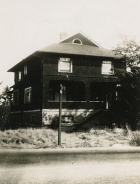
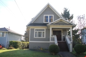
Alfred & Sarah Chrisp Residence
https://search.heritageburnaby.ca/link/landmark556
- Repository
- Burnaby Heritage Planning
- Description
- Rsidential building.
- Associated Dates
- 1913
- Street View URL
- Google Maps Street View
- Repository
- Burnaby Heritage Planning
- Geographic Access
- 11th Avenue
- Associated Dates
- 1913
- Description
- Rsidential building.
- Heritage Value
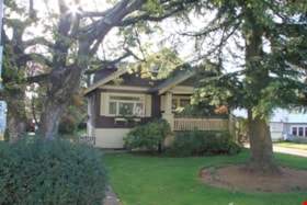
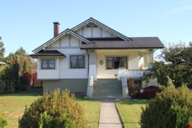
- This high-quality Craftsman bungalow was built for Alfred John Chrisp (1882-1944) and his wife Sarah Hannah Chrisp (née Hindmarch, 1883-1954). Starting in 1908, Alfred worked as an accountant for the CPR in New Westminster, and he and Sarah were married there in 1910. This house features a front gabled roof and gabled front porch, and is notable for its elaborate stained glass windows in the front door glazing, sidelights and the narrow transom over the front elevation window. Maintaining a very high degree of original integrity, the bungalow features lapped siding at the foundation level, a shingle clad main floor, a combination of casement and double-hung windows and square tapered porch columns.
- Locality
- East Burnaby
- Historic Neighbourhood
- East Burnaby (Historic Neighbourhood)
- Planning Study Area
- Edmonds Area
- Street Address
- 7349 11th Avenue
- Street View URL
- Google Maps Street View
Images
Armstrong Elementary School
https://search.heritageburnaby.ca/link/landmark762
- Repository
- Burnaby Heritage Planning
- Geographic Access
- Armstrong Avenue
- Associated Dates
- 1911
- Heritage Value
- The site for the Armstrong Avenue school was cleared in 1911. In 1955 the original structure was replaced by a new building and additions were constructed in 1962, 1964, 1967 and 1969. Armstrong Avenue was named after J.C. Armstrong, an early property owner of Burnaby who was involved in the effort to make Burnaby a municipality in 1892.
- Historic Neighbourhood
- East Burnaby (Historic Neighbourhood)
- Planning Study Area
- Cariboo-Armstrong Area
- Street Address
- 8757 Armstrong Avenue
- Street View URL
- Google Maps Street View
Images
Buena Vista Neighbourhood
https://search.heritageburnaby.ca/link/landmark759
- Repository
- Burnaby Heritage Planning
- Associated Dates
- 1905-1924
- Heritage Value
- The Buena Vista neighbourhood (so named for its wonderful views) grew out of its proximity to Edmonds and New Westminster and was developed in the period 1911-1912. By the 1950s, the area had been further subdivided and in 1986, Burnaby Municipal Council adopted the Cariboo Hills Development Plan for the neighbourhood to maintain its character as a residential area of the city.
- Historic Neighbourhood
- East Burnaby (Historic Neighbourhood)
- Planning Study Area
- Cariboo-Armstrong Area
Images
Buena Vista Subdivision Residence
https://search.heritageburnaby.ca/link/landmark661
- Repository
- Burnaby Heritage Planning
- Description
- Residential building.
- Associated Dates
- 1911
- Street View URL
- Google Maps Street View
- Repository
- Burnaby Heritage Planning
- Geographic Access
- Armstrong Avenue
- Associated Dates
- 1911
- Description
- Residential building.
- Heritage Value
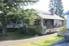
- This modest, hipped roof, cottage-style bungalow is distinguished by a full width front verandah. It was built as part of the Buena Vista subdivision in about 1911 by the Leibly & Blumer Real Estate Company. It was reported in The British Columbian in 1911: “Ten houses are now being erected by the company on the property, solid substantial five or six-room buildings that appeals to the homeseeker”. Retaining a high degree of integrity, this residence displays its original double-hung windows and lapped wooden siding. Houses of this type were often constructed from a complete package of materials offered by building supply companies, and were extremely popular due to their low cost and ease of construction.
- Locality
- East Burnaby
- Historic Neighbourhood
- East Burnaby (Historic Neighbourhood)
- Planning Study Area
- Cariboo-Armstrong Area
- Area
- 413.72
- Contributing Resource
- Building
- Ownership
- Private
- Street Address
- 8941 Armstrong Avenue
- Street View URL
- Google Maps Street View
Images
East Burnaby Neighbourhood
https://search.heritageburnaby.ca/link/landmark773
- Repository
- Burnaby Heritage Planning
- Associated Dates
- 1905-1924
- Heritage Value
- According to the 1911 December 26 edition of The British Columbian: Optimism is the word that applies to the whole community of East Burnaby. The many improvements carried out by the council during the past two years had been the means of making East Burnaby a thriving settlement, and hence one and all are optimistic as to its future. In the clearing and building line, many fine new homes are being erected...Real estate values have advanced with the times, and a notable feature is the number of better-class houses that are being built in this locality, which proves that East Burnaby is becoming very much alive and elevated.
- Historic Neighbourhood
- East Burnaby (Historic Neighbourhood)
- Planning Study Area
- Edmonds Area
Images
George S. Vickers Residence
https://search.heritageburnaby.ca/link/landmark586
- Repository
- Burnaby Heritage Planning
- Description
- Residential building.
- Associated Dates
- 1911
- Street View URL
- Google Maps Street View
- Repository
- Burnaby Heritage Planning
- Geographic Access
- 1st Street
- Associated Dates
- 1911
- Description
- Residential building.
- Heritage Value
- George S. Vickers, a compositor with The British Columbian newspaper, was a prominent Burnaby resident who became involved with real estate during the boom prior to the First World War. In December 1910, The British Columbian reported that “Mr. Vickers has commenced to build a commodious residence on Fourth Avenue between 1st and 2nd streets.” This high quality Craftsman style bungalow, completed in 1911, was originally situated on one acre of property, which contained a large kitchen garden, an orchard of 40 trees of various types and houses and runs for chickens, ducks and turkeys. In 1919, the property was advertised for $5,000 and likely sold easily because of its location (three blocks from the electric streetcar line on Sixth Street), its many amenities and property improvements. Some of its selling points included its panelled living and dining room with 3-ply veneer, beamed ceilings and an open fireplace. Craftsman-style features include battered porch piers, unusual double bargeboards, triangular eave brackets and exposed purlins. The house survives in excellent original condition, with only minor alterations.
- Locality
- East Burnaby
- Historic Neighbourhood
- East Burnaby (Historic Neighbourhood)
- Planning Study Area
- Cariboo-Armstrong Area
- Area
- 819.46
- Contributing Resource
- Building
- Ownership
- Private
- Street Address
- 7686 1st Street
- Street View URL
- Google Maps Street View
Images
Thomas & Margaret Coldicutt Residence
https://search.heritageburnaby.ca/link/landmark647
- Repository
- Burnaby Heritage Planning
- Description
- Residential building.
- Associated Dates
- 1911
- Street View URL
- Google Maps Street View
- Repository
- Burnaby Heritage Planning
- Geographic Access
- 6th Street
- Associated Dates
- 1911
- Description
- Residential building.
- Heritage Value
- This house was built by Thomas Davis Coldicutt (1879-1970) and Margaret Jane Coldicutt, pre-eminent local citizens. Thomas Coldicutt was born in Birmingham and arrived in Canada in 1900, finding success in the steamboat industry. In 1902, he married Margaret Jane Styler who had been born in Redditch, Worcester, England, and in 1908 they settled in East Burnaby–some of the first pioneers to the area–and established a fruit farm. Thomas had a successful real estate, insurance and brokerage business, and was elected as a councillor for East Burnaby in 1909. He was also active in civic, political and social circles in Burnaby and became president of the Burnaby Board of Trade. "East Burnaby is booming and the signs of prosperity that may be seen on every hand. Most of these are substantial dwellings, such as effect a permanent improvement to the countryside. Among those whose homes have been completed, or on the point of completion may be mentioned. Councillor Coldicutt, who has built himself a habitation on Second Avenue at a cost of $4,000. (The British Columbian, 1911). In 1913, Coldicutt sold his original farm described as “the show place of Burnaby” to the Burnaby School Board for the development of Second Street School and this house was moved from Second Street and Sixteenth Avenue to this site. It has been extensively altered, but retains its original form, scale and massing.
- Locality
- East Burnaby
- Historic Neighbourhood
- East Burnaby (Historic Neighbourhood)
- Planning Study Area
- Edmonds Area
- Area
- 557.42
- Contributing Resource
- Building
- Ownership
- Private
- Street Address
- 7510 6th Street
- Street View URL
- Google Maps Street View
Images
William & Rachael Karman Residence
https://search.heritageburnaby.ca/link/landmark657
- Repository
- Burnaby Heritage Planning
- Description
- Residential building.
- Associated Dates
- 1911
- Street View URL
- Google Maps Street View
- Repository
- Burnaby Heritage Planning
- Geographic Access
- 14th Avenue
- Associated Dates
- 1911
- Description
- Residential building.
- Heritage Value
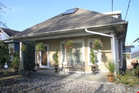
- This house was built by East Burnaby pioneers William Karman (1866-1948) and Rachael Karman (1865-1933), both born in Scotland. The Karmans originally farmed a “fruit ranch” on Cumberland Road in the 1890s but retired to this home after selling their former farm for a residential subdivision. Rachel died in 1933, and William was remarried to Mary Selkirk (1904-1981). In pristine condition, this Edwardian-era home has a front gabled roof, with symmetrical saddlebag dormers and a gabled front porch. Cedar shingle cladding is used at the foundation level and in the gable ends, and lapped wooden siding on the main level.
- Locality
- East Burnaby
- Historic Neighbourhood
- East Burnaby (Historic Neighbourhood)
- Planning Study Area
- Edmonds Area
- Area
- 696.46
- Contributing Resource
- Building
- Ownership
- Private
- Street Address
- 8088 14th Avenue
- Street View URL
- Google Maps Street View
Images
Armstrong Street School site
https://search.heritageburnaby.ca/link/museumdescription11133
- Repository
- Burnaby Village Museum
- Date
- 1915
- Collection/Fonds
- Ronald G. Scobbie collection
- Description Level
- Item
- Physical Description
- 1 survey plan : blueprint on paper ; 56 x 54 cm
- Scope and Content
- Survey plan of "Armstrong Street School Site / Burnaby Municipality" "Being a 2 acre portion of Lot 13 Group 1, & according to map 1722 which shows this as Lot E. Block 2 of subdivision of a portion, of Lot 13, Group 1, New Westminster District".
- Repository
- Burnaby Village Museum
- Collection/Fonds
- Ronald G. Scobbie collection
- Description Level
- Item
- Physical Description
- 1 survey plan : blueprint on paper ; 56 x 54 cm
- Material Details
- Scale 40 feet = 1 inch
- Scope and Content
- Survey plan of "Armstrong Street School Site / Burnaby Municipality" "Being a 2 acre portion of Lot 13 Group 1, & according to map 1722 which shows this as Lot E. Block 2 of subdivision of a portion, of Lot 13, Group 1, New Westminster District".
- Creator
- Burnett, Geoffrey K.
- Subjects
- Buildings - Schools
- Names
- Armstrong Avenue School
- Responsibility
- Burnett & McGugan, Engineers and Surveyors
- Geographic Access
- Armstrong Avenue
- Street Address
- 8757 Armstrong Avenue
- Accession Code
- BV003.83.12
- Access Restriction
- No restrictions
- Reproduction Restriction
- No known restrictions
- Date
- 1915
- Media Type
- Cartographic Material
- Historic Neighbourhood
- East Burnaby (Historic Neighbourhood)
- Planning Study Area
- Cariboo-Armstrong Area
- Scan Resolution
- 440
- Scan Date
- 22-Dec-2020
- Scale
- 100
- Notes
- Title based on contents of plan
- Note in black ink on verso of plan reads: "1746"
- Oath on plan reads: "I, Geoffrey K. Burnett...and did personally superintend the survey represented..." "Completed on the 18th day of March 1915"; signed by Geoffrey K. Burnett and notarized by "K.A. Eastman", sworn "...19th day of April 1915"; "Burnett and McGugan., B.C. Land Surveyors. Etc.. New Westminster, B.C.."
Zoomable Images
Bird's eye view of New Westminster, Burnaby and Vancouver
https://search.heritageburnaby.ca/link/museumdescription8199
- Repository
- Burnaby Village Museum
- Date
- [ca. 1911]
- Collection/Fonds
- Burnaby Village Museum Map collection
- Description Level
- Item
- Physical Description
- 1 map : hand painted ; 65.5 x 99 cm
- Scope and Content
- An untitled monochromatic grayscale map of a developer's bird's eye view looking north west from Burnaby Mountain. View includes Burnaby, New Westminster, Vancouver with the North shore in the distance. Burnaby neighbourhood subdivisions of "Burnaby Heights" and "Buena Vista" are featured near the…
- Repository
- Burnaby Village Museum
- Collection/Fonds
- Burnaby Village Museum Map collection
- Description Level
- Item
- Physical Description
- 1 map : hand painted ; 65.5 x 99 cm
- Scope and Content
- An untitled monochromatic grayscale map of a developer's bird's eye view looking north west from Burnaby Mountain. View includes Burnaby, New Westminster, Vancouver with the North shore in the distance. Burnaby neighbourhood subdivisions of "Burnaby Heights" and "Buena Vista" are featured near the centre of the map. These neighbourhood subdivisions were marketed by Real Estate Agents Liebly & Blumer in 1911. Roads, buildings, factories, railways and bridges are identified on the map.
- Subjects
- Businesses - Real Estate Agencies
- Responsibility
- Leibly & Blumer Realty Co. Incorporated
- Accession Code
- HV983.12.1
- Access Restriction
- No restrictions
- Reproduction Restriction
- No known restrictions
- Date
- [ca. 1911]
- Media Type
- Cartographic Material
- Historic Neighbourhood
- East Burnaby (Historic Neighbourhood)
- Vancouver Heights (Historic Neighbourhood)
- Planning Study Area
- Cariboo-Armstrong Area
- Burnaby Heights Area
- Scan Resolution
- 300
- Scan Date
- December 2020
- Scale
- 100
- Notes
- Title based on contents of map
- Note in pencil on verso of photograph reads: "Make tint block of Buena Vista / Blocks only as shown in lots"
Zoomable Images
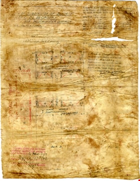
Plan of Subdivision of Block F Lot 1, D.L. 25 Group 1
https://search.heritageburnaby.ca/link/museumdescription18808
- Repository
- Burnaby Village Museum
- Date
- 17 Apr. 1912
- Collection/Fonds
- Love family fonds
- Description Level
- Item
- Physical Description
- 1 plan : black and red ink on linen ; 36 x 28.5 cm
- Scope and Content
- Item consists of Plan of Subdivision of Block F Lot 1, D.L. 25 Group 1 New Westminster District created by Provincial Land Surveyor Geoffrey K. Burnett.
- Repository
- Burnaby Village Museum
- Collection/Fonds
- Love family fonds
- Description Level
- Item
- Physical Description
- 1 plan : black and red ink on linen ; 36 x 28.5 cm
- Material Details
- Scale [1:1200]
- Scope and Content
- Item consists of Plan of Subdivision of Block F Lot 1, D.L. 25 Group 1 New Westminster District created by Provincial Land Surveyor Geoffrey K. Burnett.
- Creator
- Burnett, Geoffrey K.
- Names
- Burnett, Geoffrey K.
- Geographic Access
- Cumberland Street
- Accession Code
- BV992.26.28
- Access Restriction
- No restrictions
- Reproduction Restriction
- No known restrictions
- Date
- 17 Apr. 1912
- Media Type
- Cartographic Material
- Historic Neighbourhood
- East Burnaby (Historic Neighbourhood)
- Planning Study Area
- Cariboo-Armstrong Area
- Scan Resolution
- 600
- Scan Date
- 2022-07-11
- Scale
- 100
- Notes
- Title based on contents of item
- Scale is measured "100 FT = 1 INCH"
- "PLAN OF SUBDIVISION OF BLOCK "F" OF LOT 1, D.L. 25 GROUP 1. NEW WESTMINSTER DISTRICT"; Wright St., Sixth Ave., Fifth Ave., Cumberland St., L.1-8, 11-16; signature of Jesse Love, owner, witness S.P. King?; Geoffrey K. Burnett, P.L.S.; Fred A. Macpherson, Municipal Clerk, April 17, 1912; taxes paid to Dec. 31 1911, signed April 17 1912 by W.H. Griffin, collector"
Images
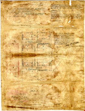
Plan of Subdivision of Block F Lot 1, D.L. 25 Group 1
https://search.heritageburnaby.ca/link/museumdescription18809
- Repository
- Burnaby Village Museum
- Date
- 17 Apr. 1912
- Collection/Fonds
- Love family fonds
- Description Level
- Item
- Physical Description
- 1 plan : black and red ink on linen ; 36 x 28.5 cm
- Scope and Content
- Item consists of Plan of Subdivision of Block F Lot 1, D.L. 25 Group 1 New Westminster District created by Provincial Land Surveyor Geoffrey K. Burnett.
- Repository
- Burnaby Village Museum
- Collection/Fonds
- Love family fonds
- Description Level
- Item
- Physical Description
- 1 plan : black and red ink on linen ; 36 x 28.5 cm
- Material Details
- Scale [1:1200]
- Scope and Content
- Item consists of Plan of Subdivision of Block F Lot 1, D.L. 25 Group 1 New Westminster District created by Provincial Land Surveyor Geoffrey K. Burnett.
- Creator
- Burnett, Geoffrey K.
- Names
- Burnett, Geoffrey K.
- Geographic Access
- Cumberland Street
- Accession Code
- BV992.26.29
- Access Restriction
- No restrictions
- Reproduction Restriction
- No known restrictions
- Date
- 17 Apr. 1912
- Media Type
- Cartographic Material
- Historic Neighbourhood
- East Burnaby (Historic Neighbourhood)
- Planning Study Area
- Cariboo-Armstrong Area
- Scan Resolution
- 600
- Scan Date
- 2022-07-11
- Scale
- 100
- Notes
- Title based on contents of item
- Scale is measured "100 FT = 1 INCH"
- "PLAN OF SUBDIVISION OF BLOCK "F" OF LOT 1, D.L. 25 GROUP 1. NEW WESTMINSTER DISTRICT"; Wright St., Sixth Ave., Fifth Ave., Cumberland St., L.1-8, 11-16; signature of Jesse Love, owner, witness S.P. King?; Geoffrey K. Burnett, P.L.S.; Fred A. Macpherson, Municipal Clerk, April 17, 1912; taxes paid to Dec. 31 1911, signed April 17 1912 by W.H. Griffin, collector"
Images
Subdivision plans in New Westminster District Group 1 – Burnaby
https://search.heritageburnaby.ca/link/museumdescription6983
- Repository
- Burnaby Village Museum
- Date
- [1890-1910]
- Collection/Fonds
- Burnaby Village Museum Map collection
- Description Level
- File
- Physical Description
- 4 plans : blueprint ink on paper mounted on 2 sides of cardboard 76 x 102 cm
- Scope and Content
- Item consists of a large board of two New Westminster District Gp 1 - subdivision plans mounted on one side and two New Westminster District Gp 1 - subdivision plans mounted on the other side. Side A: 1. Blueprint "Plan of / Subdivision of Lot No. 69 / Group One / New Westminster District / Pro…
- Repository
- Burnaby Village Museum
- Collection/Fonds
- Burnaby Village Museum Map collection
- Description Level
- File
- Physical Description
- 4 plans : blueprint ink on paper mounted on 2 sides of cardboard 76 x 102 cm
- Material Details
- Scales [between 1:1584 and 1:3168]
- Index number on edge of board reads: "14"
- Scope and Content
- Item consists of a large board of two New Westminster District Gp 1 - subdivision plans mounted on one side and two New Westminster District Gp 1 - subdivision plans mounted on the other side. Side A: 1. Blueprint "Plan of / Subdivision of Lot No. 69 / Group One / New Westminster District / Property of Ernest Buse, Esq. / Scale 3 chs = 1 in. / Map No 290". Plan is signed by "Garden, Hermon and Burwell, Dom. Land Surveyor" (Geographic location: Burnaby) 2. Blueprint "Plan / of Subdivision / of Lots 1-19, 36-53 and 69-75 inclusive / in the Subdivision / of / Lot 30 / Group One / New Westminster District / Scale 2 chs = 1 in. Map No 631". Plan is signed by "Jno [sic] Strathern [sic] P.L.S." Names and Lot numbers are handwritten in red pencil in sections along Douglas Road and read: "20 - F / 21 - Fitherstruhaul [sic] / 22 - J.S. Craig / 23 - McGill & Dill / 24 / 25 / 26 / 27 / 28 - School / 29 - School / 30 - D. McDownall / 31 - W.J. Troloow [sic] / 32 - N.C. Nelson / 33 - _[sic] McGill / 34 - T.S.[sic] Craig / 35" (Geographic location: Burnaby) Side B: 1.Blueprint "Plan / of Subdivision / of Centre Portion / of Lot 28 / Group One / New Westminster District / Scale 200' = 1" / Map No 627". Plan is signed by "Jno Strathern / P.L.S." (Geographic location: Burnaby) 2. Blueprint "Plan / of Subdivision / of N.1/2 Lot 100 and S.1/2 Lot 101, / Group One / New Westminster District, BC / Scale 4 chs = 1 in." (Geographic location: Burnaby)
- Names
- Strathern, John
- Accession Code
- HV977.93.14
- Access Restriction
- No restrictions
- Reproduction Restriction
- No known restrictions
- Date
- [1890-1910]
- Media Type
- Cartographic Material
- Historic Neighbourhood
- Broadview (Historic Neighbourhood)
- East Burnaby (Historic Neighbourhood)
- Planning Study Area
- Cascade-Schou Area
- West Central Valley Area
- Second Street Area
- Lake City Area
- Scan Resolution
- 300
- Scale
- 72
- Notes
- Title based on contents of file
- Scale is measured in chains and feet. (One chain equals 792 inches)
- The term "Lot" can also refer to a "District Lot”



![Bird's eye view of New Westminster, Burnaby and Vancouver, [ca. 1911] thumbnail](/media/hpo/_Data/_BVM_Cartographic_Material/1983/1983_0012_0001_002%20Web.jpg?width=280)
![Bird's eye view of New Westminster, Burnaby and Vancouver, [ca. 1911] thumbnail](/media/hpo/_Data/_BVM_Cartographic_Material/1983/1983_0012_0001_001_seadragon/1983_0012_0001_001.jpg?w=280)
![Subdivision plans in New Westminster District Group 1 – Burnaby
, [1890-1910] thumbnail](/media/hpo/_Data/_BVM_Cartographic_Material/1977/1977_0093_0014a_001.jpg?width=280)
