Narrow Results By
Decade
- 2020s 91
- 2010s 221
- 2000s 357
- 1990s
- 1980s
- 1970s 1266
- 1960s 595
- 1950s
- 1940s 357
- 1930s 357
- 1920s 537
- 1910s 362
- 1900s 139
- 1890s 73
- 1880s 27
- 1870s 10
- 1860s 21
- 1850s 8
- 1840s 4
- 1830s 2
- 1820s 2
- 1810s 3
- 1800s 3
- 1790s 3
- 1780s 3
- 1770s 3
- 1760s 3
- 1750s 3
- 1740s 3
- 1730s 3
- 1720s 3
- 1710s 3
- 1700s 3
- 1690s 3
- 1680s 3
- 1670s 2
- 1660s 2
- 1650s 2
- 1640s 2
- 1630s 2
- 1620s 2
- 1610s 2
- 1600s 2
- 1590s 1
- 1580s 1
- 1570s 1
- 1560s 1
- 1550s 1
- 1540s 1
- 1530s 1
- 1520s 2
- 1510s 1
- 1500s 1
- 1490s 1
- 1480s 1

Burnaby Municipal Hall
https://search.heritageburnaby.ca/link/landmark807
- Repository
- Burnaby Heritage Planning
- Geographic Access
- Canada Way
- Associated Dates
- 1956
- Heritage Value
- When staff outgrew the municipal buildings at Edmonds and Kingsway, a debate erupted over where to build a new municipal hall. North Burnaby residents argued against the Kingsway and Edmonds site as it was too removed for their needs, but South Burnaby residents were not prepared to accept a hall in North Burnaby. The debate was finally resolved when it was suggested that the new civic centre for the municipality be in the exact geographic centre of Burnaby. Fortunately, this meant that the new hall was to be built near Deer Lake, in the beautiful Central Valley setting. Burnaby voters accepted this decision and approved the $625,000.00 it would take to build the new structure and the official opening ceremony was held June 22, 1956 when then Reeve Charles MacSorley received the keys to the hall from the contractor.
- Historic Neighbourhood
- Burnaby Lake (Historic Neighbourhood)
- Planning Study Area
- Douglas-Gilpin Area
- Street Address
- 4949 Canada Way
- Street View URL
- Google Maps Street View
Images


Burnaby Central School
https://search.heritageburnaby.ca/link/landmark814
- Repository
- Burnaby Heritage Planning
- Geographic Access
- Canada Way
- Associated Dates
- 1958
- Heritage Value
- Burnaby Central School became the third high school to be built in Burnaby (following Burnaby North and Burnaby South). The increased school enrolments due to the rapidly growing population in Burnaby meant that the School District required this third high school to be placed between the other two. In its first year, 719 students attended Burnaby Central.
- Historic Neighbourhood
- Burnaby Lake (Historic Neighbourhood)
- Planning Study Area
- Douglas-Gilpin Area
- Street Address
- 4939 Canada Way
- Street View URL
- Google Maps Street View
Images


Burnaby Winter Club
https://search.heritageburnaby.ca/link/landmark816
- Repository
- Burnaby Heritage Planning
- Geographic Access
- Canada Way
- Associated Dates
- 1956
- Heritage Value
- Skating on Deer Lake and Burnaby Lake was the inspiration to form the Burnaby Winter Club in the 1950s. In 1958, the volunteer group opened an indoor ice facility, still operating today at 4990 Canada Way. Originally, the facility boasted 8 sheets of curling ice, that were used to capacity by the more than 500 family and individual members in the heyday of the Club. The Winter Club was a social centre: in addition to curling, it was a popular place for banquets and dances, and a place for families to spend time together. In the 1960s, the eight sheets of curling ice were reduced to five, to make room for a sheet of hockey ice for the members’ children. Volunteer coaches were committed to excellence, and the Club produced many professional hockey players. By 1964, the Club’s first future NHL player was playing: Pee Wee player Jack McIlhargey.
- Historic Neighbourhood
- Burnaby Lake (Historic Neighbourhood)
- Planning Study Area
- Douglas-Gilpin Area
- Street Address
- 4990 Canada Way
- Street View URL
- Google Maps Street View
Images

Proposed demolition of residential dwellings within Municipal Business Park 4547 and 4549 Canada Way (Northeast corner Canada Way and Willingdon Avenue)
https://search.heritageburnaby.ca/link/councilreport18108
- Repository
- City of Burnaby Archives
- Report ID
- 2921
- Meeting Date
- 8-Nov-1982
- Format
- Council - Manager's Report
- Manager's Report No.
- 62
- Item No.
- 3
- Collection/Fonds
- City Council and Office of the City Clerk fonds
- Repository
- City of Burnaby Archives
- Report ID
- 2921
- Meeting Date
- 8-Nov-1982
- Format
- Council - Manager's Report
- Manager's Report No.
- 62
- Item No.
- 3
- Collection/Fonds
- City Council and Office of the City Clerk fonds
Documents
Development enquiry, Canadian Tire Company, Community Plan 8 Canada Way/Smith Avenue Area Apartment Study Area "I" (3841 Canada Way)
https://search.heritageburnaby.ca/link/councilreport18644
- Repository
- City of Burnaby Archives
- Report ID
- 2386
- Meeting Date
- 8-Feb-1982
- Format
- Council - Manager's Report
- Manager's Report No.
- 9
- Item No.
- 6
- Collection/Fonds
- City Council and Office of the City Clerk fonds
- Repository
- City of Burnaby Archives
- Report ID
- 2386
- Meeting Date
- 8-Feb-1982
- Format
- Council - Manager's Report
- Manager's Report No.
- 9
- Item No.
- 6
- Collection/Fonds
- City Council and Office of the City Clerk fonds
Documents
Development Inquiry, Community Plan 8 - Canada Way/Smith Avenue area Apartment Study Area "I" (3841 Canada Way) Canadian Tire
https://search.heritageburnaby.ca/link/councilreport18675
- Repository
- City of Burnaby Archives
- Report ID
- 2362
- Meeting Date
- 25-Jan-1982
- Format
- Council - Manager's Report
- Manager's Report No.
- 5
- Item No.
- 10
- Collection/Fonds
- City Council and Office of the City Clerk fonds
- Repository
- City of Burnaby Archives
- Report ID
- 2362
- Meeting Date
- 25-Jan-1982
- Format
- Council - Manager's Report
- Manager's Report No.
- 5
- Item No.
- 10
- Collection/Fonds
- City Council and Office of the City Clerk fonds
Documents
Proposed relocation of a bus shelter from westbound Canada Way east of Willingdon Avenue to eastbound Canada Way east of Sperling
https://search.heritageburnaby.ca/link/councilreport19636
- Repository
- City of Burnaby Archives
- Report ID
- 1383
- Meeting Date
- 15-Sep-1980
- Format
- Council - Manager's Report
- Manager's Report No.
- 58
- Item No.
- 1
- Collection/Fonds
- City Council and Office of the City Clerk fonds
- Repository
- City of Burnaby Archives
- Report ID
- 1383
- Meeting Date
- 15-Sep-1980
- Format
- Council - Manager's Report
- Manager's Report No.
- 58
- Item No.
- 1
- Collection/Fonds
- City Council and Office of the City Clerk fonds
Documents
Proposed sale and development of Municipal Lands N.E. quadrant - Canada Way and Willingdon Avenue - Rem. Lot 45 DL 70 Plan 56349 (4545 Canada Way)
https://search.heritageburnaby.ca/link/councilreport19655
- Repository
- City of Burnaby Archives
- Report ID
- 1368
- Meeting Date
- 8-Sep-1980
- Format
- Council - Manager's Report
- Manager's Report No.
- 56
- Item No.
- 3
- Collection/Fonds
- City Council and Office of the City Clerk fonds
- Repository
- City of Burnaby Archives
- Report ID
- 1368
- Meeting Date
- 8-Sep-1980
- Format
- Council - Manager's Report
- Manager's Report No.
- 56
- Item No.
- 3
- Collection/Fonds
- City Council and Office of the City Clerk fonds
Documents
6869 Canada Way C6-Zoned Property at Canada Way and Elwell Street
https://search.heritageburnaby.ca/link/councilreport14250
- Repository
- City of Burnaby Archives
- Report ID
- 8949
- Meeting Date
- 11-Jan-1988
- Format
- Council - Manager's Report
- Manager's Report No.
- 3
- Item No.
- 6
- Collection/Fonds
- City Council and Office of the City Clerk fonds
- Repository
- City of Burnaby Archives
- Report ID
- 8949
- Meeting Date
- 11-Jan-1988
- Format
- Council - Manager's Report
- Manager's Report No.
- 3
- Item No.
- 6
- Collection/Fonds
- City Council and Office of the City Clerk fonds
Documents
Proposed Duplex Development - 5060 Canada Way - Canada Way/Clayton Avenue Area Plan
https://search.heritageburnaby.ca/link/councilreport5966
- Repository
- City of Burnaby Archives
- Report ID
- 61188
- Meeting Date
- 15-Dec-1997
- Format
- Council - Manager's Report
- Manager's Report No.
- 33
- Item No.
- 6
- Collection/Fonds
- City Council and Office of the City Clerk fonds
- Repository
- City of Burnaby Archives
- Report ID
- 61188
- Meeting Date
- 15-Dec-1997
- Format
- Council - Manager's Report
- Manager's Report No.
- 33
- Item No.
- 6
- Collection/Fonds
- City Council and Office of the City Clerk fonds
Documents
Assessment Roll Reductions for Canada Safeway, Sears Canada, and Burlington Northern Railway Properties
https://search.heritageburnaby.ca/link/councilreport5548
- Repository
- City of Burnaby Archives
- Report ID
- 61577
- Meeting Date
- 13-Jul-1998
- Format
- Council - Manager's Report
- Manager's Report No.
- 19
- Item No.
- 25
- Collection/Fonds
- City Council and Office of the City Clerk fonds
- Repository
- City of Burnaby Archives
- Report ID
- 61577
- Meeting Date
- 13-Jul-1998
- Format
- Council - Manager's Report
- Manager's Report No.
- 19
- Item No.
- 25
- Collection/Fonds
- City Council and Office of the City Clerk fonds
Documents
Statistics Canada - Report on the Demographic Situation in Canada 1994 - Current Demographic Analysis
https://search.heritageburnaby.ca/link/archivedescription32060
- Repository
- City of Burnaby Archives
- Date
- 1994
- Collection/Fonds
- Planning Department fonds
- Description Level
- File
- Physical Description
- Textual record
- Repository
- City of Burnaby Archives
- Date
- 1994
- Collection/Fonds
- Planning Department fonds
- Physical Description
- Textual record
- Description Level
- File
- Record No.
- 35074
- Accession Number
- 2006-16
- Media Type
- Textual Record

South Burnaby Cenotaph
https://search.heritageburnaby.ca/link/landmark860
- Repository
- Burnaby Heritage Planning
- Description
- The South Burnaby Cenotaph is located in Bonsor Park at the corner of Nelson Avenue and Imperial Street. The cenotaph commemorates those lost in the First World War, Second World War and the Korean War.
- Associated Dates
- 1988
- Other Names
- Bonsor Park Cenotaph
- Street View URL
- Google Maps Street View
- Repository
- Burnaby Heritage Planning
- Other Names
- Bonsor Park Cenotaph
- Geographic Access
- Nelson Avenue
- Associated Dates
- 1988
- Description
- The South Burnaby Cenotaph is located in Bonsor Park at the corner of Nelson Avenue and Imperial Street. The cenotaph commemorates those lost in the First World War, Second World War and the Korean War.
- Historic Neighbourhood
- Central Park (Historic Neighbourhood)
- Planning Study Area
- Marlborough Area
- Community
- Burnaby
- Cadastral Identifier
- P.I.D. No. 027-719-375
- Boundaries
- The property (Bonsor Park) is comprised of a single municipally-owned property located at 6749 Nelson Avenue.
- Area
- 3570.00
- Contributing Resource
- Landscape Feature
- Structure
- Ownership
- Public (local)
- Street Address
- 6749 Nelson Avenue
- Street View URL
- Google Maps Street View
Images


Shadbolt Centre for the Arts
https://search.heritageburnaby.ca/link/landmark820
- Repository
- Burnaby Heritage Planning
- Geographic Access
- Deer Lake Avenue
- Associated Dates
- 1995
- Heritage Value
- The Shadbolt Centre for the Arts opened in 1995. The Shadbolt Centre was named after two Burnaby residents who dedicated a lifetime of support and cultivation of the arts locally, nationally and internationally. Doris and Jack Shadbolt resided in Burnaby for over 50 years until Jack's death in November 1998. Doris Shadbolt spent her life's work bringing the artist and the audience closer together through her writing and curatorial work. Jack Shadbolt was an internationally recognized Canadian painter. He was also an author and both received many awards including the Order of Canada. In keeping with the Shadbolts' generosity the arts, Jack Shadbolt donated two of his paintings to the Centre for permanent display.
- Historic Neighbourhood
- Burnaby Lake (Historic Neighbourhood)
- Planning Study Area
- Douglas-Gilpin Area
- Street Address
- 6450 Deer Lake Avenue
- Street View URL
- Google Maps Street View
Images

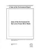
State of the environment for the Lower Fraser River Basin
https://search.heritageburnaby.ca/link/museumlibrary7450
- Repository
- Burnaby Village Museum
- Collection
- Reference Collection
- Material Type
- Textual Record
- ISBN
- 0662192346
- Call Number
- 363.7 SOE
- Place of Publication
- Ottawa, (Ont)
- Publisher
- Canada. Environment Canada.
- Publication Date
- c1992
- Physical Description
- 79 p. : ill., maps ; 22 x 28 cm.
- Library Subject (LOC)
- Environmental monitoring--Fraser River (B.C.)
- Environmental surveillance--Fraser River (B.C.)
- Environmental health--Fraser River (B.C.)
- Environmental monitoring--British Columbia
- Notes
- Co-published by the British Columbia Ministry of Environment, Lands and Parks.
- Includes bibliographical references.

Motor Vehicle Mechanic
https://search.heritageburnaby.ca/link/museumlibrary7530
- Repository
- Burnaby Village Museum
- Publication Date
- c1956
- Repository
- Burnaby Village Museum
- Collection
- Special Collection
- Material Type
- Photograph
- Accession Code
- BV016.7.4
- Contributor
- Cabeldu Motors Limited
- L'Ecole de L'Automobile de Montreal Technical High School
- Myers Motors
- General Motors of Canada
- Anders, Fred
- Buccino, Fred
- Lund, Chris
- O'Connor, Hugh
- Place of Publication
- Ottawa
- Publisher
- National Film Board of Canada
- Publication Date
- c1956
- Physical Description
- 39 photographs : filmstrip ; cellulose aacetate, b&w pos.
- Library Subject (LOC)
- Documentary Films
- Filmstrips
- Automobiles--Maintenance and repair
- Automobiles--Motors
- Object History
- Came in with Oakalla Prison records and artifacts in 1991. Filmstrip was utilized by staff and inmates of Oakalla. Digitized by BVM into preservation and accessible formats in 2020.
- Notes
- Filmstrip (photographs and illustrations with subtitles) provides a brief synopsis of apprenticeship training for a motor vehicle mechanic. Segments include "Motor Vehicle Mechanic"; "Related Fields of Training"; "Opportunities in the Trade". Film was created in collaboration with the Occupational Analysis Section of the Department of Labour. Film frame 36 reads: "For further information... read Monograph No. 10 in the "Canadian Occupations" series, consult your local National Employment Service office, teachers, counsellors and person familiar with the automobile trades." Accompanying sound recording is missing.
Images

Documents

Willingdon Heights Neighbourhood
https://search.heritageburnaby.ca/link/landmark670
- Repository
- Burnaby Heritage Planning
- Associated Dates
- 1925-1954
- Heritage Value
- Willingdon Heights was another new subdivision developed in Burnaby during the post-World War Two building boom. A brochure about the development published in 1948 proclaimed "the Willingdon Heights 500 home development project in Burnaby fulfills its promise to provide a self-contained community for former members of the armed services and their families...the largest single veteran housing project in Canada as far as homes for individual ownership is concerned, Willingdon Heights development was planned by the Central Mortgage and Housing Corporation...At this date the earlier built rows of homes have passable roads and the owners are improving lawns and gardens in spare time...eventually additional stores and professional services will be installed and recreational projects will add to the amenities of a community of congenial residents..."
- Planning Study Area
- Willingdon Heights Area
Images


Trans Mountain Pipeline Company
https://search.heritageburnaby.ca/link/landmark685
- Repository
- Burnaby Heritage Planning
- Geographic Access
- Shellmont Street
- Associated Dates
- 1953
- Heritage Value
- On March 21, 1951 the Parliament of Canada granted the Trans Mountain Oil Pipe Line Company a charter. By May of the following year, the Corporation of Burnaby gave final reading to Bylaw No. 3203, which resulted in the conveyance of land in DL 142, 143 and 144 (Burnaby Mountain site) to the Trans Mountain Oil Pipe Line Company. Construction of the Burnaby Mountain tank farm was completed in October of 1953 and the site became operational as the first shipment of oil reached Trans Mountain’s Burnaby Terminal.
- Planning Study Area
- Lake City Area
- Street Address
- 8099 Shellmont Street
- Street View URL
- Google Maps Street View
Images


Simpson-Sears
https://search.heritageburnaby.ca/link/landmark696
- Repository
- Burnaby Heritage Planning
- Geographic Access
- Kingsway
- Associated Dates
- 1954
- Heritage Value
- The Simpson-Sears store on Kingsway opened in 1954 and was the second Simpson-Sears to be located in British Columbia. The store helped to solidify the neighbourhood's growing reputation as a major commercial centre in the Lower Mainland and became a prototype for the company's large format stores across Canada.
- Historic Neighbourhood
- Central Park (Historic Neighbourhood)
- Planning Study Area
- Maywood Area
- Street Address
- 4700 Kingsway
Images


Willingdon Heights Neighbourhood
https://search.heritageburnaby.ca/link/landmark777
- Repository
- Burnaby Heritage Planning
- Associated Dates
- 1955-2008
- Heritage Value
- The convenient location of Willingdon Heights to the Trans Canada Highway, Lougheed Highway and Hastings Street has fostered its development as a primarily residential commuter neighbourhood. Characterised in the post-World War Two period by predominantly single-family developments, the neighbourhood has retained this identity despite some higher density apartment buildings now found there.
- Planning Study Area
- Willingdon Heights Area
Images
