Narrow Results By
Subject
- Agriculture 1
- Agriculture - Farms 1
- Buildings - Schools 2
- Documentary Artifacts 2
- Documentary Artifacts - Books 2
- Documentary Artifacts - Leaflets 1
- Documentary Artifacts - Maps 1
- Education 1
- Emergency Measures - Civil Defence 1
- Geographic Features - Roads 1
- Indigenous peoples - British Columbia 1
- Indigenous peoples - British Columbia - Languages 1
Creator
- Burnaby Village Museum 2
- Burnett, Geoffrey K. 1
- Burnett & McGugan, Engineers and Surveyors 2
- Canada. Office of the Director of Civil Air Raid Precautions 1
- Carter, David 1
- City of Burnaby 1
- Codd, Lisa 1
- Cooke, Rosemary 1
- Crawford, T. James (Thomas James) 1
- Fong, Denise 1
- Fortney, Sharon 1
- Friends of Interurban 1223 1
![Copy of Official British Columbia Road Maps, [193-] thumbnail](/media/hpo/_Data/_BVM_Cartographic_Material/1972/1972_0179_0001_001.jpg?width=280)
Copy of Official British Columbia Road Maps
https://search.heritageburnaby.ca/link/museumdescription18945
- Repository
- Burnaby Village Museum
- Date
- [193-]
- Collection/Fonds
- Burnaby Village Museum Map collection
- Physical Description
- 1 map : lithographic print on sheet ; 43 x 56 cm folded to 22 x 11 cm
- Scope and Content
- Item consists of Road maps of British Columbia presented by Union Oil Company of Canada Limited. Includes seventeen maps printed on both sides of sheet. One side of sheet includes ten separate road maps titled "Cariboo"; "Chilcotin Plateau"; "150 Mile House to Prince George"; "Prince George - Burns…
- Repository
- Burnaby Village Museum
- Collection/Fonds
- Burnaby Village Museum Map collection
- Physical Description
- 1 map : lithographic print on sheet ; 43 x 56 cm folded to 22 x 11 cm
- Material Details
- Scale not defined
- Scope and Content
- Item consists of Road maps of British Columbia presented by Union Oil Company of Canada Limited. Includes seventeen maps printed on both sides of sheet. One side of sheet includes ten separate road maps titled "Cariboo"; "Chilcotin Plateau"; "150 Mile House to Prince George"; "Prince George - Burns Lake"; "Burns Lake - Hazelton"; "Similkameen - Nicola"; "Salmon Arm to Revelstoke"; "Ashcroft to Salmon Arm / Kamloops to Vernon"; "Okanagan Valley"; "Boundary District". Other side of sheet includes seven road maps titled "Vancouver Island"; "Vancouver to Yale"' "Fraser Canyon Section Cariboo Road"; "Lytton to 150 Mile House"; "Arrow and Kootenay Lakes"; "The Kootenays"; "Columbia Valley". When folded, cover of maps reads "COPY OF / OFFICIAL / BRITISH COLUMBIA / ROAD-MAPS" / Presented by / UNION OIL / COMPANY / of Canada Ltd."; verso of cover includes advertisement for Union Motor oil "MOTORITE"; inside cover includes advertisement for Union Gasoline with title reading "See Canada's Evergreen Playground".
- Responsibility
- Union Oil Company of Canada Limited
- Accession Code
- HV972.179.1
- Access Restriction
- No restrictions
- Reproduction Restriction
- No known restrictions
- Date
- [193-]
- Media Type
- Cartographic Material
- Scan Resolution
- 600
- Scan Date
- 2023-08-17
- Notes
- Title based on contents of map
Images
![Copy of Official British Columbia Road Maps, [193-] thumbnail](/media/hpo/_Data/_BVM_Cartographic_Material/1972/1972_0179_0001_001.jpg)


Subdivision plans in New Westminster District Group 1 – Burnaby, Vancouver and map - Canada Department of Mines
https://search.heritageburnaby.ca/link/museumdescription6994
- Repository
- Burnaby Village Museum
- Date
- 1890-1909
- Collection/Fonds
- Burnaby Village Museum Map collection
- Description Level
- File
- Physical Description
- 1 plan : graphite on paper + 2 plans : black ink on paper + 1 map : col. on paper mounted on 2 sides of cardboard 76 x 102 cm
- Scope and Content
- Item consists of a large board with one New Westminster District subdivision plan mounted on one side and two New Westminster District subdivision plans and one colour map mounted on the other side. Side A: 1. "Plan / of Subdivision of / Blocks 2, 3, 4, 5, 6 / Lot 77 / Group 1 / New Westminster D…
- Repository
- Burnaby Village Museum
- Collection/Fonds
- Burnaby Village Museum Map collection
- Description Level
- File
- Physical Description
- 1 plan : graphite on paper + 2 plans : black ink on paper + 1 map : col. on paper mounted on 2 sides of cardboard 76 x 102 cm
- Material Details
- Scales 1:720 and 1:1200 and 1:.00001578
- Scope and Content
- Item consists of a large board with one New Westminster District subdivision plan mounted on one side and two New Westminster District subdivision plans and one colour map mounted on the other side. Side A: 1. "Plan / of Subdivision of / Blocks 2, 3, 4, 5, 6 / Lot 77 / Group 1 / New Westminster District / BC. / Scale 100 feet = 1 inch", "Deposited 8th day / of April 1890 / Mowileg [sic] / Dist. Regt". Plan is drawn in graphite with annotations: "AB_Parts_lettered_are_lots_in / the_different_subdivisions" / "Owners: / James E. Hall / P.S.Cabilan [sic] by his attorney Joseph Hall / Joseph Hall / Eliza J. Shannon / John Harrison"; "This plan is correct and is prepared under the / provisions of the Land Registry Act" ; signed by: "Gordon Herman & Burwell / Dominion & Provincial Land Surveryors / Vancouver March 19th/90" . Plan is initialed by: "RB" [sic] (in blue pencil crayon) and measures: 99.5 x 65 cm (Geographic location: Burnaby) Side B: 1. Map titled "Canada / Department of Mines / Geological Survey Branch" / "Hon.W Templeton, Minister / A.P. Low, Deputy Minister / R.W. Brock, Acting Director", Vol. XXXI, Plate I / Compiled under the direction of / James White, F.R.G.S. Geographer /Dep. of Interior". Note above map reads: "To illustrate Mr. James Barrowman's report as Delegate at the Excursion - meeting of the Canadian Mining Institute", "The instiitution of Mining Engineers / Transactions 1908 - 1909", "The Mining Institute of Scotland / Transactions 1908-1909". Map identifies minerals and includes a Legend and Scale: 100 miles = 1 inch 2. "Plan / of Subdivision of / Lot 4 / of Subdivision of / Lot 87. Gr. 1 / New Westminster District / Scale 60' = 1in." Plan is initialed by: "RB" [sic] along with a note "also Board / 48" (in blue pencil crayon) (Geographic location: Burnaby) 3. Plan of "Lot 335 / G. 1" west of Boundary Road and north of River Road - Vancouver. (Geographic location: Vancouver)
- Publisher
- The Mining Institute of Scotland
- Geographic Access
- Vancouver
- Accession Code
- HV977.93.25
- Access Restriction
- No restrictions
- Reproduction Restriction
- No known restrictions
- Date
- 1890-1909
- Media Type
- Cartographic Material
- Scan Resolution
- 300
- Scale
- 72
- Notes
- Title based on contents of file
- Scale is measured in feet and miles.
- The term "Lot" often refers to "District Lot"
Images


New instructions on how to fight fire bombs
https://search.heritageburnaby.ca/link/museumlibrary5109
- Repository
- Burnaby Village Museum
- Collection
- Special Collection
- Material Type
- Book
- Accession Code
- BV988.47.20
- Call Number
- 358.3 CAN v.2
- Place of Publication
- Ottawa
- Publisher
- Edmond Cloutier
- Publication Date
- 1942
- Physical Description
- 4 p. : ill. ; 21 cm.
- Library Subject (LOC)
- Canada--Civil defense
- Incendiary bombs
- Fire extinction
- Subjects
- Documentary Artifacts
- Documentary Artifacts - Leaflets
- Wars
- Wars - World War, 1939-1945
- Emergency Measures - Civil Defence
- Notes
- Version 2 of 2
Images


20th century typewriting : complete course
https://search.heritageburnaby.ca/link/museumlibrary5012
- Repository
- Burnaby Village Museum
- Collection
- Special Collection
- Material Type
- Book
- Accession Code
- BV007.2.1
- Call Number
- 652.3 LES
- Edition
- 6th ed.
- Place of Publication
- Cincinnati
- Publisher
- South-Western Publishing Co.
- Publication Date
- c1952
- Physical Description
- 340 p. : ill. : 20 x 28 cm.
- Library Subject (LOC)
- Typewriting
- Subjects
- Documentary Artifacts - Books
- Historic Neighbourhood
- Edmonds (Historic Neighbourhood)
- Burnaby Lake (Historic Neighbourhood)
- Planning Study Area
- Kingsway-Beresford Area
- Douglas-Gilpin Area
- Geographic Access
- Canada Way
- Southoaks Crescent
- Street Address
- 4939 Canada Way
- 6650 Southoaks Crescent
- Object History
- Was used by Burnaby resident Barbara Copan when she taught typing at Burnaby Central circa 1963-65. It may have originally belonged to Barbara's mother who also taught typing at Burnaby South High School circa 1957 to 1965. She mainly taught typing in night school.
- Notes
- Authors' given name and date as follows: Lessenberry, D.D. (David Daniel), 1896- Crawford, T. James (Thomas James)
Images


Douglas Road School site
https://search.heritageburnaby.ca/link/museumdescription11136
- Repository
- Burnaby Village Museum
- Date
- April 19, 1915
- Collection/Fonds
- Ronald G. Scobbie collection
- Description Level
- Item
- Physical Description
- 1 survey plan : blueprint on paper ; 56 x 54 cm
- Scope and Content
- Survey plan of "Douglas Road School Site / Burnaby Municipality" "Being Lot 21, of Blocks 1-5 inc. 11 & 12 of the subd. of north half of Lot 80, Group 1, New Westminster District".
- Repository
- Burnaby Village Museum
- Collection/Fonds
- Ronald G. Scobbie collection
- Description Level
- Item
- Physical Description
- 1 survey plan : blueprint on paper ; 56 x 54 cm
- Material Details
- Scale 40 feet = 1 inch
- Scope and Content
- Survey plan of "Douglas Road School Site / Burnaby Municipality" "Being Lot 21, of Blocks 1-5 inc. 11 & 12 of the subd. of north half of Lot 80, Group 1, New Westminster District".
- Creator
- McGugan, Donald Johnston
- Subjects
- Buildings - Schools
- Names
- Douglas Road School
- Responsibility
- Burnett & McGugan, Engineers and Surveyors
- Geographic Access
- Canada Way
- Street Address
- 4861 Canada Way
- Accession Code
- BV003.83.15
- Access Restriction
- No restrictions
- Reproduction Restriction
- No known restrictions
- Date
- April 19, 1915
- Media Type
- Cartographic Material
- Historic Neighbourhood
- Burnaby Lake (Historic Neighbourhood)
- Planning Study Area
- Douglas-Gilpin Area
- Scan Resolution
- 440
- Scan Date
- 22-Dec-2020
- Scale
- 100
- Notes
- Title based on contents of plan
- Note in black ink on verso of plan reads: "1747"
- Oath on plan reads: "I, D.G. McGugan..." "...and did person- ally superintend the survey..." "...completed on the 3rd day of April 1915"; signed by D.J. McGugan, notarized by "H.A. Eastman", sworn "...19th day of April 1915" "Burnett and McGugan" "B.C. Land Surveyors Etc. New Westminster, B.C.."
Images


Schou Street School site
https://search.heritageburnaby.ca/link/museumdescription11138
- Repository
- Burnaby Village Museum
- Date
- April 12, 1915
- Collection/Fonds
- Ronald G. Scobbie collection
- Description Level
- Item
- Physical Description
- 1 survey plan : blueprint on paper ; 56 x 54 cm
- Scope and Content
- Survey plan of "Schou Street School Site / Burnaby Municipality" "Being Lot 1-12 inc. of Block 47, of subd. of Blocks 8-12 and 15-49 inclusive, Lot 69, Group 1" "New Westminster District";
- Repository
- Burnaby Village Museum
- Collection/Fonds
- Ronald G. Scobbie collection
- Description Level
- Item
- Physical Description
- 1 survey plan : blueprint on paper ; 56 x 54 cm
- Material Details
- Scale 40 feet = 1 inch
- Scope and Content
- Survey plan of "Schou Street School Site / Burnaby Municipality" "Being Lot 1-12 inc. of Block 47, of subd. of Blocks 8-12 and 15-49 inclusive, Lot 69, Group 1" "New Westminster District";
- Creator
- Burnett, Geoffrey K.
- Subjects
- Buildings - Schools
- Names
- Schou Street School
- Responsibility
- Burnett & McGugan, Engineers and Surveyors
- Geographic Access
- Canada Way
- Grandview Highway
- Gilmore Avenue
- Street Address
- 4054 Norfolk Street
- Accession Code
- BV003.83.17
- Access Restriction
- No restrictions
- Reproduction Restriction
- No known restrictions
- Date
- April 12, 1915
- Media Type
- Cartographic Material
- Historic Neighbourhood
- Broadview (Historic Neighbourhood)
- Planning Study Area
- Cascade-Schou Area
- Scan Resolution
- 440
- Scan Date
- 22-Dec-2020
- Scale
- 100
- Notes
- Title based on contents of plan
- Oath on plan reads: "I, Geoffrey K. Burnett...did person- ally superintend the survey..." "...completed on the 12th day of April 1915"; signed by Geoffrey K. Burnett, notarized by "S.F. Mark", sworn "..12th day.. April 1915" "Burnett and McGugan" "B.C. Land Surveyors Etc. New Westminster, B.C.
- ."handwritten on back, "1751"
- two school buildings are shown on this blueprint, "Old School Building", "New School Building"
Images


Chinese Canadian history in Burnaby resource guide
https://search.heritageburnaby.ca/link/museumlibrary7608
- Repository
- Burnaby Village Museum
- Publication Date
- [2022]
- Call Number
- 971.1 CHI
because
of their appearance, religious beliefs, language, and countries
of origin.
FRONT COVER: Lee Quon Lip (right), his eldest son Gary Lee
(centre) with his niece and her two children in front of the Lee’s
family corner store C & L Grocery Confectionery, 1968. Lee
Quon Lip arrived in Canada in 1921
- Repository
- Burnaby Village Museum
- Collection
- Digital Reference Collection
- Material Type
- Digital Resource
- Accession Code
- BV022.8.1
- Call Number
- 971.1 CHI
- Contributor
- City of Burnaby
- Place of Publication
- Burnaby, BC
- Publisher
- City of Burnaby
- Publication Date
- [2022]
- Physical Description
- 36 p. ; ill. (some col.), maps, ports
- Library Subject (LOC)
- Burnaby (B.C.)--History
- Burnaby (B.C.)--Social Life and Customs
- Chinese Canadians--British Columbia--Burnaby--History
- Chinese--British Columbia--History
- Pharmacy--Canada
- Pharmacy--United States
- Pharmaceutical museums
- Directories
- Object History
- Chinese Canadians have contributed to Burnaby’s growth for over a century. The long and intertwining histories between Chinese Canadians, Indigenous people and other communities have shaped the founding of Burnaby and British Columbia. This resource guide was created because their life experiences and important contributions to Burnaby’s development are not widely known.
Images

Digital Books

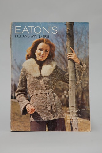
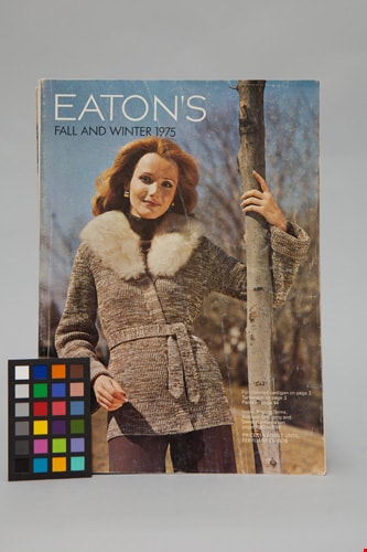
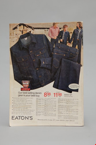
Eaton's catalogue: fall and winter, 1975
https://search.heritageburnaby.ca/link/museumlibrary5421
- Repository
- Burnaby Village Museum
- Collection
- Special Collection
- Material Type
- Book
- Accession Code
- BV012.14.166
- Call Number
- 381 EAT 1975
- Edition
- [Winnipeg]
- Place of Publication
- [Toronto]
- Publisher
- [T. Eaton Co. Ltd.]
- Publication Date
- 1975
- Series
- Eaton's catalogue
- Physical Description
- 894 p. : ill. (some col.) ; 28 cm.
- Library Subject (LOC)
- Manufactures
- Department stores--Canada
- Catalogs
- Names
- T. Eaton Company Limited
Images
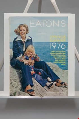
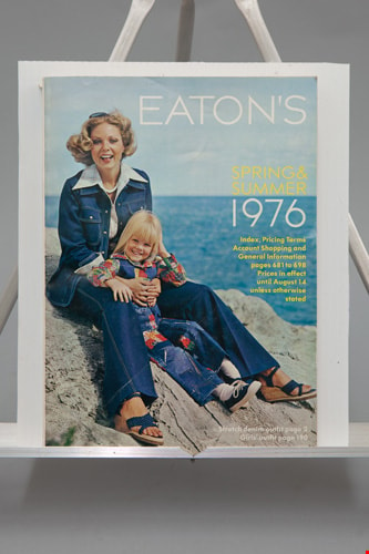
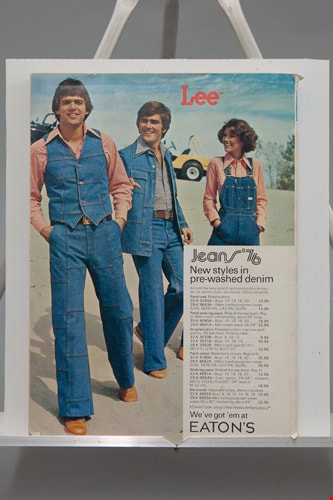
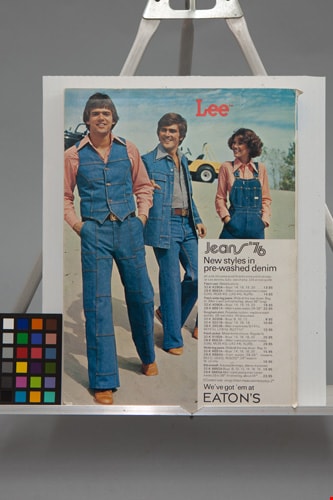
Eaton's catalogue: spring and summer, 1976
https://search.heritageburnaby.ca/link/museumlibrary5423
- Repository
- Burnaby Village Museum
- Collection
- Special Collection
- Material Type
- Book
- Accession Code
- BV012.14.165
- Call Number
- 381 EAT 1976
- Edition
- [Winnipeg]
- Place of Publication
- [Toronto]
- Publisher
- [T. Eaton Co. Ltd.]
- Publication Date
- 1976
- Series
- Eaton's catalogue
- Physical Description
- 698 p. : ill. (some col.) ; 28 cm.
- Library Subject (LOC)
- Manufactures
- Department stores--Canada
- Catalogs
- Names
- T. Eaton Company Limited
Images

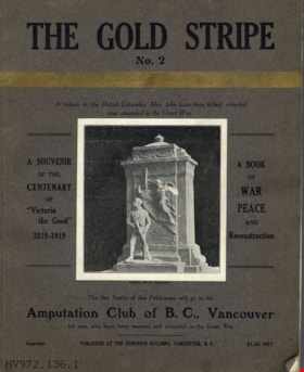
The gold stripe no. 2 : a tribute to the British Columbia men who have been killed, crippled and wounded in the Great War
https://search.heritageburnaby.ca/link/museumlibrary4910
- Repository
- Burnaby Village Museum
- Collection
- Special Collection
- Material Type
- Book
- Accession Code
- HV972.136.6
- Call Number
- 940.46771 GOL
- Place of Publication
- Vancouver
- Publisher
- [s.n.]
- Publication Date
- 1919
- Printer
- Pacific Printers
- Physical Description
- 160, xxviii : ill. ; 30 cm.
- Library Subject (LOC)
- World War, 1914-1918--Literary collections
- World War, 1914-1918--Personal narratives, Canadian
- World War, 1914-1918--Registers of dead--British Columbia
- Veterans, Disabled--British Columbia
- World War, 1914-1918--Canada--Registers
- Notes
- "A book of war, peace, and reconstruction" -- Title page
- "Published for the benefit of The Amputation Club of B.C. in May 1919, the centenary of 'Victoria the Good'" -- Title page
- "A souvenir of the centenary of 'Victoria the Good' 1819-1919" -- Cover
- "The net profits of this publication will go to the Amputation Club of B.C., Vancouver for men who have been maimed and wounded in the Great War" -- Cover
- Includes index.
Images


![Highways map of British Columbia, Alberta and adjacent states, [1930] thumbnail](/media/hpo/_Data/_BVM_Cartographic_Material/1977/1977_0037_0187_001.jpg?width=280)
Highways map of British Columbia, Alberta and adjacent states
https://search.heritageburnaby.ca/link/museumdescription9668
- Repository
- Burnaby Village Museum
- Date
- [1930]
- Collection/Fonds
- Burnaby Village Museum Map collection
- Description Level
- Item
- Physical Description
- 1 map : col. lithographic print ; both sides ; 89.5 x 58 cm, folded to 11.5 x 20 cm
- Scope and Content
- Double sided road map published by Imperial Oil, Ltd. and featuring the main travelled highway routes of British Columbia, Alberta and the Northwestern-most states of the United States of America. The map is a colour lithograph. The main map is green, with the highways highlighted in red. The litho…
- Repository
- Burnaby Village Museum
- Collection/Fonds
- Burnaby Village Museum Map collection
- Description Level
- Item
- Physical Description
- 1 map : col. lithographic print ; both sides ; 89.5 x 58 cm, folded to 11.5 x 20 cm
- Material Details
- Scale 1 inch = 20 miles
- A.R. THOMSON / CHIEF CARTOGRAPHER
- Scope and Content
- Double sided road map published by Imperial Oil, Ltd. and featuring the main travelled highway routes of British Columbia, Alberta and the Northwestern-most states of the United States of America. The map is a colour lithograph. The main map is green, with the highways highlighted in red. The lithograph was created in Canada by Rolph Clark Stone Ltd in Toronto. The opposite side of the map features inset maps of the following: the Trans-Canada Highway, the highway between Prince Rupert and Prince George, the highway through the Canadian Rockies, and the highway through the Peace River District. Small city plan maps of highways through major cities, as well as advertisements for Imperial Oil products, are also found on the opposite side of the main map. This map is one of four produced by Imperial Oil that covered the most populated areas of Canada from coast to coast and paralleled Imperial Oil's distribution service.
- Creator
- Thomson, A.R.
- Publisher
- Imperial Oil Limited
- Accession Code
- HV977.37.187
- Access Restriction
- No restrictions
- Reproduction Restriction
- No known restrictions
- Date
- [1930]
- Media Type
- Cartographic Material
- Scan Resolution
- 600
- Scan Date
- 2023-11-10
- Notes
- Title based on content of map
Zoomable Images
![Highways map of British Columbia, Alberta and adjacent states, [1930] thumbnail](/media/hpo/_Data/_BVM_Cartographic_Material/1977/1977_0037_0187_003_seadragon/1977_0037_0187_003.jpg?w=280)


Indigenous History in Burnaby Resource Guide
https://search.heritageburnaby.ca/link/museumlibrary7493
- Repository
- Burnaby Village Museum
- Edition
- First
- Publication Date
- 2019
- Call Number
- 971.100497 BVM
Resource Guide
Indigenous History in Burnaby
6501 Deer Lake Ave, Burnaby, BC V5G 3T6 | 604-297-4565 | burnabyvillagemuseum.ca
Tsleil-Waututh community members paddling Burrard Inlet, June 18, 2014.
Copyright Tsleil-Waututh Nation, Photograph by Blake Evans, 2014.
�4949 Canada Way, Burnaby, British
- Repository
- Burnaby Village Museum
- Collection
- Digital Reference Collection
- Material Type
- Digital Resource
- Accession Code
- BV019.64.1
- Call Number
- 971.100497 BVM
- Edition
- First
- Contributor
- Kwantlen First Nation
- Sḵwx̱wú7mesh First Nation
- Tsleil-Waututh First Nation
- ʷməθkʷəy̓əm (Musqueam) First Nation
- Place of Publication
- Burnaby, BC
- Publisher
- City of Burnaby
- Publication Date
- 2019
- Library Subject (LOC)
- Indigenous peoples--British Columbia
- Indigenous peoples--British Columbia--History
- Indigenous peoples--Canada--History
- Subjects
- Indigenous peoples - British Columbia
- Indigenous peoples - British Columbia - Languages
- Indigenous peoples - British Columbia - Societies, etc.
- Name Access
- Burnaby Village Museum
- Object History
- 2019 version of working document developed by Burnaby Village Museum in collaboration with a number of First Nations partners over the course of several years. We recognize that Burnaby falls within the shared, ancestral and unceded territories of the hən̓q̓əmin̓əm and Sḵwx̱wú7mesh speaking people. We equally respect each of the Nations who share territory in Burnaby, and invite and welcome their ongoing participation in developing the contents of the Indigenous History in Burnaby Resource Guide.
Images

Digital Books

Map of South Western Part of British Columbia
https://search.heritageburnaby.ca/link/museumdescription8688
- Repository
- Burnaby Village Museum
- Date
- 1897
- Collection/Fonds
- Burnaby Village Museum Map collection
- Description Level
- Item
- Physical Description
- 1 map : col. ink on paper ; 68 x 88 cm
- Scope and Content
- Item consists of a "MAP OF THE SOUTH-WESTERN PART OF BRITISH COLUMBIA”. Map identifies geographic land districts of New Westminster District; Coast District; Lillooet District; Yale District, Kamloops Division, Yale Division and districts on Vancouver Island. Map also includes the northern portions…
- Repository
- Burnaby Village Museum
- Collection/Fonds
- Burnaby Village Museum Map collection
- Description Level
- Item
- Physical Description
- 1 map : col. ink on paper ; 68 x 88 cm
- Material Details
- Scale [1:633600]
- Scope and Content
- Item consists of a "MAP OF THE SOUTH-WESTERN PART OF BRITISH COLUMBIA”. Map identifies geographic land districts of New Westminster District; Coast District; Lillooet District; Yale District, Kamloops Division, Yale Division and districts on Vancouver Island. Map also includes the northern portions of the State of Washington below the 49th parallel.
- Publisher
- The Colonist Litho Victoria B.C.
- Responsibility
- Martin, George Bohun
- Accession Code
- BV993.12.12
- Access Restriction
- No restrictions
- Reproduction Restriction
- No known restrictions
- Date
- 1897
- Media Type
- Cartographic Material
- Scan Resolution
- 600
- Scan Date
- 2023-08-17
- Notes
- Transcribed title
- Scale equals 1 inch to 10 miles
- "Compiled and drawn by direction of the Honouable G.B. Martin, Chief Commissioner of Lands and Works, Victoria, B.C."
- Signed by Surveyor General "Tom Kains"
Zoomable Images


Okanagan Fishing Guide
https://search.heritageburnaby.ca/link/museumdescription11398
- Repository
- Burnaby Village Museum
- Date
- 1948
- Collection/Fonds
- Burnaby Village Museum Map collection
- Description Level
- Item
- Physical Description
- 1 map : col. ink on paper handcol. ; 24 x 35 cm
- Scope and Content
- Item consists of map titled "Okanagan Fishing Guide / Showing / Major Roads / and the / Best Fish Lakes". Hand drawn map compiled and drawn by W.C. Rueber, Kelowna B.C. of Okanagan Lake area. Advertisement at bottom of page indicates that it may have been produced by "OK USED FURNITURE STORE / 239 …
- Repository
- Burnaby Village Museum
- Collection/Fonds
- Burnaby Village Museum Map collection
- Description Level
- Item
- Physical Description
- 1 map : col. ink on paper handcol. ; 24 x 35 cm
- Scope and Content
- Item consists of map titled "Okanagan Fishing Guide / Showing / Major Roads / and the / Best Fish Lakes". Hand drawn map compiled and drawn by W.C. Rueber, Kelowna B.C. of Okanagan Lake area. Advertisement at bottom of page indicates that it may have been produced by "OK USED FURNITURE STORE / 239 BERNARD AVE., KELOWNA, B.C....". The map was copyrighted in Canada on July 20, 1948, No. 79416.
- Creator
- Rueber, W.C.
- Publisher
- OK Used Furniture Store
- Accession Code
- BV006.24.116
- Access Restriction
- No restrictions
- Reproduction Restriction
- May be restricted by third party rights
- Date
- 1948
- Media Type
- Cartographic Material
- Scan Resolution
- 600
- Scan Date
- 2021-11-23
- Notes
- Transcribed title
- Staining on map with creases from being folded and handcoloured markings with blue pencil
Images


Rooted : Chinese Canadian stories in Burnaby
https://search.heritageburnaby.ca/link/museumlibrary7646
- Repository
- Burnaby Village Museum
- Publication Date
- 2023
- Call Number
- 971.133 ROO
in Burnaby at the time,
1930. COURTESY OF THE
WONG FAMILY. (p 125)
郑素英的移民卡。尽管
她出生在加拿大,但根
据 1923 年颁布的
《华人移民法 》
,
她必须进行登记。
BV017.24.32。李陈桂
秋提供。
(第36页)
Laura Suey Ying Jung’s
immigration card. Even
though she was born
in Canada, she was
required to register
under the Chinese
Immigration Act of 1923.
BV017.24.32
- Repository
- Burnaby Village Museum
- Collection
- Digital Reference Collection
- Material Type
- Digital Resource
- ISBN
- 978-0-9689849-2-5
- Call Number
- 971.133 ROO
- Contributor
- Fong, Denise
- Lemke, Jane
- Codd, Lisa
- Place of Publication
- Burnaby
- Publisher
- City of Burnaby
- Publication Date
- 2023
- Printer
- Metropolitan Fine Printers
- Physical Description
- 203 p. : ill. ; 30.5 cm
- Library Subject (LOC)
- Chinese Canadians--British Columbia--Burnaby--History
- Race discrimination -- Canada
- Subjects
- Persons - Chinese Canadians
- Agriculture
- Agriculture - Farms
- Persons - Families
- Rights
- Rights - Human Rights
- Social Issues
- Social Issues - Racism
- Notes
- There are two versions of the book: English and Simplified Chinese (left, below) and the other in English and Traditional Chinese (right, below).
- From the late 1800s to the present day, Chinese Canadians have made Burnaby into a more vibrant and livable city. Rooted: Chinese Canadian Stories in Burnaby brings together a collection of diverse stories and photographs from the community, celebrating the legacy and contributions of Burnaby’s Chinese Canadian community spanning over a century. This coffee-table book features oral histories and interviews with descendants of multigenerational family farms, green grocers, corner stores, restaurants, and places of worship. Also included are archival research and community perspectives on anti-Asian racism, community activism, courage, and resilience.
- The publication has been timed to coincide with the 100th anniversary of the introduction of the Chinese Exclusion Act by the Government of Canada in 1923. This federal legislation followed decades of discriminatory legislation by Canada’s federal, provincial and municipal governments that targeted Chinese Canadians by limiting opportunities to live, work and raise families in Canada. The Chinese Exclusion Act banned almost all migration from China and remained in place until 1947. Publishing this book in 2023 is an effort by the City of Burnaby to recognize the impact of discriminatory legislation on Chinese Canadians in our community, including discriminatory bylaws and practices implemented by Burnaby’s early municipal government.
- Edited by Denise Fong (Lead Researcher), Jane Lemke (Burnaby Village Museum Curator) and Lisa Codd (City of Burnaby Heritage Planner).
Images

Digital Books

Sketch map of the Province of British Columbia showing mining divisions
https://search.heritageburnaby.ca/link/museumdescription18946
- Repository
- Burnaby Village Museum
- Date
- 1907
- Collection/Fonds
- Burnaby Village Museum Map collection
- Description Level
- Item
- Physical Description
- 1 map : col. lithographic print on paper ; 52 x 59 cm
- Scope and Content
- Item consists of a map titled "Sketch map of the Province of / British Columbia / Showing Mining Divisions"; "Department of Mines, / Victoria, 1907". Map includes wagon roads and trails and geographic disticts.
- Repository
- Burnaby Village Museum
- Collection/Fonds
- Burnaby Village Museum Map collection
- Description Level
- Item
- Physical Description
- 1 map : col. lithographic print on paper ; 52 x 59 cm
- Material Details
- Scale not determinable
- Scope and Content
- Item consists of a map titled "Sketch map of the Province of / British Columbia / Showing Mining Divisions"; "Department of Mines, / Victoria, 1907". Map includes wagon roads and trails and geographic disticts.
- Accession Code
- HV977.37.172
- Access Restriction
- No restrictions
- Reproduction Restriction
- No known restrictions
- Date
- 1907
- Media Type
- Cartographic Material
- Scan Resolution
- 600
- Scan Date
- 2023-08-17
- Notes
- Title based on contents of map
- Stamp on verso of map reads: "Compliments of Vancouver Tourist Bureau"
Zoomable Images


Pioneer tales of Burnaby
https://search.heritageburnaby.ca/link/museumlibrary5860
- Repository
- Burnaby Village Museum
- Publication Date
- c1987
- Call Number
- 971.133 SON COPY 4
reserved. Excerpts from
this publication, in part or in
whole, may freely be used
with proper credit,
without prior permission
of the publisher.
Publisher:
The Corporation of the District of Burnaby
Municipal Hall
4949 Canada Way
Burnaby, B.C.
V5G 1M2
ISBN No. 0-9692828-0-X
Book design by Ted Staunton
- Repository
- Burnaby Village Museum
- Collection
- Digital Reference Collection
- Reference Collection
- Material Type
- Book
- ISBN
- 096928280x
- Call Number
- 971.133 SON COPY 4
- Contributor
- Sone, Michael
- Place of Publication
- Burnaby, B.C.
- Publisher
- Corporation of the District of Burnaby
- Publication Date
- c1987
- Physical Description
- 495 p. : ill. ; 31 cm.
- Inscription
- "TR687 - Bryburgh" / handprinted in pencil on frontend page
- Library Subject (LOC)
- Pioneers--British Columbia--Burnaby
- Frontier and pioneer life
- Biography
- Object History
- Early Burnaby as recalled by the settlers themselves who arrived from every corner of the world between 1888 and 1930, some witnessing incorporation of the district in 1892, all seeking a better life for themselves and especially for their children, all helping transform the wilderness into the modern municipality of today.
- Notes
- "Editor Michael Sone".
- Includes index.
- 4 copies held: copy 4
Images

Digital Books

Inkwells to Internet: A History of Burnaby Schools
https://search.heritageburnaby.ca/link/museumlibrary7551
- Repository
- Burnaby Village Museum
- Publication Date
- 2020
- Call Number
- 371 CAR
of Burnaby
4949 Canada Way
Burnaby, B.C.
Canada V5G 1M2
Cataloguing in publication
Title : Inkwells to internet : a history of Burnaby schools / contributing authors,
Dave Carter, Rosemary Cooke, Harry Pride, Janet White, Gail Yip.
Other titles : History of Burnaby schools
Names : Carter, Dave, 1939- author
- Repository
- Burnaby Village Museum
- Collection
- Reference Collection
- Digital Reference Collection
- Material Type
- Book
- ISBN
- 978-0-9781979-2-6
- Call Number
- 371 CAR
- Place of Publication
- Burnaby
- Publisher
- City of Burnaby
- Publication Date
- 2020
- Physical Description
- vii, 35 p. : ill. ; 29 cm.
- Library Subject (LOC)
- Burnaby (B.C.)--History
- Schools--British Columbia--Burnaby
- Subjects
- Education
- Notes
- "Includes index"
- A history of the Burnaby school district and individual school buildings in Burnaby, BC, between 1893 and 2013.
- The “First Nations cemetery” described on page 109 in Mary Johnson’s recollections was originally written as “Indian” and may refer to the Khalsa Diwan Society’s Sikh cremations at the Vancouver Cemetery.
Images

Digital Books

History of Burnaby and vicinity
https://search.heritageburnaby.ca/link/museumlibrary6890
- Repository
- Burnaby Village Museum
- Author
- Green, George, 1872-1955
- Publication Date
- 1947
- Call Number
- 971.133 GRE Copy 2 Ver. 1
- Repository
- Burnaby Village Museum
- Collection
- Digital Reference Collection
- Special Collection
- Material Type
- Book
- Accession Code
- BV017.17.1
- Call Number
- 971.133 GRE Copy 2 Ver. 1
- Author
- Green, George, 1872-1955
- Place of Publication
- [S.l.]
- Publisher
- [s.n.]
- Publication Date
- 1947
- Printer
- Shoemaker , McLean & Veitch
- Physical Description
- 233 p. : ill., maps, ports. ; 23 cm.
- Inscription
- "Presented To my valued fried Rev. D. W. Scott. a former neighbor at Capitol Hill with best wishes of the author George Green Victoria March 1 1947" [handwritten in black ink on page opposing front pastedown] "BMMM-WU SIGNED 1st ED 50.00" [handwritten in pencil on page opposing front pastedown]
- Library Subject (LOC)
- Burnaby (B.C.)--History
- Burnaby (B.C.)
- Biography
- Name Access
- Green, George
- Notes
- Autographed by author
- "By George Green, pioneer resident of Burnaby, and an ex-Councillor. Charter Member of the British Columbia Historical Association, Vancouver Branch, and an Executive Member."
- Copy 2 of 2
Images

Digital Books

History of Burnaby Resource Guide
https://search.heritageburnaby.ca/link/museumlibrary7492
- Repository
- Burnaby Village Museum
- Author
- Burnaby Village Museum
- Publication Date
- 2019
enabled newcomers to settle. North Road, Kingsway,
Canada Way, and Marine Drive all began as overland routes that the
Dispossession & Early Settlers, 1858-1880s
This ancestral knife may have been used
to cut and prepare fish for drying racks.
Found near the current site of Burnaby
Village Museum
- Repository
- Burnaby Village Museum
- Collection
- Digital Reference Collection
- Material Type
- Digital Resource
- Accession Code
- BV019.63.1
- Author
- Burnaby Village Museum
- Place of Publication
- Burnaby, BC
- Publisher
- City of Burnaby
- Publication Date
- 2019
- Physical Description
- 21 p. : ill.
- Library Subject (LOC)
- Burnaby (B.C.)--History
- Directories
- Object History
- Created from research gathered by Burnaby Village Museum staff into the diverse History of Burnaby.
Images
