Narrow Results By
Subject
- Agriculture - Fruit and Berries 2
- Arts - Paintings 1
- Arts - Sculptures 1
- Buildings - Agricultural - Stables 1
- Buildings - Commercial 1
- Buildings - Commercial - Grocery Stores 2
- Buildings - Heritage 7
- Buildings - Religious 3
- Buildings - Religious - Churches 1
- Buildings - Residences - Houses 1
- Buildings - Residential 1
- Buildings - Residential - Cottages 1

Alfred & Ruth MacLeod Cottage
https://search.heritageburnaby.ca/link/landmark503
- Repository
- Burnaby Heritage Planning
- Description
- Located atop a hill on the southern shore of picturesque Deer Lake, the Alfred and Ruth MacLeod Cottage is a one and one-half storey, wood-frame, rustic Arts and Crafts-style bungalow. The cottage is well-maintained, but has been altered through the enclosure of much of its original wraparound vera…
- Associated Dates
- 1913
- Repository
- Burnaby Heritage Planning
- Geographic Access
- Deer Lake Drive
- Associated Dates
- 1913
- Description
- Located atop a hill on the southern shore of picturesque Deer Lake, the Alfred and Ruth MacLeod Cottage is a one and one-half storey, wood-frame, rustic Arts and Crafts-style bungalow. The cottage is well-maintained, but has been altered through the enclosure of much of its original wraparound verandah. Its sits on the brow of a steep slope, with panoramic views north to Deer Lake.
- Heritage Value
- The Alfred and Ruth MacLeod Cottage is valued as a significant example of the early development of summer estates in Burnaby, specifically in the Deer Lake neighbourhood, that attracted residents from the burgeoning cities of New Westminster and Vancouver. Access to the area was facilitated by the construction of the Burnaby Lake Interurban tramline, which opened in June 1911. This modest, rustic cottage illustrates the desire for a simple country lifestyle and retreat into nature of those who settled on the south shore of Deer Lake. While the grand mansions on the north shore of Deer Lake are set in formally landscaped gardens, the informality of this cottage demonstrates reverence for its natural, wooded surroundings, oriented towards views of Deer Lake. The Alfred and Ruth MacLeod Cottage is important for its connection with prominent New Westminster insurance and real estate broker, Alfred W. MacLeod, and his wife, Ruth. The MacLeods had recently constructed a large city home, and built this cottage as a summer residence in 1913. In 2005, the Alfred and Ruth MacLeod Cottage was purchased by the City of Burnaby and today constitutes part of the Deer Lake Park Heritage Precinct, which is Burnaby's most significant collection of historic sites.
- Defining Elements
- Key elements that define the heritage character of the Alfred and Ruth MacLeod Cottage include its: - secluded setting on the brow of a steep hill on the southern shore of Deer Lake, with expansive views of Deer Lake to the north - residential form, scale and massing as expressed by its one and one-half storey rectangular plan, side-gabled roof, hipped roof over original verandah and two shed dormers - associated landscape features such as mature coniferous and deciduous trees surrounding the property
- Historic Neighbourhood
- Burnaby Lake (Historic Neighbourhood)
- Planning Study Area
- Morley-Buckingham Area
- Function
- Primary Historic--Single Dwelling
- Primary Current--Single Dwelling
- Cadastral Identifier
- P.I.D.000-708-038
- Boundaries
- The Alfred and Ruth MacLeod Cottage is comprised of a single residential lot located at 6466 Deer Lake Drive, Burnaby.
- Area
- 13354.63
- Contributing Resource
- Building
- Ownership
- Public (local)
- Documentation
- City of Burnaby Planning and Building Department, Heritage Site Files
- Street Address
- 6466 Deer Lake Drive
Images


Andy Johnson House
https://search.heritageburnaby.ca/link/landmark515
- Repository
- Burnaby Heritage Planning
- Description
- The Andy Johnson House is a large, one and one-half storey plus above-ground basement wood-frame mansion on a rubble-stone granite foundation with a red terra cotta pantile roof and an octagonal corner turret. The building stands in a prominent location on a corner lot on Kingsway, one of Burnaby’s…
- Associated Dates
- 1912
- Formal Recognition
- Community Heritage Register
- Other Names
- Andrew M. & Margaret Johnson House 'Glenedward'
- Street View URL
- Google Maps Street View
- Repository
- Burnaby Heritage Planning
- Other Names
- Andrew M. & Margaret Johnson House 'Glenedward'
- Geographic Access
- Kingsway
- Associated Dates
- 1912
- Formal Recognition
- Community Heritage Register
- Enactment Type
- Council Resolution
- Enactment Date
- 26/05/2003
- Description
- The Andy Johnson House is a large, one and one-half storey plus above-ground basement wood-frame mansion on a rubble-stone granite foundation with a red terra cotta pantile roof and an octagonal corner turret. The building stands in a prominent location on a corner lot on Kingsway, one of Burnaby’s main transportation and commercial corridors, and stands adjacent to the Burlington Square Development.
- Heritage Value
- The Andy Johnson House 'Glenedward' is a valued representation of a prominent upper middle-class family dwelling from the pre-First World War era. Andrew M. Johnson (1861-1934), an early Vancouver pioneer, and his wife Margaret built this house in 1912, in an imposing style favoured by the newly wealthy of the prewar boom period. Born in Norway, Andrew Johnson arrived in Vancouver just months after the Great Fire of 1886 and went into partnership with J. (Ollie) Atkins in a transportation company that became the Mainland Transfer Company, eventually the largest of its kind in Vancouver. Johnson also operated Burnaby's historic Royal Oak Hotel, once located on the opposite corner from his estate. Additionally, the Andy Johnson House is significant for the high-quality design and construction of both the house and its landscaped setting. Designed in the British Arts and Crafts style, the house exhibits a rare degree of opulence in building materials, including imported terra cotta roof tiles, oak and walnut interior millwork, and stained glass manufactured by the Royal City Glass Company. The rubble-stone foundations and perimeter walls were obtained from two massive granite glacial erratic boulders found on the property. The house has been relocated closer to the corner, but the encircling stone walls, the gate posts and gates manufactured by the Westminster Iron Works and some of the original plantings have been retained. A grouping of three giant Sequoias, other mature deciduous trees and massings of shrubbery indicate the type of landscape setting considered appropriate for an estate house in the early years of the twentieth century.
- Defining Elements
- Key elements that define the heritage character of the Andy Johnson House include its: - corner location on Kingsway at Royal Oak Avenue - residential form, scale and massing as expressed by the one and one-half storey height, above-ground basement, octagonal corner turret and rectangular plan - British Arts and Crafts details such as the use of natural indigenous materials, half-timbering in the gables and dormers, picturesque roofline, cedar shingle siding, extended eaves, native granite rubble-stone foundation with red-coloured mortar, and granite piers and chimneys - additional exterior features such as the central front entrance, elaborate wrap-around verandah, porte-cochere and balcony at second storey lighted with original cast iron electric lanterns - red terra cotta pantile roof cladding - fenestration, such as double-hung 1-over-1 wooden-sash windows with stained glass and leaded lights in the upper sash - original interior features such as fireplaces, wainscoting finished with oak and walnut millwork, and three-quarter sawn oak flooring - associated landscape features including three giant Sequoias. granite walls, granite gate posts and wrought iron gates
- Historic Neighbourhood
- Central Park (Historic Neighbourhood)
- Planning Study Area
- Marlborough Area
- Builder
- J.C. Allen
- Function
- Primary Historic--Single Dwelling
- Primary Current--Eating or Drinking Establishment
- Community
- Burnaby
- Cadastral Identifier
- 003-004-538
- Boundaries
- The Andy Johnson House is comprised of a single residential lot located at 5152 Kingsway, Burnaby
- Area
- 1424.21
- Contributing Resource
- Building
- Ownership
- Private
- Street Address
- 5152 Kingsway
- Street View URL
- Google Maps Street View
Images


Annie Barrett-Lennard Residence
https://search.heritageburnaby.ca/link/landmark559
- Repository
- Burnaby Heritage Planning
- Description
- Residential building.
- Associated Dates
- c.1935
- Street View URL
- Google Maps Street View
- Repository
- Burnaby Heritage Planning
- Geographic Access
- Parker Street
- Associated Dates
- c.1935
- Description
- Residential building.
- Heritage Value
- Built for Annie Barrett-Lennard, this British Arts and Crafts residence has retained many of its original features, such as its stucco and half-timbering exterior with a cat’s slide roof over the front entrance. The steeply-pitched gables, asymmetrical half-massing, leaded windows and pegged joinery are all references to traditional British antecedents.
- Locality
- Capitol Hill
- Historic Neighbourhood
- Capitol Hill (Historic Neighbourhood)
- Planning Study Area
- Parkcrest-Aubrey Area
- Area
- 1227.44
- Contributing Resource
- Building
- Ownership
- Private
- Street Address
- 5450 Parker Street
- Street View URL
- Google Maps Street View
Images


Arthur Long Residence
https://search.heritageburnaby.ca/link/landmark560
- Repository
- Burnaby Heritage Planning
- Description
- Residential building.
- Associated Dates
- 1912
- Street View URL
- Google Maps Street View
- Repository
- Burnaby Heritage Planning
- Geographic Access
- Stanley Street
- Associated Dates
- 1912
- Description
- Residential building.
- Heritage Value
- Arthur Long, of the Water Rights Office of Victoria, purchased this land from neighbour Henry Ramsay, and built this beautiful Arts and Crafts styled home. The house appears to have many similarities to the neighbouring Ramsay House, which was designed by Vancouver architect R. Mackay Fripp. The house has retained its original complex gabled roof, triangular eave brackets and horizontal siding.
- Locality
- Burnaby Lake
- Historic Neighbourhood
- Burnaby Lake (Historic Neighbourhood)
- Planning Study Area
- Lakeview-Mayfield Area
- Ownership
- Private
- Street Address
- 7828 Stanley Street
- Street View URL
- Google Maps Street View
Images


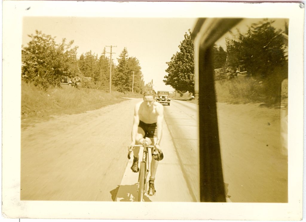
Bicycle rider
https://search.heritageburnaby.ca/link/museumdescription2722
- Repository
- Burnaby Village Museum
- Date
- June 31, 1936
- Collection/Fonds
- Hawkshaw family fonds
- Description Level
- Item
- Physical Description
- 1 photograph : sepia ; 5.5 x 8 cm
- Scope and Content
- Photograph of a bicycle rider riding along the highway to Bellingham, Washington.
- Repository
- Burnaby Village Museum
- Collection/Fonds
- Hawkshaw family fonds
- Description Level
- Item
- Physical Description
- 1 photograph : sepia ; 5.5 x 8 cm
- Scope and Content
- Photograph of a bicycle rider riding along the highway to Bellingham, Washington.
- Subjects
- Transportation - Bicycles
- Accession Code
- BV996.6.38
- Access Restriction
- No restrictions
- Reproduction Restriction
- No known restrictions
- Date
- June 31, 1936
- Media Type
- Photograph
- Scan Resolution
- 600
- Scan Date
- 2/16/2010
- Scale
- 100
- Notes
- Title based on contents of photograph
- Captions for photograph read: "Sun June 31/36" and "Highway to Bellingham"
- Note in pencil on verso of photograph reads: "Art"
- Photograph is part of photograph album BV996.6.1
Images
Bicycle rider
https://search.heritageburnaby.ca/link/museumdescription2723
- Repository
- Burnaby Village Museum
- Date
- June 31, 1936
- Collection/Fonds
- Hawkshaw family fonds
- Description Level
- Item
- Physical Description
- 1 photograph : sepia ; 5.5 x 8 cm
- Scope and Content
- Photograph of a bicycle rider riding along the highway to Bellingham, Washington.
- Repository
- Burnaby Village Museum
- Collection/Fonds
- Hawkshaw family fonds
- Description Level
- Item
- Physical Description
- 1 photograph : sepia ; 5.5 x 8 cm
- Scope and Content
- Photograph of a bicycle rider riding along the highway to Bellingham, Washington.
- Subjects
- Transportation - Bicycles
- Accession Code
- BV996.6.39
- Access Restriction
- No restrictions
- Reproduction Restriction
- No known restrictions
- Date
- June 31, 1936
- Media Type
- Photograph
- Scan Resolution
- 600
- Scan Date
- 2/16/2010
- Scale
- 100
- Notes
- Title based on contents of photograph
- Captions for photograph read: "Sun June 31/36" and "Highway to Bellingham"
- Note in pencil on verso of photograph reads: "Art"
- Photograph is part of photograph album BV996.6.1
Images

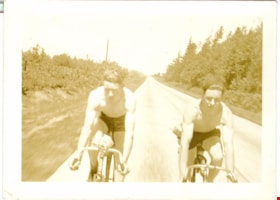
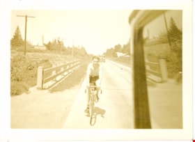
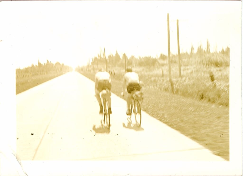
Bicycle riders
https://search.heritageburnaby.ca/link/museumdescription2721
- Repository
- Burnaby Village Museum
- Date
- June 31, 1936
- Collection/Fonds
- Hawkshaw family fonds
- Description Level
- Item
- Physical Description
- 1 photograph : sepia ; 5.5 x 8 cm
- Scope and Content
- Photograph of two bicycle riders riding along the highway to Bellingham, Washington.
- Repository
- Burnaby Village Museum
- Collection/Fonds
- Hawkshaw family fonds
- Description Level
- Item
- Physical Description
- 1 photograph : sepia ; 5.5 x 8 cm
- Scope and Content
- Photograph of two bicycle riders riding along the highway to Bellingham, Washington.
- Subjects
- Transportation - Bicycles
- Accession Code
- BV996.6.37
- Access Restriction
- No restrictions
- Reproduction Restriction
- No known restrictions
- Date
- June 31, 1936
- Media Type
- Photograph
- Scan Resolution
- 600
- Scan Date
- 2/16/2010
- Scale
- 100
- Notes
- Title based on contents of photograph
- Captions for photograph read: "Sun June 31/36" and "Highway to Bellingham"
- Note in pencil on verso of photograph reads: "Art"
- Photograph is part of photograph album BV996.6.1
Images


Bicycle riders
https://search.heritageburnaby.ca/link/museumdescription3551
- Repository
- Burnaby Village Museum
- Date
- June 31, 1936
- Collection/Fonds
- Hawkshaw family fonds
- Description Level
- Item
- Physical Description
- 1 photograph : sepia ; 5.5 x 8 cm
- Scope and Content
- Photograph of two bicycle riders riding along the highway to Bellingham, Washington.
- Repository
- Burnaby Village Museum
- Collection/Fonds
- Hawkshaw family fonds
- Description Level
- Item
- Physical Description
- 1 photograph : sepia ; 5.5 x 8 cm
- Scope and Content
- Photograph of two bicycle riders riding along the highway to Bellingham, Washington.
- Subjects
- Transportation - Bicycles
- Accession Code
- BV996.6.40
- Access Restriction
- No restrictions
- Reproduction Restriction
- No known restrictions
- Date
- June 31, 1936
- Media Type
- Photograph
- Scan Resolution
- 600
- Scan Date
- 2/16/2010
- Scale
- 100
- Notes
- Title based on contents of photograph
- Captions for photograph read: "Sun June 31/36" and "Highway to Bellingham"
- Note in pencil on verso of photograph reads: "Art"
- Photograph is part of photograph album BV996.6.1
Images

Bishop Block
https://search.heritageburnaby.ca/link/landmark562
- Repository
- Burnaby Heritage Planning
- Description
- Commercial building.
- Associated Dates
- 1935
- Street View URL
- Google Maps Street View
- Repository
- Burnaby Heritage Planning
- Geographic Access
- Hastings Street
- Associated Dates
- 1935
- Description
- Commercial building.
- Heritage Value
- This one-storey commercial block retains its original division into three retail units. An eclectic Spanish Colonial Revival character is imparted by the use of visor roofs, covered in metal pantiles, that extend over the recessed entries. The stepped parapets are more reminiscent of the Art Deco style. Each of the three retail spaces retains their plate glass display windows. This commercial block was owned in 1939 by Mary J. Bishop of Vancouver.
- Locality
- Vancouver Heights
- Historic Neighbourhood
- Vancouver Heights (Historic Neighbourhood)
- Planning Study Area
- Willingdon Heights Area
- Ownership
- Private
- Street Address
- 3736 Hastings Street
- Street View URL
- Google Maps Street View
Images


![Bruce Patterson with his wife Elva, [1918] (date of original), copied 1977 thumbnail](/media/hpo/_Data/_BVM_Images/1977/1977_0099_0005_001.jpg?width=280)
Bruce Patterson with his wife Elva
https://search.heritageburnaby.ca/link/museumdescription563
- Repository
- Burnaby Village Museum
- Date
- [1918] (date of original), copied 1977
- Collection/Fonds
- Burnaby Village Museum Photograph collection
- Description Level
- Item
- Physical Description
- 1 photograph : b&w ; 25.2 x 20.2 cm print
- Scope and Content
- Photograph of Charles Bruce Patterson and his first wife, Elva Patterson.
- Repository
- Burnaby Village Museum
- Collection/Fonds
- Burnaby Village Museum Photograph collection
- Description Level
- Item
- Physical Description
- 1 photograph : b&w ; 25.2 x 20.2 cm print
- Scope and Content
- Photograph of Charles Bruce Patterson and his first wife, Elva Patterson.
- Charles Bruce Patterson (called Bruce) built many early homes in the Edmonds district of Burnaby. He also built the Sperling Avenue School in 1913. For a time he was put in charge of Vulcan Iron Works of New Westminster, a business owned by his father Dugald Campbell Patterson Sr. Bruce quickly developed a passion for wrought iron work which would last his entire lifetime. Some years after the Vulcan Iron Works property was absorbed into the Dominion Bridge Company, Bruce opened a smaller iron works operation in the Arrow Transfer building on Granville Island. He named this company Vulcan Metal Works Ltd. Here, he made a variety of artistic railings for homes, churches and apartment buildings and drew inspiration from both Art Nouveau and Art Deco styles. In addition to his wrought iron railings, he also designed and created many other architectural pieces which included iron patio furniture, leaded glass window panels for French doors, headboards, and decorative designs for the exteriors of clocks. Bruce also built and renovated numerous homes throughout the lower mainland. Bruce married Elva Eleanore Elliott on July 17, 1918. After Elva’s death he married again at the age of 82. His second wife’s name was Martha May (Bird) Summers. [Biography provided by Raymond Reitsma.]
- Accession Code
- HV977.99.5
- Access Restriction
- No restrictions
- Reproduction Restriction
- May be restricted by third party rights
- Date
- [1918] (date of original), copied 1977
- Media Type
- Photograph
- Related Material
- For another photograph of Elva Patterson, see HV977.99.4
- Scan Resolution
- 600
- Scan Date
- 2023-07-11
- Notes
- Title based on contents of photograph
Images
![Bruce Patterson with his wife Elva, [1918] (date of original), copied 1977 thumbnail](/media/hpo/_Data/_BVM_Images/1977/1977_0099_0005_001.jpg)

Burnaby South High School
https://search.heritageburnaby.ca/link/landmark770
- Repository
- Burnaby Heritage Planning
- Associated Dates
- 1922-1988
- Street View URL
- Google Maps Street View
- Repository
- Burnaby Heritage Planning
- Geographic Access
- Southoaks Crescent
- Associated Dates
- 1922-1988
- Heritage Value
- Burnaby South and Burnaby North were Burnaby's first high schools. The first rooms of the school were built in 1922 on the same grounds as the Kingsway East Elementary School. In 1940, a two-storey building was erected and additions were made in 1963, 1967 and 1972. Kingsway East closed in 1925 and its buildings were used by the high school for Industrial Arts and Home Economics. In the early 1990s, a new "urban education centre" (Burnaby South/B.C. School for the Deaf) was opened, replacing the old Burnaby South High School.
- Historic Neighbourhood
- Edmonds (Historic Neighbourhood)
- Planning Study Area
- Kingsway-Beresford Area
- Street Address
- 6650 Southoaks Crescent
- Street View URL
- Google Maps Street View
Images

![Christ the King Seminary, [1939] (date of original), copied [2001] thumbnail](/media/hpo/_Data/_Archives_Images/_Unrestricted/371/416-003.jpg?width=280)
Christ the King Seminary
https://search.heritageburnaby.ca/link/archivedescription38356
- Repository
- City of Burnaby Archives
- Date
- [1939] (date of original), copied [2001]
- Collection/Fonds
- Burnaby Historical Society fonds
- Description Level
- Item
- Physical Description
- 1 photograph :b&w ; 20.5 x 25.5 cm print
- Scope and Content
- Photograph of the Robert and Bessie Anderson house at Deer Lake, which was built in 1912. In 1939, the house was purchased by the Benedictine Monks for use as part of the Seminary of Christ the King. In 1971, the house was purchased by Burnaby to be used as part of the Arts Centre and, in 1992, wa…
- Repository
- City of Burnaby Archives
- Date
- [1939] (date of original), copied [2001]
- Collection/Fonds
- Burnaby Historical Society fonds
- Subseries
- Municipal record subseries
- Physical Description
- 1 photograph :b&w ; 20.5 x 25.5 cm print
- Description Level
- Item
- Record No.
- 416-003
- Access Restriction
- No restrictions
- Reproduction Restriction
- No known restrictions
- Accession Number
- BHS2001-6
- Scope and Content
- Photograph of the Robert and Bessie Anderson house at Deer Lake, which was built in 1912. In 1939, the house was purchased by the Benedictine Monks for use as part of the Seminary of Christ the King. In 1971, the house was purchased by Burnaby to be used as part of the Arts Centre and, in 1992, was designated as a city heritage site.
- Names
- Christ the King Seminary
- Media Type
- Photograph
- Notes
- Title based on contents of photograph
- Geographic Access
- Deer Lake Avenue
- Historic Neighbourhood
- Burnaby Lake (Historic Neighbourhood)
- Planning Study Area
- Douglas-Gilpin Area
Images
![Christ the King Seminary, [1939] (date of original), copied [2001] thumbnail](/media/hpo/_Data/_Archives_Images/_Unrestricted/371/416-003.jpg)
![Christ the King Seminary, [1939] (date of original), copied [2001] thumbnail](/media/hpo/_Data/_Archives_Images/_Unrestricted/371/416-004.jpg?width=280)
Christ the King Seminary
https://search.heritageburnaby.ca/link/archivedescription38357
- Repository
- City of Burnaby Archives
- Date
- [1939] (date of original), copied [2001]
- Collection/Fonds
- Burnaby Historical Society fonds
- Description Level
- Item
- Physical Description
- 1 photograph : b&w ; 20.5 x 25.5 cm print
- Scope and Content
- Photograph of the Robert and Bessie Anderson house at Deer Lake, which was built in 1912. In 1939, the house was purchased by the Benedictine Monks for use as part of the Seminary of Christ the King. In 1971, the house was purchased by Burnaby to be used as part of the Arts Centre and, in 1992, wa…
- Repository
- City of Burnaby Archives
- Date
- [1939] (date of original), copied [2001]
- Collection/Fonds
- Burnaby Historical Society fonds
- Subseries
- Municipal record subseries
- Physical Description
- 1 photograph : b&w ; 20.5 x 25.5 cm print
- Description Level
- Item
- Record No.
- 416-004
- Access Restriction
- No restrictions
- Reproduction Restriction
- No known restrictions
- Accession Number
- BHS2001-6
- Scope and Content
- Photograph of the Robert and Bessie Anderson house at Deer Lake, which was built in 1912. In 1939, the house was purchased by the Benedictine Monks for use as part of the Seminary of Christ the King. In 1971, the house was purchased by Burnaby to be used as part of the Arts Centre and, in 1992, was designated as a city heritage site.
- Names
- Christ the King Seminary
- Media Type
- Photograph
- Notes
- Title based on contents of photograph
- Geographic Access
- Deer Lake Avenue
- Historic Neighbourhood
- Burnaby Lake (Historic Neighbourhood)
- Planning Study Area
- Douglas-Gilpin Area
Images
![Christ the King Seminary, [1939] (date of original), copied [2001] thumbnail](/media/hpo/_Data/_Archives_Images/_Unrestricted/371/416-004.jpg)

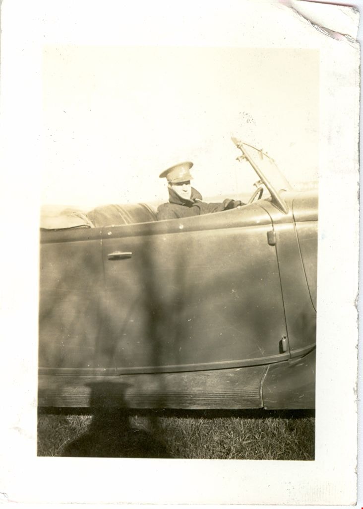
Crichton Hawkshaw
https://search.heritageburnaby.ca/link/museumdescription2680
- Repository
- Burnaby Village Museum
- Date
- October 21, 1937
- Collection/Fonds
- Hawkshaw family fonds
- Description Level
- Item
- Physical Description
- 1 photograph : sepia ; 8 x 5.5 cm
- Scope and Content
- Photograph of Crichton Hawkshaw sitting in the driver's side of a car while in uniform at Sarcee Barracks, Canadian Forces Base, Calgary.
- Repository
- Burnaby Village Museum
- Collection/Fonds
- Hawkshaw family fonds
- Description Level
- Item
- Physical Description
- 1 photograph : sepia ; 8 x 5.5 cm
- Scope and Content
- Photograph of Crichton Hawkshaw sitting in the driver's side of a car while in uniform at Sarcee Barracks, Canadian Forces Base, Calgary.
- Subjects
- Clothing - Military Uniforms
- Accession Code
- BV996.6.9
- Access Restriction
- No restrictions
- Reproduction Restriction
- No known restrictions
- Date
- October 21, 1937
- Media Type
- Photograph
- Scan Resolution
- 600
- Scan Date
- 2/9/2010
- Scale
- 100
- Notes
- Title based on contents of photograph
- Caption for photograph reads: "Acting Art. Sgt."
- Stamp on verso of photograph reads: "Certified / Taylor Made / Nutone / Oct 21 1937"
- Photograph is part of photograph album BV996.6.1
Images

Daniel & Amelia Mowat House
https://search.heritageburnaby.ca/link/landmark570
- Repository
- Burnaby Heritage Planning
- Description
- Residential building.
- Associated Dates
- 1913
- Formal Recognition
- Heritage Designation, Community Heritage Register
- Street View URL
- Google Maps Street View
- Repository
- Burnaby Heritage Planning
- Geographic Access
- Beresford Street
- McKay Avenue
- Associated Dates
- 1913
- Formal Recognition
- Heritage Designation, Community Heritage Register
- Enactment Type
- Bylaw No. 13058
- Enactment Date
- 12/03/2012
- Description
- Residential building.
- Heritage Value
- This home was built by Daniel Mowat (1848-1923) and Amelia Mary Mowat (née Hoy, 1848-1923). Daniel originally worked as a merchant, and was operating a chicken farm at this location as early as 1908, and later a goat ranch. It is one of Burnaby’s few two-storey Arts and Crafts residences. The generous proportions of the house, its broad, medium-pitched, front-gabled roof and symmetrical design serve as further features. Additionally, the house boasts a high degree of integrity, retaining its original shingle wall cladding, half-timbered gables and original windows – a combination of casement windows with stained glass transoms and double-hung windows with square, multi-paned upper sashes.This house is located adjacent to what was once the Central Park interurban rail line, operated by the B.C. Electric Company, which conveniently connected this area of Burnaby to Vancouver. The arrival of this commuter line in 1892 led to the suburban development of this area of Burnaby.
- Locality
- Central Park
- Historic Neighbourhood
- Central Park (Historic Neighbourhood)
- Planning Study Area
- Maywood Area
- Contributing Resource
- Building
- Ownership
- Private
- Street Address
- 6368 McKay Avenue
- Street View URL
- Google Maps Street View
Images


David Graybill Residence
https://search.heritageburnaby.ca/link/landmark571
- Repository
- Burnaby Heritage Planning
- Description
- Residential building.
- Associated Dates
- 1913
- Street View URL
- Google Maps Street View
- Repository
- Burnaby Heritage Planning
- Geographic Access
- Eton Street
- Associated Dates
- 1913
- Description
- Residential building.
- Heritage Value
- Built by David Graybill in 1913, this house is a unique example of a two-storey Arts and Crafts house. The visor roofs, which shield the upper storey windows, and the second storey balcony, which was incorporated into the ground floor verandah roof, add to the house’s character and remain its most notable decorative features. Other defining features are the wide, overhanging eaves with triangular eave brackets. Though the wooden siding has been covered with asbestos shingles–an easily-reversible alteration–the house remains in highly original condition.
- Locality
- Vancouver Heights
- Historic Neighbourhood
- Vancouver Heights (Historic Neighbourhood)
- Planning Study Area
- Burnaby Heights Area
- Ownership
- Private
- Street Address
- 3757 Eton Street
- Street View URL
- Google Maps Street View
Images


Dr. James Farish House
https://search.heritageburnaby.ca/link/landmark574
- Repository
- Burnaby Heritage Planning
- Description
- Residential building.
- Associated Dates
- 1912
- Street View URL
- Google Maps Street View
- Repository
- Burnaby Heritage Planning
- Geographic Access
- Cambridge Street
- Associated Dates
- 1912
- Description
- Residential building.
- Heritage Value
- This house was constructed as an investment rental property by Nova Scotia-born Dr. James Collins Farish (1866-1952). Farish was a Vancouver physician and surgeon and an eye, ear, nose & throat specialist; he retired in 1941 after fifty years of practice. In 1903, he married his first wife, Annie Gower Revely (died 1922). His second wife, Ella Jean Morrison (1887-1953) was originally from Winslow, Quebec. With its hipped roof and gabled projections, this house displays the typical elements of the Edwardian era domestic architecture. Features such as exposed rafter tails, paired square porch columns and bracketed bay windows display the emerging influence of the Arts and Crafts style. The ground floor windows are excellent examples of the multiple assemblies of casement, fixed and transom windows favoured during the era. A recent restoration project has extensively altered the original appearance and character of this impressive home.
- Locality
- Vancouver Heights
- Historic Neighbourhood
- Vancouver Heights (Historic Neighbourhood)
- Planning Study Area
- Burnaby Heights Area
- Area
- 566.71
- Contributing Resource
- Building
- Ownership
- Private
- Street Address
- 3774 Cambridge Street
- Street View URL
- Google Maps Street View
Images

![Dugald Campbell Patterson, Sr, [between 1910 and 1914] (date of original), copied 1977 thumbnail](/media/hpo/_Data/_BVM_Images/1977/1977_0099_0006_001.jpg?width=280)
Dugald Campbell Patterson, Sr
https://search.heritageburnaby.ca/link/museumdescription564
- Repository
- Burnaby Village Museum
- Date
- [between 1910 and 1914] (date of original), copied 1977
- Collection/Fonds
- Burnaby Village Museum Photograph collection
- Description Level
- Item
- Physical Description
- 1 photograph : b&w ; 20.32 x 25.4 cm print
- Scope and Content
- Photograph portrait of Dugald Campbell Patterson, Sr.
- Repository
- Burnaby Village Museum
- Collection/Fonds
- Burnaby Village Museum Photograph collection
- Description Level
- Item
- Physical Description
- 1 photograph : b&w ; 20.32 x 25.4 cm print
- Scope and Content
- Photograph portrait of Dugald Campbell Patterson, Sr.
- History
- Dugald Campbell Patterson Sr. arrived in Burnaby in 1894. He worked for Armstrong Morrison & Balfour and later became foreman boilermaker for the Vancouver Engineering Works. He was the first postmaster of Edmonds in 1909, and was elected a school trustee in 1912. He was a Director of the British Columbia Electric and Water Heat Company and was a member of the New Westminster Board of Trade. He founded an insurance and real estate company in Burnaby and New Westminster. Dugald Campbell Patterson Sr. was born in Partick, Scotland on January 2, 1860. He attended the Glasgow common school, and worked as a ship joiner at Barclay Curle & Company (founded in 1818) in Whiteinch, Scotland. After some years of study, he was employed in the Anchor Line Shipyards (founded in 1856) in Partick. Dugald arrived in Canada on July 1, 1884, and would soon add a second "T" to the spelling of his last name (changing it from "Paterson" to "Patterson"). He married Frances Mabel Webb on February 7, 1891. Together they helped form the Central Park Horticultural Society.Known for his expertise in the field of engineering, Dugald accepted a unique commission at the beginning of World War One. He travelled overseas to supervise a group of Canadians in the construction of submarines on the Clyde River in Glasgow. It was here that he sustained an injury which left him in a wheel chair. Upon his return home, he remained active in both municipal affairs and the arts. He developed a plan that would preserve ravines as parks in Burnaby, and he published a book of poetry. Dugald also served his communty through his membership in the Knights of Pythias,the Canadian Order of Forresters and the Home Reunion Association. Dugald died in Vancouver, BC on June 25, 1931. [Biography provided by Raymond Reitsma].
- Accession Code
- HV977.99.6
- Access Restriction
- No restrictions
- Reproduction Restriction
- May be restricted by third party rights
- Date
- [between 1910 and 1914] (date of original), copied 1977
- Media Type
- Photograph
- Scan Resolution
- 600
- Scan Date
- 2023-07-11
- Photographer
- Ritchie, Samuel J.
- Notes
- Title based on contents of photograph
- An annotation on the back of the photograph reads: "B. Paterson's [sic] father (Dougal [sic] Campbell Patterson). Owner Vulcan Iron Works, New Westminster, B.C. (He also started real estate business at Edmonds and K'way [Kingsway]."
- For more information on D.C. Patterson's family, see Michael Sone's book, "Pioneer Tales of Burnaby," pg. 60.
- The photographer Samuel J. Ritchie was active in New Westminster from 1910 to 1914. For reference, see David Mattison's Camera Workers: The British Columbia Photographic Directory, 1858-1950 - R - Volume 2 (1901-1950)
Images
![Dugald Campbell Patterson, Sr, [between 1910 and 1914] (date of original), copied 1977 thumbnail](/media/hpo/_Data/_BVM_Images/1977/1977_0099_0006_001.jpg)

Edmonds Baptist Church
https://search.heritageburnaby.ca/link/landmark575
- Repository
- Burnaby Heritage Planning
- Description
- Church building.
- Associated Dates
- 1912
- Street View URL
- Google Maps Street View
- Repository
- Burnaby Heritage Planning
- Geographic Access
- Walker Avenue
- Associated Dates
- 1912
- Description
- Church building.
- Heritage Value
- Beautifully designed in an Arts and Crafts idiom, this church features a textural mix of finishes including lapped siding and stucco and half timbering in the gables. The British Columbian reported in July 1912 that: "The Baptists of Edmonds will possess a fine and well planned church when the building now commenced is ready for occupation. The architects are J.P. Matheson and Son, of Vancouver, and the contractors, Muttitt and Bell, of New Westminster. The entrance porch fronts Edmonds Road and the west side faces Vancouver Road. It will have a capacity for 272 sittings, spacious aisles and choir platform besides various rooms for Baptistery, vestry and robing apartments."
- Locality
- Edmonds
- Historic Neighbourhood
- Edmonds (Historic Neighbourhood)
- Planning Study Area
- Richmond Park Area
- Architect
- J.P. Matheson & Son
- Builder
- Muttitt and Bell
- Area
- 1471.58
- Contributing Resource
- Building
- Ownership
- Private
- Names
- Matheson, John
- Street Address
- 7135 Walker Avenue
- Street View URL
- Google Maps Street View
Images


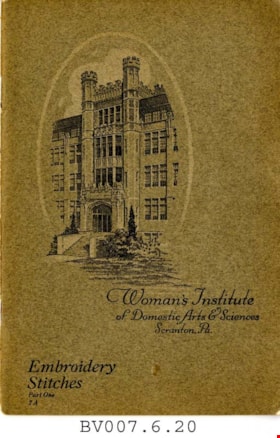
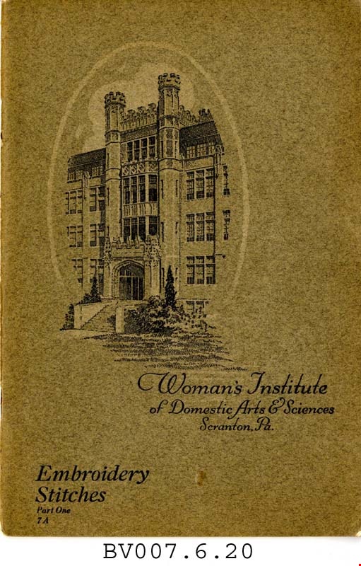
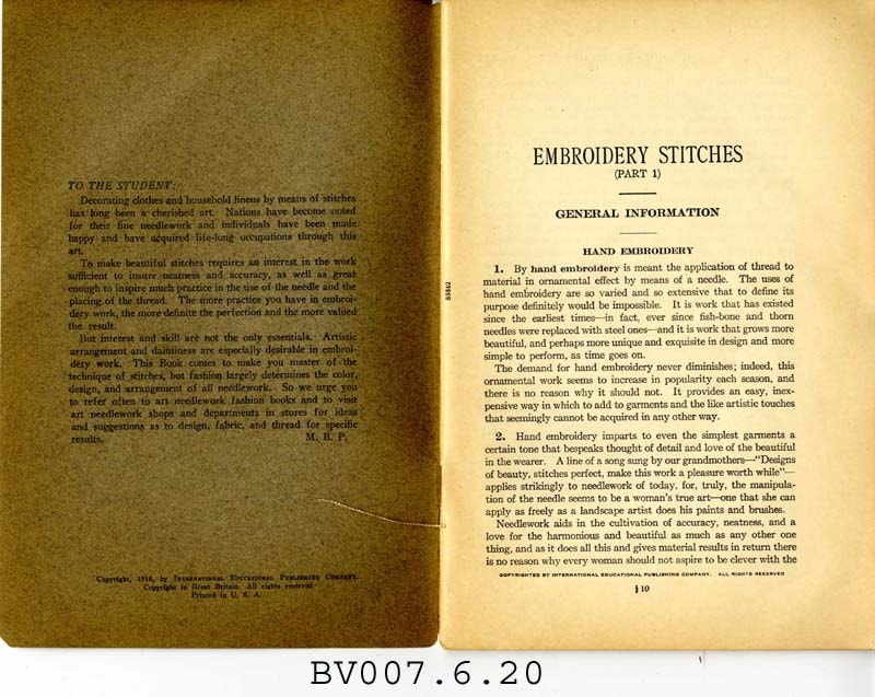
Embroidery stitches, part 1
https://search.heritageburnaby.ca/link/museumlibrary5006
- Repository
- Burnaby Village Museum
- Collection
- Special Collection
- Material Type
- Book
- Accession Code
- BV007.6.20
- Call Number
- 746.5 PIC
- Place of Publication
- Scranton, Pa.
- Publisher
- Woman's Institute of Domestic Arts and Sciences
- Publication Date
- 1921
- c1916
- Physical Description
- 44 p. : ill. : 23 cm.
- Library Subject (LOC)
- Embroidery--Study and teaching
- Stitches (Sewing)
- Subjects
- Documentary Artifacts - Booklets
- Object History
- Home sewing course used by Burnaby residents in the 1920's
- Notes
- Part 1 of 2
Images