Narrow Results By
Subject
- Buildings - Industrial - Factories 1
- Buildings - Religious - Churches 1
- Buildings - Schools 1
- Businesses - Real Estate Agencies 1
- Documentary Artifacts - Maps 1
- Exhibitions 1
- First Nations reserves - British Columbia 2
- Geographic Features - Forests 1
- Geographic Features - Roads 1
- Indigenous peoples - Indian Territory 1
Creator
- Adams, John 2
- Associated Factory Mutual Fire Insurance Cos 1
- Bancroft, Rose 1
- Bekins Moving and Storage Company Limited 1
- British Columbia Underwriters' Association 13
- Burnett, David H. 1
- Burnett & McGugan, Engineers and Surveyors 2
- City Map and White Print Co. 1
- City of Burnaby 1
- Coast Map and Blue Print Co. 1
- Dominion Map and Blueprint Co. 2
- Draper, William Nelson 1
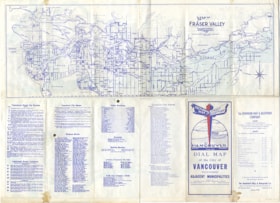
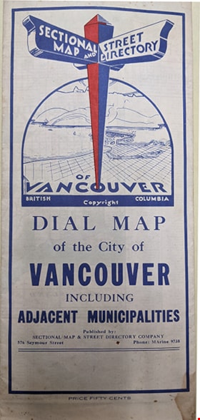
Sectional map and street directory of Vancouver : Dial map of greater Vancouver including adjacent municipalities
https://search.heritageburnaby.ca/link/museumdescription8697
- Repository
- Burnaby Village Museum
- Date
- [ca. 1950]
- Collection/Fonds
- Burnaby Village Museum Map collection
- Description Level
- Item
- Physical Description
- 2 maps and 1 p. of textual records on 1 sheet : lithographic prints, col. ; 55.5 x 75 cm + 2 dials and 25 x 72 cm + directory on sheet 55.5 x 75 cm, folded to 28.5 x 12.5 cm
- Scope and Content
- Item is a sectional map and street directory titled "Dial Map of Greater Vancouver and adjacent Municipalities" with a map on one side titled "Dial Map of Greater Vancouver and Suburbs" including Vancouver, West Vancouver, North Vancouver and Burnaby and includes street car and bus lines, railways,…
- Repository
- Burnaby Village Museum
- Collection/Fonds
- Burnaby Village Museum Map collection
- Description Level
- Item
- Physical Description
- 2 maps and 1 p. of textual records on 1 sheet : lithographic prints, col. ; 55.5 x 75 cm + 2 dials and 25 x 72 cm + directory on sheet 55.5 x 75 cm, folded to 28.5 x 12.5 cm
- Material Details
- Scales 1:42240, 1:144823
- 2 alphabetic dials on narrow strips of paper attached to map by grommets
- Scope and Content
- Item is a sectional map and street directory titled "Dial Map of Greater Vancouver and adjacent Municipalities" with a map on one side titled "Dial Map of Greater Vancouver and Suburbs" including Vancouver, West Vancouver, North Vancouver and Burnaby and includes street car and bus lines, railways, hospitals, parks, block nos. and street indexes with two alphabetic dials, one for Vancouver, the other for New Westminster. The other side of the map includes a map of "Fraser Valley" along with a directory of Vancouver street car and bus routes, business blocks, public buildings, hospitals, bathing beaches, locations of Vancouver fire halls and Vancouver city schools.
- Creator
- Dominion Map and Blueprint Co.
- Publisher
- Sectional Map and Street Directory Company
- Geographic Access
- Vancouver
- Accession Code
- BV000.3.11
- Access Restriction
- No restrictions
- Reproduction Restriction
- No known restrictions
- Date
- [ca. 1950]
- Media Type
- Cartographic Material
- Scan Resolution
- 380
- Scan Date
- 22-Dec-2020
- Scale
- 100
- Notes
- Title based on contents of map
Images
Commercial Map of Greater Vancouver and District
https://search.heritageburnaby.ca/link/museumdescription9552
- Repository
- Burnaby Village Museum
- Date
- July 1921
- Collection/Fonds
- Burnaby Village Museum Map collection
- Description Level
- Item
- Physical Description
- 1 map : col. lithograph mounted on linen ; 107 x 138 cm
- Scope and Content
- Commercial map of Greater Vancouver and District. Map depicts district lots, railroads, electric railways, streets, street car stops, schools, buildings, postal block numbers, parks and First Nations reserves. Map covers the geographcial areas of Vancouver, Burnaby, New Westminster, portions of Ric…
- Repository
- Burnaby Village Museum
- Collection/Fonds
- Burnaby Village Museum Map collection
- Description Level
- Item
- Physical Description
- 1 map : col. lithograph mounted on linen ; 107 x 138 cm
- Material Details
- Includes Legend and Index
- Scope and Content
- Commercial map of Greater Vancouver and District. Map depicts district lots, railroads, electric railways, streets, street car stops, schools, buildings, postal block numbers, parks and First Nations reserves. Map covers the geographcial areas of Vancouver, Burnaby, New Westminster, portions of Richmond, West Vancouver, North Vancouver, and Surrey with half mile circles that radiate from Vancouver City Hall on the corner of Main and Hastings. Bottom of map includes an index of street names, along with their corresponding map grid locations. The map is bordered by Marine Drive to the west, North Road to the east, Dempsey Street to the north and 20th Road to the south.
- History
- Bought by donor at thrift store years ago. No known provenance.
- Publisher
- Produced by Photo - Lithography, Colonist , Victoria, B.C.
- Geographic Access
- Vancouver
- Accession Code
- BV018.24.1
- Access Restriction
- No restrictions
- Reproduction Restriction
- No known restrictions
- Date
- July 1921
- Media Type
- Cartographic Material
- Scan Resolution
- 300
- Scan Date
- 16-Jun-20
- Scale
- 100
- Notes
- Transcribed title
- Title on map reads: "COMMERCIAL MAP / OF / GREATER VANCOUVER / AND / DISTRICT / Compiled and Published by / The Vancouver Map & Blueprint Co. Ltd. / 441 Seymour St. Vancouver B.C. / July, 1921".
Images
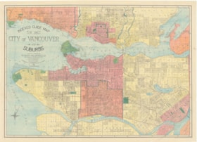
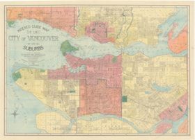
Indexed guide map of the City of Vancouver and suburbs
https://search.heritageburnaby.ca/link/museumdescription8678
- Repository
- Burnaby Village Museum
- Date
- [1920]
- Collection/Fonds
- Burnaby Village Museum Map collection
- Description Level
- Item
- Physical Description
- 1 map + textual record : col. lithographic print on paper ; 51.5 x 71 cm folded to 21 x 10 cm
- Scope and Content
- Item consists of a fold out map entitled "Indexed Guide Map of Vancouver and Suburbs" with index. Map includes concentric circles raditating out from Vancouver City Hall on corner of Hastings Street and Main Street; electric railways are indicated by heavy red lines in centres of streets. Includes …
- Repository
- Burnaby Village Museum
- Collection/Fonds
- Burnaby Village Museum Map collection
- Description Level
- Item
- Physical Description
- 1 map + textual record : col. lithographic print on paper ; 51.5 x 71 cm folded to 21 x 10 cm
- Material Details
- Scale [1:47520]
- Index on 4 pages within cardstock cover with advertisements on verso
- Scope and Content
- Item consists of a fold out map entitled "Indexed Guide Map of Vancouver and Suburbs" with index. Map includes concentric circles raditating out from Vancouver City Hall on corner of Hastings Street and Main Street; electric railways are indicated by heavy red lines in centres of streets. Includes old and new street names. Index includes a District Lot Index and Street Index.
- Publisher
- Vancouver Map and Blue Print Company
- Accession Code
- HV975.61.13
- Access Restriction
- No restrictions
- Reproduction Restriction
- No known restrictions
- Date
- [1920]
- Media Type
- Cartographic Material
- Textual Record
- Publisher Series
- 6th edition revised June 1920
- Scan Resolution
- 600
- Scan Date
- 2023-11-10
- Notes
- Title based on contents of map
- Cover of booklet reads: "INDEXED / Guide Map / of the CITY of / VANCOUVER / and / SUBURBS / Compiled and Published by / The Vancouver Map & Blue Print Co. / ...."INTERNATIONAL / BOOK SHOP / Cor. Columbia and Hastings Sts._Vancouver, B.C.".
Documents
Zoomable Images
Indexed guide map of the city of Vancouver and Suburbs
https://search.heritageburnaby.ca/link/museumdescription8694
- Repository
- Burnaby Village Museum
- Date
- 1914
- Collection/Fonds
- Burnaby Village Museum Map collection
- Description Level
- Item
- Physical Description
- 1 map + textual record : col. lithographic print on paper ; 55 x 78 cm on sheet 58.5 x 82 cm folded to 20 x 10 cm
- Scope and Content
- Item consists of a map "Indexed Guide Map of the City of Vancouver and Suburbs compiled and published by The Vancouver Map and Blueprint Co. Ltd. Map shows district lots, blocks and boundaries between City of Vancouver, Point Grey, South Vancouver, Burnaby, New Westminster and parts of Richmond, No…
- Repository
- Burnaby Village Museum
- Collection/Fonds
- Burnaby Village Museum Map collection
- Description Level
- Item
- Physical Description
- 1 map + textual record : col. lithographic print on paper ; 55 x 78 cm on sheet 58.5 x 82 cm folded to 20 x 10 cm
- Material Details
- Scale not defined
- Map is folded into booklet form
- Scope and Content
- Item consists of a map "Indexed Guide Map of the City of Vancouver and Suburbs compiled and published by The Vancouver Map and Blueprint Co. Ltd. Map shows district lots, blocks and boundaries between City of Vancouver, Point Grey, South Vancouver, Burnaby, New Westminster and parts of Richmond, North Vancouver and West Vancouver. Concentric cirlces indicate the distance in miles from the intersection of Main Street and Hastings Street, Vancouver in intervals of 1/2 mile. Map is folded into booklet form and includes a four page index with cardstock cover. Index page 1 is titled "Hotels"; page 2 is titled "District Lot Index"; pages 3-8 "Street Index".
- Publisher
- Vancouver Map and Blueprint Company Limited
- Edition
- 5th Edition revised to June 1914
- Geographic Access
- Vancouver
- Accession Code
- HV983.9.18
- Date
- 1914
- Media Type
- Cartographic Material
- Scan Resolution
- 600
- Scan Date
- 2023-08-17
- Notes
- Transcribed title from map and cover
- Sticker adhered to front cover of index of two lions "Service / "WE GIVE IT" / WESTERN SPECIALTY / LIMITED/ STATIONERS AND PRINTERS / VANCOUVER - B.C."
Documents
Zoomable Images
BC Electric Guide to Greater Vancouver
https://search.heritageburnaby.ca/link/archivedescription65826
- Repository
- City of Burnaby Archives
- Date
- April 1952
- Collection/Fonds
- Burnaby Historical Society fonds
- Description Level
- Item
- Physical Description
- 1 map : col. ; on paper ; 54 x 85 cm folded to 21 x 9 cm
- Scope and Content
- Item is the BC Electric Guide to Greater Vancouver consisting of a transit system map of Greater Vancouver, a Greater Vancouver Street Index along with listings for Parks, Golf and Country Clubs, etc.
- Repository
- City of Burnaby Archives
- Date
- April 1952
- Collection/Fonds
- Burnaby Historical Society fonds
- Subseries
- Pixie McGeachie subseries
- Physical Description
- 1 map : col. ; on paper ; 54 x 85 cm folded to 21 x 9 cm
- Material Details
- Scale : one inch equals approximately 0.57 miles
- Description Level
- Item
- Record No.
- 42686
- Accession Number
- BHS1996-08
- Scope and Content
- Item is the BC Electric Guide to Greater Vancouver consisting of a transit system map of Greater Vancouver, a Greater Vancouver Street Index along with listings for Parks, Golf and Country Clubs, etc.
- Media Type
- Cartographic Material
Bird's eye view of New Westminster, Burnaby and Vancouver
https://search.heritageburnaby.ca/link/museumdescription8199
- Repository
- Burnaby Village Museum
- Date
- [ca. 1911]
- Collection/Fonds
- Burnaby Village Museum Map collection
- Description Level
- Item
- Physical Description
- 1 map : hand painted ; 65.5 x 99 cm
- Scope and Content
- An untitled monochromatic grayscale map of a developer's bird's eye view looking north west from Burnaby Mountain. View includes Burnaby, New Westminster, Vancouver with the North shore in the distance. Burnaby neighbourhood subdivisions of "Burnaby Heights" and "Buena Vista" are featured near the…
- Repository
- Burnaby Village Museum
- Collection/Fonds
- Burnaby Village Museum Map collection
- Description Level
- Item
- Physical Description
- 1 map : hand painted ; 65.5 x 99 cm
- Scope and Content
- An untitled monochromatic grayscale map of a developer's bird's eye view looking north west from Burnaby Mountain. View includes Burnaby, New Westminster, Vancouver with the North shore in the distance. Burnaby neighbourhood subdivisions of "Burnaby Heights" and "Buena Vista" are featured near the centre of the map. These neighbourhood subdivisions were marketed by Real Estate Agents Liebly & Blumer in 1911. Roads, buildings, factories, railways and bridges are identified on the map.
- Subjects
- Businesses - Real Estate Agencies
- Responsibility
- Leibly & Blumer Realty Co. Incorporated
- Accession Code
- HV983.12.1
- Access Restriction
- No restrictions
- Reproduction Restriction
- No known restrictions
- Date
- [ca. 1911]
- Media Type
- Cartographic Material
- Historic Neighbourhood
- East Burnaby (Historic Neighbourhood)
- Vancouver Heights (Historic Neighbourhood)
- Planning Study Area
- Cariboo-Armstrong Area
- Burnaby Heights Area
- Scan Resolution
- 300
- Scan Date
- December 2020
- Scale
- 100
- Notes
- Title based on contents of map
- Note in pencil on verso of photograph reads: "Make tint block of Buena Vista / Blocks only as shown in lots"
Zoomable Images
Burrard-Westminster Boundary Railway Navigation Company (Vancouver to Mission)
https://search.heritageburnaby.ca/link/archivedescription706
- Repository
- City of Burnaby Archives
- Date
- 1912
- Collection/Fonds
- City Council and Office of the City Clerk fonds
- Description Level
- File
- Physical Description
- Textual record and cartographic material
- Scope and Content
- File contains correspondence and Council minutes regarding an application for electric railway from Vancouver through North Burnaby to Mission made by the Burrard Westminster Boundary Railway and Navigation Company.
- Repository
- City of Burnaby Archives
- Date
- 1912
- Collection/Fonds
- City Council and Office of the City Clerk fonds
- Physical Description
- Textual record and cartographic material
- Description Level
- File
- Record No.
- 2432
- Accession Number
- 2001-02
- Scope and Content
- File contains correspondence and Council minutes regarding an application for electric railway from Vancouver through North Burnaby to Mission made by the Burrard Westminster Boundary Railway and Navigation Company.
- Media Type
- Textual Record
- Cartographic Material
- Notes
- A map showing Vancouver - Mission is in map case.
Bylaw Number: 465 - City of Vancouver Water Supply Agreement Bylaw 1925
https://search.heritageburnaby.ca/link/bylaw22983
- Repository
- Legislative Services
- Bylaw Number
- 465
- Final Adoption
- 1925 Jun 08
- Format
- Bylaws - Adopted
- Collection/Fonds
- City Council and Office of the City Clerk fonds
- Repository
- Legislative Services
- Bylaw Number
- 465
- Final Adoption
- 1925 Jun 08
- Format
- Bylaws - Adopted
- Collection/Fonds
- City Council and Office of the City Clerk fonds
Documents
Bylaw Number: 466 - City of Vancouver Burwell Lake Water Supply Agreement Bylaw 1925
https://search.heritageburnaby.ca/link/bylaw22982
- Repository
- Legislative Services
- Bylaw Number
- 466
- Final Adoption
- 1925 Jun 08
- Format
- Bylaws - Adopted
- Collection/Fonds
- City Council and Office of the City Clerk fonds
- Repository
- Legislative Services
- Bylaw Number
- 466
- Final Adoption
- 1925 Jun 08
- Format
- Bylaws - Adopted
- Collection/Fonds
- City Council and Office of the City Clerk fonds
Documents
Bylaw Number: 566 - Greater Vancouver Water District Agreement Bylaw 1926
https://search.heritageburnaby.ca/link/bylaw22882
- Repository
- Legislative Services
- Bylaw Number
- 566
- Final Adoption
- 1927 Jan 20
- Format
- Bylaws - Adopted
- Collection/Fonds
- City Council and Office of the City Clerk fonds
- Repository
- Legislative Services
- Bylaw Number
- 566
- Final Adoption
- 1927 Jan 20
- Format
- Bylaws - Adopted
- Collection/Fonds
- City Council and Office of the City Clerk fonds
Documents
Bylaw Number: 582 - R P Clark and Company (Vancouver) Ltd Agreement Authorization Bylaw 1927
https://search.heritageburnaby.ca/link/bylaw22866
- Repository
- Legislative Services
- Bylaw Number
- 582
- Final Adoption
- 1927 Apr 19
- Format
- Bylaws - Adopted
- Collection/Fonds
- City Council and Office of the City Clerk fonds
- Repository
- Legislative Services
- Bylaw Number
- 582
- Final Adoption
- 1927 Apr 19
- Format
- Bylaws - Adopted
- Collection/Fonds
- City Council and Office of the City Clerk fonds
Documents
Bylaw Number: 707 - Vancouver and Districts Joint Sewerage and Drainage Board Easement Bylaw, 1928
https://search.heritageburnaby.ca/link/bylaw22744
- Repository
- Legislative Services
- Bylaw Number
- 707
- Final Adoption
- 1928 May 07
- Format
- Bylaws - Adopted
- Collection/Fonds
- City Council and Office of the City Clerk fonds
- Repository
- Legislative Services
- Bylaw Number
- 707
- Final Adoption
- 1928 May 07
- Format
- Bylaws - Adopted
- Collection/Fonds
- City Council and Office of the City Clerk fonds
Documents
Bylaw Number: 744 - Vancouver and Districts Joint Sewerage and Drainage Board Easement Bylaw No 2, 1928
https://search.heritageburnaby.ca/link/bylaw22707
- Repository
- Legislative Services
- Bylaw Number
- 744
- Final Adoption
- 1928 Jun 25
- Format
- Bylaws - Adopted
- Collection/Fonds
- City Council and Office of the City Clerk fonds
- Repository
- Legislative Services
- Bylaw Number
- 744
- Final Adoption
- 1928 Jun 25
- Format
- Bylaws - Adopted
- Collection/Fonds
- City Council and Office of the City Clerk fonds
Documents
Bylaw Number: 826 - Vancouver and Districts Joint Sewerage and Drainage Board Easement Bylaw
https://search.heritageburnaby.ca/link/bylaw22626
- Repository
- Legislative Services
- Bylaw Number
- 826
- Final Adoption
- 1929 Feb 04
- Format
- Bylaws - Adopted
- Collection/Fonds
- City Council and Office of the City Clerk fonds
- Repository
- Legislative Services
- Bylaw Number
- 826
- Final Adoption
- 1929 Feb 04
- Format
- Bylaws - Adopted
- Collection/Fonds
- City Council and Office of the City Clerk fonds
Documents
Bylaw Number: 1014 - Vancouver and Districts Joint Sewerage and Drainage Board Easement Authorization Bylaw 1930
https://search.heritageburnaby.ca/link/bylaw22439
- Repository
- Legislative Services
- Bylaw Number
- 1014
- Final Adoption
- 1930 Feb 24
- Format
- Bylaws - Adopted
- Collection/Fonds
- City Council and Office of the City Clerk fonds
- Repository
- Legislative Services
- Bylaw Number
- 1014
- Final Adoption
- 1930 Feb 24
- Format
- Bylaws - Adopted
- Collection/Fonds
- City Council and Office of the City Clerk fonds
Documents
Bylaw Number: 1211 - Greater Vancouver Water District Agreement Authorization Bylaw 1930
https://search.heritageburnaby.ca/link/bylaw22254
- Repository
- Legislative Services
- Bylaw Number
- 1211
- Final Adoption
- 1931 Jan 22
- Format
- Bylaws - Adopted
- Collection/Fonds
- City Council and Office of the City Clerk fonds
- Repository
- Legislative Services
- Bylaw Number
- 1211
- Final Adoption
- 1931 Jan 22
- Format
- Bylaws - Adopted
- Collection/Fonds
- City Council and Office of the City Clerk fonds
Documents
Bylaw Number: 1260 - Vancouver Rowing Club Lease Bylaw, 1931
https://search.heritageburnaby.ca/link/bylaw22205
- Repository
- Legislative Services
- Bylaw Number
- 1260
- Final Adoption
- 1931 May 18
- Format
- Bylaws - Adopted
- Collection/Fonds
- City Council and Office of the City Clerk fonds
- Repository
- Legislative Services
- Bylaw Number
- 1260
- Final Adoption
- 1931 May 18
- Format
- Bylaws - Adopted
- Collection/Fonds
- City Council and Office of the City Clerk fonds
Documents
Bylaw Number: 1279 - Greater Vancouver Water District Easement Authorization Bylaw 1931
https://search.heritageburnaby.ca/link/bylaw22186
- Repository
- Legislative Services
- Bylaw Number
- 1279
- Final Adoption
- 1931 Jun 29
- Format
- Bylaws - Adopted
- Collection/Fonds
- City Council and Office of the City Clerk fonds
- Repository
- Legislative Services
- Bylaw Number
- 1279
- Final Adoption
- 1931 Jun 29
- Format
- Bylaws - Adopted
- Collection/Fonds
- City Council and Office of the City Clerk fonds
Documents
Bylaw Number: 1381 - Vancouver and Districts Joint Sewerage and Drainage Board Easement Authorization Bylaw 1932
https://search.heritageburnaby.ca/link/bylaw22084
- Repository
- Legislative Services
- Bylaw Number
- 1381
- Final Adoption
- 1932 May 16
- Format
- Bylaws - Adopted
- Collection/Fonds
- City Council and Office of the City Clerk fonds
- Repository
- Legislative Services
- Bylaw Number
- 1381
- Final Adoption
- 1932 May 16
- Format
- Bylaws - Adopted
- Collection/Fonds
- City Council and Office of the City Clerk fonds
Documents
Bylaw Number: 1450 - Greater Vancouver Water District Accounts Payment Extension Bylaw, 1933
https://search.heritageburnaby.ca/link/bylaw22015
- Repository
- Legislative Services
- Bylaw Number
- 1450
- Final Adoption
- 1933 Jun 14
- Format
- Bylaws - Adopted
- Collection/Fonds
- City Council and Office of the City Clerk fonds
- Repository
- Legislative Services
- Bylaw Number
- 1450
- Final Adoption
- 1933 Jun 14
- Format
- Bylaws - Adopted
- Collection/Fonds
- City Council and Office of the City Clerk fonds
![Sectional map and street directory of Vancouver : Dial map of greater Vancouver including adjacent municipalities, [ca. 1950] thumbnail](/media/hpo/_Data/_BVM_Cartographic_Material/2000/2000_0003_0011_001%20WEB.jpg?width=280)


![Indexed guide map of the City of Vancouver and suburbs, [1920] thumbnail](/media/hpo/_Data/_BVM_Cartographic_Material/1975/1975_0061_0013_001.jpg?width=280)
![Indexed guide map of the City of Vancouver and suburbs, [1920] thumbnail](/media/hpo/_Data/_BVM_Cartographic_Material/1975/1975_0061_0013_002_seadragon/1975_0061_0013_002.jpg?w=280)


![Bird's eye view of New Westminster, Burnaby and Vancouver, [ca. 1911] thumbnail](/media/hpo/_Data/_BVM_Cartographic_Material/1983/1983_0012_0001_002%20Web.jpg?width=280)
![Bird's eye view of New Westminster, Burnaby and Vancouver, [ca. 1911] thumbnail](/media/hpo/_Data/_BVM_Cartographic_Material/1983/1983_0012_0001_001_seadragon/1983_0012_0001_001.jpg?w=280)