Narrow Results By
Decade
- 2020s 91
- 2010s 221
- 2000s 357
- 1990s
- 1980s 580
- 1970s 1267
- 1960s 596
- 1950s 463
- 1940s
- 1930s
- 1920s 537
- 1910s
- 1900s 139
- 1890s
- 1880s 27
- 1870s 10
- 1860s 21
- 1850s 8
- 1840s 4
- 1830s 2
- 1820s 2
- 1810s 3
- 1800s 3
- 1790s 3
- 1780s 3
- 1770s 3
- 1760s 3
- 1750s 3
- 1740s 3
- 1730s 3
- 1720s 3
- 1710s 3
- 1700s 3
- 1690s 3
- 1680s 3
- 1670s 2
- 1660s 2
- 1650s 2
- 1640s 2
- 1630s 2
- 1620s 2
- 1610s 2
- 1600s 2
- 1590s 1
- 1580s 1
- 1570s 1
- 1560s 1
- 1550s 1
- 1540s 1
- 1530s 1
- 1520s 2
- 1510s 1
- 1500s 1
- 1490s 1
- 1480s 1
Creator
- Adams, Edith 1
- Adams, John, 1926-1998 1
- Aitkenhead, May 1
- Albert F. Arnold McCarter & Nairne 1
- Aldwinckle, Eric 1
- Allen, R. W., 1876-1921 1
- Ames, A. F. (Albert Flintoft) 1
- Anger, Harry D. (Harry Dell), 1888-1953 1
- Anger, William Henry 2
- Annesley, Peggy 1
- Anstey, Arthur 2
- Armstrong, W. H. (William Henry) 1
The history of freemasonry in Canada from its introduction in 1749 embracing a general history of the craft and its origin, but more particularly a history of the craft in the province of Upper Canada, now Ontario, in the Dominion of Canada : compiled and written from official records and from mss. covering the period from 1749-1858, in the possession of the author, Volume 1
https://search.heritageburnaby.ca/link/museumlibrary2704
- Repository
- Burnaby Village Museum
- Collection
- Special Collection
- Material Type
- Book
- Accession Code
- HV974.60.1
- Call Number
- 366.10971 ROB v.1
- Place of Publication
- Toronto, Ont.
- Publisher
- The Hunter, Rose Company, Limited
- Publication Date
- 1899
- Physical Description
- xxi, 1196 p. : ill. (incl. ports.) maps (some folded) plans, facsims. (some folded) folded tables. ; 26 cm.
- Library Subject (LOC)
- Freemasons--History
- Secret societies--Canada
- Freemasonry
- Notes
- "Grand Lodge of Ancient Free and Accepted Masons of Canada" with the Arms of the Grand Lodge of Canada -- Front Cover
- "The edition of this work consists of two thousand sets. The number of this set is 29."
- Includes index.
- Author's given name and dates: Robertson, J. Ross (John Ross), 1841-1918.
The history of freemasonry in Canada from its introduction in 1749 embracing a general history of the craft and its origin, but more particularly a history of the craft in the province of Upper Canada, now Ontario, in the Dominion of Canada : compiled and written from official records and from mss. covering the period from 1749-1858, in the possession of the author, Volume 2
https://search.heritageburnaby.ca/link/museumlibrary2705
- Repository
- Burnaby Village Museum
- Collection
- Special Collection
- Material Type
- Book
- Accession Code
- HV974.60.2
- Call Number
- 366.10971 ROB v.2
- Place of Publication
- Toronto, Ont.
- Publisher
- The Hunter, Rose Company, Limited
- Publication Date
- 1899
- Physical Description
- xxiv, 979 p. : ill. (incl. ports.) maps (some folded) plans, facsims. (some folded) folded tables. ; 26 cm.
- Inscription
- "April 30 1874 / John Leslie St. Clair no 1353 R C Mitters Ont / H M 1895 Prince Ruperts Lodge N 13R M / Z 1883 1884 Prince Ruperts Rct 6 no 52 3R6 / Treasurers King Edward Preceptory / members it & SS Rite 32 April 8th 1887 / at it O M M S Khuram / Grand Masters Manitoba June 1899 June 1903 / Grand Z G C of Canada 1907 & 1908 / Semi Centennial held Toronto Jun 22 1908 / W M St Clair December 27 1878 to Dec 27th 1880" -- handwritten in ink on flyleaf.
- Library Subject (LOC)
- Freemasons--History
- Secret societies--Canada
- Freemasonry
- Notes
- "Grand Lodge of Ancient Free and Accepted Masons of Canada" with the Arms of the Grand Lodge of Canada -- Front Cover
- "The edition of this work consists of two thousand sets. The number of this set is 29."
- Includes index.
- Author's given name and dates: Robertson, J. Ross (John Ross), 1841-1918.
Captain William Eyres Residence
https://search.heritageburnaby.ca/link/landmark565
- Repository
- Burnaby Heritage Planning
- Description
- Residential building.
- Associated Dates
- c.1910
- Street View URL
- Google Maps Street View
- Repository
- Burnaby Heritage Planning
- Geographic Access
- Canada Way
- Associated Dates
- c.1910
- Description
- Residential building.
- Heritage Value
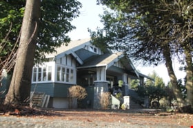
- This home was built by Captain William J. Eyres. In 1912, it was reported in The British Columbian: “Captain Eyres of Seattle is remodelling the front of his house on Douglas Road and otherwise improving it.” The house was later sold to William A. Mawhinney, who subsequently built houses at 6011 Buckingham Avenue and 7616 Burris Avenue. This spacious, high-quality Craftsman bungalow remains in excellent condition. It features a cross-gabled roof with multiple half-timbered front gables with large exposed purlins, in contrast to the shingle cladding on the rest of the house. At the front corner is a glazed sun-room. The entrance porch features tripled square columns. The property still has a beautiful garden, but once included large vegetable gardens, an orchard, and a large chicken house.
- Locality
- Burnaby Lake
- Historic Neighbourhood
- Burnaby Lake (Historic Neighbourhood)
- Planning Study Area
- Morley-Buckingham Area
- Area
- 1709.65
- Contributing Resource
- Building
- Ownership
- Private
- Street Address
- 6079 Canada Way
- Street View URL
- Google Maps Street View
Images
East Burnaby School (Edmonds Street School)
https://search.heritageburnaby.ca/link/landmark735
- Repository
- Burnaby Heritage Planning
- Geographic Access
- Canada Way
- Associated Dates
- 1894
- Heritage Value
- One of the first tasks of Burnaby's Municipal Government upon its incorporation was to lobby for a public school in Burnaby. By 1893, land on Douglas Road near Edmonds was donated and the new school was built in 1893. The one-room school opened on January 22, 1894 with 29 students under the charge of teacher, Ethel LePage. The School has been known as the Burnaby School (until1896), and then East Burnaby School from 1896 to 1907 and finally, Edmonds Street School.
- Historic Neighbourhood
- Edmonds (Historic Neighbourhood)
- Planning Study Area
- Edmonds Area
- Street Address
- 7376 Canada Way
- Street View URL
- Google Maps Street View
Images
Geoffrey & Kathleen Burnett Residence
https://search.heritageburnaby.ca/link/landmark582
- Repository
- Burnaby Heritage Planning
- Description
- Residential building.
- Associated Dates
- 1914
- Formal Recognition
- Heritage Designation, Community Heritage Register
- Street View URL
- Google Maps Street View
- Repository
- Burnaby Heritage Planning
- Geographic Access
- Canada Way
- Associated Dates
- 1914
- Formal Recognition
- Heritage Designation, Community Heritage Register
- Enactment Type
- Bylaw No. 13841
- Enactment Date
- 28/05/2018
- Description
- Residential building.
- Heritage Value
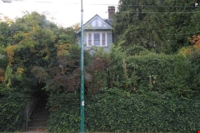
- With its long, narrow plan and hipped, cross-gabled roof, this impressive residence was designed for local surveyor and civil engineer Geoffrey Kirby Burnett, who married Kathleen Wallen (1888-1978) in 1916. It was designed by New Westminster architects R.W. Coventry Dick & Son. Beautifully conceived in the British Arts and Crafts style, it features a steeply-gabled roof over the side entry porch, with square timber columns. Other decorative details include half timbering in the gables, first storey casement windows with leaded transom lights and decorative window hoods on the side elevation.
- Locality
- Edmonds
- Historic Neighbourhood
- Edmonds (Historic Neighbourhood)
- Planning Study Area
- Richmond Park Area
- Architect
- R.W. Coventry Dick & Son
- Area
- 903.70
- Contributing Resource
- Building
- Ownership
- Private
- Street Address
- 7037 Canada Way
- Street View URL
- Google Maps Street View
Images
Hans & Anna Hau Residence
https://search.heritageburnaby.ca/link/landmark588
- Repository
- Burnaby Heritage Planning
- Description
- Residential building.
- Associated Dates
- c.1935
- Street View URL
- Google Maps Street View
- Repository
- Burnaby Heritage Planning
- Geographic Access
- Canada Way
- Associated Dates
- c.1935
- Description
- Residential building.
- Heritage Value
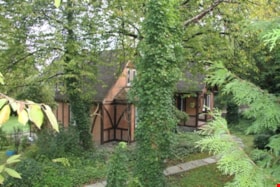
- Danish builder Hans Jorgensen Hau (1878-1944) and his wife Anna (née Sorenson, 1874-1956), constructed this highly-distinctive Tudor Revival residence circa 1935. This was a time of entrenched traditionalism, and most domestic architecture reflected period revival styles. Tudor elements have been compressed here into a cottage form, including a distinctive front façade with half timbering and brick noggin; on the sides the nogging is rock-dash stucco. Casement windows contribute to the cottage appearance. The rear façade is clad with more utilitarian shingles. A prominent brick chimney exhibits angled and corbelled brickwork. Hau worked as a bricklayer and stonemason, and this house has common elements with the Moore Residence at 5165 Sperling Avenue, which Hau designed and constructed in 1943.
- Locality
- Burnaby Lake
- Historic Neighbourhood
- Burnaby Lake (Historic Neighbourhood)
- Planning Study Area
- Morley-Buckingham Area
- Area
- 2010.52
- Contributing Resource
- Building
- Ownership
- Private
- Street Address
- 5070 Canada Way
- Street View URL
- Google Maps Street View
Images
Lonsdale Guardhouse Residence
https://search.heritageburnaby.ca/link/landmark617
- Repository
- Burnaby Heritage Planning
- Description
- Residential building.
- Associated Dates
- 1914
- Street View URL
- Google Maps Street View
- Repository
- Burnaby Heritage Planning
- Geographic Access
- Canada Way
- Associated Dates
- 1914
- Description
- Residential building.
- Heritage Value
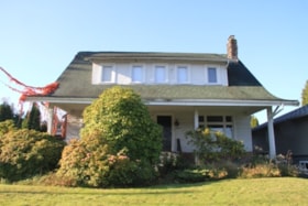
- The house was built by Lonsdale L. Guardhouse, who was employed with the real estate company of Merithew & Ramsay in 1912. The British Columbian reported in November 1913 that: "Mr. L.L. Guardhouse, a well-known New Westminster man has recently let the contract for a home on Douglas Road near Edmonds Street. This Building is to be erected after the bungalow style and will cost when completed about $4,000." This Craftsman style pattern-book residence is notable for its unusual roofline, which features gently curved eaves. The house remains in excellent original condition and retains its lapped and shingled siding. Other notable features of the house include its pre-cast concrete block foundation–simulated to look like cut stone–and a rustic red-brick chimney. The front verandah has been altered through the removal of its floor structure. Many houses at the time were built from Craftsman-style pattern book designs, which were readily available in magazines and brochures. This house has a twin located in New Westminster at 315 Fifth Avenue.
- Locality
- Edmonds
- Historic Neighbourhood
- Edmonds (Historic Neighbourhood)
- Planning Study Area
- Richmond Park Area
- Area
- 828.85
- Contributing Resource
- Building
- Ownership
- Private
- Street Address
- 6985 Canada Way
- Street View URL
- Google Maps Street View
Images
Assessment Roll Reductions for Canada Safeway, Sears Canada, and Burlington Northern Railway Properties
https://search.heritageburnaby.ca/link/councilreport5548
- Repository
- City of Burnaby Archives
- Report ID
- 61577
- Meeting Date
- 13-Jul-1998
- Format
- Council - Manager's Report
- Manager's Report No.
- 19
- Item No.
- 25
- Collection/Fonds
- City Council and Office of the City Clerk fonds
- Repository
- City of Burnaby Archives
- Report ID
- 61577
- Meeting Date
- 13-Jul-1998
- Format
- Council - Manager's Report
- Manager's Report No.
- 19
- Item No.
- 25
- Collection/Fonds
- City Council and Office of the City Clerk fonds
Documents
Proposed Duplex Development - 5060 Canada Way - Canada Way/Clayton Avenue Area Plan
https://search.heritageburnaby.ca/link/councilreport5966
- Repository
- City of Burnaby Archives
- Report ID
- 61188
- Meeting Date
- 15-Dec-1997
- Format
- Council - Manager's Report
- Manager's Report No.
- 33
- Item No.
- 6
- Collection/Fonds
- City Council and Office of the City Clerk fonds
- Repository
- City of Burnaby Archives
- Report ID
- 61188
- Meeting Date
- 15-Dec-1997
- Format
- Council - Manager's Report
- Manager's Report No.
- 33
- Item No.
- 6
- Collection/Fonds
- City Council and Office of the City Clerk fonds
Documents
Statistics Canada - Report on the Demographic Situation in Canada 1994 - Current Demographic Analysis
https://search.heritageburnaby.ca/link/archivedescription32060
- Repository
- City of Burnaby Archives
- Date
- 1994
- Collection/Fonds
- Planning Department fonds
- Description Level
- File
- Physical Description
- Textual record
- Repository
- City of Burnaby Archives
- Date
- 1994
- Collection/Fonds
- Planning Department fonds
- Physical Description
- Textual record
- Description Level
- File
- Record No.
- 35074
- Accession Number
- 2006-16
- Media Type
- Textual Record
Who's who in western Canada : a bibliographical dictionary of notable living men and women of western Canada
https://search.heritageburnaby.ca/link/museumlibrary3393
- Repository
- Burnaby Village Museum
- Collection
- Special Collection
- Material Type
- Book
- Accession Code
- BV993.12.3
- Call Number
- 920 WHO
- Contributor
- Parker, C. W. (Charles Wallace), 1864-1932
- Place of Publication
- Vancouver
- Publisher
- Canadian Press Association
- Publication Date
- 1911
- Physical Description
- 390 p. : ill., ports. ; 20 cm.
- Library Subject (LOC)
- Canada
- Dictionaries
- Biography
- Notes
- "Edited by C.W. Parker" --t.p.
Who's who in western Canada : a bibliographical dictionary of notable living men and women of western Canada, volume 1
https://search.heritageburnaby.ca/link/museumlibrary1820
- Repository
- Burnaby Village Museum
- Collection
- Special Collection
- Material Type
- Book
- Accession Code
- HV983.61.2
- Call Number
- 920 WHO
- Contributor
- Parker, C. W. (Charles Wallace), 1864-1932
- Place of Publication
- Vancouver
- Publisher
- Canadian Press Association
- Publication Date
- 1911
- Physical Description
- 390 p. : ill., ports. ; 20 cm.
- Inscription
- "Presented to Burnaby Historical Society _______ B Brown __M_ Burnaby 1932 to 1959" [handwritten in blue ink on front endpaper]
- Library Subject (LOC)
- Canada
- Dictionaries
- Biography
- Notes
- "Edited by C.W. Parker" --title page
Shadbolt Centre for the Arts
https://search.heritageburnaby.ca/link/landmark820
- Repository
- Burnaby Heritage Planning
- Geographic Access
- Deer Lake Avenue
- Associated Dates
- 1995
- Heritage Value
- The Shadbolt Centre for the Arts opened in 1995. The Shadbolt Centre was named after two Burnaby residents who dedicated a lifetime of support and cultivation of the arts locally, nationally and internationally. Doris and Jack Shadbolt resided in Burnaby for over 50 years until Jack's death in November 1998. Doris Shadbolt spent her life's work bringing the artist and the audience closer together through her writing and curatorial work. Jack Shadbolt was an internationally recognized Canadian painter. He was also an author and both received many awards including the Order of Canada. In keeping with the Shadbolts' generosity the arts, Jack Shadbolt donated two of his paintings to the Centre for permanent display.
- Historic Neighbourhood
- Burnaby Lake (Historic Neighbourhood)
- Planning Study Area
- Douglas-Gilpin Area
- Street Address
- 6450 Deer Lake Avenue
- Street View URL
- Google Maps Street View
Images
Copy of Official British Columbia Road Maps
https://search.heritageburnaby.ca/link/museumdescription18945
- Repository
- Burnaby Village Museum
- Date
- [193-]
- Collection/Fonds
- Burnaby Village Museum Map collection
- Physical Description
- 1 map : lithographic print on sheet ; 43 x 56 cm folded to 22 x 11 cm
- Scope and Content
- Item consists of Road maps of British Columbia presented by Union Oil Company of Canada Limited. Includes seventeen maps printed on both sides of sheet. One side of sheet includes ten separate road maps titled "Cariboo"; "Chilcotin Plateau"; "150 Mile House to Prince George"; "Prince George - Burns…
- Repository
- Burnaby Village Museum
- Collection/Fonds
- Burnaby Village Museum Map collection
- Physical Description
- 1 map : lithographic print on sheet ; 43 x 56 cm folded to 22 x 11 cm
- Material Details
- Scale not defined
- Scope and Content
- Item consists of Road maps of British Columbia presented by Union Oil Company of Canada Limited. Includes seventeen maps printed on both sides of sheet. One side of sheet includes ten separate road maps titled "Cariboo"; "Chilcotin Plateau"; "150 Mile House to Prince George"; "Prince George - Burns Lake"; "Burns Lake - Hazelton"; "Similkameen - Nicola"; "Salmon Arm to Revelstoke"; "Ashcroft to Salmon Arm / Kamloops to Vernon"; "Okanagan Valley"; "Boundary District". Other side of sheet includes seven road maps titled "Vancouver Island"; "Vancouver to Yale"' "Fraser Canyon Section Cariboo Road"; "Lytton to 150 Mile House"; "Arrow and Kootenay Lakes"; "The Kootenays"; "Columbia Valley". When folded, cover of maps reads "COPY OF / OFFICIAL / BRITISH COLUMBIA / ROAD-MAPS" / Presented by / UNION OIL / COMPANY / of Canada Ltd."; verso of cover includes advertisement for Union Motor oil "MOTORITE"; inside cover includes advertisement for Union Gasoline with title reading "See Canada's Evergreen Playground".
- Responsibility
- Union Oil Company of Canada Limited
- Accession Code
- HV972.179.1
- Access Restriction
- No restrictions
- Reproduction Restriction
- No known restrictions
- Date
- [193-]
- Media Type
- Cartographic Material
- Scan Resolution
- 600
- Scan Date
- 2023-08-17
- Notes
- Title based on contents of map
Images
Excursions in northern British Columbia and Yukon Territory and along the North Pacific Coast : excursions C8 and C9; no.10
https://search.heritageburnaby.ca/link/museumlibrary537
- Repository
- Burnaby Village Museum
- Collection
- Special Collection
- Material Type
- Book
- Accession Code
- BV986.53.45
- Call Number
- 557.1 GSC
- Place of Publication
- Ottawa
- Publisher
- Government Printing Bureau
- Publication Date
- 1913
- Physical Description
- 179 p. : ill., maps (some folded) ; 20 cm.
- Inscription
- Stamped inside: "Kennco Library"
- Library Subject (LOC)
- Geology--British Columbia
- Geology--Yukon
- British Columbia--Description and travel
- Canada, Western--Description and travel
- Yukon--Description and travel
- Notes
- "Excursions C8 and C9."
- Six maps on folded leaves in pocket.
- Includes bibliographies.
The Labrador Eskimo, no. 1637
https://search.heritageburnaby.ca/link/museumlibrary1998
- Repository
- Burnaby Village Museum
- Collection
- Special Collection
- Material Type
- Book
- Accession Code
- HV980.2.13
- Call Number
- 970.4 HAW
- Place of Publication
- Ottawa
- Publisher
- Government Printing Bureau
- Publication Date
- 1916
- Physical Description
- x, 235 p., viii : ill., map ; 25 cm.
- Library Subject (LOC)
- Inuit--Newfoundland and Labrador--Labrador
- Inuit--Quebec (Province)
- Notes
- At head of title: Canada, Department of Mines, Geological Survey
- "No. 1637"
State of the environment for the Lower Fraser River Basin
https://search.heritageburnaby.ca/link/museumlibrary7450
- Repository
- Burnaby Village Museum
- Collection
- Reference Collection
- Material Type
- Textual Record
- ISBN
- 0662192346
- Call Number
- 363.7 SOE
- Place of Publication
- Ottawa, (Ont)
- Publisher
- Canada. Environment Canada.
- Publication Date
- c1992
- Physical Description
- 79 p. : ill., maps ; 22 x 28 cm.
- Library Subject (LOC)
- Environmental monitoring--Fraser River (B.C.)
- Environmental surveillance--Fraser River (B.C.)
- Environmental health--Fraser River (B.C.)
- Environmental monitoring--British Columbia
- Notes
- Co-published by the British Columbia Ministry of Environment, Lands and Parks.
- Includes bibliographical references.
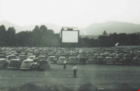
Cascades Drive-In Theatre
https://search.heritageburnaby.ca/link/landmark689
- Repository
- Burnaby Heritage Planning
- Geographic Access
- Grandview Highway
- Associated Dates
- 1946
- Heritage Value
- The Cascades Drive-In Theatre was Canada's first drive-in and was started by George and William Steel and Joe and Art Johnson in 1946. Built along Grandview Highway (Canada Way) near Smith Street, the theatre opened on August 30, 1946. In 1977, the theatre was purchased by Don Soutar, Al Chappell and Norm Green and continued to operate until 1980. The property was then redeveloped as Cascades Village - a large condominium complex.
- Historic Neighbourhood
- Broadview (Historic Neighbourhood)
- Planning Study Area
- Cascade-Schou Area
- Street Address
- 4050 Grandview Highway
Images
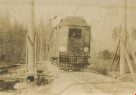
BCER Burnaby Lake Line
https://search.heritageburnaby.ca/link/landmark760
- Repository
- Burnaby Heritage Planning
- Associated Dates
- 1911
- Heritage Value
- The Burnaby Lake Line was constructed due to the advocacy of Burnaby residents and the Municipality of Burnaby to build the line. A petition was circulated by residents in 1907, and eventually substantial land bonuses were given to the company to induce them to build the line. Property owners in the area hoped the construction of the line would increase their land values. Construction of the 15-mile line was announced in 1909, and the line opened in 1911. The line travelled from Vancouver to New Westminister through central Burnaby.The last day of service was October 23, 1953. When the Trans Canada highway was constructed in the 1960s, it followed the right of way of the Burnaby Lake Line through Burnaby.
- Historic Neighbourhood
- Burnaby Lake (Historic Neighbourhood)
- Planning Study Area
- Burnaby Lake Area
Images
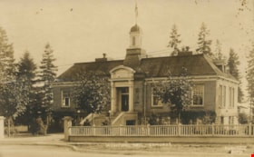
Burnaby Municipal Hall
https://search.heritageburnaby.ca/link/landmark763
- Repository
- Burnaby Heritage Planning
- Geographic Access
- Kingsway
- Associated Dates
- 1911
- Heritage Value
- In 1911, a brick building was built to replace the smaller wooden structure that had served as Burnaby's Municipal Hall since 1899. This new, larger structure was built to reflect Burnaby's growth into a large suburban municipality and remained in use for over 40 years. The old Municipal Hall became a public hall which was demolished upon the construction of the Edmonds Branch of the Burnaby Public Library in 1962. The second Municipal Hall was renovated in 1956 (when the current City Hall was built at Canada Way), and was used as a Police building. In 1966 after the construction of the new Justice Building, the old 1911 Municipal Hall was left vacant and in 1970 it was demolished. The site was redeveloped as a senior citizens residential centre with Edmonds House built on the old hall location.
- Historic Neighbourhood
- Edmonds (Historic Neighbourhood)
- Planning Study Area
- Stride Avenue Area
- Street Address
- 7282 Kingsway

![Copy of Official British Columbia Road Maps, [193-] thumbnail](/media/hpo/_Data/_BVM_Cartographic_Material/1972/1972_0179_0001_001.jpg?width=280)

