Narrow Results By
Creator
- Canada. Department of Mines 2
- Canada. Department of Mines and Technical Surveys. Geographical Branch 1
- Canadian National Railways 1
- Canadian Pacific Railway Company 1
- City of Winnipeg 1
- Donoahue, J. 1
- Garden, Hermon & Burwell 1
- Geological Survey of Canada 2
- Government of Canada - Department of Mines - Geological Survey Branch 1
- Hawkes, Ernest William, 1883- 1
- Hill, Albert James 1
- Hopkins, D. 1
Dease Lake survey map
https://search.heritageburnaby.ca/link/archivedescription64449
- Repository
- City of Burnaby Archives
- Date
- April 12, 1944
- Collection/Fonds
- Burnaby Historical Society fonds
- Description Level
- Item
- Physical Description
- 1 map
- Scope and Content
- Item is a Dease Lake survey map produced by the Canada Department of Mines and Resources, Surveys and Engineering Branch.
- Repository
- City of Burnaby Archives
- Date
- April 12, 1944
- Collection/Fonds
- Burnaby Historical Society fonds
- Subseries
- Bancroft family subseries
- Physical Description
- 1 map
- Description Level
- Item
- Record No.
- MSS110-037
- Accession Number
- BHS2004-06
- Scope and Content
- Item is a Dease Lake survey map produced by the Canada Department of Mines and Resources, Surveys and Engineering Branch.
- Media Type
- Cartographic Material
Excursions in northern British Columbia and Yukon Territory and along the North Pacific Coast : excursions C8 and C9; no.10
https://search.heritageburnaby.ca/link/museumlibrary537
- Repository
- Burnaby Village Museum
- Collection
- Special Collection
- Material Type
- Book
- Accession Code
- BV986.53.45
- Call Number
- 557.1 GSC
- Place of Publication
- Ottawa
- Publisher
- Government Printing Bureau
- Publication Date
- 1913
- Physical Description
- 179 p. : ill., maps (some folded) ; 20 cm.
- Inscription
- Stamped inside: "Kennco Library"
- Library Subject (LOC)
- Geology--British Columbia
- Geology--Yukon
- British Columbia--Description and travel
- Canada, Western--Description and travel
- Yukon--Description and travel
- Notes
- "Excursions C8 and C9."
- Six maps on folded leaves in pocket.
- Includes bibliographies.
The Labrador Eskimo, no. 1637
https://search.heritageburnaby.ca/link/museumlibrary1998
- Repository
- Burnaby Village Museum
- Collection
- Special Collection
- Material Type
- Book
- Accession Code
- HV980.2.13
- Call Number
- 970.4 HAW
- Place of Publication
- Ottawa
- Publisher
- Government Printing Bureau
- Publication Date
- 1916
- Physical Description
- x, 235 p., viii : ill., map ; 25 cm.
- Library Subject (LOC)
- Inuit--Newfoundland and Labrador--Labrador
- Inuit--Quebec (Province)
- Notes
- At head of title: Canada, Department of Mines, Geological Survey
- "No. 1637"
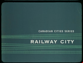
Railway City
https://search.heritageburnaby.ca/link/museumlibrary7535
- Repository
- Burnaby Village Museum
- Publication Date
- c[1960]
- Repository
- Burnaby Village Museum
- Collection
- Special Collection
- Material Type
- Photograph
- Accession Code
- BV016.7.9
- Contributor
- Hopkins, D.
- Donoahue, J.
- Moller, Hans
- Canadian National Railways
- Canadian Pacific Railway Company
- City of Winnipeg
- Manitoba Hydro
- Province of Manitoba
- Library and Archives Canada
- Place of Publication
- Ottawa
- Publisher
- National Film Board of Canada
- Publication Date
- c[1960]
- Physical Description
- 52 photographs : filmstrip ; cellulose aacetate, col. pos.
- Library Subject (LOC)
- Documentary Films
- Filmstrips
- Subjects
- Transportation - Rail
- Object History
- Came in with Oakalla Prison records and artifacts in 1991. Filmstrip was utilized by staff and inmates of Oakalla. Digitized by BVM into preservation and accessible formats in 2020.
- Notes
- A Canadian Series educational filmstrip about the history of Winnipeg and its development as a railway city. Visual material was provided by: Canadian National Railways and Canadian Pacific Railway, Montreal; City of Winnipeg Engineering Departments; Manitoba Hydro Electric Board - Winnipeg; Province of Manitoba, Department of Industry and Commerce and The Public Archives of Canada - Ottawa.
Images

Documents

Subdivision plans in New Westminster District Group 1 – Burnaby, Vancouver and map - Canada Department of Mines
https://search.heritageburnaby.ca/link/museumdescription6994
- Repository
- Burnaby Village Museum
- Date
- 1890-1909
- Collection/Fonds
- Burnaby Village Museum Map collection
- Description Level
- File
- Physical Description
- 1 plan : graphite on paper + 2 plans : black ink on paper + 1 map : col. on paper mounted on 2 sides of cardboard 76 x 102 cm
- Scope and Content
- Item consists of a large board with one New Westminster District subdivision plan mounted on one side and two New Westminster District subdivision plans and one colour map mounted on the other side. Side A: 1. "Plan / of Subdivision of / Blocks 2, 3, 4, 5, 6 / Lot 77 / Group 1 / New Westminster D…
- Repository
- Burnaby Village Museum
- Collection/Fonds
- Burnaby Village Museum Map collection
- Description Level
- File
- Physical Description
- 1 plan : graphite on paper + 2 plans : black ink on paper + 1 map : col. on paper mounted on 2 sides of cardboard 76 x 102 cm
- Material Details
- Scales 1:720 and 1:1200 and 1:.00001578
- Scope and Content
- Item consists of a large board with one New Westminster District subdivision plan mounted on one side and two New Westminster District subdivision plans and one colour map mounted on the other side. Side A: 1. "Plan / of Subdivision of / Blocks 2, 3, 4, 5, 6 / Lot 77 / Group 1 / New Westminster District / BC. / Scale 100 feet = 1 inch", "Deposited 8th day / of April 1890 / Mowileg [sic] / Dist. Regt". Plan is drawn in graphite with annotations: "AB_Parts_lettered_are_lots_in / the_different_subdivisions" / "Owners: / James E. Hall / P.S.Cabilan [sic] by his attorney Joseph Hall / Joseph Hall / Eliza J. Shannon / John Harrison"; "This plan is correct and is prepared under the / provisions of the Land Registry Act" ; signed by: "Gordon Herman & Burwell / Dominion & Provincial Land Surveryors / Vancouver March 19th/90" . Plan is initialed by: "RB" [sic] (in blue pencil crayon) and measures: 99.5 x 65 cm (Geographic location: Burnaby) Side B: 1. Map titled "Canada / Department of Mines / Geological Survey Branch" / "Hon.W Templeton, Minister / A.P. Low, Deputy Minister / R.W. Brock, Acting Director", Vol. XXXI, Plate I / Compiled under the direction of / James White, F.R.G.S. Geographer /Dep. of Interior". Note above map reads: "To illustrate Mr. James Barrowman's report as Delegate at the Excursion - meeting of the Canadian Mining Institute", "The instiitution of Mining Engineers / Transactions 1908 - 1909", "The Mining Institute of Scotland / Transactions 1908-1909". Map identifies minerals and includes a Legend and Scale: 100 miles = 1 inch 2. "Plan / of Subdivision of / Lot 4 / of Subdivision of / Lot 87. Gr. 1 / New Westminster District / Scale 60' = 1in." Plan is initialed by: "RB" [sic] along with a note "also Board / 48" (in blue pencil crayon) (Geographic location: Burnaby) 3. Plan of "Lot 335 / G. 1" west of Boundary Road and north of River Road - Vancouver. (Geographic location: Vancouver)
- Publisher
- The Mining Institute of Scotland
- Geographic Access
- Vancouver
- Accession Code
- HV977.93.25
- Access Restriction
- No restrictions
- Reproduction Restriction
- No known restrictions
- Date
- 1890-1909
- Media Type
- Cartographic Material
- Scan Resolution
- 300
- Scale
- 72
- Notes
- Title based on contents of file
- Scale is measured in feet and miles.
- The term "Lot" often refers to "District Lot"
Images

