Narrow Results By
Decade
- 2020s 55
- 2010s 85
- 2000s 157
- 1990s 258
- 1980s 460
- 1970s 427
- 1960s
- 1950s 82
- 1940s 55
- 1930s 71
- 1920s 95
- 1910s
- 1900s 44
- 1890s 16
- 1880s
- 1870s 1
- 1860s 1
- 1850s 1
- 1840s 1
- 1830s 1
- 1820s 1
- 1810s 1
- 1800s 1
- 1790s 1
- 1780s 1
- 1770s 1
- 1760s 1
- 1750s 1
- 1740s 1
- 1730s 1
- 1720s 1
- 1710s 1
- 1700s 1
- 1690s 1
- 1680s 1
- 1670s 1
- 1660s 1
- 1650s 1
- 1640s 1
- 1630s 1
- 1620s 1
- 1610s 1
- 1600s 1
Subject
- Advertising Medium - Signs and Signboards 1
- Agriculture - Fruit and Berries 2
- Arts 10
- Arts - Drawings 3
- Arts - Paintings 22
- Arts - Sculptures 3
- Buildings - Agricultural - Stables 1
- Buildings - Civic - Art Galleries 17
- Buildings - Commercial 1
- Buildings - Commercial - Grocery Stores 1
- Buildings - Commercial - Restaurants 4
- Buildings - Commercial - Service Stations 1

Edmonds Baptist Church
https://search.heritageburnaby.ca/link/landmark575
- Repository
- Burnaby Heritage Planning
- Description
- Church building.
- Associated Dates
- 1912
- Street View URL
- Google Maps Street View
- Repository
- Burnaby Heritage Planning
- Geographic Access
- Walker Avenue
- Associated Dates
- 1912
- Description
- Church building.
- Heritage Value
- Beautifully designed in an Arts and Crafts idiom, this church features a textural mix of finishes including lapped siding and stucco and half timbering in the gables. The British Columbian reported in July 1912 that: "The Baptists of Edmonds will possess a fine and well planned church when the building now commenced is ready for occupation. The architects are J.P. Matheson and Son, of Vancouver, and the contractors, Muttitt and Bell, of New Westminster. The entrance porch fronts Edmonds Road and the west side faces Vancouver Road. It will have a capacity for 272 sittings, spacious aisles and choir platform besides various rooms for Baptistery, vestry and robing apartments."
- Locality
- Edmonds
- Historic Neighbourhood
- Edmonds (Historic Neighbourhood)
- Planning Study Area
- Richmond Park Area
- Architect
- J.P. Matheson & Son
- Builder
- Muttitt and Bell
- Area
- 1471.58
- Contributing Resource
- Building
- Ownership
- Private
- Names
- Matheson, John
- Street Address
- 7135 Walker Avenue
- Street View URL
- Google Maps Street View
Images


Geoffrey & Kathleen Burnett Residence
https://search.heritageburnaby.ca/link/landmark582
- Repository
- Burnaby Heritage Planning
- Description
- Residential building.
- Associated Dates
- 1914
- Formal Recognition
- Heritage Designation, Community Heritage Register
- Street View URL
- Google Maps Street View
- Repository
- Burnaby Heritage Planning
- Geographic Access
- Canada Way
- Associated Dates
- 1914
- Formal Recognition
- Heritage Designation, Community Heritage Register
- Enactment Type
- Bylaw No. 13841
- Enactment Date
- 28/05/2018
- Description
- Residential building.
- Heritage Value
- With its long, narrow plan and hipped, cross-gabled roof, this impressive residence was designed for local surveyor and civil engineer Geoffrey Kirby Burnett, who married Kathleen Wallen (1888-1978) in 1916. It was designed by New Westminster architects R.W. Coventry Dick & Son. Beautifully conceived in the British Arts and Crafts style, it features a steeply-gabled roof over the side entry porch, with square timber columns. Other decorative details include half timbering in the gables, first storey casement windows with leaded transom lights and decorative window hoods on the side elevation.
- Locality
- Edmonds
- Historic Neighbourhood
- Edmonds (Historic Neighbourhood)
- Planning Study Area
- Richmond Park Area
- Architect
- R.W. Coventry Dick & Son
- Area
- 903.70
- Contributing Resource
- Building
- Ownership
- Private
- Street Address
- 7037 Canada Way
- Street View URL
- Google Maps Street View
Images


George & Mary Buxton Residence
https://search.heritageburnaby.ca/link/landmark583
- Repository
- Burnaby Heritage Planning
- Description
- Residential building.
- Associated Dates
- c.1912
- Street View URL
- Google Maps Street View
- Repository
- Burnaby Heritage Planning
- Geographic Access
- Buxton Street
- Associated Dates
- c.1912
- Description
- Residential building.
- Heritage Value
- George Searby Buxton (1867-1955), an English-born carpenter, built this Arts and Crafts dwelling and resided here with his wife and local teacher Mary Isabel Buxton (née Nattriss, 1865-1941). George and Mary are both buried in the picturesque St. Helen’s Anglican Church cemetery in Surrey. The house retains this style’s characteristic elements such as half-timbering, an oriel window and turned verandah supports, as well as its distinctive windows, which are casements in the lower portion of the frame and a fixed multi-paned sash in the upper. The original siding has been covered with a later coat of stucco. The house survives in well-maintained condition.
- Locality
- Central Park
- Historic Neighbourhood
- Central Park (Historic Neighbourhood)
- Planning Study Area
- Marlborough Area
- Area
- 868.85
- Contributing Resource
- Building
- Ownership
- Private
- Street Address
- 4807 Buxton Street
- Street View URL
- Google Maps Street View
Images


Greenwood Residence
https://search.heritageburnaby.ca/link/landmark555
- Repository
- Burnaby Heritage Planning
- Description
- Residential building.
- Associated Dates
- c.1911
- Other Names
- Albert & Emma Greenwood Residence
- Street View URL
- Google Maps Street View
- Repository
- Burnaby Heritage Planning
- Other Names
- Albert & Emma Greenwood Residence
- Geographic Access
- Victory Street
- Associated Dates
- c.1911
- Description
- Residential building.
- Heritage Value
- Typical of the Arts and Crafts style, this house has a front gabled roof with triangular eave brackets and a front verandah with twinned square columns on tapered piers. It is notable for its stained glass windows and early ‘ripple’ float glass. Asbestos shingles were at one point added over the original siding, but are being removed by the owner, exposing the cedar shingles. The house is believed to have been built and occupied by Albert and Emma Greenwood.
- Locality
- Alta Vista
- Historic Neighbourhood
- Alta Vista (Historic Neighbourhood)
- Planning Study Area
- Sussex-Nelson Area
- Ownership
- Private
- Street Address
- 4569 Victory Street
- Street View URL
- Google Maps Street View
Images


Hugh & Mary McCallum Residence
https://search.heritageburnaby.ca/link/landmark595
- Repository
- Burnaby Heritage Planning
- Description
- Residential building.
- Associated Dates
- c.1912
- Street View URL
- Google Maps Street View
- Repository
- Burnaby Heritage Planning
- Geographic Access
- Regent Street
- Associated Dates
- c.1912
- Description
- Residential building.
- Heritage Value
- Typical of the Arts and Crafts style, the house has its original front gabled roof, triangular eave brackets, full open front verandah and pointed bargeboards. The house has received some alterations, including the addition of asbestos shingles over the original siding. It is one of the few surviving early homes of the Broadview subdivision which was established in 1911. This was the long-term home of Hugh McCallum Senior (1873-1960), a steam engineer from Scotland, and his wife Mary (née Baxter, 1875-1958). Hugh continued to live in the house after Mary’s death.
- Locality
- Broadview
- Historic Neighbourhood
- Broadview (Historic Neighbourhood)
- Planning Study Area
- West Central Valley Area
- Area
- 623.09
- Contributing Resource
- Building
- Ownership
- Private
- Street Address
- 3838 Regent Street
- Street View URL
- Google Maps Street View
Images


James & Harriet Atkey Residence
https://search.heritageburnaby.ca/link/landmark603
- Repository
- Burnaby Heritage Planning
- Description
- Residential building.
- Associated Dates
- 1913
- Street View URL
- Google Maps Street View
- Repository
- Burnaby Heritage Planning
- Geographic Access
- MacDonald Avenue North
- Associated Dates
- 1913
- Description
- Residential building.
- Heritage Value
- This Arts and Crafts residence has retained many of its original features, such as its full open front verandah with twinned square columns, shingle siding, and triangular eave brackets. Typical of the era, the front door has glazed insets and the living room window assembly has opening casements and transoms above. The second floor sleeping porch has retained its original arched openings. It has been restored and is in very good condition. It was built by C.A. Curseaden of Kerrisdale and sold to James William Atkey (1868-1956), a general store merchant, and his wife Harriet Ellen (née Bugg, 1868-1944) in 1915.
- Locality
- Vancouver Heights
- Historic Neighbourhood
- Vancouver Heights (Historic Neighbourhood)
- Planning Study Area
- Burnaby Heights Area
- Area
- 371.61
- Contributing Resource
- Building
- Ownership
- Private
- Street Address
- 20 Macdonald Avenue North
- Street View URL
- Google Maps Street View
Images


J.R. & Frances Dawson Residence
https://search.heritageburnaby.ca/link/landmark599
- Repository
- Burnaby Heritage Planning
- Description
- Residential building.
- Associated Dates
- c.1912
- Street View URL
- Google Maps Street View
- Repository
- Burnaby Heritage Planning
- Geographic Access
- Cambridge Street
- Associated Dates
- c.1912
- Description
- Residential building.
- Heritage Value
- This beautifully-detailed house displays a highly sophisticated mix of fashionable Arts and Crafts elements. The asymmetrical design has stacked inset verandahs on one side, with the ground floor verandah wrapping around the side of the house. The second floor verandah has an arched opening, supported by short versions of the ground floor columns and accessed by French doors with geometric patterned, multi-paned glazing. A semi-circular lunette window lights the attic, and banked windows with leaded transoms are used on the front façade. Decorative details include triangular eave brackets and square verandah columns with distinctive bracketted capitals. The house has survived in original condition except for a later asbestos siding that was applied over the original shingle siding, and the enclosure of the side verandah. The home was owned by J.R. Dawson and Frances Abigail Dawson (née Thompson, 1853-1938) from 1915 until Frances’ death in 1938.
- Locality
- Vancouver Heights
- Historic Neighbourhood
- Vancouver Heights (Historic Neighbourhood)
- Planning Study Area
- Burnaby Heights Area
- Area
- 566.71
- Contributing Resource
- Building
- Ownership
- Private
- Street Address
- 3746 Cambridge Street
- Street View URL
- Google Maps Street View
Images


R.M. Edgar House
https://search.heritageburnaby.ca/link/landmark543
- Repository
- Burnaby Heritage Planning
- Description
- The R.M. Edgar House is a particularly large wood-frame Craftsman-inspired bungalow on the south shore of Deer Lake, built as a family estate home. It has a symmetrical front elevation, a deep wrap-around verandah, and a pyramidal roof with massive dormers on each face. Set on a large lot and isola…
- Associated Dates
- 1912
- Formal Recognition
- Heritage Designation, Community Heritage Register
- Other Names
- Robert McBeth & Maude Edgar Residence
- Repository
- Burnaby Heritage Planning
- Other Names
- Robert McBeth & Maude Edgar Residence
- Geographic Access
- Deer Lake Drive
- Associated Dates
- 1912
- Formal Recognition
- Heritage Designation, Community Heritage Register
- Enactment Type
- Bylaw No. 9807
- Enactment Date
- 23/11/1992
- Description
- The R.M. Edgar House is a particularly large wood-frame Craftsman-inspired bungalow on the south shore of Deer Lake, built as a family estate home. It has a symmetrical front elevation, a deep wrap-around verandah, and a pyramidal roof with massive dormers on each face. Set on a large lot and isolated from its neighbours, the house is surrounded by a manicured naturalistic landscape.
- Heritage Value
- The R.M. Edgar House represents an alternative reading of the aesthetic and lifestyle values of those who settled on these lakeside estates in the early twentieth century. By comparison with the grand mansions, set in formally landscaped gardens, on the north shore of Deer Lake, the R.M. Edgar House demonstrates a reverence for the natural, wooded environs, and a deliberate orientation near a stream running through the property. The house is important for its connection with Robert McBeth Edgar, not only a successful and wealthy businessman (partner in the real estate firm Hampton and Edgar) but also an active supporter of the Liberal party, Dominion Returning Officer for Vancouver, and Burnaby Councillor for six years; his contribution to Burnaby and British Columbia was far-reaching and significant. The house illustrates the desire for a simpler lifestyle and retreat into nature of those who settled on the south shore of Deer Lake and also this community's attraction for those of an artistic temperament. Maude Edgar was a poet and broadcaster; and the Edgar's daughter - Ann, known as 'Bebe' - was an accomplished sculptress. This was the first house built on the south shore of Deer Lake.
- Defining Elements
- Key elements that define the heritage character of the R.M. Edgar House include its: - overall bungalow massing and its location facing Deer Lake and backing onto a wilderness of Douglas Fir and moss-covered rocks, with a stream running through the site - remnants of the original landscaping such as the box hedge, rockeries and granite retaining walls - the surrounding naturalistic landscape augmented by ornamental cedars, maples, and rhododendrons - square floor plan with a deep enclosed verandah under a prominent broad hipped roof - symmetrical gable dormers - internal brick chimneys, including one at the centre peak of the roof - Craftsman-influenced exterior with such characteristics as: woodwork brackets on the square verandah pillars; deep overhanging roof eaves; and exposed rafter tails - multiple-assembly 12-paned casement wooden-sash windows in the dormers with 6-paned transoms - rustic Arts and Crafts interior with such items as Douglas fir paneling and large granite fireplace in the Drawing Room
- Locality
- Deer Lake Park
- Historic Neighbourhood
- Burnaby Lake (Historic Neighbourhood)
- Planning Study Area
- Morley-Buckingham Area
- Function
- Primary Current--Single Dwelling
- Primary Historic--Estate
- Community
- Burnaby
- Cadastral Identifier
- P.I.D. No. 001-178-024 and P.I.D. No. 001-178-016 Legal Description: Parcel 'D' (Explanatory Plan 4272) District Lot 85, Group 1, New Westminster District and Parcel 'W' (Explanatory Plan 255) District Lot 85, Group 1, New Westminster District
- Boundaries
- The R.M. Edgar House is comprised of a single municipally-owned property located at 6450 Deer Lake Drive, Burnaby.
- Area
- 11,661.30
- Contributing Resource
- Building
- Landscape Feature
- Ownership
- Public (local)
- Documentation
- Heritage Site Files: PC77000 20. City of Burnaby Planning and Building Department, 4949 Canada Way, Burnaby, B.C., V5G 1M2
- Street Address
- 6450 Deer Lake Drive
Images


Robert & Mary B. McLennan House
https://search.heritageburnaby.ca/link/landmark634
- Repository
- Burnaby Heritage Planning
- Description
- Residential building.
- Associated Dates
- 1911
- Street View URL
- Google Maps Street View
- Repository
- Burnaby Heritage Planning
- Geographic Access
- Yale Street
- Associated Dates
- 1911
- Description
- Residential building.
- Heritage Value
- Robert McLennan was the vice-president of the prominent Vancouver hardware firm of McLennan, McFeely & Company, popularly known as Mc.& Mc. Born in Pictou, Nova Scotia in 1861, Robert McLennan entered the hardware business at age fifteen. The West was an irresistible lure, and after he moved to Victoria in 1884, he took on a friend, Edward J. McFeely, as a business partner. Their business was a success and they soon opened a branch in the rapidly-developing new city of Vancouver. In 1898, Robert went to Dawson, where he opened a branch operation and served as mayor for one year in 1903. He returned to Vancouver in 1904, and as the business expanded, E.G. Prior was taken on as partner. In addition to his business pursuits, the public-spirited McLennan served on many boards and committees. In 1887, Robert returned to Nova Scotia where he married Bessie Archibald McKenzie. They had nine children, one of whom was born in Dawson. Robert died in 1927, and Bessie died in 1941. This grand residence was one of the first to be built in the Vancouver Heights subdivision, and its spectacular location retains panoramic views of Burrard Inlet and the North Shore. This house was undoubtedly designed by a local architect as it is an excellent example of the British Arts and Crafts style, with a shingled exterior, half-timbered gables and prominent brick chimneys. Although the west verandah has been enclosed and the windows altered, the house has been well maintained. Although owned by the McLennans, it may have been an investment property, as they lived for many years at a Vancouver address. In 1926, the house was sold to Vancouver Medical Health Officer, F.T. Underhill.
- Locality
- Vancouver Heights
- Historic Neighbourhood
- Vancouver Heights (Historic Neighbourhood)
- Planning Study Area
- Burnaby Heights Area
- Area
- 576.00
- Contributing Resource
- Building
- Ownership
- Private
- Street Address
- 3789 Yale Street
- Street View URL
- Google Maps Street View
Images


Schou Street School
https://search.heritageburnaby.ca/link/landmark637
- Repository
- Burnaby Heritage Planning
- Description
- School building.
- Associated Dates
- 1914
- Street View URL
- Google Maps Street View
- Repository
- Burnaby Heritage Planning
- Geographic Access
- Norfolk Street
- Associated Dates
- 1914
- Description
- School building.
- Heritage Value
- This school was built to replace tents and temporary buildings that had previously been used for the local children of the Broadview neighbourhood. The site was donated to the School Board in 1911 by the real estate firm of Leibly & Blumer in anticipation of increased settlement in the district. The school was named after the street, which had been named after Nicolai Schou, Burnaby’s second Reeve. Originally designed in the Arts and Crafts style, the character of the school was altered in 1964 when its original siding was covered in stucco and the windows were replaced, but has retained its original form and massing, including its front gabled entrance with recessed doorway and twinned square columns. Of special note is the name of the school above the front entry.This school was designed by Joseph H. Bowman (1864-1943), a specialist in school buildings, who was retained as the school board architect for South Vancouver and Burnaby. One of his first designs for Burnaby was a utilitarian two-storey school that could be built with two classrooms and later expanded to eight rooms as the district’s school population grew; five schools from this design were built in 1908, and then four others in modified versions between 1910-16, including this school.
- Locality
- Broadview
- Historic Neighbourhood
- Broadview (Historic Neighbourhood)
- Planning Study Area
- Cascade-Schou Area
- Architect
- Joseph H. Bowman
- Area
- 7660.46
- Contributing Resource
- Building
- Street Address
- 4054 Norfolk Street
- Street View URL
- Google Maps Street View
Images


St. Nicholas Anglican Church
https://search.heritageburnaby.ca/link/landmark641
- Repository
- Burnaby Heritage Planning
- Description
- Church building.
- Associated Dates
- 1912
- Street View URL
- Google Maps Street View
- Repository
- Burnaby Heritage Planning
- Geographic Access
- Triumph Street
- Associated Dates
- 1912
- Description
- Church building.
- Heritage Value
- This church was one of the first built in North Burnaby to serve the new community of Vancouver Heights. Designed by architect Frank Barrs and constructed by local builders, Arthur England and Mr. Scott, it reflected the English roots of the Anglican Church with its fine Arts and Crafts style. It was officially opened in an impressive ceremony by the Bishop of New Westminster and could accommodate 200 worshippers. It was named after Saint Nicholas, the patron saint of sailors. The adjoining parish hall was completed in 1920. The church building features a gabled roof, triangular eave brackets and a semi-octagonal apse. Stucco has been applied to the exterior, but it retains its original form, scale and massing. It now houses the Burnaby Pacific Grace Church. English-born Frank Barrs (1871-1963) arrived in Vancouver in 1907 and established an office for about one year before he began working for the Vancouver Exhibition Association. He briefly established a partnership (1912-1913) with Samuel Shewbrooks (1877-1957), and was active as an architect until about 1933.
- Locality
- Vancouver Heights
- Historic Neighbourhood
- Vancouver Heights (Historic Neighbourhood)
- Planning Study Area
- Burnaby Heights Area
- Architect
- Frank A.A. Barrs
- Area
- 1695.45
- Contributing Resource
- Building
- Ownership
- Private
- Street Address
- 3883 Triumph Street
- Street View URL
- Google Maps Street View
Images


W.J. Mathers House 'Altnadene' Gate & Wall
https://search.heritageburnaby.ca/link/landmark858
- Repository
- Burnaby Heritage Planning
- Description
- The gate and wall of the W.J. Mathers House 'Altnadene' form an integral part of the heritage character of this historic estate, which includes a two-and-one-half storey wood frame house set in a large terraced garden, now located in Deer Lake Park. Built as a family home, it is designed in the Bri…
- Associated Dates
- 1912
- Formal Recognition
- Heritage Designation, Community Heritage Register
- Other Names
- William & Mary Mathers Residence
- Street View URL
- Google Maps Street View
- Repository
- Burnaby Heritage Planning
- Other Names
- William & Mary Mathers Residence
- Geographic Access
- Deer Lake Avenue
- Associated Dates
- 1912
- Formal Recognition
- Heritage Designation, Community Heritage Register
- Enactment Type
- Bylaw No. 13196
- Enactment Date
- 13/05/2013
- Description
- The gate and wall of the W.J. Mathers House 'Altnadene' form an integral part of the heritage character of this historic estate, which includes a two-and-one-half storey wood frame house set in a large terraced garden, now located in Deer Lake Park. Built as a family home, it is designed in the British Arts and Crafts style enriched by Tudor, Romanesque, and medieval details.
- Heritage Value
- 'Altnadene' was constructed in the Deer Lake Crescent subdivision, which was originally promoted as an upper class neighbourhood. It represents one of the first residential developments in the City of Burnaby that required buildings to be of a specific value, thus demonstrating the desire for exclusivity among the successful businessmen who chose to settle in the area. The house and grounds illustrate the social, cultural, lifestyle and leisure sensibilities of the owners in the Deer Lake Crescent subdivision: such values as social aspiration, racial exclusivity, demonstration of architectural taste, importance of a landscaped garden, and the provision of facilities for fashionable pursuits such as lawn tennis. The estate is historically significant for its connection to William John Mathers (1859-1929), an early pioneer who arrived in New Westminster in 1876, an enterprising grain dealer, businessman, alderman, president of the Board of Trade and various other local organizations, and a 'public spirited and progressive citizen.' The landscape of the estate featured a landmark granite capstone wall and wrought iron gate surrounding the front garden and terraced lawns of the mansion. The overall architectural intention was to reference medieval English estates by surrounding the ‘castle’ with a stone wall with gated entrances. The stone material for the construction of the wall was quarried from large ‘glacial erratic’ granite boulders found on the property. The highly decorative wrought iron gate was designed and made by artisan James A. Blair, a Scottish blacksmith employed by the Westminster Iron Works in 1912. The design for the 'double' driveway gate was featured in the company’s original catalogue as 'Design No. 152'. These gates are a very unusual and rare example of their type and are some of the most elaborate surviving examples in the City.
- Defining Elements
- Key elements that define the heritage character of the gate and wall at 'Altnadene' include its: - wrought iron gates, massive gate-posts inscribed with 'Altnadene' and granite walls at the corner entry of the property
- Locality
- Deer Lake Park
- Historic Neighbourhood
- Burnaby Lake (Historic Neighbourhood)
- Planning Study Area
- Douglas-Gilpin Area
- Organization
- Westminster Iron Works
- Function
- Primary Current--Recreation Centre
- Primary Historic--Estate
- Community
- Burnaby
- Cadastral Identifier
- P.I.D. No. 007-527-241 Legal Description: Lot 'B', District Lot 79, Group 1, New Westminster District, Plan 6642
- Boundaries
- 'Altnadene' is comprised of a single municipally-owned property located at 6490 Deer Lake Avenue, Burnaby.
- Area
- 17,065.00
- Contributing Resource
- Landscape Feature
- Ownership
- Public (local)
- Street Address
- 6490 Deer Lake Avenue
- Street View URL
- Google Maps Street View
Images


Arrow Neon Sign
https://search.heritageburnaby.ca/link/landmark861
- Repository
- Burnaby Heritage Planning
- Description
- Commercial building.
- Associated Dates
- 1961
- Other Names
- Lost in the 50's Drive-in
- Street View URL
- Google Maps Street View
- Repository
- Burnaby Heritage Planning
- Other Names
- Lost in the 50's Drive-in
- Geographic Access
- Edmonds Street
- Associated Dates
- 1961
- Description
- Commercial building.
- Heritage Value
- The Arrow Neon Sign was built in 1961 by the Neonette Sign Company of New Westminster when this property was opened as the Tomahawk Drive-in Restaurant. The restaurant was later known as Lindy's Burger and in 1990, the business was renamed Lost in the 50's Drive-in. It stands 20-foot tall and is composed of a large double-sided hollow steel panel serpentine arrow mounted on a pole supporting a lexan sign panel measuring approximately 8 feet wide by 4 feet tall. The sign was designed with three illuminated features: a round lamp at the top of the pole, a double-sided rectangular fluorescent sign panel box, and two double-sided rows of orange neon arrows that follow the large serpentine arrow. The Arrow Neon Sign remains as a rare surviving example of neon sign art in the city and is the only historic neon sign in South Burnaby. The sign has gained prominence over the years as it has been associated with this small iconic drive-in which has also been utilized as a set for film production. Additionally, the drive-in has played a prominent role in the Edmonds community as a popular setting for recent "Show and Shine" participants to park their classic cars.
- Locality
- Edmonds
- Historic Neighbourhood
- East Burnaby (Historic Neighbourhood)
- Planning Study Area
- Lakeview-Mayfield Area
- Builder
- Neonette Sign Company
- Community
- Burnaby
- Contributing Resource
- Structure
- Ownership
- Public (local)
- Street Address
- 7741 Edmonds Street
- Street View URL
- Google Maps Street View
Images

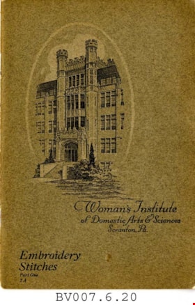
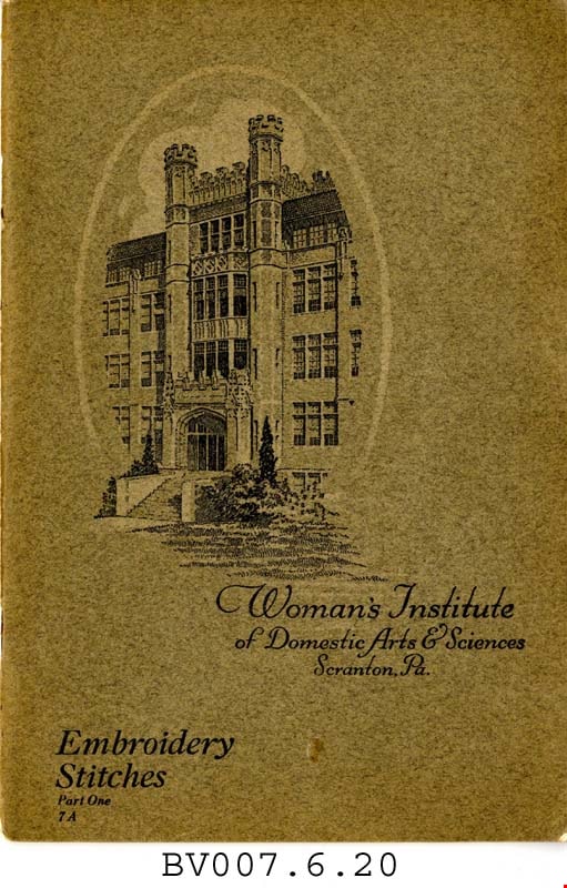
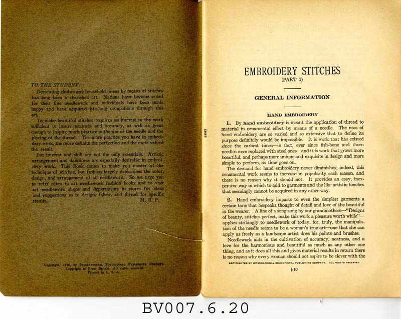
Embroidery stitches, part 1
https://search.heritageburnaby.ca/link/museumlibrary5006
- Repository
- Burnaby Village Museum
- Collection
- Special Collection
- Material Type
- Book
- Accession Code
- BV007.6.20
- Call Number
- 746.5 PIC
- Place of Publication
- Scranton, Pa.
- Publisher
- Woman's Institute of Domestic Arts and Sciences
- Publication Date
- 1921
- c1916
- Physical Description
- 44 p. : ill. : 23 cm.
- Library Subject (LOC)
- Embroidery--Study and teaching
- Stitches (Sewing)
- Subjects
- Documentary Artifacts - Booklets
- Object History
- Home sewing course used by Burnaby residents in the 1920's
- Notes
- Part 1 of 2
Images
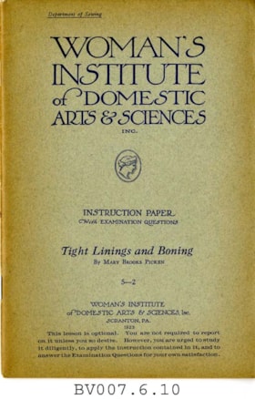
Tight linings and boning
https://search.heritageburnaby.ca/link/museumlibrary4996
- Repository
- Burnaby Village Museum
- Collection
- Special Collection
- Material Type
- Book
- Accession Code
- BV007.6.10
- Call Number
- 646 WOM
- Place of Publication
- Scranton, Pa.
- Publisher
- Education Corp. General
- Publication Date
- 1923
- c1915
- Physical Description
- 43 p. : ill. : 23 cm.
- Inscription
- "This instruction book is not included in your course of study, but is sent to show you just how to prepare your dress form for use. You will not be asked to report on this book." [Typed in purple ink and pasted to first page]
- Library Subject (LOC)
- Dressmaking
- Sewing
- Linings (Sewing)
- Woman's Institute of Domestic Arts and Sciences
- Subjects
- Documentary Artifacts - Booklets
- Object History
- Home sewing course used by Burnaby residents in the 1920's
- Notes
- "Department of sewing" -- cover
- "Instruction paper with examination questions ; 5-2" -- Cover
- "This lesson is optional. You are not required to report on it unless you so desire. However, you are urged to study it diligently, to apply the instruction contained in it, and to answer the Examination Questions for your own satisfaction." -- Cover
Images


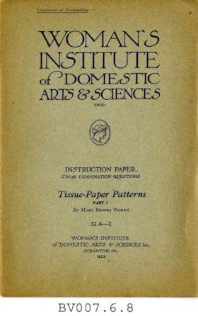
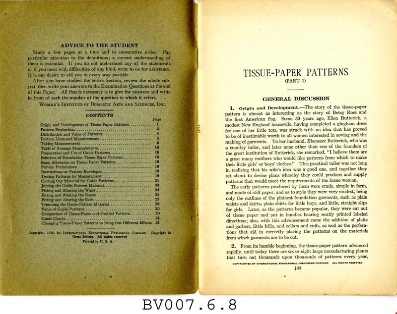
Tissue-paper patterns, part 1
https://search.heritageburnaby.ca/link/museumlibrary4994
- Repository
- Burnaby Village Museum
- Collection
- Special Collection
- Material Type
- Book
- Accession Code
- BV007.6.8
- Call Number
- 646 WOM pt. 1
- Place of Publication
- Scranton, Pa.
- Publisher
- Woman's Institute of Domestic Arts and Sciences
- Publication Date
- 1923
- c1916
- Physical Description
- 32 p. : ill. : 23 cm.
- Library Subject (LOC)
- Dressmaking
- Woman's Institute of Domestic Arts and Sciences
- Subjects
- Documentary Artifacts - Booklets
- Object History
- Home sewing course used by Burnaby residents in the 1920's
- Notes
- Part 1 of 2
- "Department of dressmaking" -- coverXXX
- "Instruction paper with examination questions; 32A-2" -- Cover
Images


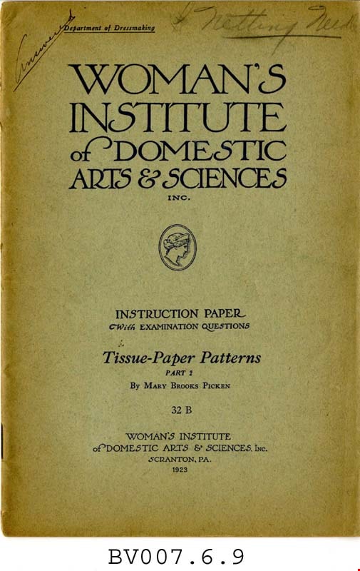
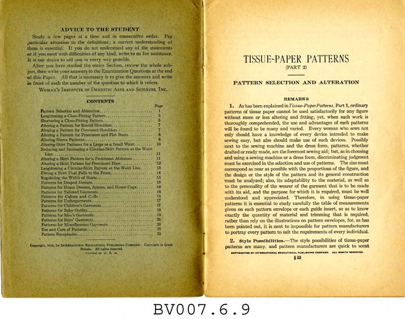
Tissue-paper patterns, part 2
https://search.heritageburnaby.ca/link/museumlibrary4995
- Repository
- Burnaby Village Museum
- Collection
- Special Collection
- Material Type
- Book
- Accession Code
- BV007.6.9
- Call Number
- 746.9 WOM pt. 2
- Place of Publication
- Scranton, Pa.
- Publisher
- Woman's Institute of Domestic Arts and Sciences
- Publication Date
- c1916
- 1923
- Physical Description
- 24 p. : ill. : 23 cm.
- Inscription
- "Answered" [Handwritten and underlined in pencil on front cover] "Netting Needle" [Handwritten, starred, and underlined in pencil on front cover] Some notes throughout.
- Library Subject (LOC)
- Dressmaking
- Woman's Institute of Domestic Arts and Sciences
- Subjects
- Documentary Artifacts - Booklets
- Object History
- Home sewing course used by Burnaby residents in the 1920's
- Notes
- Part 2 of 2
- "Department of dressmaking" -- cover
- "Instruction paper with examination questions" -- Cover
Images
Interview with Eileen Kernaghan by Rod Fowler April 10, 1990 - Track 11
https://search.heritageburnaby.ca/link/oralhistory501
- Repository
- City of Burnaby Archives
- Date Range
- 1954-1990
- Length
- 00:11:23
- Summary
- This portion of the interview is about Eileen Kernaghan’s knowledge about William F. Wolsey’s “Temple of More Abundant Life”, which occupied the Art Centre’s heritage buildings Ceperley Mansion and Mather House from 1954 to the 1960s, and the stories of ghosts haunting these buildings, the Anderson…
- Repository
- City of Burnaby Archives
- Summary
- This portion of the interview is about Eileen Kernaghan’s knowledge about William F. Wolsey’s “Temple of More Abundant Life”, which occupied the Art Centre’s heritage buildings Ceperley Mansion and Mather House from 1954 to the 1960s, and the stories of ghosts haunting these buildings, the Anderson House, and the James Cowan Theatre.
- Date Range
- 1954-1990
- Photo Info
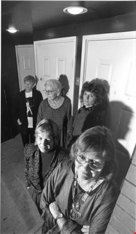
- Eileen Kernaghan standing in front of four poets at the Poetry Pocket Cafe in New Westminster, October 15, 1995. Item no. 535-0014
- Length
- 00:11:23
- Names
- Burnaby Arts Centre
- Interviewer
- Fowler, Rod
- Interview Date
- April 10, 1990
- Scope and Content
- Recording is of an interview with Eileen Kernaghan, conducted by Rod Fowler. Eileen Kernaghan was one of eleven participants interviewed as part of the SFU/Burnaby Centennial Committee's oral history series titled, "Voices of Burnaby". The interview is mainly about Eileen Kernaghan’s activities with the Burnaby Writers’ Society and the Burnaby Arts Council, describing the history of these organizations between 1967 and 1990. She describes the financial and other challenges facing the arts community, the various programs initiated by the Arts Council, and the development of the Burnaby Arts Centre facilities at Deer Lake. She also talks about her education, writing career, the Neville Street neighbourhood, and her and her husband’s bookstore business. Ghosts believed to inhabit some of the Arts Centre's heritage buildings are also a topic of conversation. To view “Narrow By” terms for each track expand this description and see “Notes”.
- Biographical Notes
- Eileen Kernaghan was born January 6, 1939, to William Alfred Monk (1910-2003) and Belinda Maude Monk (1908-1996), and grew up on a dairy farm near Grindrod in the North Okanagan. She attended a two room school in Grindrod, completed Junior and Senior High School in Enderby, and at age 17 in 1956, left home to attend UBC. She taught school in the North Okanagan area in the late 1950s, during which time she married her husband Patrick Kernaghan. They moved to Vancouver in 1961, Burnaby in 1963, and settled on Neville Street in the South Slope area in 1966 with their three children. Pat Kernaghan worked at Oakalla Prison as a correctional officer until his retirement in 1988. Eileen and Patrick Kernaghan owned and operated a bookstore on Neville Street from 1987 to 1999. They later moved to New Westminster. Eileen Kernaghan began her writing career at twelve years old with a story published in the Vancouver Sun. After her youngest child began school, with more free time, she started writing again and has become an award winning author of fantasy and science fiction novels. She helped found the Burnaby Writers’ Society in 1967, taught writing workshops, and wrote its popular Newsletter for many years. In 1971 the Society put together a small handbook for BC writers, a venture that was expanded and published by Douglas MacIntyre in 1975 as “The Upper Left-Hand Corner: a writer’s handbook for the Northwest”. The book became a Canadian best-seller. During this same period Eileen Kernaghan began her successful “Grey Isles” trilogy. In 1967 she joined the Burnaby Arts Council, worked as its Coordinator from 1973 to 1984, and was a determined advocate for municipal government support for the arts in Burnaby.
- Total Tracks
- 11
- Total Length
- 1:26:27
- Interviewee Name
- Kernaghan, Eileen
- Interviewer Bio
- Rod Fowler returned to university as a mature student in the 1980s after working about twenty years in the field of economics and computerization in business in England, Europe and Western Canada. He graduated with a BA from SFU in both History and Sociology in 1987, his MA degree in Geography in 1989, and his PhD in Cultural Geography at SFU. He taught courses in Geography, Sociology, History and Canadian Studies at several Lower Mainland colleges, before becoming a full time member of the Geography Department at Kwantlen University College.
- Collection/Fonds
- SFU/Burnaby Centennial Committee fonds
- Transcript Available
- Transcript available
- Media Type
- Sound Recording
- Web Notes
- Interviews were digitized in 2015 allowing them to be accessible on Heritage Burnaby. The digitization project was initiated by the Community Heritage Commission with support from City of Burnaby Council.
Images

Audio Tracks
Track eleven of interview with Eileen Kernaghan
Track eleven of interview with Eileen Kernaghan
https://search.heritageburnaby.ca/media/hpo/_Data/_Archives_Oral_Histories/_Unrestricted/MSS187-023/MSS187-023_Track%2011.mp3![Jack Hardman, [1964] thumbnail](/media/hpo/_Data/_Archives_Images/_Unrestricted/480/480-106.jpg?width=280)
Jack Hardman
https://search.heritageburnaby.ca/link/archivedescription45210
- Repository
- City of Burnaby Archives
- Date
- [1964]
- Collection/Fonds
- Columbian Newspaper collection
- Description Level
- Item
- Physical Description
- 1 photograph : b&w ; 24.5 x 18.5 cm
- Scope and Content
- Photograph of Jack Hardman, "one of the senior art teachers in British Columbia" and on the staff of Burnaby Central Secondary school busily working on a clay sculpture. In 1966 he won a Canada Council grant for $5000 so that he could then set up a studio in Toronto for a year. The award also stipu…
- Repository
- City of Burnaby Archives
- Date
- [1964]
- Collection/Fonds
- Columbian Newspaper collection
- Physical Description
- 1 photograph : b&w ; 24.5 x 18.5 cm
- Description Level
- Item
- Record No.
- 480-106
- Access Restriction
- No restrictions
- Reproduction Restriction
- No restrictions
- Accession Number
- 2003-02
- Scope and Content
- Photograph of Jack Hardman, "one of the senior art teachers in British Columbia" and on the staff of Burnaby Central Secondary school busily working on a clay sculpture. In 1966 he won a Canada Council grant for $5000 so that he could then set up a studio in Toronto for a year. The award also stipulated a travel allowance enabling him to observe sculpture techniques across North America.
- Subjects
- Occupations - Artists
- Arts - Sculptures
- Media Type
- Photograph
- Photographer
- King, Basil
- Notes
- Title based on contents of photograph
Images
![Jack Hardman, [1964] thumbnail](/media/hpo/_Data/_Archives_Images/_Unrestricted/480/480-106.jpg)
![Jack Hardman, [1964], March 1, 1966 thumbnail](/media/hpo/_Data/_Archives_Images/_Unrestricted/480/480-107.jpg?width=280)
Jack Hardman
https://search.heritageburnaby.ca/link/archivedescription55455
- Repository
- City of Burnaby Archives
- Date
- [1964], March 1, 1966
- Collection/Fonds
- Columbian Newspaper collection
- Description Level
- Item
- Physical Description
- 1 photograph : b&w ; 24.5 x 15.5 cm
- Scope and Content
- Photograph of Jack Hardman, "one of the senior art teachers in British Columbia" and on the staff of Burnaby Central Secondary school busily working on a clay sculpture. In 1966 he won a Canada Council grant for $5000 so that he could then set up a studio in Toronto for a year. The award also stipu…
- Repository
- City of Burnaby Archives
- Date
- [1964], March 1, 1966
- Collection/Fonds
- Columbian Newspaper collection
- Physical Description
- 1 photograph : b&w ; 24.5 x 15.5 cm
- Description Level
- Item
- Record No.
- 480-107
- Access Restriction
- No restrictions
- Reproduction Restriction
- No restrictions
- Accession Number
- 2003-02
- Scope and Content
- Photograph of Jack Hardman, "one of the senior art teachers in British Columbia" and on the staff of Burnaby Central Secondary school busily working on a clay sculpture. In 1966 he won a Canada Council grant for $5000 so that he could then set up a studio in Toronto for a year. The award also stipulated a travel allowance enabling him to observe sculpture techniques across North America.
- Subjects
- Occupations - Artists
- Arts - Sculptures
- Media Type
- Photograph
- Photographer
- King, Basil
- Notes
- Title based on contents of photograph
Images
![Jack Hardman, [1964], March 1, 1966 thumbnail](/media/hpo/_Data/_Archives_Images/_Unrestricted/480/480-107.jpg)