Narrow Results By
Subject
- Advertising Medium - Signs and Signboards 1
- Buildings - Civic - Museums 1
- Buildings - Commercial 1
- Buildings - Heritage 5
- Buildings - Residential 3
- Buildings - Residential - Houses 3
- Buildings - Schools 5
- Documentary Artifacts - Books 1
- Documentary Artifacts - Maps 1
- Exhibitions 1
- First Nations reserves - British Columbia 1
- Government - Local Government 1
Creator
- Ancona, George 1
- Anderson, Joan, 1943- 1
- Bacon, J. H. (John Henry) 1
- Baird, Nathaniel Hughes John, 1865-1936 1
- Blake, Fredrick "Fred" 1
- Bowman and Cullerne 1
- Bowman & Cullerne 4
- British Columbia Underwriters' Association 13
- Burnett, David H. 1
- Burroughs, Edgar Rice, 1875-1950 1
- Caesar, Julius 1
- Canada. Department of National Defence 1
Person / Organization
- Army, Navy and Air Force Veterans in Canada, Pompier Unit #314 1
- Barnet Lumber Company 2
- Bateman, Edwin W. 1
- Bateman, Mary Dale 1
- Bowman & Cullerne 1
- Bowman, Joseph Henry 1
- Burnaby Advisory Planning Commission 1
- Burnaby Historical Society 1
- Burnaby Village Museum 4
- Canadian Pacific Railway Company 1
- Cullerne, Harold 1
- Cunningham, Edna 1
The Canadian school atlas : containing seventy-three maps (including seven classical maps) and complete index
https://search.heritageburnaby.ca/link/museumlibrary1710
- Repository
- Burnaby Village Museum
- Edition
- Rev. and enl. ed.
- Publication Date
- 1926
- Call Number
- 912 CAN Copy 1
- Repository
- Burnaby Village Museum
- Collection
- Special Collection
- Material Type
- Book
- Accession Code
- HV984.21.23
- Call Number
- 912 CAN Copy 1
- Edition
- Rev. and enl. ed.
- Contributor
- Cornish, George A. (George Augustus), 1872-
- Place of Publication
- Toronto
- Publisher
- J. M. Dent & Sons Limited
- Publication Date
- 1926
- Printer
- Temple Press
- Physical Description
- [58], 32 p. : col. maps ; 29 cm.
- Inscription
- "Vera Morrow '36" [handwritten in black ink on front pastedown] "Vera Morrow" [handwritten twice in pencil on front pastedown] "716" [stamped in faded ink on front pastedown] "V.Z.M." [stamped in black ink on front and back endpaper] "Vera Morrow Geography Book Atlas" [handwritten three times in red and blue ink and pencil on front endpaper] "716" [stamped in black ink on front endpaper] Two hand drawn sketches of women in pencil on front endpaper. Clipping from Wed. April 1, 1959 Vancouver Sun showing "New route to border opening about May 15" found next to title page. enclosed in polyester film sleeve Hand drawn sketch of advertisement for Cunard Steamship Lines trip from New York to Havana. Found between p. 20-21 of index. "Vera Morrow Canadian School Atlas J.M. Dent + Sons" [handwritten twice in red ink and pencil on page after p. 32 of index] Three hand drawn sketches of women in pencil on page after p. 32 of index. "Vera Morrow" [handwritten in dark ink on back endpaper] Folded map of British Isles found inside back cover printed by F. P. Lloyd, Toronto, Canada
- Library Subject (LOC)
- Atlases--Canadian
- Historical geography--Maps
- Canada--History--Study and teaching
- Atlases
- Notes
- "Recommended for use in the High Schools of Ontario" --Title page.
- "Authorised for use in the schools of Nova Scotia, Quebec, Saskatchewan and British Columbia" --Title page.
- "Prepared at the Edinburgh Geographical Institute" --Half-title verso.
- "Under the editorship of George A. Cornish" --Half-title verso.
- "Companion to the 'Canadian school geography'" --Half-title verso.
- Copy 1 of 2.
- Editor's given name and dates: Cornish, George A. (George Augustus), 1872-1960
Procurement of Maps of Portions of Municipality Not Covered by Town Planning Maps
https://search.heritageburnaby.ca/link/councilreport70582
- Repository
- City of Burnaby Archives
- Report ID
- 75578
- Meeting Date
- 29-Mar-1926
- Format
- Council - Committee Report
- Collection/Fonds
- City Council and Office of the City Clerk fonds
- Repository
- City of Burnaby Archives
- Report ID
- 75578
- Meeting Date
- 29-Mar-1926
- Format
- Council - Committee Report
- Collection/Fonds
- City Council and Office of the City Clerk fonds
Documents
A Garden Party - Entertainment, Maps and Participants
https://search.heritageburnaby.ca/link/archivedescription56437
- Repository
- City of Burnaby Archives
- Date
- 1984
- Collection/Fonds
- Burnaby Historical Society fonds
- Description Level
- File
- Physical Description
- Textual record
- Repository
- City of Burnaby Archives
- Date
- 1984
- Collection/Fonds
- Burnaby Historical Society fonds
- Subseries
- Burnaby Arts Council subseries
- Physical Description
- Textual record
- Description Level
- File
- Record No.
- 39865
- Accession Number
- BHS1998-06
- Media Type
- Textual Record
The Canadian school atlas : containing seventy-three maps with complete index
https://search.heritageburnaby.ca/link/museumlibrary189
- Repository
- Burnaby Village Museum
- Edition
- Rev. and enl. ed.
- Publication Date
- 1925
- Call Number
- 912 COR
- Repository
- Burnaby Village Museum
- Collection
- Special Collection
- Material Type
- Book
- Accession Code
- HV971.120.25
- Call Number
- 912 COR
- Edition
- Rev. and enl. ed.
- Contributor
- Cornish, George A. (George Augustus), 1872-
- Place of Publication
- Toronto
- Publisher
- J. M. Dent & Sons, Ltd.
- Publication Date
- 1925
- Printer
- The Temple Press
- Physical Description
- 1 v. (multiple pagings) : col. ill. (maps) : 29 cm.
- Inscription
- "This Book Cover is presented with the / compliments of / The Royal Bank of Canada", printed on front of jacket. Atlas / Peggy McKay / Florence Nightingale School / Vancouver BC" hand written on front of dust jacket. "Peggy McKay" [Handwritten in black ink on outside envelope] "Billy McKay 409-15th Av. East Vancouver B.C. Canada" [Handwritten in pencil on front endpaper] "Jack McLennan" [Handwritten in pencil on front endpaper] "Oh dear Baby face Drawn by Peggy McKay" [Handwritten in pencil around drawing of a woman's face on front endpaper] "Peggy McKay Florence Nightingale Vancouver B.C. Canada" [Handwritten in blue ink on front flyleaf] "Along came you, sweet little you, Just like a flower you came. You came into my heart never to leave me + never to part." [Handwritten in pencil on title page] "Liar" [Handwritten in pencil on title page] "867-5309" [Handwritten in pencil on contents verso] "Jenny's number... 867-5309, 867-5309 I got it, I got it, I got you number on the wa-ll I got, I got it, for a good time for a good time CALL" [Handwritten on contents verso] Handwritten story from front flyleaf to pre-title page verso (4 pages) Drawing of woman's face on front flyleaf. Song lyrics handwritten in blue ink on title page verso and opposite contents. List of names under the index, page 32.
- Library Subject (LOC)
- Atlases--Canadian
- Historical geography--Maps
- Canada--History--Study and teaching
- Atlases
- Notes
- Includes index.
- "Under the editorship of George A. Cornish" -- Pre Title-Page Verso
- "Prepared at the Edinburgh Geographical Institute to form a companion to the 'Canadian School Geography'" -- Pre Title-Page Verso
- "Authorized for use in the schools of the provinces of Nova Scotia, Quebec, Saskatchewan and British Columbia" -- Cover
- Contributor's full name and date as follows:George A Cornish (George Augustus), 1872-1960
The Canadian school atlas : containing sixty-six maps with complete index
https://search.heritageburnaby.ca/link/museumlibrary6360
- Repository
- Burnaby Village Museum
- Collection
- Special Collection
- Material Type
- Book
- Accession Code
- X3894
- Call Number
- 912 CAN Copy 1
- Place of Publication
- Toronto
- Publisher
- J. M. Dent & Sons Limited
- Publication Date
- 1924
- Physical Description
- 1 vol. : ill., maps (mostly col.) ; 29 cm.
- Inscription
- "Alex Virostko" [handwritten in pencil on front pastedown] doodle on first endpaper
- Library Subject (LOC)
- Atlases--Canadian
- Historical geography--Maps
- Canada--History--Study and teaching
- Atlases
- Notes
- "Authorised for use in the schools of Nova Scotia, Quebec, Saskatchewan and British Columbia" --Title page.
- "Prepared at the Edinburgh Geographical Institute" --Half-title verso.
- "Under the editorship of George A. Cornish" --Half-title verso.
- Editor's given name and dates: Cornish, George A. (George Augustus), 1872-1960
- Includes index
- Copy 1 of 2
Contract for Production of Planimetric Maps in Digital Form
https://search.heritageburnaby.ca/link/councilreport16506
- Repository
- City of Burnaby Archives
- Report ID
- 8545
- Meeting Date
- 25-Feb-1985
- Format
- Council - Manager's Report
- Manager's Report No.
- 16
- Item No.
- 2
- Collection/Fonds
- City Council and Office of the City Clerk fonds
- Repository
- City of Burnaby Archives
- Report ID
- 8545
- Meeting Date
- 25-Feb-1985
- Format
- Council - Manager's Report
- Manager's Report No.
- 16
- Item No.
- 2
- Collection/Fonds
- City Council and Office of the City Clerk fonds
Documents
Letter from Mr. H. Adams, Brentwood Park Ratepayers' Association, which appeared on the Agenda for the 1984 June 18 Meeting of Council re: Clarification of Maps in the Residential Neighbourhood Environment Study Brochure
https://search.heritageburnaby.ca/link/councilreport16947
- Repository
- City of Burnaby Archives
- Report ID
- 3367
- Meeting Date
- 25-Jun-1984
- Format
- Council - Manager's Report
- Manager's Report No.
- 44
- Item No.
- 2
- Collection/Fonds
- City Council and Office of the City Clerk fonds
- Repository
- City of Burnaby Archives
- Report ID
- 3367
- Meeting Date
- 25-Jun-1984
- Format
- Council - Manager's Report
- Manager's Report No.
- 44
- Item No.
- 2
- Collection/Fonds
- City Council and Office of the City Clerk fonds
Documents
Maps of Portion of Ward 6 Not Town Planned and Portion of Ward 3 Lying West of Cariboo Road
https://search.heritageburnaby.ca/link/councilreport70541
- Repository
- City of Burnaby Archives
- Report ID
- 75544
- Meeting Date
- 15-Mar-1926
- Format
- Council - Committee Report
- Collection/Fonds
- City Council and Office of the City Clerk fonds
- Repository
- City of Burnaby Archives
- Report ID
- 75544
- Meeting Date
- 15-Mar-1926
- Format
- Council - Committee Report
- Collection/Fonds
- City Council and Office of the City Clerk fonds
Documents
Repeal of Maps Approval Bylaw
https://search.heritageburnaby.ca/link/councilreport71134
- Repository
- City of Burnaby Archives
- Report ID
- 735644
- Meeting Date
- 7-Jun-1920
- Format
- Council - Mayor/Councillor/Staff Report
- Collection/Fonds
- City Council and Office of the City Clerk fonds
- Repository
- City of Burnaby Archives
- Report ID
- 735644
- Meeting Date
- 7-Jun-1920
- Format
- Council - Mayor/Councillor/Staff Report
- Collection/Fonds
- City Council and Office of the City Clerk fonds
Documents
Request for Owners of DL 43 to Comply with Provisions of the Maps Approval Bylaw
https://search.heritageburnaby.ca/link/councilreport70787
- Repository
- City of Burnaby Archives
- Report ID
- 735040
- Meeting Date
- 16-Feb-1920
- Format
- Council - Committee Report
- Collection/Fonds
- City Council and Office of the City Clerk fonds
- Repository
- City of Burnaby Archives
- Report ID
- 735040
- Meeting Date
- 16-Feb-1920
- Format
- Council - Committee Report
- Collection/Fonds
- City Council and Office of the City Clerk fonds
Documents
Request for Owners of DL 135 to Comply with Provisions of the Maps Approval Bylaw
https://search.heritageburnaby.ca/link/councilreport70786
- Repository
- City of Burnaby Archives
- Report ID
- 735039
- Meeting Date
- 16-Feb-1920
- Format
- Council - Committee Report
- Collection/Fonds
- City Council and Office of the City Clerk fonds
- Repository
- City of Burnaby Archives
- Report ID
- 735039
- Meeting Date
- 16-Feb-1920
- Format
- Council - Committee Report
- Collection/Fonds
- City Council and Office of the City Clerk fonds
Documents
Surveys and Maps re Proposed Waterworks By-law
https://search.heritageburnaby.ca/link/councilreport70532
- Repository
- City of Burnaby Archives
- Report ID
- 75536
- Meeting Date
- 15-Mar-1926
- Format
- Council - Committee Report
- Collection/Fonds
- City Council and Office of the City Clerk fonds
- Repository
- City of Burnaby Archives
- Report ID
- 75536
- Meeting Date
- 15-Mar-1926
- Format
- Council - Committee Report
- Collection/Fonds
- City Council and Office of the City Clerk fonds
Documents
The Winston handy atlas of the world : with gazetteer of the world comprising countries and their political subdivisions; the cities and towns of the world; with populations according to the latest census; and key to their locations on the maps
https://search.heritageburnaby.ca/link/museumlibrary384
- Repository
- Burnaby Village Museum
- Author
- John C. Winston Company
- Publication Date
- c1927
- Call Number
- 912 WIN
- Repository
- Burnaby Village Museum
- Collection
- Special Collection
- Material Type
- Book
- Accession Code
- BV989.35.12
- Call Number
- 912 WIN
- Author
- John C. Winston Company
- Place of Publication
- Toronto
- Publisher
- John C. Winston
- Publication Date
- c1927
- Printer
- International Press
- Physical Description
- iv, 33, 57 p. : ill. maps (some col.) ; 24 cm.
- Library Subject (LOC)
- Atlases
A.E. Brown Residence
https://search.heritageburnaby.ca/link/landmark553
- Repository
- Burnaby Heritage Planning
- Description
- Residential building.
- Associated Dates
- 1924
- Street View URL
- Google Maps Street View
- Repository
- Burnaby Heritage Planning
- Geographic Access
- Sperling Avenue
- Associated Dates
- 1924
- Description
- Residential building.
- Heritage Value
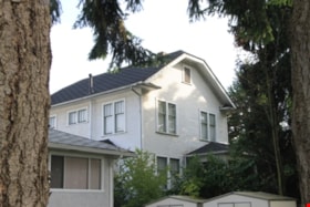
- Built after the end of the First World War, this house features an eclectic blend of Arts and Crafts elements. Constructed for A.E. Brown and a full two storeys in height, it has a front jerkin-headed roof with a jerkin-headed side projection, and a corner wraparound verandah with tapered columns. The house has been maintained in near original condition, with original lapped wooden siding, multi-paned windows and square balusters.
- Locality
- Edmonds
- Historic Neighbourhood
- Edmonds (Historic Neighbourhood)
- Planning Study Area
- Kingsway-Beresford Area
- Ownership
- Private
- Street Address
- 6830 Sperling Avenue
- Street View URL
- Google Maps Street View
Images
Barnet Lumber Company House
https://search.heritageburnaby.ca/link/landmark662
- Repository
- Burnaby Heritage Planning
- Description
- Residential building.
- Associated Dates
- 1925
- Street View URL
- Google Maps Street View
- Repository
- Burnaby Heritage Planning
- Geographic Access
- Texaco Drive
- Associated Dates
- 1925
- Description
- Residential building.
- Heritage Value
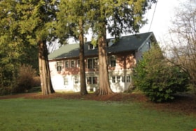
- This house is one of two surviving houses built as a “Model Home” for the manager of the Barnet Lumber Company, which was the successor to the North Pacific Lumber Company. It was used as a combined home and office. It was constructed with framing lumber and millwork sawn at the mill. Typical of the Craftsman style, the house has a front gabled roof with triangular eave brackets. It has been altered with the addition of asbestos shingles over the original siding, but retains its form, scale and massing. This house was designed by the firm of Townley & Matheson. The partnership of Fred Laughton Townley (1887-1966) and Robert Michael Matheson began in 1919, and the firm left a rich legacy of sophisticated work, including schools, commercial structures, many fine residences and the landmark Vancouver City Hall.
- Historic Neighbourhood
- Barnet (Historic Neighbourhood)
- Planning Study Area
- Burnaby Mountain Area
- Architect
- Townley & Matheson
- Area
- 2225.77
- Contributing Resource
- Building
- Ownership
- Public (local)
- Street Address
- 8007 Texaco Drive
- Street View URL
- Google Maps Street View
Images
Barnet Lumber Company House
https://search.heritageburnaby.ca/link/landmark663
- Repository
- Burnaby Heritage Planning
- Description
- Residential building.
- Associated Dates
- 1925
- Street View URL
- Google Maps Street View
- Repository
- Burnaby Heritage Planning
- Geographic Access
- Texaco Drive
- Associated Dates
- 1925
- Description
- Residential building.
- Heritage Value
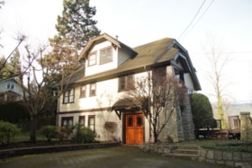
- This house is one of two surviving houses built as a “Model Home” for one of the assistant managers of the Barnet Lumber Company, using framing lumber and millwork sawn at the mill. This house was also designed by the firm of Townley & Matheson. The house was raised and renovated in 1997, resulting in alterations such as new dormers and elongated porch piers.
- Historic Neighbourhood
- Barnet (Historic Neighbourhood)
- Planning Study Area
- Burnaby Mountain Area
- Architect
- Townley & Matheson
- Contributing Resource
- Building
- Ownership
- Private
- Street Address
- 8039 Texaco Drive
- Street View URL
- Google Maps Street View
Images
Burnaby North High School
https://search.heritageburnaby.ca/link/landmark745
- Repository
- Burnaby Heritage Planning
- Associated Dates
- 1923-1982
- Street View URL
- Google Maps Street View
- Repository
- Burnaby Heritage Planning
- Geographic Access
- Willingdon Avenue
- Associated Dates
- 1923-1982
- Heritage Value
- Burnaby North and Burnaby South were the first high schools built in the City. Before the high school opened, Burnaby students had to travel to Vancouver if they wished to pursue education beyond an elementary level. In 1921, arrangements were made to use the basement of the Presbyterian Church for instruction of local students. By 1922 the Burnaby North High School opened at its first permanent location (4375 Pandora Street - which is now Rosser Elementary). In 1945, the Willingdon Avenue site was built and was used until a new building was constructed in 1961 on Hammarskjold Drive. From 1962, the school was used as Burnaby Heights Junior High school, but it closed in 1982 and the junior high students went to the new Burnaby North on Hammarskjold.
- Historic Neighbourhood
- Capitol Hill (Historic Neighbourhood)
- Planning Study Area
- Capitol Hill Area
- Street Address
- 250 Willingdon Avenue
- Street View URL
- Google Maps Street View
Images
Burnaby South High School
https://search.heritageburnaby.ca/link/landmark770
- Repository
- Burnaby Heritage Planning
- Associated Dates
- 1922-1988
- Street View URL
- Google Maps Street View
- Repository
- Burnaby Heritage Planning
- Geographic Access
- Southoaks Crescent
- Associated Dates
- 1922-1988
- Heritage Value
- Burnaby South and Burnaby North were Burnaby's first high schools. The first rooms of the school were built in 1922 on the same grounds as the Kingsway East Elementary School. In 1940, a two-storey building was erected and additions were made in 1963, 1967 and 1972. Kingsway East closed in 1925 and its buildings were used by the high school for Industrial Arts and Home Economics. In the early 1990s, a new "urban education centre" (Burnaby South/B.C. School for the Deaf) was opened, replacing the old Burnaby South High School.
- Historic Neighbourhood
- Edmonds (Historic Neighbourhood)
- Planning Study Area
- Kingsway-Beresford Area
- Street Address
- 6650 Southoaks Crescent
- Street View URL
- Google Maps Street View
Images
Capitol Hill School
https://search.heritageburnaby.ca/link/landmark564
- Repository
- Burnaby Heritage Planning
- Description
- School building.
- Associated Dates
- 1923
- Other Names
- Ecole Capitol Hill Elementary School
- Street View URL
- Google Maps Street View
- Repository
- Burnaby Heritage Planning
- Other Names
- Ecole Capitol Hill Elementary School
- Geographic Access
- Holdom Avenue
- Associated Dates
- 1923
- Description
- School building.
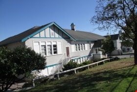
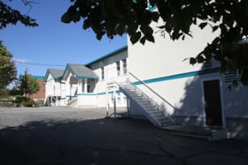
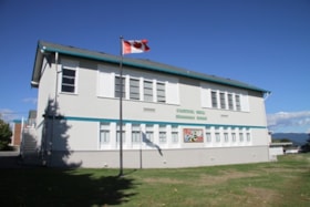
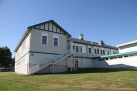
- Heritage Value
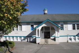
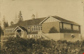
- This school was originally designed by Bowman & Cullerne as a two-storey, four-room school building in 1923, with a two-room addition completed in 1926 and another in 1927. Originally designed in the Arts and Crafts style, it has been altered, with the addition of stucco over the original siding and replacement windows, but has retained its original form and massing, as well as its roof-top ventilator and front gabled entrance with grouped columns. Bowman & Cullerne specialized in school design. After Harold Cullerne (1890-1976) returned from service during the First World War, he joined J.H. Bowman (1864-1943) in a partnership that lasted from 1919 to 1934. The firm’s other school designs included Seaforth School (1922, now relocated to Burnaby Village Museum), Burnaby North High School (1923), and Nelson Avenue School (1927).
- Locality
- Capitol Hill
- Historic Neighbourhood
- Capitol Hill (Historic Neighbourhood)
- Planning Study Area
- Capitol Hill Area
- Architect
- Bowman & Cullerne
- Ownership
- Public (local)
- Subjects
- Buildings - Heritage
- Buildings - Schools
- Street Address
- 350 Holdom Avenue
- Street View URL
- Google Maps Street View
Images
Confederation Park
https://search.heritageburnaby.ca/link/landmark672
- Repository
- Burnaby Heritage Planning
- Geographic Access
- Willingdon Avenue
- Associated Dates
- 1927
- Heritage Value
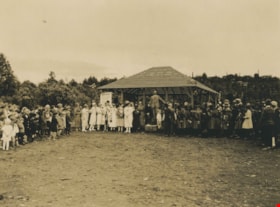
- North Burnaby’s first park began its life as the Capitol Hill subdivision during the land boom of 1909. In 1914 the boom went bust and many owners of unoccupied lots failed to pay the property taxes owing and the land became the property of the Municipality of Burnaby. By 1922, Burnaby had so many lots that it decided to reserve land for future park use and dedicated a narrow 26 acre site adjacent to the ravine. During the 1920s, the Heights area boomed again and many new residents wanted a playground for their children. A local women’s group took on the cause and enlisted local residents and businesses to raise the necessary funds. On June 25, 1927 crowds gathered to officially dedicate “Confederation Park” named in honour of the Diamond Jubilee of Canada’s Confederation (1867-1927).
- Historic Neighbourhood
- Capitol Hill (Historic Neighbourhood)
- Planning Study Area
- Capitol Hill Area
- Street Address
- 250 Willingdon Avenue
- Street View URL
- Google Maps Street View
