Narrow Results By
Decade
- 2020s 473
- 2010s 979
- 2000s 2815
- 1990s 4535
- 1980s 3033
- 1970s
- 1960s 2380
- 1950s 2541
- 1940s 2396
- 1930s 2311
- 1920s 2750
- 1910s
- 1900s 987
- 1890s 298
- 1880s 148
- 1870s 42
- 1860s 47
- 1850s 25
- 1840s 13
- 1830s 9
- 1820s 9
- 1810s 6
- 1800s 6
- 1790s 5
- 1780s 5
- 1770s 5
- 1760s 5
- 1750s
- 1740s 5
- 1730s 5
- 1720s 5
- 1710s 5
- 1700s 5
- 1690s 5
- 1680s 5
- 1670s 4
- 1660s 4
- 1650s 4
- 1640s 4
- 1630s 4
- 1620s 4
- 1610s 4
- 1600s 4
- 1590s 1
- 1580s 1
- 1570s 1
- 1560s 1
- 1550s 1
- 1540s 1
- 1530s 1
- 1520s 2
- 1510s 1
- 1500s 1
- 1490s 1
- 1480s 1
Subject
- Academic Disciplines 1
- Accidents 1
- Accidents - Train Accidents 7
- Adminstrative Groups - Committees 4
- Advertising Medium 2
- Advertising Medium - Flyer 3
- Advertising Medium - Poster 13
- Advertising Medium - Signs and Signboards 78
- Aerial Photographs 45
- Agricultural Tools and Equipment 1
- Agricultural Tools and Equipment - Gardening Equipment 3
- Agricultural Tools and Equipment - Plows 3
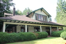
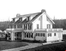
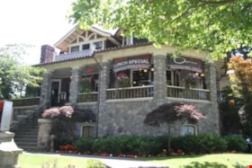
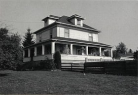
R.M. Edgar House
https://search.heritageburnaby.ca/link/landmark543
- Repository
- Burnaby Heritage Planning
- Description
- The R.M. Edgar House is a particularly large wood-frame Craftsman-inspired bungalow on the south shore of Deer Lake, built as a family estate home. It has a symmetrical front elevation, a deep wrap-around verandah, and a pyramidal roof with massive dormers on each face. Set on a large lot and isola…
- Associated Dates
- 1912
- Formal Recognition
- Heritage Designation, Community Heritage Register
- Other Names
- Robert McBeth & Maude Edgar Residence
- Repository
- Burnaby Heritage Planning
- Other Names
- Robert McBeth & Maude Edgar Residence
- Geographic Access
- Deer Lake Drive
- Associated Dates
- 1912
- Formal Recognition
- Heritage Designation, Community Heritage Register
- Enactment Type
- Bylaw No. 9807
- Enactment Date
- 23/11/1992
- Description
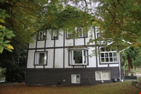
- The R.M. Edgar House is a particularly large wood-frame Craftsman-inspired bungalow on the south shore of Deer Lake, built as a family estate home. It has a symmetrical front elevation, a deep wrap-around verandah, and a pyramidal roof with massive dormers on each face. Set on a large lot and isolated from its neighbours, the house is surrounded by a manicured naturalistic landscape.
- Heritage Value
- The R.M. Edgar House represents an alternative reading of the aesthetic and lifestyle values of those who settled on these lakeside estates in the early twentieth century. By comparison with the grand mansions, set in formally landscaped gardens, on the north shore of Deer Lake, the R.M. Edgar House demonstrates a reverence for the natural, wooded environs, and a deliberate orientation near a stream running through the property. The house is important for its connection with Robert McBeth Edgar, not only a successful and wealthy businessman (partner in the real estate firm Hampton and Edgar) but also an active supporter of the Liberal party, Dominion Returning Officer for Vancouver, and Burnaby Councillor for six years; his contribution to Burnaby and British Columbia was far-reaching and significant. The house illustrates the desire for a simpler lifestyle and retreat into nature of those who settled on the south shore of Deer Lake and also this community's attraction for those of an artistic temperament. Maude Edgar was a poet and broadcaster; and the Edgar's daughter - Ann, known as 'Bebe' - was an accomplished sculptress. This was the first house built on the south shore of Deer Lake.
- Defining Elements
- Key elements that define the heritage character of the R.M. Edgar House include its: - overall bungalow massing and its location facing Deer Lake and backing onto a wilderness of Douglas Fir and moss-covered rocks, with a stream running through the site - remnants of the original landscaping such as the box hedge, rockeries and granite retaining walls - the surrounding naturalistic landscape augmented by ornamental cedars, maples, and rhododendrons - square floor plan with a deep enclosed verandah under a prominent broad hipped roof - symmetrical gable dormers - internal brick chimneys, including one at the centre peak of the roof - Craftsman-influenced exterior with such characteristics as: woodwork brackets on the square verandah pillars; deep overhanging roof eaves; and exposed rafter tails - multiple-assembly 12-paned casement wooden-sash windows in the dormers with 6-paned transoms - rustic Arts and Crafts interior with such items as Douglas fir paneling and large granite fireplace in the Drawing Room
- Locality
- Deer Lake Park
- Historic Neighbourhood
- Burnaby Lake (Historic Neighbourhood)
- Planning Study Area
- Morley-Buckingham Area
- Function
- Primary Current--Single Dwelling
- Primary Historic--Estate
- Community
- Burnaby
- Cadastral Identifier
- P.I.D. No. 001-178-024 and P.I.D. No. 001-178-016 Legal Description: Parcel 'D' (Explanatory Plan 4272) District Lot 85, Group 1, New Westminster District and Parcel 'W' (Explanatory Plan 255) District Lot 85, Group 1, New Westminster District
- Boundaries
- The R.M. Edgar House is comprised of a single municipally-owned property located at 6450 Deer Lake Drive, Burnaby.
- Area
- 11,661.30
- Contributing Resource
- Building
- Landscape Feature
- Ownership
- Public (local)
- Documentation
- Heritage Site Files: PC77000 20. City of Burnaby Planning and Building Department, 4949 Canada Way, Burnaby, B.C., V5G 1M2
- Street Address
- 6450 Deer Lake Drive
Images
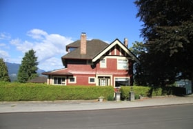
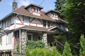
Robert & Mary B. McLennan House
https://search.heritageburnaby.ca/link/landmark634
- Repository
- Burnaby Heritage Planning
- Description
- Residential building.
- Associated Dates
- 1911
- Street View URL
- Google Maps Street View
- Repository
- Burnaby Heritage Planning
- Geographic Access
- Yale Street
- Associated Dates
- 1911
- Description
- Residential building.
- Heritage Value
- Robert McLennan was the vice-president of the prominent Vancouver hardware firm of McLennan, McFeely & Company, popularly known as Mc.& Mc. Born in Pictou, Nova Scotia in 1861, Robert McLennan entered the hardware business at age fifteen. The West was an irresistible lure, and after he moved to Victoria in 1884, he took on a friend, Edward J. McFeely, as a business partner. Their business was a success and they soon opened a branch in the rapidly-developing new city of Vancouver. In 1898, Robert went to Dawson, where he opened a branch operation and served as mayor for one year in 1903. He returned to Vancouver in 1904, and as the business expanded, E.G. Prior was taken on as partner. In addition to his business pursuits, the public-spirited McLennan served on many boards and committees. In 1887, Robert returned to Nova Scotia where he married Bessie Archibald McKenzie. They had nine children, one of whom was born in Dawson. Robert died in 1927, and Bessie died in 1941. This grand residence was one of the first to be built in the Vancouver Heights subdivision, and its spectacular location retains panoramic views of Burrard Inlet and the North Shore. This house was undoubtedly designed by a local architect as it is an excellent example of the British Arts and Crafts style, with a shingled exterior, half-timbered gables and prominent brick chimneys. Although the west verandah has been enclosed and the windows altered, the house has been well maintained. Although owned by the McLennans, it may have been an investment property, as they lived for many years at a Vancouver address. In 1926, the house was sold to Vancouver Medical Health Officer, F.T. Underhill.
- Locality
- Vancouver Heights
- Historic Neighbourhood
- Vancouver Heights (Historic Neighbourhood)
- Planning Study Area
- Burnaby Heights Area
- Area
- 576.00
- Contributing Resource
- Building
- Ownership
- Private
- Street Address
- 3789 Yale Street
- Street View URL
- Google Maps Street View
Images
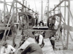
Russian Submarines at Barnet
https://search.heritageburnaby.ca/link/landmark748
- Repository
- Burnaby Heritage Planning
- Associated Dates
- 1915-1917
- Heritage Value
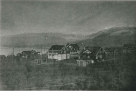
- This site was a top secret site where 460 men worked on the assembly of five submarines for the Russian Navy during World War I. The Seattle contractor was forbidden from doing the work in the US because of American neutrality regulations and he set up the secret plant here without the knowledge of the Canadian Government.
- Historic Neighbourhood
- Barnet (Historic Neighbourhood)
- Planning Study Area
- Burnaby Mountain Area
Images
Second Street Neighbourhood
https://search.heritageburnaby.ca/link/landmark826
- Repository
- Burnaby Heritage Planning
- Associated Dates
- 1955-2008
- Heritage Value
- Second Street had its origins in the 1910-1920 era and the Second Street Elementary School was built in 1928. Substantial new housing was built in the late 1940s and 1950s and infilling occurred during the 1960s and 1970s. By the 1980s, the neighbourhood was primarily a single family area with a small number of multi-family buildings.
- Historic Neighbourhood
- East Burnaby (Historic Neighbourhood)
- Planning Study Area
- Second Street Area
Images
St. Nicholas Anglican Church
https://search.heritageburnaby.ca/link/landmark641
- Repository
- Burnaby Heritage Planning
- Description
- Church building.
- Associated Dates
- 1912
- Street View URL
- Google Maps Street View
- Repository
- Burnaby Heritage Planning
- Geographic Access
- Triumph Street
- Associated Dates
- 1912
- Description
- Church building.
- Heritage Value
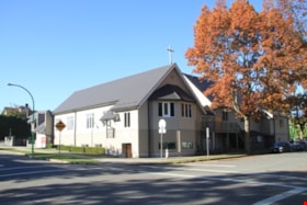
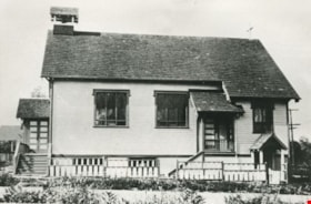
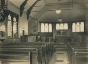
- This church was one of the first built in North Burnaby to serve the new community of Vancouver Heights. Designed by architect Frank Barrs and constructed by local builders, Arthur England and Mr. Scott, it reflected the English roots of the Anglican Church with its fine Arts and Crafts style. It was officially opened in an impressive ceremony by the Bishop of New Westminster and could accommodate 200 worshippers. It was named after Saint Nicholas, the patron saint of sailors. The adjoining parish hall was completed in 1920. The church building features a gabled roof, triangular eave brackets and a semi-octagonal apse. Stucco has been applied to the exterior, but it retains its original form, scale and massing. It now houses the Burnaby Pacific Grace Church. English-born Frank Barrs (1871-1963) arrived in Vancouver in 1907 and established an office for about one year before he began working for the Vancouver Exhibition Association. He briefly established a partnership (1912-1913) with Samuel Shewbrooks (1877-1957), and was active as an architect until about 1933.
- Locality
- Vancouver Heights
- Historic Neighbourhood
- Vancouver Heights (Historic Neighbourhood)
- Planning Study Area
- Burnaby Heights Area
- Architect
- Frank A.A. Barrs
- Area
- 1695.45
- Contributing Resource
- Building
- Ownership
- Private
- Street Address
- 3883 Triumph Street
- Street View URL
- Google Maps Street View
Images
T.O. Townley Estate 'Deerholme'
https://search.heritageburnaby.ca/link/landmark545
- Repository
- Burnaby Heritage Planning
- Description
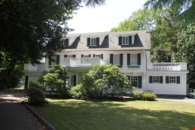
- The T.O. Townley Estate, 'Deerholme,' is located on a lake front property on the north shore of Deer Lake Park. The main house is a two-and-one-half storey symmetrical-massed wood-frame Colonial Revival structure, with flanking one-storey wings, a side gable roof and a central front entry.
- Associated Dates
- 1913
- Formal Recognition
- Heritage Designation, Community Heritage Register
- Other Names
- Thomas & Frances Townley Estate, Loftus House
- Street View URL
- Google Maps Street View
- Repository
- Burnaby Heritage Planning
- Other Names
- Thomas & Frances Townley Estate, Loftus House
- Geographic Access
- Price Street
- Associated Dates
- 1913
- Formal Recognition
- Heritage Designation, Community Heritage Register
- Enactment Type
- Bylaw No. 9807
- Enactment Date
- 23/11/1992
- Description
- The T.O. Townley Estate, 'Deerholme,' is located on a lake front property on the north shore of Deer Lake Park. The main house is a two-and-one-half storey symmetrical-massed wood-frame Colonial Revival structure, with flanking one-storey wings, a side gable roof and a central front entry.
- Heritage Value
- 'Deerholme' was built as the retirement estate of Lieutenant-Colonel Thomas Owen Townley (1862-1935) and his wife, Frances M. Townley. Townley was a pioneer resident of the Lower Mainland of British Columbia: he served as a lawyer, Registrar of Land Titles for New Westminster District and Mayor of Vancouver for one term in 1901. Built in 1913, this is one of the most significant of the Deer Lake estate houses and was the last of grand Edwardian era mansions built on the lots surrounding the lake. The area had been opened up for development two years earlier by the construction of the British Columbia Electric Railway Interurban Line. The estate speaks of a gracious way of life achieved by society's elite during the Edwardian era, supported by the use of domestic servants. Grand in scale, architecturally sophisticated and set in a bucolic landscape, this residence demonstrates the social status of the owner in the privileged classes of the rapidly developing social structure of Burnaby. The house is also significant as one of the earliest designs by the son of Thomas and Frances Townley, architect Fred Laughton Townley (1887-1966), who had graduated in architecture in 1911 from the University of Pennsylvania. In this house for his parents, he demonstrated his deft understanding of the American Period Revival styles learned during his schooling in the United States. The prevailing local taste for British-derived architecture dictated that this was a style he was rarely able to use until the Colonial Revival styles became more popular in the 1920s. F.L. Townley was a founding partner in Townley and Matheson, which achieved significant success as one of the most accomplished local architectural firms, culminating in their best-known commission, Vancouver City Hall, 1935-36.
- Defining Elements
- Key elements the define the heritage character of ‘Deerholme’ include its: - integration with its south-sloping lakefront site, which contains many original landscape features (extant rockeries, formal drive, tennis lawn, open fields, and specimen shrubs and trees) - two-and-one-half storey form with flanking one-storey wings - side gable roof with symmetrical shed dormers, three at the front and three at the rear - complex fenestration, including multi-paned wooden-sash double-hung windows, 6-over-1 on the ground floor and 6-over-9 on the second floor, and multi-paned wooden-sash casements in the dormers - pair of prominent exterior brick chimneys on each side elevation, clad with rough-cast stucco up to the roof level, and each with four chimney-pots - rough-cast stucco cladding - design elements typical of the Colonial Revival style, such as composed classical formality, side gable roof and balanced symmetrical massing - exterior architectural elements, such as classical columns, window shutters, fanlight feature window, multi-paned quarter-round windows flanking the chimneys, and projecting square brackets in the gables - superior level of design and craftsmanship throughout, including refined interior woodwork such as fireplaces, interior columned screen between hallway and living room and a staircase with Colonial Revival details - significant mature trees (such as Red Oaks, Silver Maples, and Copper Beech). - original guest house and stables, which survive on an adjacent property at 6176 Price Street
- Historic Neighbourhood
- Burnaby Lake (Historic Neighbourhood)
- Planning Study Area
- Douglas-Gilpin Area
- Architect
- Fred Laughton Townley
- Function
- Primary Current--Estate
- Primary Historic--Estate
- Community
- Burnaby
- Cadastral Identifier
- P.I.D. No. 002-652-111 Legal Description: Parcel 'C' (Explanatory Plan 12891) , Blocks 4 and 5, District Lot 79 Group 1, New Westminster District, Plan 536
- Boundaries
- ‘Deerholme’ is comprised of a single municipally-owned property located at 6110 Price Street, Burnaby.
- Area
- 14,099.52
- Contributing Resource
- Building
- Landscape Feature
- Ownership
- Public (local)
- Other Collection
- City of Vancouver Archives: T.O. Townley Residence, Original Plans, Add. MSS. 1399, Temporary No. 61, Location 920-D
- Documentation
- Heritage Site Files: PC77000 20. City of Burnaby Planning and Building Department, 4949 Canada Way, Burnaby, B.C., V5G 1M2
- Street Address
- 6110 Price Street
- Street View URL
- Google Maps Street View
Images
Vancouver Heights Neighbourhood
https://search.heritageburnaby.ca/link/landmark741
- Repository
- Burnaby Heritage Planning
- Associated Dates
- 1905-1924
- Heritage Value
- On December 13, 1912, The British Columbian Weekly described the Vancouver Heights neighbourhood as follows: "The northern portion of the municipality in the vicinity of Boundary Road has during the past three years made tremendous strides towards settlement. At that time Mr. James Herd and Mr. Peters were the only residents of the district...Soon, however, the timber was removed, streets laid out and other conveniences such as water, light and transportation provided... The school population of the district has increased so rapidly that the school has been enlarged twice this year and is at the present time inadequate. About 200 children are attending now. There are three churches in the district and one mission...At present time there are two large blocks containing six stores..."
- Historic Neighbourhood
- Vancouver Heights (Historic Neighbourhood)
- Planning Study Area
- Burnaby Heights Area
Images
William & Rachael Karman Residence
https://search.heritageburnaby.ca/link/landmark657
- Repository
- Burnaby Heritage Planning
- Description
- Residential building.
- Associated Dates
- 1911
- Street View URL
- Google Maps Street View
- Repository
- Burnaby Heritage Planning
- Geographic Access
- 14th Avenue
- Associated Dates
- 1911
- Description
- Residential building.
- Heritage Value
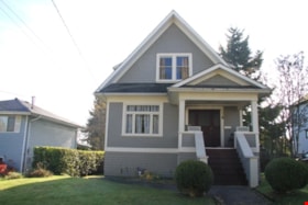
- This house was built by East Burnaby pioneers William Karman (1866-1948) and Rachael Karman (1865-1933), both born in Scotland. The Karmans originally farmed a “fruit ranch” on Cumberland Road in the 1890s but retired to this home after selling their former farm for a residential subdivision. Rachel died in 1933, and William was remarried to Mary Selkirk (1904-1981). In pristine condition, this Edwardian-era home has a front gabled roof, with symmetrical saddlebag dormers and a gabled front porch. Cedar shingle cladding is used at the foundation level and in the gable ends, and lapped wooden siding on the main level.
- Locality
- East Burnaby
- Historic Neighbourhood
- East Burnaby (Historic Neighbourhood)
- Planning Study Area
- Edmonds Area
- Area
- 696.46
- Contributing Resource
- Building
- Ownership
- Private
- Street Address
- 8088 14th Avenue
- Street View URL
- Google Maps Street View
Images
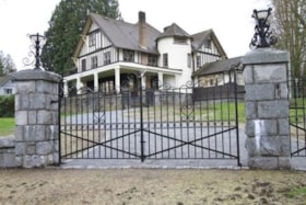
W.J. Mathers House 'Altnadene' Gate & Wall
https://search.heritageburnaby.ca/link/landmark858
- Repository
- Burnaby Heritage Planning
- Description
- The gate and wall of the W.J. Mathers House 'Altnadene' form an integral part of the heritage character of this historic estate, which includes a two-and-one-half storey wood frame house set in a large terraced garden, now located in Deer Lake Park. Built as a family home, it is designed in the Bri…
- Associated Dates
- 1912
- Formal Recognition
- Heritage Designation, Community Heritage Register
- Other Names
- William & Mary Mathers Residence
- Street View URL
- Google Maps Street View
- Repository
- Burnaby Heritage Planning
- Other Names
- William & Mary Mathers Residence
- Geographic Access
- Deer Lake Avenue
- Associated Dates
- 1912
- Formal Recognition
- Heritage Designation, Community Heritage Register
- Enactment Type
- Bylaw No. 13196
- Enactment Date
- 13/05/2013
- Description
- The gate and wall of the W.J. Mathers House 'Altnadene' form an integral part of the heritage character of this historic estate, which includes a two-and-one-half storey wood frame house set in a large terraced garden, now located in Deer Lake Park. Built as a family home, it is designed in the British Arts and Crafts style enriched by Tudor, Romanesque, and medieval details.
- Heritage Value
- 'Altnadene' was constructed in the Deer Lake Crescent subdivision, which was originally promoted as an upper class neighbourhood. It represents one of the first residential developments in the City of Burnaby that required buildings to be of a specific value, thus demonstrating the desire for exclusivity among the successful businessmen who chose to settle in the area. The house and grounds illustrate the social, cultural, lifestyle and leisure sensibilities of the owners in the Deer Lake Crescent subdivision: such values as social aspiration, racial exclusivity, demonstration of architectural taste, importance of a landscaped garden, and the provision of facilities for fashionable pursuits such as lawn tennis. The estate is historically significant for its connection to William John Mathers (1859-1929), an early pioneer who arrived in New Westminster in 1876, an enterprising grain dealer, businessman, alderman, president of the Board of Trade and various other local organizations, and a 'public spirited and progressive citizen.' The landscape of the estate featured a landmark granite capstone wall and wrought iron gate surrounding the front garden and terraced lawns of the mansion. The overall architectural intention was to reference medieval English estates by surrounding the ‘castle’ with a stone wall with gated entrances. The stone material for the construction of the wall was quarried from large ‘glacial erratic’ granite boulders found on the property. The highly decorative wrought iron gate was designed and made by artisan James A. Blair, a Scottish blacksmith employed by the Westminster Iron Works in 1912. The design for the 'double' driveway gate was featured in the company’s original catalogue as 'Design No. 152'. These gates are a very unusual and rare example of their type and are some of the most elaborate surviving examples in the City.
- Defining Elements
- Key elements that define the heritage character of the gate and wall at 'Altnadene' include its: - wrought iron gates, massive gate-posts inscribed with 'Altnadene' and granite walls at the corner entry of the property
- Locality
- Deer Lake Park
- Historic Neighbourhood
- Burnaby Lake (Historic Neighbourhood)
- Planning Study Area
- Douglas-Gilpin Area
- Organization
- Westminster Iron Works
- Function
- Primary Current--Recreation Centre
- Primary Historic--Estate
- Community
- Burnaby
- Cadastral Identifier
- P.I.D. No. 007-527-241 Legal Description: Lot 'B', District Lot 79, Group 1, New Westminster District, Plan 6642
- Boundaries
- 'Altnadene' is comprised of a single municipally-owned property located at 6490 Deer Lake Avenue, Burnaby.
- Area
- 17,065.00
- Contributing Resource
- Landscape Feature
- Ownership
- Public (local)
- Street Address
- 6490 Deer Lake Avenue
- Street View URL
- Google Maps Street View
Images
Woodward House
https://search.heritageburnaby.ca/link/landmark500
- Repository
- Burnaby Heritage Planning
- Description
- The Woodward House is a two-storey plus basement, wood-framed house with British Arts and Crafts influences. It is set in a wooded landscape on a lakefront property, on Sperling Avenue within the Deer Lake Park Heritage Precinct of Burnaby, with expansive views of the lake.
- Associated Dates
- 1912
- Formal Recognition
- Community Heritage Register
- Other Names
- Maud & Harriet Woodward Residence
- Street View URL
- Google Maps Street View
- Repository
- Burnaby Heritage Planning
- Other Names
- Maud & Harriet Woodward Residence
- Geographic Access
- Sperling Avenue
- Associated Dates
- 1912
- Formal Recognition
- Community Heritage Register
- Enactment Type
- Council Resolution
- Enactment Date
- 26/05/2003
- Description
- The Woodward House is a two-storey plus basement, wood-framed house with British Arts and Crafts influences. It is set in a wooded landscape on a lakefront property, on Sperling Avenue within the Deer Lake Park Heritage Precinct of Burnaby, with expansive views of the lake.
- Heritage Value
- Maud Sarah Woodward (1865-1958), a pioneer nurse originally from England, and her sister Harriet Julia Woodward (1879-1969), one of Burnaby’s first teachers, had this large house built in 1912 to replace the smaller cottage they owned nearby at 5141 Sperling Avenue. Farmer, builder and longtime Deer Lake resident, Bernard R. Hill (1858-1939), was hired as the contractor. The Woodward House played an important role in the Deer Lake community. The Woodward sisters were tireless community organizers and volunteers. This house served a number of functions, and in addition to being the sisters’ home was the local post office until 1949 and also a private kindergarten/school until 1935. Originally designed in the British Arts and Crafts style with a simple rustic exterior of cedar shingles, it is an excellent example of the type of residence constructed by middle-class citizens in the Deer Lake neighbourhood. The B.C. Electric Railway's Burnaby Lake Interurban line, which opened June 12, 1911, fostered the development of Deer Lake as well as other Edwardian era neighbourhoods in Burnaby.
- Defining Elements
- Key elements that define the heritage character of the Woodward House include its: - lakefront location, within the Deer Lake Park Heritage Precinct - residential form, scale and massing as exhibited by its two-storey height, full basement, square floor plan and side-gabled roof - internal red-brick chimneys - British Arts and Crafts features such as cedar shingle siding, extant under later plywood - associated landscape features such as mature coniferous trees
- Historic Neighbourhood
- Burnaby Lake (Historic Neighbourhood)
- Planning Study Area
- Morley-Buckingham Area
- Builder
- Bernard R. Hill
- Function
- Primary Historic--Single Dwelling
- Primary Current--Single Dwelling
- Community
- Deer Lake
- Cadastral Identifier
- P.I.D.002-507-064
- Boundaries
- The Woodward House is comprised of a single residential lot located at 5195 Sperling Avenue, Burnaby.
- Area
- 1788.5
- Contributing Resource
- Building
- Ownership
- Public (local)
- Documentation
- City of Burnaby Planning and Building Department, Heritage Site Files
- Street Address
- 5195 Sperling Avenue
- Street View URL
- Google Maps Street View
Images
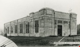
Horne-Payne Receiving Station
https://search.heritageburnaby.ca/link/landmark594
- Repository
- Burnaby Heritage Planning
- Description
- Industrial building.
- Associated Dates
- 1913
- Street View URL
- Google Maps Street View
- Repository
- Burnaby Heritage Planning
- Geographic Access
- 2nd Avenue
- Associated Dates
- 1913
- Description
- Industrial building.
- Heritage Value
- Constructed as an electrical grid substation by the B.C. Electric Railway Company, the Horne-Payne substation was part of the expansion of this utility company to central Burnaby that occurred as a result of the opening of the Burnaby Lake Interurban line in 1911. The Receiving Station is intended to rearrange the company’s system of distributing power over the whole of the Burrard Peninsula. Power will come to the transformers there and be converted and distributed to the various substations in Vancouver, New Westminster and the suburbs...Work has already been started at the foundation for the new plant. (Vancouver Daily Province, April 29, 1913) When constructed the substation was situated within a forest clearing in a largely undeveloped section of northwest Burnaby. The area now surrounding the substation is heavily developed for semi-industrial purposes. This steel-frame and poured concrete structure was designed to be utilitarian, but with decorative detailing. The south-facing front of the structure features massed corners detailed with decorative relief panels at the roofline. Additionally, this well-balanced building displayed symmetrical fenestration with blind, and tall multi-paned steel-sash windows, some crowned with keystones. A tower added to the east side of the building’s front is the most substantial change made to the appearance of the Horne-Payne substation. This industrial structure was designed by prominent British Columbian architect, Robert Lyon (1879-1963). Born in Edinburgh, Lyon apprenticed and worked as an architect in Scotland until 1908 before moving to New York in 1909. In 1911, he began his career in Vancouver as an “architectural engineer,” with the B.C. Electric Company that lasted until 1918. After a short tenure in the lumber industry, Lyon returned to architecture, this time with his own firm in Penticton. Active in municipal politics, he was instrumental in the incorporation of Penticton as a city, and became its first mayor from 1948-1949. Lyon retired from architecture in 1958 and died in 1963. Lyon also designed the Central Park Gate in Burnaby.
- Locality
- Vancouver Heights
- Historic Neighbourhood
- Vancouver Heights (Historic Neighbourhood)
- Planning Study Area
- West Central Valley Area
- Architect
- Robert Lyon
- Area
- 47400.00
- Contributing Resource
- Building
- Ownership
- Private
- Street Address
- 3700 2nd Street
- Street View URL
- Google Maps Street View
Images
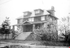
Jacob & Margaret Wysong House
https://search.heritageburnaby.ca/link/landmark507
- Repository
- Burnaby Heritage Planning
- Description
- The Jacob and Margaret Wysong House is a two and one-half storey, wood-frame Arts and Crafts house with a hipped roof and hipped dormers. Symmetrical in massing, it is distinguished by its masonry verandah columns, foundations and chimneys. It is located on a corner lot on Sperling Avenue at Stanle…
- Associated Dates
- 1912
- Formal Recognition
- Heritage Designation, Community Heritage Register
- Street View URL
- Google Maps Street View
- Repository
- Burnaby Heritage Planning
- Geographic Access
- Sperling Avenue
- Associated Dates
- 1912
- Formal Recognition
- Heritage Designation, Community Heritage Register
- Enactment Type
- By-law No. 11978
- Enactment Date
- 17/10/2005
- Description
- The Jacob and Margaret Wysong House is a two and one-half storey, wood-frame Arts and Crafts house with a hipped roof and hipped dormers. Symmetrical in massing, it is distinguished by its masonry verandah columns, foundations and chimneys. It is located on a corner lot on Sperling Avenue at Stanley Street in the Edmonds neighbourhood of South Burnaby.
- Heritage Value
- The Jacob and Margaret Wysong House is significant for illustrating the early development of the Edmonds neighbourhood, a speculative subdivision that was created and marketed during the pre-First World War real estate boom. The area’s proximity to New Westminster, coupled with extensive views and two newly developed streetcar lines, ensured that Edmonds attracted a wave of suburban development. The scale of this house is atypical of the usual suburban lots, and reflects the prominence of this location and its spectacular views. Set on a large lot, the Jacob and Margaret Wysong House is a grand estate home that is one of the earliest, and most prominent, in South Burnaby. This is also an exceptional example of Arts and Crafts architecture, displaying the use of native materials that was a hallmark of the style. The first owners were Jacob Wysong and his wife Margaret. Jacob Wysong, a local contractor, constructed the house in 1912. The stonework is exceptional, and the use of rough-cut granite and fieldstone, with overall shingle cladding, recalls the rustic vernacular common in Western park lodges, and evokes a country lifestyle in harmony with nature. The hipped roof was designed with a flat top that acted as a lookout tower that provided views of the surrounding landscape.
- Defining Elements
- Key elements that define the heritage character of the Jacob and Margaret Wysong House include its: - prominent corner location in the Edmonds neighbourhood of South Burnaby - residential form, scale and massing as expressed by its two and one-half storey plus raised basement height, symmetrical plan, hipped roof with flat top, hipped dormers, and hipped roof over the full open front verandah with a central front gable - masonry elements such as rough-cut granite and fieldstone foundations, verandah columns, stair cheeks, and external and internal chimneys - wooden-frame construction including original cedar shingling on dormers and facing verandah, shingling on remainder of house under later stucco cladding, and surviving original dimensional trim facing verandah and on dormers - Arts and Crafts features such as the use of natural materials, open soffits and angled roof overhang - windows including: double-hung 18-over-1 wooden sash windows; multi-paned casement windows; French doors to verandah; and front door with glazed sidelights - associated landscape features including surrounding mature trees, hedges and perimeter plantings
- Historic Neighbourhood
- Edmonds (Historic Neighbourhood)
- Planning Study Area
- Kingsway-Beresford Area
- Function
- Primary Historic--Single Dwelling
- Primary Current--Single Dwelling
- Community
- Edmonds
- Cadastral Identifier
- P.I.D. 000-497-801
- Boundaries
- The Jacob and Margaret Wysong House is comprised of a single residential lot located at 6325 Sperling Avenue, Burnaby.
- Area
- 1087.62
- Contributing Resource
- Building
- Ownership
- Private
- Documentation
- City of Burnaby Planning and Building Department, Heritage Site Files
- Street Address
- 6325 Sperling Avenue
- Street View URL
- Google Maps Street View
Images
Burquitlam Neighbourhood
https://search.heritageburnaby.ca/link/landmark757
- Repository
- Burnaby Heritage Planning
- Associated Dates
- 1905-1924
- Heritage Value
- In 1921, the pamphlet "Beautiful Burnaby" was produced and it described the Burquitlam neighbourhood as such: "No part of Burnaby has more consistently laboured to advance its prosperity than Burquitlam. Enterprise and intelligence has hewn homes from the forest and developed land into highly productive gardens and poultry ranches. Burquitlam is the growing suburb to the north of the City of New Westminster. It is reached by the Sapperton carline direct from Edmonds being only a few minutes ride from New Westminster market. It is also served by the B.C.E.R. Burnaby Lake line and adjoins on the best golf links in Greater Vancouver."
- Historic Neighbourhood
- Burquitlam (Historic Neighbourhood)
- Planning Study Area
- Cameron Area
- Lyndhurst Area
Images
Hastings Grove Neighbourhood
https://search.heritageburnaby.ca/link/landmark746
- Repository
- Burnaby Heritage Planning
- Associated Dates
- 1905-1924
- Heritage Value
- During the height of the real estate boom between 1909 and 1913, Vancouver developer Frederick Munson plotted the subdivision of more than 150 acres of land on Curtis Street east of Sperling Avenue, on the newly logged slopes of remote Burnaby Mountain. Burnaby opened up Curtis Street to facilitate access to Hastings Grove and Munson agreed to pay one-third of the cost but never did. He also paid only $1000.00 down on the agreed price of the land. When he failed to make further payments, the mortgage holders foreclosed and re-sold the properties. People who had bought lots from Munson lost not only the land they though they owned, but also the money they had paid for it. Hastings Grove was a disaster. The converted automobile - which served as the bus - stopped running. The few houses and most of the lots reverted to the Municipality because of non-payment of taxes and are now part of Burnaby Mountain Park. The only remaining building is the old Hastings Grove Store which still stands as an apartment building.
- Historic Neighbourhood
- Lochdale (Historic Neighbourhood)
- Planning Study Area
- Lochdale Area
Images
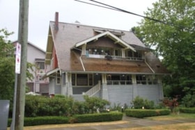
J.A. Thurston House 'Altese'
https://search.heritageburnaby.ca/link/landmark511
- Repository
- Burnaby Heritage Planning
- Description
- The J.A. Thurston House is a very large, two and one-half storey plus basement wood-frame Arts and Crafts style house. It is located on the south side of Thurston Street, near Kingsway and the SkyTrain (formerly the interurban tramline route), within the Metrotown area of Burnaby and is now part of…
- Associated Dates
- 1912
- Formal Recognition
- Heritage Designation, Community Heritage Register
- Other Names
- John A. & Sarah Thurston House
- Street View URL
- Google Maps Street View
- Repository
- Burnaby Heritage Planning
- Other Names
- John A. & Sarah Thurston House
- Geographic Access
- Thurston Street
- Associated Dates
- 1912
- Formal Recognition
- Heritage Designation, Community Heritage Register
- Enactment Type
- Bylaw No. 9934
- Enactment Date
- 09/08/1993
- Description
- The J.A. Thurston House is a very large, two and one-half storey plus basement wood-frame Arts and Crafts style house. It is located on the south side of Thurston Street, near Kingsway and the SkyTrain (formerly the interurban tramline route), within the Metrotown area of Burnaby and is now part of a large apartment complex.
- Heritage Value
- The J.A. Thurston House demonstrates Burnaby's real estate and construction boom along the interurban tramline in 1911. The house was built for John Albert Thurston (1874-1944) and his wife Sarah Sedona Thurston (1879-1961). Typical of the entrepreneurial spirit of the age, John Thurston, a manager for the Leckie Shoe Company Limited in Vancouver, was also involved in real estate development, and purchased a twenty-one lot subdivision consisting of 3.2 hectares bound by the interurban tramline right-of-way to the south, Boundary Road to the west and Smith Street (now Thurston Street) to the north. Additionally, the J.A. Thurston House is an excellent, high quality example of an Arts and Crafts style dwelling, with numerous notable design elements such as the battered piers, the elaborate second storey dormer and stained glass windows with landscape and seascape motifs. The enormous scale of the house reflects a time when large families were common and domestic servants were needed to run the household. Indicative of the labour-saving devices and luxury features being introduced at the high end of the housing market, it was equipped with a built-in vacuum system, refrigeration, servant summoning devices and a round safe built into a fireplace mantle. The J.A. Thurston House also represents the proliferation during the Edwardian era of homes built from pattern books and standardized designs as a means to expedite the construction process and offer competitive costs.
- Defining Elements
- Key elements that define the heritage character of the J.A. Thurston House include its: - location on Thurston Street, in the old Central Park district - residential form, scale and massing as exemplified by its two and one-half storey plus above-ground basement height and regular, rectangular plan - Arts and Crafts style details such as the picturesque roofline, deep open eaves with exposed purlins, narrow lapped wooden siding on the first storey and cedar shingle siding on the upper storeys - broad and unusually steep side gabled roof, clad with cedar shingles - deeply-recessed full open front verandah with complementary recessed balcony in second storey dormer, incorporating both a gabled roof and shed roof - twinned and triple square bracketed columns on the verandahs and balcony - decorative battered verandah piers, supported on exposed beams - irregular fenestration, including: double-hung wooden-sash windows; picture windows; casement windows; and several stained glass windows with landscape and seascape motifs - tall brick external chimney on east facade - original interior features such as fireplaces, and wooden trim and floors
- Historic Neighbourhood
- Central Park (Historic Neighbourhood)
- Planning Study Area
- Garden Village Area
- Function
- Primary Historic--Single Dwelling
- Primary Current--Single Dwelling
- Community
- Burnaby
- Cadastral Identifier
- 018-224-113
- Boundaries
- The J.A. Thurston House is comprised of a single residential lot located at 3762 Thurston Street, Burnaby.
- Area
- 3880
- Contributing Resource
- Building
- Ownership
- Private
- Street Address
- 3762 Thurston Street
- Street View URL
- Google Maps Street View
Images
Andy Johnson House
https://search.heritageburnaby.ca/link/landmark515
- Repository
- Burnaby Heritage Planning
- Description
- The Andy Johnson House is a large, one and one-half storey plus above-ground basement wood-frame mansion on a rubble-stone granite foundation with a red terra cotta pantile roof and an octagonal corner turret. The building stands in a prominent location on a corner lot on Kingsway, one of Burnaby’s…
- Associated Dates
- 1912
- Formal Recognition
- Community Heritage Register
- Other Names
- Andrew M. & Margaret Johnson House 'Glenedward'
- Street View URL
- Google Maps Street View
- Repository
- Burnaby Heritage Planning
- Other Names
- Andrew M. & Margaret Johnson House 'Glenedward'
- Geographic Access
- Kingsway
- Associated Dates
- 1912
- Formal Recognition
- Community Heritage Register
- Enactment Type
- Council Resolution
- Enactment Date
- 26/05/2003
- Description
- The Andy Johnson House is a large, one and one-half storey plus above-ground basement wood-frame mansion on a rubble-stone granite foundation with a red terra cotta pantile roof and an octagonal corner turret. The building stands in a prominent location on a corner lot on Kingsway, one of Burnaby’s main transportation and commercial corridors, and stands adjacent to the Burlington Square Development.
- Heritage Value
- The Andy Johnson House 'Glenedward' is a valued representation of a prominent upper middle-class family dwelling from the pre-First World War era. Andrew M. Johnson (1861-1934), an early Vancouver pioneer, and his wife Margaret built this house in 1912, in an imposing style favoured by the newly wealthy of the prewar boom period. Born in Norway, Andrew Johnson arrived in Vancouver just months after the Great Fire of 1886 and went into partnership with J. (Ollie) Atkins in a transportation company that became the Mainland Transfer Company, eventually the largest of its kind in Vancouver. Johnson also operated Burnaby's historic Royal Oak Hotel, once located on the opposite corner from his estate. Additionally, the Andy Johnson House is significant for the high-quality design and construction of both the house and its landscaped setting. Designed in the British Arts and Crafts style, the house exhibits a rare degree of opulence in building materials, including imported terra cotta roof tiles, oak and walnut interior millwork, and stained glass manufactured by the Royal City Glass Company. The rubble-stone foundations and perimeter walls were obtained from two massive granite glacial erratic boulders found on the property. The house has been relocated closer to the corner, but the encircling stone walls, the gate posts and gates manufactured by the Westminster Iron Works and some of the original plantings have been retained. A grouping of three giant Sequoias, other mature deciduous trees and massings of shrubbery indicate the type of landscape setting considered appropriate for an estate house in the early years of the twentieth century.
- Defining Elements
- Key elements that define the heritage character of the Andy Johnson House include its: - corner location on Kingsway at Royal Oak Avenue - residential form, scale and massing as expressed by the one and one-half storey height, above-ground basement, octagonal corner turret and rectangular plan - British Arts and Crafts details such as the use of natural indigenous materials, half-timbering in the gables and dormers, picturesque roofline, cedar shingle siding, extended eaves, native granite rubble-stone foundation with red-coloured mortar, and granite piers and chimneys - additional exterior features such as the central front entrance, elaborate wrap-around verandah, porte-cochere and balcony at second storey lighted with original cast iron electric lanterns - red terra cotta pantile roof cladding - fenestration, such as double-hung 1-over-1 wooden-sash windows with stained glass and leaded lights in the upper sash - original interior features such as fireplaces, wainscoting finished with oak and walnut millwork, and three-quarter sawn oak flooring - associated landscape features including three giant Sequoias. granite walls, granite gate posts and wrought iron gates
- Historic Neighbourhood
- Central Park (Historic Neighbourhood)
- Planning Study Area
- Marlborough Area
- Builder
- J.C. Allen
- Function
- Primary Historic--Single Dwelling
- Primary Current--Eating or Drinking Establishment
- Community
- Burnaby
- Cadastral Identifier
- 003-004-538
- Boundaries
- The Andy Johnson House is comprised of a single residential lot located at 5152 Kingsway, Burnaby
- Area
- 1424.21
- Contributing Resource
- Building
- Ownership
- Private
- Street Address
- 5152 Kingsway
- Street View URL
- Google Maps Street View
Images
Big Bend Neighbourhood
https://search.heritageburnaby.ca/link/landmark840
- Repository
- Burnaby Heritage Planning
- Associated Dates
- 1955-2008
- Heritage Value
- The Big Bend Neighbourhood in Burnaby maintained its status as an important agricultural area in the City in the years following 1955 and it also solidified its role as a prime industrial and commercial district. In 1972, the Big Bend Development Plan was adopted by Council and soon thereafter, approximately 620 acres of land were incorporated into the Agricultural Land Reserve. These lands have been set aside for agricultural and limited recreation purposes. By the 2000s, 160 acres of land were considered highly productive agricultural areas, and over 400 acres of land had been secured as parkland, including the Fraser Foreshore Park. The area also developed large commercial and industrial districts including those at Marine Way/Boundary, the Glenlyon Estates, Riverfront Business Park, Burnaby Business Park, and Glenwood Industrial Estates.
- Historic Neighbourhood
- Fraser Arm (Historic Neighbourhood)
- Planning Study Area
- Big Bend Area
Images
Capitol Hill Neighbourhood
https://search.heritageburnaby.ca/link/landmark742
- Repository
- Burnaby Heritage Planning
- Associated Dates
- 1905-1924
- Heritage Value
- Real estate ventures became quite active in the Vancouver Heights and Capitol Hill areas of Burnaby by 1908. Brokerage firms and agents who bought large tracts, subdivided and sold them off in parcels and by 1909 had adopted the name "Capitol Hill" to describe Burnaby's newest neighbourhood. In his book, History of Burnaby and Vicinity," historian George Green explains that the term "Capitol Hill" was taken from ancient Rome where the civic centre was built upon the Capitoline Hill, one of the seven hills of the eternal city. In 1909, the Scott Brokerage Company advertised the sale of lots on Capitol Hill, calling it "one of Vancouver's swellest suburbs."
- Historic Neighbourhood
- Capitol Hill (Historic Neighbourhood)
- Planning Study Area
- Capitol Hill Area
Images
Central Park Entrance Gate
https://search.heritageburnaby.ca/link/landmark544
- Repository
- Burnaby Heritage Planning
- Description
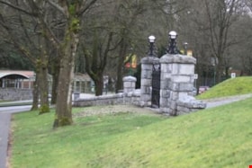
- The Central Park Entrance Gate is the ceremonial entrance to Burnaby’s historic Central Park from Kingsway, and consists of two massive stone pillars, approximately 7.5 metres high and 1.8 metres square, adjacent gate posts and a low flanking stone wall that curves into the park to the east.
- Associated Dates
- 1913
- Formal Recognition
- Heritage Designation, Community Heritage Register
- Street View URL
- Google Maps Street View
- Repository
- Burnaby Heritage Planning
- Geographic Access
- Imperial Street
- Associated Dates
- 1913
- Formal Recognition
- Heritage Designation, Community Heritage Register
- Enactment Type
- Bylaw No. 9807
- Enactment Date
- 23/11/1992
- Description
- The Central Park Entrance Gate is the ceremonial entrance to Burnaby’s historic Central Park from Kingsway, and consists of two massive stone pillars, approximately 7.5 metres high and 1.8 metres square, adjacent gate posts and a low flanking stone wall that curves into the park to the east.
- Heritage Value
- The Central Park Entrance Gate is significant as a ceremonial entry to a major park, for its connection with the early history of the British Columbia Electric Railway (BCER) and as an important design by an accomplished British Columbian architect. When the original interurban line between Vancouver and New Westminster was constructed in 1891, one of the first stations was located where the tramway crossed the Vancouver-Westminster Road (now Kingsway) within the newly-created Central Park. The interurban line ran through the park on a diagonal right-of-way (the current SkyTrain line, opened in 1986, follows this original alignment). In 1912 an agreement was reached between the successor interurban company, the BCER, and the Central Park Provincial Park Board, to deed additional land for an expanded right-of-way through the Park in exchange for improvements that included the construction of an ornamental stone wall and gate with an iron arch, with an illuminated 'Central Park' sign, adjacent to the interurban station on Kingsway. This was an early and rare example of an electric sign used for a public recreation facility. The Gate is also significant as a surviving early design by Robert Lyon (1879-1963), an Edinburgh-born and trained immigrant who was one of the most accomplished of British Columbia's early architects. After he moved to Vancouver, he was employed by the BCER from 1911 until 1918, and worked on a broad range of projects including some of the grandest and most innovative local industrial structures of the time. The arch was built by the Westminster Ironworks Company, one of the leading firms of its kind in Western Canada, operated by John Reid of New Westminster. The Gate was completed in 1914; in 1968 the decorative ironwork was removed due to corrosion and placed in storage.
- Defining Elements
- Key elements that define the heritage character of the Central Park Entrance Gate include its: - two subtly tapered massive stone pillars, which rise in stages from a larger base to a shaft with random coursed multi-coloured granite with roughly formed grey granite quoins, to a top formed of finely finished grey granite blocks with a coved and bracketed cap - adjacent gate posts with monolithic pyramidal granite caps - low flanking stone wall that curves into the park to the east, constructed of random coursed multi-coloured granite with a river rock triangular cap
- Historic Neighbourhood
- Central Park (Historic Neighbourhood)
- Planning Study Area
- Maywood Area
- Architect
- Robert Lyon
- Builder
- John Reid
- Westminster Iron Works Co.
- Function
- Primary Current--Park Fixture
- Primary Historic--Park Fixture
- Community
- Burnaby
- Cadastral Identifier
- P.I.D. No. 017-767-172 Legal Description: Block B of Lot 2 Except Firstly: Part on Plan 8669 and Secondly: Part on Plan LMP4689 District Lot 151, Group 1, New Westminster District, Plan 3443
- Boundaries
- The property (Central Park) is a municipally-owned park that lies at the western edge of Burnaby, between 49th Avenue to the south, Kingsway to the north, Boundary Road to the west and Patterson Avenue to the east.
- Area
- 853,403.82
- Contributing Resource
- Structure
- Landscape Feature
- Ownership
- Public (local)
- Names
- Lyon, Robert
- Reid, John
- Westminster Iron Works Company
- British Columbia Electric Railway Company
- Central Park Provincial Park Board
- Subjects
- Structures - Fences
- Street Address
- 3883 Imperial Street
- Street View URL
- Google Maps Street View
Images
Coburn House
https://search.heritageburnaby.ca/link/landmark510
- Repository
- Burnaby Heritage Planning
- Description
- The Coburn House is a two and one-half storey plus basement Foursquare farm house. Prominently situated on a rise of land along the east side of Boundary Road overlooking Kingsway, it stands among single-family houses later constructed on its subdivided farm land.
- Associated Dates
- 1910
- Formal Recognition
- Heritage Designation, Community Heritage Register
- Other Names
- Minerva Jane Coburn House
- Street View URL
- Google Maps Street View
- Repository
- Burnaby Heritage Planning
- Other Names
- Minerva Jane Coburn House
- Geographic Access
- Boundary Road
- Associated Dates
- 1910
- Formal Recognition
- Heritage Designation, Community Heritage Register
- Enactment Type
- Bylaw No. 9184
- Enactment Date
- 08/05/1989
- Description
- The Coburn House is a two and one-half storey plus basement Foursquare farm house. Prominently situated on a rise of land along the east side of Boundary Road overlooking Kingsway, it stands among single-family houses later constructed on its subdivided farm land.
- Heritage Value
- The Coburn House is important as a surviving representation of Burnaby’s early settlement period, when the municipality was largely an agricultural and residential suburb. It was built in 1910 by carpenter William Kirkham for Minerva Jane Coburn (1868-1940), and three years later the builder and client were married. Together, they operated the Surprise Poultry Farm, and were frequent participants at the local Central Park Farmers' Institute Exhibitions. This house is valued as an excellent and well-preserved example of a substantial Edwardian era Foursquare farm house. Significant due to its generous size, dominant symmetry, the prominent verandah that wraps around the front and both sides, and the three roof dormers, this house retains a high degree of original material and integrity. The elevated siting of the house, its tall proportions and symmetrical appearance combined with its fine condition make this an excellent example of its type.
- Defining Elements
- Key elements that define the heritage character of the Coburn House include its: - prominent location on Boundary Road, on an elevated site overlooking Vancouver - residential form, scale and massing as expressed by its cubic massing and tall, dominant roof form - Foursquare style as exemplified by its symmetry, square floor plan, pyramidal bellcast roof and three hipped dormers - Edwardian era construction details such as narrow bevelled wooden siding, broad horizontal eave band with scroll-cut eave brackets, and simple window surrounds - wraparound verandah encircling three main facades, with hipped roof, square columns and closed balustrades, connected to one storey extension at rear - projecting bay window on the main floor south facade - original double-hung 1-over-1 wooden-sash windows, some in double assembly on the ground floor - internal red brick chimney
- Historic Neighbourhood
- Central Park (Historic Neighbourhood)
- Planning Study Area
- Garden Village Area
- Function
- Primary Historic--Single Dwelling
- Primary Current--Single Dwelling
- Community
- Burnaby
- Cadastral Identifier
- 002-653-427
- Boundaries
- The Coburn House is comprised of a single residential lot located at 5170 Boundary Road, Burnaby
- Area
- 541.91
- Contributing Resource
- Building
- Ownership
- Private
- Street Address
- 5170 Boundary Road
- Street View URL
- Google Maps Street View
