Narrow Results By
Format
- Architectural Drawing 204
- Book 138
- Bylaws - Adopted 1508
- Bylaws - Repealed 99
- Cartographic Material 7
- Council - Committee Report 1442
- Council - Manager's Report 3428
- Council - Mayor/Councillor/Staff Report 166
- Council - Public Hearing Minutes 116
- Council - Regular Council Minutes 320
- Graphic Material 18
- Landmark Description
Decade
- 2020s 56
- 2010s 49
- 2000s
- 1990s 88
- 1980s 69
- 1970s 83
- 1960s 122
- 1950s 131
- 1940s 65
- 1930s 84
- 1920s 84
- 1910s 102
- 1900s 45
- 1890s 18
- 1880s 3
- 1870s 1
- 1860s
- 1850s 2
- 1840s 1
- 1830s 1
- 1820s 1
- 1810s 1
- 1800s 1
- 1790s 1
- 1780s 1
- 1770s 1
- 1760s 1
- 1750s 1
- 1740s 1
- 1730s 1
- 1720s 1
- 1710s 1
- 1700s
- 1690s 1
- 1680s 1
- 1670s 1
- 1660s 1
- 1650s 1
- 1640s 1
- 1630s 1
- 1620s 1
- 1610s 1
- 1600s 1

Ardingley-Sprott Neighbourhood
https://search.heritageburnaby.ca/link/landmark797
- Repository
- Burnaby Heritage Planning
- Associated Dates
- 1955-2008
- Heritage Value
- The Ardingley-Sprott Neighbourhood is primarily non-residential and developed in the 1970s west of the Burnaby Lake park area. It grew to include a large recreational component in the form of the Burnaby Lake Sports Complex and playing fields.
- Historic Neighbourhood
- Burnaby Lake (Historic Neighbourhood)
- Planning Study Area
- Ardingley-Sprott Area
Images


Big Bend Neighbourhood
https://search.heritageburnaby.ca/link/landmark840
- Repository
- Burnaby Heritage Planning
- Associated Dates
- 1955-2008
- Heritage Value
- The Big Bend Neighbourhood in Burnaby maintained its status as an important agricultural area in the City in the years following 1955 and it also solidified its role as a prime industrial and commercial district. In 1972, the Big Bend Development Plan was adopted by Council and soon thereafter, approximately 620 acres of land were incorporated into the Agricultural Land Reserve. These lands have been set aside for agricultural and limited recreation purposes. By the 2000s, 160 acres of land were considered highly productive agricultural areas, and over 400 acres of land had been secured as parkland, including the Fraser Foreshore Park. The area also developed large commercial and industrial districts including those at Marine Way/Boundary, the Glenlyon Estates, Riverfront Business Park, Burnaby Business Park, and Glenwood Industrial Estates.
- Historic Neighbourhood
- Fraser Arm (Historic Neighbourhood)
- Planning Study Area
- Big Bend Area
Images


Brentwood Neighbourhood
https://search.heritageburnaby.ca/link/landmark780
- Repository
- Burnaby Heritage Planning
- Associated Dates
- 1955-2008
- Heritage Value
- Between 1955 and 2001, the Brentwood Neighbourhood developed into one of Burnaby's four official Town Centres. The Brentwood Town Centre serves the north-west sector of the Municipality, providing facilities such as commercial developments - of which the Brentwood Mall is the most significant. Under Burnaby's Residential Development Framework adopted by Council in 1981, the Town Centre also incorporated a full range of multi-housing types and forms in close relationship with their commercial facilities. In 1996, the City adopted the Brentwood Town Centre Development Plant to solidify the area as a focus of higher-density and higher-intensity residential and commercial opportunities, public transit and supporting leisure facilities.
- Planning Study Area
- Brentwood Area
Images


Burnaby Heights Neighbourhood
https://search.heritageburnaby.ca/link/landmark776
- Repository
- Burnaby Heritage Planning
- Associated Dates
- 1955-2008
- Heritage Value
- Up until the 1970s, this neighbourhood was known as Vancouver Heights. When a new park was created during that decade and named "Burnaby Heights Park," the name was gradually adopted by newcomers to the area. Today, you will hear residents refer to their neighbourhood as Burnaby Heights, Vancouver Heights, or just "The Heights." Throughout the 1960s and 1970s, the commercial district in this neighbourhood continued to grow and a Retail Merchants Association was formed which later became known as the Heights Merchants Association. The neighbourhood still retains a residential neighbourhood characteristic with an increasing number of apartment buildings and multi-family units being built over the past 20 years.
- Historic Neighbourhood
- Vancouver Heights (Historic Neighbourhood)
- Planning Study Area
- Burnaby Heights Area
Images


Burnaby Lake Neighbourhood
https://search.heritageburnaby.ca/link/landmark821
- Repository
- Burnaby Heritage Planning
- Associated Dates
- 1955-2008
- Heritage Value
- In 1966 Burnaby Lake was identified as a key potential regional park in the GVRD ’s Regional Park Plan for the Lower Mainland. The lake was to be developed for nature study, strolling, trail riding, canoeing, sightseeing and picnicking. It was formally recognized as a regional nature park in 1979, at which time the GVRD assumed management of the park through a lease agreement with the City of Burnaby. In 1993 Burnaby Lake was selected by the City of Burnaby to be included in Greater Vancouver ’s Green Zone, and was identified as a key component of the GVRD ’s Park and Outdoor Recreation System (PORS) for the Burrard/Peninsula/Richmond sector, which includes Burnaby, Vancouver, New Westminster, and Richmond.
- Historic Neighbourhood
- Burnaby Lake (Historic Neighbourhood)
- Planning Study Area
- Burnaby Lake Area
Images


Burnaby Mountain Neighbourhood
https://search.heritageburnaby.ca/link/landmark792
- Repository
- Burnaby Heritage Planning
- Associated Dates
- 1955-2008
- Heritage Value
- Burnaby Mountain had been dedicated as park in 1942, however the original park boundaries were reconsidered in 1952 with the development of the Trans Mountain Pipeline. Although the boundaries were adjusted to accommodate this project, significant conservation and park lands were left untouched. When, in 1962, the government of British Columbia determined the need for additional post-secondary facilities, Burnaby Mountain was chosen as the site for the new Simon Fraser University which opened in 1965. As early as 1964, the idea of establishing a townsite around the university had been discussed by Burnaby, but it was not until the mid-1990s that the idea came to fruition and by the early 2000s, a new housing development know as the UniverCity took shape on the mountain adjacent to the university.
- Historic Neighbourhood
- Barnet (Historic Neighbourhood)
- Planning Study Area
- Burnaby Mountain Area
Images


Burnaby Mountain Secondary School
https://search.heritageburnaby.ca/link/landmark831
- Repository
- Burnaby Heritage Planning
- Geographic Access
- Eastlake Drive
- Associated Dates
- 2000
- Heritage Value
- Burnaby Mountain Secondary School is one of the more recent schools in Burnaby, having opened in 2000 and it serves neighbourhoods in northeast Burnaby and northwest Coquitlam.
- Historic Neighbourhood
- Burquitlam (Historic Neighbourhood)
- Planning Study Area
- Lyndhurst Area
- Street Address
- 8800 Eastlake Drive
- Street View URL
- Google Maps Street View
Images


Byrne Creek Secondary School
https://search.heritageburnaby.ca/link/landmark849
- Repository
- Burnaby Heritage Planning
- Geographic Access
- 18th Street
- Associated Dates
- 2005
- Heritage Value
- Byrne Creek School opened in 2005 and accommodates students from grades 8 through 12. When built, the school was created to house as many as 1200 students, but by 2009, plans have been prepared to increase that capacity to 1500.
- Historic Neighbourhood
- Edmonds (Historic Neighbourhood)
- Planning Study Area
- Stride Avenue Area
- Street Address
- 7777 18th Street
- Street View URL
- Google Maps Street View
Images


Cameron Neighbourhood
https://search.heritageburnaby.ca/link/landmark824
- Repository
- Burnaby Heritage Planning
- Associated Dates
- 1955-2008
- Heritage Value
- The Cameron Neighbourhood falls within the Lougheed Town Centre area - one of four Town Centres in Burnaby. The Cameron Neighbourhood - while containing significant high-density residential components - is also home to the Town Centre's office and commercial core. The Lougheed Mall is situated in this neighbourhood, which is served by the Millennium Line SkyTrain.
- Historic Neighbourhood
- Burquitlam (Historic Neighbourhood)
- Planning Study Area
- Cameron Area
Images


Capitol Hill Neighbourhood
https://search.heritageburnaby.ca/link/landmark781
- Repository
- Burnaby Heritage Planning
- Associated Dates
- 1955-2008
- Heritage Value
- The Capitol Hill Neighbourhood remained a primarily residential neighbourhood after the population boom of the 1950s and 1960s. The commercial focus remained the Hastings Street corridor, while the City of Burnaby moved to protect a conservation area on the north side of Capitol Hill and dedicated parkland throughout the 1970s and 1980s.
- Historic Neighbourhood
- Capitol Hill (Historic Neighbourhood)
- Planning Study Area
- Capitol Hill Area
Images


Cariboo-Armstrong Neighbourhood
https://search.heritageburnaby.ca/link/landmark825
- Repository
- Burnaby Heritage Planning
- Associated Dates
- 1955-2008
- Heritage Value
- The Cariboo-Armstrong Neighbourhood was mainly subdivided in the 1950s during the major building boom in Burnaby throughout the post-war years. Considered a primarily residential area, the neighbourhood has quick and convenient access to major highways and roads as well as being bordered to the north by the George Derby Conservation area.
- Historic Neighbourhood
- East Burnaby (Historic Neighbourhood)
- Planning Study Area
- Cariboo-Armstrong Area
Images


Cascade-Schou Neighbourhood
https://search.heritageburnaby.ca/link/landmark798
- Repository
- Burnaby Heritage Planning
- Associated Dates
- 1955-2008
- Heritage Value
- The Cascade-Schou neighbourhood, sometimes referred to as the Cascade Heights area, includes both the Burnaby General Hospital site, the Discovery Park facilities and is bordered on its eastern boundary by BCIT. Despite these health and science developments, the neighbourhood can still be considered to be a residential community. The housing stock includes single family homes as well as newer multi-family residences that developed throughout the 1980s and 1990s.
- Historic Neighbourhood
- Broadview (Historic Neighbourhood)
- Planning Study Area
- Cascade-Schou Area
Images


City of Burnaby Archives
https://search.heritageburnaby.ca/link/landmark783
- Repository
- Burnaby Heritage Planning
- Geographic Access
- Albert Street
- Associated Dates
- 2001
- Heritage Value
- The City of Burnaby Archives officially opened on Saturday, November 10, 2001. The Archives is Burnaby's first municipal archives, and is located in the McGill Branch Library. The City Archives functions as a branch of the Office of the City Clerk and operates as the official repository of Burnaby's municipal records, containing records dating back to Burnaby's incorporation in 1892. In 2007, the City of Burnaby Archives expanded its collection mandate to include private as well as public records. On February 14, 2007 an agreement was signed with the Burnaby Historical Society and, as a result, the Archives accepted into its custody the collection of community records that had been maintained and managed by the Historical Society since the 1950s. In the Spring of 2007, these records were transferred from the Burnaby Village Museum to their permanent home in the Archives facility.
- Historic Neighbourhood
- Capitol Hill (Historic Neighbourhood)
- Planning Study Area
- Capitol Hill Area
- Street Address
- 4595 Albert Street
- Street View URL
- Google Maps Street View
Images


Clinton-Glenwood Neighbourhood
https://search.heritageburnaby.ca/link/landmark841
- Repository
- Burnaby Heritage Planning
- Associated Dates
- 1955-2008
- Heritage Value
- The primarily single-family subdivision and development in the Clinton-Glenwood Neighbourhood occurred during the building boom of the 1950s. Later development fell under the guidelines established in the Royal Oak Community Plan (adopted in 1999) and resulted in an increase in the number of multi-family units.
- Historic Neighbourhood
- Alta Vista (Historic Neighbourhood)
- Planning Study Area
- Clinton-Glenwood Area
Images


Dawson-Delta Neighbourhood
https://search.heritageburnaby.ca/link/landmark779
- Repository
- Burnaby Heritage Planning
- Associated Dates
- 1955-2008
- Heritage Value
- The Dawson-Delta neighbourhood in Burnaby developed into one of Burnaby's numerous industrial areas after 1955. The Eastbrook Executive Business Park opened in the 1970s and the Willingdon Green Business Centre includes buildings from the 1980s to the 2000s. Convenient access to major roads and highways fostered these developments which remain zoned for industrial uses to this day.
- Planning Study Area
- Dawson-Delta Area
Images


Douglas-Gilpin Neighbourhood
https://search.heritageburnaby.ca/link/landmark799
- Repository
- Burnaby Heritage Planning
- Associated Dates
- 1955-2008
- Heritage Value
- The Douglas-Gilpin Neighbourhood developed into a diverse area incorporating residential, business, educational and park districts in the period after 1955. The BCIT site was built in the early 1960s, shortly after the Burnaby Municipal Hall was located on Canada Way near Deer Lake in 1956. The construction of the Municipal Hall at this location fostered the creation of an administrative and business centre adjacent to the park, while the northern and central areas of the neighbourhood retained their primarily residential character.
- Historic Neighbourhood
- Burnaby Lake (Historic Neighbourhood)
- Planning Study Area
- Douglas-Gilpin Area
Images


Douglas Road
https://search.heritageburnaby.ca/link/landmark714
- Repository
- Burnaby Heritage Planning
- Associated Dates
- 1865
- Heritage Value
- Douglas Road was built between 1862-1865 by the Royal Engineers based in New Westminster. Originally known as the Douglas Street Trail, it took its name from Governor James Douglas. In 1926 a new connection was made to reach Grandview Road in Vancouver at Boundary Road. To distinguish this new highway it was renamed the Grandview Highway and it became commonly known as the combined Grandview-Douglas Highway until 1968 when the Burnaby and New Westminister sections were renamed Canada Way, in recognition of Canada's Centennial in 1967. The old part of Douglas Road north of Sprott Street remained intact.
- Historic Neighbourhood
- Burnaby Lake (Historic Neighbourhood)
- Planning Study Area
- Douglas-Gilpin Area
- Street View URL
- Google Maps Street View
Images


Edmonds Street Neighbourhood
https://search.heritageburnaby.ca/link/landmark827
- Repository
- Burnaby Heritage Planning
- Associated Dates
- 1955-2008
- Heritage Value
- The Edmonds Street Neighbourhood is part of the larger Edmonds Town Centre - one of four Town Centres in Burnaby. This neighbourhood is considered to be primarily residential, but a strong local commercial component developed along Edmonds and Kingsway.
- Historic Neighbourhood
- Edmonds (Historic Neighbourhood)
- Planning Study Area
- Edmonds Area
Images


Garden Village Neighbourhood
https://search.heritageburnaby.ca/link/landmark800
- Repository
- Burnaby Heritage Planning
- Associated Dates
- 1955-2008
- Heritage Value
- Bounded by Moscrop Street to the north, Kingsway and Grange to the south, Willingdon to the east and Boundary Road to the west, the Garden Village Neighbourhood is characterised as a primarily residential area that is well-served due to its proximity to commercial, park and business centres. The north-east corner of the neighbourhood is a typical 1950s subdivision of mostly single family homes located on an irregular street pattern, while the remaining areas saw some transition to multi-family housing types throughout the 1970s and up to the current time.
- Historic Neighbourhood
- Central Park (Historic Neighbourhood)
- Planning Study Area
- Garden Village Area
Images


Government Road Neighbourhood
https://search.heritageburnaby.ca/link/landmark822
- Repository
- Burnaby Heritage Planning
- Associated Dates
- 1955-2008
- Heritage Value
- After the building boom of the 1950s, the Government Road Neighbourhood became characterised as a stable, single-family residential area. In addition to the residential component, the neighbourhood also has a significant industrial sector, along the north side of Burnaby Lake, and a commercial zone to the north along the Lougheed Highway.
- Historic Neighbourhood
- Lozells (Historic Neighbourhood)
- Planning Study Area
- Government Road Area
Images


Kingsway-Beresford Neighbourhood
https://search.heritageburnaby.ca/link/landmark805
- Repository
- Burnaby Heritage Planning
- Associated Dates
- 1955-2008
- Heritage Value
- Since the building boom of the 1950s, the Kingsway-Beresford Neighbourhood has maintained a residential character with the exception of the Kingsway corridor, which has become a primary commercial and light industrial sector.
- Historic Neighbourhood
- Edmonds (Historic Neighbourhood)
- Planning Study Area
- Kingsway-Beresford Area
Images


Lake City Neighbourhood
https://search.heritageburnaby.ca/link/landmark793
- Repository
- Burnaby Heritage Planning
- Associated Dates
- 1955-2008
- Heritage Value
- When Simon Fraser University opened in 1965, approximately sixteen industrial properties had been developed in the Lake City Industrial Park. In addition, significant tracts of land in the western portion had been pre-cleared and graded in anticipation of additional development, while most of the eastern half remained forested. Some of the early companies to locate in the area were Nabob Foods, Volkswagen Canada, British Columbia Television Broadcasting, Simpson Sears, and H.Y. Louie Company Limited. Both Imperial Oil and Shell Oil established petroleum storage and distribution facilities in the area. Initially a heavy industrial area, by 1979, single family neighbourhoods south of Lougheed Highway and west of Eagle Creek had been largely developed. By the mid1980's, the Burnaby 200 multi-family development along Forest Grove Drive had also been completed.
- Planning Study Area
- Lake City Area
Images


Lakeview-Mayfield Neighbourhood
https://search.heritageburnaby.ca/link/landmark830
- Repository
- Burnaby Heritage Planning
- Associated Dates
- 1955-2008
- Heritage Value
- Like many other areas of the City, the Lakeview-Mayfield Neighbourhood was subdivided during the 1950s post-war building boom. Pockets of newer homes were built in the 1970s, and the neighbourhood retained its character as a primarily residential area. The neighbourhood is bordered to the east by Robert Burnaby Park.
- Planning Study Area
- Lakeview-Mayfield Area
Images


Lochdale Neighbourhood
https://search.heritageburnaby.ca/link/landmark790
- Repository
- Burnaby Heritage Planning
- Associated Dates
- 1955-2008
- Heritage Value
- Despite the rapid growth witnessed in Burnaby in the post-war years, the Lochdale Neighbourhood was characterised as a close-knit primarily residential community. Although a commercial zone developed along Sperling and Hastings, single-family, duplex and multi-family homes were the primary buildings in the area. Basement suites and student accommodation also flourished in this neighbourhood after the creation of Simon Fraser University on Burnaby Mountain.
- Historic Neighbourhood
- Lochdale (Historic Neighbourhood)
- Planning Study Area
- Lochdale Area
Images


Lyndhurst Neighbourhood
https://search.heritageburnaby.ca/link/landmark823
- Repository
- Burnaby Heritage Planning
- Associated Dates
- 1955-2008
- Heritage Value
- The Lyndhurst Neighbourhood falls within the Lougheed Town Centre area - one of four Town Centres in Burnaby. The Lyndhurst Neighbourhood accounts for a significant portion of the residential component of the Town Centre. To the east of Stoney Creek Park, lies the Sullivan Heights single family subdivision which was built in the 1950s. To the west of the park, is a higher-density residential area consisting of multi-family buildings that were developed after 1974.
- Historic Neighbourhood
- Burquitlam (Historic Neighbourhood)
- Planning Study Area
- Lyndhurst Area
Images


Marlborough Neighbourhood
https://search.heritageburnaby.ca/link/landmark802
- Repository
- Burnaby Heritage Planning
- Associated Dates
- 1955-2008
- Heritage Value
- The Marlborough Neighbourhood is another residential area that was witness to rapid growth and subdivision during the 1950s and 1960s, creating primarily single-family housing stock. In the 1970s and 1980s, as the commercial district around Kingsway grew, so too did higher density housing projects such as townhomes and condominiums.
- Historic Neighbourhood
- Central Park (Historic Neighbourhood)
- Planning Study Area
- Marlborough Area
Images


Maywood Neighbourhood
https://search.heritageburnaby.ca/link/landmark801
- Repository
- Burnaby Heritage Planning
- Associated Dates
- 1955-2008
- Heritage Value
- Burnaby's Maywood Neighbourhood consists of the Metrotown Town Centre - one of four Town Centres in the City. Metrotown is one of the region's most developed and fastest growing centres. It is served by the first SkyTrain line developed in the mid-1980s and anchored by B.C.'s largest shopping and entertainment complex. As an older centre that has progressively added new developments over the years, Metrotown offers a range of housing types and tenures from three-storey walk-up apartments to modern residential towers.
- Historic Neighbourhood
- Central Park (Historic Neighbourhood)
- Planning Study Area
- Maywood Area
Images


Morley-Buckingham Neighbourhood
https://search.heritageburnaby.ca/link/landmark829
- Repository
- Burnaby Heritage Planning
- Associated Dates
- 1955-2008
- Heritage Value
- In the 1980 "Residential Neighbourhood Environment Study," the Morley-Buckingham Neighbourhood is described as "perhaps Burnaby's most prestigious residential area. The lots are larger than most other areas of the Municipality and this, along with the new expensive housing developed over the past 10 years, has created a very desirable residential neighbourhood...The older area of Buckingham lies at the lower edge of the slope and here the homes and streets are more uniform and aged between 20 and 25 years old...to the east of Canada Way lies...a cluster townhouse development."
- Historic Neighbourhood
- Burnaby Lake (Historic Neighbourhood)
- Planning Study Area
- Morley-Buckingham Area
Images


Oakalla Neighbourhood
https://search.heritageburnaby.ca/link/landmark804
- Repository
- Burnaby Heritage Planning
- Associated Dates
- 1955-2008
- Heritage Value
- The phasing out and demolition of the Oakalla Prison farm allowed for the planned development of the Oakalla Neighbourhood in the 1980s. By 1991, the City of Burnaby had adopted the Oakalla Development Plan which called for the transfer of land to the Deer Lake Park reserve as well as the creation of a new residential area consisting of multi-family housing types.
- Historic Neighbourhood
- Central Park (Historic Neighbourhood)
- Planning Study Area
- Oakalla Area
Images


Parkcrest-Aubrey Neighbourhood
https://search.heritageburnaby.ca/link/landmark782
- Repository
- Burnaby Heritage Planning
- Associated Dates
- 1955-2008
- Heritage Value
- After its initial subdivision and development in the early 1950s, the Parkcrest-Audrey Neighbourhood continued to be a primarily residential area. In the 1980 Residential Neighbourhood Environment Study, the area was characterised as a stable residential neighbourhood that was served by the major collector streets Holdom, Broadway, Parker and Kensington.
- Planning Study Area
- Parkcrest-Aubrey Area
Images


Richmond Park Neighbourhood
https://search.heritageburnaby.ca/link/landmark828
- Repository
- Burnaby Heritage Planning
- Associated Dates
- 1955-2008
- Heritage Value
- The Richmond Park Neighbourhood is part of the larger Edmonds Town Centre - one of four official Town Centres in the City. Richmond Park contains a residential subdivision that developed during the 1950s as well as a strong commercial and retail centre along Edmonds and Kingsway.
- Historic Neighbourhood
- Edmonds (Historic Neighbourhood)
- Planning Study Area
- Richmond Park Area
Images


Second Street Neighbourhood
https://search.heritageburnaby.ca/link/landmark826
- Repository
- Burnaby Heritage Planning
- Associated Dates
- 1955-2008
- Heritage Value
- Second Street had its origins in the 1910-1920 era and the Second Street Elementary School was built in 1928. Substantial new housing was built in the late 1940s and 1950s and infilling occurred during the 1960s and 1970s. By the 1980s, the neighbourhood was primarily a single family area with a small number of multi-family buildings.
- Historic Neighbourhood
- East Burnaby (Historic Neighbourhood)
- Planning Study Area
- Second Street Area
Images


Sperling-Broadway Neighbourhood
https://search.heritageburnaby.ca/link/landmark789
- Repository
- Burnaby Heritage Planning
- Associated Dates
- 1955-2008
- Heritage Value
- By the 1970s, the Sperling-Broadway Neighbourhood was characterised as one of the Municipality's fastest growing residential areas. In 1980, it was estimated that slightly less than half of the homes were single-family residences, while the remaining development was taking the form of townhouse and high-rise apartments. The emphasis shifted back to single family housing during the construction of planned subdivisions such as the Camrose subdivision in the 1980s and the area remains primarily residential in nature. The neighbourhood is well-served by park facilities and is also home to the Burnaby Mountain Golf Course.
- Historic Neighbourhood
- Lochdale (Historic Neighbourhood)
- Planning Study Area
- Sperling-Broadway Area
Images


Stride Avenue Neighbourhood
https://search.heritageburnaby.ca/link/landmark845
- Repository
- Burnaby Heritage Planning
- Associated Dates
- 1955-2008
- Heritage Value
- The interurban link between New Westminster and Vancouver stimulated the early settlement of Stride Avenue. Infilling of the area took place in the early 1950s and the pace of development had slowed considerably by 1970. Duplexes became a popular feature in the decade between 1970 and 1980 and in the late 1980s, the neighbourhood was incorporated into the Edmonds Town Centre South plan.
- Historic Neighbourhood
- Edmonds (Historic Neighbourhood)
- Planning Study Area
- Stride Avenue Area
Images


Stride Hill Neighbourhood
https://search.heritageburnaby.ca/link/landmark846
- Repository
- Burnaby Heritage Planning
- Associated Dates
- 1955-2008
- Heritage Value
- The residential areas that are located within the Stride Hill Neighbourhood were primarily developed in the 1950s during Burnaby's post-war building boom. The area lying to the south of Byrne Creek Ravine Park was used as a municipal garbage dump until the 1960s and as a landfill site for yard waste disposal until the early 1990s at which point the area was incorporated into the Edmonds Town Centre Plan and the land was made into park and open space.
- Historic Neighbourhood
- Edmonds (Historic Neighbourhood)
- Planning Study Area
- Stride Hill Area
Images


Suncrest Neighbourhood
https://search.heritageburnaby.ca/link/landmark839
- Repository
- Burnaby Heritage Planning
- Associated Dates
- 1955-2008
- Heritage Value
- The Suncrest Neighbourhood is a small residential area south of Burnaby's Central Park. The Ocean View Burial Park takes up a large area of land in the north-east corner of this neighbourhood and the majority of the housing was built during the 1930-1960 period.
- Historic Neighbourhood
- Alta Vista (Historic Neighbourhood)
- Planning Study Area
- Suncrest Area
Images


Sussex-Nelson Neighbourhood
https://search.heritageburnaby.ca/link/landmark838
- Repository
- Burnaby Heritage Planning
- Associated Dates
- 1955-2008
- Heritage Value
- The Sussex-Nelson Neighbourhood is located just south of Metrotown and in 1980 was characterised as the most populated of all of Burnaby's Planning Study areas. The area immediately south of Metrotown was initially developed as post-war 1950s housing stock, while the sector south of Rumble was developed after the 1960s and 1970s as single-family housing.
- Historic Neighbourhood
- Alta Vista (Historic Neighbourhood)
- Planning Study Area
- Sussex-Nelson Area
Images


Taylor Park Elementary School
https://search.heritageburnaby.ca/link/landmark847
- Repository
- Burnaby Heritage Planning
- Geographic Access
- Mission Avenue
- Associated Dates
- 2004
- Heritage Value
- Taylor Park Elementary School was opened in 2004 with 240 students from kindergarten to grade three (with older students attending Stride Avenue Community School). By 2006, Taylor Park had been designated as its own school and extended its classes from kindergarten through grade six.
- Historic Neighbourhood
- Edmonds (Historic Neighbourhood)
- Planning Study Area
- Stride Hill Area
- Street Address
- 7590 Mission Avenue
- Street View URL
- Google Maps Street View
Images

![Gilley Brothers Logging team, [1895]. . thumbnail](/media/hpo/_Data/_Archives_Images/_Unrestricted/371/461-003.jpg?width=280)
Vancouver Road (Kingsway)
https://search.heritageburnaby.ca/link/landmark729
- Repository
- Burnaby Heritage Planning
- Associated Dates
- 1860
- Heritage Value
- The street we know as Kingsway is one of the legacies of the Royal Engineers' military defences for New Westminster. The fear of an American attack prompted the construction of the False Creek trail - later known as Vancouver Road and now Kingsway - in 1860 to connect the capital city to the ice-free salt water harbour at English Bay.
- Historic Neighbourhood
- Central Park (Historic Neighbourhood)
- Edmonds (Historic Neighbourhood)
- Planning Study Area
- Maywood Area
- Marlborough Area
- Windsor Area
- Kingsway-Beresford Area
- Stride Avenue Area
- Edmonds Area
Images
![Gilley Brothers Logging team, [1895]. . thumbnail](/media/hpo/_Data/_Archives_Images/_Unrestricted/371/461-003.jpg)

West Central Valley Neighbourhood
https://search.heritageburnaby.ca/link/landmark778
- Repository
- Burnaby Heritage Planning
- Associated Dates
- 1955-2008
- Heritage Value
- The West Central Valley Neighbourhood is home to the Bridge Business Park and is a primarily industrial neighbourhood. Similar to the adjacent Dawson-Delta Neighbourhood, West Central Valley offers businesses convenient access to major roads and highways.
- Historic Neighbourhood
- Broadview (Historic Neighbourhood)
- Planning Study Area
- West Central Valley Area
Images


Westridge Neighbourhood
https://search.heritageburnaby.ca/link/landmark791
- Repository
- Burnaby Heritage Planning
- Associated Dates
- 1955-2008
- Heritage Value
- The Westridge Neighbourhood is effectively separated into two areas by Inlet Drive. To the west of the highway lies a typical 1950s subdivision of single-family homes, while to the east is a newer (1970s) subdivision featuring larger lots and some low-rise units. In the 1980 Residential Neighbourhood Environment Study, Westridge was characterised as a stable community with little need for direct Municipal involvement in growth and development.
- Historic Neighbourhood
- Lochdale (Historic Neighbourhood)
- Planning Study Area
- Westridge Area
Images


William Holmes House
https://search.heritageburnaby.ca/link/landmark736
- Repository
- Burnaby Heritage Planning
- Geographic Access
- North Road
- Brunette River
- Associated Dates
- 1860
- Heritage Value
- William Holmes is considered to be the first non-Native resident of Burnaby. In March, 1860, Holmes acquired the first land title in the area that would become the Municipality of Burnaby. Legally known as Lot One, Block One, this parcel was located on North Road and the Brunette River. The eight-member Holmes family built a log cabin on the lot on a bluff above the river in which they lived for many years until a bigger home was built. The log cabin remained and in 1892 was used as an isolation hospital when a smallpox epidemic hit the lower mainland. Afterwards, local health officials burned the cabin to prevent the spread of disease.
- Planning Study Area
- Cariboo-Armstrong Area
Images


Willingdon Heights Neighbourhood
https://search.heritageburnaby.ca/link/landmark777
- Repository
- Burnaby Heritage Planning
- Associated Dates
- 1955-2008
- Heritage Value
- The convenient location of Willingdon Heights to the Trans Canada Highway, Lougheed Highway and Hastings Street has fostered its development as a primarily residential commuter neighbourhood. Characterised in the post-World War Two period by predominantly single-family developments, the neighbourhood has retained this identity despite some higher density apartment buildings now found there.
- Planning Study Area
- Willingdon Heights Area
Images


Windsor Neighbourhood
https://search.heritageburnaby.ca/link/landmark803
- Repository
- Burnaby Heritage Planning
- Associated Dates
- 1955-2008
- Heritage Value
- The Windsor Neighbourhood comprises a number of different districts with different characteristics. To the north, stretching to the border of the Deer Lake Park, is the primarily residential area that was developed after the building boom of the 1950s and now consists of a mix of single-family and multi-family housing. To the south, from Kingsway to the Skytrain line, an industrial area was maintained along with a significant commercial corridor along Kingsway. In recent years, the growth and development of this area has been guided by the Royal Oak Community Plan adopted by Council in 1999.
- Planning Study Area
- Windsor Area
Images


B.C.E.R. Video: Then and now
https://search.heritageburnaby.ca/link/museumlibrary5926
- Repository
- Burnaby Village Museum
- Collection
- Reference Collection
- Material Type
- Moving Images
- Accession Code
- BV013.27.21
- Call Number
- 388.46 TRA VR Ver 1
- Place of Publication
- Vancouver
- Publisher
- Transit Museum Society
- Publication Date
- c2004
- Physical Description
- 1 videodisc (128 min, 43 sec.) : sd., col. ; 4 3/4 in
- Library Subject (LOC)
- Street-railroads
- Electric railroads
- Transportation
- Geographic Access
- Vancouver
- Notes
- Original footage shot on 16mm film in the early 1950's by Ken Hodgsen.
- Summary : Historical film footage of Lower Mainland trams on their various routes as well as an excursion train. Film footage is part of the B.C. Transit Centennial and includes a voice over commentary by Frank Horn and Vic Sharman. Frank worked as a motorman on the BC Electric Railway. The trams are shown travelling through Vancouver, Burnaby, New Westminster, Surrey, North Delta, Langley, Abbotsford, and Chilliwack. The excursion train was filmed in Washington State, U.S.A. The narrators give commentary, describing the routes, landmarks of the past and present, the various kinds of trams and buses seen, drivers’ protocols, and historical information.
- Produced by David Asselin, President, Transit Musem Society
- Cover on verso of DVD case includes photos with description: "Here are three instructors... Vic Sharman, Frank Horne & Don Bellamy for the Downtown Historic Railway (D.H.R.) Who have all had previous experience driving interurbans in the Vancouver area in the 1940's & 1950's"
- Contact Burnaby Village Museum to view video.
Images

![Burnaby Village Museum & Carousel Highlights, [1993] (date of original), digitized in 2020 thumbnail](/media/hpo/_Data/_BVM_Moving_Images/2020_0004_0033_001.jpg?width=280)
Burnaby Village Museum & Carousel Highlights
https://search.heritageburnaby.ca/link/museumdescription12343
- Repository
- Burnaby Village Museum
- Date
- [1993] (date of original), digitized in 2020
- Collection/Fonds
- Burnaby Village Museum fonds
- Description Level
- Item
- Physical Description
- 1 videocassette (2 min., 9 sec.) : VHS, 29 fps, col. , sd.
- Scope and Content
- Film footage highlights about the Burnaby Village Museum and Carousel. Film opens with title “Burnaby Village Museum & Carousel / Step back in time” followed by a montage of various events, programs and exhibits taking place at the museum. Montage is supported with background music and choral singi…
- Repository
- Burnaby Village Museum
- Collection/Fonds
- Burnaby Village Museum fonds
- Description Level
- Item
- Physical Description
- 1 videocassette (2 min., 9 sec.) : VHS, 29 fps, col. , sd.
- Scope and Content
- Film footage highlights about the Burnaby Village Museum and Carousel. Film opens with title “Burnaby Village Museum & Carousel / Step back in time” followed by a montage of various events, programs and exhibits taking place at the museum. Montage is supported with background music and choral singing, there is no narration.
- Creator
- Burnaby Village Museum
- Subjects
- Recreational Devices - Carousels
- Responsibility
- City of Burnaby
- Accession Code
- BV020.4.33
- Access Restriction
- No restrictions
- Reproduction Restriction
- May be restricted by third party rights
- Date
- [1993] (date of original), digitized in 2020
- Media Type
- Moving Images
- Related Material
- See also: BV020.4.36; BV020.4.38; BV929.4.29b
- Notes
- Transcribed title from film
Images
![Burnaby Village Museum & Carousel Highlights, [1993] (date of original), digitized in 2020 thumbnail](/media/hpo/_Data/_BVM_Moving_Images/2020_0004_0033_001.jpg)
Video
Burnaby Village Museum & Carousel Highlights, [1993] (date of original), digitized in 2020
Burnaby Village Museum & Carousel Highlights, [1993] (date of original), digitized in 2020
https://search.heritageburnaby.ca/media/hpo/_Data/_BVM_Moving_Images/2020_0004_0033_001.m4v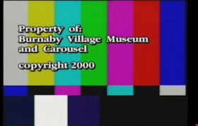
Burnaby Village Museum & Carousel - promotional footage
https://search.heritageburnaby.ca/link/museumdescription13063
- Repository
- Burnaby Village Museum
- Date
- 2000 (date of original), digitized in 2020
- Collection/Fonds
- Burnaby Village Museum fonds
- Description Level
- Item
- Physical Description
- 1 videocassette (29 min. , 33 sec.) : Betacam SP, 29 fps, col., sd.
- Scope and Content
- Item consists of promotional film footage for the Burnaby Village Museum & Carousel". Film footage includes glimpses of the Burnaby Village Museum site with visitors touring the various exhibits and programs through museum's interpreters including Heritage Christmas, Easter Weekend, Labour Day Week…
- Repository
- Burnaby Village Museum
- Collection/Fonds
- Burnaby Village Museum fonds
- Description Level
- Item
- Physical Description
- 1 videocassette (29 min. , 33 sec.) : Betacam SP, 29 fps, col., sd.
- Scope and Content
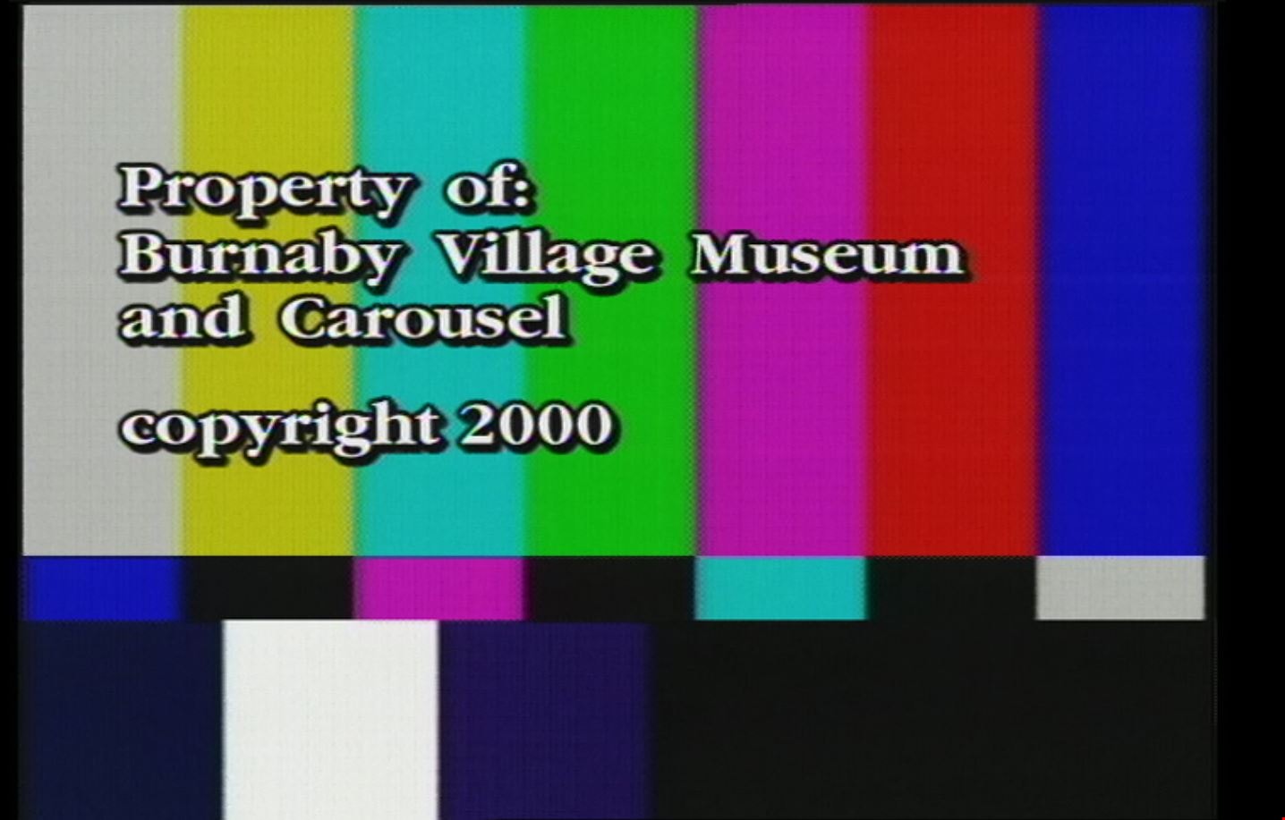
- Item consists of promotional film footage for the Burnaby Village Museum & Carousel". Film footage includes glimpses of the Burnaby Village Museum site with visitors touring the various exhibits and programs through museum's interpreters including Heritage Christmas, Easter Weekend, Labour Day Week, Fall Fair Event and a final versions with highlights. Summary of Content: 00:00-00:27 Blank screen 00:28-00:48 SMPTE colour bar screen reads "Property of: / Burnaby Village Museum / and Carousel / copyright 2000". 00:49-00:58 Blank screen 00:59-12:44 Heritage Christmas with entertainers, Father Christmas, Print Shop, Blacksmith Shop, Seaforth School, Elworth House, Herbalist, Village exteriors, Christmas Carolers, Love Farmhouse and the C.W. Parker Carousel. 12:45-15:29 Easter Weekend: Entertainment, Ice Cream Parlour, Speeches, Easter Bonnet Parade, bunnies and chicks. 15:30-22:40 Canada Day Celebrations and Labour Day Week: Visitors arriving, flag waving, singing O'Canada, cake cutting and entertainment. 22:41-24:18 Fall Fair Event: harvest displays, potatoe sack races, baking and preserves competition, fortune telling, 24:19- 24:25 Blank screen 24:26-26:45 Highlight Video: "Burnaby Village Museum & Carousel / Step back in time...". Includes compiled footage some gathered from previous content. This footage is followed by edited promotional footage "Burnaby Village Museum & Carousel / Step back in time" which includes some of the previous film footage. 26:46-29:33 Blank screen
- Creator
- Burnaby Village Museum
- Publisher
- Voice of the Fraser Productions Inc. 2000
- Subjects
- Recreational Devices - Carousels
- Names
- Burnaby Village Museum
- Shadbolt Centre for the Arts
- Burnaby Art Gallery
- C.W. Parker no. 119 Carousel
- Responsibility
- Burnaby Village Museum - City of Burnaby
- Accession Code
- BV020.4.36
- Access Restriction
- No restrictions
- Reproduction Restriction
- May be restricted by third party rights
- Date
- 2000 (date of original), digitized in 2020
- Media Type
- Moving Images
- Related Material
- See also: BV020.4.33; BV020.4.29b; BV929.4.38
- Notes
- Transcribed title from film content
- Label inside videocassette case reads: Burnaby Village Museum & Carousel / Promotional footage: / 00:01:00:00 Heritage Christmas... / 00:12:50:00 Easter Weekend... / 00:15:43:00 Canada Day Celebrations ... / 00:20:17:00 Labour Day Week / 00:21:54:00 Fall Fair Event.../ 00:24:28:00 Highlight Video / (2:00)"
Images
Video
Burnaby Village Museum & Carousel - promotional footage, 2000 (date of original), digitized in 2020
Burnaby Village Museum & Carousel - promotional footage, 2000 (date of original), digitized in 2020
https://search.heritageburnaby.ca/media/hpo/_Data/_BVM_Moving_Images/2020_0004_0036_001.mp4Burnaby Village Museum fonds
https://search.heritageburnaby.ca/link/museumdescription13037
- Repository
- Burnaby Village Museum
- Date
- 1990-2019
- Collection/Fonds
- Burnaby Village Museum fonds
- Description Level
- Fonds
- Physical Description
- Over 3000 photographs + approx. 100 architectural drawings + technical drawings + 25 videocassettes + 43 video recordings (mp4) + 2 video recordings (m4v) + 56 sound recordings (mp3) + 5 audio cassettes + approx. 2 m. of textual records
- Scope and Content
- Fonds consists of a selection of curatorial records created and collected by the Burnaby Village Museum in the course of their work. Records pertain to the village site, exhibits, programs, curatorial projects, outreach and special events. Fonds is arranged in the following series: 1) Museum photo…
- Repository
- Burnaby Village Museum
- Collection/Fonds
- Burnaby Village Museum fonds
- Description Level
- Fonds
- Physical Description
- Over 3000 photographs + approx. 100 architectural drawings + technical drawings + 25 videocassettes + 43 video recordings (mp4) + 2 video recordings (m4v) + 56 sound recordings (mp3) + 5 audio cassettes + approx. 2 m. of textual records
- Scope and Content
- Fonds consists of a selection of curatorial records created and collected by the Burnaby Village Museum in the course of their work. Records pertain to the village site, exhibits, programs, curatorial projects, outreach and special events. Fonds is arranged in the following series: 1) Museum photographs series 2) Museum film collection series 3) Museum architectural records series 4) Museum Marketing photographs series 5) Museum exhibits series 6) Museum reports series 7) Curatorial Collections adminstrative records series 8) Museum Oral Histories series 9) Jesse Love farmhouse series 10) Bell's Dry Goods series 11) Burnaby Neighbourhood Speaker Series series 12) C.W. Parker no. 119 carousel series 13) Royal Bank exhibit series 14) UBC Partnership series 15) Burnaby Community Heritage Commission 125 Video Collection series
- History
- Burnaby Village Museum is an open air museum that represents a typical tram-stop community. Museum interpreters welcome visitors, provide demonstrations and on site programming. The museum’s collection consists of thousands of artifacts, community records as well as several original Burnaby heritage buildings, a 1912 carousel, 1912 B.C. Electric Railway interurban tram, a Chinese Market Garden and Indigenous Learning House and Matriarch's Garden. In 1990, the Corporation of the District of Burnaby assumed the operation and management of Burnaby Village Museum from the Burnaby Village Museum Association. Burnaby Village Museum (formerly named Heritage Village) was originally created by the Burnaby Centennial '71 Committee in 1971 as a commemorative project for British Columbia's Centennial. A concept for an open-air museum was developed near Deer Lake on Districts Lots 79/ 85. The official sod turning for Heritage Village took place on the site on April 11, 1971. In the spring of 1971, a museum director and curator were hired to oversee the development of the project and the acquisition of artifacts with funding from the Parks and Recreation Commission. The Century Park Museum Association (later named Burnaby Village Museum Association) was formed on October 26, 1971 as a governing body for Heritage Village Museum. The museum opened on November 19, 1971 with Mayor Bob Pritte and Canada's Governor General Roland Michener. IN July 1972, the museum opened for it's first public season. The Village was described as depictive of the 1890 to 1920 era of the lower mainland. Since 1990, the site expanded from it’s original four acre size to it's current ten acres. In the 1990s and early 2000s staff and volunteers created exhibits and programs about Burnaby with an emphasis on the 1920s. Since it's 40th anniversary in 2011, the museum has implemented changes to make the museum more interactive and inclusive in telling the story of Burnaby's history.
- Creator
- Burnaby Village Museum
- Accession Code
- X2294
- X5124
- X5125
- BV013.19
- BV017.39
- BV017.45
- BV018.6
- BV018.12
- BV018.14
- BV018.18
- BV018.41
- BV019.2
- BV019.13
- BV019.15
- BV019.18
- BV019.19
- BV019.36
- Bv019.39
- BV019.52
- BV019.61
- BV020.4
- BV020.5
- BV020.12
- BV020.28
- BV020.29
- BV021.5
- BV021.7
- BV021.14
- BV021.17
- BV021.31
- BV022.1
- BV022.2
- BV022.27
- Date
- 1990-2019
- Media Type
- Architectural Drawing
- Moving Images
- Photograph
- Sound Recording
- Technical Drawing
- Textual Record
- Arrangement
- The following series have been arranged into subseries: Exhibits series; Oral History series; Jesse Love farmhouse series; Bell's Dry Goods exhibits series; Burnaby Neighbourhood Speaker Series series; C.W. Parker no. 119 carousel series; Royal Bank exhibits series; UBC Partnership series
- Notes
- Title based on contents of fonds
- Further accruals expected
- For other records pertaining to the history of Burnaby Village Museum see: Don Copan collection; Burnaby Centennial '71 Committee collection; Century Park Museum Association fonds; Don Wrigley fonds
- See Artifacts descriptions for Publications and Newsletters produced by Burnaby Village Museum and Century Park Museum Association
C.W. Parker no. 119 carousel series
https://search.heritageburnaby.ca/link/museumdescription17810
- Repository
- Burnaby Village Museum
- Date
- [190-] (date of originals) - 2012
- Collection/Fonds
- Burnaby Village Museum fonds
- Description Level
- Series
- Physical Description
- 238 photographs + 3 audio cassettes + 2 sound recordings (mp3) + 6 videocassettes + 8 video recordings (mp4)
- Scope and Content
- Series consists of records created and adminstered by the Burnaby Village Museum pertaining to the history, acquistion, restoration, preservation and documentation of the C.W. Parker no. 119 carousel. Series have been arranged into the following subseries: 1) Carousel photographs subseries 2) Caro…
- Repository
- Burnaby Village Museum
- Collection/Fonds
- Burnaby Village Museum fonds
- Description Level
- Series
- Physical Description
- 238 photographs + 3 audio cassettes + 2 sound recordings (mp3) + 6 videocassettes + 8 video recordings (mp4)
- Scope and Content
- Series consists of records created and adminstered by the Burnaby Village Museum pertaining to the history, acquistion, restoration, preservation and documentation of the C.W. Parker no. 119 carousel. Series have been arranged into the following subseries: 1) Carousel photographs subseries 2) Carousel sound recordings and films subseries
- History
- "The C.W. Parker no. 119 carousel was built in 1912 in Leavenworth Kansas by the Charles Wallace Parker Company. It was the one hundred and nineteenth carousel made by the company and was so named the C.W. Parker no. 119 carousel. In 1913 the carousel was sold to Mr. F.K. Leggett of Houston Texas for $5,886.00 and was originally equipped with a steam engine and ""wishbones/grass-hopper/jumping horse"" mechanisms. It toured Texas for two years with the Lone Star Circus until 1915 when the machine was shipped back to the factory. It is believed that the machine was rebuilt by the factory with fancier horses and heavier rounding boards referred to as the “Superior” style. Some of the horses were built around 1917 and some between 1920 and 1922. The factory records consulted do not tell for certain where the machine went between 1915 and 1936, possibly to San Jose, California from 1918 until 1922 and then to San Francisco California, or Tacoma, Washington. Accounts from the family of James W. "Jimmy" Robertson, supervisor of rides for Happyland, tell of him travelling with his wife Dora Robertson to Washington, Oregon and California in the fall of 1935 or early 1936 to pick up a new carousel for Happyland. By May 1936, the C.W. Parker no. 119 carousel was in operation in Happlyland inside Hastings Park. The Parker #119 carousel was installed in a pavilion in Happyland which had been built in 1928 by a rival company (Philadelphia Toboggan Company - P.T.C.) and was located next to the "Shoot the Chutes" ride in Hastings Park. Here it remained until Happyland was demolished in 1957. The C.W. Parker no. 119 carousel was then moved to a new small pavilion in Playland until that too was demolished in 1972. From 1972 to 1990, the C.W. Parker no. 119 carousel was operated outdoors inside Playland, and was put away each winter. In 1989 it was announced that the carousel would be sold off horse by horse at an auction in New York. Venus Solano and Doug McCallum and other local people came together to save the carousel and formed The Lower Mainland Association of Friends of the Vancouver Carousel (also known as "Friends of the Carousel"). The first directors of the society consisted of, President and Chairman, Venus Solano; Secretary, Doug McCallum; Director, Keith Jamieson and Director, Nina Freid Rhodes. In May 1989, the Friends of the Carousel approached the Burnaby Village Museum Association who agreed to provide a home for the carousel, pending the approval of Burnaby Municipal Council. Don Wrigley who was president of the Burnaby Village Museum Association joined the board of The Friends of the Carousel as a liaison. The Friends of the Carousel first acquired two horses from the carousel, who were named Julius and Belle. These two carousel horses were used in fundraising over the summer of 1990, at which time the carousel was operating again for a short time inside Playland. The carousel horse named Julius was restored by William Dentzel III (a descendant of one of North America’s original carousel manufacturers) and the carousel horse named Belle was partially stripped and repaired. These carousel horses served as before and after examples of restoration. In June 1990 Don Wrigley was elected as president of The Friends of the Carousel and they set about raising the $350,000 to purchase the carousel and begin restoration work. With a lot of hard work, the help of the Government of British Columbia and the support of the Municipality of Burnaby, the carousel was purchased. Funds were also raised by The Friends of the Carousel to pay for the restoration, and Burnaby agreed to build a new pavilion for it as a Centennial project. Keith Jamieson, a carousel expert, was brought in to coordinate the rebuilding project and restoration work. The Centennial Parker Carousel (C.W. Parker no. 119 carousel) and the Don Wrigley Pavilion where the carousel is housed, opened at Burnaby Village Museum on March 25, 1993.
- Accession Code
- BV013.19
- BV019.21
- BV019.39
- BV020.5
- BV020.12
- BV022.2
- X5124
- X5125
- Date
- [190-] (date of originals) - 2012
- Media Type
- Photograph
- Moving Images
- Sound Recording
- Related Material
- Lower Mainland Association of the Friends of the Vancouver Carousel fonds
- Keith Jamieson fonds
- Faye Diamond fonds
- See also: Burnaby Village Museum artifacts for the C.W. Parker no. 119 carousel as well as souvenir memorabilia from Lower Mainland Association of Friends of the Vancouver Carousel
- Arrangement
- Records have been created by various staff members of Burnaby Village Museum during the acquistion and research of the carousel. Some records were compiled together into a collection by subject and arranged according to their general material designations within the Burnaby Village Museum archival collection.
- Notes
- Title based on contents of series
- Further accruals are expected
- Contact Burnaby Village Museum to access sound recordings and moving images
![Interview with Kanwal Singh Neel, [1973-2023] (interview content), interviewed 5 Jul. 2023 thumbnail](/media/hpo/_Data/_BVM_Sound_Recordings/Oral_Histories/2023_0016_0011_002.jpg?width=280)
Interview with Kanwal Singh Neel
https://search.heritageburnaby.ca/link/museumdescription19607
- Repository
- Burnaby Village Museum
- Date
- [1973-2023] (interview content), interviewed 5 Jul. 2023
- Collection/Fonds
- Burnaby Village Museum fonds
- Description Level
- Item
- Physical Description
- 1 video recording (mp4) (50 min., 32 sec.) : digital, col., sd., stereo ; 30 fps
- Scope and Content
- Item consists of a recording of an oral history interview with Kanwal Singh Neel conducted by Burnaby Village Museum Registrar, Rajdeep. The interview was conducted and recorded on the Zoom platform. 00:00 – 00:06:47 Kanwal shares some of the mentors that influenced him in his life, education and …
- Repository
- Burnaby Village Museum
- Collection/Fonds
- Burnaby Village Museum fonds
- Series
- Museum Oral Histories series
- Subseries
- Many Voices Project Interviews subseries
- Description Level
- Item
- Physical Description
- 1 video recording (mp4) (50 min., 32 sec.) : digital, col., sd., stereo ; 30 fps
- Material Details
- Interviewer: Rajdeep Interviewee: Kanwal Singh Neel Interview Date: July 5, 2023 Total Number of tracks: 1 Total Length of all Tracks: 50 min., 32 sec. Recording Device: Zoom video communication platform
- Scope and Content
- Item consists of a recording of an oral history interview with Kanwal Singh Neel conducted by Burnaby Village Museum Registrar, Rajdeep. The interview was conducted and recorded on the Zoom platform. 00:00 – 00:06:47 Kanwal shares some of the mentors that influenced him in his life, education and career, how his three-year grandson has been an inspiration and how important it is to educate yourself in different ways. 00:06:48 - 00:19:02 Kanwal talks about the diversity in the schools that he’s encountered over the years as a student and as an educator and shares his experiences getting hired as an educator on public television and being known as "the math guy". 00:19:03 - 00:46:39 Kanwal talks about the “Friends of Simon” tutoring out-reach program and his involvement. 00:26:40 - 00:30:24 Kanwal shares his experiences officiating the Canada Summer Games, the Harry Jerome Track Classic, the Commonwealth Games and other world class sporting events. 00:30:25 - 00:38:58 Kanwal describes a typical day while working at Simon Fraser University as Associate Director of Professional Programs, as a sports official and his involvement with Friends of Simon. Kanwal speaks about the importance of finding a balance between staying connected, finding your purpose and carrying on the passions that you enjoy. Kanwal talks about some of his favourite places in Burnaby including Simon Fraser University, Burnaby Mountain, Deer Lake and Central Park. 00:38:59 - 00:43:31 Kanwal talks about the changes that he’s seen in the lower mainland over his life time including; diminishing agricultural land, the fishing industry, public transportation, housing and retail infrastructure and homelessness. 00:43:32 - 00:50:32 Kanwal talks about his involvement with the Punjabi Cultural Association, the introduction of Punjabi language courses in public schools and his involvement in a Bhangra event. Kanwal imparts a final message to youth of today emphasizing the importance of, building relationships, giving back to your community, learning through education and being respectful of your own journey and others.
- History
- Interviewee biography: Kanwal Singh Neel was born in Mombasa, Kenya in 1953 and immigrated with his family to Canada in 1969. For the first few weeks after immigrating the family stayed at the Sikh Temple on Second Avenue before moving into a house which they rented. Kanwal attended Kitsilano Secondary School and later transferred to Steveston High School when his family moved to Richmond. In 1972, Kanwal and friends formed a bhangra group "Punjab Cultural Association" and in 1974 they performed at the World Exposition in Spokane, Washington. The group performed at various venues including the Pacific National Exhibition and other cities in the Province. In 1973, Kanwal was an officiate during the Canada Summer Games at Swangard Stadium in Burnaby. Kanwal obtained a Bachelor’s of Science Degree from University of British Columbia in computer science and mathematics and got his first teaching job in 1977. In 1978, he was an officiate of the Commonwealth Games in Edmonton, Alberta. Over the next ten years he devoted himself to becoming an educator and during this time he became more involved with the B.C. Math Teachers Association. Kanwal and his wife Nancy married in 1982 and have two daughters. In the early 1990's, Kanwal joined Simon Fraser University as a faculty associate to work, train and mentor student teachers. Kanwal became President of the B.C. Math Teachers Association and travelled throughout the province to help solve issues being faced by students. In 1993, he co-hosted a TV show "Math Shop" on The Knowledge Network and he later co-authored a textbook series titled "Math Makes Sense". Kanwal continued to advance his knowledge in the field of mathematics obtaining a Doctorate from Simon Fraser University in 2008. Kanwal developed his doctoral work in Haida Gwaii, studying the mathematics that the Haida peoples used in day to day life, applying the applications and integrating the mathematics concepts with their cultural knowledge. Kanwal also worked with the Sḵwx̱wú7mesh Nation and the Stó:lō Nation in helping to develop resources for them. Kanwal has been recognized with various awards and honours including being awarded an honorary doctorate by Kwantlen Polytechnic University and in 2017 as an inductee in the Sports Wall of Fame in Richmond for his outstanding contribution to amateur sport as an International Athletics Official. Since retirement, Kanwal continues to be involved in a project at Simon Fraser University "Friends of Simon" where university students go out and mentor and tutor immigrant and refugee children from South Asia and Africa and other countries. Interviewer biography: Rajdeep was born and raised in the Lower Mainland and is of Punjabi (South Asian) descent. She has an Associate of Arts degree in Asian Studies from Kwantlen Polytechnic University, a Bachelor of Arts (Hons.) in Anthropology from the University of British Columbia. She is a student in the Restoration of Natural Systems program at the University of Victoria. Rajdeep works at Simon Fraser University as a Program Assistant and as a researcher with the City of Burnaby. At Burnaby Village Museum, Rajdeep contributed to the exhibit “Truths Not Often Told: Being South Asian in Burnaby”.
- Creator
- Burnaby Village Museum
- Subjects
- Persons - South Asian Canadians
- Education
- Social Issues
- Social Issues - Racism
- Sports
- Events - Competitions
- Housing
- Performances
- Names
- Neel, Kanwal Singh
- Simon Fraser University
- Friends of Simon
- Canada Summer Games
- Swangard Stadium
- Punjabi Cultural Association
- Responsibility
- Rajdeep
- Geographic Access
- Burnaby Mountain Conservation Area
- Central Park
- Accession Code
- BV023.16.11
- Date
- [1973-2023] (interview content), interviewed 5 Jul. 2023
- Media Type
- Moving Images
- Notes
- Title based on contents of item
Images
![Interview with Kanwal Singh Neel, [1973-2023] (interview content), interviewed 5 Jul. 2023 thumbnail](/media/hpo/_Data/_BVM_Sound_Recordings/Oral_Histories/2023_0016_0011_002.jpg)