Narrow Results By
Decade
- 2020s
- 2010s 132
- 2000s 227
- 1990s 354
- 1980s 372
- 1970s 569
- 1960s 346
- 1950s 419
- 1940s 385
- 1930s 365
- 1920s
- 1910s 238
- 1900s 119
- 1890s 42
- 1880s 12
- 1870s 12
- 1860s 12
- 1850s 10
- 1840s 5
- 1830s 3
- 1820s 3
- 1810s 3
- 1800s 3
- 1790s 2
- 1780s 2
- 1770s 2
- 1760s 2
- 1750s 2
- 1740s 2
- 1730s 2
- 1720s
- 1710s 2
- 1700s 2
- 1690s
- 1680s 2
- 1670s 1
- 1660s 1
- 1650s 1
- 1640s 1
- 1630s 1
- 1620s 1
- 1610s 1
- 1600s 1
Subject
- Agriculture 8
- Agriculture - Crops 1
- Agriculture - Farms 12
- Agriculture - Ranches 2
- Animals - Birds 1
- Animals - Dogs 1
- Animals - Fish 1
- Animals - Pigs 2
- Buildings - Commercial - General Stores 1
- Buildings - Commercial - Grocery Stores 4
- Buildings - Commercial - Restaurants 7
- Buildings - Commercial - Service Stations 1
Creator
- Alphonse J. Toebaert 1
- Angus, H. F. (Henry Forbes), 1891-1991 1
- Atkinson, Dorothy Mallett 1
- Bancroft, Rose 1
- Bingham, Alfred "Alf" 2
- Binks, James 8
- Black, Newton Henry, 1874-1961 3
- Bowman and Cullerne 1
- Brereton, Bernard, 1868- 1
- British Columbia Underwriters' Association 13
- Brown, Donald N. "Don" 1
- Bullen, Harry Elder 1

Commercial Map of Greater Vancouver and District
https://search.heritageburnaby.ca/link/museumdescription9552
- Repository
- Burnaby Village Museum
- Date
- July 1921
- Collection/Fonds
- Burnaby Village Museum Map collection
- Description Level
- Item
- Physical Description
- 1 map : col. lithograph mounted on linen ; 107 x 138 cm
- Scope and Content
- Commercial map of Greater Vancouver and District. Map depicts district lots, railroads, electric railways, streets, street car stops, schools, buildings, postal block numbers, parks and First Nations reserves. Map covers the geographcial areas of Vancouver, Burnaby, New Westminster, portions of Ric…
- Repository
- Burnaby Village Museum
- Collection/Fonds
- Burnaby Village Museum Map collection
- Description Level
- Item
- Physical Description
- 1 map : col. lithograph mounted on linen ; 107 x 138 cm
- Material Details
- Includes Legend and Index
- Scope and Content
- Commercial map of Greater Vancouver and District. Map depicts district lots, railroads, electric railways, streets, street car stops, schools, buildings, postal block numbers, parks and First Nations reserves. Map covers the geographcial areas of Vancouver, Burnaby, New Westminster, portions of Richmond, West Vancouver, North Vancouver, and Surrey with half mile circles that radiate from Vancouver City Hall on the corner of Main and Hastings. Bottom of map includes an index of street names, along with their corresponding map grid locations. The map is bordered by Marine Drive to the west, North Road to the east, Dempsey Street to the north and 20th Road to the south.
- History
- Bought by donor at thrift store years ago. No known provenance.
- Publisher
- Produced by Photo - Lithography, Colonist , Victoria, B.C.
- Geographic Access
- Vancouver
- Accession Code
- BV018.24.1
- Access Restriction
- No restrictions
- Reproduction Restriction
- No known restrictions
- Date
- July 1921
- Media Type
- Cartographic Material
- Scan Resolution
- 300
- Scan Date
- 16-Jun-20
- Scale
- 100
- Notes
- Transcribed title
- Title on map reads: "COMMERCIAL MAP / OF / GREATER VANCOUVER / AND / DISTRICT / Compiled and Published by / The Vancouver Map & Blueprint Co. Ltd. / 441 Seymour St. Vancouver B.C. / July, 1921".
Images

![Interview with Josephine Chow by Denise Fong February 7, 2020, [1900-2020] (interview content), interviewed Feb. 7, 2020 thumbnail](/media/hpo/_Data/_BVM_Images/2017/2017_0036_0004_001.jpg?width=280)
Interview with Josephine Chow by Denise Fong February 7, 2020
https://search.heritageburnaby.ca/link/museumdescription12337
- Repository
- Burnaby Village Museum
- Date
- [1900-2020] (interview content), interviewed Feb. 7, 2020
- Collection/Fonds
- Burnaby Village Museum fonds
- Description Level
- Item
- Physical Description
- 1 sound recording (mp3) (00:43:19 min.)
- Scope and Content
- Recording consists of an interview with Josephine Chow (nee Hong) conducted by BVM researcher Denise Fong at the Burnaby Village Museum. Josephine describes her family history and recollects her childhood experiences in 1950s and 60s while growing with her family on their "Hop On" farm in Burnaby. …
- Repository
- Burnaby Village Museum
- Collection/Fonds
- Burnaby Village Museum fonds
- Series
- Museum Oral Histories series
- Subseries
- Chinese Canadians in Burnaby subseries
- Description Level
- Item
- Physical Description
- 1 sound recording (mp3) (00:43:19 min.)
- Material Details
- Interviewer: Denise Fong Interviewee: Josephine Chow Location of Interview: Burnaby Village Museum Interview Date: February 7, 2020 Total Number of Tracks: 1 Total Length of all Tracks: 00:43:19
- Scope and Content
- Recording consists of an interview with Josephine Chow (nee Hong) conducted by BVM researcher Denise Fong at the Burnaby Village Museum. Josephine describes her family history and recollects her childhood experiences in 1950s and 60s while growing with her family on their "Hop On" farm in Burnaby. The farm is situated in the Big Bend area along Marine Drive and is still in operation today. 0:00-08:45 Josephine Chow provides some historical background on the history of “Hop On Farm” and her family in British Columbia. She tells of how her grandfather Gay Tim Hong and three partners pooled money together to purchase twelve acres on Marine Drive in 1951. Prior to this, most of them farmed on the ʷməθkʷəy̓əm (Musqueam) First Nation Reserve for 20-30 years. It all began when her great grandfather Sui Wing Hong, first came to Canada from China and slowly brought over her grandfather, father and other members of the family. Her grandfather, Gay Tim Hong went back and forth between Canada and China at least four times since he and her grandmother had four children including her father, who was born in 1931. Her father came to Canada at 10 years of age to live with his father. Josephine’s great grandfather came to Vancouver from Zhongshan county in Canton Province (also known as Guangdong). 8:46- 14:20 Josephine provides the names of her siblings from the eldest to the youngest; Pauline, Josephine (herself), Catherine, Noreen, Gary, Darlene and Marlene. She describes what life was like on the farm with her parents working from sunrise to sunset. The family farmed vegetable produce taking orders from local stores in the lower mainland. Often the children helped their parents with the orders starting at eight or nine years of age. Other workers on the farm travelled by bus from Vancouver’s Chinatown. She also tells of how her father was an animal lover and raised chickens, pigeons, geese, koy, goldfish and dogs. 14: 21 – 16:56 Josephine describes what Burnaby was like during the time that she grew up in the late 1950s. She explains that Burnaby was very quiet with nothing being open on Sundays. On the farm, she and her siblings would entertain themselves by playing games like soccer, baseball and kick ball or also by catching frogs, snails, caterpillars and ladybugs. There were neighbours living on Marine Drive and almost every house had someone who we went to the same elementary school. The neighbourhood children would often come to play with them on their farm. 16:56- 26:47 Josephine describes how when they were young there were farms all around them and how on Sunday drives with her father, they would go to feed horses or look at the cows. Josephine shares that her elder sister Pauline was the only one born in China and how when she first arrived that she lived on the ʷməθkʷəy̓əm (Musqueam) First Nations Reserve with their parents before they moved to Burnaby. Josephine recollects that most of her friends were farmer’s kids from the neighbourhood but while in school, she had more Caucasian friends. Josephine and her siblings attended Glenwood Elementary on Marine Drive and later Junior Secondary at McPherson Park (grades 8-10) and Burnaby South Senior Secondary (grades 11-12. ). She shares some of her experiences while attending school. She said that there were about a dozen Asians in school with her, mostly from farming families in the “Flats”. 26:48- 30:45 Josephine describes what life was like for her and her siblings after school. They often helped on the farm when they got home, usually taking care of orders for green onions. Her mother made dinner and did all of the cooking for family and workers on the farm as well as working in the fields. Her father did all of the grocery shopping in Vancouver’s Chinatown two or three times per week where he purchased meat and fish. She says that her grandfather, often travelled by bus every Saturday or Sunday to meet up with friends in Chinatown. Extracurricular activities for her and her siblings included volley ball and soccer as long as it didn’t interfere with their work schedule on the farm. 30:46- 37:03 Josephine describes what occurred while living at home, the food they ate, shopping and attending Chinese school. Her mother cooked only Chinese food, she didn’t know how to cook “Western food”. For school lunches, the kids made their own sandwiches. She tells of a Chinese language school arranged by Mrs. Joe [sic] who lived on Gilley Road and was Canadian born Chinese. Mrs. Joe [sic] also arranged an English class for farmer’s wives on Tuesday nights in which her mother attended. Josephine recollects learning Mandarin from Mrs. Joe [sic] a few days a week after her regular school. Chinese school took place at Riverway School on Meadow Avenue in Burnaby. Mrs. Joe also taught them a lot about Chinese culture including Kung Fu, Chinese Dance and Chinese brush painting. 37:04- 39:39 Josephine describes Medical Care for her and her family in the 1950s and 1960s. She tells of a female Chinese doctor in Vancouver, Dr. Madeline Chung. Dr. Chung was responsible for delivering a lot of Chinese babies including Josephine. The family also visited herbalists in Vancouver Chinatown. They would often buy herbs for colds etc. Josephine also tells of how her parents stayed in touch with family in China by writing letters. Her mother’s family, including her parents and siblings were still in China while most of her father’s family were here in Canada. 39:40- 43:19 – In closing, Josephine shares how life is much busier now and of how she misses the quietness of her days growing up. She briefly describes her life on the family farm now and how different it is from when her parents worked the farm. She explains how farming methods have changed and how they don’t have to work as hard as her parents did.
- History
- Interviewee biography: Josephine Chow (nee Hong) is the second eldest child of Chan Kow Hong and Sui Ha Hong. In 1925, Josephine's grandfather, Gay Tim Hong immigrated to Canada from Zhongshan county in Canton Province (also known as Guangdong). In 1952, her father, Chan Kow Hong joined his father, Gay Tim Hong and by 1953, he established "Hop On Farms" in the Big Bend area of Burnaby near Marine Drive. Josephine grew up on the farm with her parents and six siblings; Pauline, Catherine, Norine, Gary, Darlene and Marlene. In 1969, Josephine's elder sister Pauline and her husband Jack Chan took over the family farm and in 1972 their father and grandfather moved to Kamloops to open a restaurant. As an adult, Josephine worked in several different areas including owning and running her own Aesthetics business. Josephine eventually retired and returned to the farm to assist her siblings. The farm is still in operation. Interviewer biography: Denise Fong is a historical researcher at Burnaby Village Museum. She has degrees in Anthropology (BA) and Archaeology (MA), and is completing her doctoral degree at UBC in Interdisciplinary Studies. Her primary research interests are in Chinese Canadian history and critical heritage studies. She is the co-curator of BVM’s “Across the Pacific” exhibition, and the Museum of Vancouver’s “A Seat at the Table – Chinese Immigration and British Columbia”.
- Creator
- Burnaby Village Museum
- Subjects
- Persons - Chinese Canadians
- Agriculture - Farms
- Education
- Buildings - Schools
- First Nations reserves - British Columbia
- Names
- Chow, Josephine
- Glenwood Elementary School
- McPherson Park Junior Secondary School
- ʷməθkʷəy̓əm (Musqueam)
- Responsibility
- Fong, Denise
- Geographic Access
- Byrne Road
- Accession Code
- BV020.6.1
- Access Restriction
- No restrictions
- Reproduction Restriction
- No known restrictions
- Date
- [1900-2020] (interview content), interviewed Feb. 7, 2020
- Media Type
- Sound Recording
- Historic Neighbourhood
- Fraser Arm (Historic Neighbourhood)
- Planning Study Area
- Big Bend Area
- Related Material
- See also BV017.36*
- Scan Resolution
- 600
- Scan Date
- 12/3/2017
- Scale
- 100
- Notes
- Title based on contents of interview
- Photograph info: Gary Hong and Chan Kow Hong harvesting celery at Hop-On Farms [1969]. BV017.36.4
Images
![Interview with Josephine Chow by Denise Fong February 7, 2020, [1900-2020] (interview content), interviewed Feb. 7, 2020 thumbnail](/media/hpo/_Data/_BVM_Images/2017/2017_0036_0004_001.jpg)
Audio Tracks
Interview with Josephine Chow by Denise Fong February 7, 2020, [1900-2020] (interview content), interviewed Feb. 7, 2020
Interview with Josephine Chow by Denise Fong February 7, 2020, [1900-2020] (interview content), interviewed Feb. 7, 2020
https://search.heritageburnaby.ca/media/hpo/_Data/_BVM_Sound_Recordings/Oral_Histories/2020_0006_0001_001.mp3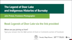
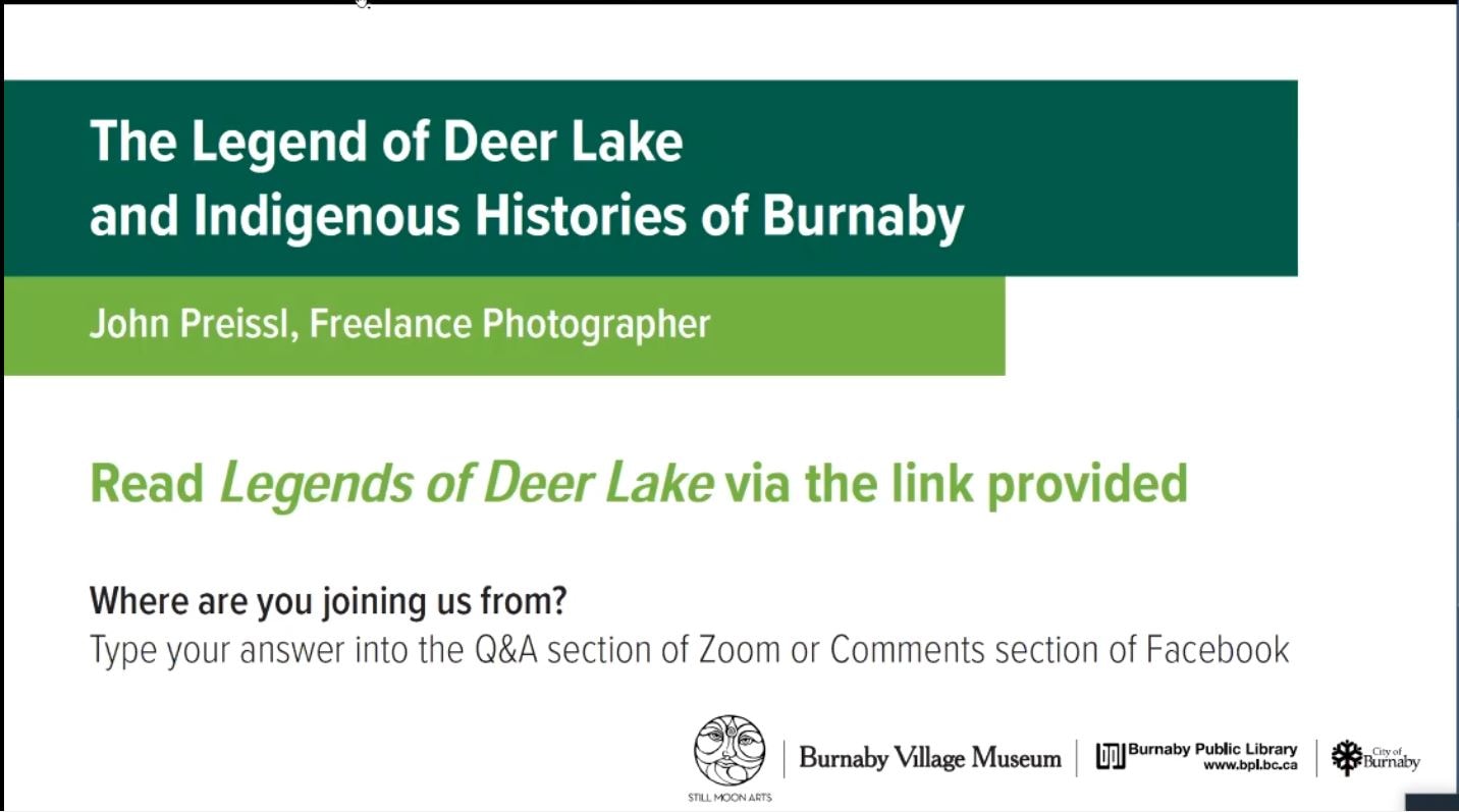
The Legend of Deer Lake and Indigenous histories of Burnaby
https://search.heritageburnaby.ca/link/museumdescription15666
- Repository
- Burnaby Village Museum
- Date
- 4 May 2021
- Collection/Fonds
- Burnaby Village Museum fonds
- Description Level
- Item
- Physical Description
- 1 video recording (mp4) (62 min., 28 sec.) : digital, col., sd., stereo ; 29 fps
- Scope and Content
- Item consists of a video recording of a live Zoom webinar hosted by Adrian Avendaño, Stewardship Program Manager with Still Moon Arts Society. The webinar is presented in partnership with the Burnaby Village Museum, Burnaby Public Library and Still Moon Arts Society. The webinar is titled "The Lege…
- Repository
- Burnaby Village Museum
- Collection/Fonds
- Burnaby Village Museum fonds
- Description Level
- Item
- Physical Description
- 1 video recording (mp4) (62 min., 28 sec.) : digital, col., sd., stereo ; 29 fps
- Material Details
- Presenter: John Preissl
- Host: Adrian Avendano (Still Moon Arts Society)
- Date of Presentation: Tuesday, May 4, 7:00 pm - 8:00 pm
- Total Number of tracks: 1
- Total Length of all tracks: 62 min., 28 sec.
- Recording Device: Zoom video communication platform
- Recording Note: Film was edited from it's original recorded version (77 min., 48 sec.) to edited version (62 min., 28 sec.) for public viewing on Heritage Burnaby.
- Scope and Content
- Item consists of a video recording of a live Zoom webinar hosted by Adrian Avendaño, Stewardship Program Manager with Still Moon Arts Society. The webinar is presented in partnership with the Burnaby Village Museum, Burnaby Public Library and Still Moon Arts Society. The webinar is titled "The Legend of Deer Lake and Indigenous histories of Burnaby" and is presented by John Preissl, Freelance Photographer of Sḵwx̱wú7mesh and Leq’á:mel Nation ancestry. The Zoom webinar is the third in a series of six "Neighbourhood Speaker series" webinars exploring a range of topics shared by Indigenous speakers and knowledge keepers that were presented and made available to the public between April 27 and May 12, 2021. The live webinar was also made available on the Burnaby Village Museum's facebook page. Community members were invited to participate by bringing questions during the interactive online sessions. This webinar was made available in In partnership with Still Moon Arts Society. In this webinar, John Preissl shares his family’s long history from the first Chief Capilano in the late 1700's to the present day. Looking through the lens of his camera, John weaves together stories of the Legend of Deer Lake, resource gathering in the Burnaby Lake Watershed, and protection of the sacred salmon and eagle habitat on the shared homelands of the hən̓q̓əmin̓əm and Sḵwx̱wú7mesh speaking peoples. The presentation is supported with photographs that John has taken over the years documenting the diverse environment and wildlife habitats in Burnaby, the lower mainland and west coast including waterways and the fight to protect it. Following the presentation, John Preissl takes questions from the audience that are moderated by the host, Adrian Avendaño.
- History
- John Preissl is a Burnaby-based environmental, adventure, wildlife and Indigenous freelance photographer. He is a media expert with over two decades of media experience and consulting. John is of Sḵwx̱wú7mesh and Leq’á:mel Nation ancestry. His Great times-two Grandfather was the Great Chief Joe Capilano. John leads many First Nations Tours in Burnaby from Deer Lake, Burnaby Lake, Burnaby Mountain and pretty well all over Sḵwx̱wú7mesh and Tsleil-Waututh Nations Lands.
- Subjects
- Indigenous peoples - British Columbia - Social life and customs
- Animals - Birds
- Animals - Fish
- Geographic Features - Lakes and Ponds
- Geographic Features - Ravines
- Names
- Preissl, John
- Tsleil-Waututh Nation
- Sḵwx̱wú7mesh Nation
- Avendaño, Adrian
- Burnaby Village Museum
- Accession Code
- BV021.17.3
- Access Restriction
- No restrictions
- Reproduction Restriction
- No known restrictions
- Date
- 4 May 2021
- Media Type
- Moving Images
- Historic Neighbourhood
- Burnaby Lake (Historic Neighbourhood)
- Planning Study Area
- Burnaby Lake Area
- Notes
- Title based on content of video recording The following links were shared at the end of the presentation:
- The Legend of Deer Lake: https://www.legendsofvancouver.net/deer-lake-burnaby-vancouver
- Saving the Salmon: the Brunette River Story, a short film about the preservation of Brunette River: https://search.heritageburnaby.ca/permalink/museumvideo4486
- Saving Burnaby Lake, a short film about the preservation of Burnaby Lake: https://search.heritageburnaby.ca/permalink/museumvideo4485
- Still Creek Streamkeepers: https://stillmoonarts.ca/stewardship/streamkeepers/
- John Preissl’s photography website: https://johnpreisslphotography.ca/
Images
Video
The Legend of Deer Lake and Indigenous histories of Burnaby, 4 May 2021
The Legend of Deer Lake and Indigenous histories of Burnaby, 4 May 2021
https://search.heritageburnaby.ca/media/hpo/_Data/_BVM_Moving_Images/2021_0017_0003_002.mp4![The Lions from Burnaby Park, [between 1926 and 1929] thumbnail](/media/hpo/_Data/_BVM_Images/1971/197202040003.jpg?width=280)
The Lions from Burnaby Park
https://search.heritageburnaby.ca/link/museumdescription3109
- Repository
- Burnaby Village Museum
- Date
- [between 1926 and 1929]
- Collection/Fonds
- Burnaby Village Museum Photograph collection
- Description Level
- Item
- Physical Description
- 1 photograph : b&w photogravure ; 14.5 x 9.5 cm
- Scope and Content
- Photograph of the north shore mountains, including the Lions, taken from Robert Burnaby Park.
- Repository
- Burnaby Village Museum
- Collection/Fonds
- Burnaby Village Museum Photograph collection
- Description Level
- Item
- Physical Description
- 1 photograph : b&w photogravure ; 14.5 x 9.5 cm
- Scope and Content
- Photograph of the north shore mountains, including the Lions, taken from Robert Burnaby Park.
- Geographic Access
- Wedgewood Street
- Robert Burnaby Park
- Street Address
- 8155 Wedgewood Street
- Accession Code
- HV972.204.3
- Access Restriction
- No restrictions
- Reproduction Restriction
- No known restrictions
- Date
- [between 1926 and 1929]
- Media Type
- Photograph
- Historic Neighbourhood
- Burnaby Lake (Historic Neighbourhood)
- Planning Study Area
- Lakeview-Mayfield Area
- Related Material
- For other photographs from the same album, see HV972.204.3 - .14
- Scan Resolution
- 600
- Scan Date
- 2023-04-25
- Photographer
- Lloyd, Frank Ernest
- Notes
- Annotations made in white paint on recto of photograph read: "'The Lions' from Burnaby Park" and "Lloyd Studio, McKay."
Images
![The Lions from Burnaby Park, [between 1926 and 1929] thumbnail](/media/hpo/_Data/_BVM_Images/1971/197202040003.jpg)
Neighbourhood Speaker Series - Spring 2021 subseries
https://search.heritageburnaby.ca/link/museumdescription15663
- Repository
- Burnaby Village Museum
- Date
- 2021
- Collection/Fonds
- Burnaby Village Museum fonds
- Description Level
- Subseries
- Physical Description
- 6 video recordings (mp4)
- Scope and Content
- Subseries consists of six webinars created in the Spring of 2021 that were presented on Zoom and the Burnaby Village Museum’s facebook page between April 27 and May 12, 2021. The webinars are hosted by Burnaby Village Museum in partnership with Burnaby Public Library. Burnaby Village Museum curator…
- Repository
- Burnaby Village Museum
- Collection/Fonds
- Burnaby Village Museum fonds
- Description Level
- Subseries
- Physical Description
- 6 video recordings (mp4)
- Scope and Content
- Subseries consists of six webinars created in the Spring of 2021 that were presented on Zoom and the Burnaby Village Museum’s facebook page between April 27 and May 12, 2021. The webinars are hosted by Burnaby Village Museum in partnership with Burnaby Public Library. Burnaby Village Museum curator, Jane Lemke; assistant curator, Kate Petrusa and Adrian Avendaño, Stewardship Program Manager with Still Moon Arts Society acted as hosts for the webinars. The series explores a range of topics shared by Indigenous speakers and knowledge keepers. Community members were invited to participate by bringing questions during the interactive online sessions. Webinars: 1) Bringing Visibility to the Land: A Tsleil-Waututh Perspective on Community Building presented by Michelle George 2) Traditional, Ancestral & Unceded: A Conversation on Territorial Acknowledgement presented by Fancy Poitras and Rebekah Mahaffey 3) The Legend of Deer Lake and Indigenous Histories of Burnaby presented by John Preissl 4) Creating Visibility in Wood Working presented by Xwalacktun 5) Weaving and Learning Through Art presented by Nicole Preissl 6) Are We Really Changing? Reflections on Reconciliation presented by Brandon Gabriel
- Accession Code
- BV021.17
- Access Restriction
- No restrictions
- Reproduction Restriction
- No known restrictions
- Date
- 2021
- Media Type
- Moving Images
- Notes
- Title based on contents of subseries
- Item level descriptions of webinars will be processed as they become available
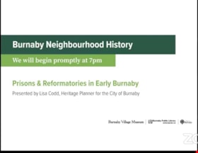
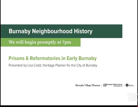
Prisons & Reformatories in Early Burnaby
https://search.heritageburnaby.ca/link/museumdescription14759
- Repository
- Burnaby Village Museum
- Date
- 15 Oct. 2020
- Collection/Fonds
- Burnaby Village Museum fonds
- Description Level
- Item
- Physical Description
- 1 video recording (mp4) (60 min., 53 sec.) : digital, col., sd., stereo ; 29 fps
- Scope and Content
- Item consists of a video recording of a live Zoom webinar hosted by Burnaby Village Museum's Kate Petrusa. The webinar is titled "Prisons & Reformatories in Early Burnaby" and is presented by Lisa Codd, Heritage Planner for the City of Burnaby. The zoom webinar is the fourth in a collection of seve…
- Repository
- Burnaby Village Museum
- Collection/Fonds
- Burnaby Village Museum fonds
- Description Level
- Item
- Physical Description
- 1 video recording (mp4) (60 min., 53 sec.) : digital, col., sd., stereo ; 29 fps
- Material Details
- Presenter: Lisa Codd
- Host: Kate Petrusa
- Date of Presentation: October 15, 6:00 pm - 8:00 pm
- Total Number of tracks: 1
- Total Length of all tracks:60 min., 53 sec
- Recording Device: Zoom video communication platform
- Scope and Content
- Item consists of a video recording of a live Zoom webinar hosted by Burnaby Village Museum's Kate Petrusa. The webinar is titled "Prisons & Reformatories in Early Burnaby" and is presented by Lisa Codd, Heritage Planner for the City of Burnaby. The zoom webinar is the fourth in a collection of seven "Burnaby Neighbourhood Speaker series" webinars that were presented and made available to the public between September 29 and October 27, 2020. The live webinar and recording was also made available on the Burnaby Village Museum's facebook page. In this webinar, Lisa Codd talks about how in the early 20th century Burnaby was home to several correctional and detention institutions that sought to reform their residents, including the Oakalla Prison Farm, New Haven Borstal Home for Boys and Youthful Offenders, the United Church Home for Girls and Home of the Friendless. Lisa supports her presentation with contemporary and historical photographs and research. Lisa pauses throughout the presentation to take questions from webinar participants.
- Creator
- Burnaby Village Museum
- Subjects
- Persons - Japanese Canadians
- Indigenous peoples - British Columbia
- Public Services - Correctional
- Names
- Codd, Lisa
- Oakalla Prison Farm
- New Haven Correctional Centre
- Lower Mainland Regional Correctional Centre
- George, Richardson
- George, Eneas
- George, Alex
- George, Joseph
- Peltier, Leonard
- Home of the Friendless
- Responsibility
- Petrusa, Kate
- Geographic Access
- Oakmount Crescent
- Street Address
- 5220 Oakmount Crescent
- 4250 Marine Drive
- Accession Code
- BV020.29.4
- Access Restriction
- No restrictions
- Reproduction Restriction
- No known restrictions
- Date
- 15 Oct. 2020
- Media Type
- Moving Images
- Historic Neighbourhood
- Burnaby Lake (Historic Neighbourhood)
- Fraser Arm (Historic Neighbourhood)
- Planning Study Area
- Oakalla Area
- Suncrest Area
- Notes
- Title based on contents of video recording
- Video recording was edited for publication on Heritage Burnaby. Original mp4 video recording (BV020.29.4.1) is 73 min.
Images
Video
Prisons & Reformatories in Early Burnaby, 15 Oct. 2020
Prisons & Reformatories in Early Burnaby, 15 Oct. 2020
https://search.heritageburnaby.ca/media/hpo/_Data/_BVM_Moving_Images/2020_0029_0004_002.mp4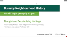
Thoughts on decolonizing heritage
https://search.heritageburnaby.ca/link/museumdescription14757
- Repository
- Burnaby Village Museum
- Date
- 1 Oct. 2020
- Collection/Fonds
- Burnaby Village Museum fonds
- Description Level
- Item
- Physical Description
- 1 video recording (mp4) (88 min., 3 sec.) : digital, col., sd., stereo ; 29 fps
- Scope and Content
- Item consists of a video recording of a live Zoom webinar hosted by Burnaby Village Museum's Kate Petrusa. The webinar is titled "Thoughts on Decolonizing Heritage" and is presented by Kamala Todd - Indigenous Community Planner, Filmmaker, and Adjunct Professor SFU. The zoom webinar is the second i…
- Repository
- Burnaby Village Museum
- Collection/Fonds
- Burnaby Village Museum fonds
- Description Level
- Item
- Physical Description
- 1 video recording (mp4) (88 min., 3 sec.) : digital, col., sd., stereo ; 29 fps
- Material Details
- Presenter: Kamala Todd
- Host: Kate Petrusa
- Date of Presentation: October 1, 7:00 pm - 8:30 pm
- Total Number of tracks: 1
- Total Length of all tracks: 88 min., 3 sec.
- Recording Device: Zoom video communication platform
- Scope and Content
- Item consists of a video recording of a live Zoom webinar hosted by Burnaby Village Museum's Kate Petrusa. The webinar is titled "Thoughts on Decolonizing Heritage" and is presented by Kamala Todd - Indigenous Community Planner, Filmmaker, and Adjunct Professor SFU. The zoom webinar is the second in a collection of seven "Neighbourhood Speaker series" webinars that were presented and made available to the public between September 29 and October 27, 2020. The live webinar and recording was also made available on the Burnaby Village Museum's facebook page. In this webinar, Kamala Todd speaks about how narratives and sense of place shape our connection to the lands we live upon. Kamala highlights how dominant colonial narratives are embedded into the built environment, place names, heritage landscapes, and the very planning of our cities contributing to exclusion and erasure of the hən̓q̓əmin̓əm and Sḵwx̱wú7mesh speaking people, who have lived on their unceded territories since time immemorial.Todd provides her perspectives by asking the questions; How has “Heritage” contributed to colonial harms and erasures? And what will it take to decolonize and re-Indigenize the stories, landscapes, and understandings of the places we call home? The presentation is supported with contemporary and historic photographs. Kamala takes questions from webinar participants and reads from writings of different authors including Stó:lō author, Lee Maracle and Salish poet, Will George.
- Creator
- Burnaby Village Museum
- Subjects
- Indigenous peoples - British Columbia
- Indigenous peoples - Canada - Government relations
- Indigenous peoples - Canada - , Treatment of
- Persons - Pioneers
- Government - Colonial Government
- Monuments
- Responsibility
- Petrusa, Kate
- Geographic Access
- Vancouver
- Accession Code
- BV020.29.2
- Access Restriction
- No restrictions
- Reproduction Restriction
- No known restrictions
- Date
- 1 Oct. 2020
- Media Type
- Moving Images
- Notes
- Title based on contents of video recording
- Video recording was edited for publication on Heritage Burnaby. Original mp4 video recording (BV020.29.2.1) is 103 min., 49 sec.
Images

Video
Thoughts on decolonizing heritage, 1 Oct. 2020
Thoughts on decolonizing heritage, 1 Oct. 2020
https://search.heritageburnaby.ca/media/hpo/_Data/_BVM_Moving_Images/2020_0029_0002_002.mp4
Drs. Blythe and Violet Eagles Estate
https://search.heritageburnaby.ca/link/landmark535
- Repository
- Burnaby Heritage Planning
- Description
- The Drs. Blythe and Violet Eagles Estate is a one hectare property located within Deer Lake Park in Burnaby. The property encompasses a carefully conceived garden of local, non-conventional, and exotic plantings. Conceived as a series of rockeries and terraces, the garden cascades from the house do…
- Associated Dates
- 1929
- Formal Recognition
- Heritage Designation, Community Heritage Register
- Other Names
- Eagles Estate Heritage Garden
- Street View URL
- Google Maps Street View
- Repository
- Burnaby Heritage Planning
- Other Names
- Eagles Estate Heritage Garden
- Geographic Access
- Sperling Avenue
- Associated Dates
- 1929
- Formal Recognition
- Heritage Designation, Community Heritage Register
- Enactment Type
- Bylaw No. 11592
- Enactment Date
- 15/09/2003
- Description
- The Drs. Blythe and Violet Eagles Estate is a one hectare property located within Deer Lake Park in Burnaby. The property encompasses a carefully conceived garden of local, non-conventional, and exotic plantings. Conceived as a series of rockeries and terraces, the garden cascades from the house down towards the waterfront, divided by paths and strips of plantings.
- Heritage Value
- The Eagles Estate is significant because of its unique character within Burnaby’s Deer Lake Park heritage precinct, and the people who were its creators and residents. The garden is a unique expression of the talents and tastes of both the Eagles and Frank Ebenezer Buck (1875-1970). Buck served as the Assistant Dominion Horticulturist in charge of landscape horticulture and floriculture in Ottawa from 1912. In 1920, he was head of the Horticultural Department and the Campus Landscape Architect at the University of British Columbia. He established the plan for the Eagles garden while Dr. Blythe Alfred Eagles (1902-1990), the long-time Dean of the Faculty of Agriculture at UBC, selected many of the plantings. The Eagles themselves designed the house as a romantic cottage inspired by the British Arts and Crafts style. Trained in enzyme chemistry, Dr. Violet Evelyn (Dunbar) Eagles (1899-1994) was an enthusiastic amateur gardener, and was perhaps the driving force behind the maintenance and continued development of the garden. The Eagles were also well known in Burnaby for their active volunteerism in the local community as well as at UBC. When Simon Fraser University opened in Burnaby as the Greater Vancouver’s second university, the Eagles, in particular Violet, became well-known for entertaining dignitaries and special guests of the university in their lavish garden. Drs. Blythe and Violet Eagles were recognized for their good citizenship and the ongoing use of their garden for charitable Burnaby-based functions and celebrations.
- Defining Elements
- Due to the extensive and varied nature of the garden, the character-defining elements of the Eagles Estate are many and complex. The elements that encompass the character of the site include its: - British Arts and Crafts-inspired house with original exterior features such as a picturesque roofline, stucco cladding and six- and eight-paned steel-frame casement windows, and original interior features such as the central fireplace, wood floors and kitchen cabinetry - formal staircase leading to the north (formal entry) side of the house - carefully planned yet informal garden design, with 'garden rooms' used to create intimacy - terraced landscape cascading from the house down to the garden - incorporation of local, exotic, flowering and non-flowering plants. - contrast of manicured versus freely growing landscape elements - use of wood lattice fencing gates, arbors and trellis
- Historic Neighbourhood
- Burnaby Lake (Historic Neighbourhood)
- Planning Study Area
- Morley-Buckingham Area
- Community
- Burnaby
- Cadastral Identifier
- P.I.D. No. 007-302-801 Legal Description: Lot 143, District Lot 85, Group 1, New Westminster District, Plan 36335
- Boundaries
- The Eagles Estate is comprised of a single municipally-owned property located at 5655 Sperling Avenue, Burnaby.
- Area
- 6,403.91
- Contributing Resource
- Building
- Landscape Feature
- Documentation
- Heritage Site Files: PC77000 20. City of Burnaby Planning and Building Department, 4949 Canada Way, Burnaby, B.C., V5G 1M2
- Street Address
- 5655 Sperling Avenue
- Street View URL
- Google Maps Street View
Images


Edmonds Neighbourhood
https://search.heritageburnaby.ca/link/landmark758
- Repository
- Burnaby Heritage Planning
- Associated Dates
- 1905-1924
- Heritage Value
- From The British Columbian, March 19, 1912: "On the fringe of New Westminster there is…a suburban townsite in Edmonds. During the past eighteen months it has grown and prospered quite phenomenally. It is ideally situated, is in easy communication with New Westminster by two car lines. Its climate is clear and bracing, being exceptionally free from the fogs that are more or less prevalent along the river section and gulf shore...Edmonds, in fact, is one of the finest residential parts of the province. This is fast becoming known and appreciated beyond its borders. Elegant and substantial residences are being erected in various parts, and stores are being put up in convenient localities. The new municipal building is one of the finest in British Columbia for so young a municipality."
- Historic Neighbourhood
- Edmonds (Historic Neighbourhood)
- Planning Study Area
- Edmonds Area
Images


Mortimer-Lamb House
https://search.heritageburnaby.ca/link/landmark494
- Repository
- Burnaby Heritage Planning
- Description
- The Mortimer-Lamb House is a one and one half-storey, Arts and Crafts-style residence with a steeply pitched, side-gabled roof. The original cottage form has been enlarged with a later addition on the west side of the house. Located next to the Burnaby Lake Regional Park Wildlife Rescue Care Centre…
- Associated Dates
- c.1922
- Formal Recognition
- Community Heritage Register
- Other Names
- Harold & Katherine Mortimer-Lamb Residence
- Street View URL
- Google Maps Street View
- Repository
- Burnaby Heritage Planning
- Other Names
- Harold & Katherine Mortimer-Lamb Residence
- Geographic Access
- Glencarin Drive
- Associated Dates
- c.1922
- Formal Recognition
- Community Heritage Register
- Enactment Type
- Council Resolution
- Enactment Date
- 26/05/2003
- Description
- The Mortimer-Lamb House is a one and one half-storey, Arts and Crafts-style residence with a steeply pitched, side-gabled roof. The original cottage form has been enlarged with a later addition on the west side of the house. Located next to the Burnaby Lake Regional Park Wildlife Rescue Care Centre, the house has picturesque views of Burnaby Lake.
- Heritage Value
- Built circa 1922, the Mortimer-Lamb House is valued for its association with first owners, Harold Mortimer-Lamb (1872-1970), and his wife, Katherine Mary Mortimer-Lamb (1873-1939). Born in Leatherhead, Surrey, England, Harold Mortimer-Lamb immigrated to Canada in 1889. Seven years later in Vancouver, he married Katherine Mary Lindsay, a native of Winnipeg. Mortimer-Lamb was a key figure in the B.C. mining industry, serving as Secretary of the Mining Association of B.C. between 1900 and 1945, and also as the Secretary of the Canadian Institute of Mining and Metallurgy. In addition to his professional life, Mortimer-Lamb was a pioneer art photographer and was among Canada's leading art critics, and this house served as a central gathering place for renowned Canadian artists of the day. Mortimer-Lamb’s daughter, Molly Lamb Bobak (born 1922), became a renowned watercolourist, and was the only woman ever hired as an official Canadian war artist. The Mortimer-Lamb House is a significant example of the work of noted architect, Samuel Maclure (1860-1929) and his partner, Ross Lort (1889-1969). Maclure, who was a close friend of the Mortimer-Lamb family, was British Columbia's leading residential architect, and was renowned for his high quality designs for prominent citizens in both Vancouver and Victoria. Maclure was a leading exponent of the Art and Crafts design movement in B.C., and established a sophisticated local variation of residential architecture. The Mortimer-Lamb House was designed at the time when Maclure was in partnership with Ross Lort. In 1907, Lort began working for Maclure's firm as a draftsman, and by 1920 was in charge of Maclure's Vancouver office. Lort's architectural career spanned some sixty-years, and he designed some of the province's most familiar houses, apartments, institutions and places of worship. The Mortimer-Lamb House is also a significant local example of the Arts and Crafts style, and incorporates elements such as board-and-batten siding on the ground floor, shingled gables and leaded casement windows. It is a testament to the domestic architecture built outside of established suburbs during the post-First World War era, typically modest in scale and representative of middle-class residential ideals.
- Defining Elements
- Key elements that define the heritage character of the Mortimer-Lamb House include its: - treed setting with views of Burnaby Lake - residential form, scale and massing as expressed by its one and one-half storey height, rectangular plan and steeply pitched side-gabled roof - wood-frame construction - Arts and Crafts elements such as board-and-batten siding on the ground floor, cedar shingles in the gables and open soffits - original straight-leaded casement windows in single and multiple-assembly - internal red-brick chimney with corbelled cap
- Historic Neighbourhood
- Burnaby Lake (Historic Neighbourhood)
- Planning Study Area
- Burnaby Lake Area
- Organization
- Mining Association of B.C.
- G.F. and J. Galt Limited
- Architect
- Samuel Maclure
- Ross Lort
- Function
- Primary Historic--Single Dwelling
- Primary Current--Single Dwelling
- Community
- Burnaby Lake
- Cadastral Identifier
- P.I.D.002-977-788
- Boundaries
- The Mortimer-Lamb House is comprised of a single residential lot located at 5180 Glencairn Drive, Burnaby.
- Area
- 5652.78
- Contributing Resource
- Building
- Ownership
- Private
- Documentation
- City of Burnaby Planning and Building Department, Heritage Site Files
- Street Address
- 5180 Glencarin Drive
- Street View URL
- Google Maps Street View
Images


Ocean View Burial Park - Mausoleum
https://search.heritageburnaby.ca/link/landmark630
- Repository
- Burnaby Heritage Planning
- Geographic Access
- Imperial Street
- Associated Dates
- 1928
- Description
- Cemetery site.
- Heritage Value
- In 1928, the design for the Ocean View Abbey was provided by San Francisco architect Wallace H. Hubbert, who specialized in the design of mausoleums. This was the first large-scale mausoleum and columbarium constructed in British Columbia. Although planned to be a much larger structure initially, only one wing was completed in 1931 before the Great Depression halted further additions. Hubbert was born in San Francisco in 1891 and attended the San Francisco Architectural Club. From 1914-15, he worked for famed architect Bernard Maybeck, and during the Depression years he temporarily closed his solo practice and worked for Miller & Pflueger from 1935-1939. He died in San Francisco in 1948. Hubbert was responsible for the designs of the Sunset Mausoleums in Berkeley and Eureka, Evergreen Mausoleum in Oakland and others in Merced and Santa Monica.
- Locality
- Alta Vista
- Historic Neighbourhood
- Alta Vista (Historic Neighbourhood)
- Planning Study Area
- Suncrest Area
- Architect
- Wallace H. Hubbert
- Area
- 359280.00
- Contributing Resource
- Building
- Ownership
- Private
- Street Address
- 4000 Imperial Street
Images


Seaforth Schoolhouse
https://search.heritageburnaby.ca/link/landmark541
- Repository
- Burnaby Heritage Planning
- Description
- The Seaforth Schoolhouse is a one-storey wood-frame rectangular plan building with a projecting entry porch, located in the Burnaby Village Museum.
- Associated Dates
- 1922
- Formal Recognition
- Heritage Designation, Community Heritage Register
- Repository
- Burnaby Heritage Planning
- Geographic Access
- Deer Lake Avenue
- Associated Dates
- 1922
- Formal Recognition
- Heritage Designation, Community Heritage Register
- Enactment Type
- Bylaw No. 8148
- Enactment Date
- 03/01/1984
- Description
- The Seaforth Schoolhouse is a one-storey wood-frame rectangular plan building with a projecting entry porch, located in the Burnaby Village Museum.
- Heritage Value
- The heritage value of the Seaforth Schoolhouse lies in its representation of a one-room school once located in one of the city’s rural districts. The school was constructed due to the demand of increasing population after the First World War, in what was then known as the Lozells District, so isolated at the time that parents were concerned about the danger to their children from wild bears and cougars that roamed the area. The school was named after its sponsor, the Seaforth Chapter of the Imperial Order of Daughters of the Empire. Bowman and Cullerne, the architects for the Burnaby School Board, designed the one room schoolhouse. It was constructed by local contractor, Alphonse J. Toebaert, following the standards of British Columbia public school architecture, which specified the plan and orientation of the building. It indicates the values and the design control of school boards of the time, and the central role of the provincial government in setting educational standards. The heritage value of this school also lies in its interpretive value within the Burnaby Village Museum. The site is an important cultural feature for the interpretation of Burnaby’s heritage to the public, illustrating the changes in the local school system over time. The school was moved to Burnaby Village Museum in 1983, and was opened to the public after extensive restoration in 1987. Both the interior and exterior have been restored and interpreted to the date of original construction. The North Vancouver School Board donated most of the early desks, and the remainder of the interior artifacts are from the museum’s own collection.
- Defining Elements
- Key elements that define the heritage character of the Seaforth Schoolhouse include its: - rectangular plan - hipped roof with cedar shingle cladding - hipped-roof entry porch - typical school fenestration of the era, with a bank of double-hung 6-over-6 wooden-sash windows on one facade - cedar shingle cladding - original and authentic interior elements such as interior mouldings, blackboards and desks
- Locality
- Deer Lake Park
- Historic Neighbourhood
- Burnaby Lake (Historic Neighbourhood)
- Planning Study Area
- Morley-Buckingham Area
- Organization
- Seaforth Chapter of the Imperial Order of Daughters of the Empire
- Burnaby School Board
- Burnaby Village Museum
- Architect
- Bowman and Cullerne
- Builder
- Alphonse J. Toebaert
- Function
- Primary Historic--One-Room School
- Primary Current--Museum
- Community
- Burnaby
- Cadastral Identifier
- P.I.D. No. 011-030-356 Legal Description: Parcel 1, District Lot 79 and District Lot 85, Group 1, New Westminster District, Reference Plan 77594
- Boundaries
- Burnaby Village Museum is comprised of a single municipally-owned property located at 6501 Deer Lake Avenue, Burnaby.
- Area
- 38,488.63
- Contributing Resource
- Building
- Landscape Feature
- Structure
- Ownership
- Public (local)
- Documentation
- Heritage Site Files: PC77000 20. City of Burnaby Planning and Building Department, 4949 Canada Way, Burnaby, B.C., V5G 1M2
- Street Address
- 6501 Deer Lake Avenue
Images


A Pig's Tale
https://search.heritageburnaby.ca/link/museumdescription14365
- Repository
- Burnaby Village Museum
- Date
- Oct. 2020
- Collection/Fonds
- Burnaby Village Museum fonds
- Description Level
- Item
- Physical Description
- 3 video recordings (mp4) (5 min., 28 sec.) : digital, col., sd., stereo, subtitles
- Scope and Content
- Item consists of part two in a two part video series "A Taste of History" created by Debbie Liang and Joty Gill, University of British Columbia alumni and graduates from the Asian Canadian & Asian Migration Studies program (ACAM). Part two is titled "A Pig's Tale". The film highlights the history o…
- Repository
- Burnaby Village Museum
- Collection/Fonds
- Burnaby Village Museum fonds
- Series
- UBC Partnership series
- Description Level
- Item
- Physical Description
- 3 video recordings (mp4) (5 min., 28 sec.) : digital, col., sd., stereo, subtitles
- Material Details
- Script: Debbie Liang; Joty Gill Narration: Joty Gill Editor: Debbie Liang Subtitles: English; Simplified Chinese; Traditional Chinese Video Appearances: Kathy Lee; Eleanor Lee Illustrations and Animations: Debbie Liang Photos, Images & B-roll: Piggery photo, image courtesy of Elwin Xie; Douglas Road: City of Burnaby Archives, 477-841; Canada Way, City of Burnaby Archives, 556-522, photo by Peg Campbell; Red pig by Debbie Liang; Piglets sleeping, image courtesy of RoyBuri from pixabay, free to use; Chinese Zodiac, image courtesy of RoofOfAllLight from wikimedia, Creative Commons Attribution-Share Alike 4.0 International license; Pictograph for Home by Debbie Liang; Pigs lying down, image courtesy of Elwin Xie; Council minutes all from heritageburnaby.com; Cleanliness illustration set by Debbie Liang; "The Heathen Chinese in British Columbia" from Library and Archives Canada; Laundryman spitting from Daily News, Prince Rupert in 1911; Slicer on counter at Way Sang Yuen Wat Kee & Co., Burnaby Village Museum BV017.7.290; Way Sang Yuen Wat Kee & Co. Store front, Burnaby Village Museum BV017.7.191; Medical Practices Disagreement illustration by Debbie Liang; Butchering pig, image courtesy of Elwin Xie; Chinatown brolls, courtesy of Food2 group from UBC's 2019 ACAM 390 Class; Black Rotary telephone beside ball pen on white printed paper, image courtesy of Pixabay from pexels.com, free to use; Burnaby Lake on a cloudy day, image courtesy of Flying Pegunin from wikipedia; The Vancouver Sun May 4, 1921 from newspapers.com; Vancouver Daily May 3, 1921 from newspapers.com; Reduce number of pigs illustration by Debbie Liang; Black and white photo of piggery, image courtesy of Elwin Xie; 2019 Piggery illustration by Debbie Liang Music and Sound Effects: "Acoustic Mediation 2" from audionautix; Pig Grunting sounds from Kiddopedia Animasl, Creative Commons 0; "Piano moment" & "November" from bensound.com; "Ding sound effect" from freesoundlibrary; Wuxia2_Guzheng_Pipa by PeriTune http://peritune.com; Music promoted by https://www.free-stock-music.com; Attribution 4.0 International (CC BY 4.0) https://creativecommons.org/licenses/by/4.0/ Video adapted from 2019 BVM intern project by Debbie Liang and Marcela Gomez Special thanks to: UBC: Joanna Yang, Jenny Lu, Denise Fong, Henry Yu; BVM: Kate Petrusa, Amy Wilson Changes to music may have been made for the purposes of this video
- Scope and Content
- Item consists of part two in a two part video series "A Taste of History" created by Debbie Liang and Joty Gill, University of British Columbia alumni and graduates from the Asian Canadian & Asian Migration Studies program (ACAM). Part two is titled "A Pig's Tale". The film highlights the history of Chinese pig farms also known as "Piggeries" in Burnaby. The film tells the story of how many of these farms were established by Chinese immigrants along Douglas Road (now Canada Way) between the 1890s and 1920s; the importance of the pig in the Chinese Culture as well as a way for Chinese immigrants to make a living and the racism and discriminatory bylaws that the Chinese pig farmers suffered that finally led to the closure of many of these farms. Content references three documented piggery ranches along Douglas Road: Ah Sam; Young Chung and Hop Hin Yen. The films are supported with voice over in english, subtitles, animation along with historical photographs. One version of the film is supported with subtitles in English while two other versions of the film are supported with subtitles in Simplified Chinese and Traditional Chinese.
- History
- In 2020, due to the restrictions of COVID-19, University of British Columbia student interns with the Burnaby Village Museum Chinese Canadian History in Burnaby project were asked to create virtual experiences to reimagine Burnaby Village Museum's historical Chinese Canadian programming in remote online spaces. Debbie Liang and Joty Gill (UBC alumni and graduates of Dr. Henry Yu's 2019 summer ACAM 390A Global Seminar to Aisa) returned to work with Burnaby Village Museum to create two short films showcasing the history of Chinese Canadian Chop Suey restaurants and piggeries in Burnaby.
- Creator
- Liang, Debbie
- Debbie Liang
- Subjects
- Persons - Chinese Canadians
- Social Issues - Discrimination
- Social Issues - Racism
- Regulations
- Agriculture
- Agriculture - Farms
- Agriculture - Ranches
- Animals - Pigs
- Names
- Liang, Debbie
- Gill, Joty
- Burnaby Village Museum
- University of British Columbia
- Xie, Elwin
- Way Sang Yuen Wat Kee & Company
- Ah Sam
- Young Chung
- Hop Hin Yen
- Responsibility
- University of British Columbia
- UBC Initiative for Student Teaching and Research in Chinese Canadian Studies
- Burnaby Village Museum
- Geographic Access
- Douglas Road
- Canada Way
- Accession Code
- BV020.28.7
- Access Restriction
- No restrictions
- Reproduction Restriction
- No known restrictions
- Date
- Oct. 2020
- Media Type
- Moving Images
- Historic Neighbourhood
- Burnaby Lake (Historic Neighbourhood)
- Planning Study Area
- Douglas-Gilpin Area
- Notes
- Transcribed title
Images


Video
A Pig's Tale, Oct. 2020
A Pig's Tale, Oct. 2020
https://search.heritageburnaby.ca/media/hpo/_Data/_BVM_Moving_Images/2020_0028_0007_001.mp4Certificate of Registration of Birth
https://search.heritageburnaby.ca/link/museumdescription20359
- Repository
- Burnaby Village Museum
- Date
- 1922
- Collection/Fonds
- Robert Leonard Love fonds
- Description Level
- Item
- Physical Description
- 1 certificate
- Scope and Content
- Item consists of a Province of British Columbia, Certificate of Registration of Birth for Robert Leonard Love. Parents are listed as John Leonard Love and Jennie [sic] Kennedy Love.
- Repository
- Burnaby Village Museum
- Collection/Fonds
- Robert Leonard Love fonds
- Description Level
- Item
- Physical Description
- 1 certificate
- Scope and Content
- Item consists of a Province of British Columbia, Certificate of Registration of Birth for Robert Leonard Love. Parents are listed as John Leonard Love and Jennie [sic] Kennedy Love.
- Creator
- Province of British Columbia
- Accession Code
- BV023.24.6
- Access Restriction
- Subject to FIPPA
- Reproduction Restriction
- Reproductions subject to FIPPA
- Date
- 1922
- Media Type
- Textual Record
- Notes
- Title based on contents of item

Fire insurance key plan - Greater Vancouver - Volume XIX - Municipality of Burnaby
https://search.heritageburnaby.ca/link/museumdescription17799
- Repository
- Burnaby Village Museum
- Date
- 1927
- Collection/Fonds
- Burnaby Village Museum Map collection
- Description Level
- Item
- Physical Description
- 1 plan on 1 sheet : col. lithographic print ; 64 x 54 cm
- Scope and Content
- Item consists of a one page fire insurance key plan titled "Greater Vancouver / Volume XIX / Municipality / of Burnaby / Key Plan" surveyed May 1927. Key plan from compilation, "Insurance Plans of Greater Vancouver Plan No. 11, Volumes 15 to 19 Burnaby".
- Repository
- Burnaby Village Museum
- Collection/Fonds
- Burnaby Village Museum Map collection
- Description Level
- Item
- Physical Description
- 1 plan on 1 sheet : col. lithographic print ; 64 x 54 cm
- Material Details
- Scale [1:6000]
- Scope and Content
- Item consists of a one page fire insurance key plan titled "Greater Vancouver / Volume XIX / Municipality / of Burnaby / Key Plan" surveyed May 1927. Key plan from compilation, "Insurance Plans of Greater Vancouver Plan No. 11, Volumes 15 to 19 Burnaby".
- Publisher
- Plan Department of Fire Branch of British Columbia Underwriters' Association
- Accession Code
- BV987.1.70
- Access Restriction
- No restrictions
- Reproduction Restriction
- May be restricted by third party rights
- Date
- 1927
- Media Type
- Cartographic Material
- Historic Neighbourhood
- Fraser Arm (Historic Neighbourhood)
- Planning Study Area
- Big Bend Area
- Scan Resolution
- 400
- Scan Date
- 2021-11-17
- Notes
- Title based on contents of item
- Scale 500 feet = 1 inch
- These plans were removed from a bound book with labels on cover page reading: "Plan No. 90 / THIS INSURANCE PLAN / of / Vancouver VOLUME "8" / IN THE PROPERTY OF THE / British Columbia Insurance Underwriter's Association / Vancouver B.C. / AND IS LOANED / MELVILLE F. THOMSON CO. .../ Date May 26th, 1934"; / "Plan No. 74 / THIS INSURANCE PLAN / OF / VANCOUVER VOLUME "9"" / Plan No. 11 / THIS INSURANCE PLAN / OF / BURNABY VOLUMES 15-19" / "THIS PLAN IS THE PROPERTY OF / THE / BRITISH LAW INSURANCE COMPANY / LIMITED"
- Does not include the corresponding key plan page or associated plans numbered 1901 to 1914
- Contact Burnaby Village Museum to view associated fire insurance plans
Zoomable Images

Fire insurance key plan - Greater Vancouver - Volume XIX - Municipality of Burnaby, 1927
Zoom into Image
Fire insurance key plan - Greater Vancouver - Volume XVI - Municipality of Burnaby
https://search.heritageburnaby.ca/link/museumdescription17796
- Repository
- Burnaby Village Museum
- Date
- 1927
- Collection/Fonds
- Burnaby Village Museum Map collection
- Description Level
- Item
- Physical Description
- 2 plans on 2 sheets: col. lithographic print ; 64 x 54 cm
- Scope and Content
- Item consists of a two page fire insurance key plan titled "Greater Vancouver / Volume XVI / Municipality / of Burnaby / Key Plan" surveyed May 1927. Volume XVI includes a two page Key Plan (C and D). .
- Repository
- Burnaby Village Museum
- Collection/Fonds
- Burnaby Village Museum Map collection
- Description Level
- Item
- Physical Description
- 2 plans on 2 sheets: col. lithographic print ; 64 x 54 cm
- Scope and Content
- Item consists of a two page fire insurance key plan titled "Greater Vancouver / Volume XVI / Municipality / of Burnaby / Key Plan" surveyed May 1927. Volume XVI includes a two page Key Plan (C and D). .
- Publisher
- Plan Department of Fire Branch of British Columbia Underwriters Association
- Accession Code
- BV987.1.70
- Access Restriction
- No restrictions
- Reproduction Restriction
- May be restricted by third party rights
- Date
- 1927
- Media Type
- Cartographic Material
- Scan Resolution
- 400
- Scan Date
- 11/17/2021
- Notes
- Title based on contents of item
- Item "GREATER VANCOUVER / VOLUME XVI / MUNICIPALITY OF / BURNABY / KEY PLAN" does not include associated numbered plans (1601 to 1651)
- These plans were removed from a bound book with labels on cover page reading: "Plan No. 90 / THIS INSURANCE PLAN / of / Vancouver VOLUME "8" / IN THE PROPERTY OF THE / British Columbia Insurance Underwriter's Association / Vancouver B.C. / AND IS LOANED / MELVILLE F. THOMSON CO. .../ Date May 26th, 1934"; / "Plan No. 74 / THIS INSURANCE PLAN / OF / VANCOUVER VOLUME "9"" / Plan No. 11 / THIS INSURANCE PLAN / OF / BURNABY VOLUMES 15-19" / "THIS PLAN IS THE PROPERTY OF / THE / BRITISH LAW INSURANCE COMPANY / LIMITED"
Zoomable Images

Fire insurance key plan - Greater Vancouver - Volume XVI - Municipality of Burnaby, 1927
Zoom into Image
Fire insurance plans - Greater Vancouver - Volume XVIII - Municipality of Burnaby
https://search.heritageburnaby.ca/link/museumdescription17798
- Repository
- Burnaby Village Museum
- Date
- 1927-1950
- Collection/Fonds
- Burnaby Village Museum Map collection
- Description Level
- Item
- Physical Description
- 22 plans on 12 sheets : col. lithographic print ; 64 x 54 cm
- Scope and Content
- Item consists of fire insurance plans titled "Greater Vancouver / Volume XVIII / Municipality / of Burnaby" surveyed May 1927, revised in October 1940 and September 1950. Includes a two page key plan (G and H) and twenty associated plans numbered; 1801; 1802; 1803; 1804; 1805; 1806; 1807; 1808; 18…
- Repository
- Burnaby Village Museum
- Collection/Fonds
- Burnaby Village Museum Map collection
- Description Level
- Item
- Physical Description
- 22 plans on 12 sheets : col. lithographic print ; 64 x 54 cm
- Material Details
- Scales between [1:600] and [1:6000]
- Scope and Content
- Item consists of fire insurance plans titled "Greater Vancouver / Volume XVIII / Municipality / of Burnaby" surveyed May 1927, revised in October 1940 and September 1950. Includes a two page key plan (G and H) and twenty associated plans numbered; 1801; 1802; 1803; 1804; 1805; 1806; 1807; 1808; 1809; 1810; 1811; 1812; 1813; 1814; 1815; 1819; 1820; 1821; 1822 and 1832.
- Publisher
- Plan Department of Fire Branch of British Columbia Underwriters' Association
- Accession Code
- BV987.1.70
- Access Restriction
- No restrictions
- Reproduction Restriction
- May be restricted by third party rights
- Date
- 1927-1950
- Media Type
- Cartographic Material
- Scan Resolution
- 400
- Scan Date
- 11/17/2021
- Notes
- Title based on contents of item
- Scale 1 inch = 50 feet
- These plans were removed from a bound book with labels on cover page reading: "Plan No. 90 / THIS INSURANCE PLAN / of / Vancouver VOLUME "8" / IN THE PROPERTY OF THE / British Columbia Insurance Underwriter's Association / Vancouver B.C. / AND IS LOANED / MELVILLE F. THOMSON CO. .../ Date May 26th, 1934"; / "Plan No. 74 / THIS INSURANCE PLAN / OF / VANCOUVER VOLUME "9"" / Plan No. 11 / THIS INSURANCE PLAN / OF / BURNABY VOLUMES 15-19" / "THIS PLAN IS THE PROPERTY OF / THE / BRITISH LAW INSURANCE COMPANY / LIMITED"
- Contact Burnaby Village Museum to view associated fire insurance plans
Fire insurance plans - Greater Vancouver - Volume XVII - Municipality of Burnaby
https://search.heritageburnaby.ca/link/museumdescription17797
- Repository
- Burnaby Village Museum
- Date
- 1927-1950
- Collection/Fonds
- Burnaby Village Museum Map collection
- Description Level
- Item
- Physical Description
- 4 plans on 4 sheets : col. lithographic prints
- Scope and Content
- Item consists of fire insurance plans titled "Greater Vancouver / Volume XVII / Municipality / of Burnaby" surveyed May 1927, revised in October 1940 and September 1950. Includes a two page key plan (E and F) and two associated plans numbered 1729 and 1738 (located within District Lot 35).
- Repository
- Burnaby Village Museum
- Collection/Fonds
- Burnaby Village Museum Map collection
- Description Level
- Item
- Physical Description
- 4 plans on 4 sheets : col. lithographic prints
- Scope and Content
- Item consists of fire insurance plans titled "Greater Vancouver / Volume XVII / Municipality / of Burnaby" surveyed May 1927, revised in October 1940 and September 1950. Includes a two page key plan (E and F) and two associated plans numbered 1729 and 1738 (located within District Lot 35).
- Publisher
- Plan Department of Fire Branch of British Columbia Underwriters' Association
- Accession Code
- BV987.1.70
- Access Restriction
- No restrictions
- Reproduction Restriction
- May be restricted by third party rights
- Date
- 1927-1950
- Media Type
- Cartographic Material
- Historic Neighbourhood
- Central Park (Historic Neighbourhood)
- Planning Study Area
- Garden Village Area
- Scan Resolution
- 400
- Scan Date
- 2021-11-17
- Notes
- Title based on contents of item
- These plans were removed from a bound book with labels on cover page reading: "Plan No. 90 / THIS INSURANCE PLAN / of / Vancouver VOLUME "8" / IN THE PROPERTY OF THE / British Columbia Insurance Underwriter's Association / Vancouver B.C. / AND IS LOANED / MELVILLE F. THOMSON CO. .../ Date May 26th, 1934"; / "Plan No. 74 / THIS INSURANCE PLAN / OF / VANCOUVER VOLUME "9"" / Plan No. 11 / THIS INSURANCE PLAN / OF / BURNABY VOLUMES 15-19" / "THIS PLAN IS THE PROPERTY OF / THE / BRITISH LAW INSURANCE COMPANY / LIMITED"
- Contact Burnaby Village Museum to view associated fire insurance plans XVIII
Fire insurance plans - Greater Vancouver - Volume XV - Municipality of Burnaby
https://search.heritageburnaby.ca/link/museumdescription17795
- Repository
- Burnaby Village Museum
- Date
- 1927-1940
- Collection/Fonds
- Burnaby Village Museum Map collection
- Description Level
- Item
- Physical Description
- 11 plans on 8 sheets : col. lithographic print ; 64 x 54 cm
- Scope and Content
- Item consists of fire insurance plans titled "Greater Vancouver / Volume XV / Municipality / of Burnaby" surveyed May 1927 and revised October 1940. Volume XV includes a two page Key Plan (A and B) identifying associated plan numbers and district lots and nine numbered fire insurance plans identifi…
- Repository
- Burnaby Village Museum
- Collection/Fonds
- Burnaby Village Museum Map collection
- Description Level
- Item
- Physical Description
- 11 plans on 8 sheets : col. lithographic print ; 64 x 54 cm
- Material Details
- Scales between [1:600] and [1:6000]
- Scope and Content
- Item consists of fire insurance plans titled "Greater Vancouver / Volume XV / Municipality / of Burnaby" surveyed May 1927 and revised October 1940. Volume XV includes a two page Key Plan (A and B) identifying associated plan numbers and district lots and nine numbered fire insurance plans identified as; 1507; 1508 ; 1517; 1518; 1519; 1520;1521; 1531and 1532.
- Publisher
- Plan Department of Fire Branch of British Columbia Underwriters' Association
- Accession Code
- BV987.1.70
- Access Restriction
- No restrictions
- Reproduction Restriction
- May be restricted by third party rights
- Date
- 1927-1940
- Media Type
- Cartographic Material
- Historic Neighbourhood
- Vancouver Heights (Historic Neighbourhood)
- Planning Study Area
- Burnaby Heights Area
- Willingdon Heights Area
- Scan Resolution
- 400
- Notes
- Title based on contents of item
- These plans are contained within a bound book with labels on cover page reading: "Plan No. 90 / THIS INSURANCE PLAN / of / Vancouver VOLUME "8" / IN THE PROPERTY OF THE / British Columbia Insurance Underwriter's Association / Vancouver B.C. / AND IS LOANED / MELVILLE F. THOMSON CO. .../ Date May 26th, 1934"; / "Plan No. 74 / THIS INSURANCE PLAN / OF / VANCOUVER VOLUME "9"" / Plan No. 11 / THIS INSURANCE PLAN / OF / BURNABY VOLUMES 15-19" / "THIS PLAN IS THE PROPERTY OF / THE / BRITISH LAW INSURANCE COMPANY / LIMITED"
- Fire insurance plans cover various district lots in Burnaby including: District Lot 116,121, 186 and 187.
- Sticker adhered to Key Plan B reads: "
- Contact Burnaby Village Museum to view fire insurance plans that are part of Volume XV
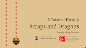
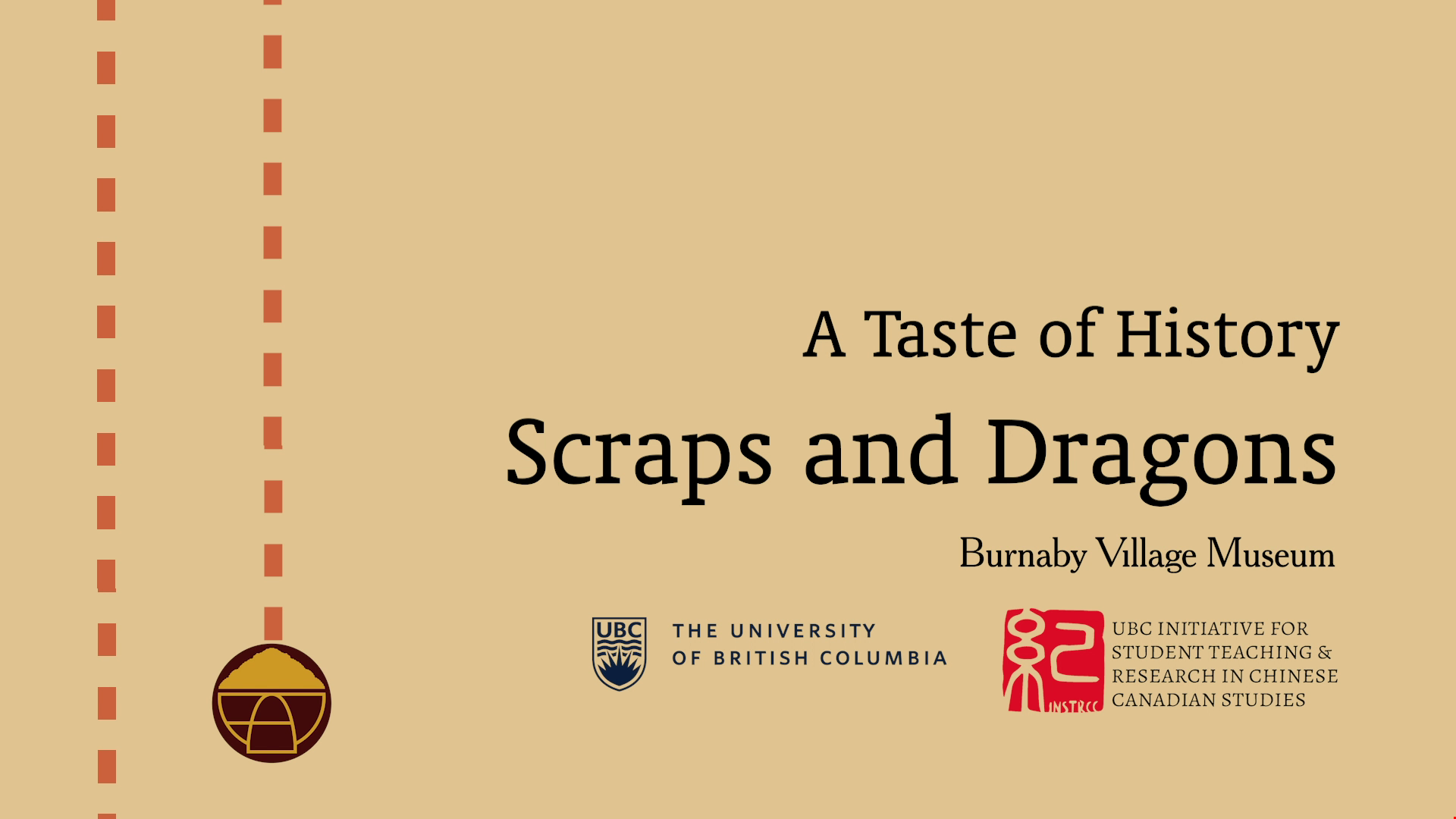
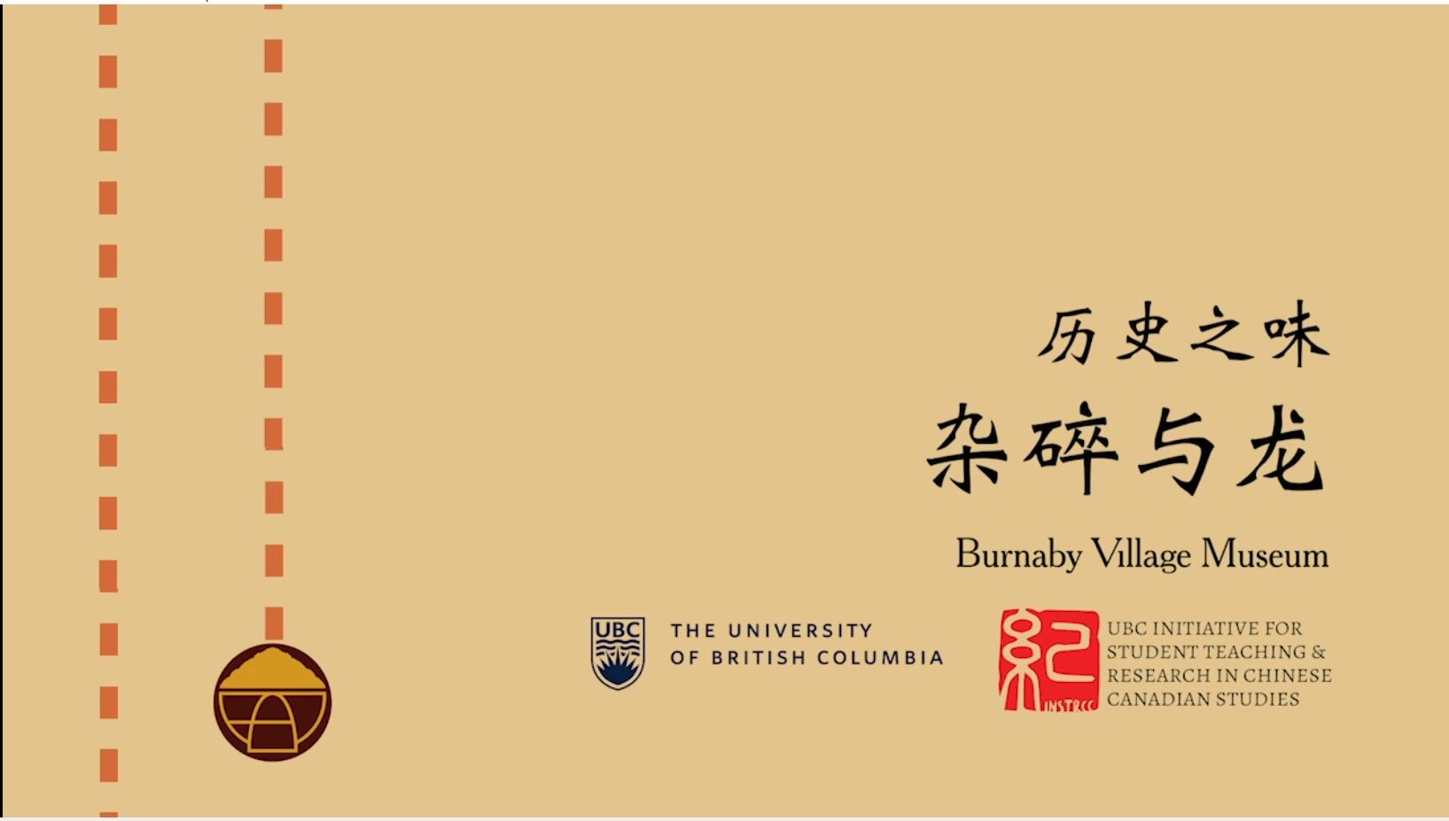
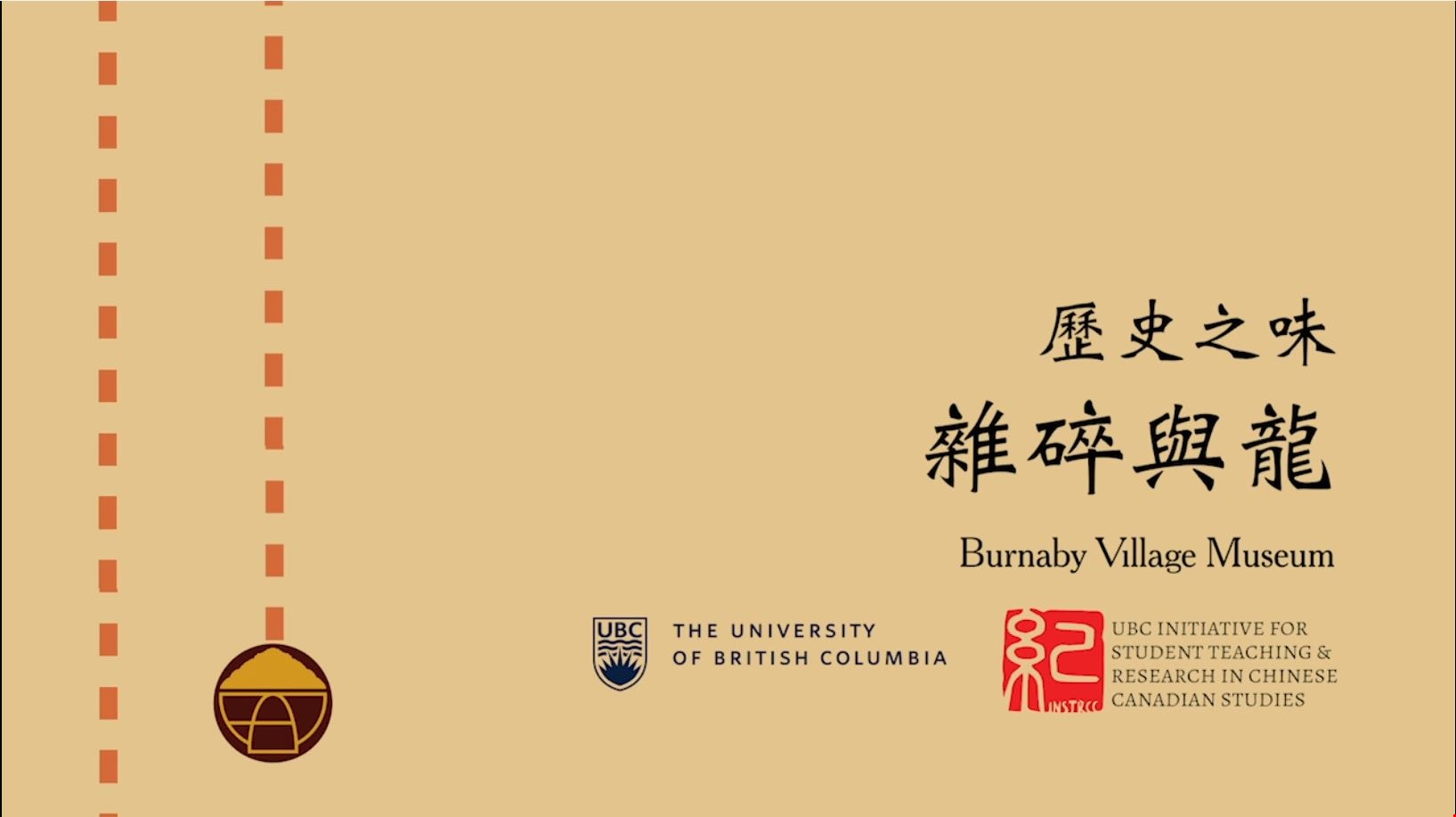
Scraps and Dragons
https://search.heritageburnaby.ca/link/museumdescription14273
- Repository
- Burnaby Village Museum
- Date
- Oct. 2020
- Collection/Fonds
- Burnaby Village Museum fonds
- Description Level
- Item
- Physical Description
- 3 video recordings (mp4) (11 min., 19 sec.) : digital, col., sd., stereo, subtitles
- Scope and Content
- Item consists of part one in a two part video series "A Taste of History" created by Debbie Liang and Joty Gill, University of British Columbia alumni and graduates from the Asian Canadian & Asian Migration Studies program (ACAM). Part one is titled "Scraps and Dragons". The film provides backgroun…
- Repository
- Burnaby Village Museum
- Collection/Fonds
- Burnaby Village Museum fonds
- Series
- UBC Partnership series
- Description Level
- Item
- Physical Description
- 3 video recordings (mp4) (11 min., 19 sec.) : digital, col., sd., stereo, subtitles
- Material Details
- Script: Debbie Liang; Joty Gill Narration: Debbie Liang Editor: Debbie Liang Subtitles: English; Simplified Chinese; Traditional Chinese Video Appearances: Kathy Lee; Eleanor Lee Interviews filmed by: Eleanor Lee Interview questions: Eleanor Lee; Debbie Liang Illustrations and Animations: Debbie Liang Photos, Images & B-roll: Vegetable letters from Shutterstock; Green onion and carrot footage from Debbie Liang; Chop Suey image courtesy of pulaw from Flickr, Creative Commons Attribution 2.0 Generic (CC By 2.0); Chop Suey from Shutterstock; Menus by Amy Wilson; Gold Dragon booklet cover and menu image- courtesy of UBC RBSC Chung Collection (RBSC-ARC-1679-CCTX-309-122); Chop Suey Nation book cover, image courtesy of Douglas & MacIntyre; Dragon Inn: City of Burnaby Archives, 556-239 photo by John McCarron; Larry Lee, image courtesy of Eleanor Lee; VanTech, image courtesy of Mike from Flickr, Creative Commons Attribution-ShareAlike 2.0 Generic (CC BY-SA 2.0); Bamboo Terrace, image courtesy of Rob from Flickr, public domain; Map image courtesy of Sentinel 2 from wikimedia Creative Commons; Salad bar inside of Dragon Inn Restaurant, Burnaby Village Museum, BV017.37.3; John Lee: City of Burnaby Archives, 535-0415, photo by Brian Langdeau; Photograph - Bar Inside the Dragon Inn Restaurant - Burnaby Village Museum, BV017.37.2; Chopping Mushrooms, footage courtesy of Pressmaster from pexels.com; Chopping Parsley, footage courtesy of Pressmaster from pexels.com; Kwan Luck from Debbie Liang; Crystall Mall as taken from the north side of Kingsway in Burnaby, image courtesy of w:en: Colin Keigher from wikimedia, Creative Commons Attribution 2.5 Generic license; Lok's Produce at Crystal mall (Burnaby) in the Underground Chinese Produce Market image courtesy of William Chen from wikimedia, Creative Commons Attribution Share Alike 4.0 International license; Crystal Mall foodcourt, image courtesy of Jay Friedman, Gastrolust; Restaurant and Dragon Innn art by Debbie Liang Music and Sound Effects: "Alison", "Acoustic Mediation 2" from audionautix; "Slow Motion", "Creative Minds" & "Cute" from bensound.com; "Kitchen sounds" & "Pop" from Debbie Liang; "Ding sound effect" from freesoundlibrary Video adapted from 2019 BVM intern project by Debbie Liang and Marcela Gomez Special thanks to: UBC: Joanna Yang, Jenny Lu, Denise Fong, Henry Yu; BVM: Kate Petrusa, Amy Wilson Changes to music may have been made for the purposes of this video
- Scope and Content
- Item consists of part one in a two part video series "A Taste of History" created by Debbie Liang and Joty Gill, University of British Columbia alumni and graduates from the Asian Canadian & Asian Migration Studies program (ACAM). Part one is titled "Scraps and Dragons". The film provides background information on the origins of the Chinese-Canadian culinary dish "chop suey" and tells the story of Chinese Canadian Chop Suey restaurants, highlighting the history of the "Dragon Inn" chop suey restaurant owned by Larry Lee. The film is supported with voice over in english, subtitles, animation, historical and family photographs and interviews with family members, Kathy Lee and Eleanor Lee. One version of the film is supported with subtitles in English while two other versions of the film are supported with subtitles in Simplified Chinese and Traditional Chinese.
- History
- In 2020, due to the restrictions of COVID-19, University of British Columbia student interns with the Burnaby Village Museum Chinese Canadian History in Burnaby project were asked to create virtual experiences to reimagine Burnaby Village Museum's historical Chinese Canadian programming in remote online spaces. Debbie Liang and Joty Gill (UBC alumni and graduates of Dr. Henry Yu's 2019 summer ACAM 390A Global Seminar to Aisa) returned to work with Burnaby Village Museum to create two short films showcasing the history of Chinese Canadian Chop Suey restaurants and piggeries in Burnaby. Larry Lee was born in Kaiping, Guangdong, China and immigrated to Canada in 1949 at the age of sixteen to reunite with his father, Lee Soon. Larry Lee's father had been in Canada for years before his son immigrated to join him. Larry attended Vancouver Technical Secondary School and learned English and carpentry. After he graduated, he was hired by Mr. Wong. Larry and Mr. Wong operated an IGA grocery store at Lonsdale in North Vancouver. Following this, Larry worked as a cashier for his father at "Bamboo Terrace" Chinese restaurant in Vancouver's Chinatown. In 1958, he married his wife Kathy and one year later, in 1959 he started a new business of his own. Larry opened the "Dragon Inn" chop suey restaurant at 2516 Kingsway (at Slocan) in Vancouver. Once the restaurant was doing well, Larry opened the "Park Inn" at Kingsway and 25th Avenue. The "Park Inn" was the first Chinese food restaurant with a smorgasboard in Vancouver. With the success of these restaurants and subsequent restaurants Larry Lee opened three other "Dragon Inn" chop suey restaurants located at; 4510 Kingsway and Willingdon in Burnaby (1964); 250 Columbia Street in New Westminster (1971) and Hastings and Willingdon (1990s). In the 1990s Larry retained ownership of the Dragon Inn at 4510 Kingsway and Willingdon and sold the other restaurants. In 1996, Larry sold the property of the Dragon Inn and surrounding lots located at Kingsway and Willingdon to make way for the construction of Crystal Mall. Larry and Kathy Lee had eight children who all worked in the family run restaurants until they were sold.
- Creator
- Liang, Debbie
- Debbie Liang
- Names
- Lee, Larry
- Lee, Kathy
- Lee, Eleanor
- Liang, Debbie
- Gill, Joty
- Burnaby Village Museum
- University of British Columbia
- Responsibility
- University of British Columbia
- UBC Initiative for Student Teaching and Research in Chinese Canadian Studies
- Burnaby Village Museum
- Geographic Access
- Vancouver
- New Westminster
- Street Address
- 4510 Kingsway
- Accession Code
- BV020.28.6
- Access Restriction
- No restrictions
- Reproduction Restriction
- No known restrictions
- Date
- Oct. 2020
- Media Type
- Moving Images
- Historic Neighbourhood
- Central Park (Historic Neighbourhood)
- Planning Study Area
- Marlborough Area
- Notes
- Transcribed title
Images
Video
Scraps and Dragons, Oct. 2020
Scraps and Dragons, Oct. 2020
https://search.heritageburnaby.ca/media/hpo/_Data/_BVM_Moving_Images/2020_0028_0006_001.mp4