Narrow Results By
Decade
- 2020s 473
- 2010s 979
- 2000s 2815
- 1990s 4535
- 1980s 3033
- 1970s 5028
- 1960s
- 1950s 2541
- 1940s 2396
- 1930s 2311
- 1920s
- 1910s 2165
- 1900s 986
- 1890s 298
- 1880s 148
- 1870s 42
- 1860s 47
- 1850s 25
- 1840s 13
- 1830s 9
- 1820s 9
- 1810s 6
- 1800s 6
- 1790s 5
- 1780s 5
- 1770s 5
- 1760s 5
- 1750s 5
- 1740s 5
- 1730s 5
- 1720s 5
- 1710s 5
- 1700s 5
- 1690s 5
- 1680s 5
- 1670s 4
- 1660s 4
- 1650s 4
- 1640s 4
- 1630s 4
- 1620s 4
- 1610s 4
- 1600s 4
- 1590s 1
- 1580s 1
- 1570s 1
- 1560s 1
- 1550s 1
- 1540s 1
- 1530s 1
- 1520s 2
- 1510s
- 1500s 1
- 1490s 1
- 1480s 1
Subject
- Academic Disciplines 3
- Accidents 1
- Accidents - Automobile Accidents 2
- Accidents - Train Accidents 2
- Adornment - Jewelry 2
- Advertising Medium 1
- Advertising Medium - Signs and Signboards 20
- Aerial Photographs 37
- Agricultural Tools and Equipment 2
- Agricultural Tools and Equipment - Plows 4
- Agriculture 5
- Agriculture - Crops 7
Creator
- Alphonse J. Toebaert 1
- Amundsen, Allan 1
- Anderson, Eva 1
- Archer, Tom 1
- Archer, Tony 1
- Armstrong, Vera 1
- Atkinson, Dorothy Mallett 1
- Baden-Powell of Gilwell, Robert Stephenson Smyth Baden-Powell, Baron, 1857-1941 1
- Bailey, Robert 2
- Baker, Edna Dean, 1883-1956 1
- Baker, James W. (James Williams), 1873-1938 1
- Baldwin, Ruth 1
Louis & Annie Hill Residence
https://search.heritageburnaby.ca/link/landmark504
- Repository
- Burnaby Heritage Planning
- Description
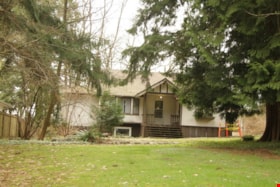
- The Louis and Annie Hill Residence is a modest one-storey, wood-frame, side-gabled Arts and Crafts bungalow with two projecting front gables, that was originally part of the Deer Lake Crescent Subdivision. The lot is heavily treed, and sits near the east end of Deer Lake.
- Associated Dates
- 1925
- Street View URL
- Google Maps Street View
- Repository
- Burnaby Heritage Planning
- Geographic Access
- Deer Lake Avenue
- Associated Dates
- 1925
- Description
- The Louis and Annie Hill Residence is a modest one-storey, wood-frame, side-gabled Arts and Crafts bungalow with two projecting front gables, that was originally part of the Deer Lake Crescent Subdivision. The lot is heavily treed, and sits near the east end of Deer Lake.
- Heritage Value
- The heritage value of the Louis and Annie Hill Residence lies in its association with prominent Burnaby pioneers, Louis Hill (1860-1931) and his wife, Annie Sara Hill (née Kenrick, 1864-1957). Originally from London, England, Louis Hill immigrated to Burnaby circa 1887, and established a small fruit farm on this site in 1891. Hill was elected to the first municipal council in 1892, when Burnaby was incorporated, and was later responsible for the subdivision of Buckingham Estate in the Deer Lake neighbourhood. The Louis and Annie Hill Residence, built as a retirement home in 1925, is further valued as a representation of the continued suburban development of the Deer Lake Crescent Subdivision, that was originally promoted in 1911 as an upper class suburban neighbourhood. Its modest nature illustrates the reduced scale of residential construction during the austere times that followed the end of the First World War. The style of the house demonstrates the late persistence of the Arts and Crafts movement, which remained a strong influence on domestic architecture. In 2006, the Louis and Annie Hill Residence was purchased by the City of Burnaby, and today it is part of the Deer Lake Park Heritage Precinct, Burnaby's most significant collection of historic sites.
- Defining Elements
- Key elements that define the heritage character of the Louis and Annie Hill Residence include its: - location within the Deer Lake Park Heritage Precinct - residential form, scale and massing as expressed by its one-storey height plus crawlspace, side-gabled-roof, front projecting gables, square projecting front bay and open front porch - wood-frame construction with original wood siding intact under a later coat of stucco - modest Arts and Crafts details such as diamond-point triangular eave brackets - windows, including double-hung, 1-over-1 wooden sash windows with horns - associated landscape features, including mature cedars lining the driveway
- Historic Neighbourhood
- Burnaby Lake (Historic Neighbourhood)
- Planning Study Area
- Morley-Buckingham Area
- Function
- Primary Historic--Single Dwelling
- Primary Current--Single Dwelling
- Community
- Deer Lake
- Cadastral Identifier
- P.I.D.012-446-963
- Boundaries
- The Louis and Annie Hill Residence is comprised of a single residential lot located at 6570 Deer Lake Avenue, Burnaby.
- Area
- 1521.75
- Contributing Resource
- Building
- Ownership
- Public (local)
- Documentation
- City of Burnaby Planning and Building Department, Heritage Site Files
- Street Address
- 6570 Deer Lake Avenue
- Street View URL
- Google Maps Street View
Images
Stanley & Isabel Picken House 'Aintree'
https://search.heritageburnaby.ca/link/landmark519
- Repository
- Burnaby Heritage Planning
- Description
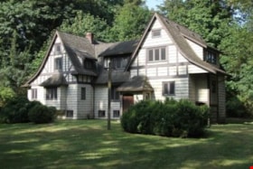
- Nestled within a stand of deciduous trees, the Stanley and Isabel Picken House 'Aintree' is a two and one-half storey plus basement shingled and half-timbered Arts and Crafts influenced residence, set on its original 0.6 hectare site adjacent to Brunette Creek in the Burnaby Lake Regional Nature Pa…
- Associated Dates
- 1929
- Formal Recognition
- Heritage Designation, Community Heritage Register
- Street View URL
- Google Maps Street View
- Repository
- Burnaby Heritage Planning
- Geographic Access
- Cariboo Road
- Associated Dates
- 1929
- Formal Recognition
- Heritage Designation, Community Heritage Register
- Enactment Type
- Bylaw No. 11756
- Enactment Date
- 09/08//2004
- Description
- Nestled within a stand of deciduous trees, the Stanley and Isabel Picken House 'Aintree' is a two and one-half storey plus basement shingled and half-timbered Arts and Crafts influenced residence, set on its original 0.6 hectare site adjacent to Brunette Creek in the Burnaby Lake Regional Nature Park.
- Heritage Value
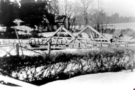
- 'Aintree' is an example of the type of private country estate residences built in Burnaby outside of the established suburbs during the 1920s, and is representative of middle-class residential life during this time. Stanley Boyd Picken (1890-1950) and Isabel Grace Frederique Picken (1893-1971) purchased this property in 1927 to establish the Aintree Dog Kennels, which was the first in the province to breed Irish Setters. This country residence was completed in 1929. Stanley Picken worked at a variety of other jobs including his position as keeper of the Brunette River Caribou Dam. Considered a fine example of romantic architecture, 'Aintree' stands in harmony with its woodland setting. The north wing was added in a compatible style in 1932 using former bridge support beams from the old Caribou Road Bridge for foundation support. 'Aintree' retains most of its original exterior elements including its picturesque shingled siding and half-timbering, demonstrating the late influence of an Arts and Crafts sensibility considered compatible with a country lifestyle.
- Defining Elements
- Key elements that define the heritage character of 'Aintree' include its: - woodland setting adjacent to Brunette Creek in the Burnaby Lake Regional Nature Park, with a deep setback from Cariboo Road - residential form, scale and massing as exemplified by its asymmetrical two and one-half storey plus basement height and irregular U-shaped plan - romantic Arts and Crafts influence as expressed in elements such as half-timbering on the upper storeys and hand-split cedar shake wall cladding - steeply pitched cross-gabled roofs with dormers connected by a lower central gabled roof, and 'cat slide' extension over side entry - regular fenestration, including wooden-sash casement windows with diamond leaded glass - red brick internal chimney with corbelled cap - associated landscape features, such as a curving driveway leading to the house, an early garage, grassed yard and a backdrop of mature deciduous trees
- Historic Neighbourhood
- Burquitlam (Historic Neighbourhood)
- Planning Study Area
- Burnaby Lake Area
- Function
- Primary Historic--Single Dwelling
- Community
- Burnaby
- Cadastral Identifier
- 010-867-147
- Boundaries
- 'Aintree' is comprised of a single residential lot located at 6825 Cariboo Road, Burnaby.
- Area
- 5436.75
- Contributing Resource
- Building
- Ownership
- Private
- Names
- Picken, Stanley
- Street Address
- 6825 Cariboo Road
- Street View URL
- Google Maps Street View
Images
Ardingley-Sprott Neighbourhood
https://search.heritageburnaby.ca/link/landmark797
- Repository
- Burnaby Heritage Planning
- Associated Dates
- 1955-2008
- Heritage Value
- The Ardingley-Sprott Neighbourhood is primarily non-residential and developed in the 1970s west of the Burnaby Lake park area. It grew to include a large recreational component in the form of the Burnaby Lake Sports Complex and playing fields.
- Historic Neighbourhood
- Burnaby Lake (Historic Neighbourhood)
- Planning Study Area
- Ardingley-Sprott Area
Images
Arrow Neon Sign
https://search.heritageburnaby.ca/link/landmark861
- Repository
- Burnaby Heritage Planning
- Description
- Commercial building.
- Associated Dates
- 1961
- Other Names
- Lost in the 50's Drive-in
- Street View URL
- Google Maps Street View
- Repository
- Burnaby Heritage Planning
- Other Names
- Lost in the 50's Drive-in
- Geographic Access
- Edmonds Street
- Associated Dates
- 1961
- Description
- Commercial building.
- Heritage Value
- The Arrow Neon Sign was built in 1961 by the Neonette Sign Company of New Westminster when this property was opened as the Tomahawk Drive-in Restaurant. The restaurant was later known as Lindy's Burger and in 1990, the business was renamed Lost in the 50's Drive-in. It stands 20-foot tall and is composed of a large double-sided hollow steel panel serpentine arrow mounted on a pole supporting a lexan sign panel measuring approximately 8 feet wide by 4 feet tall. The sign was designed with three illuminated features: a round lamp at the top of the pole, a double-sided rectangular fluorescent sign panel box, and two double-sided rows of orange neon arrows that follow the large serpentine arrow. The Arrow Neon Sign remains as a rare surviving example of neon sign art in the city and is the only historic neon sign in South Burnaby. The sign has gained prominence over the years as it has been associated with this small iconic drive-in which has also been utilized as a set for film production. Additionally, the drive-in has played a prominent role in the Edmonds community as a popular setting for recent "Show and Shine" participants to park their classic cars.
- Locality
- Edmonds
- Historic Neighbourhood
- East Burnaby (Historic Neighbourhood)
- Planning Study Area
- Lakeview-Mayfield Area
- Builder
- Neonette Sign Company
- Community
- Burnaby
- Contributing Resource
- Structure
- Ownership
- Public (local)
- Street Address
- 7741 Edmonds Street
- Street View URL
- Google Maps Street View
Images
Barnet Lumber Company House
https://search.heritageburnaby.ca/link/landmark662
- Repository
- Burnaby Heritage Planning
- Description
- Residential building.
- Associated Dates
- 1925
- Street View URL
- Google Maps Street View
- Repository
- Burnaby Heritage Planning
- Geographic Access
- Texaco Drive
- Associated Dates
- 1925
- Description
- Residential building.
- Heritage Value
- This house is one of two surviving houses built as a “Model Home” for the manager of the Barnet Lumber Company, which was the successor to the North Pacific Lumber Company. It was used as a combined home and office. It was constructed with framing lumber and millwork sawn at the mill. Typical of the Craftsman style, the house has a front gabled roof with triangular eave brackets. It has been altered with the addition of asbestos shingles over the original siding, but retains its form, scale and massing. This house was designed by the firm of Townley & Matheson. The partnership of Fred Laughton Townley (1887-1966) and Robert Michael Matheson began in 1919, and the firm left a rich legacy of sophisticated work, including schools, commercial structures, many fine residences and the landmark Vancouver City Hall.
- Historic Neighbourhood
- Barnet (Historic Neighbourhood)
- Planning Study Area
- Burnaby Mountain Area
- Architect
- Townley & Matheson
- Area
- 2225.77
- Contributing Resource
- Building
- Ownership
- Public (local)
- Street Address
- 8007 Texaco Drive
- Street View URL
- Google Maps Street View
Images
Barnet Lumber Company House
https://search.heritageburnaby.ca/link/landmark663
- Repository
- Burnaby Heritage Planning
- Description
- Residential building.
- Associated Dates
- 1925
- Street View URL
- Google Maps Street View
- Repository
- Burnaby Heritage Planning
- Geographic Access
- Texaco Drive
- Associated Dates
- 1925
- Description
- Residential building.
- Heritage Value
- This house is one of two surviving houses built as a “Model Home” for one of the assistant managers of the Barnet Lumber Company, using framing lumber and millwork sawn at the mill. This house was also designed by the firm of Townley & Matheson. The house was raised and renovated in 1997, resulting in alterations such as new dormers and elongated porch piers.
- Historic Neighbourhood
- Barnet (Historic Neighbourhood)
- Planning Study Area
- Burnaby Mountain Area
- Architect
- Townley & Matheson
- Contributing Resource
- Building
- Ownership
- Private
- Street Address
- 8039 Texaco Drive
- Street View URL
- Google Maps Street View
Images
Barnet Neighbourhood
https://search.heritageburnaby.ca/link/landmark681
- Repository
- Burnaby Heritage Planning
- Associated Dates
- 1925-1954
- Heritage Value
- In 1925, the mill at Barnet was under new ownership and was known as the Barnet Lumber Company. It was one of the most successful local employers in Burnaby until the 1930s, when the economic crisis of the Great Depression resulted in a strike at the mill. The City of Burnaby eventually assumed control of the site - including all of the homes - when the company failed to pay its taxes. The City then dismantled the mill and resold the property in two parts - the eastern section would become the Kapoor sawmill and the western portion, the McColl-Frontenac Oil Company.
- Historic Neighbourhood
- Barnet (Historic Neighbourhood)
- Planning Study Area
- Burnaby Mountain Area
Images
Barnet Neighbourhood
https://search.heritageburnaby.ca/link/landmark747
- Repository
- Burnaby Heritage Planning
- Associated Dates
- 1905-1924
- Heritage Value
- The original Barnet mill burned down in 1909 after a dramatic explosion in the boiler house. The company rebuilt a new plant, considered a model of mill construction. The company's timber was towed down the Pacific in huge rafts containing about 400,000 to 500,000 board feet. Mill capacity during a 10-hour day was 150,000 board feet with an amazing annual output of 50 million feet.
- Historic Neighbourhood
- Barnet (Historic Neighbourhood)
- Planning Study Area
- Burnaby Mountain Area
Images
Buckingham Elementary School
https://search.heritageburnaby.ca/link/landmark832
- Repository
- Burnaby Heritage Planning
- Geographic Access
- Buckingham Avenue
- Associated Dates
- 1962
- Heritage Value
- Buckingham Elementary School opened in 1962 with 86 pupils. The school was intended to take some of the pressure off of both Lakeview and Morley Elementary Schools which saw large volumes of enrolments throughout the 1950s. In 1964, two additional rooms were built onto the school and in 1969 a library, staffroom and medical room were added.
- Historic Neighbourhood
- Burnaby Lake (Historic Neighbourhood)
- Planning Study Area
- Morley-Buckingham Area
- Street Address
- 6066 Buckingham Avenue
- Street View URL
- Google Maps Street View
Images
Buena Vista Neighbourhood
https://search.heritageburnaby.ca/link/landmark759
- Repository
- Burnaby Heritage Planning
- Associated Dates
- 1905-1924
- Heritage Value
- The Buena Vista neighbourhood (so named for its wonderful views) grew out of its proximity to Edmonds and New Westminster and was developed in the period 1911-1912. By the 1950s, the area had been further subdivided and in 1986, Burnaby Municipal Council adopted the Cariboo Hills Development Plan for the neighbourhood to maintain its character as a residential area of the city.
- Historic Neighbourhood
- East Burnaby (Historic Neighbourhood)
- Planning Study Area
- Cariboo-Armstrong Area
Images
Cariboo-Armstrong Neighbourhood
https://search.heritageburnaby.ca/link/landmark825
- Repository
- Burnaby Heritage Planning
- Associated Dates
- 1955-2008
- Heritage Value
- The Cariboo-Armstrong Neighbourhood was mainly subdivided in the 1950s during the major building boom in Burnaby throughout the post-war years. Considered a primarily residential area, the neighbourhood has quick and convenient access to major highways and roads as well as being bordered to the north by the George Derby Conservation area.
- Historic Neighbourhood
- East Burnaby (Historic Neighbourhood)
- Planning Study Area
- Cariboo-Armstrong Area
Images
Cariboo Hill Secondary School
https://search.heritageburnaby.ca/link/landmark837
- Repository
- Burnaby Heritage Planning
- Geographic Access
- 16th Avenue
- Associated Dates
- 1961
- Heritage Value
- By 1961, three new elementary schools had been built in the northeast section of Burnaby - Armstrong, Seaforth, and Lyndhurst. With growing enrolment at each, too many students were required to travel a farther distance to attend Edmonds Junior High School. As a result, the Cariboo Hill Secondary School was built in 1961 and opened with 410 students. Its peak enrolment was during the 1974 school year when over 1100 students attended. Additions to the school were made in 1969, 1971 and 1974.
- Historic Neighbourhood
- East Burnaby (Historic Neighbourhood)
- Planning Study Area
- Cariboo-Armstrong Area
- Street Address
- 8580 16th Avenue
- Street View URL
- Google Maps Street View
Images
Crabtown
https://search.heritageburnaby.ca/link/landmark674
- Repository
- Burnaby Heritage Planning
- Associated Dates
- 1912-1957
- Heritage Value
- North Burnaby's waterfront was the location of a unique squatter's community known as Crabtown. Although its origins are obscure, it is believed that the first shacks were built before 1912. When the depression of 1913-1917 began, the shacks became permanent homes for impoverished workers. During the Great Depression of the 1930s, the community grew larger. Crabtown was not a slum, but a neighbourhood - the community even rallied together to build a water supply system and trails up the steep bluff with steps and banisters so children could go to school safely. In 1957, the National Harbours Board decided that Crabtown was encroaching on Federal property and evicted all 130 residents. Within a few months, residents were relocated and 114 homes were levelled.
- Historic Neighbourhood
- Vancouver Heights (Historic Neighbourhood)
- Planning Study Area
- Burnaby Heights Area
Images
Douglas-Gilpin Neighbourhood
https://search.heritageburnaby.ca/link/landmark799
- Repository
- Burnaby Heritage Planning
- Associated Dates
- 1955-2008
- Heritage Value
- The Douglas-Gilpin Neighbourhood developed into a diverse area incorporating residential, business, educational and park districts in the period after 1955. The BCIT site was built in the early 1960s, shortly after the Burnaby Municipal Hall was located on Canada Way near Deer Lake in 1956. The construction of the Municipal Hall at this location fostered the creation of an administrative and business centre adjacent to the park, while the northern and central areas of the neighbourhood retained their primarily residential character.
- Historic Neighbourhood
- Burnaby Lake (Historic Neighbourhood)
- Planning Study Area
- Douglas-Gilpin Area
Images
Douglas Road School
https://search.heritageburnaby.ca/link/landmark573
- Repository
- Burnaby Heritage Planning
- Description
- School building.
- Associated Dates
- 1928
- Other Names
- Douglas Road Elementary School
- Street View URL
- Google Maps Street View
- Repository
- Burnaby Heritage Planning
- Other Names
- Douglas Road Elementary School
- Geographic Access
- Canada Way
- Associated Dates
- 1928
- Description
- School building.
- Heritage Value
- The Douglas Road School was originally established as a two-room school in 1908 on this site, and later expanded to four classrooms. Anticipating rapid settlement of this district, the School Board purchased two acres adjoining the old building. Two of the four rooms were designed to become one large auditorium suitable for special events and public gatherings, with seating for two hundred people. The classically-influenced school has been altered with new windows and extended with additional wings, but has retained its original red-brick veneer, tan-brick quoins and bellcast octagonal roof ventilator. Designed by McCarter & Nairne, the school was built by contractor A.S. Perry. McCarter & Nairne, who also designed the Second Street School, were the Burnaby School Board architects at this time. John Y. McCarter (1886-1981) and George Nairne (1884-1953) formed their partnership in 1921 after serving overseas during the First World War. The partners began designing houses and small apartment buildings, and their commissions included Vancouver’s first skyscraper, the Marine Building (1928-30).
- Locality
- Burnaby Lake
- Historic Neighbourhood
- Burnaby Lake (Historic Neighbourhood)
- Planning Study Area
- Douglas-Gilpin Area
- Architect
- McCarter & Nairne
- Subjects
- Buildings - Heritage
- Buildings - Schools
- Street Address
- 4861 Canada Way
- Street View URL
- Google Maps Street View
Images
Dr. William & Ruth Baldwin House
https://search.heritageburnaby.ca/link/landmark534
- Repository
- Burnaby Heritage Planning
- Description
- The Dr. William & Ruth Baldwin House is a two-storey modern post-and-beam structure, located on the southern shore of Deer Lake in Burnaby's Deer Lake Park. The site is steeply sloped, and the main entrance of the house is at the top of the slope facing onto Deer Lake Drive.
- Associated Dates
- 1965
- Formal Recognition
- Community Heritage Register
- Repository
- Burnaby Heritage Planning
- Geographic Access
- Deer Lake Drive
- Associated Dates
- 1965
- Formal Recognition
- Community Heritage Register
- Enactment Type
- Council Resolution
- Enactment Date
- 26/05/2003
- Description
- The Dr. William & Ruth Baldwin House is a two-storey modern post-and-beam structure, located on the southern shore of Deer Lake in Burnaby's Deer Lake Park. The site is steeply sloped, and the main entrance of the house is at the top of the slope facing onto Deer Lake Drive.
- Heritage Value
- The Baldwin House is valued as a prime example of Burnaby’s post-Second World War modern heritage and progressive architectural style, as well as for its personal connections to internationally-acclaimed architect, Arthur Erickson. Inspired by the modern domestic idiom established earlier in the twentieth century by Frank Lloyd Wright and Richard Neutra, Erickson conceived his architecture as responding directly to the site. A cohesive expression of simple orthogonal lines and ultimate transparency, this structure reduces the idea of post-and-beam West Coast modernism to its most refined elements. A fine example of the evolving talent of Erickson’s earlier work, this house is a landmark modern house in Burnaby and is unique in terms of siting and context. Having just won the 1963 competition for the new Simon Fraser University in Burnaby with his partner, Geoff Massey, and having built fewer than half a dozen homes previously, Erickson’s reputation was growing and his skill as a designer of modern buildings was in great demand. The same year that Erickson/Massey Architects designed SFU, Dr. William Baldwin and his wife, Ruth, personal friends of Erickson, commissioned him to design this house. Erickson was already familiar with the site; as a child he had spent time at this spot when his family visited friends who lived on Deer Lake. Both the Baldwin House and the university were completed in 1965. SFU became internationally famous; the Baldwin House was also considered an architectural success and was recognized in publications of the time. Only a single storey of this two-storey house is visible from the road, as it is built into the hillside in response to its steep site and proximity to Deer Lake. Like many other Erickson designs, this structure was conceived as a pavilion. Constructed of glass and wood, its transparency facilitates visual access to the lake’s edge, acting as an invitation, rather than a barrier, to the landscape. The house blends into the natural surroundings and the site includes other man-made landscape features such as a reflecting pool. As a reaction to the often grey quality of light in the region, Erickson exploits flat planes of water as a source of borrowed light. The refined and purposeful design, transparency, openness of plan and adjacency to the lake combine to give the house a floating appearance at the water's edge. The concept of a floating house set within an accompanying garden was inspired, in part, by the palaces and house boats of Dal Lake in Kashmir and the famed nearby Mughal Gardens. Although Erickson never visited Dal Lake, he travelled extensively throughout India, and specifically mentions the Kashmir reference in relation to this house. There is a rich complexity of other allusions worked into the fabric of the house, unified by a feeling for the conjunction of light, water and land at this special location. Widely renowned as Canada’s most brilliant modern architect, Erickson’s reputation is important to the development and growth of modern architecture in Canada and North America.
- Defining Elements
- The elements of the Baldwin House that define its character are those materials and details which respond to the location of the building and determine the relation between landscape and building, combining to create a single cohesive site. These include its: - close proximity to water - orthogonal plan and massing, with flat tar-and-gravel roof - stepped down massing orienting the house towards the water - post-and-beam construction, with the width of the beams matched to the width of the posts - wood and glass used as primary building materials - transparency and light achieved by the abundant use of glass - large undivided sheets of single glazing - butt glazed glass corners - abundant and generous balconies, which blur the transition from interior to exterior - horizontal flush cedar siding - use of salvaged brick for chimneys - use of chains as downspouts - built-in rooftop barbeque - built in furniture and fittings dating to the time of construction, such as original hardware, benches, bathroom vanities and kitchen cabinets - landscaped site including reflecting pool, plantings and a dock protruding into the lake
- Locality
- Deer Lake Park
- Historic Neighbourhood
- Burnaby Lake (Historic Neighbourhood)
- Planning Study Area
- Morley-Buckingham Area
- Function
- Primary Current--Single Dwelling
- Primary Historic--Single Dwelling
- Community
- Burnaby
- Cadastral Identifier
- P.I.D. No. 011-946-032 and P.I.D. No. 011-946-067
- Boundaries
- The Baldwin House is comprised of two municipally-owned lots located at 6543 and 6545 Deer Lake Drive, Burnaby.
- Area
- 6,070.20
- Contributing Resource
- Building
- Landscape Feature
- Ownership
- Public (local)
- Other Collection
- Canadian Architectural Archives, University of Calgary, Collection: Original Plans No. ERI 4A/76.13
- Documentation
- Heritage Site Files: PC77000 20. City of Burnaby Planning and Building Department, 4949 Canada Way, Burnaby, B.C., V5G 1M2
- Street Address
- 6543 Deer Lake Drive
Images
Floden House
https://search.heritageburnaby.ca/link/landmark524
- Repository
- Burnaby Heritage Planning
- Description
- The Floden House is a gambrel roofed, one and one-half storey plus basement wood-frame Dutch Colonial Revival residence, located at the head of the T-intersection of Fourth Street and Edmonds Street in a residential area of East Burnaby.
- Associated Dates
- 1929
- Formal Recognition
- Heritage Designation, Community Heritage Register
- Other Names
- Eric B. & Carrie Floden House
- Street View URL
- Google Maps Street View
- Repository
- Burnaby Heritage Planning
- Other Names
- Eric B. & Carrie Floden House
- Geographic Access
- 4th Street
- Associated Dates
- 1929
- Formal Recognition
- Heritage Designation, Community Heritage Register
- Enactment Type
- Bylaw No. 11358
- Enactment Date
- 27/05/2002
- Description
- The Floden House is a gambrel roofed, one and one-half storey plus basement wood-frame Dutch Colonial Revival residence, located at the head of the T-intersection of Fourth Street and Edmonds Street in a residential area of East Burnaby.
- Heritage Value
- Built in 1929 for Swedish emigrant Eric Birger Floden (1896-1971) and his Norwegian wife, Carrie (1899-1943), the Floden House is a valued representation of local middle-class housing from the 1920s, at a time of increasing prosperity just prior to the onset of the Great Depression. Eric Birger Floden was the head sawyer at Shook Mills in New Westminster, and his family occupied the house until 1964. Additionally, the Floden House is significant as an example of a residential pattern book design from the 1920s. With a reviving economy after the First World War, pattern books were widely used to expedite residential design and construction. It was built by Floden's brother in-law, Nels Olund, a talented contractor of the Fraser Valley who was experienced in building gambrel roof barns. The Floden House is also valued as an example of the Dutch Colonial Revival style, and is typical of period revival houses built in the 1920s that reflected the modern ideals of economy and good design as well as an ongoing pride in past traditions. It was presumed at the time that a well-built house would display a traditional and readily-identifiable style as a hallmark of good taste. The use of the various Colonial Revival styles had gained new popularity during the late 1920s at the time of the American Sesquicentennial. A local landmark, the house originally stood at 7997 18th Avenue and was moved two blocks to its current location by the City of Burnaby when it purchased and rehabilitated the house to save it from demolition, indicating the City's commitment to heritage conservation.
- Defining Elements
- Key elements that define the heritage character of the Floden House include its: - residential form, scale and massing as expressed by its one and one-half storey plus basement height, rectangular plan and distinctive roof form - Dutch Colonial Revival style details such as its side gambrel roof, front and rear shed dormers, attic fanlights, decorative shutters and regular fenestration - roof configuration, with overhanging eaves on the front facade with returns on the side facades, and clipped eaves on the side facades - asymmetrical front entry with small entry porch with lattice surrounds - front projecting bay window - wide lapped horizontal cedar siding - irregular fenestration, with original double-hung 6-over-1 wooden-sash windows - secondary side entry with balcony over - internal red brick chimney with concrete chimney caps
- Historic Neighbourhood
- East Burnaby (Historic Neighbourhood)
- Planning Study Area
- Edmonds Area
- Builder
- Nels Olund
- Function
- Primary Historic--Single Dwelling
- Primary Current--Single Dwelling
- Community
- Burnaby
- Cadastral Identifier
- 009-931-490
- Boundaries
- The Floden House is comprised of a single residential lot located at 7244 Fourth Street, Burnaby.
- Area
- 804.13
- Contributing Resource
- Building
- Ownership
- Private
- Street Address
- 7244 4th Street
- Street View URL
- Google Maps Street View
Images
François & Cezarie Comeau Residence
https://search.heritageburnaby.ca/link/landmark580
- Repository
- Burnaby Heritage Planning
- Description
- Residential building.
- Associated Dates
- c.1925
- Street View URL
- Google Maps Street View
- Repository
- Burnaby Heritage Planning
- Geographic Access
- Esmond Avenue
- Associated Dates
- c.1925
- Description
- Residential building.
- Heritage Value
- This home was built for Francois Xavier “Frank” Comeau (1863-1943), a blacksmith who moved from Quebec to Vancouver in about 1890, and his wife Cezarie Marie (née Fortin, 1860-1950), also from Quebec, whom he married in 1903. Featuring a front gabled roof with decorative triangular eave brackets, this comfortable Craftsman bungalow displays other characteristics typical of the style such as lapped siding at the foundation, a shingle-clad main floor, casement windows and stained glass transoms on the front elevation. The most notable feature of the plan is the inset verandah with subtle segmental-arched openings and tapered square columns.
- Locality
- Vancouver Heights
- Historic Neighbourhood
- Vancouver Heights (Historic Neighbourhood)
- Planning Study Area
- Burnaby Heights Area
- Area
- 566.71
- Contributing Resource
- Building
- Ownership
- Private
- Street Address
- 306 Esmond Avenue
- Street View URL
- Google Maps Street View
Images
Frederick & Edna Cunningham House
https://search.heritageburnaby.ca/link/landmark522
- Repository
- Burnaby Heritage Planning
- Description
- Set back from Douglas Road, the Frederick and Edna Cunningham House is a picturesque wood-frame one and one-half storey British Arts and Crafts-style residence, clad with rough-cast stucco and featuring half-timbering in the gable ends. Set far back on a large east-sloping site in a mature landscap…
- Associated Dates
- 1923
- Formal Recognition
- Heritage Designation, Community Heritage Register
- Street View URL
- Google Maps Street View
- Repository
- Burnaby Heritage Planning
- Geographic Access
- Douglas Road
- Associated Dates
- 1923
- Formal Recognition
- Heritage Designation, Community Heritage Register
- Enactment Type
- Bylaw No. 10470
- Enactment Date
- 04/11/1996
- Description
- Set back from Douglas Road, the Frederick and Edna Cunningham House is a picturesque wood-frame one and one-half storey British Arts and Crafts-style residence, clad with rough-cast stucco and featuring half-timbering in the gable ends. Set far back on a large east-sloping site in a mature landscape setting, it is located in the Douglas Road neighbourhood located in the central valley of Burnaby.
- Heritage Value
- Considered a landmark in the Douglas Road neighbourhood, the Cunningham House is valued as a good example of a British Arts and Crafts-style residence. The house blends into its surroundings, which are extensively landscaped with rockeries, lawns, shrubs, trees and perennial beds. The two majestic copper beech trees, over 60 years old, are among the best specimens of their type to be found in Greater Vancouver and are protected under covenant. The Cunningham property is significant as one of the last estate homes remaining on the old Douglas Road, at one time noted for its beautiful estates set within the rural character of Burnaby’s Central Valley. Insurance agent Frederick Woodman Cunningham (1882-1963) and his wife, Edna Elizabeth Cunningham (1884-1982), built this country residence in 1923. Fred was the only son of James Cunningham, a pioneer of New Westminster who arrived in 1862 and served as the City’s Mayor from 1872 to 1874. The landmark flagpole that once stood in the garden was moved to this site when Fred Cunningham's prestigious family home in New Westminster at Third Avenue and Seventh Street was demolished in 1938. Kept within the family until 1982 and largely maintained in its original condition, the Cunningham House is an excellent example of one of Burnaby's best estate homes from the 1920s and was designated by the City of Burnaby in 1996.
- Defining Elements
- Key elements that define the heritage character of the Cunningham House include its: - location on Douglas Road, in Burnaby’s Central Valley - views from the property to the east and towards the North Shore - residential form, scale and massing as exemplified by its one and one-half storey height and rectangular plan - side gabled roof with front gabled dormer and cedar shingle cladding - British Arts and Crafts elements such as its rough-cast stucco, tapered porch columns, large eave brackets, exposed purlins and half-timbering - irregular fenestration including double-hung 1-over-1 wooden-sash windows, multi-pane wooden-sash casement windows and multiple-assembly windows in the gable ends - front entrance porch with shed roof - two internal red brick chimneys - early cedar-shingled garage at side of house - associated landscape features, including two landmark Copper beech trees and landscaped rockeries at the front of the property
- Historic Neighbourhood
- Burnaby Lake (Historic Neighbourhood)
- Planning Study Area
- Douglas-Gilpin Area
- Function
- Primary Historic--Single Dwelling
- Primary Current--Single Dwelling
- Community
- Burnaby
- Cadastral Identifier
- 003-118-746
- Boundaries
- The Cunningham House is comprised of a single residential lot located at 3555 Douglas Road, Burnaby.
- Area
- 4446.5
- Contributing Resource
- Building
- Ownership
- Private
- Street Address
- 3555 Douglas Road
- Street View URL
- Google Maps Street View
Images
George & Rose Nuttall Residence
https://search.heritageburnaby.ca/link/landmark585
- Repository
- Burnaby Heritage Planning
- Description
- Residential building.
- Associated Dates
- 1921
- Other Names
- HILLCREST
- Street View URL
- Google Maps Street View
- Repository
- Burnaby Heritage Planning
- Other Names
- HILLCREST
- Geographic Access
- McGill Street
- Associated Dates
- 1921
- Description
- Residential building.
- Heritage Value
- This house was built for local plumber contractor George Nuttall (1883-1970) and his wife Rose Ann Nuttall (née Clagg, 1881-1955). George continued to live in the house after Rose’s death, until his own death in 1970. Although typical of the Craftsman style and form with its side-gabled roof, triangular eave brackets and front gabled dormer, this house has a number of special details, such as its beautiful art glass transom windows. The front verandah supports are massive stucco columns that contain stained glass lanterns with the house name, Hillcrest, and address.
- Locality
- Vancouver Heights
- Historic Neighbourhood
- Vancouver Heights (Historic Neighbourhood)
- Planning Study Area
- Burnaby Heights Area
- Area
- 566.71
- Contributing Resource
- Building
- Ownership
- Private
- Street Address
- 3756 McGill Street
- Street View URL
- Google Maps Street View
