![All Saints Church, [ca.1910] thumbnail](/media/hpo/_Data/_BVM_Cartographic_Material/2003/2003_0083_0046_001.jpg?width=280)
All Saints Church
https://search.heritageburnaby.ca/link/museumdescription11924
- Repository
- Burnaby Village Museum
- Date
- [ca.1910]
- Collection/Fonds
- Ronald G. Scobbie collection
- Description Level
- Item
- Physical Description
- 1 plan : black ink and watercol. on paper ; 30.45 x 30.5 cm
- Scope and Content
- Item consists of building insurance plan of "All Saints Church / Lot "A" BK 29 DL 98 GP1 N.W.D.". Watling Street is idenfied to the north of the church building and Royal Oak Avenue to the west.
- Repository
- Burnaby Village Museum
- Collection/Fonds
- Ronald G. Scobbie collection
- Description Level
- Item
- Physical Description
- 1 plan : black ink and watercol. on paper ; 30.45 x 30.5 cm
- Material Details
- Scale 1 inch = 20 feet
- Scope and Content
- Item consists of building insurance plan of "All Saints Church / Lot "A" BK 29 DL 98 GP1 N.W.D.". Watling Street is idenfied to the north of the church building and Royal Oak Avenue to the west.
- Subjects
- Buildings - Religious - Churches
- Accession Code
- BV003.83.46
- Access Restriction
- No restrictions
- Reproduction Restriction
- No known restrictions
- Date
- [ca.1910]
- Media Type
- Cartographic Material
- Scan Resolution
- 600
- Scan Date
- 15-Jan-2021
- Scale
- 100
- Notes
- Transcribed title
- Note in pencil on verso reads: ""All Saints Church / Lot "A" BK 29 DL 98 / Scale 1 inch = 20 feet"
- Note in balck in on verso reads: "3704"
Images
![All Saints Church, [ca.1910] thumbnail](/media/hpo/_Data/_BVM_Cartographic_Material/2003/2003_0083_0046_001.jpg)
![Anglican Church, [ca.1910] thumbnail](/media/hpo/_Data/_BVM_Cartographic_Material/2003/2003_0083_0043_001.jpg?width=280)
Anglican Church
https://search.heritageburnaby.ca/link/museumdescription11921
- Repository
- Burnaby Village Museum
- Date
- [ca.1910]
- Collection/Fonds
- Ronald G. Scobbie collection
- Description Level
- Item
- Physical Description
- 1 plan : black ink and watercol. on paper ; 30.45 x 30.5 cm
- Scope and Content
- Item consists of building insurance plan of "Anglican Church / Lot 2 BK 37 DL69, GP.1, N.W.D. (15th Ave. (Dominion) is identified to the north of Lots 1, 2 and 3).
- Repository
- Burnaby Village Museum
- Collection/Fonds
- Ronald G. Scobbie collection
- Description Level
- Item
- Physical Description
- 1 plan : black ink and watercol. on paper ; 30.45 x 30.5 cm
- Material Details
- Scale 1 inch = 20 feet
- Scope and Content
- Item consists of building insurance plan of "Anglican Church / Lot 2 BK 37 DL69, GP.1, N.W.D. (15th Ave. (Dominion) is identified to the north of Lots 1, 2 and 3).
- Subjects
- Buildings - Religious - Churches
- Accession Code
- BV003.83.43
- Access Restriction
- No restrictions
- Reproduction Restriction
- No known restrictions
- Date
- [ca.1910]
- Media Type
- Cartographic Material
- Scan Resolution
- 600
- Scan Date
- 15-Jan-2021
- Scale
- 100
- Notes
- Transcribed title
- Note in pencil on verso reads: "Anglican Church / Lot 2 Bk 37 DL69 / 1"=20' "
- Note in balck in on verso reads: "3704"
Images
![Anglican Church, [ca.1910] thumbnail](/media/hpo/_Data/_BVM_Cartographic_Material/2003/2003_0083_0043_001.jpg)

Armstrong Street School site
https://search.heritageburnaby.ca/link/museumdescription11133
- Repository
- Burnaby Village Museum
- Date
- 1915
- Collection/Fonds
- Ronald G. Scobbie collection
- Description Level
- Item
- Physical Description
- 1 survey plan : blueprint on paper ; 56 x 54 cm
- Scope and Content
- Survey plan of "Armstrong Street School Site / Burnaby Municipality" "Being a 2 acre portion of Lot 13 Group 1, & according to map 1722 which shows this as Lot E. Block 2 of subdivision of a portion, of Lot 13, Group 1, New Westminster District".
- Repository
- Burnaby Village Museum
- Collection/Fonds
- Ronald G. Scobbie collection
- Description Level
- Item
- Physical Description
- 1 survey plan : blueprint on paper ; 56 x 54 cm
- Material Details
- Scale 40 feet = 1 inch
- Scope and Content
- Survey plan of "Armstrong Street School Site / Burnaby Municipality" "Being a 2 acre portion of Lot 13 Group 1, & according to map 1722 which shows this as Lot E. Block 2 of subdivision of a portion, of Lot 13, Group 1, New Westminster District".
- Creator
- Burnett, Geoffrey K.
- Subjects
- Buildings - Schools
- Names
- Armstrong Avenue School
- Responsibility
- Burnett & McGugan, Engineers and Surveyors
- Geographic Access
- Armstrong Avenue
- Street Address
- 8757 Armstrong Avenue
- Accession Code
- BV003.83.12
- Access Restriction
- No restrictions
- Reproduction Restriction
- No known restrictions
- Date
- 1915
- Media Type
- Cartographic Material
- Historic Neighbourhood
- East Burnaby (Historic Neighbourhood)
- Planning Study Area
- Cariboo-Armstrong Area
- Scan Resolution
- 440
- Scan Date
- 22-Dec-2020
- Scale
- 100
- Notes
- Title based on contents of plan
- Note in black ink on verso of plan reads: "1746"
- Oath on plan reads: "I, Geoffrey K. Burnett...and did personally superintend the survey represented..." "Completed on the 18th day of March 1915"; signed by Geoffrey K. Burnett and notarized by "K.A. Eastman", sworn "...19th day of April 1915"; "Burnett and McGugan., B.C. Land Surveyors. Etc.. New Westminster, B.C.."
Zoomable Images


Barnet School site
https://search.heritageburnaby.ca/link/museumdescription11140
- Repository
- Burnaby Village Museum
- Date
- May 27, 1915
- Collection/Fonds
- Ronald G. Scobbie collection
- Description Level
- Item
- Physical Description
- 1 survey plan : blueprint on paper ; 56 x 54 cm
- Scope and Content
- Survey plan of "Barnet School Site / Burnaby Municipality" "Being a portion of the west half of lot / 214, Group 1 / New Westminster District”.
- Repository
- Burnaby Village Museum
- Collection/Fonds
- Ronald G. Scobbie collection
- Description Level
- Item
- Physical Description
- 1 survey plan : blueprint on paper ; 56 x 54 cm
- Material Details
- Scale 40 feet = 1 inch
- Scope and Content
- Survey plan of "Barnet School Site / Burnaby Municipality" "Being a portion of the west half of lot / 214, Group 1 / New Westminster District”.
- Creator
- McGugan, Donald Johnston
- Subjects
- Buildings - Schools
- Names
- Barnet School
- Responsibility
- Burnett & McGugan, Engineers and Surveyors
- Geographic Access
- Barnet Road
- Street Address
- 7820 Barnet Road
- Accession Code
- BV003.83.19
- Access Restriction
- No restrictions
- Reproduction Restriction
- No known restrictions
- Date
- May 27, 1915
- Media Type
- Cartographic Material
- Historic Neighbourhood
- Barnet (Historic Neighbourhood)
- Planning Study Area
- Burnaby Mountain Area
- Scan Resolution
- 440
- Scan Date
- 22-Dec-2020
- Scale
- 100
- Notes
- Title based on contents of plan
- handwritten on back "Burnaby Schools" "23R" twice, "1783"
- Oath on plan reads: "I, D.J. McGugan...and did personally superintend the survey..." "completed on the 27th day of May 1915"; signed by D.J. McGugan, notarized by "Walter Edmonds" "sworn "...29th day of May 1915" "Burnett and McGugan" "B.C. Land Surveyors Etc. New Westminster, B.C.";
Zoomable Images

![Bird's eye view of New Westminster, Burnaby and Vancouver, [ca. 1911] thumbnail](/media/hpo/_Data/_BVM_Cartographic_Material/1983/1983_0012_0001_002%20Web.jpg?width=280)
Bird's eye view of New Westminster, Burnaby and Vancouver
https://search.heritageburnaby.ca/link/museumdescription8199
- Repository
- Burnaby Village Museum
- Date
- [ca. 1911]
- Collection/Fonds
- Burnaby Village Museum Map collection
- Description Level
- Item
- Physical Description
- 1 map : hand painted ; 65.5 x 99 cm
- Scope and Content
- An untitled monochromatic grayscale map of a developer's bird's eye view looking north west from Burnaby Mountain. View includes Burnaby, New Westminster, Vancouver with the North shore in the distance. Burnaby neighbourhood subdivisions of "Burnaby Heights" and "Buena Vista" are featured near the…
- Repository
- Burnaby Village Museum
- Collection/Fonds
- Burnaby Village Museum Map collection
- Description Level
- Item
- Physical Description
- 1 map : hand painted ; 65.5 x 99 cm
- Scope and Content
- An untitled monochromatic grayscale map of a developer's bird's eye view looking north west from Burnaby Mountain. View includes Burnaby, New Westminster, Vancouver with the North shore in the distance. Burnaby neighbourhood subdivisions of "Burnaby Heights" and "Buena Vista" are featured near the centre of the map. These neighbourhood subdivisions were marketed by Real Estate Agents Liebly & Blumer in 1911. Roads, buildings, factories, railways and bridges are identified on the map.
- Subjects
- Businesses - Real Estate Agencies
- Responsibility
- Leibly & Blumer Realty Co. Incorporated
- Accession Code
- HV983.12.1
- Access Restriction
- No restrictions
- Reproduction Restriction
- No known restrictions
- Date
- [ca. 1911]
- Media Type
- Cartographic Material
- Historic Neighbourhood
- East Burnaby (Historic Neighbourhood)
- Vancouver Heights (Historic Neighbourhood)
- Planning Study Area
- Cariboo-Armstrong Area
- Burnaby Heights Area
- Scan Resolution
- 300
- Scan Date
- December 2020
- Scale
- 100
- Notes
- Title based on contents of map
- Note in pencil on verso of photograph reads: "Make tint block of Buena Vista / Blocks only as shown in lots"
Zoomable Images
![Bird's eye view of New Westminster, Burnaby and Vancouver, [ca. 1911] thumbnail](/media/hpo/_Data/_BVM_Cartographic_Material/1983/1983_0012_0001_001_seadragon/1983_0012_0001_001.jpg?w=280)

Book of birds
https://search.heritageburnaby.ca/link/museumlibrary4819
- Repository
- Burnaby Village Museum
- Collection
- Special Collection
- Material Type
- Book
- Accession Code
- BV985.6170.1
- Call Number
- 598 BOO
- Place of Publication
- London
- Publisher
- Ernest Nister
- Publication Date
- 1914
- Physical Description
- 1 v. (unpaged) : col. ill. : 27 cm.
- Inscription
- "Ma___ Burd from Nancy Bompa Xmas 1914" [Handwritten in pencil on front endpaper]
- Library Subject (LOC)
- Birds
- Juvenile literature
- Children's literature
- Animals
- Subjects
- Animals - Birds
- Animals
Images


The book of knowledge : the children's encyclopaedia, volume i
https://search.heritageburnaby.ca/link/museumlibrary668
- Repository
- Burnaby Village Museum
- Collection
- Special Collection
- Material Type
- Book
- Accession Code
- BV985.3668.1
- Call Number
- 032 MEE v. 1 1918
- Contributor
- Mee, Arthur, 1875-1943
- Thompson, Holland, 1873-1940
- Finley, John H. (John Huston), 1863-1940
- Place of Publication
- New York
- Publisher
- The Grolier Society
- Publication Date
- c1918
- Series
- The Book of Knowledge, v. 1
- Physical Description
- x, 334 p. : ill. : 25 cm.
- Library Subject (LOC)
- Encyclopedias and dictionaries
- Children's encyclopædias and dictionaries
- Notes
- "Editors-in-chief Arthur Mee...Holland Thompson..." -- Title page
- "With an introduction by John H. Finley..." -- Title page
- Contributor's full name and dates: Finley, John H. (John Huston), 1863-1940
- page 1-334
- Volume 1 of 20
Images

The book of knowledge : the children's encyclopaedia, volume ii
https://search.heritageburnaby.ca/link/museumlibrary669
- Repository
- Burnaby Village Museum
- Collection
- Special Collection
- Material Type
- Book
- Accession Code
- BV985.3668.2
- Call Number
- 032 MEE v.2 1918
- Contributor
- Mee, Arthur, 1875-1943
- Thompson, Holland, 1873-1940
- Finley, John H. (John Huston), 1863-1940
- Place of Publication
- New York
- Publisher
- The Grolier Society
- Publication Date
- c1918
- Series
- The Book of Knowledge, v. 2
- Physical Description
- 335-660 p. : ill. : 25 cm.
- Library Subject (LOC)
- Encyclopedias and dictionaries
- Children's encyclopædias and dictionaries
- Notes
- "Editors-in-chief Arthur Mee...Holland Thompson..." -- Title page
- "With an introduction b John H. Findley..." -- Title page
- Contributor's full name and dates: Finley, John H. (John Huston), 1863-1940
- pages 335-660
- volume 2 of 20
Images
The book of knowledge : the children's encyclopaedia, volume iii
https://search.heritageburnaby.ca/link/museumlibrary670
- Repository
- Burnaby Village Museum
- Collection
- Special Collection
- Material Type
- Book
- Accession Code
- BV985.3668.3
- Call Number
- 032 MEE v. 3 1918
- Contributor
- Mee, Arthur, 1875-1943
- Thompson, Holland, 1873-1940
- Finley, John H. (John Huston), 1863-1940
- Place of Publication
- New York
- Publisher
- The Grolier Society
- Publication Date
- c1918
- Series
- The Book of Knowledge, v. 3
- Physical Description
- 662-992 p. : ill.(some col.) : 25 cm.
- Inscription
- "Gross 1955 3 on R Gross" [Handwritten in blue ink on back flyleaf]
- Library Subject (LOC)
- Encyclopedias and dictionaries
- Children's encyclopædias and dictionaries
- Notes
- "Editors-in-chief Arthur Mee...Holland Thompson..." -- Title page
- "With an introduction by John H. Finley..." -- Title page
- Contributor's full name and dates: Finley, John H. (John Huston), 1863-1940
- pages 662-992
- volume 3 of 20
Images
The book of knowledge : the children's encyclopaedia, volume iv
https://search.heritageburnaby.ca/link/museumlibrary671
- Repository
- Burnaby Village Museum
- Collection
- Special Collection
- Material Type
- Book
- Accession Code
- BV985.3668.4
- Call Number
- 032 MEE v.4 1918
- Contributor
- Mee, Arthur, 1875-1943
- Thompson, Holland, 1873-1940
- Finley, John H. (John Huston), 1863-1940
- Place of Publication
- New York
- Publisher
- The Grolier Society
- Publication Date
- c1918
- Series
- The Book of Knowledge, v. 4
- Physical Description
- 993-1312 : ill. : 25 cm.
- Library Subject (LOC)
- Encyclopedias and dictionaries
- Children's encyclopædias and dictionaries
- Notes
- "Editors-in-chief Arthur Mee...Holland Thompson..." -- Title page
- "With an introduction by John H. Finley..." -- Title page
- Contributor's full name and dates: Finley, John H. (John Huston), 1863-1940
- pages 993-1312
- volume 4 of 20
Images
The book of knowledge : the children's encyclopaedia, volume v
https://search.heritageburnaby.ca/link/museumlibrary672
- Repository
- Burnaby Village Museum
- Collection
- Special Collection
- Material Type
- Book
- Accession Code
- BV985.3668.5
- Call Number
- 032 MEE v.5 1918
- Contributor
- Mee, Arthur, 1875-1943
- Thompson, Holland, 1873-1940
- Finley, John H. (John Huston), 1863-1940
- Place of Publication
- New York
- Publisher
- The Grolier Society
- Publication Date
- c1918
- Series
- The Book of Knowledge, v. 5
- Physical Description
- 1313-1638 p. : ill. : 25 cm.
- Library Subject (LOC)
- Encyclopedias and dictionaries
- Children's encyclopædias and dictionaries
- Notes
- "Editors-in-chief Arthur Mee...Holland Thompson..." -- Title page
- "With and introduction by John H. Finley..." -- Title page
- Contributor's full name and dates: Finley, John H. (John Huston), 1863-1940
- pages 1313-1638
- volume 5 of 20
Images
The book of knowledge : the children's encyclopaedia, volume vi
https://search.heritageburnaby.ca/link/museumlibrary673
- Repository
- Burnaby Village Museum
- Collection
- Special Collection
- Material Type
- Book
- Accession Code
- BV985.3668.6
- Call Number
- 032 MEE v. 6 1918
- Contributor
- Mee, Arthur, 1875-1943
- Thompson, Holland, 1873-1940
- Finley, John H. (John Huston), 1863-1940
- Place of Publication
- New York
- Publisher
- The Grolier Society
- Publication Date
- c1918
- Series
- The Book of Knowledge, v. 6
- Physical Description
- iv, 1639-1958, : ill. : 25 cm.
- Library Subject (LOC)
- Encyclopedias and dictionaries
- Children's encyclopædias and dictionaries
- Notes
- "Editors-in-chief Arthur Mee...Holland Thompson..." -- Title page
- "With an introduction by John H. Finley..." -- Title page
- Contributor's full name and dates: Finley, John H. (John Huston), 1863-1940
- pages 1639-1958
- volume 6 of 20
Images
The book of knowledge : the children's encyclopaedia, volume vii
https://search.heritageburnaby.ca/link/museumlibrary674
- Repository
- Burnaby Village Museum
- Collection
- Special Collection
- Material Type
- Book
- Accession Code
- BV985.3668.7
- Call Number
- 032 MEE v. 7 1918
- Place of Publication
- New York
- Publisher
- The Grolier Society
- Publication Date
- c1918
- 1919
- Series
- The Book of Knowledge, v. 7
- Physical Description
- iv, 1959-2278 : ill. : 25 cm.
- Library Subject (LOC)
- Encyclopedias and dictionaries
- Children's encyclopædias and dictionaries
- Notes
- "Editors-in-chief Arthur Mee...Holland Thompson..." -- Title page
- "With an introduction by John H. Finley..." -- Title page
- Contributor's full name and dates: Finley, John H. (John Huston), 1863-1940
- pages 1959-2278
- volume 7 of 20
Images
The book of knowledge : the children's encyclopaedia, volume viii
https://search.heritageburnaby.ca/link/museumlibrary675
- Repository
- Burnaby Village Museum
- Collection
- Special Collection
- Material Type
- Book
- Accession Code
- BV985.3668.8
- Call Number
- 032 MEE v.8 1918
- Place of Publication
- New York
- Publisher
- The Grolier Society
- Publication Date
- c1918
- Series
- The Book of Knowledge, v. 8
- Physical Description
- iv, 2279-2610 : ill. : 26 cm.
- Library Subject (LOC)
- Encyclopedias and dictionaries
- Children's encyclopædias and dictionaries
- Notes
- "Editors-in-chief Arthur Mee...Holland Thompson..." -- Title page
- "With an introduction by John H. Finley..." -- Title page
- Contributor's full name and dates: Finley, John H. (John Huston), 1863-1940
- page 2279-2610
- volume 8 of 20
Images
The book of knowledge : the children's encyclopaedia : volume xix
https://search.heritageburnaby.ca/link/museumlibrary684
- Repository
- Burnaby Village Museum
- Collection
- Special Collection
- Material Type
- Book
- Accession Code
- BV985.3668.17
- Call Number
- 032 MEE v.19 1918
- Place of Publication
- New York
- Publisher
- Grolier Society
- Publication Date
- c1918
- Physical Description
- 327 p. : ill. ; 25 cm.
- Library Subject (LOC)
- Encyclopedias and dictionaries
- Children's encyclopædias and dictionaries
- Notes
- paged 5875 - 6202.
Images
The book of knowledge : the children's encyclopaedia : volume xviii
https://search.heritageburnaby.ca/link/museumlibrary683
- Repository
- Burnaby Village Museum
- Collection
- Special Collection
- Material Type
- Book
- Accession Code
- BV985.3668.16
- Call Number
- 032 MEE v.18 1918
- Place of Publication
- New York
- Publisher
- Grolier Society
- Publication Date
- c1918
- Series
- The book of knowledge
- Physical Description
- 323 p. : ill. ; 25 cm.
- Inscription
- "R Paul G" [handwritten in pencil onpage opposite front pastedown] "Paul Hofer" [handwritten in pencil on title page]
- Library Subject (LOC)
- Encyclopedias and dictionaries
- Children's encyclopædias and dictionaries
- Notes
- paged 5551 - 5874.
Images
The book of knowledge : the children's encyclopaedia : volume xx
https://search.heritageburnaby.ca/link/museumlibrary685
- Repository
- Burnaby Village Museum
- Collection
- Special Collection
- Material Type
- Book
- Accession Code
- BV985.3668.18
- Call Number
- 032 MEE v.20 1918
- Place of Publication
- New York
- Publisher
- Grolier Society
- Publication Date
- c1918
- Physical Description
- 379 p. : ill. ; 25 cm.
- Inscription
- Scribbles in pencil on back pastedown and opposing page
- Library Subject (LOC)
- Encyclopedias and dictionaries
- Children's encyclopædias and dictionaries
- Notes
- paged 6203 - 6582.
- Includes index.
Images
The book of knowledge : the children's encyclopædia, vol. 17
https://search.heritageburnaby.ca/link/museumlibrary682
- Repository
- Burnaby Village Museum
- Collection
- Special Collection
- Material Type
- Book
- Accession Code
- BV985.3668.15
- Call Number
- 032 MEE v.17
- Contributor
- Mee, Arthur, 1875-1943
- Thompson, Holland, 1873-1940
- Finley, John H. (John Huston), 1863-1940
- Place of Publication
- New York
- Publisher
- The Grolier Society
- Publication Date
- c1918
- Series
- The Book of Knowledge
- Physical Description
- 322 p. : ill
- Library Subject (LOC)
- Children's encyclopædias and dictionaries
- Notes
- pages numbered 5228-5550
- Contributors' given names, dates and contribution:
- Mee, Arthur, 1875-1943. (editor-in-chief)
- Thompson, Holland, 1873-1940. (editor-in-chief)
- "with an introduction by John H. Finley, LLD Late President of the College of New York Commissioner of Education of the State of New York"
Images

Boys of the Bible
https://search.heritageburnaby.ca/link/museumlibrary5848
- Repository
- Burnaby Village Museum
- Collection
- Special Collection
- Material Type
- Book
- Accession Code
- BV007.31.5
- Call Number
- 220.9 BOY
- Contributor
- Turner, A. M.
- Place of Publication
- New York
- Publisher
- Sam'l Gabriel Sons & Co.
- Publication Date
- c1916
- Physical Description
- 32 p. : ill. : 28 cm.
- Inscription
- "Presented to Nina Atkinson for Proficiency in bible study and general aptitude: from The East Burnaby Methodist Sunday School August 1917" [Handwritten in pencil on front flyleaf]
- Library Subject (LOC)
- Bible
- Bible. Old Testament
- Juvenile literature
- Notes
- "Illustrated by A. M. Turner" -- Title page
Images

![Broadview Presbyterian Church, [ca.1910] thumbnail](/media/hpo/_Data/_BVM_Cartographic_Material/2003/2003_0083_0049_001.jpg?width=280)
Broadview Presbyterian Church
https://search.heritageburnaby.ca/link/museumdescription11927
- Repository
- Burnaby Village Museum
- Date
- [ca.1910]
- Collection/Fonds
- Ronald G. Scobbie collection
- Description Level
- Item
- Physical Description
- 1 plan : black ink and watercol. on paper ; 30.45 x 30.5 cm
- Scope and Content
- Item consists of building insurance plan of "Broadview Presbyterian Church / Lot 6, BK 31, DL 69 / GP1 N.W.D." . Fourteenth Avenue (Manor) is identified to the north and Douglas Ave. to the east.
- Repository
- Burnaby Village Museum
- Collection/Fonds
- Ronald G. Scobbie collection
- Description Level
- Item
- Physical Description
- 1 plan : black ink and watercol. on paper ; 30.45 x 30.5 cm
- Material Details
- Scale 1 inch = 20 feet
- Scope and Content
- Item consists of building insurance plan of "Broadview Presbyterian Church / Lot 6, BK 31, DL 69 / GP1 N.W.D." . Fourteenth Avenue (Manor) is identified to the north and Douglas Ave. to the east.
- Subjects
- Buildings - Religious - Churches
- Accession Code
- BV003.83.49
- Access Restriction
- No restrictions
- Reproduction Restriction
- No known restrictions
- Date
- [ca.1910]
- Media Type
- Cartographic Material
- Scan Resolution
- 600
- Scan Date
- 15-Jan-2021
- Scale
- 100
- Notes
- Transcribed title
- Note in pencil on verso reads: "Broadview Presbyterian Church / Lot 6, BK 31, DL 69 / 1" = 20' "
- Note in balck in on verso reads: "3704"
Images
![Broadview Presbyterian Church, [ca.1910] thumbnail](/media/hpo/_Data/_BVM_Cartographic_Material/2003/2003_0083_0049_001.jpg)

Douglas Road School site
https://search.heritageburnaby.ca/link/museumdescription11136
- Repository
- Burnaby Village Museum
- Date
- April 19, 1915
- Collection/Fonds
- Ronald G. Scobbie collection
- Description Level
- Item
- Physical Description
- 1 survey plan : blueprint on paper ; 56 x 54 cm
- Scope and Content
- Survey plan of "Douglas Road School Site / Burnaby Municipality" "Being Lot 21, of Blocks 1-5 inc. 11 & 12 of the subd. of north half of Lot 80, Group 1, New Westminster District".
- Repository
- Burnaby Village Museum
- Collection/Fonds
- Ronald G. Scobbie collection
- Description Level
- Item
- Physical Description
- 1 survey plan : blueprint on paper ; 56 x 54 cm
- Material Details
- Scale 40 feet = 1 inch
- Scope and Content
- Survey plan of "Douglas Road School Site / Burnaby Municipality" "Being Lot 21, of Blocks 1-5 inc. 11 & 12 of the subd. of north half of Lot 80, Group 1, New Westminster District".
- Creator
- McGugan, Donald Johnston
- Subjects
- Buildings - Schools
- Names
- Douglas Road School
- Responsibility
- Burnett & McGugan, Engineers and Surveyors
- Geographic Access
- Canada Way
- Street Address
- 4861 Canada Way
- Accession Code
- BV003.83.15
- Access Restriction
- No restrictions
- Reproduction Restriction
- No known restrictions
- Date
- April 19, 1915
- Media Type
- Cartographic Material
- Historic Neighbourhood
- Burnaby Lake (Historic Neighbourhood)
- Planning Study Area
- Douglas-Gilpin Area
- Scan Resolution
- 440
- Scan Date
- 22-Dec-2020
- Scale
- 100
- Notes
- Title based on contents of plan
- Note in black ink on verso of plan reads: "1747"
- Oath on plan reads: "I, D.G. McGugan..." "...and did person- ally superintend the survey..." "...completed on the 3rd day of April 1915"; signed by D.J. McGugan, notarized by "H.A. Eastman", sworn "...19th day of April 1915" "Burnett and McGugan" "B.C. Land Surveyors Etc. New Westminster, B.C.."
Images

![Dundonald United Church, [ca.1910] thumbnail](/media/hpo/_Data/_BVM_Cartographic_Material/2003/2003_0083_0052_001.jpg?width=280)
Dundonald United Church
https://search.heritageburnaby.ca/link/museumdescription11930
- Repository
- Burnaby Village Museum
- Date
- [ca.1910]
- Collection/Fonds
- Ronald G. Scobbie collection
- Description Level
- Item
- Physical Description
- 1 plan : black ink and watercol. on paper ; 30.45 x 30.5 cm
- Scope and Content
- Item consists of a building insurance plan of "Dundonald United Church / Lots 9, 10 BK 28 DL 159 GP 1 / N.W.D.". Clinton Street is identified to the north of Lots nine and ten.
- Repository
- Burnaby Village Museum
- Collection/Fonds
- Ronald G. Scobbie collection
- Description Level
- Item
- Physical Description
- 1 plan : black ink and watercol. on paper ; 30.45 x 30.5 cm
- Material Details
- Scale 1 inch = 20 feet
- Scope and Content
- Item consists of a building insurance plan of "Dundonald United Church / Lots 9, 10 BK 28 DL 159 GP 1 / N.W.D.". Clinton Street is identified to the north of Lots nine and ten.
- Subjects
- Buildings - Religious - Churches
- Names
- Dundonald United Church
- Accession Code
- BV003.83.52
- Access Restriction
- No restrictions
- Reproduction Restriction
- No known restrictions
- Date
- [ca.1910]
- Media Type
- Cartographic Material
- Scan Resolution
- 600
- Scan Date
- 15-Jan-2021
- Scale
- 100
- Notes
- Transcribed title
- Note in pencil on verso reads: "_ _Church / Lots 9 & 10 BK 28 DL 159 / 1" = 20' "
- Note in black ink on verso reads: "3704"
Images
![Dundonald United Church, [ca.1910] thumbnail](/media/hpo/_Data/_BVM_Cartographic_Material/2003/2003_0083_0052_001.jpg)
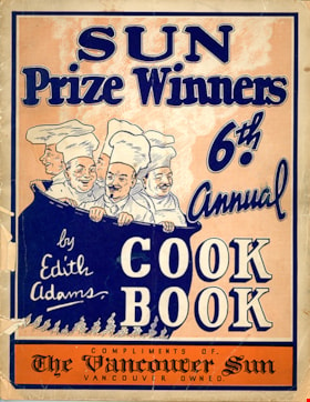
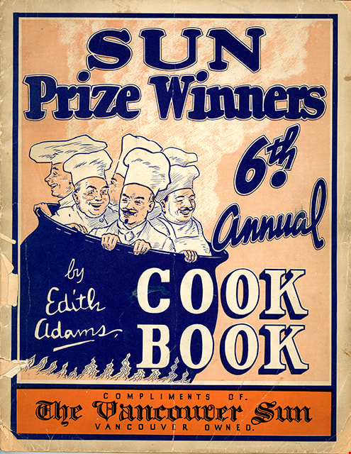
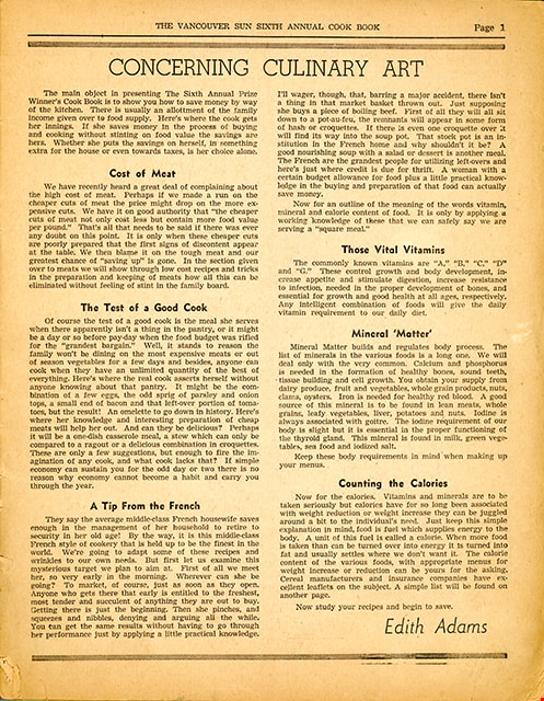
Edith Adams' sixth annual prize cookbook
https://search.heritageburnaby.ca/link/museumlibrary4903
- Repository
- Burnaby Village Museum
- Collection
- Special Collection
- Material Type
- Book
- Accession Code
- HV972.18.7
- Call Number
- 641.5 ADA
- Author
- Adams, Edith
- Place of Publication
- Vancouver
- Publisher
- The Vancouver Sun
- Publication Date
- 1948
- Physical Description
- 64 p. : ill. : 29 cm.
- Library Subject (LOC)
- Cooking
- Baking
- Food
- Formulas, recipes, etc.
- Edith Adams
- Cookbooks--1940-1949
- Object History
- This item was purchased from the St.James United Church.
- Notes
- "Sun prize winners 6th annual cook book" -- Cover
Images

Edmonds Street School site
https://search.heritageburnaby.ca/link/museumdescription11125
- Repository
- Burnaby Village Museum
- Date
- March 8, 1915
- Collection/Fonds
- Ronald G. Scobbie collection
- Description Level
- Item
- Physical Description
- 1 survey plan : blueprint on paper ; 56 x 54 cm
- Scope and Content
- Survey plan of "Edmonds Street School Site" "Burnaby Municipality" "Being Lots 28 and 29 of the Subdivision of Lot 30, Group 1, New Westminster District";
- Repository
- Burnaby Village Museum
- Collection/Fonds
- Ronald G. Scobbie collection
- Description Level
- Item
- Physical Description
- 1 survey plan : blueprint on paper ; 56 x 54 cm
- Material Details
- Scale: 4 feet = 1 inch
- Scope and Content
- Survey plan of "Edmonds Street School Site" "Burnaby Municipality" "Being Lots 28 and 29 of the Subdivision of Lot 30, Group 1, New Westminster District";
- Subjects
- Buildings - Schools
- Names
- Edmonds Community School
- Responsibility
- Burnett and McGugan B.C. Land Surveyors, New Westminster
- Geographic Access
- Edmonds Street
- Street Address
- 7641 Edmonds Street
- Accession Code
- BV003.83.5
- Access Restriction
- No restrictions
- Reproduction Restriction
- No known restrictions
- Date
- March 8, 1915
- Media Type
- Cartographic Material
- Historic Neighbourhood
- Edmonds (Historic Neighbourhood)
- Planning Study Area
- Edmonds Area
- Scan Resolution
- 440
- Scan Date
- 22-Dec-2020
- Scale
- 100
- Notes
- Title based on contents of plan
- Oath in bottom left corner reads: "I, D.J. McGugan...and did personally superintend the survey..." "...completed on the 8th day of March 1915"; signed "D.J. McGugan", notarized by "S.F. Mark" "sworn...12th Day of April 1915"
- handwritten on back, "1756"
Zoomable Images

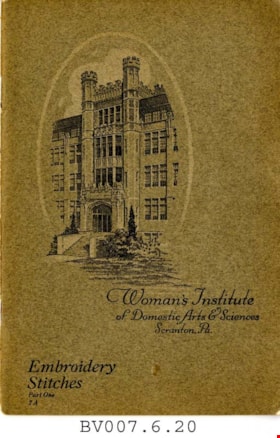
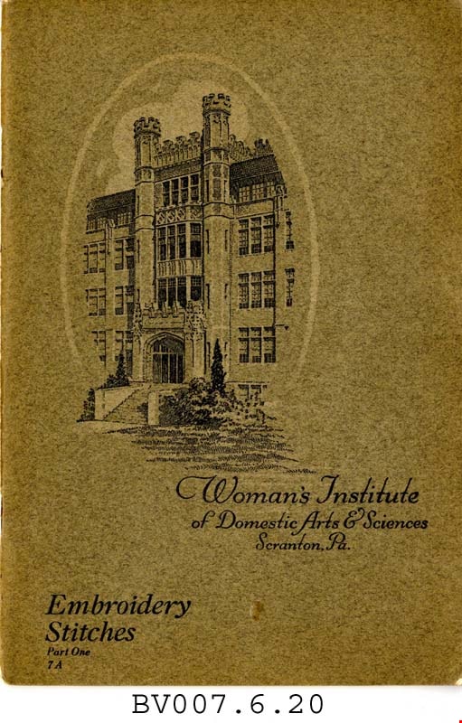
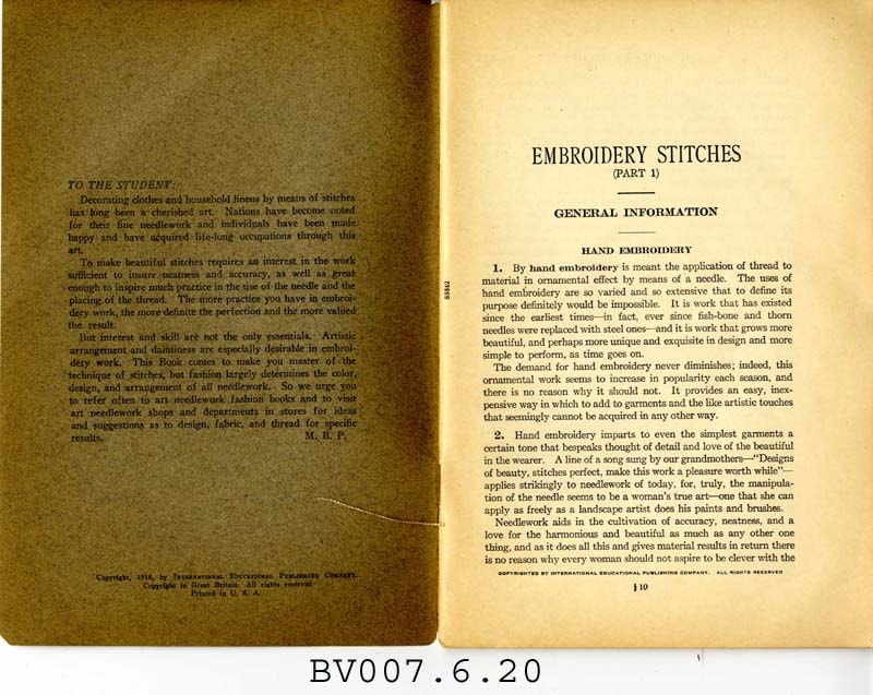
Embroidery stitches, part 1
https://search.heritageburnaby.ca/link/museumlibrary5006
- Repository
- Burnaby Village Museum
- Collection
- Special Collection
- Material Type
- Book
- Accession Code
- BV007.6.20
- Call Number
- 746.5 PIC
- Place of Publication
- Scranton, Pa.
- Publisher
- Woman's Institute of Domestic Arts and Sciences
- Publication Date
- 1921
- c1916
- Physical Description
- 44 p. : ill. : 23 cm.
- Library Subject (LOC)
- Embroidery--Study and teaching
- Stitches (Sewing)
- Subjects
- Documentary Artifacts - Booklets
- Object History
- Home sewing course used by Burnaby residents in the 1920's
- Notes
- Part 1 of 2
Images