Narrow Results By
Format
- Architectural Drawing 293
- Book 163
- Bylaws - Adopted 1545
- Bylaws - Repealed 64
- Cartographic Material 10
- Council - Committee Report 1752
- Council - Manager's Report 5018
- Council - Mayor/Councillor/Staff Report 171
- Council - Public Hearing Minutes 122
- Council - Regular Council Minutes 376
- Graphic Material 15
- Landmark Description
Decade
- 2020s 56
- 2010s 49
- 2000s 60
- 1990s
- 1980s 69
- 1970s 83
- 1960s 122
- 1950s 131
- 1940s 65
- 1930s 84
- 1920s 85
- 1910s 102
- 1900s 45
- 1890s 18
- 1880s 3
- 1870s 1
- 1860s 4
- 1850s 2
- 1840s 1
- 1830s 1
- 1820s 1
- 1810s 1
- 1800s 1
- 1790s 1
- 1780s 1
- 1770s 1
- 1760s 1
- 1750s 1
- 1740s 1
- 1730s 1
- 1720s 1
- 1710s 1
- 1700s 1
- 1690s 1
- 1680s 1
- 1670s 1
- 1660s 1
- 1650s 1
- 1640s 1
- 1630s 1
- 1620s 1
- 1610s 1
- 1600s 1
Subject
- Buildings - Civic - Museums 2
- Buildings - Commercial 1
- Buildings - Commercial - Grocery Stores 1
- Buildings - Commercial - Hardware Stores 1
- Buildings - Heritage 1
- Buildings - Recreational - Bandstands 1
- Documentary Artifacts - Photographs 1
- Education 1
- Events - Competitions 1
- Events - May Day 1
- Events - Parades 1
- Housing 1

Ardingley-Sprott Neighbourhood
https://search.heritageburnaby.ca/link/landmark797
- Repository
- Burnaby Heritage Planning
- Associated Dates
- 1955-2008
- Heritage Value
- The Ardingley-Sprott Neighbourhood is primarily non-residential and developed in the 1970s west of the Burnaby Lake park area. It grew to include a large recreational component in the form of the Burnaby Lake Sports Complex and playing fields.
- Historic Neighbourhood
- Burnaby Lake (Historic Neighbourhood)
- Planning Study Area
- Ardingley-Sprott Area
Images


Big Bend Neighbourhood
https://search.heritageburnaby.ca/link/landmark840
- Repository
- Burnaby Heritage Planning
- Associated Dates
- 1955-2008
- Heritage Value
- The Big Bend Neighbourhood in Burnaby maintained its status as an important agricultural area in the City in the years following 1955 and it also solidified its role as a prime industrial and commercial district. In 1972, the Big Bend Development Plan was adopted by Council and soon thereafter, approximately 620 acres of land were incorporated into the Agricultural Land Reserve. These lands have been set aside for agricultural and limited recreation purposes. By the 2000s, 160 acres of land were considered highly productive agricultural areas, and over 400 acres of land had been secured as parkland, including the Fraser Foreshore Park. The area also developed large commercial and industrial districts including those at Marine Way/Boundary, the Glenlyon Estates, Riverfront Business Park, Burnaby Business Park, and Glenwood Industrial Estates.
- Historic Neighbourhood
- Fraser Arm (Historic Neighbourhood)
- Planning Study Area
- Big Bend Area
Images


Brentwood Neighbourhood
https://search.heritageburnaby.ca/link/landmark780
- Repository
- Burnaby Heritage Planning
- Associated Dates
- 1955-2008
- Heritage Value
- Between 1955 and 2001, the Brentwood Neighbourhood developed into one of Burnaby's four official Town Centres. The Brentwood Town Centre serves the north-west sector of the Municipality, providing facilities such as commercial developments - of which the Brentwood Mall is the most significant. Under Burnaby's Residential Development Framework adopted by Council in 1981, the Town Centre also incorporated a full range of multi-housing types and forms in close relationship with their commercial facilities. In 1996, the City adopted the Brentwood Town Centre Development Plant to solidify the area as a focus of higher-density and higher-intensity residential and commercial opportunities, public transit and supporting leisure facilities.
- Planning Study Area
- Brentwood Area
Images


Burnaby Heights Neighbourhood
https://search.heritageburnaby.ca/link/landmark776
- Repository
- Burnaby Heritage Planning
- Associated Dates
- 1955-2008
- Heritage Value
- Up until the 1970s, this neighbourhood was known as Vancouver Heights. When a new park was created during that decade and named "Burnaby Heights Park," the name was gradually adopted by newcomers to the area. Today, you will hear residents refer to their neighbourhood as Burnaby Heights, Vancouver Heights, or just "The Heights." Throughout the 1960s and 1970s, the commercial district in this neighbourhood continued to grow and a Retail Merchants Association was formed which later became known as the Heights Merchants Association. The neighbourhood still retains a residential neighbourhood characteristic with an increasing number of apartment buildings and multi-family units being built over the past 20 years.
- Historic Neighbourhood
- Vancouver Heights (Historic Neighbourhood)
- Planning Study Area
- Burnaby Heights Area
Images


Burnaby Lake Neighbourhood
https://search.heritageburnaby.ca/link/landmark821
- Repository
- Burnaby Heritage Planning
- Associated Dates
- 1955-2008
- Heritage Value
- In 1966 Burnaby Lake was identified as a key potential regional park in the GVRD ’s Regional Park Plan for the Lower Mainland. The lake was to be developed for nature study, strolling, trail riding, canoeing, sightseeing and picnicking. It was formally recognized as a regional nature park in 1979, at which time the GVRD assumed management of the park through a lease agreement with the City of Burnaby. In 1993 Burnaby Lake was selected by the City of Burnaby to be included in Greater Vancouver ’s Green Zone, and was identified as a key component of the GVRD ’s Park and Outdoor Recreation System (PORS) for the Burrard/Peninsula/Richmond sector, which includes Burnaby, Vancouver, New Westminster, and Richmond.
- Historic Neighbourhood
- Burnaby Lake (Historic Neighbourhood)
- Planning Study Area
- Burnaby Lake Area
Images


Burnaby Mountain Neighbourhood
https://search.heritageburnaby.ca/link/landmark792
- Repository
- Burnaby Heritage Planning
- Associated Dates
- 1955-2008
- Heritage Value
- Burnaby Mountain had been dedicated as park in 1942, however the original park boundaries were reconsidered in 1952 with the development of the Trans Mountain Pipeline. Although the boundaries were adjusted to accommodate this project, significant conservation and park lands were left untouched. When, in 1962, the government of British Columbia determined the need for additional post-secondary facilities, Burnaby Mountain was chosen as the site for the new Simon Fraser University which opened in 1965. As early as 1964, the idea of establishing a townsite around the university had been discussed by Burnaby, but it was not until the mid-1990s that the idea came to fruition and by the early 2000s, a new housing development know as the UniverCity took shape on the mountain adjacent to the university.
- Historic Neighbourhood
- Barnet (Historic Neighbourhood)
- Planning Study Area
- Burnaby Mountain Area
Images


Burnaby South Secondary School and The B.C. Provincial School for the Deaf
https://search.heritageburnaby.ca/link/landmark844
- Repository
- Burnaby Heritage Planning
- Geographic Access
- Rumble Street
- Associated Dates
- 1993
- Heritage Value
- The original Burnaby South High School was replaced in 1993 and the new Burnaby South Secondary School and BC Provincial School for the Deaf was built at this location. This school was built with the latest technology and modern equipment to ensure it was fully accessible and offers integrated academic, social and recreational activities for its students.
- Historic Neighbourhood
- Alta Vista (Historic Neighbourhood)
- Planning Study Area
- Clinton-Glenwood Area
- Street Address
- 5455 Rumble Street
- Street View URL
- Google Maps Street View
Images


Cameron Neighbourhood
https://search.heritageburnaby.ca/link/landmark824
- Repository
- Burnaby Heritage Planning
- Associated Dates
- 1955-2008
- Heritage Value
- The Cameron Neighbourhood falls within the Lougheed Town Centre area - one of four Town Centres in Burnaby. The Cameron Neighbourhood - while containing significant high-density residential components - is also home to the Town Centre's office and commercial core. The Lougheed Mall is situated in this neighbourhood, which is served by the Millennium Line SkyTrain.
- Historic Neighbourhood
- Burquitlam (Historic Neighbourhood)
- Planning Study Area
- Cameron Area
Images


Capitol Hill Neighbourhood
https://search.heritageburnaby.ca/link/landmark781
- Repository
- Burnaby Heritage Planning
- Associated Dates
- 1955-2008
- Heritage Value
- The Capitol Hill Neighbourhood remained a primarily residential neighbourhood after the population boom of the 1950s and 1960s. The commercial focus remained the Hastings Street corridor, while the City of Burnaby moved to protect a conservation area on the north side of Capitol Hill and dedicated parkland throughout the 1970s and 1980s.
- Historic Neighbourhood
- Capitol Hill (Historic Neighbourhood)
- Planning Study Area
- Capitol Hill Area
Images


Cariboo-Armstrong Neighbourhood
https://search.heritageburnaby.ca/link/landmark825
- Repository
- Burnaby Heritage Planning
- Associated Dates
- 1955-2008
- Heritage Value
- The Cariboo-Armstrong Neighbourhood was mainly subdivided in the 1950s during the major building boom in Burnaby throughout the post-war years. Considered a primarily residential area, the neighbourhood has quick and convenient access to major highways and roads as well as being bordered to the north by the George Derby Conservation area.
- Historic Neighbourhood
- East Burnaby (Historic Neighbourhood)
- Planning Study Area
- Cariboo-Armstrong Area
Images


Cascade-Schou Neighbourhood
https://search.heritageburnaby.ca/link/landmark798
- Repository
- Burnaby Heritage Planning
- Associated Dates
- 1955-2008
- Heritage Value
- The Cascade-Schou neighbourhood, sometimes referred to as the Cascade Heights area, includes both the Burnaby General Hospital site, the Discovery Park facilities and is bordered on its eastern boundary by BCIT. Despite these health and science developments, the neighbourhood can still be considered to be a residential community. The housing stock includes single family homes as well as newer multi-family residences that developed throughout the 1980s and 1990s.
- Historic Neighbourhood
- Broadview (Historic Neighbourhood)
- Planning Study Area
- Cascade-Schou Area
Images


Clinton-Glenwood Neighbourhood
https://search.heritageburnaby.ca/link/landmark841
- Repository
- Burnaby Heritage Planning
- Associated Dates
- 1955-2008
- Heritage Value
- The primarily single-family subdivision and development in the Clinton-Glenwood Neighbourhood occurred during the building boom of the 1950s. Later development fell under the guidelines established in the Royal Oak Community Plan (adopted in 1999) and resulted in an increase in the number of multi-family units.
- Historic Neighbourhood
- Alta Vista (Historic Neighbourhood)
- Planning Study Area
- Clinton-Glenwood Area
Images


Dawson-Delta Neighbourhood
https://search.heritageburnaby.ca/link/landmark779
- Repository
- Burnaby Heritage Planning
- Associated Dates
- 1955-2008
- Heritage Value
- The Dawson-Delta neighbourhood in Burnaby developed into one of Burnaby's numerous industrial areas after 1955. The Eastbrook Executive Business Park opened in the 1970s and the Willingdon Green Business Centre includes buildings from the 1980s to the 2000s. Convenient access to major roads and highways fostered these developments which remain zoned for industrial uses to this day.
- Planning Study Area
- Dawson-Delta Area
Images


Douglas-Gilpin Neighbourhood
https://search.heritageburnaby.ca/link/landmark799
- Repository
- Burnaby Heritage Planning
- Associated Dates
- 1955-2008
- Heritage Value
- The Douglas-Gilpin Neighbourhood developed into a diverse area incorporating residential, business, educational and park districts in the period after 1955. The BCIT site was built in the early 1960s, shortly after the Burnaby Municipal Hall was located on Canada Way near Deer Lake in 1956. The construction of the Municipal Hall at this location fostered the creation of an administrative and business centre adjacent to the park, while the northern and central areas of the neighbourhood retained their primarily residential character.
- Historic Neighbourhood
- Burnaby Lake (Historic Neighbourhood)
- Planning Study Area
- Douglas-Gilpin Area
Images


Edmonds Street Neighbourhood
https://search.heritageburnaby.ca/link/landmark827
- Repository
- Burnaby Heritage Planning
- Associated Dates
- 1955-2008
- Heritage Value
- The Edmonds Street Neighbourhood is part of the larger Edmonds Town Centre - one of four Town Centres in Burnaby. This neighbourhood is considered to be primarily residential, but a strong local commercial component developed along Edmonds and Kingsway.
- Historic Neighbourhood
- Edmonds (Historic Neighbourhood)
- Planning Study Area
- Edmonds Area
Images


Garden Village Neighbourhood
https://search.heritageburnaby.ca/link/landmark800
- Repository
- Burnaby Heritage Planning
- Associated Dates
- 1955-2008
- Heritage Value
- Bounded by Moscrop Street to the north, Kingsway and Grange to the south, Willingdon to the east and Boundary Road to the west, the Garden Village Neighbourhood is characterised as a primarily residential area that is well-served due to its proximity to commercial, park and business centres. The north-east corner of the neighbourhood is a typical 1950s subdivision of mostly single family homes located on an irregular street pattern, while the remaining areas saw some transition to multi-family housing types throughout the 1970s and up to the current time.
- Historic Neighbourhood
- Central Park (Historic Neighbourhood)
- Planning Study Area
- Garden Village Area
Images


Government Road Neighbourhood
https://search.heritageburnaby.ca/link/landmark822
- Repository
- Burnaby Heritage Planning
- Associated Dates
- 1955-2008
- Heritage Value
- After the building boom of the 1950s, the Government Road Neighbourhood became characterised as a stable, single-family residential area. In addition to the residential component, the neighbourhood also has a significant industrial sector, along the north side of Burnaby Lake, and a commercial zone to the north along the Lougheed Highway.
- Historic Neighbourhood
- Lozells (Historic Neighbourhood)
- Planning Study Area
- Government Road Area
Images


Kingsway-Beresford Neighbourhood
https://search.heritageburnaby.ca/link/landmark805
- Repository
- Burnaby Heritage Planning
- Associated Dates
- 1955-2008
- Heritage Value
- Since the building boom of the 1950s, the Kingsway-Beresford Neighbourhood has maintained a residential character with the exception of the Kingsway corridor, which has become a primary commercial and light industrial sector.
- Historic Neighbourhood
- Edmonds (Historic Neighbourhood)
- Planning Study Area
- Kingsway-Beresford Area
Images


Lake City Neighbourhood
https://search.heritageburnaby.ca/link/landmark793
- Repository
- Burnaby Heritage Planning
- Associated Dates
- 1955-2008
- Heritage Value
- When Simon Fraser University opened in 1965, approximately sixteen industrial properties had been developed in the Lake City Industrial Park. In addition, significant tracts of land in the western portion had been pre-cleared and graded in anticipation of additional development, while most of the eastern half remained forested. Some of the early companies to locate in the area were Nabob Foods, Volkswagen Canada, British Columbia Television Broadcasting, Simpson Sears, and H.Y. Louie Company Limited. Both Imperial Oil and Shell Oil established petroleum storage and distribution facilities in the area. Initially a heavy industrial area, by 1979, single family neighbourhoods south of Lougheed Highway and west of Eagle Creek had been largely developed. By the mid1980's, the Burnaby 200 multi-family development along Forest Grove Drive had also been completed.
- Planning Study Area
- Lake City Area
Images


Lakeview-Mayfield Neighbourhood
https://search.heritageburnaby.ca/link/landmark830
- Repository
- Burnaby Heritage Planning
- Associated Dates
- 1955-2008
- Heritage Value
- Like many other areas of the City, the Lakeview-Mayfield Neighbourhood was subdivided during the 1950s post-war building boom. Pockets of newer homes were built in the 1970s, and the neighbourhood retained its character as a primarily residential area. The neighbourhood is bordered to the east by Robert Burnaby Park.
- Planning Study Area
- Lakeview-Mayfield Area
Images


Lochdale Neighbourhood
https://search.heritageburnaby.ca/link/landmark790
- Repository
- Burnaby Heritage Planning
- Associated Dates
- 1955-2008
- Heritage Value
- Despite the rapid growth witnessed in Burnaby in the post-war years, the Lochdale Neighbourhood was characterised as a close-knit primarily residential community. Although a commercial zone developed along Sperling and Hastings, single-family, duplex and multi-family homes were the primary buildings in the area. Basement suites and student accommodation also flourished in this neighbourhood after the creation of Simon Fraser University on Burnaby Mountain.
- Historic Neighbourhood
- Lochdale (Historic Neighbourhood)
- Planning Study Area
- Lochdale Area
Images


Lyndhurst Neighbourhood
https://search.heritageburnaby.ca/link/landmark823
- Repository
- Burnaby Heritage Planning
- Associated Dates
- 1955-2008
- Heritage Value
- The Lyndhurst Neighbourhood falls within the Lougheed Town Centre area - one of four Town Centres in Burnaby. The Lyndhurst Neighbourhood accounts for a significant portion of the residential component of the Town Centre. To the east of Stoney Creek Park, lies the Sullivan Heights single family subdivision which was built in the 1950s. To the west of the park, is a higher-density residential area consisting of multi-family buildings that were developed after 1974.
- Historic Neighbourhood
- Burquitlam (Historic Neighbourhood)
- Planning Study Area
- Lyndhurst Area
Images


Marlborough Neighbourhood
https://search.heritageburnaby.ca/link/landmark802
- Repository
- Burnaby Heritage Planning
- Associated Dates
- 1955-2008
- Heritage Value
- The Marlborough Neighbourhood is another residential area that was witness to rapid growth and subdivision during the 1950s and 1960s, creating primarily single-family housing stock. In the 1970s and 1980s, as the commercial district around Kingsway grew, so too did higher density housing projects such as townhomes and condominiums.
- Historic Neighbourhood
- Central Park (Historic Neighbourhood)
- Planning Study Area
- Marlborough Area
Images


Maywood Neighbourhood
https://search.heritageburnaby.ca/link/landmark801
- Repository
- Burnaby Heritage Planning
- Associated Dates
- 1955-2008
- Heritage Value
- Burnaby's Maywood Neighbourhood consists of the Metrotown Town Centre - one of four Town Centres in the City. Metrotown is one of the region's most developed and fastest growing centres. It is served by the first SkyTrain line developed in the mid-1980s and anchored by B.C.'s largest shopping and entertainment complex. As an older centre that has progressively added new developments over the years, Metrotown offers a range of housing types and tenures from three-storey walk-up apartments to modern residential towers.
- Historic Neighbourhood
- Central Park (Historic Neighbourhood)
- Planning Study Area
- Maywood Area
Images

McPherson Park Junior High School
https://search.heritageburnaby.ca/link/landmark710
- Repository
- Burnaby Heritage Planning
- Associated Dates
- 1951-1993
- Street View URL
- Google Maps Street View
- Repository
- Burnaby Heritage Planning
- Geographic Access
- Rumble Street
- Associated Dates
- 1951-1993
- Heritage Value
- In 1950, the Burnaby School Inspector reported: "the recent development of a number of large housing projects and the continuing growth of new homes in settled areas are compelling the Board to consider a building program of major proportions...now under construction, including McPherson Park with 21 classrooms." Enrolment in its first year was 686 students. In the late 1980s and early 1990s, junior high schools were replaced with expanded secondary schools encompassing grades 7 through 12; as a result, McPherson Park Junior High was closed and Burnaby South Secondary School opened.
- Historic Neighbourhood
- Alta Vista (Historic Neighbourhood)
- Planning Study Area
- Clinton-Glenwood Area
- Street Address
- 5455 Rumble Street
- Street View URL
- Google Maps Street View

Morley-Buckingham Neighbourhood
https://search.heritageburnaby.ca/link/landmark829
- Repository
- Burnaby Heritage Planning
- Associated Dates
- 1955-2008
- Heritage Value
- In the 1980 "Residential Neighbourhood Environment Study," the Morley-Buckingham Neighbourhood is described as "perhaps Burnaby's most prestigious residential area. The lots are larger than most other areas of the Municipality and this, along with the new expensive housing developed over the past 10 years, has created a very desirable residential neighbourhood...The older area of Buckingham lies at the lower edge of the slope and here the homes and streets are more uniform and aged between 20 and 25 years old...to the east of Canada Way lies...a cluster townhouse development."
- Historic Neighbourhood
- Burnaby Lake (Historic Neighbourhood)
- Planning Study Area
- Morley-Buckingham Area
Images


Oakalla Neighbourhood
https://search.heritageburnaby.ca/link/landmark804
- Repository
- Burnaby Heritage Planning
- Associated Dates
- 1955-2008
- Heritage Value
- The phasing out and demolition of the Oakalla Prison farm allowed for the planned development of the Oakalla Neighbourhood in the 1980s. By 1991, the City of Burnaby had adopted the Oakalla Development Plan which called for the transfer of land to the Deer Lake Park reserve as well as the creation of a new residential area consisting of multi-family housing types.
- Historic Neighbourhood
- Central Park (Historic Neighbourhood)
- Planning Study Area
- Oakalla Area
Images


Parkcrest-Aubrey Neighbourhood
https://search.heritageburnaby.ca/link/landmark782
- Repository
- Burnaby Heritage Planning
- Associated Dates
- 1955-2008
- Heritage Value
- After its initial subdivision and development in the early 1950s, the Parkcrest-Audrey Neighbourhood continued to be a primarily residential area. In the 1980 Residential Neighbourhood Environment Study, the area was characterised as a stable residential neighbourhood that was served by the major collector streets Holdom, Broadway, Parker and Kensington.
- Planning Study Area
- Parkcrest-Aubrey Area
Images


Richmond Park Neighbourhood
https://search.heritageburnaby.ca/link/landmark828
- Repository
- Burnaby Heritage Planning
- Associated Dates
- 1955-2008
- Heritage Value
- The Richmond Park Neighbourhood is part of the larger Edmonds Town Centre - one of four official Town Centres in the City. Richmond Park contains a residential subdivision that developed during the 1950s as well as a strong commercial and retail centre along Edmonds and Kingsway.
- Historic Neighbourhood
- Edmonds (Historic Neighbourhood)
- Planning Study Area
- Richmond Park Area
Images


Second Street Neighbourhood
https://search.heritageburnaby.ca/link/landmark826
- Repository
- Burnaby Heritage Planning
- Associated Dates
- 1955-2008
- Heritage Value
- Second Street had its origins in the 1910-1920 era and the Second Street Elementary School was built in 1928. Substantial new housing was built in the late 1940s and 1950s and infilling occurred during the 1960s and 1970s. By the 1980s, the neighbourhood was primarily a single family area with a small number of multi-family buildings.
- Historic Neighbourhood
- East Burnaby (Historic Neighbourhood)
- Planning Study Area
- Second Street Area
Images


Shadbolt Centre for the Arts
https://search.heritageburnaby.ca/link/landmark820
- Repository
- Burnaby Heritage Planning
- Geographic Access
- Deer Lake Avenue
- Associated Dates
- 1995
- Heritage Value
- The Shadbolt Centre for the Arts opened in 1995. The Shadbolt Centre was named after two Burnaby residents who dedicated a lifetime of support and cultivation of the arts locally, nationally and internationally. Doris and Jack Shadbolt resided in Burnaby for over 50 years until Jack's death in November 1998. Doris Shadbolt spent her life's work bringing the artist and the audience closer together through her writing and curatorial work. Jack Shadbolt was an internationally recognized Canadian painter. He was also an author and both received many awards including the Order of Canada. In keeping with the Shadbolts' generosity the arts, Jack Shadbolt donated two of his paintings to the Centre for permanent display.
- Historic Neighbourhood
- Burnaby Lake (Historic Neighbourhood)
- Planning Study Area
- Douglas-Gilpin Area
- Street Address
- 6450 Deer Lake Avenue
- Street View URL
- Google Maps Street View
Images


Shell Oil Company
https://search.heritageburnaby.ca/link/landmark675
- Repository
- Burnaby Heritage Planning
- Geographic Access
- Kensington Avenue
- Associated Dates
- ca. 1930-1993
- Heritage Value
- After considering several sites in the Greater Vancouver area, the Shell Oil Company chose 70 acres in North Burnaby with frontage of one third of a mile on Burrard Inlet. Shell proposed to build a four-million dollar plant that would employ up to 2000 - providing some relief in the middle of Burnaby's economic crisis of the Depression years. The site became known as the Shellburn Refinery and was in operation until 1993.
- Historic Neighbourhood
- Lochdale (Historic Neighbourhood)
- Planning Study Area
- Westridge Area
Images


South Slope Elementary School & The B.C. Provincial School for the Deaf
https://search.heritageburnaby.ca/link/landmark843
- Repository
- Burnaby Heritage Planning
- Geographic Access
- Watling Street
- Associated Dates
- 1992
- Heritage Value
- South Slope/B.C. School for the Deaf opened in 1992 and is one of the newer elementary schools in the City. The 2009 School Growth Plan notes that South Slope/BC School for the Deaf replaced the former Jericho Hill School for the Deaf in Vancouver.
- Historic Neighbourhood
- Alta Vista (Historic Neighbourhood)
- Planning Study Area
- Sussex-Nelson Area
- Street Address
- 4446 Watling Street
- Street View URL
- Google Maps Street View
Images


Sperling-Broadway Neighbourhood
https://search.heritageburnaby.ca/link/landmark789
- Repository
- Burnaby Heritage Planning
- Associated Dates
- 1955-2008
- Heritage Value
- By the 1970s, the Sperling-Broadway Neighbourhood was characterised as one of the Municipality's fastest growing residential areas. In 1980, it was estimated that slightly less than half of the homes were single-family residences, while the remaining development was taking the form of townhouse and high-rise apartments. The emphasis shifted back to single family housing during the construction of planned subdivisions such as the Camrose subdivision in the 1980s and the area remains primarily residential in nature. The neighbourhood is well-served by park facilities and is also home to the Burnaby Mountain Golf Course.
- Historic Neighbourhood
- Lochdale (Historic Neighbourhood)
- Planning Study Area
- Sperling-Broadway Area
Images


Stride Avenue Neighbourhood
https://search.heritageburnaby.ca/link/landmark845
- Repository
- Burnaby Heritage Planning
- Associated Dates
- 1955-2008
- Heritage Value
- The interurban link between New Westminster and Vancouver stimulated the early settlement of Stride Avenue. Infilling of the area took place in the early 1950s and the pace of development had slowed considerably by 1970. Duplexes became a popular feature in the decade between 1970 and 1980 and in the late 1980s, the neighbourhood was incorporated into the Edmonds Town Centre South plan.
- Historic Neighbourhood
- Edmonds (Historic Neighbourhood)
- Planning Study Area
- Stride Avenue Area
Images


Stride Hill Neighbourhood
https://search.heritageburnaby.ca/link/landmark846
- Repository
- Burnaby Heritage Planning
- Associated Dates
- 1955-2008
- Heritage Value
- The residential areas that are located within the Stride Hill Neighbourhood were primarily developed in the 1950s during Burnaby's post-war building boom. The area lying to the south of Byrne Creek Ravine Park was used as a municipal garbage dump until the 1960s and as a landfill site for yard waste disposal until the early 1990s at which point the area was incorporated into the Edmonds Town Centre Plan and the land was made into park and open space.
- Historic Neighbourhood
- Edmonds (Historic Neighbourhood)
- Planning Study Area
- Stride Hill Area
Images


Suncrest Neighbourhood
https://search.heritageburnaby.ca/link/landmark839
- Repository
- Burnaby Heritage Planning
- Associated Dates
- 1955-2008
- Heritage Value
- The Suncrest Neighbourhood is a small residential area south of Burnaby's Central Park. The Ocean View Burial Park takes up a large area of land in the north-east corner of this neighbourhood and the majority of the housing was built during the 1930-1960 period.
- Historic Neighbourhood
- Alta Vista (Historic Neighbourhood)
- Planning Study Area
- Suncrest Area
Images


Sussex-Nelson Neighbourhood
https://search.heritageburnaby.ca/link/landmark838
- Repository
- Burnaby Heritage Planning
- Associated Dates
- 1955-2008
- Heritage Value
- The Sussex-Nelson Neighbourhood is located just south of Metrotown and in 1980 was characterised as the most populated of all of Burnaby's Planning Study areas. The area immediately south of Metrotown was initially developed as post-war 1950s housing stock, while the sector south of Rumble was developed after the 1960s and 1970s as single-family housing.
- Historic Neighbourhood
- Alta Vista (Historic Neighbourhood)
- Planning Study Area
- Sussex-Nelson Area
Images


West Central Valley Neighbourhood
https://search.heritageburnaby.ca/link/landmark778
- Repository
- Burnaby Heritage Planning
- Associated Dates
- 1955-2008
- Heritage Value
- The West Central Valley Neighbourhood is home to the Bridge Business Park and is a primarily industrial neighbourhood. Similar to the adjacent Dawson-Delta Neighbourhood, West Central Valley offers businesses convenient access to major roads and highways.
- Historic Neighbourhood
- Broadview (Historic Neighbourhood)
- Planning Study Area
- West Central Valley Area
Images


Westridge Neighbourhood
https://search.heritageburnaby.ca/link/landmark791
- Repository
- Burnaby Heritage Planning
- Associated Dates
- 1955-2008
- Heritage Value
- The Westridge Neighbourhood is effectively separated into two areas by Inlet Drive. To the west of the highway lies a typical 1950s subdivision of single-family homes, while to the east is a newer (1970s) subdivision featuring larger lots and some low-rise units. In the 1980 Residential Neighbourhood Environment Study, Westridge was characterised as a stable community with little need for direct Municipal involvement in growth and development.
- Historic Neighbourhood
- Lochdale (Historic Neighbourhood)
- Planning Study Area
- Westridge Area
Images


Willingdon Heights Neighbourhood
https://search.heritageburnaby.ca/link/landmark777
- Repository
- Burnaby Heritage Planning
- Associated Dates
- 1955-2008
- Heritage Value
- The convenient location of Willingdon Heights to the Trans Canada Highway, Lougheed Highway and Hastings Street has fostered its development as a primarily residential commuter neighbourhood. Characterised in the post-World War Two period by predominantly single-family developments, the neighbourhood has retained this identity despite some higher density apartment buildings now found there.
- Planning Study Area
- Willingdon Heights Area
Images


Windsor Neighbourhood
https://search.heritageburnaby.ca/link/landmark803
- Repository
- Burnaby Heritage Planning
- Associated Dates
- 1955-2008
- Heritage Value
- The Windsor Neighbourhood comprises a number of different districts with different characteristics. To the north, stretching to the border of the Deer Lake Park, is the primarily residential area that was developed after the building boom of the 1950s and now consists of a mix of single-family and multi-family housing. To the south, from Kingsway to the Skytrain line, an industrial area was maintained along with a significant commercial corridor along Kingsway. In recent years, the growth and development of this area has been guided by the Royal Oak Community Plan adopted by Council in 1999.
- Planning Study Area
- Windsor Area
Images

![1912 Parker Carousel Restoration 1991 to 1994, [between 1991 and 1994] thumbnail](/media/hpo/_Data/_BVM_Moving_Images/2020_0012_0001_001.jpg?width=280)
1912 Parker Carousel Restoration 1991 to 1994
https://search.heritageburnaby.ca/link/museumdescription12334
- Repository
- Burnaby Village Museum
- Date
- [between 1991 and 1994]
- Collection/Fonds
- Burnaby Village Museum fonds
- Description Level
- Item
- Physical Description
- 1 video recording (mp4) file (1 hr., 9 min., 44 sec.) : digital, 29 fps, col., sd., stereo
- Scope and Content
- Item consists of unedited film footage titled “1912 Parker Carousel / Restoration / 1991 to 1994" by Alex Matches. Film footage documents various stages of restoration of the carousel including, the carousel horses, the "doghouse" and Wurlitzer. There is some narration by the camera person but soun…
- Repository
- Burnaby Village Museum
- Collection/Fonds
- Burnaby Village Museum fonds
- Description Level
- Item
- Physical Description
- 1 video recording (mp4) file (1 hr., 9 min., 44 sec.) : digital, 29 fps, col., sd., stereo
- Material Details
- Segments are marked by date
- Scope and Content
- Item consists of unedited film footage titled “1912 Parker Carousel / Restoration / 1991 to 1994" by Alex Matches. Film footage documents various stages of restoration of the carousel including, the carousel horses, the "doghouse" and Wurlitzer. There is some narration by the camera person but sound quality is poor and segments contain ambient noise. The footage is divided into segments marked by dates, visible in the bottom right corner. Dates range between April 1991 and March 1993. Some of this unedited footage could have been used for the Burnaby Village Museum film "Labour of Love - The Saving of Number 119" (see BV020.4.28). 00:00 - 03:23: Apr. 20, 1991 : Volunteers and staff working on the restoration of carousel horses in the Texaco warehouse. They are busy scraping away old paint. Various horses are suspended on frames while some are laid on their sides on work benches. 03:24 - 06:15: Nov. 2 1991 : Volunteers and staff working on scraping and sanding away old layers of paint on carousel horses in the Texaco warehouse. Some horses are getting repairs. A little narrative coming from camera operator but mostly ambient sound. Pieces of the "doghouse" are also visible. 06:16 - 08:20 : Dec. 28 1991 : Horses are in various stages of restoration and repair inside the Texaco warehouse. 08:21 - 09:40 : Dec. 28, 1991 : Volunteers are gathered in a lunch room taking a break. Views of carousel horses in another room of the warehouse which have been applied with a sealer. The Worlitzer is also visible during a stage of restoration. Camera pans outside the Texaco warehouse located at the base of Burnaby Mountain on Burrard Inlet. 09:42 - 11:03 : Mar. 31 1992 : Some horses have been sealed with a clear coating and others have been applied with a white undercoat primer. 11:04 - 17:36 : Apr. 11 1992 : Horses with primer undercoat, views of the Wurlitzer under restoration as well as panels of the "doghouse" 17:37 - 18:18 : May 30, 1992 : Wurlitzer and painted horses 18:19 - 21:53 : Jul. 25 1992 : Volunteers are working on painting carousel horses, various parts of carousel including the floor decks are also visible. 21:54 - 25:39 : Sept. 19 1992 : Volunteers are working on painting carousel horses and pieces of the "doghouse", mirrors are being inserted, decking is varnished. 25:40 - 30:39 : Oct. 10 1992 : Views of carousel horses with coats of primer, freshly painted horses, segments of the varnished deck, volunteers painting segments of the "doghouse" and finished horses. 30:41 - 41:30 : Nov. 14 1992 : Loading finished horses from warehouse into van to transport to museum. Photography shoot in warehouse of completed horses, mounting horses on poles at museum. Don Wrigley assisting. A view of the Carousel building at Burnaby Village Museum under construction. 41:32 - 47:27 : Nov. 20 1992 : Painted horses - details; parts of the carousel gears, poles etc 47:28 - 50:00 : Footage recorded from an exerpt from Red Robinson's Classic theatre where he narrates about the History and Saving of the Carousel. 50:02 - 1:03 : Mar. 15 1993 : Completed carousel inside the carousel building at Burnaby Village Museum, volunteers and staff are putting together the finishing touches for the opening day. Volunteers are gathering inside and seating themselves on horses around the carousel for the Volunteers Grand Opening. The carousel begins to move with some volunteers riding various horses while the Wurlitzer plays in the background. 1:04:10 - 1:09:44 : March 27 1993 - Carousel is officially opened. Includes interviews by curator Colin Stevens with Friends of Carousel president, Don Wrigley and Dave Zieffert, Restorator of the Wurlitzer and Gordie Ironside who helped work with the restoration. Gordie demonstrates how each carousel horse was built using a prototype that was built for educational purposes.
- Creator
- Matches, Alex
- Subjects
- Recreational Devices - Carousels
- Names
- Lower Mainland Association of the Friends of the Vancouver Carousel
- C.W. Parker no. 119 Carousel
- Burnaby Village Museum
- Accession Code
- BV020.12.1
- Access Restriction
- No restrictions
- Reproduction Restriction
- May be restricted by third party rights
- Date
- [between 1991 and 1994]
- Media Type
- Moving Images
- Related Material
- BV020.4.28
- Notes
- Transcribed title taken from film footage
Images
![1912 Parker Carousel Restoration 1991 to 1994, [between 1991 and 1994] thumbnail](/media/hpo/_Data/_BVM_Moving_Images/2020_0012_0001_001.jpg)
Video
1912 Parker Carousel Restoration 1991 to 1994, [between 1991 and 1994]
1912 Parker Carousel Restoration 1991 to 1994, [between 1991 and 1994]
https://search.heritageburnaby.ca/media/hpo/_Data/_BVM_Moving_Images/2020_0012_0001_001.mp4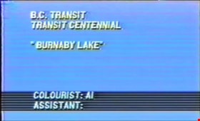
B.C. Transit Centennial: Chilliwack and Fraser Valley Way Points
https://search.heritageburnaby.ca/link/museumdescription10100
- Repository
- Burnaby Village Museum
- Date
- 1990
- Collection/Fonds
- Burnaby Village Museum Film and Video collection
- Description Level
- Item
- Physical Description
- 1 videocassette (2 hr., 3 min., 4 sec.) : VHS, 29 fps, col., sd., stereo
- Scope and Content
- Historical film excerpts of B.C. Electric Lower Mainland trams on their various routes as well as an excursion train shot by Ken Hodgson in 1948/1949 and in 1950. Film footage is part of the B.C. Transit Centennial and includes a voice over commentary by Frank Horne and Vic Sharman. Frank and Vic w…
- Repository
- Burnaby Village Museum
- Collection/Fonds
- Burnaby Village Museum Film and Video collection
- Description Level
- Item
- Physical Description
- 1 videocassette (2 hr., 3 min., 4 sec.) : VHS, 29 fps, col., sd., stereo
- Material Details
- VHS video tape in slip case "1950 / BCE Rail Archives / Burn. Lake / Central Park / Oak-Marpole / Skagit / Tourist Ride Chilliwack" hand written on label.
- "Railway Pictures Inc." "Chilliwack and Fraser Valley Way Points"- Directed and Produced by Ken Hodgson
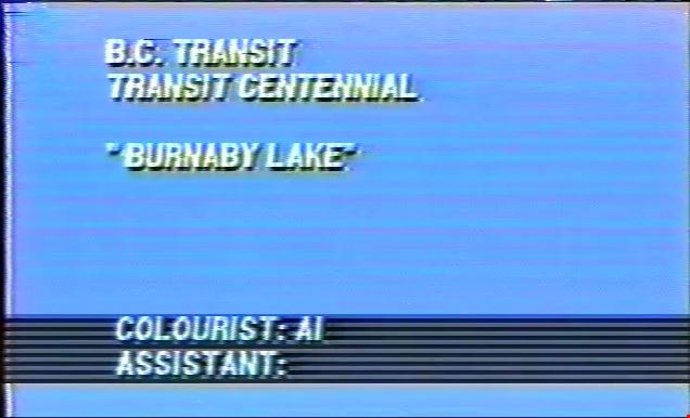
- Opening title card on film excerpt reads: "GASTOWN POST & TRANSFER / B.C. TRANSIT CENTENNIAL / "BURNABY LAKE" / COLOURIST: Al / ASSISTANT"
- Scope and Content
- Historical film excerpts of B.C. Electric Lower Mainland trams on their various routes as well as an excursion train shot by Ken Hodgson in 1948/1949 and in 1950. Film footage is part of the B.C. Transit Centennial and includes a voice over commentary by Frank Horne and Vic Sharman. Frank and Vic worked as motormen on the BC Electric Railway. The trams are shown travelling through Vancouver, Burnaby, New Westminster, Surrey, North Delta, Langley, Abbotsford, and Chilliwack. The excursion train was filmed in Washington State, U.S.A. The narrators give commentary, describing the routes, landmarks of the past and present, the various kinds of trams and buses seen, drivers’ protocols, and historical information. Summary: 0:00 – 16:18: Title card reads "Gastown Post & Transfer" "BC Transit / Transit Centennial" "Burnaby Lake". Footage of a Burnaby Lake Line tram from the Carrall Street depot in Vancouver to the Sapperton terminus, New Westminster. 16:18 – 30:20: Title card reads "Gastown Post & Transfer" "BC Transit / Transit Centennial" "Central Park". Footage of a Central Park Line tram from the New Westminster depot to the Carrall Street depot. 30:20 - 40:53: Title card reads "Gastown Post & Transfer" "BC Transit / Transit Centennial" "Oak St. Line". Footage of an Oak St. Line tram from Victory Square to the Marpole terminus. 40:53 – 49:41:Title card reads "Gastown Post & Transfer" "BC Transit / Transit Centennial" "Fairview Belt Line 1". Although the title card reads “Fairview Belt Line 1”, this is an observation car from the intersection of Cambie and Hastings Streets to the Dunbar terminus and back to Victory Square by way of Granville Street. 49:41 – 57:34: Title card reads "Gastown Post & Transfer" "Skagit River Railway". Footage of Skagit River Railway, Washington, U.S.A., from Newhalem to the Diablo Dam powerhouse and lift, then to the boat which crossed the lake to Ross Dam 57:34 – 1:12:54: the title card reads “Observation Car Trip” but this is a Fairview Belt Line tram on the outer line run, from Broadway and Main on a complete loop through downtown. 1:12:54 – 1:15:49: Title reads: "Railway Pictures Inc." "Chilliwack and Fraser Valley Way Points" with voice over by Frank Horne and Vic Sharman, directed and produced by Ken Hodgson. Opens with Vic Sharman, his wife and family at Liverpool Old Station (Scott Road) preparing for the last trip on the Chilliwack Line October, 1950. The last Fraser Valley Line tram from Vancouver meets the last tram from Chilliwack in Langley for the last-day-of-service ceremony, October 1, 1950 1:15:49 – 1:56:10: Footage of a Fraser Valley line tram from the Carrall Street depot, leaving in sections which meet at the New Westminster depot and continue on together to Chilliwack Depot, then return to New Westminster. 1:56:10 – 2:03:04: Footage of decommissioning of the system: removal of the tram power lines, scrapping and burning of tram cars at the Kitsilano yard.
- History
- Film footage shot in 1948 -1949 and 1950 and voice-over recorded in 1990. The end-of-service ceremony film is dated October 1, 1950.
- Creator
- Hodgson, Kenneth A. "Ken"
- Publisher
- Railway Pictures Incorporated
- Accession Code
- BV012.37.12
- Access Restriction
- No restrictions
- Reproduction Restriction
- May be restricted by third party rights
- Date
- 1990
- Media Type
- Moving Images
- Related Material
- See also BV020.5.1060
- Notes
- Title based on contents of film
- Other organizations participated in the filming of the footage: B.C. Transit and Gastown Post & Transfer.
- Film is narrated by Frank Horn and Vic Sharman
- VHS is a copy created from original excerpts
Images
Video
B.C. Transit Centennial: Chilliwack and Fraser Valley Way Points, 1990
B.C. Transit Centennial: Chilliwack and Fraser Valley Way Points, 1990
https://search.heritageburnaby.ca/media/hpo/_Data/_BVM_Moving_Images/2012_0037_0012_001.mp4
Bell's Dry Goods
https://search.heritageburnaby.ca/link/museumdescription14036
- Repository
- Burnaby Village Museum
- Date
- 11 Aug. 1994
- Collection/Fonds
- Burnaby Village Museum fonds
- Description Level
- Item
- Physical Description
- 1 videocassette (62 min., 50 sec.) : VHS, col., sd.
- Scope and Content
- Film footage of an interview conducted and recorded by Burnaby Village Museum curator Colin Stevens with Burnaby residents gathered inside of Bell's Dry Goods store on the site of Burnaby Village Museum. Burnaby residents were customers and friends of Mr. and Mrs. Bell and included: Jim Agnew; Mary…
- Repository
- Burnaby Village Museum
- Collection/Fonds
- Burnaby Village Museum fonds
- Subseries
- Bell's research files subseries
- Description Level
- Item
- Physical Description
- 1 videocassette (62 min., 50 sec.) : VHS, col., sd.
- Scope and Content
- Film footage of an interview conducted and recorded by Burnaby Village Museum curator Colin Stevens with Burnaby residents gathered inside of Bell's Dry Goods store on the site of Burnaby Village Museum. Burnaby residents were customers and friends of Mr. and Mrs. Bell and included: Jim Agnew; Mary Agne; May and Bill Long; Mel Coutts; Lois Coutts; Isobel Coutts and Aubrey Coutts. These residents all lived in the area of the building and knew the owners between 1920 and 1950. Residents recall the layout and furnishings of the interior of the building when it was operated as Bell's Dry Goods (1925 to 1937), Jean's Grocery Store [?], Whitechurch Hardware (1937-1973). Colin Stevens is particularly interested in gathering information on the layout and furnishings in Bell's since the museum intends to restore the building and display to the 1920s era.
- Creator
- Stevens, Colin
- Subjects
- Buildings - Commercial
- Buildings - Commercial - Grocery Stores
- Buildings - Commercial - Hardware Stores
- Names
- Agnew, Jim
- Agnew, Mary
- Coutts, Mel
- Coutts, Lois Hollands
- Coutts, Aubrey
- Coutts, Isobel
- Long, May Walker
- Long, Bill
- Stevens, Colin
- Accession Code
- BV020.5.737
- Access Restriction
- Restricted access
- Reproduction Restriction
- May be restricted by third party rights
- Date
- 11 Aug. 1994
- Media Type
- Moving Images
- Notes
- Title based on contents
- Label on videocassette reads: "Bells' Dry Goods" / "Interview with People / who used to shop there / at / "Bells' Dry Goods" / 6th St. Burnaby / 1994 Aug 11 Colin Stevens"
Images

Bell's research files subseries
https://search.heritageburnaby.ca/link/museumdescription17005
- Repository
- Burnaby Village Museum
- Date
- 1996-1997
- Collection/Fonds
- Burnaby Village Museum fonds
- Description Level
- Subseries
- Physical Description
- textual records + video recording + photographs : copy prints
- Scope and Content
- Subseries consists of historical research pertaining to the history of the Bell's Dry Goods store and Whitechurch Hardware store and their owners. Series includes research notes, correspondence, reports and interviews.
- Repository
- Burnaby Village Museum
- Collection/Fonds
- Burnaby Village Museum fonds
- Subseries
- Bell's research files subseries
- Description Level
- Subseries
- Physical Description
- textual records + video recording + photographs : copy prints
- Scope and Content
- Subseries consists of historical research pertaining to the history of the Bell's Dry Goods store and Whitechurch Hardware store and their owners. Series includes research notes, correspondence, reports and interviews.
- Names
- Burnaby Village Museum
- Accession Code
- BV020.5
- Access Restriction
- Subject to FIPPA
- Reproduction Restriction
- Reproductions subject to FIPPA
- Date
- 1996-1997
- Media Type
- Textual Record
- Moving Images
- Photograph
- Notes
- Title based on content of subseries

Blacksmith Shop with Jeff Chenatte
https://search.heritageburnaby.ca/link/museumdescription12344
- Repository
- Burnaby Village Museum
- Date
- 1998 (date of original), digitized in 2020
- Collection/Fonds
- Burnaby Village Museum fonds
- Description Level
- Item
- Physical Description
- 1 videocassette (32 min., 59 sec.) : VHS, 29 fps, col. , sd.
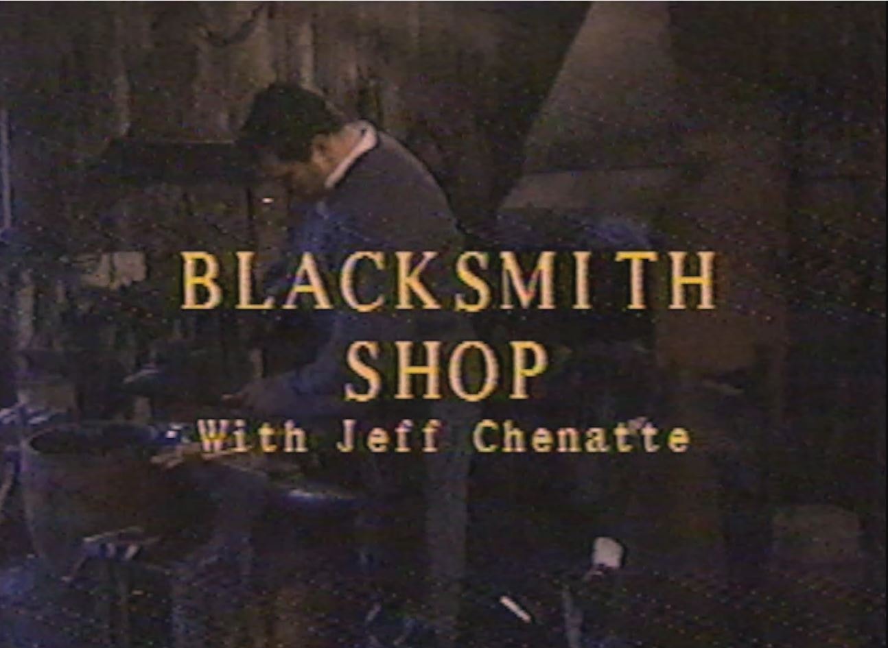
- Scope and Content
- Film, titled "Blacksmith Shop with Jeff Chenatte" is an instructional training video about the fundamentals of Blacksmithing taking place at the Burnaby Village Museum. The film is narrated by experienced Blacksmith Jeff Chenatte who provides historic background in the art of blacksmithing and demo…
- Repository
- Burnaby Village Museum
- Collection/Fonds
- Burnaby Village Museum fonds
- Description Level
- Item
- Physical Description
- 1 videocassette (32 min., 59 sec.) : VHS, 29 fps, col. , sd.
- Material Details
- Film opens with SMPTE colour bars
- Scope and Content
- Film, titled "Blacksmith Shop with Jeff Chenatte" is an instructional training video about the fundamentals of Blacksmithing taking place at the Burnaby Village Museum. The film is narrated by experienced Blacksmith Jeff Chenatte who provides historic background in the art of blacksmithing and demonstrates detailed step by step instructions in how to use the forge and various tools and machinery in the Village Museum’s Blacksmith Shop.
- Creator
- Kroon, Morgan H.
- Chenatte, Jeff
- Responsibility
- Burnaby Village Museum
- Accession Code
- BV020.4.34
- Access Restriction
- No restrictions
- Reproduction Restriction
- May be restricted by third party rights
- Date
- 1998 (date of original), digitized in 2020
- Media Type
- Moving Images
- Photographer
- Kroon, Morgan H.
- Notes
- Transcribed title from film
- Film credits read: “Directed Shot & Edited / by Morgan H Kroon / Written by / Jeff Chenatte / Thanks to / Jeff Chenatte / Maurice Guibord / Shadbolt Centre / Cineworks / Burnaby Village Museum”; “Burnaby Village Museum / Education Dept 1998”
Images
Video
Blacksmith Shop with Jeff Chenatte, 1998 (date of original), digitized in 2020
Blacksmith Shop with Jeff Chenatte, 1998 (date of original), digitized in 2020
https://search.heritageburnaby.ca/media/hpo/_Data/_BVM_Moving_Images/2020_0004_0034_001.m4vBurnaby at 100: Images and Voices
https://search.heritageburnaby.ca/link/archivedescription64772
- Repository
- City of Burnaby Archives
- Date
- 1992
- Collection/Fonds
- Burnaby Historical Society fonds
- Description Level
- Item
- Physical Description
- 1 video cassette (21 min., 59 sec.) : b&w, col., sd.
- Scope and Content
- Item is a VHS tape entitled “Burnaby at 100 / Images and Voices" produced by SFU. The video includes material drawn from the Burnaby Image Bank and participants in the Oral History project. An introduction is provided by SFU Archivist, Jim Ross with voice narration by Bill Lewarane, Merril Gordon a…
- Repository
- City of Burnaby Archives
- Date
- 1992
- Collection/Fonds
- Burnaby Historical Society fonds
- Subseries
- Burnaby at 100 Video subseries
- Physical Description
- 1 video cassette (21 min., 59 sec.) : b&w, col., sd.
- Material Details
- Video Home System (VHS) tape
- Description Level
- Item
- Record No.
- 578-001
- Access Restriction
- Open Access
- Reproduction Restriction
- May be restricted by third party rights
- Accession Number
- BHS2004-13
- Scope and Content
- Item is a VHS tape entitled “Burnaby at 100 / Images and Voices" produced by SFU. The video includes material drawn from the Burnaby Image Bank and participants in the Oral History project. An introduction is provided by SFU Archivist, Jim Ross with voice narration by Bill Lewarane, Merril Gordon and Ed Apps. Background music by "Solid Comfort" was recorded by Kurtis Vanel with additional footage by Chris Hildred.
- Media Type
- Moving Images
- Notes
- Transcribed title
- Variations on the title for this project include; "Burnaby at 100: Images and Voices" and "Burnaby at 100: Visions and Voices
- Item came with MSS131-003, a program titled, "[t]he 'Images of Burnaby' Travelling Photographic Exhibition / In Honour of Burnaby's Centennial Year"
Burnaby at 100 Video subseries
https://search.heritageburnaby.ca/link/archivedescription88276
- Repository
- City of Burnaby Archives
- Date
- 1992
- Collection/Fonds
- Burnaby Historical Society fonds
- Description Level
- Subseries
- Physical Description
- 1 video cassette
- Scope and Content
- Subseries consists of a video titled "Burnaby at 100: Images and Voices of Burnaby" created by the SFU/Burnaby Centennial Committee to celebrate Burnaby's centennial anniversary. The video brought together photographs from the Burnaby Image Bank and a selection of interviewees from the Oral Histor…
- Repository
- City of Burnaby Archives
- Date
- 1992
- Collection/Fonds
- Burnaby Historical Society fonds
- Subseries
- Burnaby at 100 Video subseries
- Physical Description
- 1 video cassette
- Description Level
- Subseries
- Access Restriction
- Open Access
- Accession Number
- BHS2004-13
- Scope and Content
- Subseries consists of a video titled "Burnaby at 100: Images and Voices of Burnaby" created by the SFU/Burnaby Centennial Committee to celebrate Burnaby's centennial anniversary. The video brought together photographs from the Burnaby Image Bank and a selection of interviewees from the Oral History project. The video and Burnaby Image Bank collection were buried together in the City of Burnaby's time capsule which was mounted at City Hall.
- Media Type
- Moving Images
- Creator
- SFU/Burnaby Centennial Committee
- Notes
- Title based on contents of subseries
Burnaby Centennial Committee subseries
https://search.heritageburnaby.ca/link/archivedescription96371
- Repository
- City of Burnaby Archives
- Date
- 1989-1993
- Collection/Fonds
- City Council and Office of the City Clerk fonds
- Description Level
- Subseries
- Physical Description
- 15 folders of textual records + 2 audio tape recordings + 6 photograph albums of newspaper clippings + 1 videocassette tape
- Scope and Content
- Subseries consists of committee records for the Burnaby Centennial Committee including minutes, correspondence, news clippings, a recording of the Burnaby anthem, and video of the Burnaby Centennial Dinner.
- Repository
- City of Burnaby Archives
- Date
- 1989-1993
- Collection/Fonds
- City Council and Office of the City Clerk fonds
- Series
- Council Committee series
- Subseries
- Burnaby Centennial Committee subseries
- Physical Description
- 15 folders of textual records + 2 audio tape recordings + 6 photograph albums of newspaper clippings + 1 videocassette tape
- Description Level
- Subseries
- Scope and Content
- Subseries consists of committee records for the Burnaby Centennial Committee including minutes, correspondence, news clippings, a recording of the Burnaby anthem, and video of the Burnaby Centennial Dinner.
- History
- The Burnaby Centennial Committee was established June 5, 1989. The Committee was responsible for overseeing the celebration of Burnaby's centennial anniversary in 1992. This committee disbanded in 1993.