Narrow Results By
Subject
- Animals 1
- Animals - Birds 1
- Buildings - Religious - Churches 10
- Buildings - Schools 16
- Businesses - Real Estate Agencies 1
- Documentary Artifacts 3
- Documentary Artifacts - Booklets 4
- Documentary Artifacts - Books 2
- Documentary Artifacts - Leaflets 1
- Emergency Measures - Civil Defence 1
- First Nations reserves - British Columbia 3
- Foods 1
Creator
- Adams, Edith 1
- British Columbia Underwriters' Association 1
- Burnett and McGugan B.C. Land Surveyors, New Westminster 5
- Burnett, Geoffrey K. 5
- Burnett & McGugan, Engineers and Surveyors 20
- Canada. Office of the Director of Civil Air Raid Precautions 1
- Coast Map and Blue Print Co. 1
- Cody, Henry John, 1868-1951 3
- D. Jayne and Son 1
- Finley, John H. (John Huston), 1863-1940 9
- Garden, Hermon and Burwell 2
- Gauvreau, Narcisse B. 1
Person / Organization
- All Saints Anglican Church 1
- Armstrong Avenue School 1
- Barnet School 1
- Broadview Presbyterian Church 1
- Burnett, Geoffrey K. 2
- Chapman, Nina Christina Atkinson 1
- Corsbie, Joseph Hardcastle-Cumberland "Joe" 1
- Douglas Road School 1
- Dundonald United Church 1
- East Burnaby Methodist Church, 1904-1925 1
- Edmonds Community School 2
- Gilmore Avenue School 1

The book of knowledge : the children's encyclopaedia, volume i
https://search.heritageburnaby.ca/link/museumlibrary668
- Repository
- Burnaby Village Museum
- Collection
- Special Collection
- Material Type
- Book
- Accession Code
- BV985.3668.1
- Call Number
- 032 MEE v. 1 1918
- Contributor
- Mee, Arthur, 1875-1943
- Thompson, Holland, 1873-1940
- Finley, John H. (John Huston), 1863-1940
- Place of Publication
- New York
- Publisher
- The Grolier Society
- Publication Date
- c1918
- Series
- The Book of Knowledge, v. 1
- Physical Description
- x, 334 p. : ill. : 25 cm.
- Library Subject (LOC)
- Encyclopedias and dictionaries
- Children's encyclopædias and dictionaries
- Notes
- "Editors-in-chief Arthur Mee...Holland Thompson..." -- Title page
- "With an introduction by John H. Finley..." -- Title page
- Contributor's full name and dates: Finley, John H. (John Huston), 1863-1940
- page 1-334
- Volume 1 of 20
Images

The book of knowledge : the children's encyclopaedia, volume ii
https://search.heritageburnaby.ca/link/museumlibrary669
- Repository
- Burnaby Village Museum
- Collection
- Special Collection
- Material Type
- Book
- Accession Code
- BV985.3668.2
- Call Number
- 032 MEE v.2 1918
- Contributor
- Mee, Arthur, 1875-1943
- Thompson, Holland, 1873-1940
- Finley, John H. (John Huston), 1863-1940
- Place of Publication
- New York
- Publisher
- The Grolier Society
- Publication Date
- c1918
- Series
- The Book of Knowledge, v. 2
- Physical Description
- 335-660 p. : ill. : 25 cm.
- Library Subject (LOC)
- Encyclopedias and dictionaries
- Children's encyclopædias and dictionaries
- Notes
- "Editors-in-chief Arthur Mee...Holland Thompson..." -- Title page
- "With an introduction b John H. Findley..." -- Title page
- Contributor's full name and dates: Finley, John H. (John Huston), 1863-1940
- pages 335-660
- volume 2 of 20
Images
The book of knowledge : the children's encyclopaedia, volume iii
https://search.heritageburnaby.ca/link/museumlibrary670
- Repository
- Burnaby Village Museum
- Collection
- Special Collection
- Material Type
- Book
- Accession Code
- BV985.3668.3
- Call Number
- 032 MEE v. 3 1918
- Contributor
- Mee, Arthur, 1875-1943
- Thompson, Holland, 1873-1940
- Finley, John H. (John Huston), 1863-1940
- Place of Publication
- New York
- Publisher
- The Grolier Society
- Publication Date
- c1918
- Series
- The Book of Knowledge, v. 3
- Physical Description
- 662-992 p. : ill.(some col.) : 25 cm.
- Inscription
- "Gross 1955 3 on R Gross" [Handwritten in blue ink on back flyleaf]
- Library Subject (LOC)
- Encyclopedias and dictionaries
- Children's encyclopædias and dictionaries
- Notes
- "Editors-in-chief Arthur Mee...Holland Thompson..." -- Title page
- "With an introduction by John H. Finley..." -- Title page
- Contributor's full name and dates: Finley, John H. (John Huston), 1863-1940
- pages 662-992
- volume 3 of 20
Images
The book of knowledge : the children's encyclopaedia, volume iv
https://search.heritageburnaby.ca/link/museumlibrary671
- Repository
- Burnaby Village Museum
- Collection
- Special Collection
- Material Type
- Book
- Accession Code
- BV985.3668.4
- Call Number
- 032 MEE v.4 1918
- Contributor
- Mee, Arthur, 1875-1943
- Thompson, Holland, 1873-1940
- Finley, John H. (John Huston), 1863-1940
- Place of Publication
- New York
- Publisher
- The Grolier Society
- Publication Date
- c1918
- Series
- The Book of Knowledge, v. 4
- Physical Description
- 993-1312 : ill. : 25 cm.
- Library Subject (LOC)
- Encyclopedias and dictionaries
- Children's encyclopædias and dictionaries
- Notes
- "Editors-in-chief Arthur Mee...Holland Thompson..." -- Title page
- "With an introduction by John H. Finley..." -- Title page
- Contributor's full name and dates: Finley, John H. (John Huston), 1863-1940
- pages 993-1312
- volume 4 of 20
Images
The book of knowledge : the children's encyclopaedia, volume v
https://search.heritageburnaby.ca/link/museumlibrary672
- Repository
- Burnaby Village Museum
- Collection
- Special Collection
- Material Type
- Book
- Accession Code
- BV985.3668.5
- Call Number
- 032 MEE v.5 1918
- Contributor
- Mee, Arthur, 1875-1943
- Thompson, Holland, 1873-1940
- Finley, John H. (John Huston), 1863-1940
- Place of Publication
- New York
- Publisher
- The Grolier Society
- Publication Date
- c1918
- Series
- The Book of Knowledge, v. 5
- Physical Description
- 1313-1638 p. : ill. : 25 cm.
- Library Subject (LOC)
- Encyclopedias and dictionaries
- Children's encyclopædias and dictionaries
- Notes
- "Editors-in-chief Arthur Mee...Holland Thompson..." -- Title page
- "With and introduction by John H. Finley..." -- Title page
- Contributor's full name and dates: Finley, John H. (John Huston), 1863-1940
- pages 1313-1638
- volume 5 of 20
Images
The book of knowledge : the children's encyclopaedia, volume vi
https://search.heritageburnaby.ca/link/museumlibrary673
- Repository
- Burnaby Village Museum
- Collection
- Special Collection
- Material Type
- Book
- Accession Code
- BV985.3668.6
- Call Number
- 032 MEE v. 6 1918
- Contributor
- Mee, Arthur, 1875-1943
- Thompson, Holland, 1873-1940
- Finley, John H. (John Huston), 1863-1940
- Place of Publication
- New York
- Publisher
- The Grolier Society
- Publication Date
- c1918
- Series
- The Book of Knowledge, v. 6
- Physical Description
- iv, 1639-1958, : ill. : 25 cm.
- Library Subject (LOC)
- Encyclopedias and dictionaries
- Children's encyclopædias and dictionaries
- Notes
- "Editors-in-chief Arthur Mee...Holland Thompson..." -- Title page
- "With an introduction by John H. Finley..." -- Title page
- Contributor's full name and dates: Finley, John H. (John Huston), 1863-1940
- pages 1639-1958
- volume 6 of 20
Images
The book of knowledge : the children's encyclopaedia, volume vii
https://search.heritageburnaby.ca/link/museumlibrary674
- Repository
- Burnaby Village Museum
- Collection
- Special Collection
- Material Type
- Book
- Accession Code
- BV985.3668.7
- Call Number
- 032 MEE v. 7 1918
- Place of Publication
- New York
- Publisher
- The Grolier Society
- Publication Date
- c1918
- 1919
- Series
- The Book of Knowledge, v. 7
- Physical Description
- iv, 1959-2278 : ill. : 25 cm.
- Library Subject (LOC)
- Encyclopedias and dictionaries
- Children's encyclopædias and dictionaries
- Notes
- "Editors-in-chief Arthur Mee...Holland Thompson..." -- Title page
- "With an introduction by John H. Finley..." -- Title page
- Contributor's full name and dates: Finley, John H. (John Huston), 1863-1940
- pages 1959-2278
- volume 7 of 20
Images
The book of knowledge : the children's encyclopaedia, volume viii
https://search.heritageburnaby.ca/link/museumlibrary675
- Repository
- Burnaby Village Museum
- Collection
- Special Collection
- Material Type
- Book
- Accession Code
- BV985.3668.8
- Call Number
- 032 MEE v.8 1918
- Place of Publication
- New York
- Publisher
- The Grolier Society
- Publication Date
- c1918
- Series
- The Book of Knowledge, v. 8
- Physical Description
- iv, 2279-2610 : ill. : 26 cm.
- Library Subject (LOC)
- Encyclopedias and dictionaries
- Children's encyclopædias and dictionaries
- Notes
- "Editors-in-chief Arthur Mee...Holland Thompson..." -- Title page
- "With an introduction by John H. Finley..." -- Title page
- Contributor's full name and dates: Finley, John H. (John Huston), 1863-1940
- page 2279-2610
- volume 8 of 20
Images
The book of knowledge : the children's encyclopædia, vol. 17
https://search.heritageburnaby.ca/link/museumlibrary682
- Repository
- Burnaby Village Museum
- Collection
- Special Collection
- Material Type
- Book
- Accession Code
- BV985.3668.15
- Call Number
- 032 MEE v.17
- Contributor
- Mee, Arthur, 1875-1943
- Thompson, Holland, 1873-1940
- Finley, John H. (John Huston), 1863-1940
- Place of Publication
- New York
- Publisher
- The Grolier Society
- Publication Date
- c1918
- Series
- The Book of Knowledge
- Physical Description
- 322 p. : ill
- Library Subject (LOC)
- Children's encyclopædias and dictionaries
- Notes
- pages numbered 5228-5550
- Contributors' given names, dates and contribution:
- Mee, Arthur, 1875-1943. (editor-in-chief)
- Thompson, Holland, 1873-1940. (editor-in-chief)
- "with an introduction by John H. Finley, LLD Late President of the College of New York Commissioner of Education of the State of New York"
Images
The book of knowledge : the children's encyclopaedia : volume xviii
https://search.heritageburnaby.ca/link/museumlibrary683
- Repository
- Burnaby Village Museum
- Collection
- Special Collection
- Material Type
- Book
- Accession Code
- BV985.3668.16
- Call Number
- 032 MEE v.18 1918
- Place of Publication
- New York
- Publisher
- Grolier Society
- Publication Date
- c1918
- Series
- The book of knowledge
- Physical Description
- 323 p. : ill. ; 25 cm.
- Inscription
- "R Paul G" [handwritten in pencil onpage opposite front pastedown] "Paul Hofer" [handwritten in pencil on title page]
- Library Subject (LOC)
- Encyclopedias and dictionaries
- Children's encyclopædias and dictionaries
- Notes
- paged 5551 - 5874.
Images
The book of knowledge : the children's encyclopaedia : volume xix
https://search.heritageburnaby.ca/link/museumlibrary684
- Repository
- Burnaby Village Museum
- Collection
- Special Collection
- Material Type
- Book
- Accession Code
- BV985.3668.17
- Call Number
- 032 MEE v.19 1918
- Place of Publication
- New York
- Publisher
- Grolier Society
- Publication Date
- c1918
- Physical Description
- 327 p. : ill. ; 25 cm.
- Library Subject (LOC)
- Encyclopedias and dictionaries
- Children's encyclopædias and dictionaries
- Notes
- paged 5875 - 6202.
Images
The book of knowledge : the children's encyclopaedia : volume xx
https://search.heritageburnaby.ca/link/museumlibrary685
- Repository
- Burnaby Village Museum
- Collection
- Special Collection
- Material Type
- Book
- Accession Code
- BV985.3668.18
- Call Number
- 032 MEE v.20 1918
- Place of Publication
- New York
- Publisher
- Grolier Society
- Publication Date
- c1918
- Physical Description
- 379 p. : ill. ; 25 cm.
- Inscription
- Scribbles in pencil on back pastedown and opposing page
- Library Subject (LOC)
- Encyclopedias and dictionaries
- Children's encyclopædias and dictionaries
- Notes
- paged 6203 - 6582.
- Includes index.
Images
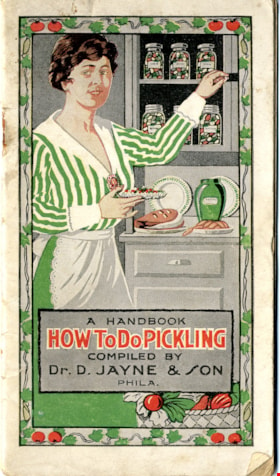
How to do pickling : a book of tested recipes
https://search.heritageburnaby.ca/link/museumlibrary3872
- Repository
- Burnaby Village Museum
- Author
- D. Jayne and Son
- Publication Date
- c1917
- Call Number
- 641.42 JAY
- Repository
- Burnaby Village Museum
- Collection
- Special Collection
- Material Type
- Book
- Accession Code
- BV005.11.2
- Call Number
- 641.42 JAY
- Author
- D. Jayne and Son
- Place of Publication
- Philadelphia, Pa.
- Publisher
- Dr. D. Jayne & Son
- Publication Date
- c1917
- Physical Description
- 16] leaves ; 16 cm.
- Inscription
- A Handbook / How to do Pickling / Compiled by / Dr. D. Jayne & Son / Phila. / Copyright, 1917 by..
- Library Subject (LOC)
- Canning and preserving
- Patent medicines
- Cookbooks--1910-1919
- Cooking
Images
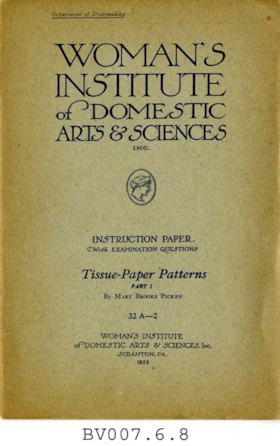
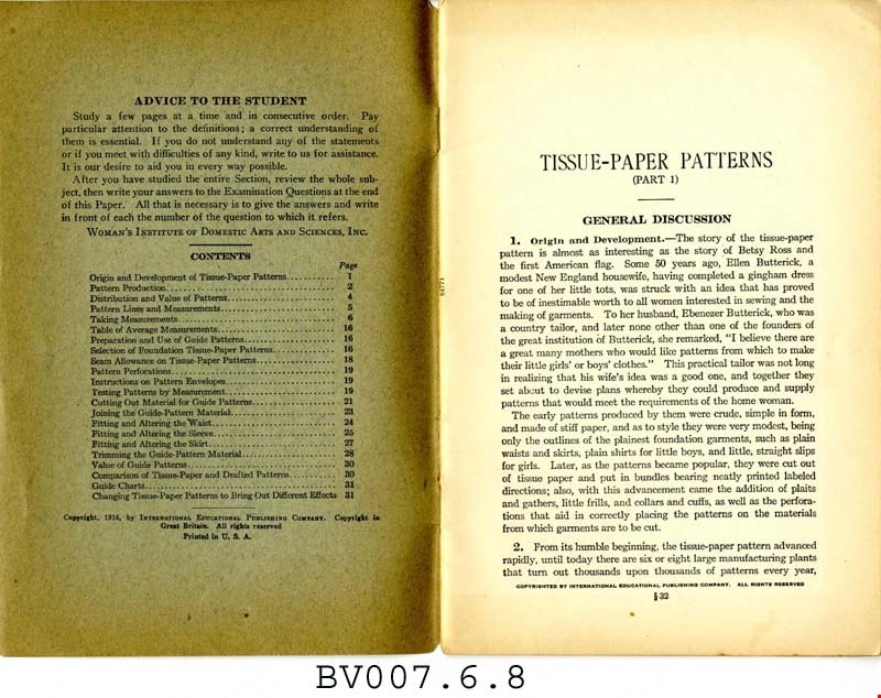
Tissue-paper patterns, part 1
https://search.heritageburnaby.ca/link/museumlibrary4994
- Repository
- Burnaby Village Museum
- Collection
- Special Collection
- Material Type
- Book
- Accession Code
- BV007.6.8
- Call Number
- 646 WOM pt. 1
- Place of Publication
- Scranton, Pa.
- Publisher
- Woman's Institute of Domestic Arts and Sciences
- Publication Date
- 1923
- c1916
- Physical Description
- 32 p. : ill. : 23 cm.
- Library Subject (LOC)
- Dressmaking
- Woman's Institute of Domestic Arts and Sciences
- Subjects
- Documentary Artifacts - Booklets
- Object History
- Home sewing course used by Burnaby residents in the 1920's
- Notes
- Part 1 of 2
- "Department of dressmaking" -- coverXXX
- "Instruction paper with examination questions; 32A-2" -- Cover
Images


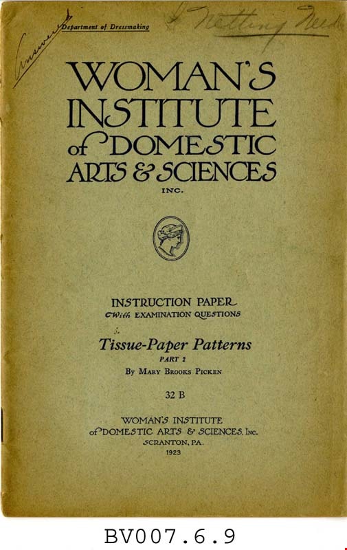
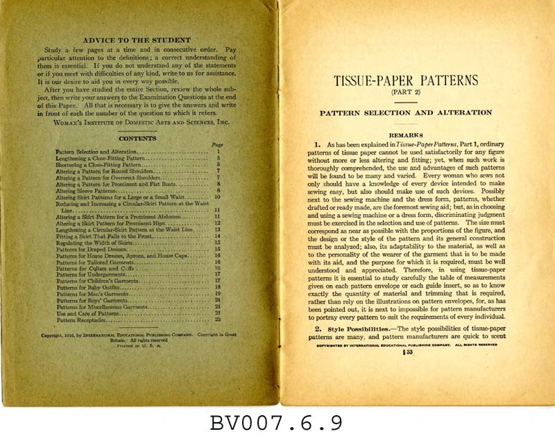
Tissue-paper patterns, part 2
https://search.heritageburnaby.ca/link/museumlibrary4995
- Repository
- Burnaby Village Museum
- Collection
- Special Collection
- Material Type
- Book
- Accession Code
- BV007.6.9
- Call Number
- 746.9 WOM pt. 2
- Place of Publication
- Scranton, Pa.
- Publisher
- Woman's Institute of Domestic Arts and Sciences
- Publication Date
- c1916
- 1923
- Physical Description
- 24 p. : ill. : 23 cm.
- Inscription
- "Answered" [Handwritten and underlined in pencil on front cover] "Netting Needle" [Handwritten, starred, and underlined in pencil on front cover] Some notes throughout.
- Library Subject (LOC)
- Dressmaking
- Woman's Institute of Domestic Arts and Sciences
- Subjects
- Documentary Artifacts - Booklets
- Object History
- Home sewing course used by Burnaby residents in the 1920's
- Notes
- Part 2 of 2
- "Department of dressmaking" -- cover
- "Instruction paper with examination questions" -- Cover
Images
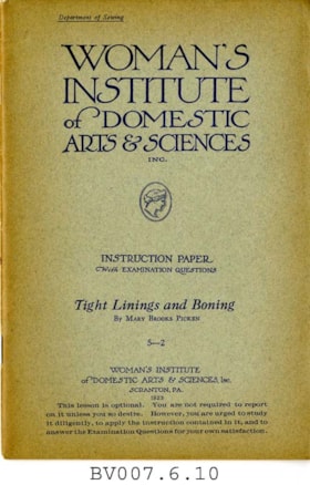
Tight linings and boning
https://search.heritageburnaby.ca/link/museumlibrary4996
- Repository
- Burnaby Village Museum
- Collection
- Special Collection
- Material Type
- Book
- Accession Code
- BV007.6.10
- Call Number
- 646 WOM
- Place of Publication
- Scranton, Pa.
- Publisher
- Education Corp. General
- Publication Date
- 1923
- c1915
- Physical Description
- 43 p. : ill. : 23 cm.
- Inscription
- "This instruction book is not included in your course of study, but is sent to show you just how to prepare your dress form for use. You will not be asked to report on this book." [Typed in purple ink and pasted to first page]
- Library Subject (LOC)
- Dressmaking
- Sewing
- Linings (Sewing)
- Woman's Institute of Domestic Arts and Sciences
- Subjects
- Documentary Artifacts - Booklets
- Object History
- Home sewing course used by Burnaby residents in the 1920's
- Notes
- "Department of sewing" -- cover
- "Instruction paper with examination questions ; 5-2" -- Cover
- "This lesson is optional. You are not required to report on it unless you so desire. However, you are urged to study it diligently, to apply the instruction contained in it, and to answer the Examination Questions for your own satisfaction." -- Cover
Images


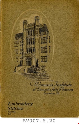
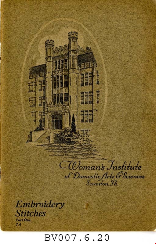
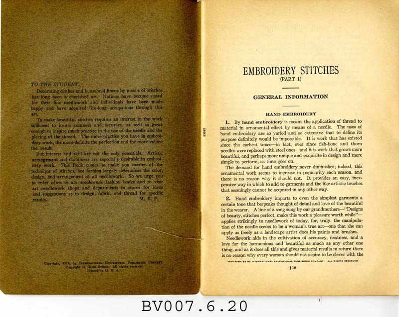
Embroidery stitches, part 1
https://search.heritageburnaby.ca/link/museumlibrary5006
- Repository
- Burnaby Village Museum
- Collection
- Special Collection
- Material Type
- Book
- Accession Code
- BV007.6.20
- Call Number
- 746.5 PIC
- Place of Publication
- Scranton, Pa.
- Publisher
- Woman's Institute of Domestic Arts and Sciences
- Publication Date
- 1921
- c1916
- Physical Description
- 44 p. : ill. : 23 cm.
- Library Subject (LOC)
- Embroidery--Study and teaching
- Stitches (Sewing)
- Subjects
- Documentary Artifacts - Booklets
- Object History
- Home sewing course used by Burnaby residents in the 1920's
- Notes
- Part 1 of 2
Images

Boys of the Bible
https://search.heritageburnaby.ca/link/museumlibrary5848
- Repository
- Burnaby Village Museum
- Collection
- Special Collection
- Material Type
- Book
- Accession Code
- BV007.31.5
- Call Number
- 220.9 BOY
- Contributor
- Turner, A. M.
- Place of Publication
- New York
- Publisher
- Sam'l Gabriel Sons & Co.
- Publication Date
- c1916
- Physical Description
- 32 p. : ill. : 28 cm.
- Inscription
- "Presented to Nina Atkinson for Proficiency in bible study and general aptitude: from The East Burnaby Methodist Sunday School August 1917" [Handwritten in pencil on front flyleaf]
- Library Subject (LOC)
- Bible
- Bible. Old Testament
- Juvenile literature
- Notes
- "Illustrated by A. M. Turner" -- Title page
Images

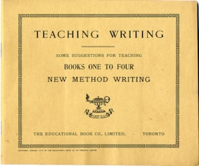
Teaching writing : some suggestions for teaching books one to four ; new method writing
https://search.heritageburnaby.ca/link/museumlibrary6452
- Repository
- Burnaby Village Museum
- Collection
- Special Collection
- Material Type
- Book
- Accession Code
- HV973.70.7
- Call Number
- 372.634 EDU
- Place of Publication
- Toronto
- Publisher
- The Educational Book Co., Limited
- Publication Date
- c1913
- Physical Description
- 63 p. : ill. ; 19 x 23 cm.
- Library Subject (LOC)
- Penmanship
- Penmanship--Study and teaching
Images

![Survey and Subdivision plans in New Westminster District Group 1 – Burnaby
, [1861]-[1910] thumbnail](/media/hpo/_Data/_BVM_Cartographic_Material/1977/1977_0093_0019a_001.jpg?width=280)
Survey and Subdivision plans in New Westminster District Group 1 – Burnaby
https://search.heritageburnaby.ca/link/museumdescription6988
- Repository
- Burnaby Village Museum
- Date
- [1861]-[1910]
- Collection/Fonds
- Burnaby Village Museum Map collection
- Description Level
- File
- Physical Description
- 14 plans : 3 plans : black ink on paper hand col. + 7 plans : black ink on paper + 4 plans : graphite on paper mounted on 2 sides of cardboard 76 x 102 cm
- Scope and Content
- Item consists of a large board of four New Westminster District Gp 1 - subdivision plans mounted on one side and ten New Westminster District Gp 1 - subdivision plans mounted on the other side. Side A: 1. "Plan /of / Lots 166A, 166 and 167 /, Gr.1, N.W.D. / Showing Misconstructed Roads in Gree…
- Repository
- Burnaby Village Museum
- Collection/Fonds
- Burnaby Village Museum Map collection
- Description Level
- File
- Physical Description
- 14 plans : 3 plans : black ink on paper hand col. + 7 plans : black ink on paper + 4 plans : graphite on paper mounted on 2 sides of cardboard 76 x 102 cm
- Material Details
- Scales [between 1:2376 and 1:7920]
- Index number on edge of board reads: "19"
- Scope and Content
- Item consists of a large board of four New Westminster District Gp 1 - subdivision plans mounted on one side and ten New Westminster District Gp 1 - subdivision plans mounted on the other side. Side A: 1. "Plan /of / Lots 166A, 166 and 167 /, Gr.1, N.W.D. / Showing Misconstructed Roads in Green / 5 chs = 1 in.". (plan is drawn in black ink and hand coloured in red, green and orange ink). A section in the centre of the plan is coloured in red ink and identified as "C.S. Richmond" running from the North Arm of Fraser River to Wiggins Road and divided by "New Wiggins Rd. (as gazetted)" (coloured in orange ink) and two"Constructed Road(s)" (coloured in green ink). Plan is initialed by: "RB" [sic] (in blue pencil crayon) 2. Plan of / Subdivision of / Lot 166 / Group One / New Westminster District / Scale 4 chs = 1 in. / Map No 524". Plan is drawn in graphite and signed by "Surrig [sic] Welhams [sic] / P.L.S." Plan is initialed by: "RB" [sic] (in blue pencil crayon) 3. Plan of "Survey / of Highway / For / Burnaby Council / in / Lots 13 _14 / Group One / Scale 4 chs = 1 in." Signed by "Albert J. Hill, P.L.S." Caribou Street and Caribou Road run through the centre of the plan. Plan is stamped: "Albert J. Hill, Civil Engineer / and / Provincial Land Surveyor, / New Westminster, / B.C.". Plan is initialed by: "RB" [sic] (in blue pencil crayon) 4. A Plan of Lots 166A, 166 and 167, Group One, New Westminster District (drawn in graphite). A section in the centre of the plan is identified as "C.S. Richmond" running from the North Arm of Fraser River and divided by "New Wiggins Rd. (as gazetted)" and two "Constructed Road(s)". Plan is initialed by: "RB" [sic] (in blue pencil crayon) Side B: 1. Small plan drawn in black ink (no title) identifying lots north of the "North Arm" of the Fraser River. Lots identified include: Lot 99, Lot 98, Lot 157, Lot 158, Lot 163, Lot 162, Lot 159, Lot 163, Lot 162, Lot 165, Lot 166A, Lot 155B, Lot 155A and Lot 159. "Scale 40 chains to one inch" . Plan is initialed by: "RB" [sic] (in blue pencil crayon) (Geographic location: Burnaby) 2. Small plan drawn in black ink (no title) identifying lots north of the North Arm of the Fraser River as "Lots 155, 155A, 155B, 155C, 162, 163, 164, 165, 166A and 167". Plan is initialed by: "RB" [sic] (in blue pencil crayon) (Geographic location: Burnaby) 3. Small plan drawn in black ink (no title) which identifies "Lot 151 / Reserve/ for / Race Course"; "Reserve / 64 A / L. 152 G.1"; and other Lots: 32, 33, 34, 35, 36, 38, 39. The plan is signed "Surveyor G.Turn [sic] July / 61 / from Vol 40 R.L. notes [sic]" Plan is stamped: "Albert J. Hill, Civil Engineer / and / Provincial Land Surveyor, / New Westminster, / B.C." Plan is initialed by: "RB" [sic] (in blue pencil crayon) (Geographic location: Burnaby) 4. Small plan drawn in black in with faded red colouring on centre lot identified as "Lot 34" running north from "Vancouver Road" . Plan is stamped: "Albert J. Hill, Civil Engineer / and / Provincial Land Surveyor, / New Westminster, / B.C." Plan is initialed by: "RB" [sic] (in blue pencil crayon) (Geographic location: Burnaby) 5. Plan drawn in graphite and identified as "Lot 98, Gr.1," along with the intials "RB" [sic] (both are handwritten in blue crayon pencil on top of plan) The B.C.E.Railway is identified running through the plan along with Jubilee Road and Royal Oak Road. The plan is signed with the name "Wm. Murray" and the Plan is stamped: "Albert J. Hill, Civil Engineer / and / Provincial Land Surveyor, / New Westminster, / B.C.". (Geographic location: Burnaby) 6. Plan drawn in graphite identified as "Port Lot 13, Gr.1" along with the intials "RB" [sic] (both are handwritten in blue crayon pencil on top of plan) Plan is stamped: "Albert J. Hill, Civil Engineer / and / Provincial Land Surveyor, / New Westminster, / B.C.". (Geographic location: Burnaby) 7.Plan drawn in black ink and identified as "Lot 98 G.1" along with the intials "RB" [sic] (both are handwritten in blue crayon pencil on top of plan). A "Road Reservation" is identified running north between "Electric Tramway" and connecting with "Royal Oak Road". Plan is stamped: "Albert J. Hill, Civil Engineer / and / Provincial Land Surveyor, / New Westminster, / B.C." (Geographic location: Burnaby) 8. Plan drawn in black ink and divided into two sections, the upper plan is identified as "Portion / Lots 100 / area / 101, Gr.1" and the lower plan is identified as "Portion L. 3 G. 1" along with the intials "RB" [sic] (these identifiers are handwritten in blue crayon pencil on top of the plan). Portions of Lot 100 and Lot 101 are each divided into 6 sections and the Portion of Lot 3 plan is divided into 24 sections. The plan includes a note in black ink that reads: " Received from Wm Fromme [sic] / from Wm. Trapp / Nov. 28, 1895 / A. J. T...[sic]". (Geographic location: Burnaby) 9. Plan drawn in black ink (no title) identifying soil, buildings and geographic features in southern Burnaby. The plan is bordered by "New Westminster City" (Tenth Avenue and DL 172) to the south east and DL 173 to the south, DL 158 to the west and the B.C.E. Tramway to the north. Plan includes District Lots: 155A, 158, 159, 171, 160, 53 and 95 and identifies soil, marshland and ravines throughout. Plan identifies the following features: a "Team Road" running through Lots 158 and 159 along with "Fair Orchard Soil / Even Surface Throughout / No Ravines", "Gravel and Shingle" (bottom of Lot 158), "North Arm Road" crossing "Byrne Road" and connecting with "Power House Road" which runs north to connect with "Highland Park Station" and the B.C.E. Tramway, "Power Ho" in the northeast corner of DL 160, a "Brook" connected with a "Deep Ravine" running between DL 53, DL 95 and DL 160 along with "Good Soil" and "Fair Orchard Soil" identified nearby in DL 95. Scale is identified as "10 chs = 1 in." Plan is stamped: "Albert J. Hill, Civil Engineer / and / Provincial Land Surveyor, / New Westminster, / B.C." Plan is initialed by: "RB" [sic] (in blue pencil crayon) (Geographic location: Burnaby) 10. Plan drawn in black ink (no title) with Burnaby Lake and Deer Lake at the centre. The plan is bordered by the following District Lots identified as: 117, 118 and 68 to the west, Lots 80, 79 and 85 to the southwest, Lots 11, 13, and 1 (City of New Westminster) to the south east, the North Road boundary to the east and Lots 8, 56, 57, 59, and 136 to the North. The lower right hand corner of the plan has a small inset which reads: "Burnaby Lake" and "Page 19 R.B. Notes". Plan is initialed by: "RB" [sic] (in blue pencil crayon) (Geographic location: Burnaby)
- Creator
- Hill, Albert James
- Accession Code
- HV977.93.19
- Access Restriction
- No restrictions
- Reproduction Restriction
- No known restrictions
- Date
- [1861]-[1910]
- Media Type
- Cartographic Material
- Scan Resolution
- 300
- Scale
- 72
- Notes
- Title based on contents of file
- Scale is measured in chains. (One chain equals 792 inches)
- The term "Lot" can also refer to a "District Lot”
- Some plans are stamped: "Albert J. Hill, Civil Engineer / and / Provincial Land Surveyor, / New Westminster, / B.C." and intialed: "RB" [sic]
Images
![Survey and Subdivision plans in New Westminster District Group 1 – Burnaby
, [1861]-[1910] thumbnail](/media/hpo/_Data/_BVM_Cartographic_Material/1977/1977_0093_0019a_001.jpg)

![Subdivision plans in New Westminster District Group 1 – Burnaby
, [1882-1910] thumbnail](/media/hpo/_Data/_BVM_Cartographic_Material/1977/1977_0093_0013a_001.jpg?width=280)
Subdivision plans in New Westminster District Group 1 – Burnaby
https://search.heritageburnaby.ca/link/museumdescription6982
- Repository
- Burnaby Village Museum
- Date
- [1882-1910]
- Collection/Fonds
- Burnaby Village Museum Map collection
- Description Level
- File
- Physical Description
- 4 plans : blueprint on paper mounted on 2 sides of cardboard 76 x 102 cm
- Scope and Content
- Item consists of a large board of two New Westminster District Gp 1 - subdivision plans mounted on one side and two New Westminster District Gp 1 - subdivision plans mounted on the other side. Side A: 1. Blueprint "Plan / of the / Subdivision / of / Lot 98 / G.1, N.W.D. / Scale 4 chs = 1 in. / …
- Repository
- Burnaby Village Museum
- Collection/Fonds
- Burnaby Village Museum Map collection
- Description Level
- File
- Physical Description
- 4 plans : blueprint on paper mounted on 2 sides of cardboard 76 x 102 cm
- Material Details
- Scales [between 1:1584 and 1:3168]
- Index number on edge of board reads: "13"
- Scope and Content
- Item consists of a large board of two New Westminster District Gp 1 - subdivision plans mounted on one side and two New Westminster District Gp 1 - subdivision plans mounted on the other side. Side A: 1. Blueprint "Plan / of the / Subdivision / of / Lot 98 / G.1, N.W.D. / Scale 4 chs = 1 in. / Map No 573" (Geographic location: Burnaby) 2. Blueprint "Plan / of Subdivision of / Lot 157 / Gr.1, New. West. Dist. / Scale 3 chs = 1 in. / Map No. 612". (Geographic location: Burnaby) Side B: 1. Blueprint "Plan / of Subdivision / of a Portion of / Lot 90 / Group One / New Westminster Dist. / Scale 2 chs = 1 in. / Map No. 555". Plan is signed by "Jno Strathern [sic]_P.L.S."n (Geographic location: Burnaby) 2. Blueprint "Subdivision of Lot 31, Group 1. / New Westminster District / As Amended by Order of Court / 1st Sept. 1882 and Numbered 847 / Scale 4 chs = 1in. / Map No 80" (Geographic location: Burnaby)
- Creator
- Stathern, John
- Accession Code
- HV977.93.13
- Access Restriction
- No restrictions
- Reproduction Restriction
- No known restrictions
- Date
- [1882-1910]
- Media Type
- Cartographic Material
- Historic Neighbourhood
- Alta Vista (Historic Neighbourhood)
- Planning Study Area
- Richmond Park Area
- Lakeview-Mayfield Area
- Scan Resolution
- 300
- Scale
- 72
- Notes
- Title based on contents of file
- Scale is measured in chains. (One chain equals 792 inches)
- The term "Lot" can also refer to a "District Lot”
Images
![Subdivision plans in New Westminster District Group 1 – Burnaby
, [1882-1910] thumbnail](/media/hpo/_Data/_BVM_Cartographic_Material/1977/1977_0093_0013a_001.jpg)

![Subdivision plans in New Westminster District Group 1 – Burnaby
, [1890-1910] thumbnail](/media/hpo/_Data/_BVM_Cartographic_Material/1977/1977_0093_0014a_001.jpg?width=280)
Subdivision plans in New Westminster District Group 1 – Burnaby
https://search.heritageburnaby.ca/link/museumdescription6983
- Repository
- Burnaby Village Museum
- Date
- [1890-1910]
- Collection/Fonds
- Burnaby Village Museum Map collection
- Description Level
- File
- Physical Description
- 4 plans : blueprint ink on paper mounted on 2 sides of cardboard 76 x 102 cm
- Scope and Content
- Item consists of a large board of two New Westminster District Gp 1 - subdivision plans mounted on one side and two New Westminster District Gp 1 - subdivision plans mounted on the other side. Side A: 1. Blueprint "Plan of / Subdivision of Lot No. 69 / Group One / New Westminster District / Pro…
- Repository
- Burnaby Village Museum
- Collection/Fonds
- Burnaby Village Museum Map collection
- Description Level
- File
- Physical Description
- 4 plans : blueprint ink on paper mounted on 2 sides of cardboard 76 x 102 cm
- Material Details
- Scales [between 1:1584 and 1:3168]
- Index number on edge of board reads: "14"
- Scope and Content
- Item consists of a large board of two New Westminster District Gp 1 - subdivision plans mounted on one side and two New Westminster District Gp 1 - subdivision plans mounted on the other side. Side A: 1. Blueprint "Plan of / Subdivision of Lot No. 69 / Group One / New Westminster District / Property of Ernest Buse, Esq. / Scale 3 chs = 1 in. / Map No 290". Plan is signed by "Garden, Hermon and Burwell, Dom. Land Surveyor" (Geographic location: Burnaby) 2. Blueprint "Plan / of Subdivision / of Lots 1-19, 36-53 and 69-75 inclusive / in the Subdivision / of / Lot 30 / Group One / New Westminster District / Scale 2 chs = 1 in. Map No 631". Plan is signed by "Jno [sic] Strathern [sic] P.L.S." Names and Lot numbers are handwritten in red pencil in sections along Douglas Road and read: "20 - F / 21 - Fitherstruhaul [sic] / 22 - J.S. Craig / 23 - McGill & Dill / 24 / 25 / 26 / 27 / 28 - School / 29 - School / 30 - D. McDownall / 31 - W.J. Troloow [sic] / 32 - N.C. Nelson / 33 - _[sic] McGill / 34 - T.S.[sic] Craig / 35" (Geographic location: Burnaby) Side B: 1.Blueprint "Plan / of Subdivision / of Centre Portion / of Lot 28 / Group One / New Westminster District / Scale 200' = 1" / Map No 627". Plan is signed by "Jno Strathern / P.L.S." (Geographic location: Burnaby) 2. Blueprint "Plan / of Subdivision / of N.1/2 Lot 100 and S.1/2 Lot 101, / Group One / New Westminster District, BC / Scale 4 chs = 1 in." (Geographic location: Burnaby)
- Names
- Strathern, John
- Accession Code
- HV977.93.14
- Access Restriction
- No restrictions
- Reproduction Restriction
- No known restrictions
- Date
- [1890-1910]
- Media Type
- Cartographic Material
- Historic Neighbourhood
- Broadview (Historic Neighbourhood)
- East Burnaby (Historic Neighbourhood)
- Planning Study Area
- Cascade-Schou Area
- West Central Valley Area
- Second Street Area
- Lake City Area
- Scan Resolution
- 300
- Scale
- 72
- Notes
- Title based on contents of file
- Scale is measured in chains and feet. (One chain equals 792 inches)
- The term "Lot" can also refer to a "District Lot”
Images
![Subdivision plans in New Westminster District Group 1 – Burnaby
, [1890-1910] thumbnail](/media/hpo/_Data/_BVM_Cartographic_Material/1977/1977_0093_0014a_001.jpg)

![Subdivision plans in New Westminster District Group 1 – Burnaby
, [1891-1910] thumbnail](/media/hpo/_Data/_BVM_Cartographic_Material/1977/1977_0093_0015a_001.jpg?width=280)
Subdivision plans in New Westminster District Group 1 – Burnaby
https://search.heritageburnaby.ca/link/museumdescription6984
- Repository
- Burnaby Village Museum
- Date
- [1891-1910]
- Collection/Fonds
- Burnaby Village Museum Map collection
- Description Level
- File
- Physical Description
- 4 plans : blueprint ink on paper mounted on 2 sides of cardboard 76 x 102 cm
- Scope and Content
- Item consists of a large board of two New Westminster District Gp 1 - subdivision plans mounted on one side and two New Westminster District Gp 1 - subdivision plans mounted on the other side. Side A: 1. Blueprint "Plan / of Subdivision / of / Lot 29 / Group One / New Westminster District / Scal…
- Repository
- Burnaby Village Museum
- Collection/Fonds
- Burnaby Village Museum Map collection
- Description Level
- File
- Physical Description
- 4 plans : blueprint ink on paper mounted on 2 sides of cardboard 76 x 102 cm
- Material Details
- Scales [between 1:600 and 1:7920]
- Index number on edge of board reads: "15"
- Scope and Content
- Item consists of a large board of two New Westminster District Gp 1 - subdivision plans mounted on one side and two New Westminster District Gp 1 - subdivision plans mounted on the other side. Side A: 1. Blueprint "Plan / of Subdivision / of / Lot 29 / Group One / New Westminster District / Scale 4 chs = 1 in. / Map No 564, Depostd '91". "Reichenbach", dep. Aug. 1891. (Geographic location: Burnaby) 2. Blueprint "Plan / of Subdivision / of / Lot 93 / Group One / New Westminster District / Scale 4 chs = 1 in. / Map No 284". (Geographic location: Burnaby) Side B: 1. Blueprint "Plan / of Subdivision / of a Portion / of / [Lot A of ] Lot 29 / Group One / New Westminster District / Scale 50 ' = 1"" Plan is bordered by Douglas Road to the east, False Creek Trail to the south and Lot 30 to the north. (Geographic location: Burnaby) 2. Blueprint "Plan / of Central Park / and Vicinity / Scale 10 chs = 1 in." (Geographic location: Burnaby)
- Accession Code
- HV977.93.15
- Access Restriction
- No restrictions
- Reproduction Restriction
- No known restrictions
- Date
- [1891-1910]
- Media Type
- Cartographic Material
- Historic Neighbourhood
- Edmonds (Historic Neighbourhood)
- Planning Study Area
- Edmonds Area
- Scan Resolution
- 300
- Scale
- 72
- Notes
- Title based on contents of file
- Scale is measured in chains and feet. (One chain equals 792 inches)
- The term "Lot" can also refer to a "District Lot”
Images
![Subdivision plans in New Westminster District Group 1 – Burnaby
, [1891-1910] thumbnail](/media/hpo/_Data/_BVM_Cartographic_Material/1977/1977_0093_0015a_001.jpg)

![Subdivision plans in New Westminster District Group 1 – Burnaby
, [1893-1910] thumbnail](/media/hpo/_Data/_BVM_Cartographic_Material/1977/1977_0093_0016a_001.jpg?width=280)
Subdivision plans in New Westminster District Group 1 – Burnaby
https://search.heritageburnaby.ca/link/museumdescription6985
- Repository
- Burnaby Village Museum
- Date
- [1893-1910]
- Collection/Fonds
- Burnaby Village Museum Map collection
- Description Level
- File
- Physical Description
- 4 plans : blueprint ink on paper mounted on 2 sides of cardboard 76 x 102 cm
- Scope and Content
- Item consists of a large board of two New Westminster District Gp 1 - subdivision plans mounted on one side and two New Westminster District Gp 1 - subdivision plans mounted on the other side. Side A: 1. Blueprint "Plan / of Subdivision / of / Lot 6 / Group One / New Westminster District / Scale…
- Repository
- Burnaby Village Museum
- Collection/Fonds
- Burnaby Village Museum Map collection
- Description Level
- File
- Physical Description
- 4 plans : blueprint ink on paper mounted on 2 sides of cardboard 76 x 102 cm
- Material Details
- Scales [between 1:1584 and 1:3960]
- Index number on edge of board reads: "16"
- Scope and Content
- Item consists of a large board of two New Westminster District Gp 1 - subdivision plans mounted on one side and two New Westminster District Gp 1 - subdivision plans mounted on the other side. Side A: 1. Blueprint "Plan / of Subdivision / of / Lot 6 / Group One / New Westminster District / Scale 5 chs = 1 in. / Map No 748" (Geographic location: Burnaby) 2. Blueprint "Plan / of Subdivision / of a Portion / of / Lot 29 / Group One / New Westminster Dist. / Scale 2 chs = 1 in. / Map No." Name identified in Block H is "Reichenbach" (Geographic location: Burnaby) Side B: 1. Blueprint "Plan / of Subdivision / of North 1/2 of Lot 80 / Group One / New Westminster District / Scale 3 chs = 1 in. / Map No 719" Plan is signed by: "Garden, Hermon & Burwell P.L.S. / Vancouver Jan. 23rd, 1893" (Geographic location: Burnaby) 2. Blueprint "Plan / of Subdivision / of Lot 79, Gr.1 / New Westminster Dist. / Scale 4 chas = 1 in. / Map No 536" Plan is signed by "Garden Hermon & Burwell / Provincial Land Surveyors". (Geographic location: Burnaby)
- Creator
- Garden, Hermon and Burwell
- Accession Code
- HV977.93.16
- Access Restriction
- No restrictions
- Reproduction Restriction
- No known restrictions
- Date
- [1893-1910]
- Media Type
- Cartographic Material
- Historic Neighbourhood
- Edmonds (Historic Neighbourhood)
- Burnaby Lake (Historic Neighbourhood)
- Planning Study Area
- Douglas-Gilpin Area
- Edmonds Area
- Cameron Area
- Scan Resolution
- 300
- Scale
- 72
- Notes
- Title based on contents of file
- Scale is measured in chains. (One chain equals 792 inches)
- The term "Lot" can also refer to a "District Lot”
Images
![Subdivision plans in New Westminster District Group 1 – Burnaby
, [1893-1910] thumbnail](/media/hpo/_Data/_BVM_Cartographic_Material/1977/1977_0093_0016a_001.jpg)

![Survey and Subdivision plans in New Westminster District Group 1 & Group 2 - Port Moody, Surrey
, [1898-1910] thumbnail](/media/hpo/_Data/_BVM_Cartographic_Material/1977/1977_0093_0073_001.jpg?width=280)
Survey and Subdivision plans in New Westminster District Group 1 & Group 2 - Port Moody, Surrey
https://search.heritageburnaby.ca/link/museumdescription7042
- Repository
- Burnaby Village Museum
- Date
- [1898-1910]
- Collection/Fonds
- Burnaby Village Museum Map collection
- Description Level
- File
- Physical Description
- 10 plans : graphite and ink on paper and linen; various sizes mounted on 2 sides of cardboard 76 x 102 cm
- Scope and Content
- File consists of a large board with four plans in New Westminster District mounted on one side and six plans mounted on the other side. Side A: 1. Plan : black ink and graphite on paper ; 46.5 x 37.5 cm. Title reads: "Bon Accord Hatchery / Sec 6 B5N R1W". Signed by Albert J. Hill P.L.S. August 1…
- Repository
- Burnaby Village Museum
- Collection/Fonds
- Burnaby Village Museum Map collection
- Description Level
- File
- Physical Description
- 10 plans : graphite and ink on paper and linen; various sizes mounted on 2 sides of cardboard 76 x 102 cm
- Material Details
- Scales vary (One chain equals 792 inches)
- Indexed number on tape on edge of board reads "73"
- Scope and Content
- File consists of a large board with four plans in New Westminster District mounted on one side and six plans mounted on the other side. Side A: 1. Plan : black ink and graphite on paper ; 46.5 x 37.5 cm. Title reads: "Bon Accord Hatchery / Sec 6 B5N R1W". Signed by Albert J. Hill P.L.S. August 12, 1903. Plan covers land identified as Section 6, Section 7, Located along the south shore of the Fraser River in Port Mann (Geographic location: Surrey). 2. Plan : black ink and graphite on paper ; 36 x 31 cm. Title reads: "Survey of Portions of Sec. 20 B5N R2W". Plan is stamped in red ink: "Albert J. Hill, Civil Engineer". Scale 4 chains = 1 inch. 3. Plan : black ink on linen ; 14 x 23 cm. Title reads:"Port Moody". Plan covers sections in Lot 191 (District Lot 191) bordered by Burrard Inlet to the west and Lot 235 and Lot 233 to the south. Streets identified include Water Street, Beauregard Street, Yonge Street, Clinton Street and Oxford Street. 4. Plan: graphite and ink on paper ; 43.5 x 64.5 cm. Title reads: "Sketch Plan Approved by Council [sic] / _[sic]1898". (No identifying geographic landmarks provided) Side B: 1. Plan : graphite on paper ; 53.5 x 31 cm. Title reads: "Plan of Lot 13, Gr. II, N.W. Dist". Sketch plan covers area along the Fraser River in District Lot 13, New Westminster District, Group 2. District Lot 13 is bordered by District Lot 14 (to the west) and Lot 12 (to the east). Natural geographic features within District Lot 13 are noted as "dense brush and fallen timber / sallal / rough spruce and cedar / swamp / fine alder / sallal / fine alder bottom land / fine brook". Scale: 3 chains = 1 inch (Geographic location: Surrey) 2. Plan : black ink on paper ; 50.5 x 34.5 cm. Title reads: "Indian Reserve / Opposite / New Westminster". Plan covers area on the south shore of the Fraser River in New Westminster District Group 2 in an area known as Brownsville. Lots are identified as District Lots 1, 2, 3, 4, 18, 17 and 8 and Sections A and B. Two areas of land are noted as "Indian Reserve"; one 6.3 acre parcel and one 104.25 acre parcel, both within District Lot 1. Note on plan reads: "N.B. this plan shows reserves and adjacent properties as they are on the ground". (Geographic location: Surrey) 3. Plan : black and col. ink on paper ; 19.5 x 31.5 cm. Title reads: "Bon Accord Road". Plan shows elevation. "Average section 10 feet = 1 inch". Plan is stamped in red ink: "Albert J. Hill, Civil Engineer and Provincial Land Surveyor, New Westminster, B.C." (Geographic location: Surrey) 4. Plan : black and col. ink on linen ; 16.5 x 25.5 cm. (no formal title) Plan covers area of Section 35, south of Yale Wagon Road and east of Quible Road. Plan is signed by "Albert J. Hill / B.C.L.S." (Geographic location: Surrey) 5. Plan: black and col. ink on linen ; 22.5 x 22.5 cm. (no formal title) Plan covers area between Yale Road and Townline Road in Surrey. Scale: 4 chains = 1 inch. Plan is signed by Albert J. Hill B.C.L.S. [190-] (Geographic location: Surrey) 6. Plan : graphite on paper ; 24 x 54 cm. (no formal title) Plan covers sectioned areas along Bon Accord Road. Sections are identified as " Sec. 8 / T.F. Patterson"; "Sec. 9 / Russell"; "Elliott_Burnett_Crean / Sec. 16"; "Dom. Govt. / Sec. 17". (Geographic location: Surrey, beneath the Port Mann bridge)
- Names
- ʷməθkʷəy̓əm (Musqueam)
- Accession Code
- HV977.93.73
- Access Restriction
- No restrictions
- Reproduction Restriction
- No known restrictions
- Date
- [1898-1910]
- Media Type
- Cartographic Material
- Scan Resolution
- 600
- Scan Date
- 2023-06-26
- Notes
- Title based on contents of file
- Note re plan 2B: The sight of Brownsville was also the former site of the Qayqayt First Nation and one of the main summer villages of the Kwantlen and ʷməθkʷəy̓əm (Musqueam) peoples
Zoomable Images
![Survey and Subdivision plans in New Westminster District Group 1 & Group 2 - Port Moody, Surrey
, [1898-1910] thumbnail](/media/hpo/_Data/_BVM_Cartographic_Material/1977/1977_0093_0073_003_seadragon/1977_0093_0073_003.jpg?w=280)
Survey and Subdivision plans in New Westminster District Group 1 & Group 2 - Port Moody, Surrey , [1898-1910]
Zoom into Image