Narrow Results By
Decade
- 2020s 2390
- 2010s 6268
- 2000s 9728
- 1990s 13495
- 1980s 12565
- 1970s 18312
- 1960s 12800
- 1950s 11063
- 1940s 7248
- 1930s 7925
- 1920s 12034
- 1910s
- 1900s 4204
- 1890s 1860
- 1880s 298
- 1870s 125
- 1860s 176
- 1850s 45
- 1840s 24
- 1830s 14
- 1820s 11
- 1810s 8
- 1800s 11
- 1790s 6
- 1780s 5
- 1770s 5
- 1760s 5
- 1750s 5
- 1740s 5
- 1730s 5
- 1720s 5
- 1710s 7
- 1700s 6
- 1690s 5
- 1680s 6
- 1670s 4
- 1660s 4
- 1650s 4
- 1640s 4
- 1630s 4
- 1620s 4
- 1610s 4
- 1600s 4
- 1590s 1
- 1580s 1
- 1570s 1
- 1560s 1
- 1550s 1
- 1540s 1
- 1530s 1
- 1520s 2
- 1510s 1
- 1500s 1
- 1490s 1
- 1480s 1
Subject
- Accidents 1
- Accidents - Train Accidents 1
- Advertising Medium 1
- Advertising Medium - Signs and Signboards 8
- Agricultural Tools and Equipment 1
- Agricultural Tools and Equipment - Gardening Equipment 3
- Agricultural Tools and Equipment - Plows 3
- Agriculture 6
- Agriculture - Crops 6
- Agriculture - Dairy 1
- Agriculture - Farms 23
- Agriculture - Fruit and Berries 7
Creator
- A. A. Marks (firm) 1
- Abbott, George Knapp, 1880-1959 1
- Addingley, Amy 1
- Addington, H.E. 1
- Adee, J. N. 1
- Alberta Photo Company 1
- Albert F. Arnold 1
- Alcott, Louisa May, 1832-1888 2
- Alexander, Charles M. (Charles McCallon), 1867-1920 1
- Alexander, William John, 1855-1944 1
- Allardyce, Mrs. 1
- Allen, James Lane, 1849-1925 1
Lozells Neighbourhood
https://search.heritageburnaby.ca/link/landmark756
- Repository
- Burnaby Heritage Planning
- Associated Dates
- 1905-1924
- Heritage Value
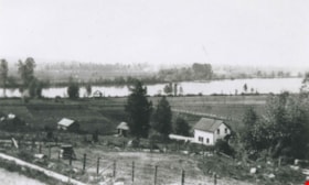
- In 1906 C.T. Piper and Alfred Wiggs built a sawmill at the foot of what is now Piper Avenue along the north shore of Burnaby Lake. These operations and the proximity of the Great Northern Railway encourage settlers to move into this area and among them were Colonel and Mrs. James Ward. They were authorized to open a post office here and Mrs. Ward named it 'Lozells' after the Anglican parish to which she had been a member in Birmingham, England.
- Historic Neighbourhood
- Lozells (Historic Neighbourhood)
- Planning Study Area
- Government Road Area
Images
Burquitlam Neighbourhood
https://search.heritageburnaby.ca/link/landmark757
- Repository
- Burnaby Heritage Planning
- Associated Dates
- 1905-1924
- Heritage Value
- In 1921, the pamphlet "Beautiful Burnaby" was produced and it described the Burquitlam neighbourhood as such: "No part of Burnaby has more consistently laboured to advance its prosperity than Burquitlam. Enterprise and intelligence has hewn homes from the forest and developed land into highly productive gardens and poultry ranches. Burquitlam is the growing suburb to the north of the City of New Westminster. It is reached by the Sapperton carline direct from Edmonds being only a few minutes ride from New Westminster market. It is also served by the B.C.E.R. Burnaby Lake line and adjoins on the best golf links in Greater Vancouver."
- Historic Neighbourhood
- Burquitlam (Historic Neighbourhood)
- Planning Study Area
- Cameron Area
- Lyndhurst Area
Images
Edmonds Neighbourhood
https://search.heritageburnaby.ca/link/landmark758
- Repository
- Burnaby Heritage Planning
- Associated Dates
- 1905-1924
- Heritage Value
- From The British Columbian, March 19, 1912: "On the fringe of New Westminster there is…a suburban townsite in Edmonds. During the past eighteen months it has grown and prospered quite phenomenally. It is ideally situated, is in easy communication with New Westminster by two car lines. Its climate is clear and bracing, being exceptionally free from the fogs that are more or less prevalent along the river section and gulf shore...Edmonds, in fact, is one of the finest residential parts of the province. This is fast becoming known and appreciated beyond its borders. Elegant and substantial residences are being erected in various parts, and stores are being put up in convenient localities. The new municipal building is one of the finest in British Columbia for so young a municipality."
- Historic Neighbourhood
- Edmonds (Historic Neighbourhood)
- Planning Study Area
- Edmonds Area
Images
Buena Vista Neighbourhood
https://search.heritageburnaby.ca/link/landmark759
- Repository
- Burnaby Heritage Planning
- Associated Dates
- 1905-1924
- Heritage Value
- The Buena Vista neighbourhood (so named for its wonderful views) grew out of its proximity to Edmonds and New Westminster and was developed in the period 1911-1912. By the 1950s, the area had been further subdivided and in 1986, Burnaby Municipal Council adopted the Cariboo Hills Development Plan for the neighbourhood to maintain its character as a residential area of the city.
- Historic Neighbourhood
- East Burnaby (Historic Neighbourhood)
- Planning Study Area
- Cariboo-Armstrong Area
Images
BCER Burnaby Lake Line
https://search.heritageburnaby.ca/link/landmark760
- Repository
- Burnaby Heritage Planning
- Associated Dates
- 1911
- Heritage Value
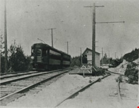
- The Burnaby Lake Line was constructed due to the advocacy of Burnaby residents and the Municipality of Burnaby to build the line. A petition was circulated by residents in 1907, and eventually substantial land bonuses were given to the company to induce them to build the line. Property owners in the area hoped the construction of the line would increase their land values. Construction of the 15-mile line was announced in 1909, and the line opened in 1911. The line travelled from Vancouver to New Westminister through central Burnaby.The last day of service was October 23, 1953. When the Trans Canada highway was constructed in the 1960s, it followed the right of way of the Burnaby Lake Line through Burnaby.
- Historic Neighbourhood
- Burnaby Lake (Historic Neighbourhood)
- Planning Study Area
- Burnaby Lake Area
Images
Armstrong Elementary School
https://search.heritageburnaby.ca/link/landmark762
- Repository
- Burnaby Heritage Planning
- Geographic Access
- Armstrong Avenue
- Associated Dates
- 1911
- Heritage Value
- The site for the Armstrong Avenue school was cleared in 1911. In 1955 the original structure was replaced by a new building and additions were constructed in 1962, 1964, 1967 and 1969. Armstrong Avenue was named after J.C. Armstrong, an early property owner of Burnaby who was involved in the effort to make Burnaby a municipality in 1892.
- Historic Neighbourhood
- East Burnaby (Historic Neighbourhood)
- Planning Study Area
- Cariboo-Armstrong Area
- Street Address
- 8757 Armstrong Avenue
- Street View URL
- Google Maps Street View
Images
Burnaby Municipal Hall
https://search.heritageburnaby.ca/link/landmark763
- Repository
- Burnaby Heritage Planning
- Geographic Access
- Kingsway
- Associated Dates
- 1911
- Heritage Value
- In 1911, a brick building was built to replace the smaller wooden structure that had served as Burnaby's Municipal Hall since 1899. This new, larger structure was built to reflect Burnaby's growth into a large suburban municipality and remained in use for over 40 years. The old Municipal Hall became a public hall which was demolished upon the construction of the Edmonds Branch of the Burnaby Public Library in 1962. The second Municipal Hall was renovated in 1956 (when the current City Hall was built at Canada Way), and was used as a Police building. In 1966 after the construction of the new Justice Building, the old 1911 Municipal Hall was left vacant and in 1970 it was demolished. The site was redeveloped as a senior citizens residential centre with Edmonds House built on the old hall location.
- Historic Neighbourhood
- Edmonds (Historic Neighbourhood)
- Planning Study Area
- Stride Avenue Area
- Street Address
- 7282 Kingsway
Images
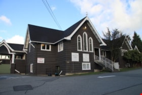
St. Stephen's Anglican Church
https://search.heritageburnaby.ca/link/landmark765
- Repository
- Burnaby Heritage Planning
- Geographic Access
- Cameron Street
- Associated Dates
- 1913
- Heritage Value
- The site of St. Stephen's Anglican Church is one of the historic landmarks of old Burquitlam. Originally this was part of the Alexander and Ethel Evans farm, Saint Phillians. Initial services for the church were held in the Evans home and later in the Burquitlam school. Alexander Evans donated this site to the Anglican Church in trust with the wish that it become a future church and consecrated ground for a family burial plot. In 1913, the parish raised the funds to build the first church. St. Stephen's was consecrated by Bishop de Pencier on September 28, 1913.
- Historic Neighbourhood
- Burquitlam (Historic Neighbourhood)
- Planning Study Area
- Lyndhurst Area
- Street Address
- 9887 Cameron Street
- Street View URL
- Google Maps Street View
Images
Alta Vista Neighbourhood
https://search.heritageburnaby.ca/link/landmark766
- Repository
- Burnaby Heritage Planning
- Associated Dates
- 1905-1924
- Heritage Value
- Alta Vista, named for its high views of the Fraser Valley, rapidly grew during the period 1910-1912, seeing its settlement jump from about a dozen buildings in 1910 to about four hundred by the end of 1912. Home-seekers were attracted to its location just a short walk from the B.C.E.R. line at Royal Oak and Highland Park and easily accessible to both New Westminster and Vancouver.
- Historic Neighbourhood
- Alta Vista (Historic Neighbourhood)
- Planning Study Area
- Sussex-Nelson Area
Images
Fraser Arm Neighbourhood
https://search.heritageburnaby.ca/link/landmark767
- Repository
- Burnaby Heritage Planning
- Associated Dates
- 1905-1924
- Heritage Value
- Fraser Arm - so named because there the tram crossed Gilley Avenue, running down to the North Arm of the Fraser River - was served by the River Road [Marine Drive] which traversed the municipality of Burnaby, leading to both New Westminster and Vancouver. This area did not experience a real estate boom during the 1909-1913 as did many other Burnaby neighbourhoods - in fact, by 1912, only three homes had been built along Riverway as it remained a predominantly agricultural area.
- Historic Neighbourhood
- Fraser Arm (Historic Neighbourhood)
- Planning Study Area
- Big Bend Area
Images
East Burnaby Neighbourhood
https://search.heritageburnaby.ca/link/landmark773
- Repository
- Burnaby Heritage Planning
- Associated Dates
- 1905-1924
- Heritage Value
- According to the 1911 December 26 edition of The British Columbian: Optimism is the word that applies to the whole community of East Burnaby. The many improvements carried out by the council during the past two years had been the means of making East Burnaby a thriving settlement, and hence one and all are optimistic as to its future. In the clearing and building line, many fine new homes are being erected...Real estate values have advanced with the times, and a notable feature is the number of better-class houses that are being built in this locality, which proves that East Burnaby is becoming very much alive and elevated.
- Historic Neighbourhood
- East Burnaby (Historic Neighbourhood)
- Planning Study Area
- Edmonds Area
Images
BCER Connaught Cut-off
https://search.heritageburnaby.ca/link/landmark774
- Repository
- Burnaby Heritage Planning
- Associated Dates
- 1912
- Heritage Value
- The BCER Connaught Cut-off was named after the Duke of Connaught, who visited Burnaby in 1912. The original route of the interurban tramline was built along 12th Street into New Westminister, which proved to be too steep of a route, with many accidents occuring due to the grade. The Connaught Cut-Off was built in 1912 to re-route the interurban tram to the south of its original route from Highland Park Station, avoiding the steep hill on 12th Street. Streetcar service was introduced on the now abandonned track on 12th Street, connecting to the Highland Park Station. This streetcar route was known as the Highland Park Streetcar.
- Historic Neighbourhood
- Burnaby Lake (Historic Neighbourhood)
- Planning Study Area
- Big Bend Area
Images
Kingsway
https://search.heritageburnaby.ca/link/landmark775
- Repository
- Burnaby Heritage Planning
- Associated Dates
- 1913
- Heritage Value
- The years 1911-1912 saw great expansion and settlement in Burnaby and large public works projects were undertaken to service the growing community. One project that was determined to be a necessity was the construction of a proper highway between New Westminster and Vancouver. The Province and the Municipality agreed to share the costs of construction (with Burnaby paying 25% and the Province 75%) and so Kingsway was built to improve the current Vancouver Road. The road was named after the famous King's Way in London, England.
- Historic Neighbourhood
- Central Park (Historic Neighbourhood)
- Edmonds (Historic Neighbourhood)
- Planning Study Area
- Maywood Area
- Marlborough Area
- Windsor Area
- Kingsway-Beresford Area
- Stride Avenue Area
- Edmonds Area
Images
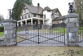
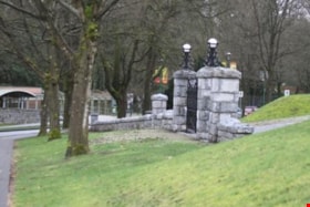
W.J. Mathers House 'Altnadene' Gate & Wall
https://search.heritageburnaby.ca/link/landmark858
- Repository
- Burnaby Heritage Planning
- Description
- The gate and wall of the W.J. Mathers House 'Altnadene' form an integral part of the heritage character of this historic estate, which includes a two-and-one-half storey wood frame house set in a large terraced garden, now located in Deer Lake Park. Built as a family home, it is designed in the Bri…
- Associated Dates
- 1912
- Formal Recognition
- Heritage Designation, Community Heritage Register
- Other Names
- William & Mary Mathers Residence
- Street View URL
- Google Maps Street View
- Repository
- Burnaby Heritage Planning
- Other Names
- William & Mary Mathers Residence
- Geographic Access
- Deer Lake Avenue
- Associated Dates
- 1912
- Formal Recognition
- Heritage Designation, Community Heritage Register
- Enactment Type
- Bylaw No. 13196
- Enactment Date
- 13/05/2013
- Description
- The gate and wall of the W.J. Mathers House 'Altnadene' form an integral part of the heritage character of this historic estate, which includes a two-and-one-half storey wood frame house set in a large terraced garden, now located in Deer Lake Park. Built as a family home, it is designed in the British Arts and Crafts style enriched by Tudor, Romanesque, and medieval details.
- Heritage Value
- 'Altnadene' was constructed in the Deer Lake Crescent subdivision, which was originally promoted as an upper class neighbourhood. It represents one of the first residential developments in the City of Burnaby that required buildings to be of a specific value, thus demonstrating the desire for exclusivity among the successful businessmen who chose to settle in the area. The house and grounds illustrate the social, cultural, lifestyle and leisure sensibilities of the owners in the Deer Lake Crescent subdivision: such values as social aspiration, racial exclusivity, demonstration of architectural taste, importance of a landscaped garden, and the provision of facilities for fashionable pursuits such as lawn tennis. The estate is historically significant for its connection to William John Mathers (1859-1929), an early pioneer who arrived in New Westminster in 1876, an enterprising grain dealer, businessman, alderman, president of the Board of Trade and various other local organizations, and a 'public spirited and progressive citizen.' The landscape of the estate featured a landmark granite capstone wall and wrought iron gate surrounding the front garden and terraced lawns of the mansion. The overall architectural intention was to reference medieval English estates by surrounding the ‘castle’ with a stone wall with gated entrances. The stone material for the construction of the wall was quarried from large ‘glacial erratic’ granite boulders found on the property. The highly decorative wrought iron gate was designed and made by artisan James A. Blair, a Scottish blacksmith employed by the Westminster Iron Works in 1912. The design for the 'double' driveway gate was featured in the company’s original catalogue as 'Design No. 152'. These gates are a very unusual and rare example of their type and are some of the most elaborate surviving examples in the City.
- Defining Elements
- Key elements that define the heritage character of the gate and wall at 'Altnadene' include its: - wrought iron gates, massive gate-posts inscribed with 'Altnadene' and granite walls at the corner entry of the property
- Locality
- Deer Lake Park
- Historic Neighbourhood
- Burnaby Lake (Historic Neighbourhood)
- Planning Study Area
- Douglas-Gilpin Area
- Organization
- Westminster Iron Works
- Function
- Primary Current--Recreation Centre
- Primary Historic--Estate
- Community
- Burnaby
- Cadastral Identifier
- P.I.D. No. 007-527-241 Legal Description: Lot 'B', District Lot 79, Group 1, New Westminster District, Plan 6642
- Boundaries
- 'Altnadene' is comprised of a single municipally-owned property located at 6490 Deer Lake Avenue, Burnaby.
- Area
- 17,065.00
- Contributing Resource
- Landscape Feature
- Ownership
- Public (local)
- Street Address
- 6490 Deer Lake Avenue
- Street View URL
- Google Maps Street View
Images
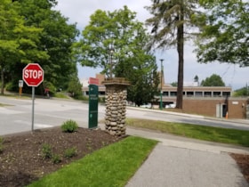
H.T. Ceperley Estate 'Fairacres' Estate Gate
https://search.heritageburnaby.ca/link/landmark863
- Repository
- Burnaby Heritage Planning
- Description
- The 'Fairacres Estate Gate' marks the location of one of the original driveway entrances to the estate.
- Associated Dates
- 1911
- Formal Recognition
- Heritage Designation, Community Heritage Register
- Street View URL
- Google Maps Street View
- Repository
- Burnaby Heritage Planning
- Geographic Access
- Deer Lake Avenue
- Associated Dates
- 1911
- Formal Recognition
- Heritage Designation, Community Heritage Register
- Enactment Type
- Bylaw No. 140665
- Enactment Date
- 23/11/1992
- Description
- The 'Fairacres Estate Gate' marks the location of one of the original driveway entrances to the estate.
- Heritage Value
- Fairacres was designed as a country estate with a working farm that included over 10 acres of productive berry and vegetable fields, with a large kitchen garden, a root house to store food, and greenhouses heated by steam. The agricultural potential ofthe Deer Lake area made it one of the first parts of the municipality to attract settlement. Construction of the Fairacres Estate represented a shift toward wealthy country estates over more modest farms, and the Ceperleys employed a large staff to manage the estate's agricultural production. Agricultural use of the estate continued when a Catholic order of Benedictine monks purchased the estate as part of the Priory of St. Joseph and the Seminary of Christ the King, and continued to farm the land until 1953. The overall architectural intention of the estate's architect was to reflect the ideals of the Arts & Crafts movement to showcase craftsmanship, and to incorporate high quality materials, including many local materials, such as wood and stone from the site. On the mansion exterior, the rustic style is seen in the use of natural materials such as cedar shingles and siding, cobblestone foundations and chimneys and the half-timbering in gable ends. The estate's remaining gate pillar features the same rustic field and cobblestones used on the mansion. The original estate driveway had two entrances constructed in 1910, each marked by a pair of entry gate pillars which supported iron gates. The main entrance gate pillars which marked the lower driveway and the east pillar of the upper entrance were demolished many years ago and the iron gates removed. A single gate pillar remains marking the upper driveway, adjacent to the Garage and Stables. This gate pillar is a significant site feature and incorporates cobble stone and a carved sandstone capstone.
- Defining Elements
- Key elements that define the heritage character of the ‘Fairacres Estate Gate' include: - setting in relation to the estate boundary and estate buildings - Cobble stone and sandstone construction, which represents a typical Arts and Crafts use of local materials, and matches the extensive use of cobblestone as chimneys and foundations on the Fairacres mansion, as well as the use of sandstone on the mansion's exterior.
- Locality
- Deer Lake Park
- Historic Neighbourhood
- Burnaby Lake (Historic Neighbourhood)
- Planning Study Area
- Douglas-Gilpin Area
- Function
- Primary Historic--Estate
- Community
- Burnaby
- Cadastral Identifier
- P.I.D. No. 004-493-311 Legal Description: Block 3 Except: Part subdivided by Plan 26865, District Lot 79, Group 1, New Westminster District, Plan 536
- Boundaries
- ‘Fairacres’ is comprised of a single municipally-owned property located at 6344 Deer Lake Avenue, Burnaby.
- Area
- 17,065.00
- Contributing Resource
- Landscape Feature
- Ownership
- Public (local)
- Other Collection
- Burnaby Historical Society, Community Archives: Ceperley Photograph Album
- Documentation
- Heritage Site Files: PC77000 20. City of Burnaby Planning and Building Department, 4949 Canada Way, Burnaby, B.C., V5G 1M2
- Subjects
- Structures - Fences
- Street Address
- 6344 Deer Lake Avenue
- Street View URL
- Google Maps Street View
Images
10-Jul-1911 Regular Council Minutes
https://search.heritageburnaby.ca/link/councilminutes62219
- Repository
- City of Burnaby Archives
- Meeting Date
- 10-Jul-1911
- Format
- Council - Regular Council Minutes
- Collection/Fonds
- City Council and Office of the City Clerk fonds
- Repository
- City of Burnaby Archives
- Meeting Date
- 10-Jul-1911
- Format
- Council - Regular Council Minutes
- Collection/Fonds
- City Council and Office of the City Clerk fonds
Documents
24-Jul-1911 Regular Council Minutes
https://search.heritageburnaby.ca/link/councilminutes62221
- Repository
- City of Burnaby Archives
- Meeting Date
- 24-Jul-1911
- Format
- Council - Regular Council Minutes
- Collection/Fonds
- City Council and Office of the City Clerk fonds
- Repository
- City of Burnaby Archives
- Meeting Date
- 24-Jul-1911
- Format
- Council - Regular Council Minutes
- Collection/Fonds
- City Council and Office of the City Clerk fonds
Documents
7-Aug-1911 Regular Council Minutes
https://search.heritageburnaby.ca/link/councilminutes62222
- Repository
- City of Burnaby Archives
- Meeting Date
- 7-Aug-1911
- Format
- Council - Regular Council Minutes
- Collection/Fonds
- City Council and Office of the City Clerk fonds
- Repository
- City of Burnaby Archives
- Meeting Date
- 7-Aug-1911
- Format
- Council - Regular Council Minutes
- Collection/Fonds
- City Council and Office of the City Clerk fonds
Documents
21-Aug-1911 Regular Council Minutes
https://search.heritageburnaby.ca/link/councilminutes62223
- Repository
- City of Burnaby Archives
- Meeting Date
- 21-Aug-1911
- Format
- Council - Regular Council Minutes
- Collection/Fonds
- City Council and Office of the City Clerk fonds
- Repository
- City of Burnaby Archives
- Meeting Date
- 21-Aug-1911
- Format
- Council - Regular Council Minutes
- Collection/Fonds
- City Council and Office of the City Clerk fonds
Documents
5-Sep-1911 Regular Council Minutes
https://search.heritageburnaby.ca/link/councilminutes62224
- Repository
- City of Burnaby Archives
- Meeting Date
- 5-Sep-1911
- Format
- Council - Regular Council Minutes
- Collection/Fonds
- City Council and Office of the City Clerk fonds
- Repository
- City of Burnaby Archives
- Meeting Date
- 5-Sep-1911
- Format
- Council - Regular Council Minutes
- Collection/Fonds
- City Council and Office of the City Clerk fonds


