Narrow Results By
Subject
- Advertising Medium - Signs and Signboards 2
- Building Components 1
- Buildings - Agricultural 4
- Buildings - Agricultural - Greenhouses 2
- Buildings - Agricultural - Stables 1
- Buildings - Civic 1
- Buildings - Civic - Community Centres 1
- Buildings - Civic - Museums 1
- Buildings - Commercial - Restaurants 1
- Buildings - Commercial - Stores 1
- Buildings - Heritage 14
- Buildings - Public - Detention Facilities 2
Person / Organization
- Allen, James Charles 1
- Army, Navy and Air Force Veterans in Canada, Pompier Unit #314 1
- Barnet Lumber Company 2
- Bateman, Edwin W. 1
- Bateman, Mary Dale 1
- Bell, Flora 1
- Bell, William 1
- Borstal School 2
- Bowman & Cullerne 1
- Bowman, Joseph Henry 1
- British Columbia Electric Railway 3
- British Columbia Electric Railway Company 1

Edmonds Neighbourhood
https://search.heritageburnaby.ca/link/landmark704
- Repository
- Burnaby Heritage Planning
- Associated Dates
- 1925-1954
- Heritage Value
- The historic growth of Edmonds as a neighbourhood was based on its strategic location on the early interurban line between Vancouver and New Westminster. Even by 1980 when a survey of the residential neighbourhoods was conducted, a full 25% of homes in the area predated 1930. The 1950s was a period of strong housing development, with both single-family and multi-family units being constructed. Although Burnaby's City Hall was moved from Kingsway and Edmonds in the early 1950s, Edmonds remained an important centre in the community.
- Historic Neighbourhood
- Edmonds (Historic Neighbourhood)
- Planning Study Area
- Stride Avenue Area
Images


Alta Vista Neighbourhood
https://search.heritageburnaby.ca/link/landmark707
- Repository
- Burnaby Heritage Planning
- Associated Dates
- 1925-1954
- Heritage Value
- As with many areas of Burnaby during this period, the years after World War Two marked a rapid growth in residential development in the Alta-Vista Neighbourhood. Subdivisions like Sussex and Suncrest were built and new schools and amenities were constructed to meet the demands of increased population.
- Historic Neighbourhood
- Alta Vista (Historic Neighbourhood)
- Planning Study Area
- Sussex-Nelson Area
Images


Fraser Arm Neighbourhood
https://search.heritageburnaby.ca/link/landmark708
- Repository
- Burnaby Heritage Planning
- Associated Dates
- 1925-1954
- Heritage Value
- By the late 1920s, the Fraser Arm Neighbourhood in Burnaby was developing into an industrial and manufacturing district. In 1931, the Canadian National Railway built a bridge over the Fraser River from Burnaby to Lulu Island and advertised that over 30 industries were currently operating along the North Fraser. Along with industries, this district remained an important agricultural area for the Lower Mainland. Chinese market gardens continued to develop and thrive and in 1926, the Vancouver Sun estimated that that Chinese farms in the Lower Fraser Valley then supplied 90 per cent of all green vegetables consumed in the Vancouver market area.
- Historic Neighbourhood
- Fraser Arm (Historic Neighbourhood)
- Planning Study Area
- Big Bend Area
Images

McPherson Park Junior High School
https://search.heritageburnaby.ca/link/landmark710
- Repository
- Burnaby Heritage Planning
- Associated Dates
- 1951-1993
- Street View URL
- Google Maps Street View
- Repository
- Burnaby Heritage Planning
- Geographic Access
- Rumble Street
- Associated Dates
- 1951-1993
- Heritage Value
- In 1950, the Burnaby School Inspector reported: "the recent development of a number of large housing projects and the continuing growth of new homes in settled areas are compelling the Board to consider a building program of major proportions...now under construction, including McPherson Park with 21 classrooms." Enrolment in its first year was 686 students. In the late 1980s and early 1990s, junior high schools were replaced with expanded secondary schools encompassing grades 7 through 12; as a result, McPherson Park Junior High was closed and Burnaby South Secondary School opened.
- Historic Neighbourhood
- Alta Vista (Historic Neighbourhood)
- Planning Study Area
- Clinton-Glenwood Area
- Street Address
- 5455 Rumble Street
- Street View URL
- Google Maps Street View

Riverside School
https://search.heritageburnaby.ca/link/landmark711
- Repository
- Burnaby Heritage Planning
- Geographic Access
- Marine Drive
- Associated Dates
- 1953-1983
- Heritage Value
- The south-east corner of Burnaby featured homes that were scattered in a rural setting. Previously, Riverway East and then Clinton Elementary School had served this neighbourhood, but a more central location was preferable to the School Board to limit bussing of students, so Riverside School was opened in 1953. There were 84 students registered in its first year, but by the late 1970s, enrolments across the City had declined and a number of schools, including Riverside, were closed.
- Historic Neighbourhood
- Fraser Arm (Historic Neighbourhood)
- Planning Study Area
- Big Bend Area
Images


East Burnaby Neighbourhood
https://search.heritageburnaby.ca/link/landmark712
- Repository
- Burnaby Heritage Planning
- Associated Dates
- 1925-1954
- Heritage Value
- After a lull in construction during the World War I period, East Burnaby Neighbourhood's growth resumed during the 1920s when many homes and businesses were constructed. The post-World War Two period also saw rapid construction and the creation of new housing developments in response to a population boom. The neighbourhood remained a primarily single-family residential area.
- Historic Neighbourhood
- Edmonds (Historic Neighbourhood)
- Planning Study Area
- Stride Avenue Area
Images


Barnet Neighbourhood
https://search.heritageburnaby.ca/link/landmark716
- Repository
- Burnaby Heritage Planning
- Associated Dates
- 1889-1904
- Heritage Value
- The North Pacific Lumber Company in Barnet was one of Burnaby's first industrial developments and one of the largest in the British Empire. Partners James MacLaren and Frank Ross built the mill in 1889 (activated in 1899) as a requirement for obtaining 84,000 acres of timber rights in northern BC. Due to the mill's isolation, the firm built homes for its employees with families and bunkhouses for the bachelors which separated Caucasian workers from Chinese and Sikh workers. Barnet became a distinct company town with its own general store, school, post office, community hall and telephone exchange.
- Historic Neighbourhood
- Barnet (Historic Neighbourhood)
- Planning Study Area
- Burnaby Mountain Area
Images


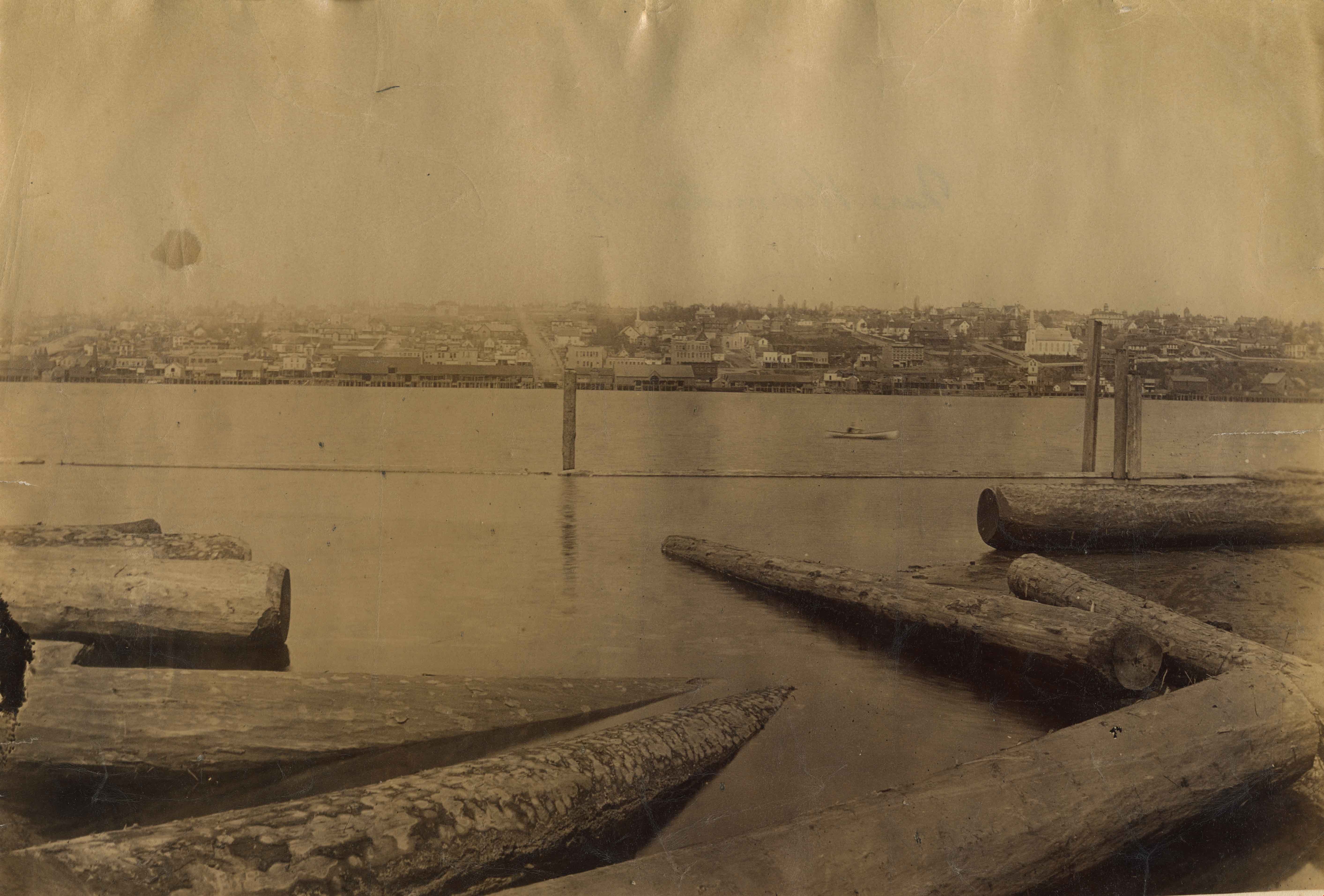
Burrard Inlet
https://search.heritageburnaby.ca/link/landmark717
- Repository
- Burnaby Heritage Planning
- Repository
- Burnaby Heritage Planning
- Heritage Value
- According to Tsleil'wautuh Chief Len George, as many as 10,000 band members once lived along both sides of the Burrard Inlet, but disease took its toll in the 1400s and Europeans brought smallpox in the 1800s. In 1792, Captain George Vancouver charted this inlet of the Pacific Ocean.
- Historic Neighbourhood
- Vancouver Heights (Historic Neighbourhood)
- Capitol Hill (Historic Neighbourhood)
- Barnet (Historic Neighbourhood)
- Planning Study Area
- Burnaby Heights Area
- Capitol Hill Area
- Westridge Area
Images


Burnaby Mountain
https://search.heritageburnaby.ca/link/landmark718
- Repository
- Burnaby Heritage Planning
- Repository
- Burnaby Heritage Planning
- Heritage Value
- The higher elevations of Burnaby Mountain's south slope produced the ideal soil and temperature conditions for prized native foodstuffs like salmonberry, Indian plum, red elderberry, and other plant species to produce fruit three weeks earlier than elsewhere.
- Historic Neighbourhood
- Barnet (Historic Neighbourhood)
- Planning Study Area
- Burnaby Mountain Area
Images


Central Park Neighbourhood
https://search.heritageburnaby.ca/link/landmark723
- Repository
- Burnaby Heritage Planning
- Associated Dates
- 1891-1904
- Heritage Value
- Central Park was one of the first and fastest-growing communities in Burnaby. Located along the electric tram line and the Vancouver Road (Kingsway), it was also chosen for a government settlement project referred to as the Central Park Small Holdings. The lands held by the Provincial Government were subdivided and sold around 1894 and by 1899 the settlement was large enough to warrant the construction of an Anglican Church there.
- Historic Neighbourhood
- Central Park (Historic Neighbourhood)
- Planning Study Area
- Maywood Area
Images


Deer Lake
https://search.heritageburnaby.ca/link/landmark724
- Repository
- Burnaby Heritage Planning
- Repository
- Burnaby Heritage Planning
- Heritage Value
- In their legends, the Sḵwx̱wú7mesh native people identified Burnaby's Deer Lake as a mystical location. For generations, one story was told of an underground tunnel connecting Deer Lake with False Creek. In Pauline Johnson's famous book "Legends of Vancouver," the story "Deer Lake" records how Old Chief Capilano chased a giant seal, which escaped through an underground tunnel in False Creek, to Deer Lake in the early 1800s. Aboriginal peoples still came to camp by the Lake up until the early 1900s. At the turn of the century, Deer Lake was recognized for its tranquility and beautiful scenery, which, in turn, attracted New Westminster and Vancouver residents to relocate to the area and build family homes.
- Historic Neighbourhood
- Burnaby Lake (Historic Neighbourhood)
- Planning Study Area
- Morley-Buckingham Area
- Oakalla Area
Images


Burnaby Lake Neighbourhood
https://search.heritageburnaby.ca/link/landmark733
- Repository
- Burnaby Heritage Planning
- Repository
- Burnaby Heritage Planning
- Heritage Value
- After New Westminster was established as the Capital City, the surrounding lands were surveyed by the Royal Engineers. The discovery of Burnaby Lake by Robert Burnaby in 1859 soon led to the construction of Douglas Road to Deer Lake in 1861. The completion of the tramline in 1891 renewed interest in the lands around both Burnaby Lake and Deer Lake and soon a group of gentlemen farmers had established strawberry fields and orchards to serve the New Westminster market. These were the most productive and well managed "fruit ranches" in the Fraser Valley. Local strawberries were so admired that they commanded 50 cents more per crate at local markets. One local paper reported that the area appeared as if "an English Village had been taken and planted amidst the grandeur of British Columbia scenery."
- Historic Neighbourhood
- Burnaby Lake (Historic Neighbourhood)
- Planning Study Area
- Douglas-Gilpin Area
Images


Burquitlam Neighbourhood
https://search.heritageburnaby.ca/link/landmark734
- Repository
- Burnaby Heritage Planning
- Repository
- Burnaby Heritage Planning
- Heritage Value
- Burnaby's first non-Native settler, William Holmes, selected land near the Brunette River on which to build his home in 1860. From this beginning, the neighbourhood of Burquitlam developed, fostered by its proximity to the North Road trail which linked it to New Westminster. In 1906, the Burquitlam Post Office opened and in 1910 the Hamilton Road school opened to serve the growing population of children in the area.
- Historic Neighbourhood
- Burquitlam (Historic Neighbourhood)
- Planning Study Area
- Cameron Area
- Lyndhurst Area
Images


Fraser Arm Neighbourhood
https://search.heritageburnaby.ca/link/landmark737
- Repository
- Burnaby Heritage Planning
- Repository
- Burnaby Heritage Planning
- Heritage Value
- Hugh MacRoberts, a farmer on Sea Island in Richmond, constructed a trail (which later became Marine Drive) to New Westminster in 1862 in order to bring his produce to market. The land along the Fraser River had been used as cranberry bogs and the fertile soil allowed opportunities for hay, root crops and other agricultural endeavours. The settlement grew around the River Road and by 1905 the Dundonald School opened, followed three years later by the Fraser Arm Post Office.
- Historic Neighbourhood
- Fraser Arm (Historic Neighbourhood)
- Planning Study Area
- Big Bend Area
Images

Jerry Rogers' Ditch
https://search.heritageburnaby.ca/link/landmark738
- Repository
- Burnaby Heritage Planning
- Repository
- Burnaby Heritage Planning
- Heritage Value
- Jeremiah "Jerry" Rogers (b. 1818, St. Andrews, NB; d 24 Oct 1879, English Bay) began logging at a camp near Jericho Beach in 1865 (the name Jericho may be a corruption of “Jerry’s Cove.”) His operation, which cleared much of what is now Kitsilano, provided spars for sailing ships and logs for Edward Stamp's mill on Burrard Inlet. In the 1870s, he became one of the first logging operators in Burnaby, establishing a camp in South Burnaby in about 1870 at Woolard Creek (Byrne Creek), where he cut timber for ship masts. Rogers constructed a ditch to facilitate the movement of the large trees. It is likely a series of locks were installed in the ditch to trap the waters of the Fraser River when the tides were high, and to trap water flowing from Woolard Creek. When the locks were released, the logs could more easily make their way to the Fraser River. A similar system of locks was used west of Jerry Rogers' Ditch, at Byrne's logging ditch constructed by Peter Byrne in 1893.
- Historic Neighbourhood
- Fraser Arm (Historic Neighbourhood)
- Planning Study Area
- Big Bend Area

Fraser River
https://search.heritageburnaby.ca/link/landmark740
- Repository
- Burnaby Heritage Planning
- Repository
- Burnaby Heritage Planning
- Heritage Value
- In peak years, upwards of 100 million salmon would swim up the Fraser River - the largest salmon-bearing river in the world. In August and September sockeye salmon would be pursued by almost 1000 canoes of fishers from all over the coast; people from Sechelt, Nanaimo, Cowichan, Saanich, Lummi Island, Skagit, Snohomish, Sḵwx̱wú7mesh. The estimated peak year sockeye salmon run was 60 million and the estimated yearly consumption by Natives was at least 4 million. In 1808, Simon Fraser became the first known European to travel in the Lower Fraser River.
- Historic Neighbourhood
- Fraser Arm (Historic Neighbourhood)
- Planning Study Area
- Big Bend Area
Images

Vancouver Heights Neighbourhood
https://search.heritageburnaby.ca/link/landmark741
- Repository
- Burnaby Heritage Planning
- Associated Dates
- 1905-1924
- Heritage Value
- On December 13, 1912, The British Columbian Weekly described the Vancouver Heights neighbourhood as follows: "The northern portion of the municipality in the vicinity of Boundary Road has during the past three years made tremendous strides towards settlement. At that time Mr. James Herd and Mr. Peters were the only residents of the district...Soon, however, the timber was removed, streets laid out and other conveniences such as water, light and transportation provided... The school population of the district has increased so rapidly that the school has been enlarged twice this year and is at the present time inadequate. About 200 children are attending now. There are three churches in the district and one mission...At present time there are two large blocks containing six stores..."
- Historic Neighbourhood
- Vancouver Heights (Historic Neighbourhood)
- Planning Study Area
- Burnaby Heights Area
Images


Capitol Hill Neighbourhood
https://search.heritageburnaby.ca/link/landmark742
- Repository
- Burnaby Heritage Planning
- Associated Dates
- 1905-1924
- Heritage Value
- Real estate ventures became quite active in the Vancouver Heights and Capitol Hill areas of Burnaby by 1908. Brokerage firms and agents who bought large tracts, subdivided and sold them off in parcels and by 1909 had adopted the name "Capitol Hill" to describe Burnaby's newest neighbourhood. In his book, History of Burnaby and Vicinity," historian George Green explains that the term "Capitol Hill" was taken from ancient Rome where the civic centre was built upon the Capitoline Hill, one of the seven hills of the eternal city. In 1909, the Scott Brokerage Company advertised the sale of lots on Capitol Hill, calling it "one of Vancouver's swellest suburbs."
- Historic Neighbourhood
- Capitol Hill (Historic Neighbourhood)
- Planning Study Area
- Capitol Hill Area
Images


Lochdale Neighbourhood
https://search.heritageburnaby.ca/link/landmark743
- Repository
- Burnaby Heritage Planning
- Associated Dates
- 1905-1924
- Heritage Value
- "Picturesquely situated on the south-westerly slope of the highest hill on the Burrard Peninsula is a district that in many ways resembles the early pioneer settlements…its centre is at the intersection of east Hastings Street and Sperling Avenue. Only a few years ago a dense forest covered this area and the settlers were few and some distance apart. After the war working men began to enter the Lochdale woods in quest of cheap home-sites. Today there are more than 400 residents in the district who combine to make a happy contented industrious community living on the edge of a big city yet enjoying the life offered by the country...The Community Hall is the centre of all social activities. Dances, concerts and other forms of entertainment are all there...Curtis Street runs from Sperling Avenue up to the hill, locally known as Hastings Grove. From the top on a clear day there is a view for miles around." ~ From the Sunday Province, March 8, 1925.
- Historic Neighbourhood
- Lochdale (Historic Neighbourhood)
- Planning Study Area
- Lochdale Area
Images


Burnaby North High School
https://search.heritageburnaby.ca/link/landmark745
- Repository
- Burnaby Heritage Planning
- Associated Dates
- 1923-1982
- Street View URL
- Google Maps Street View
- Repository
- Burnaby Heritage Planning
- Geographic Access
- Willingdon Avenue
- Associated Dates
- 1923-1982
- Heritage Value
- Burnaby North and Burnaby South were the first high schools built in the City. Before the high school opened, Burnaby students had to travel to Vancouver if they wished to pursue education beyond an elementary level. In 1921, arrangements were made to use the basement of the Presbyterian Church for instruction of local students. By 1922 the Burnaby North High School opened at its first permanent location (4375 Pandora Street - which is now Rosser Elementary). In 1945, the Willingdon Avenue site was built and was used until a new building was constructed in 1961 on Hammarskjold Drive. From 1962, the school was used as Burnaby Heights Junior High school, but it closed in 1982 and the junior high students went to the new Burnaby North on Hammarskjold.
- Historic Neighbourhood
- Capitol Hill (Historic Neighbourhood)
- Planning Study Area
- Capitol Hill Area
- Street Address
- 250 Willingdon Avenue
- Street View URL
- Google Maps Street View
Images
