Narrow Results By
Format
- Architectural Drawing 18
- Book 168
- Bylaws - Adopted 2007
- Bylaws - Other 1
- Bylaws - Repealed 299
- Cartographic Material 35
- Council - Committee Report 3269
- Council - Manager's Report 3483
- Council - Mayor/Councillor/Staff Report 4078
- Council - Public Hearing Minutes 137
- Council - Regular Council Minutes 761
- Graphic Material 29
Decade
- 2020s 56
- 2010s
- 2000s 60
- 1990s 88
- 1980s 69
- 1970s 83
- 1960s 122
- 1950s
- 1940s 65
- 1930s 84
- 1920s 85
- 1910s 102
- 1900s 45
- 1890s 18
- 1880s 3
- 1870s 1
- 1860s 4
- 1850s 2
- 1840s 1
- 1830s 1
- 1820s 1
- 1810s 1
- 1800s 1
- 1790s 1
- 1780s 1
- 1770s 1
- 1760s 1
- 1750s 1
- 1740s 1
- 1730s 1
- 1720s 1
- 1710s 1
- 1700s 1
- 1690s 1
- 1680s 1
- 1670s 1
- 1660s 1
- 1650s 1
- 1640s 1
- 1630s 1
- 1620s 1
- 1610s 1
- 1600s 1
Subject
- Advertising Medium - Signs and Signboards 1
- Agriculture - Farms 2
- Animals - Cats 1
- Animals - Dogs 4
- Animals - Fish 1
- Buildings - Civic - Museums 1
- Buildings - Commercial 1
- Buildings - Commercial - Malls 2
- Buildings - Commercial - Stores 4
- Buildings - Heritage 1
- Buildings - Recreational - Bowling Alleys 5
- Buildings - Schools 6
Creator
- Aujla, Kehar Singh 1
- Belcastro, Arlene 1
- Bobic, Janice 1
- British Columbia Electric Company 1
- Brown, Donald N. "Don" 1
- Burnaby Village Museum 6
- Burnaby Village Museum - City of Burnaby 2
- Canadian Broadcasting Corporation 1
- City of Burnaby 2
- Digney, Andy 26
- Digney, Ernest Frank "Dig" 4
- Digney family 1
100 Years of Gilmore School
https://search.heritageburnaby.ca/link/museumdescription4488
- Repository
- Burnaby Village Museum
- Date
- 2017
- Collection/Fonds
- 100 Years of Gilmore School video collection
- Description Level
- Item
- Physical Description
- 1 video recording (mp4) (34 min., 23 sec.) : digital, 29 fps, col., sd., stereo
- Scope and Content
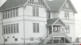
- "100 Years of Gilmore School". Filmed by Yunuen Perez Vertti and made by the Heights Neighbourhood Association. The film includes interviews with former students and highlights their experiences through the Great Depression, the Second World War and the 1960s.
- Repository
- Burnaby Village Museum
- Collection/Fonds
- 100 Years of Gilmore School video collection
- Description Level
- Item
- Physical Description
- 1 video recording (mp4) (34 min., 23 sec.) : digital, 29 fps, col., sd., stereo
- Scope and Content
- "100 Years of Gilmore School". Filmed by Yunuen Perez Vertti and made by the Heights Neighbourhood Association. The film includes interviews with former students and highlights their experiences through the Great Depression, the Second World War and the 1960s.
- History
- Yunuen Perez Vertti is a filmmaker and digital media artist originally from Mexico City. She has produced films for many public, private and non-profit organizations.
- Creator
- Perez Vertti, Yunuen
- Names
- Gilmore Avenue School
- Responsibility
- Heights Neighbourhood Association
- Geographic Access
- Gilmore Avenue
- Street Address
- 50 Gilmore Avenue
- Accession Code
- BV018.13.1
- Access Restriction
- Restricted access
- Reproduction Restriction
- May be restricted by third party rights
- Date
- 2017
- Media Type
- Moving Images
- Historic Neighbourhood
- Vancouver Heights (Historic Neighbourhood)
- Planning Study Area
- Burnaby Heights Area
- Notes
- Transcribed title
- Reproductions are restricted by copyright holder
Images
Video
100 Years of Gilmore School, 2017
100 Years of Gilmore School, 2017
https://search.heritageburnaby.ca/media/hpo/_Data/_BVM_Moving_Images/2018_0013_0001_001.mp4100 Years of Gilmore School video collection
https://search.heritageburnaby.ca/link/museumdescription10596
- Repository
- Burnaby Village Museum
- Date
- 2017
- Collection/Fonds
- 100 Years of Gilmore School video collection
- Description Level
- Fonds
- Physical Description
- 6 video recordings (mp4) (approx. 42 min.) : digital, 24 fps and 29 fps, col., sd., stereo
- Scope and Content
- Fonds consists of film content relating to the history of Gilmore Avenue School (Gilmore Community School) upon the recognition of it's 100th anniversary and includes a documentary film created by Yunuen Perez Vertti titled: "100 Years of Gilmore School" along with five short anecdotal films from s…
- Repository
- Burnaby Village Museum
- Collection/Fonds
- 100 Years of Gilmore School video collection
- Description Level
- Fonds
- Physical Description
- 6 video recordings (mp4) (approx. 42 min.) : digital, 24 fps and 29 fps, col., sd., stereo
- Scope and Content
- Fonds consists of film content relating to the history of Gilmore Avenue School (Gilmore Community School) upon the recognition of it's 100th anniversary and includes a documentary film created by Yunuen Perez Vertti titled: "100 Years of Gilmore School" along with five short anecdotal films from students past and present.
- History
- In 2016, the Heights Neighbourhood Association decided to recognize the 100th anniversary of Gilmore Avenue School. The Association partnered with filmmaker and producer, Yunuen Perez Vertti to create a film featuring historic photographs and interviews with students from decades past. The premier screening of the film was held at Gilmore Community School on Friday May 13, 2016. The film was later screened at Burnaby's McGill Public Library on January 17, 2017 where community members were invited to share their own memories of the school in front of the audience. Some of these memories were captured on film by Yunuen Perez Vertti and donated with permissions to Burnaby Village Museum.
- Accession Code
- BV018.13
- BV017.48
- Reproduction Restriction
- May be restricted by third party rights
- Date
- 2017
- Media Type
- Moving Images
- Notes
- Title based on contents of fonds
Alfred's Fountain Pen
https://search.heritageburnaby.ca/link/museumdescription9684
- Repository
- Burnaby Village Museum
- Date
- 2016
- Collection/Fonds
- Burnaby Village Museum Film and Video collection
- Description Level
- Item
- Physical Description
- 1 video recording (mp4) (3 min., 40 sec.) : digital, 25 fps, col., sd., stereo
- Scope and Content
- The video depicts the challenges of film maker Alfred Woo’s physical, social, and cultural transformation to a foreign country. Sentimentally prior to departing Hong Kong in 1954, Alfred was presented a fountain pen by some of his grade two classmates, a souvenir that he has cherished all these yea…
- Repository
- Burnaby Village Museum
- Collection/Fonds
- Burnaby Village Museum Film and Video collection
- Description Level
- Item
- Physical Description
- 1 video recording (mp4) (3 min., 40 sec.) : digital, 25 fps, col., sd., stereo
- Scope and Content
- The video depicts the challenges of film maker Alfred Woo’s physical, social, and cultural transformation to a foreign country. Sentimentally prior to departing Hong Kong in 1954, Alfred was presented a fountain pen by some of his grade two classmates, a souvenir that he has cherished all these years despite losing contact with them long ago. In his seniority, he muses poignantly about the symbolism of this writing instrument and shares his wonderment about the destiny of these childhood benefactors.
- History
- Immigrating from Hong Kong to Canada as a child, Alfred Woo easily assimilated into the Canadian way of life at an early age and has enjoyed the best of both worlds. A law graduate, his professional career included service as a Crown Counsel, securities administrator, corporate executive, and as private practitioner. He also served in the Canadian Army (Reserve Force) as a legal officer and an artillery officer before being honorably discharged at the rank of Major. A Burnaby resident for over 30 years, and now retired, he continues to volunteer helping seniors, a community service club, and a veterans group.
- Creator
- Woo, Alfred
- Other Title Information
- title supplied by film maker
- Subjects
- Persons - Chinese Canadians
- Names
- Woo, Alfred
- Accession Code
- BV016.37.15
- Access Restriction
- No restrictions
- Reproduction Restriction
- May be restricted by third party rights
- Date
- 2016
- Media Type
- Moving Images
- Notes
- Transcribed title
Images
Video
Alfred's Fountain Pen, 2016
Alfred's Fountain Pen, 2016
https://search.heritageburnaby.ca/media/hpo/_Data/_BVM_Moving_Images/2016_0037_0015_001.mp4Alpha Secondary School
https://search.heritageburnaby.ca/link/landmark678
- Repository
- Burnaby Heritage Planning
- Geographic Access
- Parker Street
- Associated Dates
- 1950
- Heritage Value
- The unexpected period of growth in Burnaby during the first few years of the 1950s resulted in many overcrowded schools. As a result, the School Board decided it required a Junior High to alleviate enrolment issues at Gilmore Avenue Elementary-Junior school. Alpha opened in 1950 with 423 students. The new school had 12 rooms but added more in 1953. There were fires at the school in 1956 and 1964, resulting in the rebuilding of seven classrooms, library and administrative offices. There were additions made in 1968 and 1969 and in 1976 a gymnasium was built.
- Planning Study Area
- Brentwood Area
- Street Address
- 4600 Parker Street
- Street View URL
- Google Maps Street View
Images
Alta Vista Neighbourhood
https://search.heritageburnaby.ca/link/landmark707
- Repository
- Burnaby Heritage Planning
- Associated Dates
- 1925-1954
- Heritage Value
- As with many areas of Burnaby during this period, the years after World War Two marked a rapid growth in residential development in the Alta-Vista Neighbourhood. Subdivisions like Sussex and Suncrest were built and new schools and amenities were constructed to meet the demands of increased population.
- Historic Neighbourhood
- Alta Vista (Historic Neighbourhood)
- Planning Study Area
- Sussex-Nelson Area
Images
Andy Digney Film
https://search.heritageburnaby.ca/link/archivedescription85335
- Repository
- City of Burnaby Archives
- Date
- [between 1934 and 1961]
- Collection/Fonds
- Digney Family fonds
- Description Level
- Item
- Physical Description
- 2 optical discs (approx. 2 hrs, 40 min) : digital, b&w, col., si.
- Scope and Content
- Item is a collection of 18 short films on DVD. These films were created by Andy Digney using his 8 mm camera and provide views of the Digney family gatherings, trips, vacations at home and abroad. They also provide glimpses of Burnaby parades, celebrations and the Digney Speedway. The 18 segments h…
- Repository
- City of Burnaby Archives
- Date
- [between 1934 and 1961]
- Collection/Fonds
- Digney Family fonds
- Physical Description
- 2 optical discs (approx. 2 hrs, 40 min) : digital, b&w, col., si.
- Description Level
- Item
- Record No.
- 562-003
- Access Restriction
- No restrictions
- Reproduction Restriction
- May be restricted by third party rights
- Accession Number
- 2014-04
- Scope and Content
- Item is a collection of 18 short films on DVD. These films were created by Andy Digney using his 8 mm camera and provide views of the Digney family gatherings, trips, vacations at home and abroad. They also provide glimpses of Burnaby parades, celebrations and the Digney Speedway. The 18 segments have all been described at item level.
- Subjects
- Animals - Dogs
- Recreational Activities - Fishing
- Recreational Activities - Camping
- Recreational Activities - Picnics
- Geographic Features - Rivers
- Events - Parades
- Media Type
- Moving Images
- Photographer
- Digney, Andy
- Creator
- Digney, Andy
- Notes
- Title based on contents of film
- The original 8mm film footage was digitized and broken down into 18 segments, reflecting the original order. Items are described as 562-003-1 : 562-003-18
Ardingley-Sprott Neighbourhood
https://search.heritageburnaby.ca/link/landmark797
- Repository
- Burnaby Heritage Planning
- Associated Dates
- 1955-2008
- Heritage Value
- The Ardingley-Sprott Neighbourhood is primarily non-residential and developed in the 1970s west of the Burnaby Lake park area. It grew to include a large recreational component in the form of the Burnaby Lake Sports Complex and playing fields.
- Historic Neighbourhood
- Burnaby Lake (Historic Neighbourhood)
- Planning Study Area
- Ardingley-Sprott Area
Images
A Tribute to Grandma Lamb
https://search.heritageburnaby.ca/link/museumdescription9675
- Repository
- Burnaby Village Museum
- Date
- 2016
- Collection/Fonds
- Burnaby Village Museum Film and Video collection
- Description Level
- Item
- Physical Description
- 1 video recording (mp4) (7 min., 28 sec.) : digital, 25 fps, col., sd., stereo
- Scope and Content
- Arlene Belcastro tells the story of her grandmother, Dakota Lamb, who was born to Norwegian parents in the late 1800s in North Dakota. She moved to Milk River, Alberta around 1900, then took up residence in Carmengay, Alberta during the Depression where she raised four children as a single mother a…
- Repository
- Burnaby Village Museum
- Collection/Fonds
- Burnaby Village Museum Film and Video collection
- Description Level
- Item
- Physical Description
- 1 video recording (mp4) (7 min., 28 sec.) : digital, 25 fps, col., sd., stereo
- Scope and Content
- Arlene Belcastro tells the story of her grandmother, Dakota Lamb, who was born to Norwegian parents in the late 1800s in North Dakota. She moved to Milk River, Alberta around 1900, then took up residence in Carmengay, Alberta during the Depression where she raised four children as a single mother after her husband left. She supported her family by taking in boarders, ironing, and working as a midwife. The family later moved to Edmonton, where she was one of the first Avon ladies. In 1944, she was able to take a job as a pastry cook up north during the construction of the Alaska Highway and save enough money to purchase her own home. The film includes Arlene’s memories of visiting Grandma Lamb’s rustic cabin at Baptiste Lake north of Edmonton, Alberta. Starting at age 6, Arlene and her cousin, Donna, spent every summer with Grandma Lamb. The rustic cabin did not have running water or electricity, so the girls learned about kerosene lamps, wood stoves, and using a cold storage trunk for refrigeration. Grandma Lamb taught them life-skills through chores such as gathering kindling and tending the garden, and encouraged their independence. Arlene recalls that they also learned by example from Grandma Lamb, who instilled a respect for nature and for other people and never complained about life or what material things she didn’t have. She was a resilient, respectful, and wise role model.
- History
- Arlene Belcastro was born in Edmonton and attended H.A. Gray School and Victoria High School, where she completed commercial courses. She was married in Edmonton at age 19, and moved to Calgary after her eldest child was born. She learned to ride a horse at Elkana Ranch at Bragg Creek while living in Calgary. Following the birth of her second son, the family briefly lived in Nassau. Arlene returned to Edmonton after her marriage ended, and soon moved to the Vancouver/Burnaby area where she has lived for more than 40 years. At age 50, Arlene began acting and is currently a student of drumming, a community volunteer, and an avid traveler.
- Creator
- Belcastro, Arlene
- Other Title Information
- title supplied by film maker
- Accession Code
- BV016.37.6
- Access Restriction
- No restrictions
- Reproduction Restriction
- May be restricted by third party rights
- Date
- 2016
- Media Type
- Moving Images
- Notes
- Transcribed title
Images
Video
A Tribute to Grandma Lamb, 2016
A Tribute to Grandma Lamb, 2016
https://search.heritageburnaby.ca/media/hpo/_Data/_BVM_Moving_Images/2016_0037_0006_001.mp4Aubrey Elementary School
https://search.heritageburnaby.ca/link/landmark785
- Repository
- Burnaby Heritage Planning
- Geographic Access
- Stratford Avenue
- Associated Dates
- 1959
- Heritage Value
- Aubrey Avenue School was built in 1959 to help alleviate the increased enrolment at other North Burnaby schools due to the development of new subdivisions such as Brentwood, Capitol Hill and Westridge. Additions to the original structure were made in 1962, 1963, 1964, 1967 and 1972.
- Planning Study Area
- Parkcrest-Aubrey Area
- Street Address
- 1075 Stratford Avenue
- Street View URL
- Google Maps Street View
Images
Barnet Neighbourhood
https://search.heritageburnaby.ca/link/landmark681
- Repository
- Burnaby Heritage Planning
- Associated Dates
- 1925-1954
- Heritage Value
- In 1925, the mill at Barnet was under new ownership and was known as the Barnet Lumber Company. It was one of the most successful local employers in Burnaby until the 1930s, when the economic crisis of the Great Depression resulted in a strike at the mill. The City of Burnaby eventually assumed control of the site - including all of the homes - when the company failed to pay its taxes. The City then dismantled the mill and resold the property in two parts - the eastern section would become the Kapoor sawmill and the western portion, the McColl-Frontenac Oil Company.
- Historic Neighbourhood
- Barnet (Historic Neighbourhood)
- Planning Study Area
- Burnaby Mountain Area
Images
The Bet
https://search.heritageburnaby.ca/link/museumdescription9774
- Repository
- Burnaby Village Museum
- Date
- 2016
- Collection/Fonds
- Burnaby Village Museum Film and Video collection
- Description Level
- Item
- Physical Description
- 1 video recording (mp4) (8 min., 9 sec.) : digital, 25 fps, col., sd., stereo
- Scope and Content
- The film details Teresa Florkow’s journey to restore and maintain her tugboat, the Papco III in 1982, at the prodding of her dock neighbour Ollie Iverson.
- Repository
- Burnaby Village Museum
- Collection/Fonds
- Burnaby Village Museum Film and Video collection
- Description Level
- Item
- Physical Description
- 1 video recording (mp4) (8 min., 9 sec.) : digital, 25 fps, col., sd., stereo
- Scope and Content
- The film details Teresa Florkow’s journey to restore and maintain her tugboat, the Papco III in 1982, at the prodding of her dock neighbour Ollie Iverson.
- History
- Teresa Florkow was born on October 11 1932 in Natal BC (now Sparwood BC). Her parents, Ann and John Bowman had another three girls (Betty Ann, Marilyn and Frances) before moving to Burnaby in 1945. They settled at 1713 Frederick Avenue at Rumble Street. Teresa attended Nelson Avenue School and then Burnaby South High School. After graduation, she worked at the Royal Bank at Kingsway and McKay for 7 years. She married Arc Florkow on July 14 1952. The couple moved to 5887 Berwick Street in Burnaby and had three children: Chris, Jill and Gail. Arc worked as a furniture painter until he bought a tugboat in 1975.
- Creator
- Florkow, Teresa
- Other Title Information
- title supplied by film maker
- Subjects
- Transportation - Boats
- Names
- Florkow, Teresa
- Accession Code
- BV016.37.17
- Access Restriction
- No restrictions
- Reproduction Restriction
- May be restricted by third party rights
- Date
- 2016
- Media Type
- Moving Images
- Notes
- Transcribed title
Images
Video
The Bet, 2016
Big Bend Neighbourhood
https://search.heritageburnaby.ca/link/landmark840
- Repository
- Burnaby Heritage Planning
- Associated Dates
- 1955-2008
- Heritage Value
- The Big Bend Neighbourhood in Burnaby maintained its status as an important agricultural area in the City in the years following 1955 and it also solidified its role as a prime industrial and commercial district. In 1972, the Big Bend Development Plan was adopted by Council and soon thereafter, approximately 620 acres of land were incorporated into the Agricultural Land Reserve. These lands have been set aside for agricultural and limited recreation purposes. By the 2000s, 160 acres of land were considered highly productive agricultural areas, and over 400 acres of land had been secured as parkland, including the Fraser Foreshore Park. The area also developed large commercial and industrial districts including those at Marine Way/Boundary, the Glenlyon Estates, Riverfront Business Park, Burnaby Business Park, and Glenwood Industrial Estates.
- Historic Neighbourhood
- Fraser Arm (Historic Neighbourhood)
- Planning Study Area
- Big Bend Area
Images
Brentwood Neighbourhood
https://search.heritageburnaby.ca/link/landmark669
- Repository
- Burnaby Heritage Planning
- Associated Dates
- 1925-1954
- Heritage Value
- In July, 1953, Burnaby's Municipal Council gave approval for the construction of a $12,000,000 residential and shopping development to be called Brentwood Park, located on the northeast corner of Lougheed and Willingdon. Plans called for about 400 homes and a 30-acre shopping centre to be built in this new subdivision - the first large residential subdivision in Burnaby to be developed with sewers and paved streets as well as other services.
- Planning Study Area
- Brentwood Area
Images
Brentwood Neighbourhood
https://search.heritageburnaby.ca/link/landmark780
- Repository
- Burnaby Heritage Planning
- Associated Dates
- 1955-2008
- Heritage Value
- Between 1955 and 2001, the Brentwood Neighbourhood developed into one of Burnaby's four official Town Centres. The Brentwood Town Centre serves the north-west sector of the Municipality, providing facilities such as commercial developments - of which the Brentwood Mall is the most significant. Under Burnaby's Residential Development Framework adopted by Council in 1981, the Town Centre also incorporated a full range of multi-housing types and forms in close relationship with their commercial facilities. In 1996, the City adopted the Brentwood Town Centre Development Plant to solidify the area as a focus of higher-density and higher-intensity residential and commercial opportunities, public transit and supporting leisure facilities.
- Planning Study Area
- Brentwood Area
Images
Brentwood Park Elementary School
https://search.heritageburnaby.ca/link/landmark679
- Repository
- Burnaby Heritage Planning
- Geographic Access
- Delta Avenue
- Associated Dates
- 1954
- Heritage Value
- Brentwood Park Elementary School was built during the post-World War Two housing boom in Burnaby and like other schools at the time, was similar in design - no basements, no second stories and no high stairways. New classrooms could be added in line with the original structure as was the case when two additions were put on between 1956 and 1958, a new classroom and library added in 1965-1966 and two more classrooms in 1969.
- Planning Study Area
- Brentwood Area
- Street Address
- 1455 Delta Avenue
- Street View URL
- Google Maps Street View
Images
Broadview Neighbourhood
https://search.heritageburnaby.ca/link/landmark687
- Repository
- Burnaby Heritage Planning
- Associated Dates
- 1925-1954
- Heritage Value
- Development in the Broadview area slowed during World War Two, but after the war, the area became home to a number of industrial sites. The first major plant to be built here was the Dominion Bridge Company which opened in 1930.
- Historic Neighbourhood
- Broadview (Historic Neighbourhood)
- Planning Study Area
- Cascade-Schou Area
Images
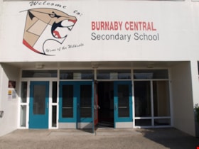
Burnaby Central School
https://search.heritageburnaby.ca/link/landmark814
- Repository
- Burnaby Heritage Planning
- Geographic Access
- Canada Way
- Associated Dates
- 1958
- Heritage Value
- Burnaby Central School became the third high school to be built in Burnaby (following Burnaby North and Burnaby South). The increased school enrolments due to the rapidly growing population in Burnaby meant that the School District required this third high school to be placed between the other two. In its first year, 719 students attended Burnaby Central.
- Historic Neighbourhood
- Burnaby Lake (Historic Neighbourhood)
- Planning Study Area
- Douglas-Gilpin Area
- Street Address
- 4939 Canada Way
- Street View URL
- Google Maps Street View
Images
Burnaby Community Heritage Commission 125 Video collection series
https://search.heritageburnaby.ca/link/museumdescription10594
- Repository
- Burnaby Village Museum
- Date
- 2018
- Collection/Fonds
- Burnaby Village Museum fonds
- Description Level
- Series
- Physical Description
- 5 video recordings (mp4) (approx. 19 min.)
- Scope and Content
- Series consists of five short films produced by the City of Burnaby Community Heritage Commission in recognition of Burnaby's 125th anniversary. The five films are titled; "Eileen Daily: Taking a stand"; "Burnaby’s Chinese Canadian Market Gardens"; "Saving Burnaby Lake"; "Saving the Salmon: the Bru…
- Repository
- Burnaby Village Museum
- Collection/Fonds
- Burnaby Village Museum fonds
- Description Level
- Series
- Physical Description
- 5 video recordings (mp4) (approx. 19 min.)
- Scope and Content
- Series consists of five short films produced by the City of Burnaby Community Heritage Commission in recognition of Burnaby's 125th anniversary. The five films are titled; "Eileen Daily: Taking a stand"; "Burnaby’s Chinese Canadian Market Gardens"; "Saving Burnaby Lake"; "Saving the Salmon: the Brunette River Story" and "Troubled Times: Burnaby in the 1930s".
- History
- The Community Heritage Commission was established in 1988 by Burnaby City Council under the provisions of the B.C. Heritage Conservation Act. The role of the Commission has been to advise Council on various heritage matters referred to it by Council. The Commission has evolved to oversee programs and projects that support heritage conservation in Burnaby as guided by the Official Community Plan. One of the goals of the plan is to provide opportunities for increased awareness and the conservation of the City's unique natural, cultural, archaeological and built heritage. In 2017, the Community Heritage Commission received funding from Burnaby City Council and the BC/Canada 150 project to launch a Heritage Interpretive Plaque Program to celebrate and mark Burnaby's 125 anniversary. The project was launched by the Planning and Building Department in partnership with the Burnaby Village Museum which included the development of online video vignettes to accompany the markers in a new expanded interpretive program.
- Publisher
- City of Burnaby Community Heritage Commission
- Accession Code
- BV018.12
- Date
- 2018
- Media Type
- Moving Images
- Notes
- Title based on contents of series
- Reproduction of content is restricted
Burnaby General Hospital
https://search.heritageburnaby.ca/link/landmark690
- Repository
- Burnaby Heritage Planning
- Geographic Access
- Kincaid Street
- Associated Dates
- 1952
- Heritage Value
- Burnaby residents had long been asking for a hospital in their municipality so on July 14, 1943, the first meeting of the Burnaby Hospital Fund-raising Committee was held at the Canadian Legion Hall at Royal Oak and Kingsway. In 1947, the group was incorporated as the Burnaby Hospital Society and after extensive lobbying and fundraising, the Burnaby General Hospital opened its doors on October 30, 1952. The site was provided by the Municipality of Burnaby on 17.5 acres of parkland on a small hill in the Cascade Heights area. In its first year, the hospital admitted 5010 patients and delivered 944 babies.
- Historic Neighbourhood
- Broadview (Historic Neighbourhood)
- Planning Study Area
- Cascade-Schou Area
- Street Address
- 3935 Kincaid Street
- Street View URL
- Google Maps Street View
Images
Burnaby Heights Neighbourhood
https://search.heritageburnaby.ca/link/landmark776
- Repository
- Burnaby Heritage Planning
- Associated Dates
- 1955-2008
- Heritage Value
- Up until the 1970s, this neighbourhood was known as Vancouver Heights. When a new park was created during that decade and named "Burnaby Heights Park," the name was gradually adopted by newcomers to the area. Today, you will hear residents refer to their neighbourhood as Burnaby Heights, Vancouver Heights, or just "The Heights." Throughout the 1960s and 1970s, the commercial district in this neighbourhood continued to grow and a Retail Merchants Association was formed which later became known as the Heights Merchants Association. The neighbourhood still retains a residential neighbourhood characteristic with an increasing number of apartment buildings and multi-family units being built over the past 20 years.
- Historic Neighbourhood
- Vancouver Heights (Historic Neighbourhood)
- Planning Study Area
- Burnaby Heights Area
