Narrow Results By
Subject
- Advertising Medium - Signs and Signboards 2
- Agriculture - Crops 1
- Agriculture - Farms 1
- Building Components 1
- Buildings - Agricultural 4
- Buildings - Agricultural - Greenhouses 2
- Buildings - Agricultural - Stables 1
- Buildings - Civic 1
- Buildings - Civic - Community Centres 1
- Buildings - Civic - Museums 1
- Buildings - Commercial - Restaurants 1
- Buildings - Commercial - Stores 1
Creator
- Adams, John 2
- Albert F. Arnold 1
- Albert F. Arnold McCarter & Nairne 1
- Alphonse J. Toebaert 1
- Associated Factory Mutual Fire Insurance Cos 1
- Bancroft, Rose 1
- Bekins Moving and Storage Company Limited 1
- Bernard R. Hill 1
- Bowman and Cullerne 2
- Bowman & Cullerne 5
- British Columbia Underwriters' Association 13
- Bureau of Post War Rehabilitation and Reconstruction Regional Planning Division 1
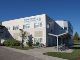
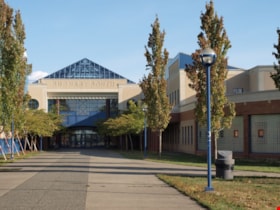
Byrne Creek Secondary School
https://search.heritageburnaby.ca/link/landmark849
- Repository
- Burnaby Heritage Planning
- Geographic Access
- 18th Street
- Associated Dates
- 2005
- Heritage Value
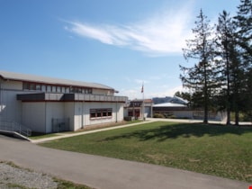
- Byrne Creek School opened in 2005 and accommodates students from grades 8 through 12. When built, the school was created to house as many as 1200 students, but by 2009, plans have been prepared to increase that capacity to 1500.
- Historic Neighbourhood
- Edmonds (Historic Neighbourhood)
- Planning Study Area
- Stride Avenue Area
- Street Address
- 7777 18th Street
- Street View URL
- Google Maps Street View
Images
City of Burnaby Orthophoto Map
https://search.heritageburnaby.ca/link/archivedescription91896
- Repository
- City of Burnaby Archives
- Date
- 2004
- Collection/Fonds
- Fire Department fonds
- Description Level
- File
- Physical Description
- 1 orthophoto map on 63 sheets ; 61 x 86 cm
- Scope and Content
- File consists of 1 orthophoto map of the City of Burnaby, printed on 63 sheets.
- Repository
- City of Burnaby Archives
- Date
- 2004
- Collection/Fonds
- Fire Department fonds
- Physical Description
- 1 orthophoto map on 63 sheets ; 61 x 86 cm
- Material Details
- Scale 1:2000
- Description Level
- File
- Record No.
- 62613
- File Class
- 22000-2
- Access Restriction
- Open access
- Reproduction Restriction
- May be restricted by third party rights
- Accession Number
- 2017-54
- Scope and Content
- File consists of 1 orthophoto map of the City of Burnaby, printed on 63 sheets.
- Media Type
- Cartographic Material
- Notes
- Title based on content of file
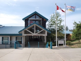
Taylor Park Elementary School
https://search.heritageburnaby.ca/link/landmark847
- Repository
- Burnaby Heritage Planning
- Geographic Access
- Mission Avenue
- Associated Dates
- 2004
- Heritage Value
- Taylor Park Elementary School was opened in 2004 with 240 students from kindergarten to grade three (with older students attending Stride Avenue Community School). By 2006, Taylor Park had been designated as its own school and extended its classes from kindergarten through grade six.
- Historic Neighbourhood
- Edmonds (Historic Neighbourhood)
- Planning Study Area
- Stride Hill Area
- Street Address
- 7590 Mission Avenue
- Street View URL
- Google Maps Street View
Images
City of Burnaby Archives
https://search.heritageburnaby.ca/link/landmark783
- Repository
- Burnaby Heritage Planning
- Geographic Access
- Albert Street
- Associated Dates
- 2001
- Heritage Value
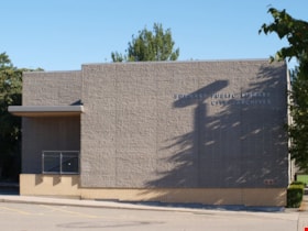
- The City of Burnaby Archives officially opened on Saturday, November 10, 2001. The Archives is Burnaby's first municipal archives, and is located in the McGill Branch Library. The City Archives functions as a branch of the Office of the City Clerk and operates as the official repository of Burnaby's municipal records, containing records dating back to Burnaby's incorporation in 1892. In 2007, the City of Burnaby Archives expanded its collection mandate to include private as well as public records. On February 14, 2007 an agreement was signed with the Burnaby Historical Society and, as a result, the Archives accepted into its custody the collection of community records that had been maintained and managed by the Historical Society since the 1950s. In the Spring of 2007, these records were transferred from the Burnaby Village Museum to their permanent home in the Archives facility.
- Historic Neighbourhood
- Capitol Hill (Historic Neighbourhood)
- Planning Study Area
- Capitol Hill Area
- Street Address
- 4595 Albert Street
- Street View URL
- Google Maps Street View
Images
Burnaby Mountain Secondary School
https://search.heritageburnaby.ca/link/landmark831
- Repository
- Burnaby Heritage Planning
- Geographic Access
- Eastlake Drive
- Associated Dates
- 2000
- Heritage Value
- Burnaby Mountain Secondary School is one of the more recent schools in Burnaby, having opened in 2000 and it serves neighbourhoods in northeast Burnaby and northwest Coquitlam.
- Historic Neighbourhood
- Burquitlam (Historic Neighbourhood)
- Planning Study Area
- Lyndhurst Area
- Street Address
- 8800 Eastlake Drive
- Street View URL
- Google Maps Street View
Images
Lougheed Town Centre Plan Map
https://search.heritageburnaby.ca/link/archivedescription56654
- Repository
- City of Burnaby Archives
- Date
- 1997
- Collection/Fonds
- Planning Department fonds
- Description Level
- Item
- Physical Description
- 1 map
- Scope and Content
- Map shows the land use concept and design plan for the Lougheed Town Centre.
- Repository
- City of Burnaby Archives
- Date
- 1997
- Collection/Fonds
- Planning Department fonds
- Physical Description
- 1 map
- Description Level
- Item
- Record No.
- 40080
- Accession Number
- 2008-16
- Scope and Content
- Map shows the land use concept and design plan for the Lougheed Town Centre.
- Media Type
- Textual Record
- Cartographic Material
Shadbolt Centre for the Arts
https://search.heritageburnaby.ca/link/landmark820
- Repository
- Burnaby Heritage Planning
- Geographic Access
- Deer Lake Avenue
- Associated Dates
- 1995
- Heritage Value
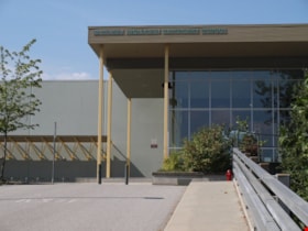
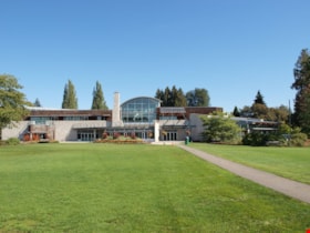
- The Shadbolt Centre for the Arts opened in 1995. The Shadbolt Centre was named after two Burnaby residents who dedicated a lifetime of support and cultivation of the arts locally, nationally and internationally. Doris and Jack Shadbolt resided in Burnaby for over 50 years until Jack's death in November 1998. Doris Shadbolt spent her life's work bringing the artist and the audience closer together through her writing and curatorial work. Jack Shadbolt was an internationally recognized Canadian painter. He was also an author and both received many awards including the Order of Canada. In keeping with the Shadbolts' generosity the arts, Jack Shadbolt donated two of his paintings to the Centre for permanent display.
- Historic Neighbourhood
- Burnaby Lake (Historic Neighbourhood)
- Planning Study Area
- Douglas-Gilpin Area
- Street Address
- 6450 Deer Lake Avenue
- Street View URL
- Google Maps Street View
Images
Burnaby South Secondary School and The B.C. Provincial School for the Deaf
https://search.heritageburnaby.ca/link/landmark844
- Repository
- Burnaby Heritage Planning
- Geographic Access
- Rumble Street
- Associated Dates
- 1993
- Heritage Value
- The original Burnaby South High School was replaced in 1993 and the new Burnaby South Secondary School and BC Provincial School for the Deaf was built at this location. This school was built with the latest technology and modern equipment to ensure it was fully accessible and offers integrated academic, social and recreational activities for its students.
- Historic Neighbourhood
- Alta Vista (Historic Neighbourhood)
- Planning Study Area
- Clinton-Glenwood Area
- Street Address
- 5455 Rumble Street
- Street View URL
- Google Maps Street View
Images
Committee projects
https://search.heritageburnaby.ca/link/archivedescription88257
- Repository
- City of Burnaby Archives
- Date
- 1992-1994
- Collection/Fonds
- SFU/Burnaby Centennial Committee fonds
- Description Level
- File
- Physical Description
- 1 cm of textual records and cartographic material
- Scope and Content
- File consists of records pertaining to committee projects including; minutes of meetings; the map project, titled, "Burnaby Unfolding" which includes correspondence, colour maps illustrating the patterns of growth and research notes; a draft outline for "Burnaby at 100: Images and Voices"; a progra…
- Repository
- City of Burnaby Archives
- Date
- 1992-1994
- Collection/Fonds
- SFU/Burnaby Centennial Committee fonds
- Physical Description
- 1 cm of textual records and cartographic material
- Description Level
- File
- Record No.
- MSS187-006
- Access Restriction
- Subject to FOIPPA
- Reproduction Restriction
- Reproductions subject to FOIPPA
- Accession Number
- 2014-28
- Scope and Content
- File consists of records pertaining to committee projects including; minutes of meetings; the map project, titled, "Burnaby Unfolding" which includes correspondence, colour maps illustrating the patterns of growth and research notes; a draft outline for "Burnaby at 100: Images and Voices"; a program for the opening ceremony of "Burnaby's Centennial 1892-1992" ; an outline providing some background history of the committee,it's many projects and correspondence regarding the status of the committee's projects.
- Media Type
- Textual Record
- Cartographic Material
- Notes
- Title based on contents of file
South Slope Elementary School & The B.C. Provincial School for the Deaf
https://search.heritageburnaby.ca/link/landmark843
- Repository
- Burnaby Heritage Planning
- Geographic Access
- Watling Street
- Associated Dates
- 1992
- Heritage Value
- South Slope/B.C. School for the Deaf opened in 1992 and is one of the newer elementary schools in the City. The 2009 School Growth Plan notes that South Slope/BC School for the Deaf replaced the former Jericho Hill School for the Deaf in Vancouver.
- Historic Neighbourhood
- Alta Vista (Historic Neighbourhood)
- Planning Study Area
- Sussex-Nelson Area
- Street Address
- 4446 Watling Street
- Street View URL
- Google Maps Street View
Images
1892 Burnaby Centennial
https://search.heritageburnaby.ca/link/museumdescription8704
- Repository
- Burnaby Village Museum
- Date
- [1992]
- Collection/Fonds
- Burnaby Village Museum Map collection
- Description Level
- Item
- Physical Description
- 1 map : blueline print ; 71 cm x 119 cm
- Scope and Content
- A birds eye view map of Burnaby, drawn by Mark Lewis, Parks staff, as a Parks-Maintenance Centennial Project for the 1892 - 1992 Burnaby Centennial. It features wildlife found in Burnaby and highlights civic buildings, parks and other prominent structures of the time. This is not a scale map.
- Repository
- Burnaby Village Museum
- Collection/Fonds
- Burnaby Village Museum Map collection
- Description Level
- Item
- Physical Description
- 1 map : blueline print ; 71 cm x 119 cm
- Material Details
- "1892 BURNABY/ CENTENNIAL 1992" printed in a banner across the top of the map Burnaby Centennial logo is located in the lower right side. "ALL WILDLIFE SHOWN CAN STILL / BE FOUND IN THE BURNABY AREA" printed in lower right corner "DRAWN BY / MARK LEWIS / A PARKS-MAINTENANCE / CENTENNIAL PROJECT" printed in the very lower right corner.
- The map is dark blue ink, there is no colour.
- Scope and Content
- A birds eye view map of Burnaby, drawn by Mark Lewis, Parks staff, as a Parks-Maintenance Centennial Project for the 1892 - 1992 Burnaby Centennial. It features wildlife found in Burnaby and highlights civic buildings, parks and other prominent structures of the time. This is not a scale map.
- History
- Drawn by Mark Lewis of the Parks-Maintenance Dept for the 1882 - 1992 Centennial of Burnaby. Mark always loved birds-eye maps, and showed this map to his supervisors while the work was still in progress. They suggested the map could be a Parks Maintenance Centennial Project. Mark agreed, and completed the map, including Burnaby landmarks and sketches of wildlife. Several copies of the map were given to schools so students could colour them.
- Creator
- Lewis, Mark
- Accession Code
- BV013.8.1
- Access Restriction
- No restrictions
- Reproduction Restriction
- No known restrictions
- Date
- [1992]
- Media Type
- Cartographic Material
- Scan Resolution
- 300
- Scan Date
- 05-Jun-2013
- Scale
- 96
- Notes
- Transcribed title
Images
Correspondence and reports for SFU/Burnaby Centennial Committee Projects
https://search.heritageburnaby.ca/link/archivedescription88268
- Repository
- City of Burnaby Archives
- Date
- 1991-1993
- Collection/Fonds
- SFU/Burnaby Centennial Committee fonds
- Description Level
- File
- Physical Description
- 1 cm of textual records and cartographic material
- Scope and Content
- File consists of the SFU (Simon Fraser University)/Burnaby Centennial Committee project documents and correspondence including; final project documentation for the Burnaby Image Bank and a S.F.U./Burnaby Centennial Committee, "Project Proposals" document for official endorsements and assistance, ma…
- Repository
- City of Burnaby Archives
- Date
- 1991-1993
- Collection/Fonds
- SFU/Burnaby Centennial Committee fonds
- Physical Description
- 1 cm of textual records and cartographic material
- Description Level
- File
- Record No.
- MSS187-008
- Access Restriction
- Subject to FOIPPA
- Reproduction Restriction
- Reproductions subject to FOIPPA
- Accession Number
- 2014-28
- Scope and Content
- File consists of the SFU (Simon Fraser University)/Burnaby Centennial Committee project documents and correspondence including; final project documentation for the Burnaby Image Bank and a S.F.U./Burnaby Centennial Committee, "Project Proposals" document for official endorsements and assistance, map project proposal documents and a list of committee members positions and their contact information.
- Media Type
- Textual Record
- Cartographic Material
- Notes
- Title based on contents of file
Burnaby Map Project proposal and other projects
https://search.heritageburnaby.ca/link/archivedescription88269
- Repository
- City of Burnaby Archives
- Date
- 1991-1993
- Collection/Fonds
- SFU/Burnaby Centennial Committee fonds
- Description Level
- File
- Physical Description
- 0.5 cm of textual records
- Scope and Content
- File consists of the SFU (Simon Fraser University)/Burnaby Centennial Committee project documents including; correspondence and indexing for the "Burnaby Unfolding" map project, final project documentation and correspondence for the Burnaby Image Bank and other projects. (The Burnaby map project n…
- Repository
- City of Burnaby Archives
- Date
- 1991-1993
- Collection/Fonds
- SFU/Burnaby Centennial Committee fonds
- Physical Description
- 0.5 cm of textual records
- Description Level
- File
- Record No.
- MSS187-009
- Access Restriction
- Subject to FOIPPA
- Reproduction Restriction
- Reproductions subject to FOIPPA
- Accession Number
- 2014-28
- Scope and Content
- File consists of the SFU (Simon Fraser University)/Burnaby Centennial Committee project documents including; correspondence and indexing for the "Burnaby Unfolding" map project, final project documentation and correspondence for the Burnaby Image Bank and other projects. (The Burnaby map project never came to fruition, being surpassed by the "Suburb of Happy Homes..." book).
- Media Type
- Textual Record
- Cartographic Material
- Notes
- Title based on contents of file
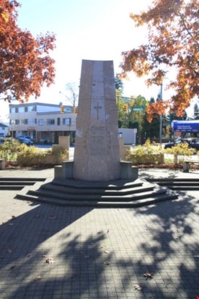
South Burnaby Cenotaph
https://search.heritageburnaby.ca/link/landmark860
- Repository
- Burnaby Heritage Planning
- Description
- The South Burnaby Cenotaph is located in Bonsor Park at the corner of Nelson Avenue and Imperial Street. The cenotaph commemorates those lost in the First World War, Second World War and the Korean War.
- Associated Dates
- 1988
- Other Names
- Bonsor Park Cenotaph
- Street View URL
- Google Maps Street View
- Repository
- Burnaby Heritage Planning
- Other Names
- Bonsor Park Cenotaph
- Geographic Access
- Nelson Avenue
- Associated Dates
- 1988
- Description
- The South Burnaby Cenotaph is located in Bonsor Park at the corner of Nelson Avenue and Imperial Street. The cenotaph commemorates those lost in the First World War, Second World War and the Korean War.
- Historic Neighbourhood
- Central Park (Historic Neighbourhood)
- Planning Study Area
- Marlborough Area
- Community
- Burnaby
- Cadastral Identifier
- P.I.D. No. 027-719-375
- Boundaries
- The property (Bonsor Park) is comprised of a single municipally-owned property located at 6749 Nelson Avenue.
- Area
- 3570.00
- Contributing Resource
- Landscape Feature
- Structure
- Ownership
- Public (local)
- Street Address
- 6749 Nelson Avenue
- Street View URL
- Google Maps Street View
Images
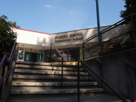
Forest Grove School
https://search.heritageburnaby.ca/link/landmark795
- Repository
- Burnaby Heritage Planning
- Geographic Access
- Forest Grove Drive
- Associated Dates
- 1986
- Heritage Value
- The Forest Grove subdivision in Burnaby was developed during the early 1980s and resulted in a rapidly growing population that required a school facility to support this "instant" community. Forest Grove Elementary was the second largest elementary school in the city when it opened and 374 pupils were recorded in its first year.
- Planning Study Area
- Lake City Area
- Street Address
- 8525 Forest Grove Drive
- Street View URL
- Google Maps Street View
Images
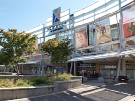
Metrotown
https://search.heritageburnaby.ca/link/landmark817
- Repository
- Burnaby Heritage Planning
- Geographic Access
- Kingsway
- Associated Dates
- 1986
- Heritage Value
- Although the idea for Metrotown was first expressed in the 1970s, the building itself opened in 1986 and was soon served by the Expo Line of the new SkyTrain system. In the ensuing twenty years, the complex developed into three distinct but adjoining malls - Metropolis at Metrotown, Metrotown Centre, and Station Square. Today, Metrotown serves as the city’s commercial and retail anchor. The mall also includes two large office towers, which by 2001 were home to the head offices for Shaw Cable and TransLink.
- Historic Neighbourhood
- Central Park (Historic Neighbourhood)
- Planning Study Area
- Maywood Area
- Street Address
- 4700 Kingsway
- Street View URL
- Google Maps Street View
Images
Walking Tour Project for South Burnaby
https://search.heritageburnaby.ca/link/archivedescription87824
- Repository
- City of Burnaby Archives
- Date
- 1982-1986
- Collection/Fonds
- Mary Forsyth fonds
- Description Level
- File
- Physical Description
- 2 cm of textual records + 1 map : col. on paper ; 65.5 x 70 cm
- Scope and Content
- File consists of Mary Forsyth's proposal "A Walking Environment for South Burnaby" which includes, a City of Burnaby Director's Report (No. 21 1986-Oct-01) from the Parks and Recreation Committee, various notes and articles, correspondence, feedback and comment sheets from her presentation, an essa…
- Repository
- City of Burnaby Archives
- Date
- 1982-1986
- Collection/Fonds
- Mary Forsyth fonds
- Physical Description
- 2 cm of textual records + 1 map : col. on paper ; 65.5 x 70 cm
- Description Level
- File
- Record No.
- MSS185-001
- Access Restriction
- Open access
- Accession Number
- 2014-27
- Scope and Content
- File consists of Mary Forsyth's proposal "A Walking Environment for South Burnaby" which includes, a City of Burnaby Director's Report (No. 21 1986-Oct-01) from the Parks and Recreation Committee, various notes and articles, correspondence, feedback and comment sheets from her presentation, an essay submitted for her Environmental Education course at Simon Fraser University (draft copy and final), an anotated map of various routes of South Burnaby walks and trails and a recognition letter for a Commission Award from the North Fraser Harbour Commission.
- Media Type
- Textual Record
- Cartographic Material
- Notes
- Transcribed title
Bylaw Number: 7650 - Ratification Bylaw 1981
https://search.heritageburnaby.ca/link/bylaw16728
- Repository
- Legislative Services
- Bylaw Number
- 7650
- Final Adoption
- 1981 Jun 01
- Format
- Bylaws - Other
- Collection/Fonds
- City Council and Office of the City Clerk fonds
- Repository
- Legislative Services
- Bylaw Number
- 7650
- Final Adoption
- 1981 Jun 01
- Format
- Bylaws - Other
- Collection/Fonds
- City Council and Office of the City Clerk fonds
Documents
Burnaby
https://search.heritageburnaby.ca/link/archivedescription65839
- Repository
- City of Burnaby Archives
- Date
- June 1977
- Collection/Fonds
- Burnaby Historical Society fonds
- Description Level
- Item
- Physical Description
- 1 map : col. ink on paper ; 77 x 55 cm folded to 28 x 19 cm
- Scope and Content
- Item is a map of Burnaby District Municipality, British Columbia, compiled by the Burnaby Planning Department. The map indicates locations of schools, parks, cemeteries, improved streets and private roads, etc.
- Repository
- City of Burnaby Archives
- Date
- June 1977
- Collection/Fonds
- Burnaby Historical Society fonds
- Subseries
- Municipal record subseries
- Physical Description
- 1 map : col. ink on paper ; 77 x 55 cm folded to 28 x 19 cm
- Material Details
- Scale : 1 cm = 1/8 of a mile
- Description Level
- Item
- Record No.
- 42694
- Accession Number
- BHS2007-04
- Scope and Content
- Item is a map of Burnaby District Municipality, British Columbia, compiled by the Burnaby Planning Department. The map indicates locations of schools, parks, cemeteries, improved streets and private roads, etc.
- Media Type
- Cartographic Material
Bird's Eye View of the Burnaby Lake Area
https://search.heritageburnaby.ca/link/museumdescription15144
- Repository
- Burnaby Village Museum
- Date
- 1977
- Collection/Fonds
- Century Park Museum Association fonds
- Description Level
- Item
- Physical Description
- 1 map : b&w print on paper ; 43 x 63.5 cm
- Scope and Content
- Item consists of a map titled "Birds Eye View of the Burnaby Lake Area Circa 1910". The overview of the Burnaby Lake area was compiled and drawn at Heritage Village by curator John Adams and artist, Carol Swan. The map identifies the Burnaby Lake inter-urban tram line; roads including: Sperling Ave…
- Repository
- Burnaby Village Museum
- Collection/Fonds
- Century Park Museum Association fonds
- Description Level
- Item
- Physical Description
- 1 map : b&w print on paper ; 43 x 63.5 cm
- Material Details
- Scale indeterminable
- Scope and Content
- Item consists of a map titled "Birds Eye View of the Burnaby Lake Area Circa 1910". The overview of the Burnaby Lake area was compiled and drawn at Heritage Village by curator John Adams and artist, Carol Swan. The map identifies the Burnaby Lake inter-urban tram line; roads including: Sperling Avenue (Pole Line Road); Gilpin Avenue; Douglas Road; trail to Vancouver Westminster Road (Kingsway); Buckingham Avenue; Haszard Street; various farms and residences including: Charles Sprott "Norland"; H.T. Ceperley "Fairacres"; Claude Hill's "Brookfield farm" and "Broadview"; F.J. Hart's "Avalon"; Miss Woodward's former and new home, school and post office; Councillor Edgar's hunting cabin; Edgar Sprott's "Mayfield farm" and "Mayfield Lodge"; F.J. Peers "Greyfriars"; Arthur de Windt Haszard; Bernard Hill's boathouse as well as other landmarks including: Doran's Mill; tram stations; Burnaby Lake Store; logging camps; wood cutter's shacks; ice houses; cranberry bog; Still Creek; Deer Lake; Burnaby Lake; Deer Lake Creek; Provincial Government Reserve Proposed Hospital (later Oakalla Prison).
- Creator
- Adams, John
- Swan, Carol
- Names
- Hill, Arthur Claude
- Sprott, Charles Frederick
- Sprott, Louis "Edgar"
- Hart, Frederick John, 1884-1945
- Ceperley, H.T.
- Woodward, Maude
- Woodward, Harriet
- Peers, Francis J.
- Haszard, Arthur de Windt
- Hill, Bernard R.
- Geographic Access
- Deer Lake Avenue
- Sperling Avenue
- Haszard Street
- Buckingham Avenue
- Accession Code
- BV021.1.3
- Access Restriction
- No restrictions
- Reproduction Restriction
- No known restrictions
- Date
- 1977
- Media Type
- Cartographic Material
- Historic Neighbourhood
- Burnaby Lake (Historic Neighbourhood)
- Planning Study Area
- Burnaby Lake Area
- Related Material
- See also: Life with the Moores of Hart House : pioneer days on Burnaby's Deer Lake
- Scan Resolution
- 600
- Scan Date
- 2021-11-12
- Scale
- 100
- Notes
- Transcribed title
- Compiled by John Adams; illustration by Carol Swan
- The map depicts the Burnaby Lake Tram Line as being double tracked, whereas in reality it was single tracked.
- Map is part of the book "Life with the Moores of Hart House : pioneer days on Burnaby's Deer Lake https://search.heritageburnaby.ca/permalink/museumlibrary6314-102
![1892 Burnaby Centennial, [1992] thumbnail](/media/hpo/_Data/_BVM_Cartographic_Material/2013/2013_0008_0001_001.jpg?width=280)
