Narrow Results By
Subject
- Advertising Medium - Signs and Signboards 2
- Agriculture - Crops 1
- Agriculture - Farms 1
- Building Components 1
- Buildings - Agricultural 4
- Buildings - Agricultural - Greenhouses 2
- Buildings - Agricultural - Stables 1
- Buildings - Civic 1
- Buildings - Civic - Community Centres 1
- Buildings - Civic - Museums 1
- Buildings - Commercial - Restaurants 1
- Buildings - Commercial - Stores 1
Creator
- Adams, John 2
- Albert F. Arnold 1
- Albert F. Arnold McCarter & Nairne 1
- Alphonse J. Toebaert 1
- Associated Factory Mutual Fire Insurance Cos 1
- Bancroft, Rose 1
- Bekins Moving and Storage Company Limited 1
- Bernard R. Hill 1
- Bowman and Cullerne 2
- Bowman & Cullerne 5
- British Columbia Underwriters' Association 13
- Bureau of Post War Rehabilitation and Reconstruction Regional Planning Division 1
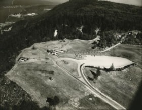
Burnaby Mountain Park & Centennial Pavilion
https://search.heritageburnaby.ca/link/landmark794
- Repository
- Burnaby Heritage Planning
- Geographic Access
- Centennial Way
- Associated Dates
- 1958
- Heritage Value
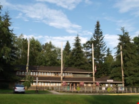
- The first formal park dedication bylaw covering Burnaby Mountain was passed in 1942, but the boundaries were re-adjusted in 1952 with the creation of the Trans Mountain Pipeline site. Significant portions of the mountain remained as dedicated park, however, and in 1957, the site was chosen to house Burnaby's contribution to the celebration of British Columbia's centennial - the Centennial Pavilion. The grounds around the pavilion became a favourite picnic site that provided for the first time a formal viewpoint and public access to other mountain trails. In the 1980s, the Pavilion underwent major renovations and opened in 1986 as Horizons restaurant.
- Historic Neighbourhood
- Barnet (Historic Neighbourhood)
- Planning Study Area
- Burnaby Mountain Area
- Street Address
- 100 Centennial Way
- Street View URL
- Google Maps Street View
Images
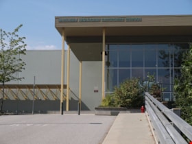
Burnaby Mountain Secondary School
https://search.heritageburnaby.ca/link/landmark831
- Repository
- Burnaby Heritage Planning
- Geographic Access
- Eastlake Drive
- Associated Dates
- 2000
- Heritage Value
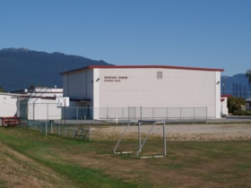
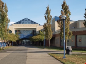
- Burnaby Mountain Secondary School is one of the more recent schools in Burnaby, having opened in 2000 and it serves neighbourhoods in northeast Burnaby and northwest Coquitlam.
- Historic Neighbourhood
- Burquitlam (Historic Neighbourhood)
- Planning Study Area
- Lyndhurst Area
- Street Address
- 8800 Eastlake Drive
- Street View URL
- Google Maps Street View
Images
Burnaby Municipal Hall
https://search.heritageburnaby.ca/link/landmark730
- Repository
- Burnaby Heritage Planning
- Geographic Access
- Kingsway
- Associated Dates
- 1899
- Heritage Value
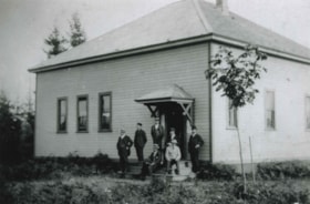
- Although Burnaby was incorporated as a municipality in 1892, its first Municipal Hall was not built until 1899 and located at Kingsway and Edmonds. It was close to the tram line on Kingsway and at the population centre of South Burnaby.
- Historic Neighbourhood
- Edmonds (Historic Neighbourhood)
- Planning Study Area
- Stride Avenue Area
- Street Address
- 7252 Kingsway
- Street View URL
- Google Maps Street View
Images
Burnaby Municipal Hall
https://search.heritageburnaby.ca/link/landmark763
- Repository
- Burnaby Heritage Planning
- Geographic Access
- Kingsway
- Associated Dates
- 1911
- Heritage Value
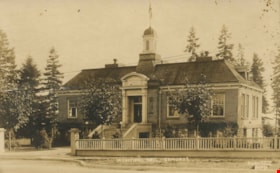
- In 1911, a brick building was built to replace the smaller wooden structure that had served as Burnaby's Municipal Hall since 1899. This new, larger structure was built to reflect Burnaby's growth into a large suburban municipality and remained in use for over 40 years. The old Municipal Hall became a public hall which was demolished upon the construction of the Edmonds Branch of the Burnaby Public Library in 1962. The second Municipal Hall was renovated in 1956 (when the current City Hall was built at Canada Way), and was used as a Police building. In 1966 after the construction of the new Justice Building, the old 1911 Municipal Hall was left vacant and in 1970 it was demolished. The site was redeveloped as a senior citizens residential centre with Edmonds House built on the old hall location.
- Historic Neighbourhood
- Edmonds (Historic Neighbourhood)
- Planning Study Area
- Stride Avenue Area
- Street Address
- 7282 Kingsway
Images
Burnaby Municipal Hall
https://search.heritageburnaby.ca/link/landmark807
- Repository
- Burnaby Heritage Planning
- Geographic Access
- Canada Way
- Associated Dates
- 1956
- Heritage Value
- When staff outgrew the municipal buildings at Edmonds and Kingsway, a debate erupted over where to build a new municipal hall. North Burnaby residents argued against the Kingsway and Edmonds site as it was too removed for their needs, but South Burnaby residents were not prepared to accept a hall in North Burnaby. The debate was finally resolved when it was suggested that the new civic centre for the municipality be in the exact geographic centre of Burnaby. Fortunately, this meant that the new hall was to be built near Deer Lake, in the beautiful Central Valley setting. Burnaby voters accepted this decision and approved the $625,000.00 it would take to build the new structure and the official opening ceremony was held June 22, 1956 when then Reeve Charles MacSorley received the keys to the hall from the contractor.
- Historic Neighbourhood
- Burnaby Lake (Historic Neighbourhood)
- Planning Study Area
- Douglas-Gilpin Area
- Street Address
- 4949 Canada Way
- Street View URL
- Google Maps Street View
Images
Burnaby North High School
https://search.heritageburnaby.ca/link/landmark745
- Repository
- Burnaby Heritage Planning
- Associated Dates
- 1923-1982
- Street View URL
- Google Maps Street View
- Repository
- Burnaby Heritage Planning
- Geographic Access
- Willingdon Avenue
- Associated Dates
- 1923-1982
- Heritage Value
- Burnaby North and Burnaby South were the first high schools built in the City. Before the high school opened, Burnaby students had to travel to Vancouver if they wished to pursue education beyond an elementary level. In 1921, arrangements were made to use the basement of the Presbyterian Church for instruction of local students. By 1922 the Burnaby North High School opened at its first permanent location (4375 Pandora Street - which is now Rosser Elementary). In 1945, the Willingdon Avenue site was built and was used until a new building was constructed in 1961 on Hammarskjold Drive. From 1962, the school was used as Burnaby Heights Junior High school, but it closed in 1982 and the junior high students went to the new Burnaby North on Hammarskjold.
- Historic Neighbourhood
- Capitol Hill (Historic Neighbourhood)
- Planning Study Area
- Capitol Hill Area
- Street Address
- 250 Willingdon Avenue
- Street View URL
- Google Maps Street View
Images
Burnaby North High School
https://search.heritageburnaby.ca/link/landmark788
- Repository
- Burnaby Heritage Planning
- Geographic Access
- Hammarskjold Drive
- Associated Dates
- 1961
- Heritage Value
- In 1961, Burnaby North High School moved from Willingdon Avenue to its new site on Hammarskjold Drive. The old school remained in use as a junior high school until 1982 at which point the junior high students also moved to the new Burnaby North High School.
- Planning Study Area
- Parkcrest-Aubrey Area
- Street Address
- 751 Hammarskjold Drive
- Street View URL
- Google Maps Street View
Images
Burnaby Park track
https://search.heritageburnaby.ca/link/museumdescription11918
- Repository
- Burnaby Village Museum
- Date
- June 30, 1932
- Collection/Fonds
- Ronald G. Scobbie collection
- Description Level
- Item
- Physical Description
- 1 survey plan : ink on waxed linen sheet ; 27 x 39 cm
- Scope and Content
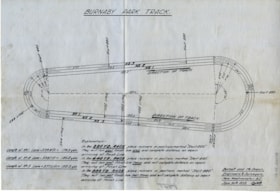
- Item consists of a survey plan titled “Burnaby Park Track”.
- Repository
- Burnaby Village Museum
- Collection/Fonds
- Ronald G. Scobbie collection
- Description Level
- Item
- Physical Description
- 1 survey plan : ink on waxed linen sheet ; 27 x 39 cm
- Scope and Content
- Item consists of a survey plan titled “Burnaby Park Track”.
- Accession Code
- BV003.83.41
- Access Restriction
- No restrictions
- Reproduction Restriction
- No known restrictions
- Date
- June 30, 1932
- Media Type
- Cartographic Material
- Notes
- Transcribed title
- Note in pencil reads: ‘4222”
Images
Burnaby Sewer Construction Bylaw No. 500
https://search.heritageburnaby.ca/link/archivedescription1312
- Repository
- City of Burnaby Archives
- Date
- 1925 - 1926
- Collection/Fonds
- City Council and Office of the City Clerk fonds
- Description Level
- File
- Physical Description
- Textual records and architectural drawing
- Scope and Content
- File includes a blueprint chart as well as original newspaper clippings, bylaw # 462 and an oversized blueprint plan associated with DL 116, DL 121 and DL 187.
- Repository
- City of Burnaby Archives
- Date
- 1925 - 1926
- Collection/Fonds
- City Council and Office of the City Clerk fonds
- Series
- Bylaws series
- Physical Description
- Textual records and architectural drawing
- Description Level
- File
- Record No.
- 3114
- Accession Number
- 2001-02
- Scope and Content
- File includes a blueprint chart as well as original newspaper clippings, bylaw # 462 and an oversized blueprint plan associated with DL 116, DL 121 and DL 187.
- Notes
- A plan showing proposed sewer system and possible extensions DL 116 and parts of DL 121 and 187 : M9-A-8-2. A list of names of streets to be sewered and assessment of costs : M9-B-3-19
Burnaby Sewer Division records
https://search.heritageburnaby.ca/link/archivedescription62792
- Repository
- City of Burnaby Archives
- Date
- [1959] -1964
- Collection/Fonds
- Burnaby Historical Society fonds
- Description Level
- File
- Physical Description
- 1 file of textual records
- Scope and Content
- File consists of a 1963 map of the sewer areas in Burnaby along with accompanying Schedules of Construction from the Burnaby Sewers Division for the years 1964 through 1966. Included in the file is an oversized street map of Burnaby produced between 1958 and 1964 which has names annotated in pencil…
- Repository
- City of Burnaby Archives
- Date
- [1959] -1964
- Collection/Fonds
- Burnaby Historical Society fonds
- Physical Description
- 1 file of textual records
- Description Level
- File
- Record No.
- MSS093-015
- Access Restriction
- Open access
- Accession Number
- BHS2000-01
- Scope and Content
- File consists of a 1963 map of the sewer areas in Burnaby along with accompanying Schedules of Construction from the Burnaby Sewers Division for the years 1964 through 1966. Included in the file is an oversized street map of Burnaby produced between 1958 and 1964 which has names annotated in pencil on properties west of Burnaby Lake (Broadview neighbourhood).
- Media Type
- Textual Record
- Cartographic Material
- Notes
- Title based on contents of file
Burnaby South High School
https://search.heritageburnaby.ca/link/landmark770
- Repository
- Burnaby Heritage Planning
- Associated Dates
- 1922-1988
- Street View URL
- Google Maps Street View
- Repository
- Burnaby Heritage Planning
- Geographic Access
- Southoaks Crescent
- Associated Dates
- 1922-1988
- Heritage Value
- Burnaby South and Burnaby North were Burnaby's first high schools. The first rooms of the school were built in 1922 on the same grounds as the Kingsway East Elementary School. In 1940, a two-storey building was erected and additions were made in 1963, 1967 and 1972. Kingsway East closed in 1925 and its buildings were used by the high school for Industrial Arts and Home Economics. In the early 1990s, a new "urban education centre" (Burnaby South/B.C. School for the Deaf) was opened, replacing the old Burnaby South High School.
- Historic Neighbourhood
- Edmonds (Historic Neighbourhood)
- Planning Study Area
- Kingsway-Beresford Area
- Street Address
- 6650 Southoaks Crescent
- Street View URL
- Google Maps Street View
Images
Burnaby South High School Cenotaph & Memorial Tennis Courts
https://search.heritageburnaby.ca/link/landmark547
- Repository
- Burnaby Heritage Planning
- Description
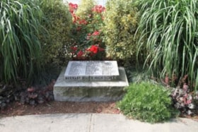
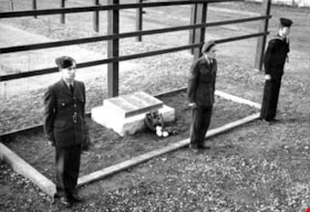
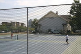
- This memorial comprises a cenotaph and three tennis courts: the former a monument of British Columbia granite inscribed with the names of fifty-one students of Burnaby South High School who lost their lives in the Second World War; and the latter a living memorial to these former students.
- Associated Dates
- 1948
- Formal Recognition
- Heritage Designation, Community Heritage Register
- Street View URL
- Google Maps Street View
- Repository
- Burnaby Heritage Planning
- Geographic Access
- Southoaks Crescent
- Associated Dates
- 1948
- Formal Recognition
- Heritage Designation, Community Heritage Register
- Enactment Type
- Bylaw No. 9807
- Enactment Date
- 23/11/1992
- Description
- This memorial comprises a cenotaph and three tennis courts: the former a monument of British Columbia granite inscribed with the names of fifty-one students of Burnaby South High School who lost their lives in the Second World War; and the latter a living memorial to these former students.
- Heritage Value
- This memorial is important for its spiritual, symbolic, and cultural associations for the former students of Burnaby South High School, and for all youth in the community. The cenotaph is of personal significance to the families of those who lost their lives. The unusual combination of cenotaph and living memorial - the tennis courts - represents a rare statement of a community's commitment to not allow the sacrifice of its youth to be forgotten by providing an active facility which draw people to the place on a regular basis rather than just on occasions of remembrance. As such it is an important symbol of a humanitarian ethic. In combination with the Kingsway East School, now rehabilitated as the Alan Emmott Centre, this memorial represents a valuable haven of green-space and recreation in the high-density urban development that now surrounds it.
- Defining Elements
- Key elements that define the heritage character of the Burnaby South High School Cenotaph & Memorial Tennis Courts include the: - location of the cenotaph adjacent to the living memorial - spatial association of this memorial and the remaining school building - physical fabric of both the granite monument and the tennis courts
- Historic Neighbourhood
- Edmonds (Historic Neighbourhood)
- Planning Study Area
- Kingsway-Beresford Area
- Function
- Primary Current--Public Feature
- Primary Historic--Public Feature
- Community
- Burnaby
- Cadastral Identifier
- P.I.D. No. 016-367-154 Legal Description: Lot 1, District Lot 96, Group 1 New Westminster District, Plan 86581
- Boundaries
- Burnaby South High School Cenotaph & Memorial Tennis Courts is comprised of a single municipally-owned property located at 6650 Southoaks Crescent, Burnaby.
- Area
- 6,070.00
- Contributing Resource
- Building
- Landscape Feature
- Structure
- Ownership
- Public (local)
- Documentation
- Heritage Site Files: PC77000 20. City of Burnaby Planning and Building Department, 4949 Canada Way, Burnaby, B.C., V5G 1M2
- Street Address
- 6650 Southoaks Crescent
- Street View URL
- Google Maps Street View
Images
Burnaby South Secondary School and The B.C. Provincial School for the Deaf
https://search.heritageburnaby.ca/link/landmark844
- Repository
- Burnaby Heritage Planning
- Geographic Access
- Rumble Street
- Associated Dates
- 1993
- Heritage Value
- The original Burnaby South High School was replaced in 1993 and the new Burnaby South Secondary School and BC Provincial School for the Deaf was built at this location. This school was built with the latest technology and modern equipment to ensure it was fully accessible and offers integrated academic, social and recreational activities for its students.
- Historic Neighbourhood
- Alta Vista (Historic Neighbourhood)
- Planning Study Area
- Clinton-Glenwood Area
- Street Address
- 5455 Rumble Street
- Street View URL
- Google Maps Street View
Images
Burnaby Village Museum
https://search.heritageburnaby.ca/link/landmark808
- Repository
- Burnaby Heritage Planning
- Geographic Access
- Deer Lake Avenue
- Associated Dates
- 1971
- Heritage Value
- The Burnaby Village Museum is a ten-acre heritage site located adjacent to Deer Lake. The site was originally created as a B.C. Centennial Project in 1971. The official sod turning for was April 11, 1971 by the then Governor General of Canada Roland Mitchener. The Village was initially managed by the Century Park Museum Association, a volunteer society of Burnaby citizens. Over the years many heritage building which could not be maintained in their original locations have been moved to the museum. Today half of the buildings in the village are heritage structures and the remainder are reproductions. In 1990 the City of Burnaby assumed direct management of the Village, and the museum became part of the Parks, Recreation and Culture Department. Visitors can enjoy the shops on Hill Street, ride the Parker 119 Carousel, and climb aboard the Interurban 1223 tram.
- Historic Neighbourhood
- Burnaby Lake (Historic Neighbourhood)
- Planning Study Area
- Douglas-Gilpin Area
- Morley-Buckingham Area
- Street Address
- 6501 Deer Lake Avenue
- Street View URL
- Google Maps Street View
Images
Burnaby Winter Club
https://search.heritageburnaby.ca/link/landmark816
- Repository
- Burnaby Heritage Planning
- Geographic Access
- Canada Way
- Associated Dates
- 1956
- Heritage Value
- Skating on Deer Lake and Burnaby Lake was the inspiration to form the Burnaby Winter Club in the 1950s. In 1958, the volunteer group opened an indoor ice facility, still operating today at 4990 Canada Way. Originally, the facility boasted 8 sheets of curling ice, that were used to capacity by the more than 500 family and individual members in the heyday of the Club. The Winter Club was a social centre: in addition to curling, it was a popular place for banquets and dances, and a place for families to spend time together. In the 1960s, the eight sheets of curling ice were reduced to five, to make room for a sheet of hockey ice for the members’ children. Volunteer coaches were committed to excellence, and the Club produced many professional hockey players. By 1964, the Club’s first future NHL player was playing: Pee Wee player Jack McIlhargey.
- Historic Neighbourhood
- Burnaby Lake (Historic Neighbourhood)
- Planning Study Area
- Douglas-Gilpin Area
- Street Address
- 4990 Canada Way
- Street View URL
- Google Maps Street View
Images
Burnaby Zoning Map
https://search.heritageburnaby.ca/link/archivedescription58303
- Repository
- City of Burnaby Archives
- Date
- 1973
- Collection/Fonds
- Burnaby Historical Society fonds
- Description Level
- Item
- Physical Description
- 1 map
- Scope and Content
- Item is a Burnaby Zoning Map describing Bylaw no. 4742 (collected by Evelyn Salisbury).
- Repository
- City of Burnaby Archives
- Date
- 1973
- Collection/Fonds
- Burnaby Historical Society fonds
- Subseries
- Evelyn Salisbury subseries
- Physical Description
- 1 map
- Description Level
- Item
- Record No.
- MSS061-100
- Access Restriction
- No restrictions
- Accession Number
- BHS1991-24
- Scope and Content
- Item is a Burnaby Zoning Map describing Bylaw no. 4742 (collected by Evelyn Salisbury).
- Media Type
- Cartographic Material
Burquitlam Neighbourhood
https://search.heritageburnaby.ca/link/landmark703
- Repository
- Burnaby Heritage Planning
- Associated Dates
- 1925-1954
- Heritage Value
- By the 1950s, the Burquitlam Neighbourhood was becoming a residential and commercial centre for the northeast section of Burnaby. The Sullivan Heights area was developed as a single-family residential area with the Lyndhurst School opening in 1954. The completion of the Lougheed Highway in 1953 encouraged more commercial and retail development and fostered the growth of the neighbourhood throughout this period.
- Historic Neighbourhood
- Burquitlam (Historic Neighbourhood)
- Planning Study Area
- Lyndhurst Area
Images
Burquitlam Neighbourhood
https://search.heritageburnaby.ca/link/landmark734
- Repository
- Burnaby Heritage Planning
- Repository
- Burnaby Heritage Planning
- Heritage Value
- Burnaby's first non-Native settler, William Holmes, selected land near the Brunette River on which to build his home in 1860. From this beginning, the neighbourhood of Burquitlam developed, fostered by its proximity to the North Road trail which linked it to New Westminster. In 1906, the Burquitlam Post Office opened and in 1910 the Hamilton Road school opened to serve the growing population of children in the area.
- Historic Neighbourhood
- Burquitlam (Historic Neighbourhood)
- Planning Study Area
- Cameron Area
- Lyndhurst Area
Images
Burquitlam Neighbourhood
https://search.heritageburnaby.ca/link/landmark757
- Repository
- Burnaby Heritage Planning
- Associated Dates
- 1905-1924
- Heritage Value
- In 1921, the pamphlet "Beautiful Burnaby" was produced and it described the Burquitlam neighbourhood as such: "No part of Burnaby has more consistently laboured to advance its prosperity than Burquitlam. Enterprise and intelligence has hewn homes from the forest and developed land into highly productive gardens and poultry ranches. Burquitlam is the growing suburb to the north of the City of New Westminster. It is reached by the Sapperton carline direct from Edmonds being only a few minutes ride from New Westminster market. It is also served by the B.C.E.R. Burnaby Lake line and adjoins on the best golf links in Greater Vancouver."
- Historic Neighbourhood
- Burquitlam (Historic Neighbourhood)
- Planning Study Area
- Cameron Area
- Lyndhurst Area
Images
Burrard Inlet
https://search.heritageburnaby.ca/link/landmark717
- Repository
- Burnaby Heritage Planning
- Repository
- Burnaby Heritage Planning
- Heritage Value
- According to Tsleil'wautuh Chief Len George, as many as 10,000 band members once lived along both sides of the Burrard Inlet, but disease took its toll in the 1400s and Europeans brought smallpox in the 1800s. In 1792, Captain George Vancouver charted this inlet of the Pacific Ocean.
- Historic Neighbourhood
- Vancouver Heights (Historic Neighbourhood)
- Capitol Hill (Historic Neighbourhood)
- Barnet (Historic Neighbourhood)
- Planning Study Area
- Burnaby Heights Area
- Capitol Hill Area
- Westridge Area
