Narrow Results By
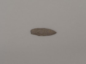
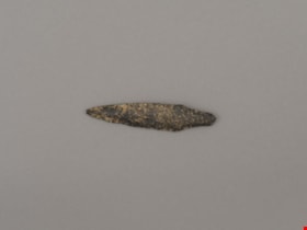
projectile point
https://search.heritageburnaby.ca/link/museumartifact44863
- Repository
- Burnaby Village Museum
- Accession Code
- BV002.57.14
- Description
- Leaf shaped basalt projectile point.
- Object History
- The donor inherited this artifact from his mother, Katherine Maude (Kitty) Peers, who inherited them from her father, Louis Claude Hill. The artifacts were found on his farm, Brookfield Farm, at Douglas Road and Sperling Avenue (now site of Burnaby Village Museum).
- Culture Phase: Possibly Locarno Beach phase (3520 -2200 Before Present)
- Historic Neighbourhood
- Burnaby Lake (Historic Neighbourhood)
Images

Documents
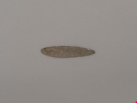
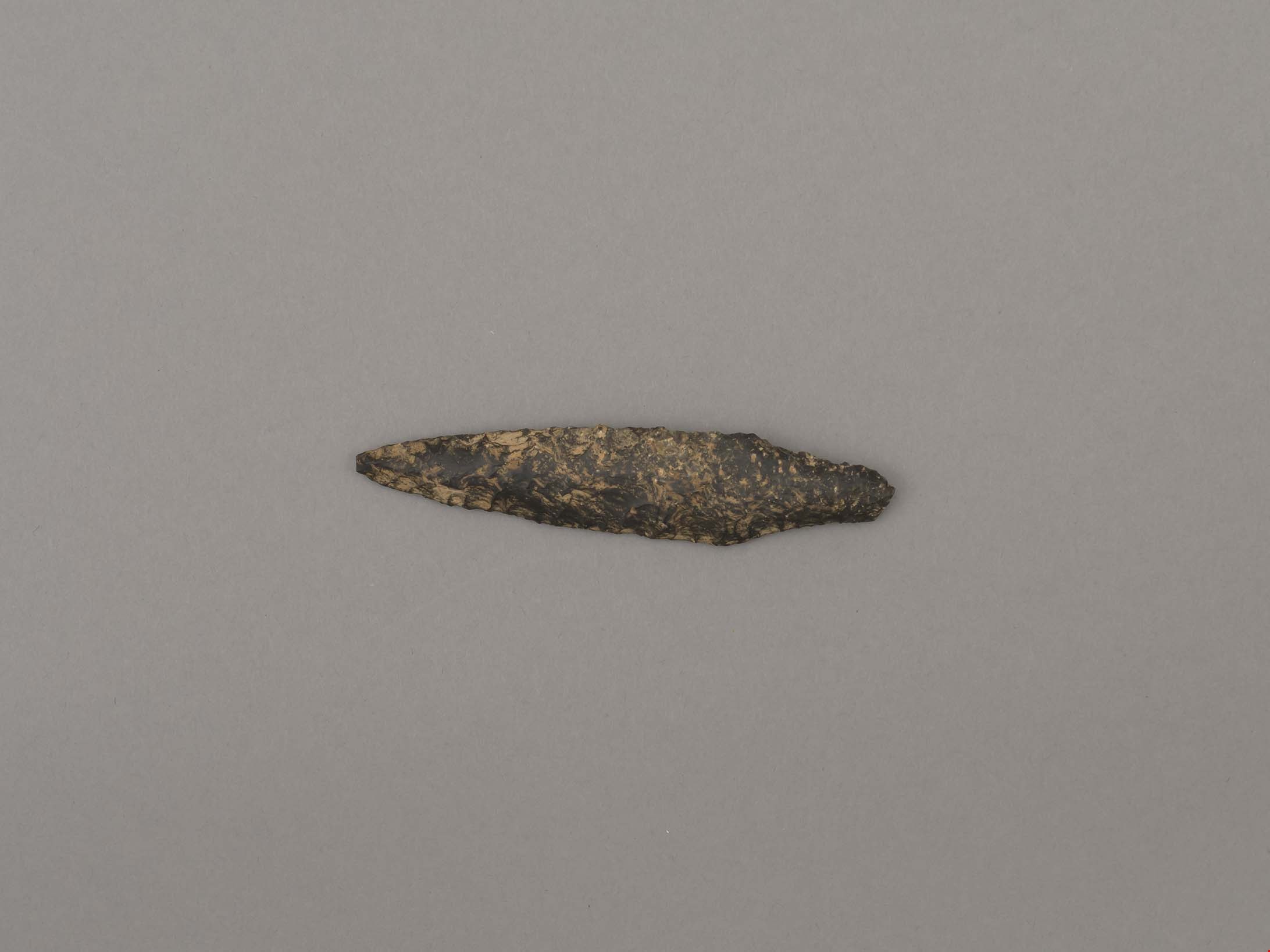
projectile point
https://search.heritageburnaby.ca/link/museumartifact44864
- Repository
- Burnaby Village Museum
- Accession Code
- BV002.57.15
- Description
- Leaf shaped basalt projectile point.
- Object History
- The donor inherited this artifact from his mother, Katherine Maude (Kitty) Peers, who inherited them from her father, Louis Claude Hill. The artifacts were found on his farm, Brookfield Farm, at Douglas Road and Sperling Avenue (now site of Burnaby Village Museum).
- Culture Phase: Possibly Locarno Beach phase (3520-2200 Before Present)
- Historic Neighbourhood
- Burnaby Lake (Historic Neighbourhood)
Images
Documents
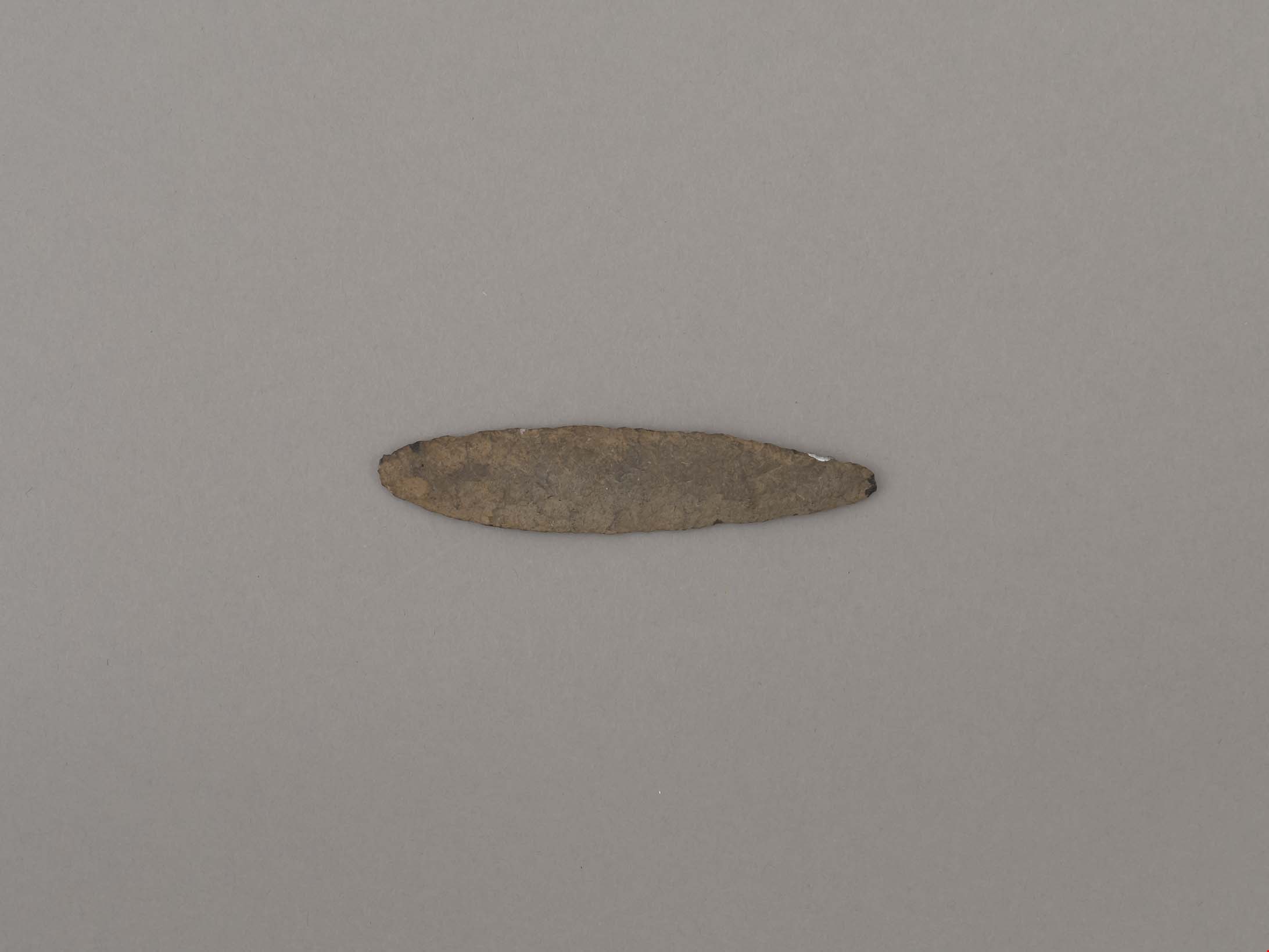
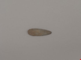
projectile point
https://search.heritageburnaby.ca/link/museumartifact44865
- Repository
- Burnaby Village Museum
- Accession Code
- BV002.57.16
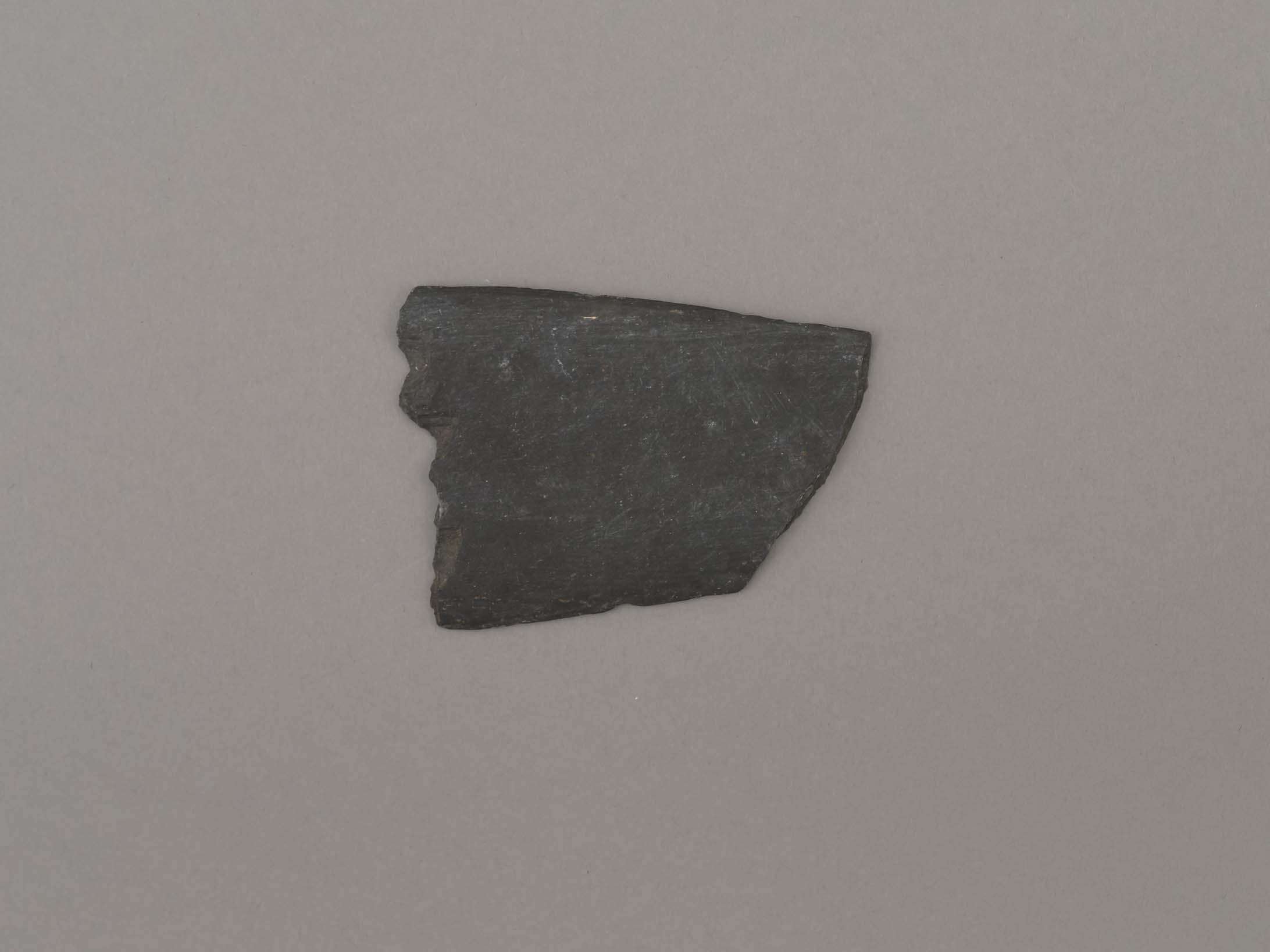
- Description
- Basal portion of lancelot-shaped point with contracting stem.
- Object History
- The donor inherited this artifact from his mother, Katherine Maude (Kitty) Peers, who inherited them from her father, Louis Claude Hill. The artifacts were found on his farm, Brookfield Farm, at Douglas Road and Sperling Avenue (now site of Burnaby Village Museum).
- Culture Phase: Possibly Locarno Beach phase (3520 -2200 Before Present)
- Historic Neighbourhood
- Burnaby Lake (Historic Neighbourhood)
Images

Documents
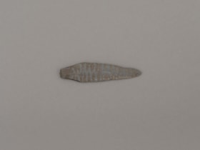
projectile point
https://search.heritageburnaby.ca/link/museumartifact44866
- Repository
- Burnaby Village Museum
- Accession Code
- BV002.57.17
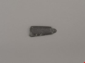
- Description
- Lancelot shaped with contracting stem.
- Object History
- The donor inherited this artifact from his mother, Katherine Maude (Kitty) Peers, who inherited them from her father, Louis Claude Hill. The artifacts were found on his farm, Brookfield Farm, at Douglas Road and Sperling Avenue (now site of Burnaby Village Museum).
- Culture Phase: Possibly Locarno Beach phase (3520-2200 Before Present)
- Historic Neighbourhood
- Burnaby Lake (Historic Neighbourhood)
Images
Documents
projectile point
https://search.heritageburnaby.ca/link/museumartifact44867
- Repository
- Burnaby Village Museum
- Accession Code
- BV002.57.18
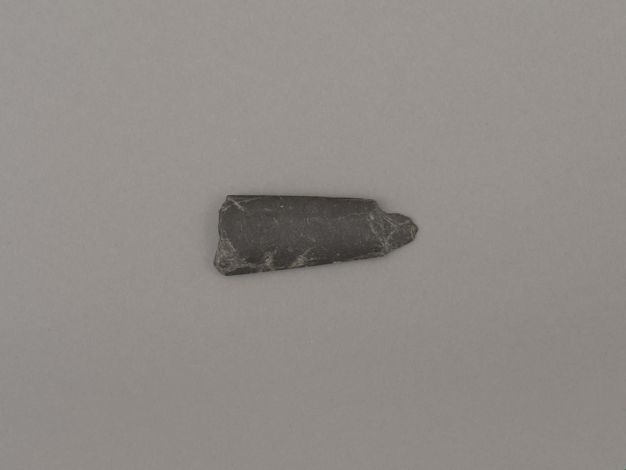
- Description
- Leaf shaped basalt point
- Object History
- The donor inherited this artifact from his mother, Katherine Maude (Kitty) Peers, who inherited them from her father, Louis Claude Hill. The artifacts were found on his farm, Brookfield Farm, at Douglas Road and Sperling Avenue (now site of Burnaby Village Museum).
- Culture Phase: Possibly Locarno Beach phase (3520-2200 Before Present)
- Historic Neighbourhood
- Burnaby Lake (Historic Neighbourhood)
Images

Documents
projectile point
https://search.heritageburnaby.ca/link/museumartifact45008
- Repository
- Burnaby Village Museum
- Accession Code
- BV002.57.34
- Description
- Projectile point, chipped at ends
- Object History
- The donor inherited this artifact from his mother, Katherine Maude (Kitty) Peers, who inherited them from her father, Louis Claude Hill. The artifacts were found on his farm, Brookfield Farm, at Douglas Road and Sperling Avenue (now site of Burnaby Village Museum).
- Historic Neighbourhood
- Burnaby Lake (Historic Neighbourhood)
Images

Documents
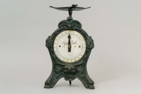
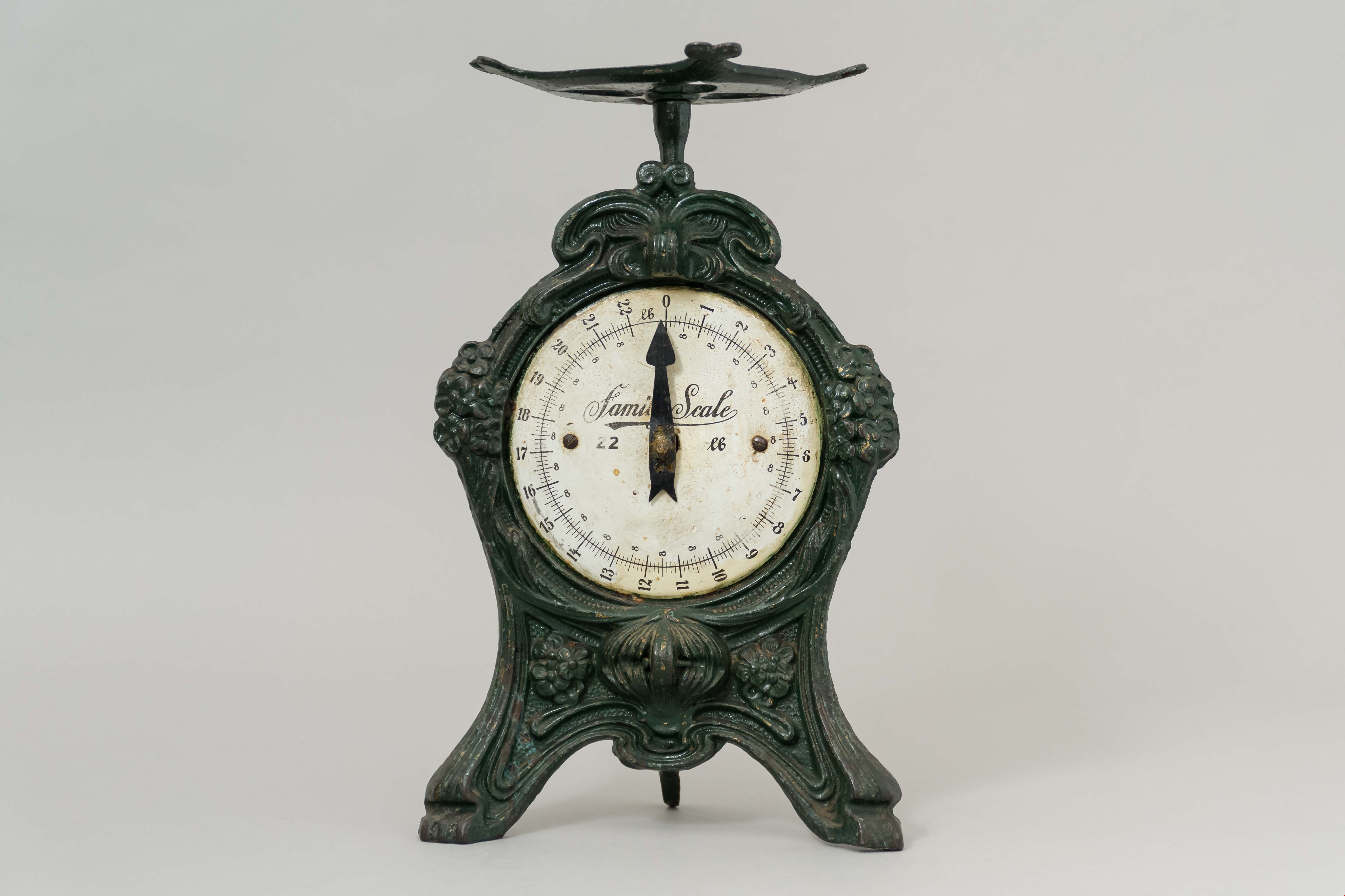
scale
https://search.heritageburnaby.ca/link/museumartifact29503
- Repository
- Burnaby Village Museum
- Accession Code
- HV973.56.53
- Description
- Scale, "Family Scale" "22 lb"; green painted cast metal; scratched into underside, "CLAUDE HILL DEC. 30 1---"
- Object History
- The scale was used by the Hill family. The family farm stood on Douglas Road at Deer Lake - where Burnaby Village Museum is today. The homestead was built in 1892, and as enlarged in 1905. The family grew strawberries on the farm. Bernard Hill worked as a surveyor for the municipality of Burnaby. He and his brother Claude were Alderman for the municipality of Burnaby.
- Category
- 04.Tools & Equipment for Materials
- Classification
- Weights and Measurements Tools and Equipment - Scales
- Object Term
- Scale
- Historic Neighbourhood
- Burnaby Lake (Historic Neighbourhood)
- Planning Study Area
- Morley-Buckingham Area
Images
![Survey and Subdivision plans in New Westminster District Group 1 and Group 2 – Vancouver, ʷməθkʷəy̓əm (Musqueam) Indian Reserve, Burnaby, Surrey
, [1910-1911] thumbnail](/media/hpo/_Data/_BVM_Cartographic_Material/1977/1977_0093_0017_001.jpg?width=280)
Survey and Subdivision plans in New Westminster District Group 1 and Group 2 – Vancouver, ʷməθkʷəy̓əm (Musqueam) Indian Reserve, Burnaby, Surrey
https://search.heritageburnaby.ca/link/museumdescription6986
- Repository
- Burnaby Village Museum
- Date
- [1910-1911]
- Collection/Fonds
- Burnaby Village Museum Map collection
- Description Level
- File
- Physical Description
- 9 plans : 4 plans : blueprint ink on paper + 4 plans : black ink on paper + 1 plan : graphite on paper mounted on 2 sides of cardboard 76 x 102 cm
- Scope and Content
- File consists of a large board of three survey plans in New Westminster District Group 1 mounted on one side and six survey and subdivision plans of District Lot 85, New Westminster District Group 1 mounted on the other side. Side A: 1. Plan : blueprint on paper ; 30.5 x 80 cm. Title reads: "Fras…
- Repository
- Burnaby Village Museum
- Collection/Fonds
- Burnaby Village Museum Map collection
- Description Level
- File
- Physical Description
- 9 plans : 4 plans : blueprint ink on paper + 4 plans : black ink on paper + 1 plan : graphite on paper mounted on 2 sides of cardboard 76 x 102 cm
- Material Details
- Scales vary (One chain equals 792 inches)
- Indexed number on tape on edge of board reads "17"
- Scope and Content
- File consists of a large board of three survey plans in New Westminster District Group 1 mounted on one side and six survey and subdivision plans of District Lot 85, New Westminster District Group 1 mounted on the other side. Side A: 1. Plan : blueprint on paper ; 30.5 x 80 cm. Title reads: "Fraser River Bridge / Plan of South Approach". Plan covers area of land north of the Fraser River and Great Northern Railway with approach for a bridge running through the "ʷməθkʷəy̓əm (Musqueam) Indian Reserve" (ʷməθkʷəy̓əm (Musqueam) First Nation) and lots marked as Dominion Government and the east half of Lot 2 identified as "C. F. Brown" "Plan 851". Plan is identified as "Plan 851 / traced / Mar. 17, 1911". (Geographic location in Vancouver) Scale: 100 feet = 1 inch, Signed by Albert J. Hill / P.L.S." 2. Plan : blueprint on paper ; 36.5 x 35 cm (no title). Includes three plans of lots on the east and west sides of North Road. Note on bottom of blueprint reads: "I.E.B. McKay Surveyor General - hereby certify / that this is a correct tracing from the field / notes of the Royal Engineers on file in the / Lands Department / E.B. McKay (signature) / Surveyor General / Victoria B.C. April 11th 1911" . Plan in top left titled "Page 11 / Vol. 1. / R.E. Notes" covers District Lots east of North Road including Lot 5, Lot 7, Lot 41, Lot 9 and Lot 107 in Coquitlam. Plan in top right corner titled "Page 17 / Vol. 1. / R.E. Notes" covers District Lots east of North Road including Lot 104, Lot 54, Lot 105, Lot 55, Lot 106, Lot 9 and Lot 107 in Coquitlam and Port Moody. Plan in lower left corner titled "Page 15 / Vol. 1 / R.E. Notes" covers District Lots west of North Road including Lot 147, Lot 148, Lot 100, Lot 15 in Burnaby. 3. Plan : blue print on paper ; 29.5 x 41.5 cm. (no formal title). Plan of the North 1/2 of Section 18. Plan covers area in the "North 1/2 of Sec.18 B.5 N RGE 1 W" and "Sec. 18 B.5 N. RGE 1 W" bordered by Section 7, Section 13, Section 17 and Section 19. Bon Accord Road runs through Sec. 18. The plan is signed by surveryor "I.H. Neville Smith... C.E.B.C.L.S. / Mar. 26th 1910" and signed by "Ludwig Pillath". (Geographic location: Surrey) Side B: 1. Plan : blueprint on paper ; 43.5 x 49.5 cm. Title reads: "Plan / of Subdivision / of a Portion / of / Lot 85 / Group One / New Westminster District. Plan covers portion of land east of Deer Lake and Pole Line Road (Sperling Avenue) and south of Hastings Road in District Lot 85 in Burnaby with section 4 and a portion of section 2 coloured in red. Plan is signed by "Albert J. Hill, B.C.L.S." Plan is initialed by: "RB" [sic] (in blue pencil crayon) Scale: 4 chains = 1 inch 2. Plaln : black black ink on linen ; 39 x 37 cm. Title reads: "L.C. Hill's Property, / Burnaby". Plan covers a triangular portion of land east of Pole Line Road (Sperling Avenue) and south of Hastings Road in District Lot 85 in Burnaby. Plan is intitaled by "RB" [sic] (in blue pencil crayon). Scale: 3 chains = 1 mile 3. Plan : graphite on paper ; 23 x 17 cm. Title reads: "Portion of Lot 85 / Gr.1". Plan covers portion of land north east of Deer Lake and west of Pole Line Road (now Sperling Avenue) in District Lot 85 in Burnaby. Plan is stamped in red ink: "Albert J. Hill, Civil Engineer". Plan is initialed by: "RB" [sic] (in blue pencil crayon). Scale: 1 chain = 1 inch 4. Plan : black ink on linen ; 16 x 19 cm. Title reads: "Lot 85". Plan covers the intersection of Pole Line Road (Sperling Avenue) and Hastings Road at the north west section of District Lot 79 and District Lot 85 in Burnaby. Plan is stamped: "A.J. Hill, Civil Engineer" with identitifed in blue pencil crayon. 5. Plan : black ink on paper ; 28.5 x 37 cm. (no formal title) Plan covers an area of land, west of Pole Line Road (Sperling Avenue) and south of Deer Lake in District Lot 85 in Burnaby. Plan is initialed by: "RB" [sic] (in blue pencil crayon) 6. Plan : black ink on paper ; 21 x 34 cm (no formal title). Plan covers an area of land, west of Pole Line Road (Sperling Avenue) and south of Deer Lake in District Lot 85 in Burnaby. Plan is initialed by: "RB" [sic] (in blue pencil crayon)
- Accession Code
- HV977.93.17
- Access Restriction
- No restrictions
- Reproduction Restriction
- No known restrictions
- Date
- [1910-1911]
- Media Type
- Cartographic Material
- Historic Neighbourhood
- Burnaby Lake (Historic Neighbourhood)
- Burquitlam (Historic Neighbourhood)
- Planning Study Area
- Morley-Buckingham Area
- Douglas-Gilpin Area
- Scan Resolution
- 600
- Scan Date
- 2023-06-26
- Notes
- Title based on contents of file
- Scale is measured in chains and feet. (One chain equals 792 inches).
- The term "Lot" also refers to a "District Lot”
- Some plans are stamped: "Albert J. Hill, Civil Engineer / and / Provincial Land Surveyor, / New Westminster, / B.C." and intialed: "RB" [sic]
Zoomable Images
![Survey and Subdivision plans in New Westminster District Group 1 and Group 2 – Vancouver, ʷməθkʷəy̓əm (Musqueam) Indian Reserve, Burnaby, Surrey
, [1910-1911] thumbnail](/media/hpo/_Data/_BVM_Cartographic_Material/1977/1977_0093_0017_003_seadragon/1977_0093_0017_003.jpg?w=280)
Survey and Subdivision plans in New Westminster District Group 1 and Group 2 – Vancouver, ʷməθkʷəy̓əm (Musqueam) Indian Reserve, Burnaby, Surrey , [1910-1911]
Zoom into Image
tool
https://search.heritageburnaby.ca/link/museumartifact44871
- Repository
- Burnaby Village Museum
- Accession Code
- BV002.57.22
- Description
- Chisel, adze or axe blade made of serpentine; rectangular shape.
- Object History
- The donor inherited this artifact from his mother, Katherine Maude (Kitty) Peers, who inherited them from her father, Louis Claude Hill. The artifacts were found on his farm, Brookfield Farm, at Douglas Road and Sperling Avenue (now site of Burnaby Village Museum).
- Culture Phase: Locarno Beach (3520-2200 Before Present) or Marpole (400BC - 400AD)
- Historic Neighbourhood
- Burnaby Lake (Historic Neighbourhood)
Images

Documents
tool
https://search.heritageburnaby.ca/link/museumartifact44875
- Repository
- Burnaby Village Museum
- Accession Code
- BV002.57.26
- Description
- Tool, stone, thin and flat; possibly slate. Slightly tapered rectangle shape; narrow sides broken off.
- Object History
- Ground Slate knives are associated with fish processing
- The donor inherited this artifact from his mother, Katherine Maude (Kitty) Peers, who inherited them from her father, Louis Claude Hill. The artifacts were found on his farm, Brookfield Farm, at Douglas Road and Sperling Avenue (now site of Burnaby Village Museum).
- Marpole Culture (400BC - 400AD) or Gulf of Georgia Culture (400 AD – 1800); Essentially these archaeological materials date to the last 2400 years
- Historic Neighbourhood
- Burnaby Lake (Historic Neighbourhood)
Images
Documents
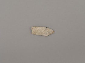
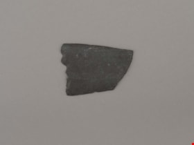
tool or projectile point
https://search.heritageburnaby.ca/link/museumartifact44877
- Repository
- Burnaby Village Museum
- Accession Code
- BV002.57.28
- Description
- Ground stone point; broken end
- Object History
- The donor inherited this artifact from his mother, Katherine Maude (Kitty) Peers, who inherited them from her father, Louis Claude Hill. The artifacts were found on his farm, Brookfield Farm, at Douglas Road and Sperling Avenue (now site of Burnaby Village Museum)..
- Culture Phase: Locarno Beach phase (3520-2200 Before Present)
- Historic Neighbourhood
- Burnaby Lake (Historic Neighbourhood)
Images
Documents

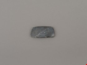
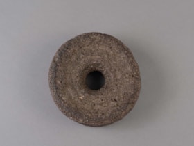
weight
https://search.heritageburnaby.ca/link/museumartifact44855
- Repository
- Burnaby Village Museum
- Accession Code
- BV002.57.3
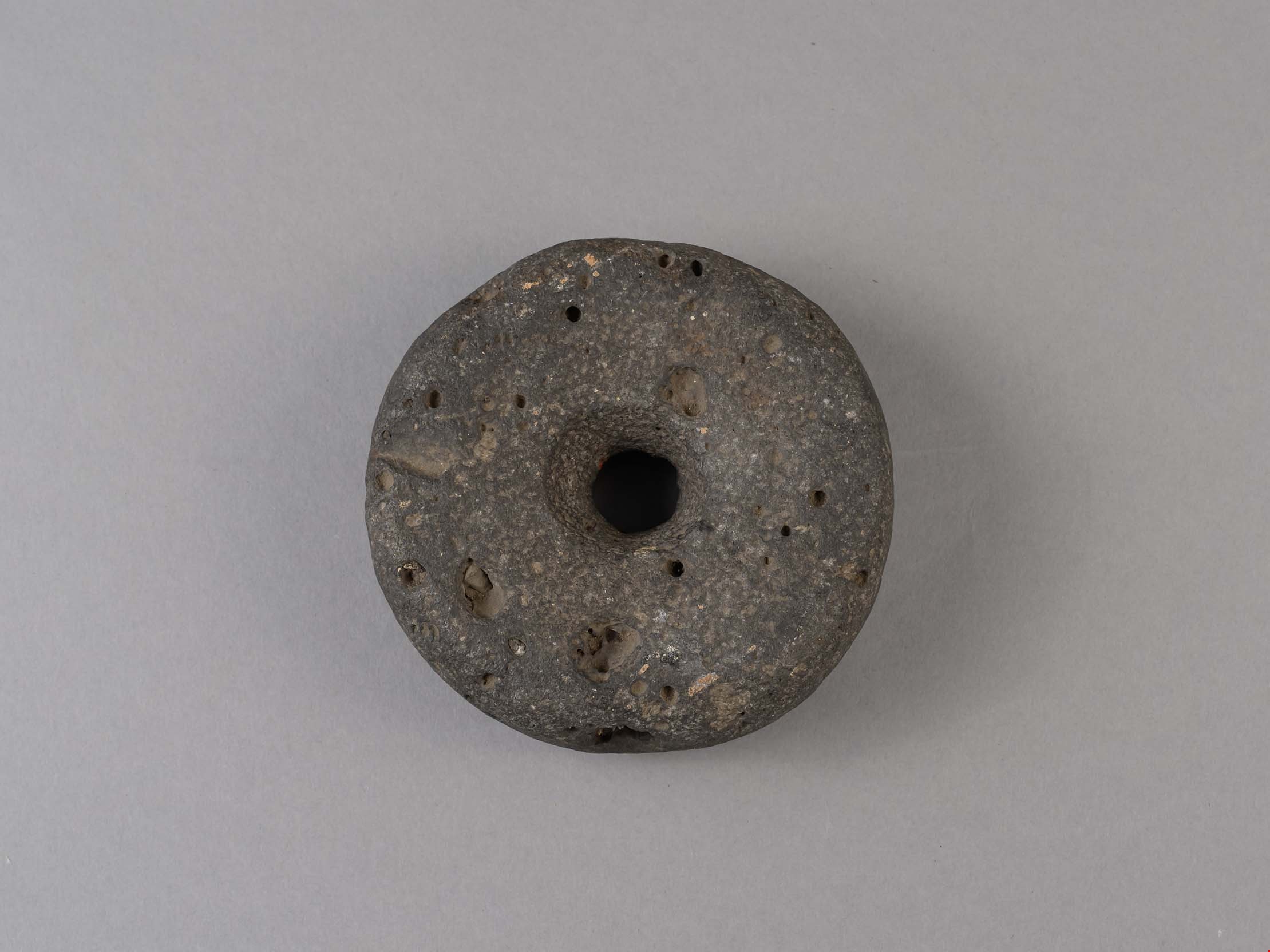
- Description
- Net weight, round, stone, doughnut-shaped with hole in the middle.
- Object History
- The donor inherited this artifact from his mother, Katherine Maude (Kitty) Peers, who inherited them from her father, Louis Claude Hill. The artifacts were found on his farm, Brookfield Farm, at Douglas Road and Sperling Avenue (now site of Burnaby Village Museum).
- Subjects
- Persons
- Indigenous peoples - British Columbia
- Weights and Measurements Tools and Equipment
- Archeological Specimen
- Historic Neighbourhood
- Burnaby Lake (Historic Neighbourhood)
Images
Documents
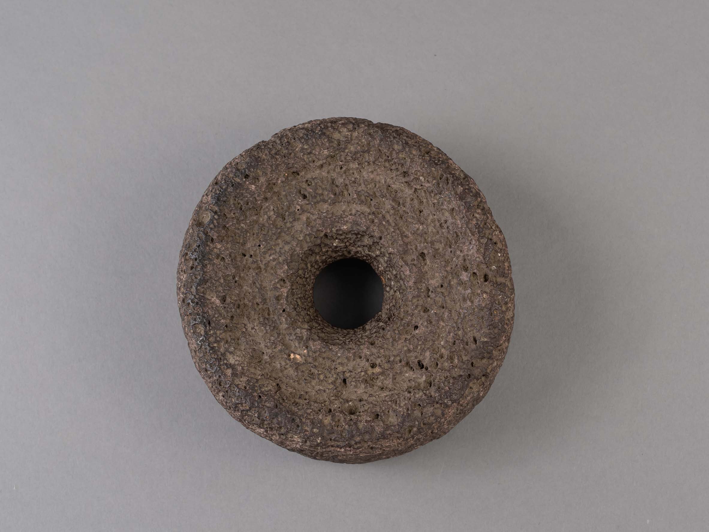
weight
https://search.heritageburnaby.ca/link/museumartifact44856
- Repository
- Burnaby Village Museum
- Accession Code
- BV002.57.4
- Description
- Net weight, round, stone, doughnut-shaped with hole in the middle. Made of volcanic stone.
- Object History
- The donor inherited this artifact from his mother, Katherine Maude (Kitty) Peers, who inherited them from her father, Louis Claude Hill. The artifacts were found on his farm, Brookfield Farm, at Douglas Road and Sperling Avenue (now site of Burnaby Village Museum).
- Subjects
- Persons
- Indigenous peoples - British Columbia
- Weights and Measurements Tools and Equipment
- Archeological Specimen
- Historic Neighbourhood
- Burnaby Lake (Historic Neighbourhood)
Images
Documents
![Welcome Committee for Earl Haig's visit to Burnaby, [192-] thumbnail](/media/hpo/_Data/_BVM_Images/1985/1985_3137_0004_001.jpg?width=280)
Welcome Committee for Earl Haig's visit to Burnaby
https://search.heritageburnaby.ca/link/museumdescription234
- Repository
- Burnaby Village Museum
- Date
- [192-]
- Collection/Fonds
- Burnaby Village Museum Photograph collection
- Description Level
- Item
- Physical Description
- 1 photograph : b&w print
- Scope and Content
- Photograph of a group of people gathered along the side of a street in front of the Municipal Hall on Edmonds, with a large sign that reads, "EARL HAIG WELCOME TO BURNABY". The crowd is mostly men in suits, women in dresses and hats, and two girls. There are flags and streamers flying in the backgr…
- Repository
- Burnaby Village Museum
- Collection/Fonds
- Burnaby Village Museum Photograph collection
- Description Level
- Item
- Physical Description
- 1 photograph : b&w print
- Scope and Content
- Photograph of a group of people gathered along the side of a street in front of the Municipal Hall on Edmonds, with a large sign that reads, "EARL HAIG WELCOME TO BURNABY". The crowd is mostly men in suits, women in dresses and hats, and two girls. There are flags and streamers flying in the background. According to the accession register, they are the Welcome Committee for the visit of Earl Haig to Burnaby Municipal Hall. Only three people in the photograph have been tentatively identified: In the centre of the picture, directly behind the little girl it appears to be L. Claude Hill and to the right of him, his wife Annie. The third man to the left of Claude Hill appears to be Burnaby Reeve Thomas F. Sanderson. The rest are unknown.
- Subjects
- Events - Visits of State
- Geographic Access
- Kingsway
- Street Address
- 7282 Kingsway
- Accession Code
- BV985.3137.4
- Reproduction Restriction
- May be restricted by third party rights
- Date
- [192-]
- Media Type
- Photograph
- Historic Neighbourhood
- Edmonds (Historic Neighbourhood)
- Planning Study Area
- Stride Avenue Area
- Scan Resolution
- 600
- Scan Date
- 2024-02-02
- Notes
- Title based on contents of photograph
- 1 b&w copy negative accompanying
Images
![Welcome Committee for Earl Haig's visit to Burnaby, [192-] thumbnail](/media/hpo/_Data/_BVM_Images/1985/1985_3137_0004_001.jpg)
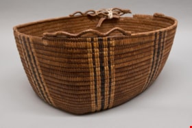
work basket
https://search.heritageburnaby.ca/link/museumartifact80211
- Repository
- Burnaby Village Museum
- Accession Code
- BV009.1.2
- Description
- Oval shaped coiled cedar root basket with cedar slat foundation. Overcast rim with remnants of a loopwork border. Decorated with vertical stripes of imbricated designs in canary grass and black dyed cherry bark. Cherry bark can be distinguished by the small eyes in the surface of the bark. If the basket maker is skilled the bark has a shiny appearance, if it has not been scraped properly it has a greyish tinge. Canary grass is differentiated from cattail and bear grass by its shiny appearance according to a Stó:lō/Stl’atl’imx elder and basket maker from Mount Currie, who was married into Upper Sḵwx̱wú7mesh.
- Object History
- Basket, ca. 1895-1910, from the collection of the L. Claude Hill family, who owned the property that became the Burnaby Village Museum. According to the Hill family, L. Claude's wife Anne Sarah Hill (nee Kendrick) traded blankets for baskets, although it is not known if this particular basket was obtained in this manner. Indigenous people travelled the trail that crossed Deer Lake Brook (Douglas Road / Canada Way).
- Measurements
- Measurements: width 31.5 cm and length 51.5 cm and depth 19.5 cm all measured from top edge to outside of basket, not including trim.
- Country Made
- Canada
- Province Made
- British Columbia
- School/Style
- Coast Salish
- Culture
- First Nations
Images
