Narrow Results By
Person / Organization
- Allen, James Charles 1
- Belcastro, Arlene 1
- British Columbia Electric Railway 3
- British Columbia Electric Railway Company 7
- British Columbia Mills Timber and Trading Company 1
- Burnaby Village Museum 3
- Central Park Provincial Park Board 1
- Ceperley, Grace 1
- Ceperley, H.T. 1
- Clarke, Ellen 1
- Clarke, Joseph 1
- Codd, Lisa 1
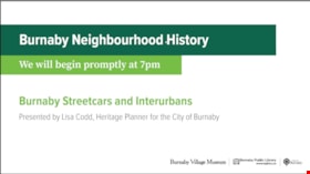
Burnaby Streetcars and Interurbans
https://search.heritageburnaby.ca/link/museumdescription14761
- Repository
- Burnaby Village Museum
- Date
- 22 Oct. 2020
- Collection/Fonds
- Burnaby Village Museum fonds
- Description Level
- Item
- Physical Description
- 1 video recording (mp4) (61 min., 39 sec.) : digital, col., sd., stereo ; 29 fps
- Scope and Content
- Item consists of a video recording of a live Zoom webinar hosted by Kate Petrusa, Burnaby Village Museum assistant curator. The webinar is titled "Burnaby Streetcars and Interurbans" and is presented by Lisa Codd, Heritage Planner for the City of Burnaby. The zoom webinar is the sixth in a collecti…
- Repository
- Burnaby Village Museum
- Collection/Fonds
- Burnaby Village Museum fonds
- Description Level
- Item
- Physical Description
- 1 video recording (mp4) (61 min., 39 sec.) : digital, col., sd., stereo ; 29 fps
- Material Details
- Presenter: Lisa Codd
- Host: Kate Petrusa
- Date of Presentation: October 22 7:00 pm - 8:00 pm
- Total Number of tracks: 1
- Total Length of all tracks:61 min., 39 sec.
- Recording Device: Zoom video communication platform
- Scope and Content
- Item consists of a video recording of a live Zoom webinar hosted by Kate Petrusa, Burnaby Village Museum assistant curator. The webinar is titled "Burnaby Streetcars and Interurbans" and is presented by Lisa Codd, Heritage Planner for the City of Burnaby. The zoom webinar is the sixth in a collection of seven "Burnaby Neighbourhood Speaker series" webinars that were presented and made available to the public between September 29 and October 27, 2020. The live webinar and recording was also made available on the Burnaby Village Museum's facebook page. In this webinar, Lisa Codd takes participants on a virtual tour of Burnaby’s early electric railway system, including visits to locations where physical traces of the railway can still be found. Lisa supports her presentation with maps and historical photographs to tell the story of the B.C. Electric Railway transportation routes that shaped Burnaby. Lisa takes questions and comments from participants throughout her presentation and at the end.
- Creator
- Burnaby Village Museum
- Responsibility
- Petrusa, Kate
- Accession Code
- BV020.29.6
- Access Restriction
- No restrictions
- Reproduction Restriction
- No known restrictions
- Date
- 22 Oct. 2020
- Media Type
- Moving Images
- Notes
- Title based on contents of video recording
- Video recording was edited for publication on Heritage Burnaby. Original mp4 video recording (BV020.29.6.1) is 76 min., 11 sec.
Images
Video
Burnaby Streetcars and Interurbans, 22 Oct. 2020
Burnaby Streetcars and Interurbans, 22 Oct. 2020
https://search.heritageburnaby.ca/media/hpo/_Data/_BVM_Moving_Images/2020_0029_0006_002.mp4
Janet's Story
https://search.heritageburnaby.ca/link/museumdescription9671
- Repository
- Burnaby Village Museum
- Date
- 2016
- Collection/Fonds
- Burnaby Village Museum Film and Video collection
- Description Level
- Item
- Physical Description
- 1 video recording (mp4) (4 min., 7 sec.) : digital, 25 fps, col., sd., stereo
- Scope and Content
- Film created by Janet Duxbury, who grew up in Burnaby, north of Imperial Street. Janet recounts her family's house that was built in 1940 and had no water or electricity during the early years. The family had chickens, vegetable gardens and used an outhouse until an addition was built a few years l…
- Repository
- Burnaby Village Museum
- Collection/Fonds
- Burnaby Village Museum Film and Video collection
- Description Level
- Item
- Physical Description
- 1 video recording (mp4) (4 min., 7 sec.) : digital, 25 fps, col., sd., stereo
- Scope and Content
- Film created by Janet Duxbury, who grew up in Burnaby, north of Imperial Street. Janet recounts her family's house that was built in 1940 and had no water or electricity during the early years. The family had chickens, vegetable gardens and used an outhouse until an addition was built a few years later. Janet played in the woods by the house as a child. Janet recounts swimming at Deer Lake Lake and walking past Oakalla Prison on the way. Janet attended Windsor Street School. She recounts visiting the Carneige Library in Vancouver and the Burnaby Public Library with her cousin.
- History
- Janet Duxbury grew up in Burnaby, north of Imperial Street. She attended Windsor Street School in Burnaby.
- Creator
- Duxbury, Janet
- Other Title Information
- title supplied by film maker
- Names
- Duxbury, Janet
- Geographic Access
- Imperial Street
- Deer Lake
- Accession Code
- BV016.37.2
- Access Restriction
- No restrictions
- Reproduction Restriction
- May be restricted by third party rights
- Date
- 2016
- Media Type
- Moving Images
- Notes
- Transcribed title
- The film was produced in 2016 as part of the Elders Digital Storytelling project. Digital storytelling is a form of narrative that creates short movies using relatively simple media technology. The project began in 2014 funded by the Social Sciences and Humanities Council of Canada (SSHRC) and AGE-WELL NCE grants. In partnership with the City of Burnaby, digital storytelling workshops were offered in Burnaby. This film was produced at one of those workshops.
Images
Video
Janet's Story, 2016

A Tribute to Grandma Lamb
https://search.heritageburnaby.ca/link/museumdescription9675
- Repository
- Burnaby Village Museum
- Date
- 2016
- Collection/Fonds
- Burnaby Village Museum Film and Video collection
- Description Level
- Item
- Physical Description
- 1 video recording (mp4) (7 min., 28 sec.) : digital, 25 fps, col., sd., stereo
- Scope and Content
- Arlene Belcastro tells the story of her grandmother, Dakota Lamb, who was born to Norwegian parents in the late 1800s in North Dakota. She moved to Milk River, Alberta around 1900, then took up residence in Carmengay, Alberta during the Depression where she raised four children as a single mother a…
- Repository
- Burnaby Village Museum
- Collection/Fonds
- Burnaby Village Museum Film and Video collection
- Description Level
- Item
- Physical Description
- 1 video recording (mp4) (7 min., 28 sec.) : digital, 25 fps, col., sd., stereo
- Scope and Content
- Arlene Belcastro tells the story of her grandmother, Dakota Lamb, who was born to Norwegian parents in the late 1800s in North Dakota. She moved to Milk River, Alberta around 1900, then took up residence in Carmengay, Alberta during the Depression where she raised four children as a single mother after her husband left. She supported her family by taking in boarders, ironing, and working as a midwife. The family later moved to Edmonton, where she was one of the first Avon ladies. In 1944, she was able to take a job as a pastry cook up north during the construction of the Alaska Highway and save enough money to purchase her own home. The film includes Arlene’s memories of visiting Grandma Lamb’s rustic cabin at Baptiste Lake north of Edmonton, Alberta. Starting at age 6, Arlene and her cousin, Donna, spent every summer with Grandma Lamb. The rustic cabin did not have running water or electricity, so the girls learned about kerosene lamps, wood stoves, and using a cold storage trunk for refrigeration. Grandma Lamb taught them life-skills through chores such as gathering kindling and tending the garden, and encouraged their independence. Arlene recalls that they also learned by example from Grandma Lamb, who instilled a respect for nature and for other people and never complained about life or what material things she didn’t have. She was a resilient, respectful, and wise role model.
- History
- Arlene Belcastro was born in Edmonton and attended H.A. Gray School and Victoria High School, where she completed commercial courses. She was married in Edmonton at age 19, and moved to Calgary after her eldest child was born. She learned to ride a horse at Elkana Ranch at Bragg Creek while living in Calgary. Following the birth of her second son, the family briefly lived in Nassau. Arlene returned to Edmonton after her marriage ended, and soon moved to the Vancouver/Burnaby area where she has lived for more than 40 years. At age 50, Arlene began acting and is currently a student of drumming, a community volunteer, and an avid traveler.
- Creator
- Belcastro, Arlene
- Other Title Information
- title supplied by film maker
- Accession Code
- BV016.37.6
- Access Restriction
- No restrictions
- Reproduction Restriction
- May be restricted by third party rights
- Date
- 2016
- Media Type
- Moving Images
- Notes
- Transcribed title
Images
Video
A Tribute to Grandma Lamb, 2016
A Tribute to Grandma Lamb, 2016
https://search.heritageburnaby.ca/media/hpo/_Data/_BVM_Moving_Images/2016_0037_0006_001.mp4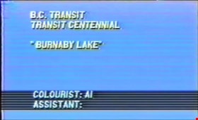
B.C. Transit Centennial: Chilliwack and Fraser Valley Way Points
https://search.heritageburnaby.ca/link/museumdescription10100
- Repository
- Burnaby Village Museum
- Date
- 1990
- Collection/Fonds
- Burnaby Village Museum Film and Video collection
- Description Level
- Item
- Physical Description
- 1 videocassette (2 hr., 3 min., 4 sec.) : VHS, 29 fps, col., sd., stereo
- Scope and Content
- Historical film excerpts of B.C. Electric Lower Mainland trams on their various routes as well as an excursion train shot by Ken Hodgson in 1948/1949 and in 1950. Film footage is part of the B.C. Transit Centennial and includes a voice over commentary by Frank Horne and Vic Sharman. Frank and Vic w…
- Repository
- Burnaby Village Museum
- Collection/Fonds
- Burnaby Village Museum Film and Video collection
- Description Level
- Item
- Physical Description
- 1 videocassette (2 hr., 3 min., 4 sec.) : VHS, 29 fps, col., sd., stereo
- Material Details
- VHS video tape in slip case "1950 / BCE Rail Archives / Burn. Lake / Central Park / Oak-Marpole / Skagit / Tourist Ride Chilliwack" hand written on label.
- "Railway Pictures Inc." "Chilliwack and Fraser Valley Way Points"- Directed and Produced by Ken Hodgson
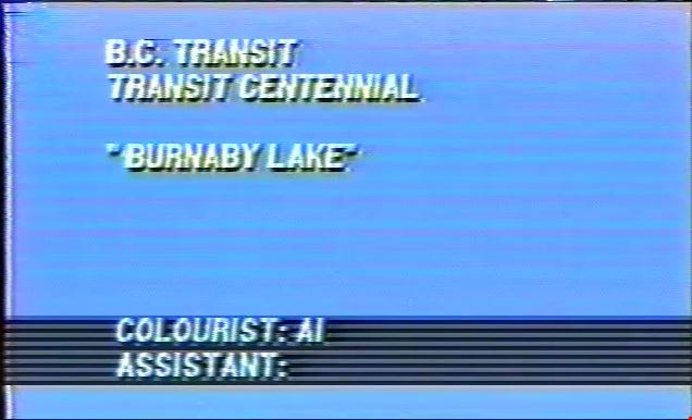
- Opening title card on film excerpt reads: "GASTOWN POST & TRANSFER / B.C. TRANSIT CENTENNIAL / "BURNABY LAKE" / COLOURIST: Al / ASSISTANT"
- Scope and Content
- Historical film excerpts of B.C. Electric Lower Mainland trams on their various routes as well as an excursion train shot by Ken Hodgson in 1948/1949 and in 1950. Film footage is part of the B.C. Transit Centennial and includes a voice over commentary by Frank Horne and Vic Sharman. Frank and Vic worked as motormen on the BC Electric Railway. The trams are shown travelling through Vancouver, Burnaby, New Westminster, Surrey, North Delta, Langley, Abbotsford, and Chilliwack. The excursion train was filmed in Washington State, U.S.A. The narrators give commentary, describing the routes, landmarks of the past and present, the various kinds of trams and buses seen, drivers’ protocols, and historical information. Summary: 0:00 – 16:18: Title card reads "Gastown Post & Transfer" "BC Transit / Transit Centennial" "Burnaby Lake". Footage of a Burnaby Lake Line tram from the Carrall Street depot in Vancouver to the Sapperton terminus, New Westminster. 16:18 – 30:20: Title card reads "Gastown Post & Transfer" "BC Transit / Transit Centennial" "Central Park". Footage of a Central Park Line tram from the New Westminster depot to the Carrall Street depot. 30:20 - 40:53: Title card reads "Gastown Post & Transfer" "BC Transit / Transit Centennial" "Oak St. Line". Footage of an Oak St. Line tram from Victory Square to the Marpole terminus. 40:53 – 49:41:Title card reads "Gastown Post & Transfer" "BC Transit / Transit Centennial" "Fairview Belt Line 1". Although the title card reads “Fairview Belt Line 1”, this is an observation car from the intersection of Cambie and Hastings Streets to the Dunbar terminus and back to Victory Square by way of Granville Street. 49:41 – 57:34: Title card reads "Gastown Post & Transfer" "Skagit River Railway". Footage of Skagit River Railway, Washington, U.S.A., from Newhalem to the Diablo Dam powerhouse and lift, then to the boat which crossed the lake to Ross Dam 57:34 – 1:12:54: the title card reads “Observation Car Trip” but this is a Fairview Belt Line tram on the outer line run, from Broadway and Main on a complete loop through downtown. 1:12:54 – 1:15:49: Title reads: "Railway Pictures Inc." "Chilliwack and Fraser Valley Way Points" with voice over by Frank Horne and Vic Sharman, directed and produced by Ken Hodgson. Opens with Vic Sharman, his wife and family at Liverpool Old Station (Scott Road) preparing for the last trip on the Chilliwack Line October, 1950. The last Fraser Valley Line tram from Vancouver meets the last tram from Chilliwack in Langley for the last-day-of-service ceremony, October 1, 1950 1:15:49 – 1:56:10: Footage of a Fraser Valley line tram from the Carrall Street depot, leaving in sections which meet at the New Westminster depot and continue on together to Chilliwack Depot, then return to New Westminster. 1:56:10 – 2:03:04: Footage of decommissioning of the system: removal of the tram power lines, scrapping and burning of tram cars at the Kitsilano yard.
- History
- Film footage shot in 1948 -1949 and 1950 and voice-over recorded in 1990. The end-of-service ceremony film is dated October 1, 1950.
- Creator
- Hodgson, Kenneth A. "Ken"
- Publisher
- Railway Pictures Incorporated
- Accession Code
- BV012.37.12
- Access Restriction
- No restrictions
- Reproduction Restriction
- May be restricted by third party rights
- Date
- 1990
- Media Type
- Moving Images
- Related Material
- See also BV020.5.1060
- Notes
- Title based on contents of film
- Other organizations participated in the filming of the footage: B.C. Transit and Gastown Post & Transfer.
- Film is narrated by Frank Horn and Vic Sharman
- VHS is a copy created from original excerpts
Images
Video
B.C. Transit Centennial: Chilliwack and Fraser Valley Way Points, 1990
B.C. Transit Centennial: Chilliwack and Fraser Valley Way Points, 1990
https://search.heritageburnaby.ca/media/hpo/_Data/_BVM_Moving_Images/2012_0037_0012_001.mp4Burnaby Village Museum fonds
https://search.heritageburnaby.ca/link/museumdescription13037
- Repository
- Burnaby Village Museum
- Date
- 1990-2019
- Collection/Fonds
- Burnaby Village Museum fonds
- Description Level
- Fonds
- Physical Description
- Over 3000 photographs + approx. 100 architectural drawings + technical drawings + 25 videocassettes + 43 video recordings (mp4) + 2 video recordings (m4v) + 56 sound recordings (mp3) + 5 audio cassettes + approx. 2 m. of textual records
- Scope and Content
- Fonds consists of a selection of curatorial records created and collected by the Burnaby Village Museum in the course of their work. Records pertain to the village site, exhibits, programs, curatorial projects, outreach and special events. Fonds is arranged in the following series: 1) Museum photo…
- Repository
- Burnaby Village Museum
- Collection/Fonds
- Burnaby Village Museum fonds
- Description Level
- Fonds
- Physical Description
- Over 3000 photographs + approx. 100 architectural drawings + technical drawings + 25 videocassettes + 43 video recordings (mp4) + 2 video recordings (m4v) + 56 sound recordings (mp3) + 5 audio cassettes + approx. 2 m. of textual records
- Scope and Content
- Fonds consists of a selection of curatorial records created and collected by the Burnaby Village Museum in the course of their work. Records pertain to the village site, exhibits, programs, curatorial projects, outreach and special events. Fonds is arranged in the following series: 1) Museum photographs series 2) Museum film collection series 3) Museum architectural records series 4) Museum Marketing photographs series 5) Museum exhibits series 6) Museum reports series 7) Curatorial Collections adminstrative records series 8) Museum Oral Histories series 9) Jesse Love farmhouse series 10) Bell's Dry Goods series 11) Burnaby Neighbourhood Speaker Series series 12) C.W. Parker no. 119 carousel series 13) Royal Bank exhibit series 14) UBC Partnership series 15) Burnaby Community Heritage Commission 125 Video Collection series
- History
- Burnaby Village Museum is an open air museum that represents a typical tram-stop community. Museum interpreters welcome visitors, provide demonstrations and on site programming. The museum’s collection consists of thousands of artifacts, community records as well as several original Burnaby heritage buildings, a 1912 carousel, 1912 B.C. Electric Railway interurban tram, a Chinese Market Garden and Indigenous Learning House and Matriarch's Garden. In 1990, the Corporation of the District of Burnaby assumed the operation and management of Burnaby Village Museum from the Burnaby Village Museum Association. Burnaby Village Museum (formerly named Heritage Village) was originally created by the Burnaby Centennial '71 Committee in 1971 as a commemorative project for British Columbia's Centennial. A concept for an open-air museum was developed near Deer Lake on Districts Lots 79/ 85. The official sod turning for Heritage Village took place on the site on April 11, 1971. In the spring of 1971, a museum director and curator were hired to oversee the development of the project and the acquisition of artifacts with funding from the Parks and Recreation Commission. The Century Park Museum Association (later named Burnaby Village Museum Association) was formed on October 26, 1971 as a governing body for Heritage Village Museum. The museum opened on November 19, 1971 with Mayor Bob Pritte and Canada's Governor General Roland Michener. IN July 1972, the museum opened for it's first public season. The Village was described as depictive of the 1890 to 1920 era of the lower mainland. Since 1990, the site expanded from it’s original four acre size to it's current ten acres. In the 1990s and early 2000s staff and volunteers created exhibits and programs about Burnaby with an emphasis on the 1920s. Since it's 40th anniversary in 2011, the museum has implemented changes to make the museum more interactive and inclusive in telling the story of Burnaby's history.
- Creator
- Burnaby Village Museum
- Accession Code
- X2294
- X5124
- X5125
- BV013.19
- BV017.39
- BV017.45
- BV018.6
- BV018.12
- BV018.14
- BV018.18
- BV018.41
- BV019.2
- BV019.13
- BV019.15
- BV019.18
- BV019.19
- BV019.36
- Bv019.39
- BV019.52
- BV019.61
- BV020.4
- BV020.5
- BV020.12
- BV020.28
- BV020.29
- BV021.5
- BV021.7
- BV021.14
- BV021.17
- BV021.31
- BV022.1
- BV022.2
- BV022.27
- Date
- 1990-2019
- Media Type
- Architectural Drawing
- Moving Images
- Photograph
- Sound Recording
- Technical Drawing
- Textual Record
- Arrangement
- The following series have been arranged into subseries: Exhibits series; Oral History series; Jesse Love farmhouse series; Bell's Dry Goods exhibits series; Burnaby Neighbourhood Speaker Series series; C.W. Parker no. 119 carousel series; Royal Bank exhibits series; UBC Partnership series
- Notes
- Title based on contents of fonds
- Further accruals expected
- For other records pertaining to the history of Burnaby Village Museum see: Don Copan collection; Burnaby Centennial '71 Committee collection; Century Park Museum Association fonds; Don Wrigley fonds
- See Artifacts descriptions for Publications and Newsletters produced by Burnaby Village Museum and Century Park Museum Association

Joseph & Anne Gartlan Residence
https://search.heritageburnaby.ca/link/landmark612
- Repository
- Burnaby Heritage Planning
- Description
- Residential building.
- Associated Dates
- c.1913
- Street View URL
- Google Maps Street View
- Repository
- Burnaby Heritage Planning
- Geographic Access
- Oxford Street
- Associated Dates
- c.1913
- Description
- Residential building.
- Heritage Value
- This house was owned by Joseph Paul Gartlan (1877-1967), a steam shovel engineer for the B.C. Electric Company from 1906 to 1943, and his wife, Annie Claudia Gartlan (née Wood, 1891-1933). Joseph was a long-time resident of the house, remaining until his death in 1967. Typical of the Edwardian era, this bungalow has a side gabled roof with a large front gable over the balcony, an open front verandah with square tapered columns, and a mix of narrow lapped wooden siding, square shingles and diamond shingles in the gable peak.
- Locality
- Vancouver Heights
- Historic Neighbourhood
- Vancouver Heights (Historic Neighbourhood)
- Planning Study Area
- Burnaby Heights Area
- Area
- 374.03
- Contributing Resource
- Building
- Ownership
- Private
- Street Address
- 4111 Oxford Street
- Street View URL
- Google Maps Street View
Images


Central Park Neighbourhood
https://search.heritageburnaby.ca/link/landmark723
- Repository
- Burnaby Heritage Planning
- Associated Dates
- 1891-1904
- Heritage Value
- Central Park was one of the first and fastest-growing communities in Burnaby. Located along the electric tram line and the Vancouver Road (Kingsway), it was also chosen for a government settlement project referred to as the Central Park Small Holdings. The lands held by the Provincial Government were subdivided and sold around 1894 and by 1899 the settlement was large enough to warrant the construction of an Anglican Church there.
- Historic Neighbourhood
- Central Park (Historic Neighbourhood)
- Planning Study Area
- Maywood Area
Images


Broadview Neighbourhood
https://search.heritageburnaby.ca/link/landmark750
- Repository
- Burnaby Heritage Planning
- Associated Dates
- 1905-1924
- Heritage Value
- Between 1905 and 1924, the Broadview neighbourhood in Burnaby was settled by almost 100 families who saw the advantage of living in an area that was served by two railway lines - the B.C. Electric Railway and the Great Northern Railway. Touted as being only a 20 minute car ride to the city centre, this neighbourhood expanded during the early 1920s with the promise of a new direct access road to the city being built by the Great Northern Railway company and new blocks being opened up on two government reserves adjoining it.
- Historic Neighbourhood
- Broadview (Historic Neighbourhood)
- Planning Study Area
- Cascade-Schou Area
Images


B.C.E.R. Video: Then and now
https://search.heritageburnaby.ca/link/museumlibrary5926
- Repository
- Burnaby Village Museum
- Collection
- Reference Collection
- Material Type
- Moving Images
- Accession Code
- BV013.27.21
- Call Number
- 388.46 TRA VR Ver 1
- Place of Publication
- Vancouver
- Publisher
- Transit Museum Society
- Publication Date
- c2004
- Physical Description
- 1 videodisc (128 min, 43 sec.) : sd., col. ; 4 3/4 in
- Library Subject (LOC)
- Street-railroads
- Electric railroads
- Transportation
- Geographic Access
- Vancouver
- Notes
- Original footage shot on 16mm film in the early 1950's by Ken Hodgsen.
- Summary : Historical film footage of Lower Mainland trams on their various routes as well as an excursion train. Film footage is part of the B.C. Transit Centennial and includes a voice over commentary by Frank Horn and Vic Sharman. Frank worked as a motorman on the BC Electric Railway. The trams are shown travelling through Vancouver, Burnaby, New Westminster, Surrey, North Delta, Langley, Abbotsford, and Chilliwack. The excursion train was filmed in Washington State, U.S.A. The narrators give commentary, describing the routes, landmarks of the past and present, the various kinds of trams and buses seen, drivers’ protocols, and historical information.
- Produced by David Asselin, President, Transit Musem Society
- Cover on verso of DVD case includes photos with description: "Here are three instructors... Vic Sharman, Frank Horne & Don Bellamy for the Downtown Historic Railway (D.H.R.) Who have all had previous experience driving interurbans in the Vancouver area in the 1940's & 1950's"
- Contact Burnaby Village Museum to view video.
Images

Dorothy's dream house
https://search.heritageburnaby.ca/link/museumlibrary7354
- Repository
- Burnaby Village Museum
- Collection
- Reference Collection
- Material Type
- Moving Images
- Call Number
- 333.3 BCH VR
- Contributor
- British Columbia Electric Company
- Place of Publication
- [British Columbia, Canada]
- Publisher
- BC Hydro
- Publication Date
- c1954-1955
- Physical Description
- 1 videodisc (30 min.) : sd., col ; 4 3/4 in.
- Library Subject (LOC)
- Construction--British Columbia
- House construction
- Household appliances
- Lions Gate Bridge (Vancouver, B.C.)--History
- Women---British Columbia--Social conditions--1945-
- Kitchens
- British Columbia Electric Company
- British Columbia--History
- Geographic Access
- Vancouver
- Notes
- Summary: Promotional film. The planning, design, construction and features of a BCE "Ease-of-Living" modern home, equipped with up-to-date electrical appliances. Footage of special interest includes a view from a car crossing Lion's Gate Bridge and views of the British Properties.
- Credit note: director: A.J.H. Pullinger; photography: Jack McCallum; photography: Denny Brearley; sound: Dave Pomeroy; sound: Telesound Film Recordings Ltd.; editor: Werner Franz; script: Robert Francis; art direction: Marguerite Roozeboom; sponsored/presented by: British Columbia Electric Company; producing agency/company: Lew Parry Film Productions
Progress report
https://search.heritageburnaby.ca/link/museumlibrary7355
- Repository
- Burnaby Village Museum
- Collection
- Reference Collection
- Material Type
- Moving Images
- Call Number
- 388.46 BCH VR
- Contributor
- British Columbia Electric Company
- Place of Publication
- [British Columbia, Canada]
- Publisher
- BC Hydro
- Publication Date
- c1947
- Physical Description
- 1 videodisc (13 min.) : sd., b&w. ; 4 3/4 in.
- Library Subject (LOC)
- Natural gas industry
- Local transit
- Hydroelectric power plants
- Electric railroads
- Electric power-plants
- Transportation
- British Columbia--History
- Subjects
- Transportation
- Geographic Access
- Vancouver
- Notes
- Summary: Promotional film. The BC Electric Railway Company's $50 million post-war expansion and modernization program, to be completed by 1950. Includes: expansion of transit services, including start of the switch from streetcars to trolley buses; water gas plant; explanation of the Bridge River project, with footage of construction (including La Joie Falls storage dam); Lower Mainland power sub-stations. Various Vancouver street scenes, especially Fraser Street and downtown
- Credit note : sponsored/presented by: British Columbia Electric Company; producer: Lew M. Parry; producing agency/company: Trans-Canada Films Ltd.
Burnaby historical reference collection series
https://search.heritageburnaby.ca/link/museumdescription18928
- Repository
- Burnaby Village Museum
- Date
- 1950-1992, predominant 1950-1973
- Collection/Fonds
- Burnaby Village Museum Film and Video collection
- Description Level
- Series
- Physical Description
- 3 film reels + 20 videocassettes + 1 avi
- Scope and Content
- Series consists of a reference collection of films relating to the history of Burnaby. Films include CBUT News footage "Burnaby Mountain Sod Turning"; a documentary film "Cabin" about the building of a log cabin at Burnaby Village Museum; a documentary film "A Friend at the Door" about the work of …
- Repository
- Burnaby Village Museum
- Collection/Fonds
- Burnaby Village Museum Film and Video collection
- Description Level
- Series
- Physical Description
- 3 film reels + 20 videocassettes + 1 avi
- Scope and Content
- Series consists of a reference collection of films relating to the history of Burnaby. Films include CBUT News footage "Burnaby Mountain Sod Turning"; a documentary film "Cabin" about the building of a log cabin at Burnaby Village Museum; a documentary film "A Friend at the Door" about the work of rural social workers in British Columbia; historical film footage from B.C. Transit Centennial of the B.C. Electric Lower Mainland trams and home movie footage created by the Handel family.
- Accession Code
- HV971.30
- BV005.8
- BV005.48
- BV012.37
- BV014.39
- BV016.37
- BV017.11
- BV020.5
- Date
- 1950-1992, predominant 1950-1973
- Media Type
- Moving Images
- Notes
- Title based on contents of series
Dinner for Miss Creeden
https://search.heritageburnaby.ca/link/museumlibrary7356
- Repository
- Burnaby Village Museum
- Collection
- Reference Collection
- Material Type
- Moving Images
- Call Number
- 388.46 BCH
- Contributor
- British Columbia Electric Company
- Place of Publication
- [British Columbia, Canada]
- Publisher
- BC Hydro
- Publication Date
- 1947
- Physical Description
- 1 videodisc (36 min.) : sd., col ; 4 3/4 in.
- Library Subject (LOC)
- Natural gas industry
- World War, 1914-1918--Mobilization
- World War, 1939-1945--Mobilization
- Street-railroads
- Electric railroads
- Transportation
- British Columbia--History
- Notes
- Summary: Industrial film. A film about the growth of B.C. Electric from 1906 to 1946, built around the story of stenographer Flossie Creeden, the first female office employee of the company. Footage includes: Goldstream power plant; Vancouver natural gas facilities; BC Electric Railway lines in Fraser Valley; Stave Falls generator plant; Alouette Lake and Ruskin plants; 1939 royal visit; BCE employee's newsletter; A.E. Grauer family at home; office scenes; plans & construction at Bridge River project; BCE employee's service in World Wars I & II; BCE streetcar and trolley bus services
- Credit notes: producer: Lew M. Parry; director: Lew M. Parry; photography: John Young; script: Cecil Maiden; sound: S.G. Wilson; narrator: A.E. Grauer; sponsored/presented by: British Columbia Electric Company; producing agency/company: Trans-Canada Films Ltd.

George S. & Jessie Haddon House
https://search.heritageburnaby.ca/link/landmark508
- Repository
- Burnaby Heritage Planning
- Description
- The George and Jessie Haddon House is a symmetrical two-storey Dutch Colonial-style house with a side-gambrel roof and shed dormers. It is situated in the Burnaby Lake neighborhood in East Burnaby.
- Associated Dates
- 1922
- Formal Recognition
- Heritage Designation, Community Heritage Register
- Street View URL
- Google Maps Street View
- Repository
- Burnaby Heritage Planning
- Geographic Access
- Buckingham Avenue
- Associated Dates
- 1922
- Formal Recognition
- Heritage Designation, Community Heritage Register
- Enactment Type
- Bylaw No. 12064
- Enactment Date
- 19/06/2006
- Description
- The George and Jessie Haddon House is a symmetrical two-storey Dutch Colonial-style house with a side-gambrel roof and shed dormers. It is situated in the Burnaby Lake neighborhood in East Burnaby.
- Heritage Value
- Built in 1923, the George and Jessie Haddon House is a significant example of the romantic period revival styles that were popular during the period between the two World Wars. These traditionally styled homes reflected ongoing pride in past traditions but also recognized the modern ideals of economy and good design. At the time, houses displayed traditional and readily-identifiable historical styles as a hallmark of good taste. The use of the various Colonial Revival styles had gained new popularity during the 1920s, and this design could have originated in a residential pattern book, which were in wide circulation and used to expedite residential projects. This house displays the typical features of the Dutch Colonial style, imported from the eastern United States and relatively rare on the West Coast. The house originally featured an unusual porte-cochere with tapered supports, that indicated the growing importance of automobiles at the time. The house was built for George Samuel Haddon (1886-1971) and his wife Jessie (née Reade) Haddon, whom he married in 1915. George Haddon, who was born in British Columbia, was a prominent Vancouver figure and served as Secretary of the Vancouver General Hospital. Following Jessie's death, George Haddon was remarried to Alice Margaret Currie (1890-1951). The George and Jessie Haddon House is further valued for its connection with the continued development of the Burnaby Lake neighbourhood in the 1920s. The area was highly desirable to wealthy Vancouver and New Westminster residents because of its scenery, and easy access was provided by the British Columbia Electric Railway 'Burnaby Lake' interurban line, which opened in June 1911. The Haddon House illustrates the evolving nature of regional transportation and the growing communities made possible by increasing options for transportation. The house originally stood on a larger lot, and was relocated in 2006 to allow for subdivision and legal protection. The current owners restored the porte-cochere in 2014.
- Defining Elements
- Key elements that define the heritage character of the George and Jessie Haddon House include its: - location within the Burnaby Lake neighbourhood - residential form, scale and massing as expressed by its two-storey height and gambrel roof with shed dormers - rough-cast stucco cladding - Colonial Revival details such as the symmetrical façade and massing, and side-gambrel roof with shed dormers - additional exterior features such as an interior chimney, exposed purlins and window boxes supported on large projecting brackets - wooden front door with glazed insets - interior features including original staircase, and wooden door and window trim
- Historic Neighbourhood
- Burnaby Lake (Historic Neighbourhood)
- Planning Study Area
- Morley-Buckingham Area
- Builder
- William Dodson
- Function
- Primary Historic--Single Dwelling
- Cadastral Identifier
- P.I.D.026-745-127
- Boundaries
- The George and Jessie Haddon House is comprised of a single residential lot located at 5558 Buckingham Avenue, Burnaby.
- Area
- 1080
- Contributing Resource
- Building
- Ownership
- Private
- Documentation
- City of Burnaby Planning and Building Department, Heritage Site Files
- Street Address
- 5558 Buckingham Avenue
- Street View URL
- Google Maps Street View
Images


'The Gables'
https://search.heritageburnaby.ca/link/landmark516
- Repository
- Burnaby Heritage Planning
- Description
- 'The Gables' is a one and one-half storey plus basement residence with a distinctive cross-gambrel roof. The foundations and first storey facade are constructed of granite rubble-stone with raised pointing, and the remainder of the house is clad in cedar shingles. It is now part of the Tudor Grove …
- Associated Dates
- 1920
- Formal Recognition
- Heritage Designation, Community Heritage Register
- Other Names
- John & Christina Mackie House
- Street View URL
- Google Maps Street View
- Repository
- Burnaby Heritage Planning
- Other Names
- John & Christina Mackie House
- Geographic Access
- Arbroath Street
- Southoaks Crescent
- Associated Dates
- 1920
- Formal Recognition
- Heritage Designation, Community Heritage Register
- Enactment Type
- Bylaw No. 10314
- Enactment Date
- 15/01/1996
- Description
- 'The Gables' is a one and one-half storey plus basement residence with a distinctive cross-gambrel roof. The foundations and first storey facade are constructed of granite rubble-stone with raised pointing, and the remainder of the house is clad in cedar shingles. It is now part of the Tudor Grove residential complex.
- Heritage Value
- The residence is valued as the house of John Mackie (1879-1937) and Christina Mackie (1881-1959) and is significant as the last house remaining from the original Highland Park subdivision. The area was first laid out in 1902, and then remarketed by C.L. Merritt and Company in 1911 as 'Gilley Park - the Suburb Beautiful.' Located on the B.C. Electric Railway interurban line, this was one of many middle-class commuter suburbs in Burnaby promoted during the Edwardian era. These suburbs were reflective of the City Beautiful Movement, a process of urbanization that sought to create morally, socially and aesthetically uplifting civic environments. The site is significant as a rare example of a modest residence incorporating high quality Arts and Crafts stylistic elements. Unusual for a house of this moderate scale, the foundation, first storey walls and chimney are constructed of rough-dressed granite. John Mackie was a stone mason, and it is assumed that he undertook the work himself. The cross gambrel roof is an unusual feature, relatively uncommon in B.C., from which the house derives its name, ‘The Gables.’
- Defining Elements
- Key elements that define the heritage character of 'The Gables' include its: - location in the original Highland Park subdivision - vernacular residential form, scale and massing as exemplified by the one and one-half storey plus basement height, inset porch and symmetrical, rectangular plan - cross-gambrel roof with closed eaves and returned lower edges, clad with cedar shingles - Arts and Crafts influence as exemplified in its use of natural materials such as rough-dressed granite rubble-stone foundation, first storey walls and chimney, and cedar shingle siding on the upper storey - other elements of masonry construction, such as the granite window-box brackets, granite stair cheeks and granite interior chimney with rustic cap - wooden-sash windows - house name, ‘The Gables,’ carved into a granite block on the left-hand pier of the front porch
- Historic Neighbourhood
- Edmonds (Historic Neighbourhood)
- Planning Study Area
- Kingsway-Beresford Area
- Function
- Primary Historic--Single Dwelling
- Primary Current--Single Dwelling
- Community
- Burnaby
- Cadastral Identifier
- 002-837-765
- Boundaries
- 'The Gables' is comprised of a single residential lot located at 6445 Arbroath Street, Burnaby.
- Area
- 5453.12
- Contributing Resource
- Building
- Ownership
- Private
- Street Address
- 6445 Arbroath Street
- Street View URL
- Google Maps Street View
Images


Sperling Avenue School
https://search.heritageburnaby.ca/link/landmark744
- Repository
- Burnaby Heritage Planning
- Geographic Access
- Sperling Avenue
- Associated Dates
- 1914
- Heritage Value
- The Sperling Avenue School was opened in 1914 to service the growing community around the B.C. Electric Company's Pole Line Road (Sperling Avenue). This school replaced the one-room Duthie schoolhouse.
- Historic Neighbourhood
- Lochdale (Historic Neighbourhood)
- Planning Study Area
- Sperling-Broadway Area
- Street Address
- 2200 Sperling Avenue
- Street View URL
- Google Maps Street View
Images


Central Park Entrance Gate
https://search.heritageburnaby.ca/link/landmark544
- Repository
- Burnaby Heritage Planning
- Description
- The Central Park Entrance Gate is the ceremonial entrance to Burnaby’s historic Central Park from Kingsway, and consists of two massive stone pillars, approximately 7.5 metres high and 1.8 metres square, adjacent gate posts and a low flanking stone wall that curves into the park to the east.
- Associated Dates
- 1913
- Formal Recognition
- Heritage Designation, Community Heritage Register
- Street View URL
- Google Maps Street View
- Repository
- Burnaby Heritage Planning
- Geographic Access
- Imperial Street
- Associated Dates
- 1913
- Formal Recognition
- Heritage Designation, Community Heritage Register
- Enactment Type
- Bylaw No. 9807
- Enactment Date
- 23/11/1992
- Description
- The Central Park Entrance Gate is the ceremonial entrance to Burnaby’s historic Central Park from Kingsway, and consists of two massive stone pillars, approximately 7.5 metres high and 1.8 metres square, adjacent gate posts and a low flanking stone wall that curves into the park to the east.
- Heritage Value
- The Central Park Entrance Gate is significant as a ceremonial entry to a major park, for its connection with the early history of the British Columbia Electric Railway (BCER) and as an important design by an accomplished British Columbian architect. When the original interurban line between Vancouver and New Westminster was constructed in 1891, one of the first stations was located where the tramway crossed the Vancouver-Westminster Road (now Kingsway) within the newly-created Central Park. The interurban line ran through the park on a diagonal right-of-way (the current SkyTrain line, opened in 1986, follows this original alignment). In 1912 an agreement was reached between the successor interurban company, the BCER, and the Central Park Provincial Park Board, to deed additional land for an expanded right-of-way through the Park in exchange for improvements that included the construction of an ornamental stone wall and gate with an iron arch, with an illuminated 'Central Park' sign, adjacent to the interurban station on Kingsway. This was an early and rare example of an electric sign used for a public recreation facility. The Gate is also significant as a surviving early design by Robert Lyon (1879-1963), an Edinburgh-born and trained immigrant who was one of the most accomplished of British Columbia's early architects. After he moved to Vancouver, he was employed by the BCER from 1911 until 1918, and worked on a broad range of projects including some of the grandest and most innovative local industrial structures of the time. The arch was built by the Westminster Ironworks Company, one of the leading firms of its kind in Western Canada, operated by John Reid of New Westminster. The Gate was completed in 1914; in 1968 the decorative ironwork was removed due to corrosion and placed in storage.
- Defining Elements
- Key elements that define the heritage character of the Central Park Entrance Gate include its: - two subtly tapered massive stone pillars, which rise in stages from a larger base to a shaft with random coursed multi-coloured granite with roughly formed grey granite quoins, to a top formed of finely finished grey granite blocks with a coved and bracketed cap - adjacent gate posts with monolithic pyramidal granite caps - low flanking stone wall that curves into the park to the east, constructed of random coursed multi-coloured granite with a river rock triangular cap
- Historic Neighbourhood
- Central Park (Historic Neighbourhood)
- Planning Study Area
- Maywood Area
- Architect
- Robert Lyon
- Builder
- John Reid
- Westminster Iron Works Co.
- Function
- Primary Current--Park Fixture
- Primary Historic--Park Fixture
- Community
- Burnaby
- Cadastral Identifier
- P.I.D. No. 017-767-172 Legal Description: Block B of Lot 2 Except Firstly: Part on Plan 8669 and Secondly: Part on Plan LMP4689 District Lot 151, Group 1, New Westminster District, Plan 3443
- Boundaries
- The property (Central Park) is a municipally-owned park that lies at the western edge of Burnaby, between 49th Avenue to the south, Kingsway to the north, Boundary Road to the west and Patterson Avenue to the east.
- Area
- 853,403.82
- Contributing Resource
- Structure
- Landscape Feature
- Ownership
- Public (local)
- Names
- Lyon, Robert
- Reid, John
- Westminster Iron Works Company
- British Columbia Electric Railway Company
- Central Park Provincial Park Board
- Subjects
- Structures - Fences
- Street Address
- 3883 Imperial Street
- Street View URL
- Google Maps Street View
Images


T.O. Townley Estate 'Deerholme'
https://search.heritageburnaby.ca/link/landmark545
- Repository
- Burnaby Heritage Planning
- Description
- The T.O. Townley Estate, 'Deerholme,' is located on a lake front property on the north shore of Deer Lake Park. The main house is a two-and-one-half storey symmetrical-massed wood-frame Colonial Revival structure, with flanking one-storey wings, a side gable roof and a central front entry.
- Associated Dates
- 1913
- Formal Recognition
- Heritage Designation, Community Heritage Register
- Other Names
- Thomas & Frances Townley Estate, Loftus House
- Street View URL
- Google Maps Street View
- Repository
- Burnaby Heritage Planning
- Other Names
- Thomas & Frances Townley Estate, Loftus House
- Geographic Access
- Price Street
- Associated Dates
- 1913
- Formal Recognition
- Heritage Designation, Community Heritage Register
- Enactment Type
- Bylaw No. 9807
- Enactment Date
- 23/11/1992
- Description
- The T.O. Townley Estate, 'Deerholme,' is located on a lake front property on the north shore of Deer Lake Park. The main house is a two-and-one-half storey symmetrical-massed wood-frame Colonial Revival structure, with flanking one-storey wings, a side gable roof and a central front entry.
- Heritage Value
- 'Deerholme' was built as the retirement estate of Lieutenant-Colonel Thomas Owen Townley (1862-1935) and his wife, Frances M. Townley. Townley was a pioneer resident of the Lower Mainland of British Columbia: he served as a lawyer, Registrar of Land Titles for New Westminster District and Mayor of Vancouver for one term in 1901. Built in 1913, this is one of the most significant of the Deer Lake estate houses and was the last of grand Edwardian era mansions built on the lots surrounding the lake. The area had been opened up for development two years earlier by the construction of the British Columbia Electric Railway Interurban Line. The estate speaks of a gracious way of life achieved by society's elite during the Edwardian era, supported by the use of domestic servants. Grand in scale, architecturally sophisticated and set in a bucolic landscape, this residence demonstrates the social status of the owner in the privileged classes of the rapidly developing social structure of Burnaby. The house is also significant as one of the earliest designs by the son of Thomas and Frances Townley, architect Fred Laughton Townley (1887-1966), who had graduated in architecture in 1911 from the University of Pennsylvania. In this house for his parents, he demonstrated his deft understanding of the American Period Revival styles learned during his schooling in the United States. The prevailing local taste for British-derived architecture dictated that this was a style he was rarely able to use until the Colonial Revival styles became more popular in the 1920s. F.L. Townley was a founding partner in Townley and Matheson, which achieved significant success as one of the most accomplished local architectural firms, culminating in their best-known commission, Vancouver City Hall, 1935-36.
- Defining Elements
- Key elements the define the heritage character of ‘Deerholme’ include its: - integration with its south-sloping lakefront site, which contains many original landscape features (extant rockeries, formal drive, tennis lawn, open fields, and specimen shrubs and trees) - two-and-one-half storey form with flanking one-storey wings - side gable roof with symmetrical shed dormers, three at the front and three at the rear - complex fenestration, including multi-paned wooden-sash double-hung windows, 6-over-1 on the ground floor and 6-over-9 on the second floor, and multi-paned wooden-sash casements in the dormers - pair of prominent exterior brick chimneys on each side elevation, clad with rough-cast stucco up to the roof level, and each with four chimney-pots - rough-cast stucco cladding - design elements typical of the Colonial Revival style, such as composed classical formality, side gable roof and balanced symmetrical massing - exterior architectural elements, such as classical columns, window shutters, fanlight feature window, multi-paned quarter-round windows flanking the chimneys, and projecting square brackets in the gables - superior level of design and craftsmanship throughout, including refined interior woodwork such as fireplaces, interior columned screen between hallway and living room and a staircase with Colonial Revival details - significant mature trees (such as Red Oaks, Silver Maples, and Copper Beech). - original guest house and stables, which survive on an adjacent property at 6176 Price Street
- Historic Neighbourhood
- Burnaby Lake (Historic Neighbourhood)
- Planning Study Area
- Douglas-Gilpin Area
- Architect
- Fred Laughton Townley
- Function
- Primary Current--Estate
- Primary Historic--Estate
- Community
- Burnaby
- Cadastral Identifier
- P.I.D. No. 002-652-111 Legal Description: Parcel 'C' (Explanatory Plan 12891) , Blocks 4 and 5, District Lot 79 Group 1, New Westminster District, Plan 536
- Boundaries
- ‘Deerholme’ is comprised of a single municipally-owned property located at 6110 Price Street, Burnaby.
- Area
- 14,099.52
- Contributing Resource
- Building
- Landscape Feature
- Ownership
- Public (local)
- Other Collection
- City of Vancouver Archives: T.O. Townley Residence, Original Plans, Add. MSS. 1399, Temporary No. 61, Location 920-D
- Documentation
- Heritage Site Files: PC77000 20. City of Burnaby Planning and Building Department, 4949 Canada Way, Burnaby, B.C., V5G 1M2
- Street Address
- 6110 Price Street
- Street View URL
- Google Maps Street View
Images


Daniel & Amelia Mowat House
https://search.heritageburnaby.ca/link/landmark570
- Repository
- Burnaby Heritage Planning
- Description
- Residential building.
- Associated Dates
- 1913
- Formal Recognition
- Heritage Designation, Community Heritage Register
- Street View URL
- Google Maps Street View
- Repository
- Burnaby Heritage Planning
- Geographic Access
- Beresford Street
- McKay Avenue
- Associated Dates
- 1913
- Formal Recognition
- Heritage Designation, Community Heritage Register
- Enactment Type
- Bylaw No. 13058
- Enactment Date
- 12/03/2012
- Description
- Residential building.
- Heritage Value
- This home was built by Daniel Mowat (1848-1923) and Amelia Mary Mowat (née Hoy, 1848-1923). Daniel originally worked as a merchant, and was operating a chicken farm at this location as early as 1908, and later a goat ranch. It is one of Burnaby’s few two-storey Arts and Crafts residences. The generous proportions of the house, its broad, medium-pitched, front-gabled roof and symmetrical design serve as further features. Additionally, the house boasts a high degree of integrity, retaining its original shingle wall cladding, half-timbered gables and original windows – a combination of casement windows with stained glass transoms and double-hung windows with square, multi-paned upper sashes.This house is located adjacent to what was once the Central Park interurban rail line, operated by the B.C. Electric Company, which conveniently connected this area of Burnaby to Vancouver. The arrival of this commuter line in 1892 led to the suburban development of this area of Burnaby.
- Locality
- Central Park
- Historic Neighbourhood
- Central Park (Historic Neighbourhood)
- Planning Study Area
- Maywood Area
- Contributing Resource
- Building
- Ownership
- Private
- Street Address
- 6368 McKay Avenue
- Street View URL
- Google Maps Street View
Images


Horne-Payne Receiving Station
https://search.heritageburnaby.ca/link/landmark594
- Repository
- Burnaby Heritage Planning
- Description
- Industrial building.
- Associated Dates
- 1913
- Street View URL
- Google Maps Street View
- Repository
- Burnaby Heritage Planning
- Geographic Access
- 2nd Avenue
- Associated Dates
- 1913
- Description
- Industrial building.
- Heritage Value
- Constructed as an electrical grid substation by the B.C. Electric Railway Company, the Horne-Payne substation was part of the expansion of this utility company to central Burnaby that occurred as a result of the opening of the Burnaby Lake Interurban line in 1911. The Receiving Station is intended to rearrange the company’s system of distributing power over the whole of the Burrard Peninsula. Power will come to the transformers there and be converted and distributed to the various substations in Vancouver, New Westminster and the suburbs...Work has already been started at the foundation for the new plant. (Vancouver Daily Province, April 29, 1913) When constructed the substation was situated within a forest clearing in a largely undeveloped section of northwest Burnaby. The area now surrounding the substation is heavily developed for semi-industrial purposes. This steel-frame and poured concrete structure was designed to be utilitarian, but with decorative detailing. The south-facing front of the structure features massed corners detailed with decorative relief panels at the roofline. Additionally, this well-balanced building displayed symmetrical fenestration with blind, and tall multi-paned steel-sash windows, some crowned with keystones. A tower added to the east side of the building’s front is the most substantial change made to the appearance of the Horne-Payne substation. This industrial structure was designed by prominent British Columbian architect, Robert Lyon (1879-1963). Born in Edinburgh, Lyon apprenticed and worked as an architect in Scotland until 1908 before moving to New York in 1909. In 1911, he began his career in Vancouver as an “architectural engineer,” with the B.C. Electric Company that lasted until 1918. After a short tenure in the lumber industry, Lyon returned to architecture, this time with his own firm in Penticton. Active in municipal politics, he was instrumental in the incorporation of Penticton as a city, and became its first mayor from 1948-1949. Lyon retired from architecture in 1958 and died in 1963. Lyon also designed the Central Park Gate in Burnaby.
- Locality
- Vancouver Heights
- Historic Neighbourhood
- Vancouver Heights (Historic Neighbourhood)
- Planning Study Area
- West Central Valley Area
- Architect
- Robert Lyon
- Area
- 47400.00
- Contributing Resource
- Building
- Ownership
- Private
- Street Address
- 3700 2nd Street
- Street View URL
- Google Maps Street View
Images

