Narrow Results By
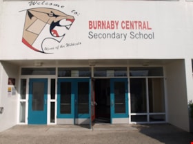
Burnaby Central School
https://search.heritageburnaby.ca/link/landmark814
- Repository
- Burnaby Heritage Planning
- Geographic Access
- Canada Way
- Associated Dates
- 1958
- Heritage Value
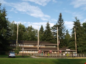
- Burnaby Central School became the third high school to be built in Burnaby (following Burnaby North and Burnaby South). The increased school enrolments due to the rapidly growing population in Burnaby meant that the School District required this third high school to be placed between the other two. In its first year, 719 students attended Burnaby Central.
- Historic Neighbourhood
- Burnaby Lake (Historic Neighbourhood)
- Planning Study Area
- Douglas-Gilpin Area
- Street Address
- 4939 Canada Way
- Street View URL
- Google Maps Street View
Images
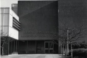
British Columbia Institute of Technology (BCIT)
https://search.heritageburnaby.ca/link/landmark806
- Repository
- Burnaby Heritage Planning
- Geographic Access
- Willingdon Avenue
- Associated Dates
- 1960
- Heritage Value
- The BC Vocational School was established in 1960 at Willingdon and Canada Way. By 1964, the British Columbia Insitute of Technology had opened and had 498 students enrolled. In the 1970s, the BC Vocational School had been renamed the Pacific Vocational Institute and in 1986 the two institutions merged. The school is a public post-secondary institution that is governed by a Board of Governors, under the authority of the Ministry of Advanced Education, Training and Technology. By 2004, the annual enrolment of part-time and full-time students reached 48,000.
- Planning Study Area
- Douglas-Gilpin Area
- Street Address
- 3700 Willingdon Avenue
- Street View URL
- Google Maps Street View
Images
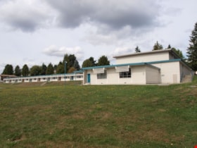
Gilpin Elementary School
https://search.heritageburnaby.ca/link/landmark811
- Repository
- Burnaby Heritage Planning
- Geographic Access
- Eglinton Street
- Associated Dates
- 1966
- Heritage Value
- Gilpin Elementary School was built to serve a new housing development extending out from the Douglas Road school area towards the Oakalla Prison site and the Forest Lawn Cemetery. Built in 1966, the school, like other elementary schools of the era, was one-storey, without basement or high stairs. Additions to the building were made in 1969 and 1973.
- Historic Neighbourhood
- Burnaby Lake (Historic Neighbourhood)
- Planning Study Area
- Douglas-Gilpin Area
- Street Address
- 5490 Eglinton Street
- Street View URL
- Google Maps Street View
Images
Burnaby Lake Neighbourhood
https://search.heritageburnaby.ca/link/landmark733
- Repository
- Burnaby Heritage Planning
- Repository
- Burnaby Heritage Planning
- Heritage Value
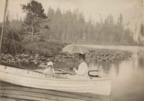
- After New Westminster was established as the Capital City, the surrounding lands were surveyed by the Royal Engineers. The discovery of Burnaby Lake by Robert Burnaby in 1859 soon led to the construction of Douglas Road to Deer Lake in 1861. The completion of the tramline in 1891 renewed interest in the lands around both Burnaby Lake and Deer Lake and soon a group of gentlemen farmers had established strawberry fields and orchards to serve the New Westminster market. These were the most productive and well managed "fruit ranches" in the Fraser Valley. Local strawberries were so admired that they commanded 50 cents more per crate at local markets. One local paper reported that the area appeared as if "an English Village had been taken and planted amidst the grandeur of British Columbia scenery."
- Historic Neighbourhood
- Burnaby Lake (Historic Neighbourhood)
- Planning Study Area
- Douglas-Gilpin Area
Images
Douglas-Gilpin Neighbourhood
https://search.heritageburnaby.ca/link/landmark799
- Repository
- Burnaby Heritage Planning
- Associated Dates
- 1955-2008
- Heritage Value
- The Douglas-Gilpin Neighbourhood developed into a diverse area incorporating residential, business, educational and park districts in the period after 1955. The BCIT site was built in the early 1960s, shortly after the Burnaby Municipal Hall was located on Canada Way near Deer Lake in 1956. The construction of the Municipal Hall at this location fostered the creation of an administrative and business centre adjacent to the park, while the northern and central areas of the neighbourhood retained their primarily residential character.
- Historic Neighbourhood
- Burnaby Lake (Historic Neighbourhood)
- Planning Study Area
- Douglas-Gilpin Area
Images
Burnaby Village Museum
https://search.heritageburnaby.ca/link/landmark808
- Repository
- Burnaby Heritage Planning
- Geographic Access
- Deer Lake Avenue
- Associated Dates
- 1971
- Heritage Value
- The Burnaby Village Museum is a ten-acre heritage site located adjacent to Deer Lake. The site was originally created as a B.C. Centennial Project in 1971. The official sod turning for was April 11, 1971 by the then Governor General of Canada Roland Mitchener. The Village was initially managed by the Century Park Museum Association, a volunteer society of Burnaby citizens. Over the years many heritage building which could not be maintained in their original locations have been moved to the museum. Today half of the buildings in the village are heritage structures and the remainder are reproductions. In 1990 the City of Burnaby assumed direct management of the Village, and the museum became part of the Parks, Recreation and Culture Department. Visitors can enjoy the shops on Hill Street, ride the Parker 119 Carousel, and climb aboard the Interurban 1223 tram.
- Historic Neighbourhood
- Burnaby Lake (Historic Neighbourhood)
- Planning Study Area
- Douglas-Gilpin Area
- Morley-Buckingham Area
- Street Address
- 6501 Deer Lake Avenue
- Street View URL
- Google Maps Street View
Images
Shadbolt Centre for the Arts
https://search.heritageburnaby.ca/link/landmark820
- Repository
- Burnaby Heritage Planning
- Geographic Access
- Deer Lake Avenue
- Associated Dates
- 1995
- Heritage Value
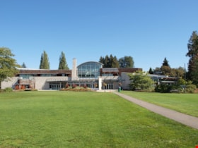
- The Shadbolt Centre for the Arts opened in 1995. The Shadbolt Centre was named after two Burnaby residents who dedicated a lifetime of support and cultivation of the arts locally, nationally and internationally. Doris and Jack Shadbolt resided in Burnaby for over 50 years until Jack's death in November 1998. Doris Shadbolt spent her life's work bringing the artist and the audience closer together through her writing and curatorial work. Jack Shadbolt was an internationally recognized Canadian painter. He was also an author and both received many awards including the Order of Canada. In keeping with the Shadbolts' generosity the arts, Jack Shadbolt donated two of his paintings to the Centre for permanent display.
- Historic Neighbourhood
- Burnaby Lake (Historic Neighbourhood)
- Planning Study Area
- Douglas-Gilpin Area
- Street Address
- 6450 Deer Lake Avenue
- Street View URL
- Google Maps Street View
