Narrow Results By
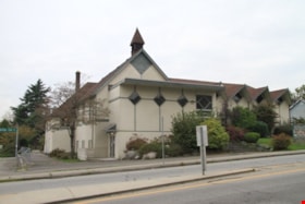
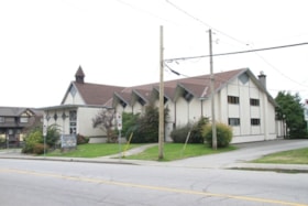
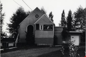
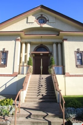
Alta Vista Baptist Church
https://search.heritageburnaby.ca/link/landmark557
- Repository
- Burnaby Heritage Planning
- Description
- Church building.
- Associated Dates
- 1936
- Other Names
- Royal Oak Community Church
- Street View URL
- Google Maps Street View
- Repository
- Burnaby Heritage Planning
- Other Names
- Royal Oak Community Church
- Geographic Access
- Royal Oak Avenue
- Associated Dates
- 1936
- Description
- Church building.
- Heritage Value
- This Baptist congregation originally held services in a tent at the corner of McGregor Avenue and Portland but they soon were able to build a small church. A membership drive by Pastor Arthur James Bowbrick (1875-1961) was so successful that the congregation was able build this fine structure, prominently located at the corner of Victory Street. Although it has been altered with later additions and stucco over the original siding, the original windows and the rooftop belfry remain.
- Locality
- Alta Vista
- Historic Neighbourhood
- Alta Vista (Historic Neighbourhood)
- Planning Study Area
- Sussex-Nelson Area
- Ownership
- Private
- Street Address
- 7175 Royal Oak Avenue
- Street View URL
- Google Maps Street View
Images
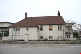
Chapel Of Peace
https://search.heritageburnaby.ca/link/landmark566
- Repository
- Burnaby Heritage Planning
- Description
- Church building.
- Associated Dates
- 1936
- Formal Recognition
- Heritage Designation, Community Heritage Register
- Other Names
- First United Spiritualist Church
- Street View URL
- Google Maps Street View
- Repository
- Burnaby Heritage Planning
- Other Names
- First United Spiritualist Church
- Geographic Access
- Kincaid Street
- Associated Dates
- 1936
- Formal Recognition
- Heritage Designation, Community Heritage Register
- Enactment Type
- Bylaw No. 13162
- Enactment Date
- 28/01/2013
- Description
- Church building.
- Heritage Value
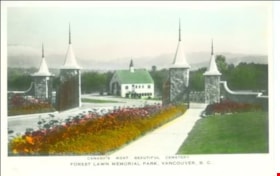
- This church was built in 1936 as the Chapel of Peace for the Forest Lawn Cemetery. It was located outside the main entrance of the cemetery at the triangular parcel of land bounded by Sprott, Royal Oak and Canada Way. It served as the location for many memorial services, local community worship and weddings. The Anglican Church purchased and relocated the building to its present site in 1955. The church has been altered with the addition of wings and stucco, but retains its steep front gabled roof and some of its arched windows. It is now used as the First United Spiritualist Church.
- Locality
- Burnaby Lake
- Historic Neighbourhood
- Burnaby Lake (Historic Neighbourhood)
- Planning Study Area
- Douglas-Gilpin Area
- Contributing Resource
- Building
- Ownership
- Private
- Street Address
- 5584 Kincaid Street
- Street View URL
- Google Maps Street View
Images
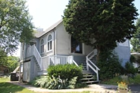
Ocean View Burial Park - Chapel
https://search.heritageburnaby.ca/link/landmark628
- Repository
- Burnaby Heritage Planning
- Geographic Access
- Imperial Street
- Associated Dates
- 1936
- Description
- Church building.
- Heritage Value
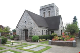
- Subsequent work at Ocean View was designed by local architects Sharp & Thompson through the 1950s, including the stone-faced Garden Chapel, built in 1936 as a replica of a Norman church. Prominent stone gates also replaced the original gates at the corner entrance. George Sharp (1880-1974) and Charles Thompson (1878-1961) formed Vancouver’s longest surviving architectural firm in 1908. They were born, educated and articled in London, before arriving in Vancouver via different routes. In 1912, the firm won the competition for the new University of British Columbia.
- Locality
- Alta Vista
- Historic Neighbourhood
- Alta Vista (Historic Neighbourhood)
- Planning Study Area
- Suncrest Area
- Architect
- Sharp & Thompson
- Area
- 359280.00
- Contributing Resource
- Building
- Ownership
- Private
- Street Address
- 4000 Imperial Street
Images
Vancouver Heights Presbyterian Church
https://search.heritageburnaby.ca/link/landmark649
- Repository
- Burnaby Heritage Planning
- Description
- Church building.
- Associated Dates
- 1930
- Street View URL
- Google Maps Street View
- Repository
- Burnaby Heritage Planning
- Geographic Access
- Esmond Avenue
- Associated Dates
- 1930
- Description
- Church building.
- Heritage Value
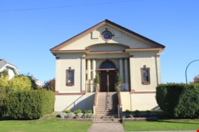
- This church replaced the first Vancouver Heights Presbyterian Church, which opened in 1911 and later became the Masonic Hall. This site was purchased in 1928, but the new church was not completed until 1930, due to the financial constraints of the Depression era. B.C. Lieutenant-Governor Bruce dedicated the church on Feb. 16, 1931. The building has retained its Classical Revival form and detailing, including its symmetrical design, columns flanking the recessed main entrance and arched windows with keystone detailing. The Vancouver Heights Presbyterian Church was designed by Australian-born architect H.H. Simmonds (1883-1954). After serving in the First World War, Simmonds resumed his local practice, and even during the Depression, his output remained prolific. In the 1920s and 30s, Simmonds was commissioned by the City of Vancouver to replace several pavilions at the Pacific National Exhibition with a consistent grouping of Art Deco buildings including the surviving Livestock Building (1929), Women and Fine Arts Building (1931) and Forum (1933).
- Locality
- Vancouver Heights
- Historic Neighbourhood
- Vancouver Heights (Historic Neighbourhood)
- Planning Study Area
- Burnaby Heights Area
- Architect
- H.H. Simmonds
- Area
- 566.79
- Contributing Resource
- Building
- Ownership
- Private
- Street Address
- 140 Esmond Avenue
- Street View URL
- Google Maps Street View
