Narrow Results By
Subject
- Advertising Medium - Signs and Signboards 1
- Animals - Dogs 3
- Buildings - Civic - Community Centres 1
- Buildings - Commercial - Malls 2
- Buildings - Commercial - Restaurants 1
- Buildings - Commercial - Stores 1
- Buildings - Recreational 1
- Buildings - Recreational - Bowling Alleys 3
- Buildings - Recreational - Sports 1
- Buildings - Recreational - Swimming Pools 1
- Buildings - Schools 2
- Geographic Features - Parks 1
Creator
- British Columbia Underwriters' Association 4
- Burnaby Village Museum 1
- Burnett and McGugan B.C. Land Surveyors, New Westminster 1
- Burnett & McGugan, Engineers and Surveyors 1
- City of Burnaby 1
- Debbie Liang 1
- Digney, Andy 12
- Digney, Ernest Frank "Dig" 5
- Liang, Debbie 1
- McGugan, Donald Johnston 2
- Plan Department, British Columbia Insurance Underwriters' Association 4
- UBC Initiative for Student Teaching and Research in Chinese Canadian Studies 1

Burnaby's COVID-19 drive thru testing site
https://search.heritageburnaby.ca/link/museumdescription15391
- Repository
- Burnaby Village Museum
- Date
- 27 Apr. 2020
- Collection/Fonds
- Burnaby Village Museum COVID-19 collection
- Description Level
- Item
- Physical Description
- 1 video recording (mp4) (17 sec.) : digital, 24 fps, col., si.
- Scope and Content
- Film clip (no sound) of the COVID-19 drive thru testing site in Central Park parking lot in Burnaby. Orange traffic posts, wayfinding signs and white tents are set up in the parking lot and staff are wearing protective face masks.
- Repository
- Burnaby Village Museum
- Collection/Fonds
- Burnaby Village Museum COVID-19 collection
- Description Level
- Item
- Physical Description
- 1 video recording (mp4) (17 sec.) : digital, 24 fps, col., si.
- Scope and Content
- Film clip (no sound) of the COVID-19 drive thru testing site in Central Park parking lot in Burnaby. Orange traffic posts, wayfinding signs and white tents are set up in the parking lot and staff are wearing protective face masks.
- Subjects
- Advertising Medium - Signs and Signboards
- Geographic Features - Parks
- Public Services - Health Services
- Pandemics - COVID-19
- Geographic Access
- Central Park
- Imperial Street
- Accession Code
- BV021.2.8
- Access Restriction
- No restrictions
- Reproduction Restriction
- May be restricted by third party rights
- Date
- 27 Apr. 2020
- Media Type
- Moving Images
- Historic Neighbourhood
- Central Park (Historic Neighbourhood)
- Planning Study Area
- Maywood Area
- Notes
- Title based on contents of photograph
Images

Video
Burnaby's COVID-19 drive thru testing site, 27 Apr. 2020
Burnaby's COVID-19 drive thru testing site, 27 Apr. 2020
https://search.heritageburnaby.ca/media/hpo/_Data/_BVM_Moving_Images/2021_0002_0008_001.mp4![Digney film 1 - Bruce Digney and Tawny, [between 1958 and 1959] (date of original), copied 2019 thumbnail](/media/hpo/_Data/_BVM_Moving_Images/2019_0018_0003_011.jpg?width=280)
Digney film 1 - Bruce Digney and Tawny
https://search.heritageburnaby.ca/link/museumdescription10614
- Repository
- Burnaby Village Museum
- Date
- [between 1958 and 1959] (date of original), copied 2019
- Collection/Fonds
- Digney Family fonds
- Description Level
- Item
- Physical Description
- 1 video recording (mp4) (1 min., 13 sec.) : digital, 23 fps, col., si.
- Scope and Content
- Film clip of Bruce Digney playing with family dog named Tawny in a pool of water in the front yard of Digney home located at 6521 Bonsor Avenue. Bruce Digney is using a hose to spray water on the dog.
- Repository
- Burnaby Village Museum
- Collection/Fonds
- Digney Family fonds
- Description Level
- Item
- Physical Description
- 1 video recording (mp4) (1 min., 13 sec.) : digital, 23 fps, col., si.
- Scope and Content
- Film clip of Bruce Digney playing with family dog named Tawny in a pool of water in the front yard of Digney home located at 6521 Bonsor Avenue. Bruce Digney is using a hose to spray water on the dog.
- Creator
- Digney, Andy
- Names
- Digney, Bruce
- Geographic Access
- Bonsor Avenue
- Street Address
- 6521 Bonsor Avenue
- Accession Code
- BV019.18.3.11
- Access Restriction
- No restrictions
- Reproduction Restriction
- No known restrictions
- Date
- [between 1958 and 1959] (date of original), copied 2019
- Media Type
- Moving Images
- Historic Neighbourhood
- Central Park (Historic Neighbourhood)
- Planning Study Area
- Maywood Area
- Notes
- Title based on contents of film segment
- Film segment originates from digitized version of original 8 mm film (See BV019.18.3)
Images
![Digney film 1 - Bruce Digney and Tawny, [between 1958 and 1959] (date of original), copied 2019 thumbnail](/media/hpo/_Data/_BVM_Moving_Images/2019_0018_0003_011.jpg)
Video
Digney film 1 - Bruce Digney and Tawny, [between 1958 and 1959] (date of original), copied 2019
Digney film 1 - Bruce Digney and Tawny, [between 1958 and 1959] (date of original), copied 2019
https://search.heritageburnaby.ca/media/hpo/_Data/_BVM_Moving_Images/2019_0018_0003_011.mp4![Digney film 1 - Playing badminton, [1960] (date of original), copied 2019 thumbnail](/media/hpo/_Data/_BVM_Moving_Images/2019_0018_0003_012.jpg?width=280)
Digney film 1 - Playing badminton
https://search.heritageburnaby.ca/link/museumdescription10615
- Repository
- Burnaby Village Museum
- Date
- [1960] (date of original), copied 2019
- Collection/Fonds
- Digney Family fonds
- Description Level
- Item
- Physical Description
- 1 video recording (mp4) (53 sec.) : digital, 23 fps, col., si.
- Scope and Content
- Film segment taken from the front yard of Digney home at 6521 Bonsor Street. Joyce Digney is in the front yard playing badminton with her son Bruce while son Paul Digney is holding a hose and filling a pool in the driveway. Bonsor Park can be seen across the road along with houses.
- Repository
- Burnaby Village Museum
- Collection/Fonds
- Digney Family fonds
- Description Level
- Item
- Physical Description
- 1 video recording (mp4) (53 sec.) : digital, 23 fps, col., si.
- Scope and Content
- Film segment taken from the front yard of Digney home at 6521 Bonsor Street. Joyce Digney is in the front yard playing badminton with her son Bruce while son Paul Digney is holding a hose and filling a pool in the driveway. Bonsor Park can be seen across the road along with houses.
- Creator
- Digney, Andy
- Subjects
- Sports - Badminton
- Geographic Access
- Bonsor Avenue
- Street Address
- 6521 Bonsor Avenue
- Accession Code
- BV019.18.3.12
- Access Restriction
- No restrictions
- Reproduction Restriction
- No known restrictions
- Date
- [1960] (date of original), copied 2019
- Media Type
- Moving Images
- Historic Neighbourhood
- Central Park (Historic Neighbourhood)
- Planning Study Area
- Maywood Area
- Photographer
- Digney, Ernest Frank "Dig"
- Notes
- Title based on contents of film segment
- Film segment originates from digitized version of original 8 mm film (See BV019.18.3)
Images
![Digney film 1 - Playing badminton, [1960] (date of original), copied 2019 thumbnail](/media/hpo/_Data/_BVM_Moving_Images/2019_0018_0003_012.jpg)
Video
Digney film 1 - Playing badminton, [1960] (date of original), copied 2019
Digney film 1 - Playing badminton, [1960] (date of original), copied 2019
https://search.heritageburnaby.ca/media/hpo/_Data/_BVM_Moving_Images/2019_0018_0003_012.mp4![Digney film 1 - Playing with Tawny, [1960] (date of original), copied 2019 thumbnail](/media/hpo/_Data/_BVM_Moving_Images/2019_0018_0003_013.jpg?width=280)
Digney film 1 - Playing with Tawny
https://search.heritageburnaby.ca/link/museumdescription10616
- Repository
- Burnaby Village Museum
- Date
- [1960] (date of original), copied 2019
- Collection/Fonds
- Digney Family fonds
- Description Level
- Item
- Physical Description
- 1 video recording (mp4) (1 min., 22 sec.) : digital, 23 fps, col., si.
- Scope and Content
- Film segment taken from the front yard of Digney home at 6521 Bonsor Street. The Digney family dog named Tawny is playing with a sprinkler in the yard, barking at the camera man who is probably Dig Digney. Film continues with Joyce Digney throwing a piece of wood for the dog while Bruce Digney look…
- Repository
- Burnaby Village Museum
- Collection/Fonds
- Digney Family fonds
- Description Level
- Item
- Physical Description
- 1 video recording (mp4) (1 min., 22 sec.) : digital, 23 fps, col., si.
- Scope and Content
- Film segment taken from the front yard of Digney home at 6521 Bonsor Street. The Digney family dog named Tawny is playing with a sprinkler in the yard, barking at the camera man who is probably Dig Digney. Film continues with Joyce Digney throwing a piece of wood for the dog while Bruce Digney looks on.
- Creator
- Digney, Andy
- Subjects
- Animals - Dogs
- Names
- Digney, Bruce
- Digney, Joyce
- Geographic Access
- Bonsor Avenue
- Street Address
- 6521 Bonsor Avenue
- Accession Code
- BV019.18.3.13
- Access Restriction
- No restrictions
- Reproduction Restriction
- No known restrictions
- Date
- [1960] (date of original), copied 2019
- Media Type
- Moving Images
- Historic Neighbourhood
- Central Park (Historic Neighbourhood)
- Planning Study Area
- Maywood Area
- Photographer
- Digney, Ernest Frank "Dig"
- Notes
- Title based on contents of film segment
- Film segment originates from digitized version of original 8 mm film (See BV019.18.3)
Images
![Digney film 1 - Playing with Tawny, [1960] (date of original), copied 2019 thumbnail](/media/hpo/_Data/_BVM_Moving_Images/2019_0018_0003_013.jpg)
Video
Digney film 1 - Playing with Tawny, [1960] (date of original), copied 2019
Digney film 1 - Playing with Tawny, [1960] (date of original), copied 2019
https://search.heritageburnaby.ca/media/hpo/_Data/_BVM_Moving_Images/2019_0018_0003_013.mp4![Digney film 2 - Construction of Simpsons-Sears, [1954] (date of original), copied 2019 thumbnail](/media/hpo/_Data/_BVM_Moving_Images/2019_0018_0004_009.jpg?width=280)
Digney film 2 - Construction of Simpsons-Sears
https://search.heritageburnaby.ca/link/museumdescription10640
- Repository
- Burnaby Village Museum
- Date
- [1954] (date of original), copied 2019
- Collection/Fonds
- Digney Family fonds
- Description Level
- Item
- Physical Description
- 1 video recording (mp4) (5 sec.) : digital, 23 fps, col., si.
- Scope and Content
- Short Film clip of a view from the Digney's backyard at 3698 Bonsor Avenue (address changed to 6521 Bonsor Ave. after 1958) of the construction of the Simpsons-Sears building on Kingsway in Burnaby.
- Repository
- Burnaby Village Museum
- Collection/Fonds
- Digney Family fonds
- Description Level
- Item
- Physical Description
- 1 video recording (mp4) (5 sec.) : digital, 23 fps, col., si.
- Scope and Content
- Short Film clip of a view from the Digney's backyard at 3698 Bonsor Avenue (address changed to 6521 Bonsor Ave. after 1958) of the construction of the Simpsons-Sears building on Kingsway in Burnaby.
- Creator
- Digney, Andy
- Subjects
- Buildings - Commercial - Malls
- Names
- Simpsons-Sears Limited
- Geographic Access
- Bonsor Avenue
- Street Address
- 6521 Bonsor Avenue
- Accession Code
- BV019.18.4.9
- Access Restriction
- No restrictions
- Reproduction Restriction
- No known restrictions
- Date
- [1954] (date of original), copied 2019
- Media Type
- Moving Images
- Historic Neighbourhood
- Central Park (Historic Neighbourhood)
- Planning Study Area
- Maywood Area
- Photographer
- Digney, Andy
- Notes
- Title based on contents of film segment
- Film segment originates from digitized version of original 8 mm film (See BV019.18.4)
Images
![Digney film 2 - Construction of Simpsons-Sears, [1954] (date of original), copied 2019 thumbnail](/media/hpo/_Data/_BVM_Moving_Images/2019_0018_0004_009.jpg)
Video
Digney film 2 - Construction of Simpsons-Sears, [1954] (date of original), copied 2019
Digney film 2 - Construction of Simpsons-Sears, [1954] (date of original), copied 2019
https://search.heritageburnaby.ca/media/hpo/_Data/_BVM_Moving_Images/2019_0018_0004_009.mp4![Digney film 2 - Construction of Simpsons-Sears building, [1954] (date of original), copied 2019 thumbnail](/media/hpo/_Data/_BVM_Moving_Images/2019_0018_0004_013.jpg?width=280)
Digney film 2 - Construction of Simpsons-Sears building
https://search.heritageburnaby.ca/link/museumdescription10644
- Repository
- Burnaby Village Museum
- Date
- [1954] (date of original), copied 2019
- Collection/Fonds
- Digney Family fonds
- Description Level
- Item
- Physical Description
- 1 video recording (mp4) (1 min., 30 sec.) : digital, 23 fps, col., si.
- Scope and Content
- Film segment documenting the construction of the Simpsons-Sears building located at 3660 Kingsway in Burnaby (address changed to 4750 Kingsway after 1958). The film footage is shot by Andy Digney from his backyard at 2698 Bonsor Avenue (address changed to 6521 Bonsor Avenue after 1958).
- Repository
- Burnaby Village Museum
- Collection/Fonds
- Digney Family fonds
- Description Level
- Item
- Physical Description
- 1 video recording (mp4) (1 min., 30 sec.) : digital, 23 fps, col., si.
- Scope and Content
- Film segment documenting the construction of the Simpsons-Sears building located at 3660 Kingsway in Burnaby (address changed to 4750 Kingsway after 1958). The film footage is shot by Andy Digney from his backyard at 2698 Bonsor Avenue (address changed to 6521 Bonsor Avenue after 1958).
- Creator
- Digney, Andy
- Names
- Simpsons-Sears Limited
- Geographic Access
- Kingsway
- Street Address
- 4750 Kingsway
- Accession Code
- BV019.18.4.13
- Access Restriction
- No restrictions
- Reproduction Restriction
- No known restrictions
- Date
- [1954] (date of original), copied 2019
- Media Type
- Moving Images
- Historic Neighbourhood
- Central Park (Historic Neighbourhood)
- Planning Study Area
- Maywood Area
- Photographer
- Digney, Andy
- Notes
- Title based on contents of film segment
- Film segment originates from digitized version of original 8 mm film (See BV019.18.4)
Images
![Digney film 2 - Construction of Simpsons-Sears building, [1954] (date of original), copied 2019 thumbnail](/media/hpo/_Data/_BVM_Moving_Images/2019_0018_0004_013.jpg)
Video
Digney film 2 - Construction of Simpsons-Sears building, [1954] (date of original), copied 2019
Digney film 2 - Construction of Simpsons-Sears building, [1954] (date of original), copied 2019
https://search.heritageburnaby.ca/media/hpo/_Data/_BVM_Moving_Images/2019_0018_0004_013.mp4![Digney film 2 - Five pin bowling, [1955] (date of original), copied 2019 thumbnail](/media/hpo/_Data/_BVM_Moving_Images/2019_0018_0004_007.jpg?width=280)
Digney film 2 - Five pin bowling
https://search.heritageburnaby.ca/link/museumdescription10638
- Repository
- Burnaby Village Museum
- Date
- [1955] (date of original), copied 2019
- Collection/Fonds
- Digney Family fonds
- Description Level
- Item
- Physical Description
- 1 video recording (mp4) (7 min., 11 sec.) : digital, 23 fps, col., si.
- Scope and Content
- Film close up of five pin bowling at the Digney Bowling Alley at 6521 Bonsor Avenue in Burnaby. Footage cuts everytime pins are reset. The Digney Bowling Alley opened in 1955.
- Repository
- Burnaby Village Museum
- Collection/Fonds
- Digney Family fonds
- Description Level
- Item
- Physical Description
- 1 video recording (mp4) (7 min., 11 sec.) : digital, 23 fps, col., si.
- Material Details
- Poor quality - dark
- Scope and Content
- Film close up of five pin bowling at the Digney Bowling Alley at 6521 Bonsor Avenue in Burnaby. Footage cuts everytime pins are reset. The Digney Bowling Alley opened in 1955.
- Creator
- Digney, Andy
- Subjects
- Sports - Bowling
- Names
- Digney Bowling Alley
- Geographic Access
- Bonsor Avenue
- Street Address
- 6521 Bonsor Avenue
- Accession Code
- BV019.18.4.7
- Access Restriction
- No restrictions
- Reproduction Restriction
- No known restrictions
- Date
- [1955] (date of original), copied 2019
- Media Type
- Moving Images
- Historic Neighbourhood
- Central Park (Historic Neighbourhood)
- Planning Study Area
- Maywood Area
- Photographer
- Digney, Andy
- Notes
- Title based on contents of film segment
- Film segment originates from digitized version of original 8 mm film (See BV019.18.4)
Images
![Digney film 2 - Five pin bowling, [1955] (date of original), copied 2019 thumbnail](/media/hpo/_Data/_BVM_Moving_Images/2019_0018_0004_007.jpg)
Video
Digney film 2 - Five pin bowling, [1955] (date of original), copied 2019
Digney film 2 - Five pin bowling, [1955] (date of original), copied 2019
https://search.heritageburnaby.ca/media/hpo/_Data/_BVM_Moving_Images/2019_0018_0004_007.mp4![Digney film 2 - Great Dane, [between 1955 and 1958] (date of original), copied 2019 thumbnail](/media/hpo/_Data/_BVM_Moving_Images/2019_0018_0004_001.jpg?width=280)
Digney film 2 - Great Dane
https://search.heritageburnaby.ca/link/museumdescription10632
- Repository
- Burnaby Village Museum
- Date
- [between 1955 and 1958] (date of original), copied 2019
- Collection/Fonds
- Digney Family fonds
- Description Level
- Item
- Physical Description
- 1 video recording (mp4) (2 min., 2 sec.) : digital, 23 fps, col., si.
- Scope and Content
- Film clip of Andy Digney's Great Dane playing in the yard of the Digney home at 6521 Bonsor Street. The elaborate dog house was built by Andy Digney.
- Repository
- Burnaby Village Museum
- Collection/Fonds
- Digney Family fonds
- Description Level
- Item
- Physical Description
- 1 video recording (mp4) (2 min., 2 sec.) : digital, 23 fps, col., si.
- Scope and Content
- Film clip of Andy Digney's Great Dane playing in the yard of the Digney home at 6521 Bonsor Street. The elaborate dog house was built by Andy Digney.
- Creator
- Digney, Andy
- Subjects
- Animals - Dogs
- Names
- Digney, Andy
- Geographic Access
- Bonsor Avenue
- Street Address
- 6521 Bonsor Avenue
- Accession Code
- BV019.18.4.1
- Access Restriction
- No restrictions
- Reproduction Restriction
- No known restrictions
- Date
- [between 1955 and 1958] (date of original), copied 2019
- Media Type
- Moving Images
- Historic Neighbourhood
- Central Park (Historic Neighbourhood)
- Planning Study Area
- Maywood Area
- Notes
- Title based on contents of film segment
- Film segment originates from digitized version of original 8 mm film (See BV019.18.4)
Images
![Digney film 2 - Great Dane, [between 1955 and 1958] (date of original), copied 2019 thumbnail](/media/hpo/_Data/_BVM_Moving_Images/2019_0018_0004_001.jpg)
Video
Digney film 2 - Great Dane, [between 1955 and 1958] (date of original), copied 2019
Digney film 2 - Great Dane, [between 1955 and 1958] (date of original), copied 2019
https://search.heritageburnaby.ca/media/hpo/_Data/_BVM_Moving_Images/2019_0018_0004_001.mp4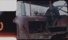
Digney Film 3 - Construction of Digney Bowling Alley
https://search.heritageburnaby.ca/link/museumdescription10648
- Repository
- Burnaby Village Museum
- Date
- 1955 (date of original), copied 2019
- Collection/Fonds
- Digney Family fonds
- Description Level
- Item
- Physical Description
- 1 video recording (mp4) (8 min., 40 sec.) : digital, 23 fps, col., si.
- Scope and Content
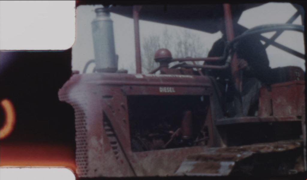
- Film segment documenting the construction of the Digney Bowling Alley in Burnaby. The bowling alley was built on the west side of the Digney family home located at 2698 Bonsor Avenue (address became 6521 Bonsor Avenue after 1958). The film documents Ozzie Cavello using his bulldozer to clear the la…
- Repository
- Burnaby Village Museum
- Collection/Fonds
- Digney Family fonds
- Description Level
- Item
- Physical Description
- 1 video recording (mp4) (8 min., 40 sec.) : digital, 23 fps, col., si.
- Scope and Content
- Film segment documenting the construction of the Digney Bowling Alley in Burnaby. The bowling alley was built on the west side of the Digney family home located at 2698 Bonsor Avenue (address became 6521 Bonsor Avenue after 1958). The film documents Ozzie Cavello using his bulldozer to clear the land followed by construction workers laying cinder block walls, a large crane helping to lay steel girders and lumber for the roof. The opening footage is taken from the parking lot of the Simpsons-Sears store on Kingsway. The Film segment closes with large flower arrangements gathered around the entrance of the Digney Bowling Alley in honour of the grand opening with Andy Digney and his brother in law Sydney Swan at the entrance.
- Creator
- Digney, Andy
- Geographic Access
- Bonsor Avenue
- Street Address
- 6521 Bonsor Avenue
- Accession Code
- BV019.18.5.1
- Access Restriction
- No restrictions
- Reproduction Restriction
- No known restrictions
- Date
- 1955 (date of original), copied 2019
- Media Type
- Moving Images
- Historic Neighbourhood
- Central Park (Historic Neighbourhood)
- Planning Study Area
- Maywood Area
- Photographer
- Digney, Andy
- Digney, Ernest Frank "Dig"
- Notes
- Title based on contents of film segment
- Film segment originates from digitized version of original 8 mm film (See BV019.18.5)
Images
Video
Digney Film 3 - Construction of Digney Bowling Alley, 1955 (date of original), copied 2019
Digney Film 3 - Construction of Digney Bowling Alley, 1955 (date of original), copied 2019
https://search.heritageburnaby.ca/media/hpo/_Data/_BVM_Moving_Images/2019_0018_0005_001.mp4![Digney Film 3 - Inside Digney Bowling Alley, [1955] (date of original), copied 2019 thumbnail](/media/hpo/_Data/_BVM_Moving_Images/2019_0018_0005_003.jpg?width=280)
Digney Film 3 - Inside Digney Bowling Alley
https://search.heritageburnaby.ca/link/museumdescription10650
- Repository
- Burnaby Village Museum
- Date
- [1955] (date of original), copied 2019
- Collection/Fonds
- Digney Family fonds
- Description Level
- Item
- Physical Description
- 1 video recording (mp4) (48 sec.) : digital, 23 fps, col., si.
- Scope and Content
- Film segment documenting the inside of the Digney Bowling Alley. Views of kitchen and counter staff working and serving customers who are gathered at the bar. The camera pans back outside and shows buses parked outside from "Channel / Chan TV. 8". Sign on roof of building reads: "BOWL" and "DIGNE…
- Repository
- Burnaby Village Museum
- Collection/Fonds
- Digney Family fonds
- Description Level
- Item
- Physical Description
- 1 video recording (mp4) (48 sec.) : digital, 23 fps, col., si.
- Scope and Content
- Film segment documenting the inside of the Digney Bowling Alley. Views of kitchen and counter staff working and serving customers who are gathered at the bar. The camera pans back outside and shows buses parked outside from "Channel / Chan TV. 8". Sign on roof of building reads: "BOWL" and "DIGNEY" sign hangs vertically out front.
- Creator
- Digney, Andy
- Names
- Digney Bowling Alley
- Geographic Access
- Bonsor Avenue
- Street Address
- 6521 Bonsor Avenue
- Accession Code
- BV019.18.5.3
- Access Restriction
- No restrictions
- Reproduction Restriction
- No known restrictions
- Date
- [1955] (date of original), copied 2019
- Media Type
- Moving Images
- Historic Neighbourhood
- Central Park (Historic Neighbourhood)
- Planning Study Area
- Maywood Area
- Photographer
- Digney, Andy
- Notes
- Title based on contents of film segment
- Film segment originates from digitized version of original 8 mm film (See BV019.18.5)
- Film segment may have been taken on the same day as BV019.18.4.2
Images
![Digney Film 3 - Inside Digney Bowling Alley, [1955] (date of original), copied 2019 thumbnail](/media/hpo/_Data/_BVM_Moving_Images/2019_0018_0005_003.jpg)
Video
Digney Film 3 - Inside Digney Bowling Alley, [1955] (date of original), copied 2019
Digney Film 3 - Inside Digney Bowling Alley, [1955] (date of original), copied 2019
https://search.heritageburnaby.ca/media/hpo/_Data/_BVM_Moving_Images/2019_0018_0005_003.mp4![Digney Film 3 - Tournament at Digney Bowling Alley, [1955] (date of original), copied 2019 thumbnail](/media/hpo/_Data/_BVM_Moving_Images/2019_0018_0005_002.jpg?width=280)
Digney Film 3 - Tournament at Digney Bowling Alley
https://search.heritageburnaby.ca/link/museumdescription10649
- Repository
- Burnaby Village Museum
- Date
- [1955] (date of original), copied 2019
- Collection/Fonds
- Digney Family fonds
- Description Level
- Item
- Physical Description
- 1 video recording (mp4) (3 min., 12 sec.) : digital, 23 fps, col., si.
- Scope and Content
- Film segment documenting a bowling tournament at the Digney Bowling Alley at 2698 Bonsor Avenue (address became 6521 Bonsor Avenue after 1958). Two male and female pairs appear to be competing against each other and a camera man and camera from Channel 8 - Chan TV are filming the event. One of the …
- Repository
- Burnaby Village Museum
- Collection/Fonds
- Digney Family fonds
- Description Level
- Item
- Physical Description
- 1 video recording (mp4) (3 min., 12 sec.) : digital, 23 fps, col., si.
- Scope and Content
- Film segment documenting a bowling tournament at the Digney Bowling Alley at 2698 Bonsor Avenue (address became 6521 Bonsor Avenue after 1958). Two male and female pairs appear to be competing against each other and a camera man and camera from Channel 8 - Chan TV are filming the event. One of the couples are wearing shirts with "Digney Bowl" printed on the back. Ernest "Dig" Digney assists in handing out awards at the end. Joyce Digney is identified working in the kitchen. The camera pans outside where there are two "Channel 8 - Chan TV" buses parked in the parking lot of the Digney Bowl.
- Creator
- Digney, Andy
- Geographic Access
- Bonsor Avenue
- Street Address
- 6521 Bonsor Avenue
- Accession Code
- BV019.18.5.2
- Access Restriction
- No restrictions
- Reproduction Restriction
- No known restrictions
- Date
- [1955] (date of original), copied 2019
- Media Type
- Moving Images
- Historic Neighbourhood
- Central Park (Historic Neighbourhood)
- Planning Study Area
- Maywood Area
- Photographer
- Digney, Andy
- Notes
- Title based on contents of film segment
- Film segment originates from digitized version of original 8 mm film (See BV019.18.5)
Images
![Digney Film 3 - Tournament at Digney Bowling Alley, [1955] (date of original), copied 2019 thumbnail](/media/hpo/_Data/_BVM_Moving_Images/2019_0018_0005_002.jpg)
Video
Digney Film 3 - Tournament at Digney Bowling Alley, [1955] (date of original), copied 2019
Digney Film 3 - Tournament at Digney Bowling Alley, [1955] (date of original), copied 2019
https://search.heritageburnaby.ca/media/hpo/_Data/_BVM_Moving_Images/2019_0018_0005_002.mp4![Digney Film 4 - Lawn bowling at Central Park, [196-] (date of original), copied 2019 thumbnail](/media/hpo/_Data/_BVM_Moving_Images/2019_0018_0006_004.jpg?width=280)
Digney Film 4 - Lawn bowling at Central Park
https://search.heritageburnaby.ca/link/museumdescription10658
- Repository
- Burnaby Village Museum
- Date
- [196-] (date of original), copied 2019
- Collection/Fonds
- Digney Family fonds
- Description Level
- Item
- Physical Description
- 1 video recording (mp4) (2 min., 9 sec.) : digital, 23 fps, col., si.
- Scope and Content
- Film segment of unidentified women and men lawn bowling at Central Park in Burnaby. Buildings along Kingsway and Boundary Road are visible in the background.
- Repository
- Burnaby Village Museum
- Collection/Fonds
- Digney Family fonds
- Description Level
- Item
- Physical Description
- 1 video recording (mp4) (2 min., 9 sec.) : digital, 23 fps, col., si.
- Scope and Content
- Film segment of unidentified women and men lawn bowling at Central Park in Burnaby. Buildings along Kingsway and Boundary Road are visible in the background.
- Creator
- Digney, Andy
- Subjects
- Sports - Lawn Bowling
- Geographic Access
- Central Park
- Boundary Road
- Kingsway
- Accession Code
- BV019.18.6.4
- Access Restriction
- No restrictions
- Reproduction Restriction
- No known restrictions
- Date
- [196-] (date of original), copied 2019
- Media Type
- Moving Images
- Historic Neighbourhood
- Central Park (Historic Neighbourhood)
- Photographer
- Digney, Ernest Frank "Dig"
- Notes
- Title based on contents of film segment
- Film segment originates from digitized version of original 8 mm film (See BV019.18.6)
Images
![Digney Film 4 - Lawn bowling at Central Park, [196-] (date of original), copied 2019 thumbnail](/media/hpo/_Data/_BVM_Moving_Images/2019_0018_0006_004.jpg)
Video
Digney Film 4 - Lawn bowling at Central Park, [196-] (date of original), copied 2019
Digney Film 4 - Lawn bowling at Central Park, [196-] (date of original), copied 2019
https://search.heritageburnaby.ca/media/hpo/_Data/_BVM_Moving_Images/2019_0018_0006_004.mp4![Digney Film 4 - Lawn bowling at Central Park, [196-] (date of original), copied 2019 thumbnail](/media/hpo/_Data/_BVM_Moving_Images/2019_0018_0006_007.jpg?width=280)
Digney Film 4 - Lawn bowling at Central Park
https://search.heritageburnaby.ca/link/museumdescription10659
- Repository
- Burnaby Village Museum
- Date
- [196-] (date of original), copied 2019
- Collection/Fonds
- Digney Family fonds
- Description Level
- Item
- Physical Description
- 1 video recording (mp4) (3 min., 22 sec.) : digital, 23 fps, col., si.
- Scope and Content
- Film segment of women and men lawn bowling at Central Park in Burnaby. Buildings along Kingsway and Boundary Road are visible in the background. Sydney Swan (wearing glasses and vest) is identified as one of the bowlers.
- Repository
- Burnaby Village Museum
- Collection/Fonds
- Digney Family fonds
- Description Level
- Item
- Physical Description
- 1 video recording (mp4) (3 min., 22 sec.) : digital, 23 fps, col., si.
- Scope and Content
- Film segment of women and men lawn bowling at Central Park in Burnaby. Buildings along Kingsway and Boundary Road are visible in the background. Sydney Swan (wearing glasses and vest) is identified as one of the bowlers.
- Creator
- Digney, Andy
- Subjects
- Sports - Lawn Bowling
- Names
- Swan, Sydney
- Geographic Access
- Central Park
- Boundary Road
- Kingsway
- Accession Code
- BV019.18.6.7
- Access Restriction
- No restrictions
- Reproduction Restriction
- No known restrictions
- Date
- [196-] (date of original), copied 2019
- Media Type
- Moving Images
- Historic Neighbourhood
- Central Park (Historic Neighbourhood)
- Planning Study Area
- Maywood Area
- Photographer
- Digney, Ernest Frank "Dig"
- Notes
- Title based on contents of film segment
- Film segment originates from digitized version of original 8 mm film (See BV019.18.6)
- Similar footage of lawn bowling - see BV019.18.6.8
Images
![Digney Film 4 - Lawn bowling at Central Park, [196-] (date of original), copied 2019 thumbnail](/media/hpo/_Data/_BVM_Moving_Images/2019_0018_0006_007.jpg)
Video
Digney Film 4 - Lawn bowling at Central Park, [196-] (date of original), copied 2019
Digney Film 4 - Lawn bowling at Central Park, [196-] (date of original), copied 2019
https://search.heritageburnaby.ca/media/hpo/_Data/_BVM_Moving_Images/2019_0018_0006_007.mp4
Inman Avenue School site
https://search.heritageburnaby.ca/link/museumdescription11128
- Repository
- Burnaby Village Museum
- Date
- May 3, 1915
- Collection/Fonds
- Ronald G. Scobbie collection
- Description Level
- Item
- Physical Description
- 1 survey plan : blueprint on paper ; 56 x 54 cm
- Scope and Content
- Survey plan of "Inman Avenue School Site" "Burnaby Municipality" "Being Lots 3 -12 inc. Blk. C. of Subd. of Blks.5" "13-19 inc. & 21-28 inc. of Subd. of Westerly 80 Acres of, and portion of D.L. 34, Group One. New Westminster District".
- Repository
- Burnaby Village Museum
- Collection/Fonds
- Ronald G. Scobbie collection
- Description Level
- Item
- Physical Description
- 1 survey plan : blueprint on paper ; 56 x 54 cm
- Material Details
- Scale: 40 feet = 1 inch
- Scope and Content
- Survey plan of "Inman Avenue School Site" "Burnaby Municipality" "Being Lots 3 -12 inc. Blk. C. of Subd. of Blks.5" "13-19 inc. & 21-28 inc. of Subd. of Westerly 80 Acres of, and portion of D.L. 34, Group One. New Westminster District".
- Creator
- McGugan, Donald Johnston
- Subjects
- Buildings - Schools
- Names
- Inman Avenue School
- Responsibility
- Burnett & McGugan, Engineers and Surveyors
- Geographic Access
- Brandon Street
- Street Address
- 3963 Brandon Street
- Accession Code
- BV003.83.7
- Access Restriction
- No restrictions
- Reproduction Restriction
- No known restrictions
- Date
- May 3, 1915
- Media Type
- Cartographic Material
- Historic Neighbourhood
- Central Park (Historic Neighbourhood)
- Planning Study Area
- Garden Village Area
- Scan Resolution
- 440
- Scan Date
- 22-Dec-2020
- Scale
- 100
- Notes
- Title based on contents of plan
- Oath in bottom left corner reads: "I, D.J. McGugan...did...superintend the survey...", "...completed on the 3rd day of May 1915"; signed "D.J. McGugan", notariz- ed by "Walter Edmonds" "sworn...22nd Day of May 1915"; "Burnett and McGugan. B.C. Land Surveyors. Etc. New Westminster. B.C.";
- handwritten note reads: "Note: Before using this Mon. see plan / of resubdivision of Lots 5 & 6 / of Block 'B' D.L. 34 / June 1945"
- handwritten twice on back, "1776"
Zoomable Images


Kingsway West School site
https://search.heritageburnaby.ca/link/museumdescription11122
- Repository
- Burnaby Village Museum
- Date
- March 16, 1915
- Collection/Fonds
- Ronald G. Scobbie collection
- Description Level
- Item
- Physical Description
- 1 survey plan : blueprint on paper with pencil notations ; 56 x 54 cm
- Scope and Content
- Survey plan of "Kingsway West School Site" "Burnaby Municipality" "being Lot 1, D.L.32, Lot 1 of Lot 21, Portion of Lot 21 and Portion of Lot 20, of subdivision of D.L.152, 153 & Portion of Lot 151, Group 1, New Westminster District". Notations in pencil extend along the south boundary line of Dist…
- Repository
- Burnaby Village Museum
- Collection/Fonds
- Ronald G. Scobbie collection
- Description Level
- Item
- Physical Description
- 1 survey plan : blueprint on paper with pencil notations ; 56 x 54 cm
- Material Details
- Scale: 40 feet = 1 inch
- Scope and Content
- Survey plan of "Kingsway West School Site" "Burnaby Municipality" "being Lot 1, D.L.32, Lot 1 of Lot 21, Portion of Lot 21 and Portion of Lot 20, of subdivision of D.L.152, 153 & Portion of Lot 151, Group 1, New Westminster District". Notations in pencil extend along the south boundary line of District Lot 32.
- Creator
- McGugan, Donald Johnston
- Subjects
- Buildings - Schools
- Names
- Kingsway West School
- Responsibility
- Burnett and McGugan B.C. Land Surveyors, New Westminster
- Geographic Access
- Kingsway
- Sussex Avenue
- Accession Code
- BV003.83.2
- Access Restriction
- No restrictions
- Reproduction Restriction
- No known restrictions
- Date
- March 16, 1915
- Media Type
- Cartographic Material
- Historic Neighbourhood
- Central Park (Historic Neighbourhood)
- Planning Study Area
- Maywood Area
- Scan Resolution
- 440
- Scan Date
- 22-Dec-2020
- Scale
- 100
- Notes
- Transcribed title
- Oath in bottom left corner reads: "I, D.J. McGugan...did personally superintend the survey ..." "...completed on the 16th day of March 1915", signed "D.J. McGugan" and is notarized on March 19th, 1915 by "S.F. Frank" with a seal
- handwritten on back, "1753";
- See also BV003.83.9 - duplicate blueprint plan without annotations
- See also BV003.83.3 for original plan on waxed linen
Zoomable Images


Municipality of Burnaby - Volume XV and Volume XVIII
https://search.heritageburnaby.ca/link/museumdescription8680
- Repository
- Burnaby Village Museum
- Date
- May 1927
- Collection/Fonds
- Burnaby Village Museum Map collection
- Description Level
- File
- Physical Description
- 4 plans on 4 sheets : col. lithographic prints ; 63.5 x 53.5 cm folded to 53 x 31.5 cm
- Scope and Content
- File consists of four pages of plans removed from a bound book containing a series of fire insurance plans of the Municipality of Burnaby. The first two pages are numbered "A" and "B" and are key plans from "GREATER VANCOUVER B.C. / VOLUME XV / Surveyed _ May 1927 / MUNICIPALITY OF / BURNABY", "PLA…
- Repository
- Burnaby Village Museum
- Collection/Fonds
- Burnaby Village Museum Map collection
- Description Level
- File
- Physical Description
- 4 plans on 4 sheets : col. lithographic prints ; 63.5 x 53.5 cm folded to 53 x 31.5 cm
- Material Details
- Scales [1:1200] and [1:6000]
- Scope and Content
- File consists of four pages of plans removed from a bound book containing a series of fire insurance plans of the Municipality of Burnaby. The first two pages are numbered "A" and "B" and are key plans from "GREATER VANCOUVER B.C. / VOLUME XV / Surveyed _ May 1927 / MUNICIPALITY OF / BURNABY", "PLAN DEPT. FIRE BRANCH _ B.C. INSURANCE UNDERWRITERS ASSN.". Key Plan "B" covers plans: 1505; 1506; 1512 to 1516; 1540 to 1544; 1550 to 1557 and District Lots: 129 to 132; 135 to 138; 205 to 208 and 215 to 218. Key Plan "A" covers plans: 1501 to 1504; 1507 to 1511; 1517 to 1525; 1531 to 1539; 1545 to 1550 and District Lots: 116 to 127 and 186 to 189. Plan "1806" is part of "GREATER VANCOUVER B.C. / VOLUME XVIII / Municipality of Burnaby / May, 1927" and covers District Lot 153. Plan "1807" is from "GREATER VANCOUVER B.C. / VOLUME XVIII / Municipality of Burnaby / May, 1927" and covers District Lots: 99,149 and 152.
- Responsibility
- British Columbia Underwriters' Association
- Accession Code
- HV972.111.2
- Access Restriction
- No restrictions
- Reproduction Restriction
- May be restricted by third party rights
- Date
- May 1927
- Media Type
- Cartographic Material
- Historic Neighbourhood
- Vancouver Heights (Historic Neighbourhood)
- Lochdale (Historic Neighbourhood)
- Capitol Hill (Historic Neighbourhood)
- Central Park (Historic Neighbourhood)
- Alta Vista (Historic Neighbourhood)
- Planning Study Area
- Burnaby Heights Area
- Sperling-Broadway Area
- Lochdale Area
- Parkcrest-Aubrey Area
- Westridge Area
- Willingdon Heights Area
- Capitol Hill Area
- Maywood Area
- Marlborough Area
- Scan Resolution
- 400
- Scan Date
- 2021-11-18
- Notes
- Title based on content of plans
- Scales are measured 1 inch = 100 feet and 1 inch = 500 feet
- See also BV987.1.70d for revised versions of plans
Zoomable Images


Municipality of Burnaby - Volume XVI and Volume XVII
https://search.heritageburnaby.ca/link/museumdescription8684
- Repository
- Burnaby Village Museum
- Date
- May 1927
- Collection/Fonds
- Burnaby Village Museum Map collection
- Description Level
- File
- Physical Description
- 4 plans on 4 sheets : col. lithographic prints ; 63.5 x 53.5 cm folded to 53 x 31.5 cm
- Scope and Content
- File consists of four pages of plans removed from a bound book containing a series of fire insurance plans of the Municipality of Burnaby. Page "D" is titled: "GREATER VANCOUVER B.C. / VOLUME XVI / Surveyed _ May 1927 / MUNICIPALITY OF / BURNABY / PLAN DEPT. FIRE BRANCH _ B.C. INSURANCE UNDERWRITE…
- Repository
- Burnaby Village Museum
- Collection/Fonds
- Burnaby Village Museum Map collection
- Description Level
- File
- Physical Description
- 4 plans on 4 sheets : col. lithographic prints ; 63.5 x 53.5 cm folded to 53 x 31.5 cm
- Material Details
- Scale [1:1200] and [1:6000]
- Scope and Content
- File consists of four pages of plans removed from a bound book containing a series of fire insurance plans of the Municipality of Burnaby. Page "D" is titled: "GREATER VANCOUVER B.C. / VOLUME XVI / Surveyed _ May 1927 / MUNICIPALITY OF / BURNABY / PLAN DEPT. FIRE BRANCH _ B.C. INSURANCE UNDERWRITERS ASSN." / KEY PLAN". Plans covered in this "Key Plan" are numbered 1601 to 1626, 1632 and 1651 covering District Lots: 15; 31; 100 to 102; 114; 141 to 144; 147 and 148; 209 to 214. Plan "E" is part of "GREATER VANCOUVER B.C. / VOLUME XVII / Municipality of Burnaby / May 1927" and covers plans: 1701 to 1705; 1711 to 1715; 1723 to 1727; 1729 to 1733; 1737 to 1742 and District Lots: 68 to 74; 80 to 84; 32 to 35 and 38 to 39. Plan marked "F" is a key plan titled: "GREATER VANCOUVER B.C. / VOLUME XVII / Surveyed _ May 1927 / MUNICIPALITY OF / BURNABY and covers plans: 1706 to 1710; 1716 to 1722; 1734 and 1735; 1743 to 1752 and District Lots: 42 to 44; 59; 75 to 80; 83 to 87; 89 to 93 and 130. Plan "1729" is part of "GREATER VANCOUVER B.C. / VOLUME XVII / Municipality of Burnaby / May 1927" and covers District Lots 34 and 35.
- Responsibility
- British Columbia Underwriters' Association
- Accession Code
- HV972.111.6
- Access Restriction
- No restrictions
- Reproduction Restriction
- May be restricted by third party rights
- Date
- May 1927
- Media Type
- Cartographic Material
- Historic Neighbourhood
- Barnet (Historic Neighbourhood)
- Burquitlam (Historic Neighbourhood)
- Central Park (Historic Neighbourhood)
- Burnaby Lake (Historic Neighbourhood)
- Broadview (Historic Neighbourhood)
- Planning Study Area
- Burnaby Mountain Area
- Lyndhurst Area
- Lake City Area
- Cascade-Schou Area
- Garden Village Area
- Douglas-Gilpin Area
- Oakalla Area
- Scan Resolution
- 400
- Scan Date
- 2021-11-18
- Notes
- Title based on content of plans
- See also BV987.1.70d for revised versions of plans
- Scale is measured 1 inch = 500 feet
Zoomable Images


Municipality of Burnaby - Volume XVIII and Volume XIX
https://search.heritageburnaby.ca/link/museumdescription8683
- Repository
- Burnaby Village Museum
- Date
- May 1927
- Collection/Fonds
- Burnaby Village Museum Map collection
- Description Level
- File
- Physical Description
- 2 plans on 2 sheets : col. lithographic prints ; 63.5 x 53.5 cm folded to 53 x 31.5 cm
- Scope and Content
- File consists of two pages of plans removed from a bound book containing a series of fire insurance plans of the Municipality of Burnaby. Plan "1832" is from "GREATER VANCOUVER B.C. / VOLUME XVIII / Municipality of Burnaby / May, 1927" and covers District Lots: 98 and 28. Plan "K" is part of a key …
- Repository
- Burnaby Village Museum
- Collection/Fonds
- Burnaby Village Museum Map collection
- Description Level
- File
- Physical Description
- 2 plans on 2 sheets : col. lithographic prints ; 63.5 x 53.5 cm folded to 53 x 31.5 cm
- Material Details
- Scale [1:1200] to [1:6000]
- Scope and Content
- File consists of two pages of plans removed from a bound book containing a series of fire insurance plans of the Municipality of Burnaby. Plan "1832" is from "GREATER VANCOUVER B.C. / VOLUME XVIII / Municipality of Burnaby / May, 1927" and covers District Lots: 98 and 28. Plan "K" is part of a key plan "GREATER VANCOUVER B.C. / Surveyed VOLUME XIX May 1927 / MUNICIPALITY OF / BURNABY / PLAN DEPT. British Columbia Ins. Underwriters Association / FIRE BRANCH / KEY PLAN", "Scale 500 FT = 1 INCH / FOR REPORT SEE VOL. XV" covering plans: 1901 to 1914 and District Lots: 161; 164 to 167; 155c; 155; 172 and 173.
- Responsibility
- British Columbia Underwriters' Association
- Accession Code
- HV972.111.5
- Access Restriction
- No restrictions
- Reproduction Restriction
- May be restricted by third party rights
- Date
- May 1927
- Media Type
- Cartographic Material
- Historic Neighbourhood
- East Burnaby (Historic Neighbourhood)
- Central Park (Historic Neighbourhood)
- Fraser Arm (Historic Neighbourhood)
- Alta Vista (Historic Neighbourhood)
- Planning Study Area
- Windsor Area
- Marlborough Area
- Second Street Area
- Big Bend Area
- Sussex-Nelson Area
- Scan Resolution
- 400
- Scan Date
- 2021-11-18
- Notes
- Title based on content of plans
- See also BV987.1.70d for revised versions of plans
- Scale is measured 1 inch = 500 feet
Zoomable Images


Municipality of Burnaby - Volume XV, Volume XVI, Volume XVII, Volume XVIII
https://search.heritageburnaby.ca/link/museumdescription8685
- Repository
- Burnaby Village Museum
- Date
- May 1927
- Collection/Fonds
- Burnaby Village Museum Map collection
- Description Level
- File
- Physical Description
- 4 plans on 4 sheets : col. lithographic prints ; 63.5 x 53.5 cm folded to 53 x 31.5 cm
- Scope and Content
- File consists of four pages of plans removed from a bound book containing a series of fire insurance plans of the Municipality of Burnaby. Plan "1531" is part of "GREATER VANCOUVER B.C. / VOLUME XV / Municipality of Burnaby / May 1927" and covers District Lots: 116 and 117. Key Plan "C" is part of …
- Repository
- Burnaby Village Museum
- Collection/Fonds
- Burnaby Village Museum Map collection
- Description Level
- File
- Physical Description
- 4 plans on 4 sheets : col. lithographic prints ; 63.5 x 53.5 cm folded to 53 x 31.5 cm
- Material Details
- Scale [1:600] and [1:1200]
- Scope and Content
- File consists of four pages of plans removed from a bound book containing a series of fire insurance plans of the Municipality of Burnaby. Plan "1531" is part of "GREATER VANCOUVER B.C. / VOLUME XV / Municipality of Burnaby / May 1927" and covers District Lots: 116 and 117. Key Plan "C" is part of "GREATER VANCOUVER B.C. / VOLUME XVI / Municipality of Burnaby / May 1927" and covers plans 1623 to 1651 and District Lots: 1 and 2; 4; 6; 8; 10 to 14; 25; 27; 40; 56 to 58; 88 and 89. Plan "1738" is part of "GREATER VANCOUVER B.C. / VOLUME XVII / Municipality of Burnaby / May 1927" and covers District Lots: 34 and 35. Key plan "G" is part of "GREATER VANCOUVER B.C. / VOLUME XVIII / Municipality of Burnaby / May 1927" and covers plans: 1801 to 1813; 1823; 1824; 1833 to 1838; 1841 to 1853 and District Lots: 32; 93; 94; 97 to 99; 149; 150; 152; 155 to 159; 161 to 164.
- Responsibility
- British Columbia Underwriters' Association
- Accession Code
- HV972.111.7
- Access Restriction
- No restrictions
- Reproduction Restriction
- May be restricted by third party rights
- Date
- May 1927
- Media Type
- Cartographic Material
- Historic Neighbourhood
- Central Park (Historic Neighbourhood)
- Fraser Arm (Historic Neighbourhood)
- Alta Vista (Historic Neighbourhood)
- Broadview (Historic Neighbourhood)
- Vancouver Heights (Historic Neighbourhood)
- Burquitlam (Historic Neighbourhood)
- East Burnaby (Historic Neighbourhood)
- Edmonds (Historic Neighbourhood)
- Lozells (Historic Neighbourhood)
- Planning Study Area
- Clinton-Glenwood Area
- Marlborough Area
- Maywood Area
- Windsor Area
- Big Bend Area
- Garden Village Area
- Willingdon Heights Area
- West Central Valley Area
- Cariboo-Armstrong Area
- Lyndhurst Area
- Cameron Area
- Lake City Area
- Edmonds Area
- Second Street Area
- Sperling-Broadway Area
- Lakeview-Mayfield Area
- Scan Resolution
- 400
- Scan Date
- 2021-11-18
- Notes
- Title based on content of plans
- See also BV987.1.70d for revised versions of plans
- Scale is measured 1 inch = 500 feet
Zoomable Images

Municipality of Burnaby - Volume XV, Volume XVI, Volume XVII, Volume XVIII, May 1927
Zoom into Image
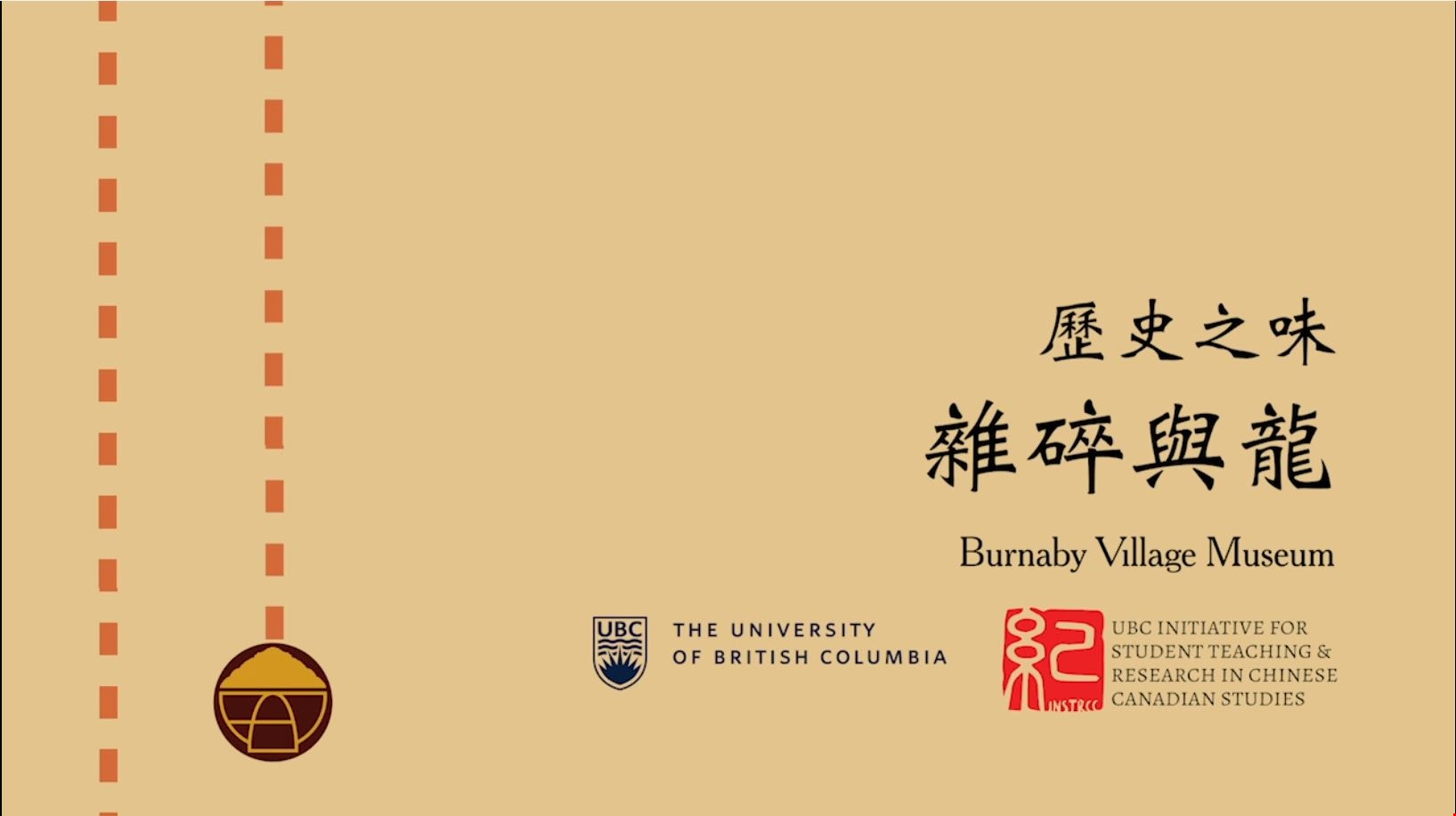
Scraps and Dragons
https://search.heritageburnaby.ca/link/museumdescription14273
- Repository
- Burnaby Village Museum
- Date
- Oct. 2020
- Collection/Fonds
- Burnaby Village Museum fonds
- Description Level
- Item
- Physical Description
- 3 video recordings (mp4) (11 min., 19 sec.) : digital, col., sd., stereo, subtitles
- Scope and Content
- Item consists of part one in a two part video series "A Taste of History" created by Debbie Liang and Joty Gill, University of British Columbia alumni and graduates from the Asian Canadian & Asian Migration Studies program (ACAM). Part one is titled "Scraps and Dragons". The film provides backgroun…
- Repository
- Burnaby Village Museum
- Collection/Fonds
- Burnaby Village Museum fonds
- Series
- UBC Partnership series
- Description Level
- Item
- Physical Description
- 3 video recordings (mp4) (11 min., 19 sec.) : digital, col., sd., stereo, subtitles
- Material Details
- Script: Debbie Liang; Joty Gill Narration: Debbie Liang Editor: Debbie Liang Subtitles: English; Simplified Chinese; Traditional Chinese Video Appearances: Kathy Lee; Eleanor Lee Interviews filmed by: Eleanor Lee Interview questions: Eleanor Lee; Debbie Liang Illustrations and Animations: Debbie Liang Photos, Images & B-roll: Vegetable letters from Shutterstock; Green onion and carrot footage from Debbie Liang; Chop Suey image courtesy of pulaw from Flickr, Creative Commons Attribution 2.0 Generic (CC By 2.0); Chop Suey from Shutterstock; Menus by Amy Wilson; Gold Dragon booklet cover and menu image- courtesy of UBC RBSC Chung Collection (RBSC-ARC-1679-CCTX-309-122); Chop Suey Nation book cover, image courtesy of Douglas & MacIntyre; Dragon Inn: City of Burnaby Archives, 556-239 photo by John McCarron; Larry Lee, image courtesy of Eleanor Lee; VanTech, image courtesy of Mike from Flickr, Creative Commons Attribution-ShareAlike 2.0 Generic (CC BY-SA 2.0); Bamboo Terrace, image courtesy of Rob from Flickr, public domain; Map image courtesy of Sentinel 2 from wikimedia Creative Commons; Salad bar inside of Dragon Inn Restaurant, Burnaby Village Museum, BV017.37.3; John Lee: City of Burnaby Archives, 535-0415, photo by Brian Langdeau; Photograph - Bar Inside the Dragon Inn Restaurant - Burnaby Village Museum, BV017.37.2; Chopping Mushrooms, footage courtesy of Pressmaster from pexels.com; Chopping Parsley, footage courtesy of Pressmaster from pexels.com; Kwan Luck from Debbie Liang; Crystall Mall as taken from the north side of Kingsway in Burnaby, image courtesy of w:en: Colin Keigher from wikimedia, Creative Commons Attribution 2.5 Generic license; Lok's Produce at Crystal mall (Burnaby) in the Underground Chinese Produce Market image courtesy of William Chen from wikimedia, Creative Commons Attribution Share Alike 4.0 International license; Crystal Mall foodcourt, image courtesy of Jay Friedman, Gastrolust; Restaurant and Dragon Innn art by Debbie Liang Music and Sound Effects: "Alison", "Acoustic Mediation 2" from audionautix; "Slow Motion", "Creative Minds" & "Cute" from bensound.com; "Kitchen sounds" & "Pop" from Debbie Liang; "Ding sound effect" from freesoundlibrary Video adapted from 2019 BVM intern project by Debbie Liang and Marcela Gomez Special thanks to: UBC: Joanna Yang, Jenny Lu, Denise Fong, Henry Yu; BVM: Kate Petrusa, Amy Wilson Changes to music may have been made for the purposes of this video
- Scope and Content
- Item consists of part one in a two part video series "A Taste of History" created by Debbie Liang and Joty Gill, University of British Columbia alumni and graduates from the Asian Canadian & Asian Migration Studies program (ACAM). Part one is titled "Scraps and Dragons". The film provides background information on the origins of the Chinese-Canadian culinary dish "chop suey" and tells the story of Chinese Canadian Chop Suey restaurants, highlighting the history of the "Dragon Inn" chop suey restaurant owned by Larry Lee. The film is supported with voice over in english, subtitles, animation, historical and family photographs and interviews with family members, Kathy Lee and Eleanor Lee. One version of the film is supported with subtitles in English while two other versions of the film are supported with subtitles in Simplified Chinese and Traditional Chinese.
- History
- In 2020, due to the restrictions of COVID-19, University of British Columbia student interns with the Burnaby Village Museum Chinese Canadian History in Burnaby project were asked to create virtual experiences to reimagine Burnaby Village Museum's historical Chinese Canadian programming in remote online spaces. Debbie Liang and Joty Gill (UBC alumni and graduates of Dr. Henry Yu's 2019 summer ACAM 390A Global Seminar to Aisa) returned to work with Burnaby Village Museum to create two short films showcasing the history of Chinese Canadian Chop Suey restaurants and piggeries in Burnaby. Larry Lee was born in Kaiping, Guangdong, China and immigrated to Canada in 1949 at the age of sixteen to reunite with his father, Lee Soon. Larry Lee's father had been in Canada for years before his son immigrated to join him. Larry attended Vancouver Technical Secondary School and learned English and carpentry. After he graduated, he was hired by Mr. Wong. Larry and Mr. Wong operated an IGA grocery store at Lonsdale in North Vancouver. Following this, Larry worked as a cashier for his father at "Bamboo Terrace" Chinese restaurant in Vancouver's Chinatown. In 1958, he married his wife Kathy and one year later, in 1959 he started a new business of his own. Larry opened the "Dragon Inn" chop suey restaurant at 2516 Kingsway (at Slocan) in Vancouver. Once the restaurant was doing well, Larry opened the "Park Inn" at Kingsway and 25th Avenue. The "Park Inn" was the first Chinese food restaurant with a smorgasboard in Vancouver. With the success of these restaurants and subsequent restaurants Larry Lee opened three other "Dragon Inn" chop suey restaurants located at; 4510 Kingsway and Willingdon in Burnaby (1964); 250 Columbia Street in New Westminster (1971) and Hastings and Willingdon (1990s). In the 1990s Larry retained ownership of the Dragon Inn at 4510 Kingsway and Willingdon and sold the other restaurants. In 1996, Larry sold the property of the Dragon Inn and surrounding lots located at Kingsway and Willingdon to make way for the construction of Crystal Mall. Larry and Kathy Lee had eight children who all worked in the family run restaurants until they were sold.
- Creator
- Liang, Debbie
- Debbie Liang
- Names
- Lee, Larry
- Lee, Kathy
- Lee, Eleanor
- Liang, Debbie
- Gill, Joty
- Burnaby Village Museum
- University of British Columbia
- Responsibility
- University of British Columbia
- UBC Initiative for Student Teaching and Research in Chinese Canadian Studies
- Burnaby Village Museum
- Geographic Access
- Vancouver
- New Westminster
- Street Address
- 4510 Kingsway
- Accession Code
- BV020.28.6
- Access Restriction
- No restrictions
- Reproduction Restriction
- No known restrictions
- Date
- Oct. 2020
- Media Type
- Moving Images
- Historic Neighbourhood
- Central Park (Historic Neighbourhood)
- Planning Study Area
- Marlborough Area
- Notes
- Transcribed title
Images

Video
Scraps and Dragons, Oct. 2020
Scraps and Dragons, Oct. 2020
https://search.heritageburnaby.ca/media/hpo/_Data/_BVM_Moving_Images/2020_0028_0006_001.mp4