Narrow Results By
Subject
- Advertising Medium - Signs and Signboards 1
- Aerial Photographs 1
- Buildings - Commercial - Train Stations 2
- Buildings - Industrial - Refineries 1
- Buildings - Public - Post Offices 3
- Buildings - Recreational 2
- Buildings - Schools - Universities and Colleges 1
- Documentary Artifacts - Postcards 3
- Education 1
- Events - May Day 1
- Events - Parades 1
- First Nations reserves - British Columbia 3
Person / Organization
- Barnet Park 1
- Bossort, Kathy 5
- British Columbia Mills Timber and Trading Company 1
- Burnaby Lawn Bowling Club 1
- Burnaby Mountain Centennial Park 1
- Burnaby Mountain Conservation Area 3
- Burnaby Mountain Park 3
- Burnaby Parks and Recreation Commission 2
- Canadian Pacific Railway Company 2
- Codd, Lisa 1
- Damer, Eric 1
- Digney, Andy 1
Access to Burrard Inlet through Confederation Park
https://search.heritageburnaby.ca/link/councilreport25822
- Repository
- City of Burnaby Archives
- Report ID
- 18058
- Meeting Date
- 24-Feb-1975
- Format
- Council - Manager's Report
- Manager's Report No.
- 13
- Item No.
- 10
- Collection/Fonds
- City Council and Office of the City Clerk fonds
- Repository
- City of Burnaby Archives
- Report ID
- 18058
- Meeting Date
- 24-Feb-1975
- Format
- Council - Manager's Report
- Manager's Report No.
- 13
- Item No.
- 10
- Collection/Fonds
- City Council and Office of the City Clerk fonds
Documents
Air Pollution/Burrard Inlet
https://search.heritageburnaby.ca/link/councilreport22157
- Repository
- City of Burnaby Archives
- Report ID
- 14717
- Meeting Date
- 3-Apr-1978
- Format
- Council - Manager's Report
- Manager's Report No.
- 26
- Item No.
- 1
- Collection/Fonds
- City Council and Office of the City Clerk fonds
- Repository
- City of Burnaby Archives
- Report ID
- 14717
- Meeting Date
- 3-Apr-1978
- Format
- Council - Manager's Report
- Manager's Report No.
- 26
- Item No.
- 1
- Collection/Fonds
- City Council and Office of the City Clerk fonds
Documents
Air Pollution - Burrard Inlet (White)
https://search.heritageburnaby.ca/link/councilreport28280
- Repository
- City of Burnaby Archives
- Report ID
- 20989
- Meeting Date
- 7-May-1973
- Format
- Council - Manager's Report
- Manager's Report No.
- 35
- Item No.
- 28
- Collection/Fonds
- City Council and Office of the City Clerk fonds
- Repository
- City of Burnaby Archives
- Report ID
- 20989
- Meeting Date
- 7-May-1973
- Format
- Council - Manager's Report
- Manager's Report No.
- 35
- Item No.
- 28
- Collection/Fonds
- City Council and Office of the City Clerk fonds
Documents
Angus & Margaret MacDonald House
https://search.heritageburnaby.ca/link/landmark495
- Repository
- Burnaby Heritage Planning
- Description
- Set on a large corner lot at North Esmond Avenue and Oxford Street, the Angus & Margaret MacDonald House is a prominent, two and one-half storey Queen Anne Revival-style residence. The high hipped roof has open projecting gables. The house is a landmark within the Vancouver Heights neighbourhood of…
- Associated Dates
- 1909
- Formal Recognition
- Heritage Designation, Community Heritage Register
- Street View URL
- Google Maps Street View
- Repository
- Burnaby Heritage Planning
- Geographic Access
- Oxford Street
- Associated Dates
- 1909
- Formal Recognition
- Heritage Designation, Community Heritage Register
- Enactment Type
- Bylaw No. 12174
- Enactment Date
- 11/12/2006
- Description
- Set on a large corner lot at North Esmond Avenue and Oxford Street, the Angus & Margaret MacDonald House is a prominent, two and one-half storey Queen Anne Revival-style residence. The high hipped roof has open projecting gables. The house is a landmark within the Vancouver Heights neighbourhood of North Burnaby, on a high point of land overlooking Burrard Inlet and the North Shore Mountains.
- Heritage Value
- The MacDonald House is valued as one of Burnaby’s most elaborate examples of the Queen Anne Revival style. The house retains many of its original features, including a prominent front corner turret wrapped by a clamshell verandah. The eclectic and transitional nature of Edwardian-era architecture is demonstrated by the late persistence of these Queen Anne Revival details, combined with the use of newly-popular classical revival elements such as Ionic columns. The interior retains a number of original architectural elements, and the early garage at the rear originally housed Angus MacDonald’s Cadillac, one of the first known automobiles owned by a Burnaby resident. Constructed in 1909, this house was built for Angus MacDonald (1857-1943) and his wife, Margaret Isabella Thompson MacDonald (1862-1939). Angus MacDonald, an electrical contractor, relocated from Nova Scotia to Vancouver in 1891 and served on Vancouver Council from 1904-08. The MacDonald family moved to Burnaby upon his retirement from the B.C. Electric Railway Company, and he then served the North Burnaby Ward as a councillor from 1911-1916 and again in 1921. MacDonald Street in Burnaby was named in his honour. The MacDonald House has additional significance as one of the surviving landmark residences, built between 1909 and 1914, during the first development of Vancouver Heights. In 1909, C.J. Peter and his employer, G.F. and J. Galt Limited, initiated the development of this North Burnaby neighbourhood, promoting it as one of the most picturesque districts in the region and an alternative to the CPR’s prestigious Shaughnessy Heights development in Vancouver. Buyers were obligated to build houses worth $3,500 at a time when the average house price was $1,000. Reputed to be the second house built in the subdivision, this house cost $7,000 to build.
- Defining Elements
- Key elements that define the heritage character of the MacDonald House include its: - prominent corner location in the Vancouver Heights neighbourhood, with views to Burrard Inlet and the North Shore Mountains - residential form, scale and massing as exemplified by its two and one-half storey height, full basement, compound plan, and high hipped roof with gabled projections at the front and side - wood-frame construction including wooden lapped siding, trim and mouldings - rubble-stone granite foundation - Queen Anne Revival details such as scroll-cut modillions, octagonal corner turret, wraparound, clamshell verandah with classical columns, and projecting square and semi-octagonal bays - external red-brick chimney with corbelled top - original windows including double-hung, 1-over-1 wooden sash windows in single and double assembly, and arched-top casement windows in the gable peaks - original interior features such as the main staircase, a panelled dining room with a fireplace and built-in cabinets, a living room with a parquet floor, and a rear den with an oak mantle and tiled hearth - associated early wood-frame garage at the rear of the property - landscape features such as mature coniferous and deciduous trees surrounding the property
- Historic Neighbourhood
- Vancouver Heights (Historic Neighbourhood)
- Planning Study Area
- Burnaby Heights Area
- Organization
- British Columbia Mills Timber and Trading Company
- Function
- Primary Historic--Single Dwelling
- Primary Current--Single Dwelling
- Community
- Vancouver Heights
- Cadastral Identifier
- P.I.D.011-999-462
- Boundaries
- The MacDonald House is comprised of a single residential lot located at 3814 Oxford Street, Burnaby.
- Area
- 566.71
- Contributing Resource
- Building
- Ownership
- Private
- Documentation
- City of Burnaby Planning and Building Department, Heritage Site Files
- Street Address
- 3814 Oxford Street
- Street View URL
- Google Maps Street View
Images
Application for Water rights on Burrard Inlet
https://search.heritageburnaby.ca/link/councilreport77641
- Repository
- City of Burnaby Archives
- Report ID
- 77223
- Meeting Date
- 25-Aug-1906
- Format
- Council - Mayor/Councillor/Staff Report
- Collection/Fonds
- City Council and Office of the City Clerk fonds
- Repository
- City of Burnaby Archives
- Report ID
- 77223
- Meeting Date
- 25-Aug-1906
- Format
- Council - Mayor/Councillor/Staff Report
- Collection/Fonds
- City Council and Office of the City Clerk fonds
Documents
Barnet Beach
https://search.heritageburnaby.ca/link/archivedescription93650
- Repository
- City of Burnaby Archives
- Date
- November 20, 1977
- Collection/Fonds
- Burnaby Public Library Contemporary Visual Archive Project
- Description Level
- Item
- Physical Description
- 1 photograph : b&w ; 12.5 x 17.5 cm
- Scope and Content
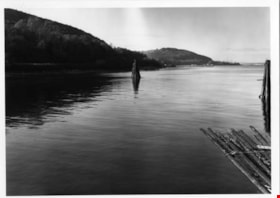
- Photograph of Burrard Inlet, taken facing west from Barnet Beach. Capitol Hill and the Second Narrows Bridge are visible in the distance.
- Repository
- City of Burnaby Archives
- Date
- November 20, 1977
- Collection/Fonds
- Burnaby Public Library Contemporary Visual Archive Project
- Physical Description
- 1 photograph : b&w ; 12.5 x 17.5 cm
- Description Level
- Item
- Record No.
- 556-607
- Access Restriction
- No restrictions
- Reproduction Restriction
- Reproduce for fair dealing purposes only
- Accession Number
- 2017-57
- Scope and Content
- Photograph of Burrard Inlet, taken facing west from Barnet Beach. Capitol Hill and the Second Narrows Bridge are visible in the distance.
- Media Type
- Photograph
- Photographer
- Chapman, Fred
- Notes
- Title taken from project information form
- Accompanied by a project information form and 1 photograph (b&w negative ; 9.5 x 12.5 cm)
- BPL no. 57
- Geographic Access
- Barnet Marine Park
- Historic Neighbourhood
- Barnet (Historic Neighbourhood)
- Planning Study Area
- Burnaby Mountain Area
Images
Barnet Park papers
https://search.heritageburnaby.ca/link/archivedescription64451
- Repository
- City of Burnaby Archives
- Date
- 1942-1978
- Collection/Fonds
- Burnaby Historical Society fonds
- Description Level
- File
- Physical Description
- 1 file of textual records
- Scope and Content
- File consists of papers pertaining to the development of Barnet Park, including Engineering Department Reports to Council, correspondence between the North Burnaby Board of Trade and the Deputy Minister of Lands in Victoria, Burnaby Citizens' Committee for Access to Burrard Inlet at Barnet Park rec…
- Repository
- City of Burnaby Archives
- Date
- 1942-1978
- Collection/Fonds
- Burnaby Historical Society fonds
- Subseries
- North Burnaby Board of Trade subseries
- Physical Description
- 1 file of textual records
- Description Level
- File
- Record No.
- MSS118-002
- Accession Number
- BHS2005-8
- Scope and Content
- File consists of papers pertaining to the development of Barnet Park, including Engineering Department Reports to Council, correspondence between the North Burnaby Board of Trade and the Deputy Minister of Lands in Victoria, Burnaby Citizens' Committee for Access to Burrard Inlet at Barnet Park recommendations and a map of Burnaby from 1968 (to accompany Burnaby Zoning Bylaw 4742).
- Media Type
- Textual Record
- Notes
- Title based on contents of file
Burnaby Mountain Conservation and Eastern Burrard Inlet Foreshore Areas - Proposed Regional Plan Amendments
https://search.heritageburnaby.ca/link/councilreport23718
- Repository
- City of Burnaby Archives
- Report ID
- 17773
- Meeting Date
- 29-Nov-1976
- Format
- Council - Manager's Report
- Manager's Report No.
- 77
- Item No.
- 3
- Collection/Fonds
- City Council and Office of the City Clerk fonds
- Repository
- City of Burnaby Archives
- Report ID
- 17773
- Meeting Date
- 29-Nov-1976
- Format
- Council - Manager's Report
- Manager's Report No.
- 77
- Item No.
- 3
- Collection/Fonds
- City Council and Office of the City Clerk fonds
Documents
Burnaby Mountain Park
https://search.heritageburnaby.ca/link/archivedescription93639
- Repository
- City of Burnaby Archives
- Date
- November 19, 1977
- Collection/Fonds
- Burnaby Public Library Contemporary Visual Archive Project
- Description Level
- Item
- Physical Description
- 1 photograph : b&w ; 12.5 x 17.5 cm
- Scope and Content
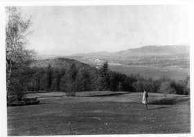
- Photograph of the hillside on the top of Burnaby Mountain Park, with a person in the foreground looking out to the view. The photograph is taken facing northwest and shows the view over the the Burrard Inlet. Capitol Hill, the North Shore Mountains, and downtown Vancouver are visible in the distanc…
- Repository
- City of Burnaby Archives
- Date
- November 19, 1977
- Collection/Fonds
- Burnaby Public Library Contemporary Visual Archive Project
- Physical Description
- 1 photograph : b&w ; 12.5 x 17.5 cm
- Description Level
- Item
- Record No.
- 556-596
- Access Restriction
- No restrictions
- Reproduction Restriction
- Reproduce for fair dealing purposes only
- Accession Number
- 2017-57
- Scope and Content
- Photograph of the hillside on the top of Burnaby Mountain Park, with a person in the foreground looking out to the view. The photograph is taken facing northwest and shows the view over the the Burrard Inlet. Capitol Hill, the North Shore Mountains, and downtown Vancouver are visible in the distance.
- Names
- Burnaby Mountain Park
- Media Type
- Photograph
- Photographer
- van Mannen, Mark
- Notes
- Title taken from project information form
- Accompanied by a project information form and 1 photograph (b&w negative ; 9.5 x 12.5 cm)
- BPL no. 45
- Geographic Access
- Burnaby Mountain Conservation Area
- Planning Study Area
- Burnaby Mountain Area
Images
Burnaby Mountain Park
https://search.heritageburnaby.ca/link/archivedescription93640
- Repository
- City of Burnaby Archives
- Date
- November 19, 1977
- Collection/Fonds
- Burnaby Public Library Contemporary Visual Archive Project
- Description Level
- Item
- Physical Description
- 1 photograph : b&w ; 12.5 x 17.5 cm
- Scope and Content
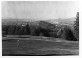
- Photograph of the top of Burnaby Mountain Park and the view of Vancouver from the hillside, with a man standing in the foreground. The photograph is taken facing west of southwest. Capitol Hill, the Burrard Inlet, the North Shore Mountains, Vancouver, and Stanley Park are visible in the distance.
- Repository
- City of Burnaby Archives
- Date
- November 19, 1977
- Collection/Fonds
- Burnaby Public Library Contemporary Visual Archive Project
- Physical Description
- 1 photograph : b&w ; 12.5 x 17.5 cm
- Description Level
- Item
- Record No.
- 556-597
- Access Restriction
- No restrictions
- Reproduction Restriction
- Reproduce for fair dealing purposes only
- Accession Number
- 2017-57
- Scope and Content
- Photograph of the top of Burnaby Mountain Park and the view of Vancouver from the hillside, with a man standing in the foreground. The photograph is taken facing west of southwest. Capitol Hill, the Burrard Inlet, the North Shore Mountains, Vancouver, and Stanley Park are visible in the distance.
- Names
- Burnaby Mountain Park
- Media Type
- Photograph
- Photographer
- McGillivray, Don
- Notes
- Title taken from project information form
- Accompanied by a project information form and 1 photograph (b&w negative ; 9.5 x 12.5 cm)
- BPL no. 46
- Geographic Access
- Burnaby Mountain Conservation Area
- Planning Study Area
- Burnaby Mountain Area
Images
Burnaby Mountain Park
https://search.heritageburnaby.ca/link/archivedescription93645
- Repository
- City of Burnaby Archives
- Date
- November 19, 1977
- Collection/Fonds
- Burnaby Public Library Contemporary Visual Archive Project
- Description Level
- Item
- Physical Description
- 1 photograph : b&w ; 12.5 x 17.5 cm
- Scope and Content
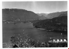
- Photograph of the view from Burnaby Mountain of the Burrard Inlet, the oil refinery, and the mountains. The photograph is taken from Burnaby Mountain Park, facing north.
- Repository
- City of Burnaby Archives
- Date
- November 19, 1977
- Collection/Fonds
- Burnaby Public Library Contemporary Visual Archive Project
- Physical Description
- 1 photograph : b&w ; 12.5 x 17.5 cm
- Description Level
- Item
- Record No.
- 556-602
- Access Restriction
- No restrictions
- Reproduction Restriction
- Reproduce for fair dealing purposes only
- Accession Number
- 2017-57
- Scope and Content
- Photograph of the view from Burnaby Mountain of the Burrard Inlet, the oil refinery, and the mountains. The photograph is taken from Burnaby Mountain Park, facing north.
- Subjects
- Geographic Features - Inlets
- Geographic Features - Parks
- Geographic Features - Mountains
- Buildings - Industrial - Refineries
- Names
- Burnaby Mountain Park
- Media Type
- Photograph
- Photographer
- van Mannen, Mark
- Notes
- Title taken from project information form
- Accompanied by a project information form and 1 photograph (b&w negative ; 9.5 x 12.5 cm)
- BPL no. 52
- Geographic Access
- Burnaby Mountain Conservation Area
- Burrard Inlet
- Planning Study Area
- Burnaby Mountain Area
Images
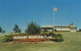
Burnaby Mountain Park and Centennial Pavilion
https://search.heritageburnaby.ca/link/archivedescription37408
- Repository
- City of Burnaby Archives
- Date
- 1970
- Collection/Fonds
- Burnaby Historical Society fonds
- Description Level
- Item
- Physical Description
- 1 photograph : col. postcard ; 9 x 14 cm
- Scope and Content
- Photographic postcard of the Burnaby Mountain Park sign a Centennial Pavilion. The caption on the back of the postcard reads: "The Centennial Pavilion was built in 1958 during British Columbia's Centenary. It is situated on Burnaby Mountain at an elevation of 1000 feet. Numerous footpaths througho…
- Repository
- City of Burnaby Archives
- Date
- 1970
- Collection/Fonds
- Burnaby Historical Society fonds
- Subseries
- Robert Prittie subseries
- Physical Description
- 1 photograph : col. postcard ; 9 x 14 cm
- Description Level
- Item
- Record No.
- 369-007
- Access Restriction
- No restrictions
- Reproduction Restriction
- Reproduce for fair dealing purposes only
- Accession Number
- BHS1999-01
- Scope and Content
- Photographic postcard of the Burnaby Mountain Park sign a Centennial Pavilion. The caption on the back of the postcard reads: "The Centennial Pavilion was built in 1958 during British Columbia's Centenary. It is situated on Burnaby Mountain at an elevation of 1000 feet. Numerous footpaths throughout the beautifully landscaped grounds lead to interesting view points which provide magnificent scenery of Burrard Inlet, Coast Range Mountains, City of Vancouver, and other surrounding Municipalities."
- Subjects
- Symbols - Flags
- Documentary Artifacts - Postcards
- Buildings - Recreational
- Advertising Medium - Signs and Signboards
- Media Type
- Photograph
- Photographer
- George Allen Aerial Photos Limited
- Notes
- Title based on caption
- Geographic Access
- Burnaby Mountain Conservation Area
- Centennial Way
- Street Address
- 100 Centennial Way
- Planning Study Area
- Burnaby Mountain Area
Images
Burrard Inlet
https://search.heritageburnaby.ca/link/councilreport27765
- Repository
- City of Burnaby Archives
- Report ID
- 21510
- Meeting Date
- 24-Sep-1973
- Format
- Council - Manager's Report
- Manager's Report No.
- 71
- Item No.
- 22
- Collection/Fonds
- City Council and Office of the City Clerk fonds
- Repository
- City of Burnaby Archives
- Report ID
- 21510
- Meeting Date
- 24-Sep-1973
- Format
- Council - Manager's Report
- Manager's Report No.
- 71
- Item No.
- 22
- Collection/Fonds
- City Council and Office of the City Clerk fonds
Documents
Burrard Inlet
https://search.heritageburnaby.ca/link/councilreport27846
- Repository
- City of Burnaby Archives
- Report ID
- 21419
- Meeting Date
- 4-Sep-1973
- Format
- Council - Manager's Report
- Manager's Report No.
- 66
- Item No.
- 17
- Collection/Fonds
- City Council and Office of the City Clerk fonds
- Repository
- City of Burnaby Archives
- Report ID
- 21419
- Meeting Date
- 4-Sep-1973
- Format
- Council - Manager's Report
- Manager's Report No.
- 66
- Item No.
- 17
- Collection/Fonds
- City Council and Office of the City Clerk fonds
Documents
Burrard Inlet Development Concept Eastern Segment - Maps
https://search.heritageburnaby.ca/link/archivedescription31087
- Repository
- City of Burnaby Archives
- Date
- 1973
- Collection/Fonds
- Planning Department fonds
- Description Level
- File
- Physical Description
- Textual record
- Repository
- City of Burnaby Archives
- Date
- 1973
- Collection/Fonds
- Planning Department fonds
- Physical Description
- Textual record
- Description Level
- File
- Record No.
- 34098
- Accession Number
- 2003-20
- Media Type
- Textual Record
Burrard Inlet Foreshore Park - Public Use of Existing Kapoor Railway Crossing
https://search.heritageburnaby.ca/link/councilreport23476
- Repository
- City of Burnaby Archives
- Report ID
- 15652
- Meeting Date
- 7-Feb-1977
- Format
- Council - Manager's Report
- Manager's Report No.
- 9
- Item No.
- 2
- Collection/Fonds
- City Council and Office of the City Clerk fonds
- Repository
- City of Burnaby Archives
- Report ID
- 15652
- Meeting Date
- 7-Feb-1977
- Format
- Council - Manager's Report
- Manager's Report No.
- 9
- Item No.
- 2
- Collection/Fonds
- City Council and Office of the City Clerk fonds
Documents
Burrard Inlet Foreshore Park - Public Use of Existing Kapoor Railway Crossing
https://search.heritageburnaby.ca/link/councilreport23579
- Repository
- City of Burnaby Archives
- Report ID
- 15578
- Meeting Date
- 17-Jan-1977
- Format
- Council - Manager's Report
- Manager's Report No.
- 3
- Item No.
- 20
- Collection/Fonds
- City Council and Office of the City Clerk fonds
- Repository
- City of Burnaby Archives
- Report ID
- 15578
- Meeting Date
- 17-Jan-1977
- Format
- Council - Manager's Report
- Manager's Report No.
- 3
- Item No.
- 20
- Collection/Fonds
- City Council and Office of the City Clerk fonds
Documents
Burrard Inlet Marine Park - Waterlot Lease Fronting Block 4, DL 214
https://search.heritageburnaby.ca/link/councilreport22962
- Repository
- City of Burnaby Archives
- Report ID
- 16163
- Meeting Date
- 27-Jun-1977
- Format
- Council - Manager's Report
- Manager's Report No.
- 47
- Item No.
- 5
- Collection/Fonds
- City Council and Office of the City Clerk fonds
- Repository
- City of Burnaby Archives
- Report ID
- 16163
- Meeting Date
- 27-Jun-1977
- Format
- Council - Manager's Report
- Manager's Report No.
- 47
- Item No.
- 5
- Collection/Fonds
- City Council and Office of the City Clerk fonds
Documents
Burrard Inlet Municipal Boundary
https://search.heritageburnaby.ca/link/councilreport24564
- Repository
- City of Burnaby Archives
- Report ID
- 16930
- Meeting Date
- 15-Mar-1976
- Format
- Council - Manager's Report
- Manager's Report No.
- 16
- Item No.
- 6
- Collection/Fonds
- City Council and Office of the City Clerk fonds
- Repository
- City of Burnaby Archives
- Report ID
- 16930
- Meeting Date
- 15-Mar-1976
- Format
- Council - Manager's Report
- Manager's Report No.
- 16
- Item No.
- 6
- Collection/Fonds
- City Council and Office of the City Clerk fonds
Documents
Burrard Inlet Odour - 1979 January 01 Council Enquiry
https://search.heritageburnaby.ca/link/councilreport21132
- Repository
- City of Burnaby Archives
- Report ID
- 13625
- Meeting Date
- 12-Mar-1979
- Format
- Council - Manager's Report
- Manager's Report No.
- 20
- Item No.
- 9
- Collection/Fonds
- City Council and Office of the City Clerk fonds
- Repository
- City of Burnaby Archives
- Report ID
- 13625
- Meeting Date
- 12-Mar-1979
- Format
- Council - Manager's Report
- Manager's Report No.
- 20
- Item No.
- 9
- Collection/Fonds
- City Council and Office of the City Clerk fonds


