Narrow Results By
Subject
- Accidents - Train Accidents 1
- Advertising Medium 1
- Advertising Medium - Signs and Signboards 4
- Agriculture - Farms 4
- Animals - Fowl 2
- Buildings - Commercial 6
- Buildings - Commercial - Automobile Dealerships 2
- Buildings - Commercial - Department Stores 1
- Buildings - Commercial - Drugstores 1
- Buildings - Commercial - Restaurants 1
- Buildings - Commercial - Stores 5
- Buildings - Commercial - Train Stations 2
Creator
- Bullen, Harry Elder 4
- Burnaby Village Museum 2
- Capitol Studios 1
- Carpenter, William Jefferson 1
- Commercial Illustrators Industrial Photographers 1
- Croton Studio Limited 1
- Dean, H.M. 12
- Debbie Liang 1
- Digney, Ernest Frank "Dig" 1
- Dominion Map and Blueprint Co. 1
- Frank, Leonard 3
- Friends of Interurban 1223 1
Person / Organization
- Auvache, Beth 1
- Baehr, G. A. 2
- Battersby, Frank 1
- Blomkey, Rena 1
- Bradley, George 1
- British Columbia Auto Company 2
- British Columbia Electric Railway Company 38
- British Columbia Provincial Police 1
- Brue, Theodore Olaf 1
- Burnaby Civic Employees Union, CUPE Local 23 1
- Burnaby South High School 1
- Burnaby Village Museum 3
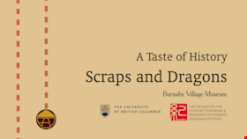
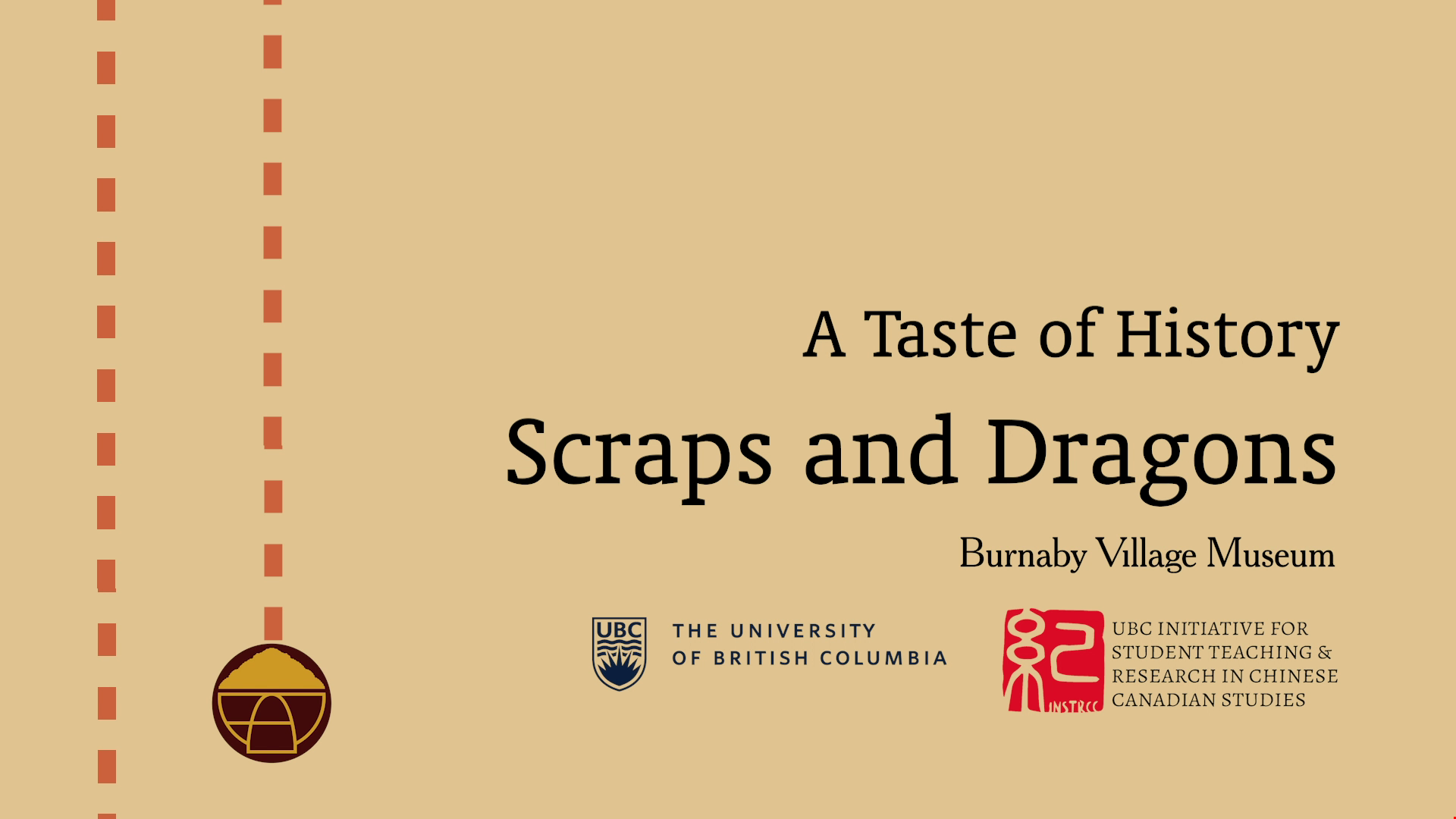
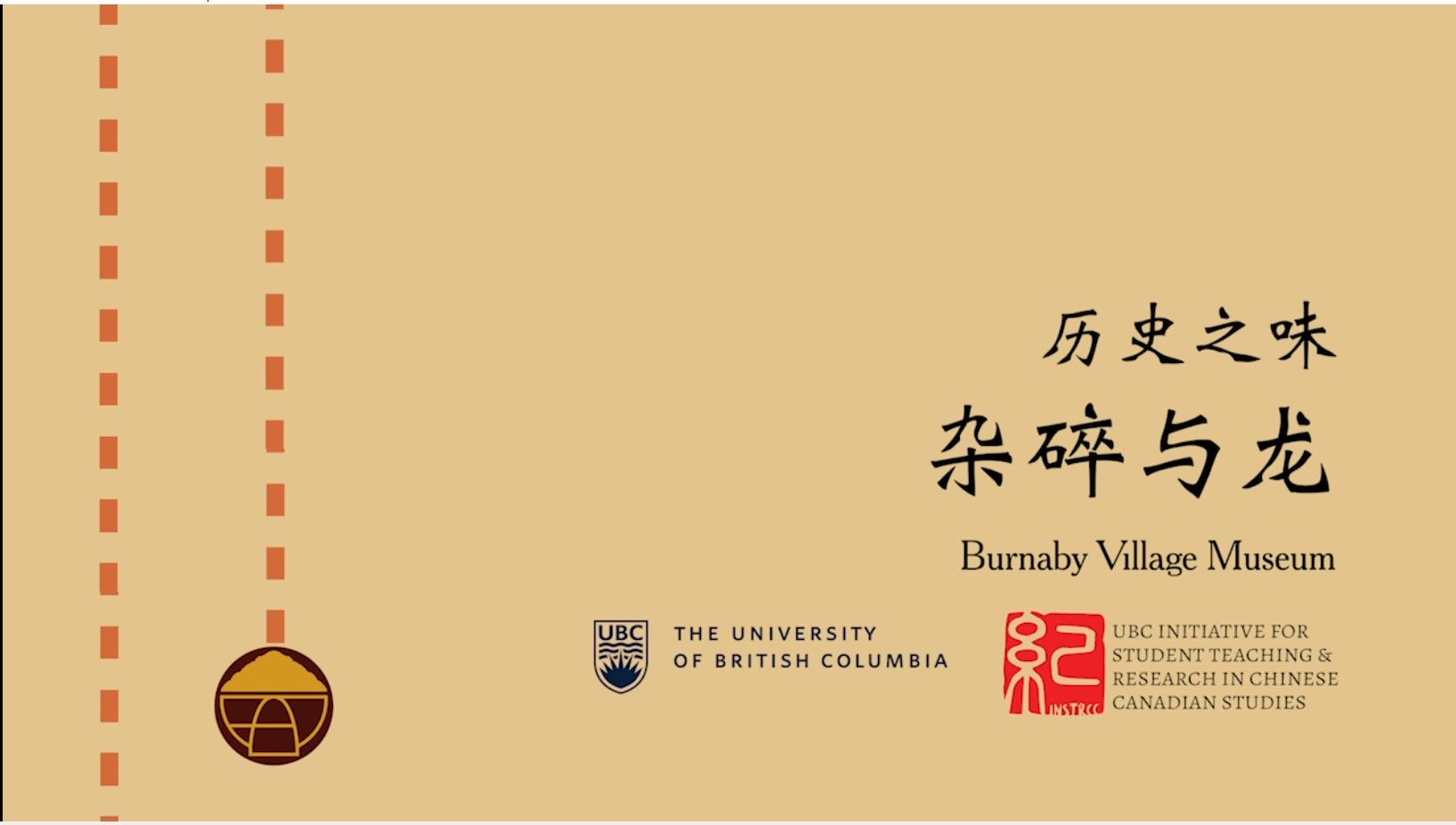
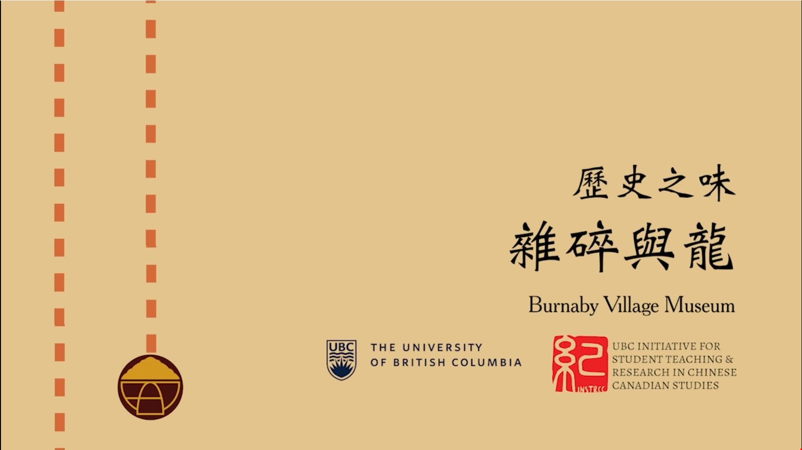
Scraps and Dragons
https://search.heritageburnaby.ca/link/museumdescription14273
- Repository
- Burnaby Village Museum
- Date
- Oct. 2020
- Collection/Fonds
- Burnaby Village Museum fonds
- Description Level
- Item
- Physical Description
- 3 video recordings (mp4) (11 min., 19 sec.) : digital, col., sd., stereo, subtitles
- Scope and Content
- Item consists of part one in a two part video series "A Taste of History" created by Debbie Liang and Joty Gill, University of British Columbia alumni and graduates from the Asian Canadian & Asian Migration Studies program (ACAM). Part one is titled "Scraps and Dragons". The film provides backgroun…
- Repository
- Burnaby Village Museum
- Collection/Fonds
- Burnaby Village Museum fonds
- Series
- UBC Partnership series
- Description Level
- Item
- Physical Description
- 3 video recordings (mp4) (11 min., 19 sec.) : digital, col., sd., stereo, subtitles
- Material Details
- Script: Debbie Liang; Joty Gill Narration: Debbie Liang Editor: Debbie Liang Subtitles: English; Simplified Chinese; Traditional Chinese Video Appearances: Kathy Lee; Eleanor Lee Interviews filmed by: Eleanor Lee Interview questions: Eleanor Lee; Debbie Liang Illustrations and Animations: Debbie Liang Photos, Images & B-roll: Vegetable letters from Shutterstock; Green onion and carrot footage from Debbie Liang; Chop Suey image courtesy of pulaw from Flickr, Creative Commons Attribution 2.0 Generic (CC By 2.0); Chop Suey from Shutterstock; Menus by Amy Wilson; Gold Dragon booklet cover and menu image- courtesy of UBC RBSC Chung Collection (RBSC-ARC-1679-CCTX-309-122); Chop Suey Nation book cover, image courtesy of Douglas & MacIntyre; Dragon Inn: City of Burnaby Archives, 556-239 photo by John McCarron; Larry Lee, image courtesy of Eleanor Lee; VanTech, image courtesy of Mike from Flickr, Creative Commons Attribution-ShareAlike 2.0 Generic (CC BY-SA 2.0); Bamboo Terrace, image courtesy of Rob from Flickr, public domain; Map image courtesy of Sentinel 2 from wikimedia Creative Commons; Salad bar inside of Dragon Inn Restaurant, Burnaby Village Museum, BV017.37.3; John Lee: City of Burnaby Archives, 535-0415, photo by Brian Langdeau; Photograph - Bar Inside the Dragon Inn Restaurant - Burnaby Village Museum, BV017.37.2; Chopping Mushrooms, footage courtesy of Pressmaster from pexels.com; Chopping Parsley, footage courtesy of Pressmaster from pexels.com; Kwan Luck from Debbie Liang; Crystall Mall as taken from the north side of Kingsway in Burnaby, image courtesy of w:en: Colin Keigher from wikimedia, Creative Commons Attribution 2.5 Generic license; Lok's Produce at Crystal mall (Burnaby) in the Underground Chinese Produce Market image courtesy of William Chen from wikimedia, Creative Commons Attribution Share Alike 4.0 International license; Crystal Mall foodcourt, image courtesy of Jay Friedman, Gastrolust; Restaurant and Dragon Innn art by Debbie Liang Music and Sound Effects: "Alison", "Acoustic Mediation 2" from audionautix; "Slow Motion", "Creative Minds" & "Cute" from bensound.com; "Kitchen sounds" & "Pop" from Debbie Liang; "Ding sound effect" from freesoundlibrary Video adapted from 2019 BVM intern project by Debbie Liang and Marcela Gomez Special thanks to: UBC: Joanna Yang, Jenny Lu, Denise Fong, Henry Yu; BVM: Kate Petrusa, Amy Wilson Changes to music may have been made for the purposes of this video
- Scope and Content
- Item consists of part one in a two part video series "A Taste of History" created by Debbie Liang and Joty Gill, University of British Columbia alumni and graduates from the Asian Canadian & Asian Migration Studies program (ACAM). Part one is titled "Scraps and Dragons". The film provides background information on the origins of the Chinese-Canadian culinary dish "chop suey" and tells the story of Chinese Canadian Chop Suey restaurants, highlighting the history of the "Dragon Inn" chop suey restaurant owned by Larry Lee. The film is supported with voice over in english, subtitles, animation, historical and family photographs and interviews with family members, Kathy Lee and Eleanor Lee. One version of the film is supported with subtitles in English while two other versions of the film are supported with subtitles in Simplified Chinese and Traditional Chinese.
- History
- In 2020, due to the restrictions of COVID-19, University of British Columbia student interns with the Burnaby Village Museum Chinese Canadian History in Burnaby project were asked to create virtual experiences to reimagine Burnaby Village Museum's historical Chinese Canadian programming in remote online spaces. Debbie Liang and Joty Gill (UBC alumni and graduates of Dr. Henry Yu's 2019 summer ACAM 390A Global Seminar to Aisa) returned to work with Burnaby Village Museum to create two short films showcasing the history of Chinese Canadian Chop Suey restaurants and piggeries in Burnaby. Larry Lee was born in Kaiping, Guangdong, China and immigrated to Canada in 1949 at the age of sixteen to reunite with his father, Lee Soon. Larry Lee's father had been in Canada for years before his son immigrated to join him. Larry attended Vancouver Technical Secondary School and learned English and carpentry. After he graduated, he was hired by Mr. Wong. Larry and Mr. Wong operated an IGA grocery store at Lonsdale in North Vancouver. Following this, Larry worked as a cashier for his father at "Bamboo Terrace" Chinese restaurant in Vancouver's Chinatown. In 1958, he married his wife Kathy and one year later, in 1959 he started a new business of his own. Larry opened the "Dragon Inn" chop suey restaurant at 2516 Kingsway (at Slocan) in Vancouver. Once the restaurant was doing well, Larry opened the "Park Inn" at Kingsway and 25th Avenue. The "Park Inn" was the first Chinese food restaurant with a smorgasboard in Vancouver. With the success of these restaurants and subsequent restaurants Larry Lee opened three other "Dragon Inn" chop suey restaurants located at; 4510 Kingsway and Willingdon in Burnaby (1964); 250 Columbia Street in New Westminster (1971) and Hastings and Willingdon (1990s). In the 1990s Larry retained ownership of the Dragon Inn at 4510 Kingsway and Willingdon and sold the other restaurants. In 1996, Larry sold the property of the Dragon Inn and surrounding lots located at Kingsway and Willingdon to make way for the construction of Crystal Mall. Larry and Kathy Lee had eight children who all worked in the family run restaurants until they were sold.
- Creator
- Liang, Debbie
- Debbie Liang
- Names
- Lee, Larry
- Lee, Kathy
- Lee, Eleanor
- Liang, Debbie
- Gill, Joty
- Burnaby Village Museum
- University of British Columbia
- Responsibility
- University of British Columbia
- UBC Initiative for Student Teaching and Research in Chinese Canadian Studies
- Burnaby Village Museum
- Geographic Access
- Vancouver
- New Westminster
- Street Address
- 4510 Kingsway
- Accession Code
- BV020.28.6
- Access Restriction
- No restrictions
- Reproduction Restriction
- No known restrictions
- Date
- Oct. 2020
- Media Type
- Moving Images
- Historic Neighbourhood
- Central Park (Historic Neighbourhood)
- Planning Study Area
- Marlborough Area
- Notes
- Transcribed title
Images
Video
Scraps and Dragons, Oct. 2020
Scraps and Dragons, Oct. 2020
https://search.heritageburnaby.ca/media/hpo/_Data/_BVM_Moving_Images/2020_0028_0006_001.mp4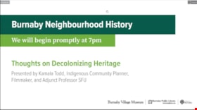
Thoughts on decolonizing heritage
https://search.heritageburnaby.ca/link/museumdescription14757
- Repository
- Burnaby Village Museum
- Date
- 1 Oct. 2020
- Collection/Fonds
- Burnaby Village Museum fonds
- Description Level
- Item
- Physical Description
- 1 video recording (mp4) (88 min., 3 sec.) : digital, col., sd., stereo ; 29 fps
- Scope and Content
- Item consists of a video recording of a live Zoom webinar hosted by Burnaby Village Museum's Kate Petrusa. The webinar is titled "Thoughts on Decolonizing Heritage" and is presented by Kamala Todd - Indigenous Community Planner, Filmmaker, and Adjunct Professor SFU. The zoom webinar is the second i…
- Repository
- Burnaby Village Museum
- Collection/Fonds
- Burnaby Village Museum fonds
- Description Level
- Item
- Physical Description
- 1 video recording (mp4) (88 min., 3 sec.) : digital, col., sd., stereo ; 29 fps
- Material Details
- Presenter: Kamala Todd
- Host: Kate Petrusa
- Date of Presentation: October 1, 7:00 pm - 8:30 pm
- Total Number of tracks: 1
- Total Length of all tracks: 88 min., 3 sec.
- Recording Device: Zoom video communication platform
- Scope and Content
- Item consists of a video recording of a live Zoom webinar hosted by Burnaby Village Museum's Kate Petrusa. The webinar is titled "Thoughts on Decolonizing Heritage" and is presented by Kamala Todd - Indigenous Community Planner, Filmmaker, and Adjunct Professor SFU. The zoom webinar is the second in a collection of seven "Neighbourhood Speaker series" webinars that were presented and made available to the public between September 29 and October 27, 2020. The live webinar and recording was also made available on the Burnaby Village Museum's facebook page. In this webinar, Kamala Todd speaks about how narratives and sense of place shape our connection to the lands we live upon. Kamala highlights how dominant colonial narratives are embedded into the built environment, place names, heritage landscapes, and the very planning of our cities contributing to exclusion and erasure of the hən̓q̓əmin̓əm and Sḵwx̱wú7mesh speaking people, who have lived on their unceded territories since time immemorial.Todd provides her perspectives by asking the questions; How has “Heritage” contributed to colonial harms and erasures? And what will it take to decolonize and re-Indigenize the stories, landscapes, and understandings of the places we call home? The presentation is supported with contemporary and historic photographs. Kamala takes questions from webinar participants and reads from writings of different authors including Stó:lō author, Lee Maracle and Salish poet, Will George.
- Creator
- Burnaby Village Museum
- Subjects
- Indigenous peoples - British Columbia
- Indigenous peoples - Canada - Government relations
- Indigenous peoples - Canada - , Treatment of
- Persons - Pioneers
- Government - Colonial Government
- Monuments
- Responsibility
- Petrusa, Kate
- Geographic Access
- Vancouver
- Accession Code
- BV020.29.2
- Access Restriction
- No restrictions
- Reproduction Restriction
- No known restrictions
- Date
- 1 Oct. 2020
- Media Type
- Moving Images
- Notes
- Title based on contents of video recording
- Video recording was edited for publication on Heritage Burnaby. Original mp4 video recording (BV020.29.2.1) is 103 min., 49 sec.
Images

Video
Thoughts on decolonizing heritage, 1 Oct. 2020
Thoughts on decolonizing heritage, 1 Oct. 2020
https://search.heritageburnaby.ca/media/hpo/_Data/_BVM_Moving_Images/2020_0029_0002_002.mp4
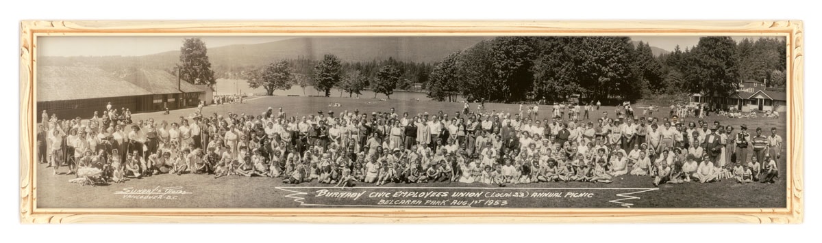
Burnaby Civic Employees Union Annual Picnic
https://search.heritageburnaby.ca/link/museumdescription3024
- Repository
- Burnaby Village Museum
- Date
- 1 Aug. 1953
- Collection/Fonds
- Burnaby Village Museum Photograph collection
- Description Level
- Item
- Physical Description
- 1 photograph : b&w ; 16.5 x 68.5 cm in frame 19 x 70.5 cm
- Scope and Content
- Photograph of the Burnaby Civic Employees Union (Local 23) Annual Picnic in Belcarra Park, Vancouver.
- Repository
- Burnaby Village Museum
- Collection/Fonds
- Burnaby Village Museum Photograph collection
- Description Level
- Item
- Physical Description
- 1 photograph : b&w ; 16.5 x 68.5 cm in frame 19 x 70.5 cm
- Material Details
- Mounted in decorative carved wooden frame painted white
- Scope and Content
- Photograph of the Burnaby Civic Employees Union (Local 23) Annual Picnic in Belcarra Park, Vancouver.
- Geographic Access
- Vancouver
- Accession Code
- HV983.18.1
- Access Restriction
- No restrictions
- Reproduction Restriction
- No known restrictions
- Date
- 1 Aug. 1953
- Media Type
- Photograph
- Photographer
- Sunday, Fred William
- Notes
- Title based on contents of photograph
Images
![Burnaby Lake line timetable, [before 1953] thumbnail](/media/hpo/_Data/_BVM_Images/1973/1973_0041_0002_001.jpg?width=280)
Burnaby Lake line timetable
https://search.heritageburnaby.ca/link/museumdescription993
- Repository
- Burnaby Village Museum
- Date
- [before 1953]
- Collection/Fonds
- Burnaby Village Museum Photograph collection
- Description Level
- Item
- Physical Description
- 1 photograph : b&w ; 25.3 x 20.6 cm
- Scope and Content
- Photograph of a BC Electric Railway Burnaby Lake line timetable for Sundays, running from Vancouver to Sapperton and New Westminster. Along with the timetable, three tickets and one cash fare receipt, costing 5 cents, were also photographed. Developed in 1910, the Burnaby Lake Line ceased operati…
- Repository
- Burnaby Village Museum
- Collection/Fonds
- Burnaby Village Museum Photograph collection
- Description Level
- Item
- Physical Description
- 1 photograph : b&w ; 25.3 x 20.6 cm
- Scope and Content
- Photograph of a BC Electric Railway Burnaby Lake line timetable for Sundays, running from Vancouver to Sapperton and New Westminster. Along with the timetable, three tickets and one cash fare receipt, costing 5 cents, were also photographed. Developed in 1910, the Burnaby Lake Line ceased operation in 1953.
- Geographic Access
- Vancouver
- New Westminster
- Accession Code
- HV973.41.2
- Access Restriction
- No restrictions
- Reproduction Restriction
- No known restrictions
- Date
- [before 1953]
- Media Type
- Photograph
- Related Material
- For an earlier donation made by the same donor in regards to BCER tram, see accession HV972.202.
- Scan Resolution
- 600
- Scan Date
- 2023-05-09
- Scale
- 100
- Notes
- Title based on contents of photograph
- For reference, check History of Regional Transit in Vancouver, at
Images
![Burnaby Lake line timetable, [before 1953] thumbnail](/media/hpo/_Data/_BVM_Images/1973/1973_0041_0002_001.jpg)
![Burnaby Rangers, [between 1960 and 1968] thumbnail](/media/hpo/_Data/_BVM_Images/2016/2016_0049_0113_001.jpg?width=280)
Burnaby Rangers
https://search.heritageburnaby.ca/link/museumdescription5220
- Repository
- Burnaby Village Museum
- Date
- [between 1960 and 1968]
- Collection/Fonds
- Burnaby Girl Guides fonds
- Description Level
- Item
- Physical Description
- 1 photograph : col. ; 9 x 12.5 cm
- Scope and Content
- Photograph of an unidentified group of Burnaby Rangers dressed in uniforms on a beach in Vancouver (could be Vanier Park) looking across to the Vancouver city skyline. Mrs. Isabelle Roper, Burnaby Area Commissioner is dressed in uniform and standing on the far left.
- Repository
- Burnaby Village Museum
- Collection/Fonds
- Burnaby Girl Guides fonds
- Description Level
- Item
- Physical Description
- 1 photograph : col. ; 9 x 12.5 cm
- Scope and Content
- Photograph of an unidentified group of Burnaby Rangers dressed in uniforms on a beach in Vancouver (could be Vanier Park) looking across to the Vancouver city skyline. Mrs. Isabelle Roper, Burnaby Area Commissioner is dressed in uniform and standing on the far left.
- Geographic Access
- Vancouver
- Accession Code
- BV016.49.113
- Access Restriction
- No restrictions
- Date
- [between 1960 and 1968]
- Media Type
- Photograph
- Notes
- Title based on content of photograph
Images
![Burnaby Rangers, [between 1960 and 1968] thumbnail](/media/hpo/_Data/_BVM_Images/2016/2016_0049_0113_001.jpg)
![Burnaby South High School Senior Girls Grass Hockey team, [1928 or 1929] thumbnail](/media/hpo/_Data/_BVM_Images/1985/198900280004.jpg?width=280)
Burnaby South High School Senior Girls Grass Hockey team
https://search.heritageburnaby.ca/link/museumdescription81
- Repository
- Burnaby Village Museum
- Date
- [1928 or 1929]
- Collection/Fonds
- Burnaby Village Museum Photograph collection
- Description Level
- Item
- Physical Description
- 1 photograph : sepia ; 6 x 10.5 cm
- Scope and Content
- Photograph of the Burnaby South High School Senior Girls Grass Hockey team. Eleven girls in uniforms are sitting and standing in two rows in front of the net in Connaught Park, Vancouver with Miss Draper (wearing a hat). Standing in the back row are (l to r); [first name unknown] Grimwood, unidenti…
- Repository
- Burnaby Village Museum
- Collection/Fonds
- Burnaby Village Museum Photograph collection
- Description Level
- Item
- Physical Description
- 1 photograph : sepia ; 6 x 10.5 cm
- Scope and Content
- Photograph of the Burnaby South High School Senior Girls Grass Hockey team. Eleven girls in uniforms are sitting and standing in two rows in front of the net in Connaught Park, Vancouver with Miss Draper (wearing a hat). Standing in the back row are (l to r); [first name unknown] Grimwood, unidentified, unidentified, Miss Draper, Hazel Groves, Rena Blomkey, Marg Jenkinsen. Sitting in the front row are ( l to r); Beth Auvache, [first name unknown] Hammond, unidentified, [first name unknown] Hammond, [first name unknown] Sloat.
- Names
- Burnaby South High School
- Grimwood, Miss
- Blomkey, Rena
- Groves, Hazel
- Jenkinsen, Marg
- Hammond, Miss
- Auvache, Beth
- Geographic Access
- Vancouver
- Accession Code
- BV989.28.4
- Access Restriction
- No restrictions
- Date
- [1928 or 1929]
- Media Type
- Photograph
- Scan Resolution
- 600
- Scan Date
- 01-Jun-09
- Scale
- 100
- Notes
- Title based on contents of photograph
- Notes on recto of photograph read: "1928-29 From Burnaby South High" and "Grenwood / Miss Draper Hazel Groves / Rena Blomberg / Mary Jenkinsen / Beth Auvache / Hammond / Hammond / Sloat/ Senior Hockey Team - Connaught Park."
Images
![Burnaby South High School Senior Girls Grass Hockey team, [1928 or 1929] thumbnail](/media/hpo/_Data/_BVM_Images/1985/198900280004.jpg)
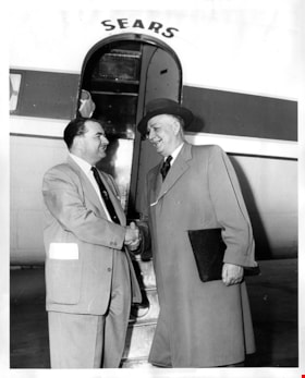
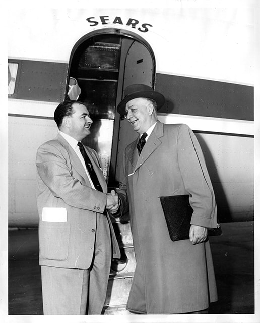
General manager of Simpsons-Sears Burnaby greeting Simpsons-Sears executive
https://search.heritageburnaby.ca/link/museumdescription17252
- Repository
- Burnaby Village Museum
- Date
- 3 May 1954
- Collection/Fonds
- Simpsons-Sears Limited Burnaby fonds
- Description Level
- Item
- Physical Description
- 1 photograph : b&w ; 25.5 x 20 cm
- Scope and Content
- Photograph of General Manager of Simpsons-Sears, Burnaby, T. Boyd Haskell shaking hands with unidentified member of Simpsons-Sears executive. The men are standing in front of an airplane with the name "Sears" above the door. Senior exectuive members of Simpsons-Sears Limited arrived in Vancouver b…
- Repository
- Burnaby Village Museum
- Collection/Fonds
- Simpsons-Sears Limited Burnaby fonds
- Description Level
- Item
- Physical Description
- 1 photograph : b&w ; 25.5 x 20 cm
- Scope and Content
- Photograph of General Manager of Simpsons-Sears, Burnaby, T. Boyd Haskell shaking hands with unidentified member of Simpsons-Sears executive. The men are standing in front of an airplane with the name "Sears" above the door. Senior exectuive members of Simpsons-Sears Limited arrived in Vancouver by plane on May 3, 1954.
- Geographic Access
- Vancouver
- Accession Code
- BV021.26.3
- Access Restriction
- No restrictions
- Reproduction Restriction
- May be restricted by third party rights
- Date
- 3 May 1954
- Media Type
- Photograph
- Scan Resolution
- 600
- Scan Date
- 2022-10-07
- Scale
- 100
- Photographer
- On-The-Spot Photographers
- Notes
- Title based on contents of photograph
- Photograph was removed from original scrapbook with newspaper clippings, photographs and ephemera
- Stamp on verso of photograph reads: "ON-THE-SPOT PHOTOGRAPHERS / NEW WESTMINSTER B.C."
Images
![Interurban Tram 1220, Burnaby Lake line, [1953] (date of original), copied 1985 thumbnail](/media/hpo/_Data/_BVM_Images/1985/1985_0328_0003_001.jpg?width=280)
Interurban Tram 1220, Burnaby Lake line
https://search.heritageburnaby.ca/link/museumdescription209
- Repository
- Burnaby Village Museum
- Date
- [1953] (date of original), copied 1985
- Collection/Fonds
- Burnaby Village Museum Photograph collection
- Description Level
- Item
- Physical Description
- 1 photograph : b&w ;12.6 x 17.7 cm print
- Scope and Content
- Photograph of a conductor standing outside on the interurban tracks in front of tram no. 1220, Burnaby Lake Line. He is using a rod to throw the crossover switch to allow the interurban to enter its private right of way (PRW). Note the commercial buildings seen to the right side of the photograph, …
- Repository
- Burnaby Village Museum
- Collection/Fonds
- Burnaby Village Museum Photograph collection
- Description Level
- Item
- Physical Description
- 1 photograph : b&w ;12.6 x 17.7 cm print
- Scope and Content
- Photograph of a conductor standing outside on the interurban tracks in front of tram no. 1220, Burnaby Lake Line. He is using a rod to throw the crossover switch to allow the interurban to enter its private right of way (PRW). Note the commercial buildings seen to the right side of the photograph, such as Grandview fuel and Malkinav Woodworks. The location is presumed to be at Commercial and 6th Avenue in Vancouver. The notes in the accession file describe the tram as "PRW" street car type 400 class.
- Subjects
- Transportation - Electric Railroads
- Geographic Access
- Vancouver
- Accession Code
- BV985.328.3
- Access Restriction
- No restrictions
- Reproduction Restriction
- May be restricted by third party rights
- Date
- [1953] (date of original), copied 1985
- Media Type
- Photograph
- Scan Resolution
- 600
- Scan Date
- 16-Jan-24
- Scale
- 100
- Notes
- Title based on contents of photograph
- 1 b&w copy negative accompanying
Images
![Interurban Tram 1220, Burnaby Lake line, [1953] (date of original), copied 1985 thumbnail](/media/hpo/_Data/_BVM_Images/1985/1985_0328_0003_001.jpg)

Subdivision plans in New Westminster District Group 1 – Burnaby, Vancouver and map - Canada Department of Mines
https://search.heritageburnaby.ca/link/museumdescription6994
- Repository
- Burnaby Village Museum
- Date
- 1890-1909
- Collection/Fonds
- Burnaby Village Museum Map collection
- Description Level
- File
- Physical Description
- 1 plan : graphite on paper + 2 plans : black ink on paper + 1 map : col. on paper mounted on 2 sides of cardboard 76 x 102 cm
- Scope and Content
- Item consists of a large board with one New Westminster District subdivision plan mounted on one side and two New Westminster District subdivision plans and one colour map mounted on the other side. Side A: 1. "Plan / of Subdivision of / Blocks 2, 3, 4, 5, 6 / Lot 77 / Group 1 / New Westminster D…
- Repository
- Burnaby Village Museum
- Collection/Fonds
- Burnaby Village Museum Map collection
- Description Level
- File
- Physical Description
- 1 plan : graphite on paper + 2 plans : black ink on paper + 1 map : col. on paper mounted on 2 sides of cardboard 76 x 102 cm
- Material Details
- Scales 1:720 and 1:1200 and 1:.00001578
- Scope and Content
- Item consists of a large board with one New Westminster District subdivision plan mounted on one side and two New Westminster District subdivision plans and one colour map mounted on the other side. Side A: 1. "Plan / of Subdivision of / Blocks 2, 3, 4, 5, 6 / Lot 77 / Group 1 / New Westminster District / BC. / Scale 100 feet = 1 inch", "Deposited 8th day / of April 1890 / Mowileg [sic] / Dist. Regt". Plan is drawn in graphite with annotations: "AB_Parts_lettered_are_lots_in / the_different_subdivisions" / "Owners: / James E. Hall / P.S.Cabilan [sic] by his attorney Joseph Hall / Joseph Hall / Eliza J. Shannon / John Harrison"; "This plan is correct and is prepared under the / provisions of the Land Registry Act" ; signed by: "Gordon Herman & Burwell / Dominion & Provincial Land Surveryors / Vancouver March 19th/90" . Plan is initialed by: "RB" [sic] (in blue pencil crayon) and measures: 99.5 x 65 cm (Geographic location: Burnaby) Side B: 1. Map titled "Canada / Department of Mines / Geological Survey Branch" / "Hon.W Templeton, Minister / A.P. Low, Deputy Minister / R.W. Brock, Acting Director", Vol. XXXI, Plate I / Compiled under the direction of / James White, F.R.G.S. Geographer /Dep. of Interior". Note above map reads: "To illustrate Mr. James Barrowman's report as Delegate at the Excursion - meeting of the Canadian Mining Institute", "The instiitution of Mining Engineers / Transactions 1908 - 1909", "The Mining Institute of Scotland / Transactions 1908-1909". Map identifies minerals and includes a Legend and Scale: 100 miles = 1 inch 2. "Plan / of Subdivision of / Lot 4 / of Subdivision of / Lot 87. Gr. 1 / New Westminster District / Scale 60' = 1in." Plan is initialed by: "RB" [sic] along with a note "also Board / 48" (in blue pencil crayon) (Geographic location: Burnaby) 3. Plan of "Lot 335 / G. 1" west of Boundary Road and north of River Road - Vancouver. (Geographic location: Vancouver)
- Publisher
- The Mining Institute of Scotland
- Geographic Access
- Vancouver
- Accession Code
- HV977.93.25
- Access Restriction
- No restrictions
- Reproduction Restriction
- No known restrictions
- Date
- 1890-1909
- Media Type
- Cartographic Material
- Scan Resolution
- 300
- Scale
- 72
- Notes
- Title based on contents of file
- Scale is measured in feet and miles.
- The term "Lot" often refers to "District Lot"
Images


booklet
https://search.heritageburnaby.ca/link/museumartifact91127
- Repository
- Burnaby Village Museum
- Accession Code
- BV011.44.9
- Description
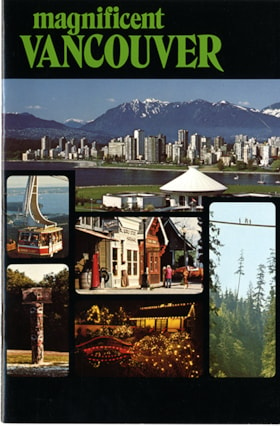
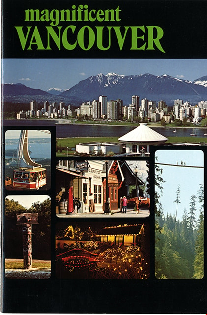
- booklet; glossy cardstock cover in black; stapled binding; pages within numbered 1-16; index on verso of front cover; title in green ink reads: "magnificent / VANCOUVER" with photo montage of six photographs in grid below including view of downtown Vancouver, north shore mountains and Museum of Vancouver and Planetarium; Grouse Mountain gondala; Heritage Village Museum; Capilano Suspension Bridge; totem pole at University of British Columbia Museum of Anthropology and Park and Tilford Gardens. Page 16 includes map with locations of these sites. Verso of back cover includes contact information for various sites.
- Object History
- Brochure of tourist sites in and around Vancouver including Heritage Village (Burnaby Village Museum) on pages 14-15. Collected by Century Park Museum Association and Heritage Village as part of their promotional materials.
- Category
- 08. Communication Artifacts
- Classification
- Documentary Artifacts - - Other Documents
- Object Term
- Pamphlet
- Measurements
- w: 18 cm h: 21.5 cm
- Country Made
- Canada
- Province Made
- British Columbia
- Site/City Made
- Vancouver
- Title
- Magnificent Vancouver
- Publication Date
- [1979]
- Names
- Burnaby Village Museum
- Geographic Access
- Vancouver
Images
booklet
https://search.heritageburnaby.ca/link/museumartifact91128
- Repository
- Burnaby Village Museum
- Accession Code
- BV011.44.11
- Description
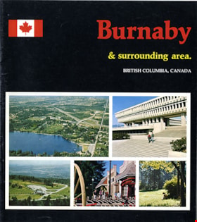
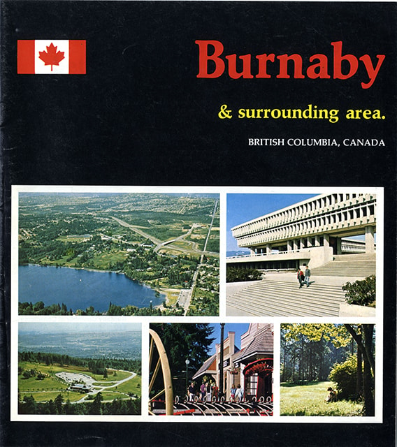
- guide booklet; glossy cover in black with colour photographs; stapled binding; pages within numbered 2-15 include colour photographs and maps. Front cover title reads "Burnaby / & surrounding area. / BRITISH COLUMBIA, CANADA" with a Canadian flag to the left of title and a grid of five colour photographs below including aerial view of Burnaby looking north from Deer Lake, Simon Fraser University, aerial view of Burnaby Mountain, Heritage Village Museum and a view of people beneath trees in a Burnaby park. Inside cover, page 2, includes "FACTS / ABOUT / BURNABY"; centre page includes map of Burnaby; page 12 includes map of British Columbia and the eastern section of Vancouver Island; page 13 title reads "SUGGESTED / SIDE TRIPS / FROM BURNABY". Back cover of booklet includes colour photograph of Burnaby Art Gallery and brief summary about Burnaby.
- Object History
- Published as a tourist brochure of tourist sites in and around Burnaby including Heritage Village (Burnaby Village Museum) on page 4. Collected by Century Park Museum Association and Heritage Village as part of their promotional materials.
- Category
- 08. Communication Artifacts
- Classification
- Documentary Artifacts - - Other Documents
- Object Term
- Pamphlet
- Measurements
- 23 cm x 20.5 cm
- Country Made
- Canada
- Province Made
- British Columbia
- Site/City Made
- Vancouver
- Title
- Burnaby and surrounding area
- Publication Date
- [1978]
- Names
- Burnaby Village Museum
- Geographic Access
- Vancouver
Images

Commercial Map of Greater Vancouver and District
https://search.heritageburnaby.ca/link/museumdescription9552
- Repository
- Burnaby Village Museum
- Date
- July 1921
- Collection/Fonds
- Burnaby Village Museum Map collection
- Description Level
- Item
- Physical Description
- 1 map : col. lithograph mounted on linen ; 107 x 138 cm
- Scope and Content
- Commercial map of Greater Vancouver and District. Map depicts district lots, railroads, electric railways, streets, street car stops, schools, buildings, postal block numbers, parks and First Nations reserves. Map covers the geographcial areas of Vancouver, Burnaby, New Westminster, portions of Ric…
- Repository
- Burnaby Village Museum
- Collection/Fonds
- Burnaby Village Museum Map collection
- Description Level
- Item
- Physical Description
- 1 map : col. lithograph mounted on linen ; 107 x 138 cm
- Material Details
- Includes Legend and Index
- Scope and Content
- Commercial map of Greater Vancouver and District. Map depicts district lots, railroads, electric railways, streets, street car stops, schools, buildings, postal block numbers, parks and First Nations reserves. Map covers the geographcial areas of Vancouver, Burnaby, New Westminster, portions of Richmond, West Vancouver, North Vancouver, and Surrey with half mile circles that radiate from Vancouver City Hall on the corner of Main and Hastings. Bottom of map includes an index of street names, along with their corresponding map grid locations. The map is bordered by Marine Drive to the west, North Road to the east, Dempsey Street to the north and 20th Road to the south.
- History
- Bought by donor at thrift store years ago. No known provenance.
- Publisher
- Produced by Photo - Lithography, Colonist , Victoria, B.C.
- Geographic Access
- Vancouver
- Accession Code
- BV018.24.1
- Access Restriction
- No restrictions
- Reproduction Restriction
- No known restrictions
- Date
- July 1921
- Media Type
- Cartographic Material
- Scan Resolution
- 300
- Scan Date
- 16-Jun-20
- Scale
- 100
- Notes
- Transcribed title
- Title on map reads: "COMMERCIAL MAP / OF / GREATER VANCOUVER / AND / DISTRICT / Compiled and Published by / The Vancouver Map & Blueprint Co. Ltd. / 441 Seymour St. Vancouver B.C. / July, 1921".
Images


Indexed guide map of the city of Vancouver and Suburbs
https://search.heritageburnaby.ca/link/museumdescription8694
- Repository
- Burnaby Village Museum
- Date
- 1914
- Collection/Fonds
- Burnaby Village Museum Map collection
- Description Level
- Item
- Physical Description
- 1 map + textual record : col. lithographic print on paper ; 55 x 78 cm on sheet 58.5 x 82 cm folded to 20 x 10 cm
- Scope and Content
- Item consists of a map "Indexed Guide Map of the City of Vancouver and Suburbs compiled and published by The Vancouver Map and Blueprint Co. Ltd. Map shows district lots, blocks and boundaries between City of Vancouver, Point Grey, South Vancouver, Burnaby, New Westminster and parts of Richmond, No…
- Repository
- Burnaby Village Museum
- Collection/Fonds
- Burnaby Village Museum Map collection
- Description Level
- Item
- Physical Description
- 1 map + textual record : col. lithographic print on paper ; 55 x 78 cm on sheet 58.5 x 82 cm folded to 20 x 10 cm
- Material Details
- Scale not defined
- Map is folded into booklet form
- Scope and Content
- Item consists of a map "Indexed Guide Map of the City of Vancouver and Suburbs compiled and published by The Vancouver Map and Blueprint Co. Ltd. Map shows district lots, blocks and boundaries between City of Vancouver, Point Grey, South Vancouver, Burnaby, New Westminster and parts of Richmond, North Vancouver and West Vancouver. Concentric cirlces indicate the distance in miles from the intersection of Main Street and Hastings Street, Vancouver in intervals of 1/2 mile. Map is folded into booklet form and includes a four page index with cardstock cover. Index page 1 is titled "Hotels"; page 2 is titled "District Lot Index"; pages 3-8 "Street Index".
- Publisher
- Vancouver Map and Blueprint Company Limited
- Edition
- 5th Edition revised to June 1914
- Geographic Access
- Vancouver
- Accession Code
- HV983.9.18
- Date
- 1914
- Media Type
- Cartographic Material
- Scan Resolution
- 600
- Scan Date
- 2023-08-17
- Notes
- Transcribed title from map and cover
- Sticker adhered to front cover of index of two lions "Service / "WE GIVE IT" / WESTERN SPECIALTY / LIMITED/ STATIONERS AND PRINTERS / VANCOUVER - B.C."
Documents
Zoomable Images

Portion of New Westminster District with Adjacent Islands and Part of Vancouver Island
https://search.heritageburnaby.ca/link/museumdescription8690
- Repository
- Burnaby Village Museum
- Date
- 1910
- Collection/Fonds
- Burnaby Village Museum Map collection
- Description Level
- Item
- Physical Description
- 1 map : col. ink on canvas ; 68 x 90 cm on canvas 70 x 95 cm
- Scope and Content
- "Map of Portion of New Westminster District with Adjacent Islands and Part of Vancouver Island / Drawn at the Lands and Works Department. Victoria, B.C."
- Repository
- Burnaby Village Museum
- Collection/Fonds
- Burnaby Village Museum Map collection
- Description Level
- Item
- Physical Description
- 1 map : col. ink on canvas ; 68 x 90 cm on canvas 70 x 95 cm
- Material Details
- Scale 1/4 inch = 80 chains
- Scope and Content
- "Map of Portion of New Westminster District with Adjacent Islands and Part of Vancouver Island / Drawn at the Lands and Works Department. Victoria, B.C."
- Geographic Access
- Vancouver
- Accession Code
- BV994.11.9
- Access Restriction
- No restrictions
- Reproduction Restriction
- No known restrictions
- Date
- 1910
- Media Type
- Cartographic Material
- Notes
- Title based on contents of map
- Cleaned by conservator Dec 2009
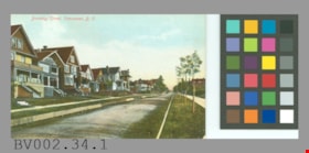
postcard
https://search.heritageburnaby.ca/link/museumartifact44517
- Repository
- Burnaby Village Museum
- Accession Code
- BV002.34.1
- Description
- Postcard: colour-tinted photo; horizontal; shows row of houses at left, road with wooden forms? either side, row of newly planted trees staked in grass at right, sidewalks; in red at top left, "Burnaby Street, Vancouver, B.C."; on reverse in red, "PRIVATE POST CARD"; up left side, "Published by Stedman Bros. Ltd., Brantford, Canada. Made in Germany."; line across card and line down centre; at left, "THIS SPACE MAY BE USED FOR CORRESPONDENCE", at right, "THIS SPACE IS FOR ADDRESS ONLY"; outline of rectangle at upper right, "1c. CANADA AND UNITED STATES." "2c. FOREIGN."; at lower left corner, "S B 2027"; unused; lightly soiled; wear on corners
- Object History
- Bought from E-Bay as purchase #1093584940.
- Classification
- Written Communication T&E - - Writing Media
- Object Term
- Postcard
- Maker
- Stedman Bros. Limited
- Country Made
- Canada
- Province Made
- Manitoba
- Site/City Made
- Brantford
- Title
- Burnaby Street, Vancouver, B.C. S B 2027
- Geographic Access
- Vancouver
Images

![Sectional map and street directory of Vancouver : Dial map of greater Vancouver including adjacent municipalities, [ca. 1950] thumbnail](/media/hpo/_Data/_BVM_Cartographic_Material/2000/2000_0003_0011_001%20WEB.jpg?width=280)
Sectional map and street directory of Vancouver : Dial map of greater Vancouver including adjacent municipalities
https://search.heritageburnaby.ca/link/museumdescription8697
- Repository
- Burnaby Village Museum
- Date
- [ca. 1950]
- Collection/Fonds
- Burnaby Village Museum Map collection
- Description Level
- Item
- Physical Description
- 2 maps and 1 p. of textual records on 1 sheet : lithographic prints, col. ; 55.5 x 75 cm + 2 dials and 25 x 72 cm + directory on sheet 55.5 x 75 cm, folded to 28.5 x 12.5 cm
- Scope and Content
- Item is a sectional map and street directory titled "Dial Map of Greater Vancouver and adjacent Municipalities" with a map on one side titled "Dial Map of Greater Vancouver and Suburbs" including Vancouver, West Vancouver, North Vancouver and Burnaby and includes street car and bus lines, railways,…
- Repository
- Burnaby Village Museum
- Collection/Fonds
- Burnaby Village Museum Map collection
- Description Level
- Item
- Physical Description
- 2 maps and 1 p. of textual records on 1 sheet : lithographic prints, col. ; 55.5 x 75 cm + 2 dials and 25 x 72 cm + directory on sheet 55.5 x 75 cm, folded to 28.5 x 12.5 cm
- Material Details
- Scales 1:42240, 1:144823
- 2 alphabetic dials on narrow strips of paper attached to map by grommets
- Scope and Content
- Item is a sectional map and street directory titled "Dial Map of Greater Vancouver and adjacent Municipalities" with a map on one side titled "Dial Map of Greater Vancouver and Suburbs" including Vancouver, West Vancouver, North Vancouver and Burnaby and includes street car and bus lines, railways, hospitals, parks, block nos. and street indexes with two alphabetic dials, one for Vancouver, the other for New Westminster. The other side of the map includes a map of "Fraser Valley" along with a directory of Vancouver street car and bus routes, business blocks, public buildings, hospitals, bathing beaches, locations of Vancouver fire halls and Vancouver city schools.
- Creator
- Dominion Map and Blueprint Co.
- Publisher
- Sectional Map and Street Directory Company
- Geographic Access
- Vancouver
- Accession Code
- BV000.3.11
- Access Restriction
- No restrictions
- Reproduction Restriction
- No known restrictions
- Date
- [ca. 1950]
- Media Type
- Cartographic Material
- Scan Resolution
- 380
- Scan Date
- 22-Dec-2020
- Scale
- 100
- Notes
- Title based on contents of map
Images
![Sectional map and street directory of Vancouver : Dial map of greater Vancouver including adjacent municipalities, [ca. 1950] thumbnail](/media/hpo/_Data/_BVM_Cartographic_Material/2000/2000_0003_0011_001%20WEB.jpg)


Tram memories : in celebration of the restoration of Interurban 1223
https://search.heritageburnaby.ca/link/museumlibrary5863
- Repository
- Burnaby Village Museum
- Author
- McGeachie, Pixie, 1921-
- Publication Date
- c2007
- Call Number
- 388.460971 TRA
completed with the assistance of the City of Burnaby.
Friends of Interurban 1223 would like to thank Jim Wolf, Heritage Planner for his production
assistance and Graphic Designer Rod Nevison for his design talent.
©2007 Friends of Interurban 1223
Printed by City of Burnaby Printshop
Cover image: Interurban
- Repository
- Burnaby Village Museum
- Collection
- Digital Reference Collection
- Reference Collection
- Material Type
- Book
- Call Number
- 388.460971 TRA
- Author
- McGeachie, Pixie, 1921-
- Contributor
- Friends of Interurban 1223
- Place of Publication
- Burnaby
- Publisher
- City of Burnaby
- Publication Date
- c2007
- Printer
- City of Burnaby Printshop
- Physical Description
- 91 p. : ill., map ;,20 cm
- Library Subject (LOC)
- Electric railroads
- Local transit
- Street-railroads
- Transportation
- Geographic Access
- Vancouver
- Name Access
- British Columbia Electric Railway Company
- Notes
- Editor : Pixie McGeachie
Images

Digital Books
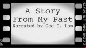
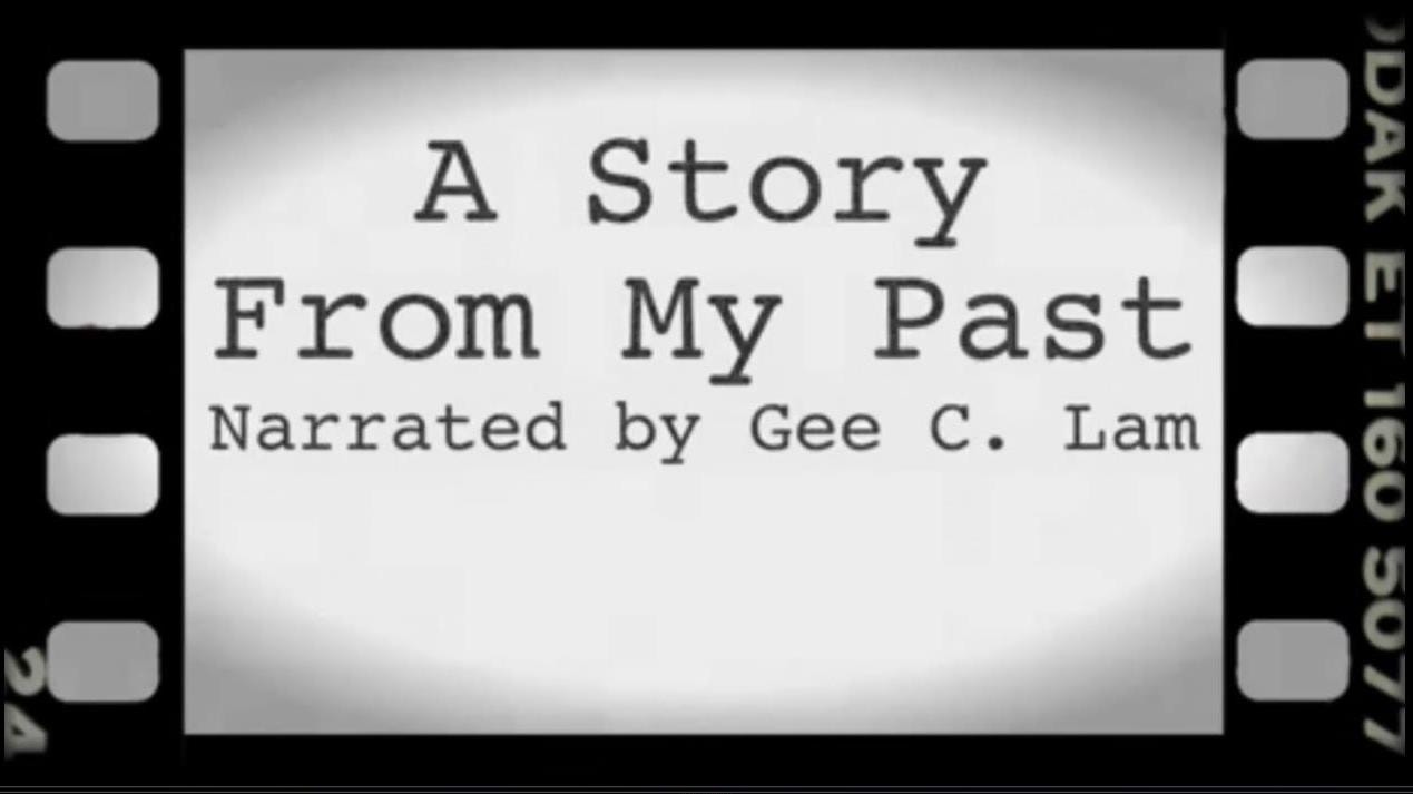
Community Hero: Recalling a Strathcona Story
https://search.heritageburnaby.ca/link/museumdescription9681
- Repository
- Burnaby Village Museum
- Date
- 2016
- Collection/Fonds
- Burnaby Village Museum Film and Video collection
- Description Level
- Item
- Physical Description
- 1 video recording (mp4) (7 min., 9 sec.) : digital, 25 fps, col., sd., stereo
- Scope and Content
- The digital video tells the story of Gee Lam’s childhood experience of growing up in the Vancouver’s East End neighbourhood known as Strathcona. His story revolved around his father’s friend Harry Con who was a community activist in the Strathcona neighbourhood, as well as a volunteer “spy” for the…
- Repository
- Burnaby Village Museum
- Collection/Fonds
- Burnaby Village Museum Film and Video collection
- Description Level
- Item
- Physical Description
- 1 video recording (mp4) (7 min., 9 sec.) : digital, 25 fps, col., sd., stereo
- Scope and Content
- The digital video tells the story of Gee Lam’s childhood experience of growing up in the Vancouver’s East End neighbourhood known as Strathcona. His story revolved around his father’s friend Harry Con who was a community activist in the Strathcona neighbourhood, as well as a volunteer “spy” for the Canadian Armed forces in World War 2. Gee shares his personal life lessons learned from “uncle Harry” regarding the importance of standing up and fighting for what is right. Harry’s community contribution had embodied Martin Luther King’s social activist principles: “The ultimate measure of a man is not where he stands in moments of comfort and convenience, but where he stands at times of challenge and controversy.” In the eyes of Gee, Harry Con was an exemplary who modeled an old Chinese proverb: “Each generation will reap what the former generation has sown. To enjoy the benefits of the hard work of one’s predecessors.” Harry’s life of selfless contributions in shaping the Vancouver Chinese community will impact generations to come. This is a story that needs to be told to the next generation to encourage them to respect and remember that the benefits of a thriving community is derived from both past and present continuous collaborations for paving long term beneficial outcomes for everyone.
- History
- Gee Lam immigrated from Hong Kong and grew up in the Strathcona neighbourhood that was adjacent to Vancouver’s Chinatown. He is a long-time resident of Burnaby. He has lived in North Burnaby with his wife since 1985. He attended Simon Fraser University’s (SFU) Burnaby campus and graduated in 1983. He obtained his M.Ed. in 2013 from SFU. He worked as a research assistant and workshop facilitator on the Elders’ Digital Storytelling project. He currently works at SFU’s Teaching and Learning Centre on top of Burnaby Mountain.
- Creator
- Lam, Gee Chung
- Other Title Information
- title supplied by film maker
- Subjects
- Persons - Chinese Canadians
- Names
- Lam, Gee Chung
- Geographic Access
- Vancouver
- Accession Code
- BV016.37.12
- Access Restriction
- No restrictions
- Reproduction Restriction
- May be restricted by third party rights
- Date
- 2016
- Media Type
- Moving Images
- Notes
- Transcribed title
Images
Video
Community Hero: Recalling a Strathcona Story, 2016
Community Hero: Recalling a Strathcona Story, 2016
https://search.heritageburnaby.ca/media/hpo/_Data/_BVM_Moving_Images/2016_0037_0012_001.mp4![Gordon and Harry Jung with Philip Mah, [between 1935 and 1945] thumbnail](/media/hpo/_Data/_BVM_Images/2021/2021_0019_0003_001.jpg?width=280)
Gordon and Harry Jung with Philip Mah
https://search.heritageburnaby.ca/link/museumdescription16728
- Repository
- Burnaby Village Museum
- Date
- [between 1935 and 1945]
- Collection/Fonds
- Julie Lee and Cecil Lee family fonds
- Description Level
- Item
- Physical Description
- 1 photograph (jpg)
- Scope and Content
- Photograph of Suey Yook "Gordon" Jung and Suey Cheung "Harry" Jung standing with young, Philip Mah on the boardwalk outside the Jung family home located on the family farm at 5460 Douglas Road (address was changed to 5286 Douglas Road in 1958) in Burnaby. Philip Mah is the son of Lil Mah.
- Repository
- Burnaby Village Museum
- Collection/Fonds
- Julie Lee and Cecil Lee family fonds
- Description Level
- Item
- Physical Description
- 1 photograph (jpg)
- Scope and Content
- Photograph of Suey Yook "Gordon" Jung and Suey Cheung "Harry" Jung standing with young, Philip Mah on the boardwalk outside the Jung family home located on the family farm at 5460 Douglas Road (address was changed to 5286 Douglas Road in 1958) in Burnaby. Philip Mah is the son of Lil Mah.
- Geographic Access
- Vancouver
- Street Address
- 5286 Douglas Road
- Accession Code
- BV021.19.3
- Access Restriction
- No restrictions
- Reproduction Restriction
- No known restrictions
- Date
- [between 1935 and 1945]
- Media Type
- Photograph
- Historic Neighbourhood
- Burnaby Lake (Historic Neighbourhood)
- Planning Study Area
- Douglas-Gilpin Area
- Scan Resolution
- 96
- Scan Date
- April 13, 2021
- Scale
- 100
- Notes
- Title based on contents of photograph
Images
![Gordon and Harry Jung with Philip Mah, [between 1935 and 1945] thumbnail](/media/hpo/_Data/_BVM_Images/2021/2021_0019_0003_001.jpg)
![Gordon Jung and Gee Shee Jung, [between 1935 and 1945] thumbnail](/media/hpo/_Data/_BVM_Images/2021/2021_0019_0001_001.jpg?width=280)
Gordon Jung and Gee Shee Jung
https://search.heritageburnaby.ca/link/museumdescription16726
- Repository
- Burnaby Village Museum
- Date
- [between 1935 and 1945]
- Collection/Fonds
- Julie Lee and Cecil Lee family fonds
- Description Level
- Item
- Physical Description
- 1 photograph (jpg)
- Scope and Content
- Photograph of Suey Yook "Gordon" Jung standing with his mother, Gee Shee Jung on the family farm located at 5460 Douglas Road in Burnaby (address was changed to 5286 Douglas Road in 1958).
- Repository
- Burnaby Village Museum
- Collection/Fonds
- Julie Lee and Cecil Lee family fonds
- Description Level
- Item
- Physical Description
- 1 photograph (jpg)
- Scope and Content
- Photograph of Suey Yook "Gordon" Jung standing with his mother, Gee Shee Jung on the family farm located at 5460 Douglas Road in Burnaby (address was changed to 5286 Douglas Road in 1958).
- Geographic Access
- Vancouver
- Street Address
- 5286 Douglas Road
- Accession Code
- BV021.19.1
- Access Restriction
- No restrictions
- Reproduction Restriction
- No known restrictions
- Date
- [between 1935 and 1945]
- Media Type
- Photograph
- Historic Neighbourhood
- Burnaby Lake (Historic Neighbourhood)
- Planning Study Area
- Douglas-Gilpin Area
- Scan Resolution
- 96
- Scan Date
- April 13, 2021
- Scale
- 100
- Notes
- Title based on contents of photograph
Images
![Gordon Jung and Gee Shee Jung, [between 1935 and 1945] thumbnail](/media/hpo/_Data/_BVM_Images/2021/2021_0019_0001_001.jpg)