Narrow Results By
Decade
- 2020s 466
- 2010s 979
- 2000s 2815
- 1990s 4534
- 1980s 3032
- 1970s 5026
- 1960s 2377
- 1950s
- 1940s
- 1930s 2311
- 1920s 2752
- 1910s 2173
- 1900s 988
- 1890s 298
- 1880s 148
- 1870s 42
- 1860s 47
- 1850s 25
- 1840s 13
- 1830s 9
- 1820s 9
- 1810s 6
- 1800s 6
- 1790s 5
- 1780s 5
- 1770s 5
- 1760s 5
- 1750s 5
- 1740s 5
- 1730s 5
- 1720s 5
- 1710s 5
- 1700s 5
- 1690s 5
- 1680s 5
- 1670s 4
- 1660s 4
- 1650s 4
- 1640s 4
- 1630s 4
- 1620s 4
- 1610s 4
- 1600s 4
- 1590s 1
- 1580s 1
- 1570s 1
- 1560s 1
- 1550s 1
- 1540s 1
- 1530s 1
- 1520s 2
- 1510s 1
- 1500s 1
- 1490s 1
- 1480s 1
Subject
- Accidents - Automobile Accidents 2
- Advertising Medium 2
- Advertising Medium - Signs and Signboards 21
- Aerial Photographs 24
- Agricultural Tools and Equipment 1
- Agricultural Tools and Equipment - Cultivators 1
- Agricultural Tools and Equipment - Gardening Equipment 1
- Agriculture 5
- Agriculture - Crops 1
- Agriculture - Farms 42
- Agriculture - Fruit and Berries 5
- Agriculture - Poultry 2
Creator
- Adair, Neal G. 3
- Adams, J. 1
- Adkins, H. E. (Hector Ernest), 1885-1962 1
- Aero Surveys Limited 2
- Aldwinckle, Eric 1
- Alexander, Michael, 1920-2004 1
- Allan, Ray 2
- Allan Studios 8
- Anderson, Robert "Bob" 2
- Architectural drawing by Harold Cullerne 1
- Artray Limited 5
- Associated Factory Mutual Fire Insurance Cos 1
Douglas-Gilpin Neighbourhood
https://search.heritageburnaby.ca/link/landmark799
- Repository
- Burnaby Heritage Planning
- Associated Dates
- 1955-2008
- Heritage Value
- The Douglas-Gilpin Neighbourhood developed into a diverse area incorporating residential, business, educational and park districts in the period after 1955. The BCIT site was built in the early 1960s, shortly after the Burnaby Municipal Hall was located on Canada Way near Deer Lake in 1956. The construction of the Municipal Hall at this location fostered the creation of an administrative and business centre adjacent to the park, while the northern and central areas of the neighbourhood retained their primarily residential character.
- Historic Neighbourhood
- Burnaby Lake (Historic Neighbourhood)
- Planning Study Area
- Douglas-Gilpin Area
Images
Frank Walsh Residence
https://search.heritageburnaby.ca/link/landmark581
- Repository
- Burnaby Heritage Planning
- Description
- Residential building.
- Associated Dates
- 1948
- Street View URL
- Google Maps Street View
- Repository
- Burnaby Heritage Planning
- Geographic Access
- Boundary Road
- Associated Dates
- 1948
- Description
- Residential building.
- Heritage Value
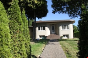
- This Streamline Moderne house is a rare example of this style in Burnaby and remains in excellent condition. Reflecting the influence of technology, industrial design and aerodynamic styling, the house has smooth rounded surfaces, rounded corners, a flat roof and prominent projecting eaves. It was built for prominent North Burnaby businessman Frank Wallace Walsh (1907-1963), who was a mechanic, and his wife Rena.
- Locality
- Vancouver Heights
- Historic Neighbourhood
- Vancouver Heights (Historic Neighbourhood)
- Planning Study Area
- Burnaby Heights Area
- Area
- 566.71
- Contributing Resource
- Building
- Ownership
- Private
- Street Address
- 270 Boundary Road
- Street View URL
- Google Maps Street View
Images
George Derby Centre
https://search.heritageburnaby.ca/link/landmark705
- Repository
- Burnaby Heritage Planning
- Geographic Access
- Cumberland Street
- Associated Dates
- 1947
- Heritage Value
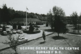
- The George Derby Centre was opened in 1947 as a rehabilitation Centre for young disabled veterans returning from the war. The centre was named after George Cleveland Derby, a World War I veteran who was injured in the Battle of Vimy Ridge and later went on to become a District Administrator in the Department of Solders’ Civil Re-establishment, the forerunner of the Department of Veterans Affairs. His work took him to wartime England where he was awarded the Order of the British Empire in 1943 for patriotic and philanthropic work.
- Historic Neighbourhood
- East Burnaby (Historic Neighbourhood)
- Planning Study Area
- Cariboo-Armstrong Area
- Street Address
- 7550 Cumberland Street
- Street View URL
- Google Maps Street View
Images
Lakeview Elementary School
https://search.heritageburnaby.ca/link/landmark834
- Repository
- Burnaby Heritage Planning
- Geographic Access
- Mayfield Street
- Associated Dates
- 1958
- Heritage Value
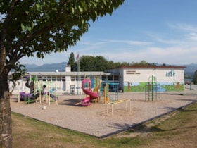
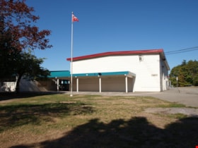
- The Burnaby School Inspector's report of 1955 estimated that by 1960, the total enrolment in Burnaby would go up by over 8000 pupils. As a result, new schools needed to be built to manage this increase, Lakeview being only one of many. Lakeview opened in 1958 with 193 students. Additions to the school were made in 1965 and 1969.
- Historic Neighbourhood
- Burnaby Lake (Historic Neighbourhood)
- Planning Study Area
- Lakeview-Mayfield Area
- Street Address
- 7777 Mayfield Street
- Street View URL
- Google Maps Street View
Images
McColl-Frontenac Oil Company
https://search.heritageburnaby.ca/link/landmark682
- Repository
- Burnaby Heritage Planning
- Associated Dates
- 1945
- Heritage Value
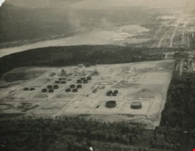
- In 1945, the McColl-Frontenac Oil Company purchased the western section of what used to be the Barnet Mill site from the City of Burnaby. McColl-Frontenac handled the distribution of Texaco gas and built a new plant at the site for this purpose. The company built an improved road access to the plant which later became known as Texaco Drive. Competition from other refineries eventually forced the closure of this plant and in 1985 the area was acquired by the Municipality for the expansion of Barnet Marine Park.
- Historic Neighbourhood
- Barnet (Historic Neighbourhood)
- Planning Study Area
- Burnaby Mountain Area
Images
Montague & Marcia Moore Residence
https://search.heritageburnaby.ca/link/landmark499
- Repository
- Burnaby Heritage Planning
- Description
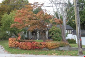
- The Montague and Marcia Moore Residence, situated on Sperling Avenue, is a one and one-half storey wood-frame house with Tudor Revival elements such as half-timbering and diamond-leaded windows. The landscaping includes a large hedge at the front of the property. It is located on a lakefront site w…
- Associated Dates
- 1943
- Street View URL
- Google Maps Street View
- Repository
- Burnaby Heritage Planning
- Geographic Access
- Sperling Avenue
- Associated Dates
- 1943
- Description
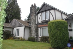
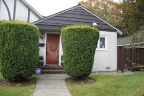
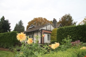
- The Montague and Marcia Moore Residence, situated on Sperling Avenue, is a one and one-half storey wood-frame house with Tudor Revival elements such as half-timbering and diamond-leaded windows. The landscaping includes a large hedge at the front of the property. It is located on a lakefront site within the scenic Deer Lake Park Heritage Precinct.
- Heritage Value
- Located within the historic Deer Lake Park neighbourhood, the Montague and Marcia Moore Residence is valued as an example of the late persistence of the historicist influence on domestic architecture, at a time when it was still considered the height of good taste for a house to be designed in a recognizable period revival style. This is reflected in the rustic Tudor Revival elements such as half-timbering, waney-edged boards in the gables, brick nogging, diamond-leaded windows, and bird houses in the main gable. The cobblestone chimney, the major focal point of the house, was constructed from river stones that were transported from Lynn Canyon. Meticulously retained in its original condition, this was the last home to be constructed by the Moore family before the Second World War construction supply rationing took effect. It was built by Danish contractor, Hans Jorgensen Hau (1878-1944), who had a flair for the construction of homes with a rustic character, and shares a number of design features with Hau’s own house at 5070 Canada Way.
- Defining Elements
- Key elements that define the heritage character of the Montague and Marcia Moore Residence include its: - location on a lakefront site, within the Deer Lake Park Heritage Precinct - residential form, scale and massing as expressed by its one and one-half storey height, rectangular plan and front gabled roof - wood-frame construction - Tudor Revival elements such as stucco and wood half-timbering, diamond-leaded casement windows, scroll-cut brackets, brick nogging on the front façade, bird houses in the main front gable, waney-edged boards at gable peaks, plank front door with strap hinges and a prominent external cobblestone chimney - associated landscape features such as a granite wall, and mature coniferous and deciduous trees
- Historic Neighbourhood
- Burnaby Lake (Historic Neighbourhood)
- Planning Study Area
- Morley-Buckingham Area
- Organization
- Canadian Institute of Mining and Metallurgy
- Builder
- Hans Jorgensen Hau
- Function
- Primary Historic--Single Dwelling
- Primary Current--Single Dwelling
- Community
- Deer Lake
- Cadastral Identifier
- P.I.D.006-082-696
- Boundaries
- The Montague and Marcia Moore Residence is comprised of a single residential lot located at 5165 Sperling Avenue, Burnaby.
- Area
- 4104
- Contributing Resource
- Building
- Ownership
- Public (local)
- Documentation
- City of Burnaby Planning and Building Department, Heritage Site Files
- Street Address
- 5165 Sperling Avenue
- Street View URL
- Google Maps Street View
Images
Moore House
https://search.heritageburnaby.ca/link/landmark497
- Repository
- Burnaby Heritage Planning
- Description
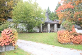
- The Moore House is a one-storey, side-gabled house with stepped roof planes and a split-level attached garage. The house faces east, and features distinct river rock porch columns and a large central tapered chimney. It is located within the Deer Lake Park Heritage Precinct, and is adjacent to a re…
- Associated Dates
- 1941
- Formal Recognition
- Community Heritage Register
- Other Names
- Ethel Moore Residence
- Street View URL
- Google Maps Street View
- Repository
- Burnaby Heritage Planning
- Other Names
- Ethel Moore Residence
- Geographic Access
- Sperling Avenue
- Associated Dates
- 1941
- Formal Recognition
- Community Heritage Register
- Enactment Type
- Council Resolution
- Enactment Date
- 26/05/2003
- Description
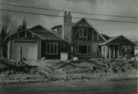
- The Moore House is a one-storey, side-gabled house with stepped roof planes and a split-level attached garage. The house faces east, and features distinct river rock porch columns and a large central tapered chimney. It is located within the Deer Lake Park Heritage Precinct, and is adjacent to a related house, the Rosalie (Moore) Barrett Residence, built the following year.
- Heritage Value
- The Moore House is significant for its relationship to first owner, Ethel Hutchings Moore (1884-1948), who purchased the property from Maud and Harriet Woodward, two of Deer Lake's first residents. Moore purchased the property with the hopes of introducing her children into the house construction business. This house, built in 1941, borrows its design from a 'California Desert House' built in Carmel a few years earlier. Rendered in traditional materials, this modern style merges comfortably with the rustic British Arts and Crafts tradition of most Deer Lake houses. Unusual for being built during wartime date, it was built at a time when domestic construction was severely curtailed due to shortages of labour and material. It is now owned by the City of Burnaby and is part of the Deer Lake Park Heritage Precinct. The Moore House is significant as a testament to Deer Lake's continued popularity as a residential neighbourhood in the 1940s. Although Burnaby was serviced by a number of transportation links at the time, the increasing availability of automobiles provided improved access to outlying suburbs. Rising real estate prices in Vancouver and New Westminster attracted residents to this neighbourhood because of its relative affordability, central location and beautiful scenery.
- Defining Elements
- Key elements that define the heritage character of the Moore House include its: - location within the Deer Lake Park Heritage Precinct - residential form, scale and massing as expressed by its one-storey height, linear plan, side gabled roof with multiple roof planes and split-level attached garage - wood-frame construction with stucco cladding - river rock porch columns and external tapered chimney - decorative embellishments including scroll-cut stickwork on the rear elevation and waney-edged boards in the gable peaks - wooden-sash casement windows with three-part, horizontal leading - associated landscaping features, including stone wall at the front of the property and coniferous and deciduous trees surrounding the property
- Historic Neighbourhood
- Burnaby Lake (Historic Neighbourhood)
- Planning Study Area
- Morley-Buckingham Area
- Function
- Primary Historic--Single Dwelling
- Primary Current--Single Dwelling
- Community
- Deer Lake
- Cadastral Identifier
- P.I.D. 011-454-521
- Boundaries
- The Moore House is comprised of a single residential lot located at 5145 Sperling Avenue, Burnaby.
- Area
- 993.39
- Contributing Resource
- Building
- Ownership
- Public (local)
- Documentation
- City of Burnaby Planning and Building Department, Heritage Site Files
- Street Address
- 5145 Sperling Avenue
- Street View URL
- Google Maps Street View
Images
Morley-Buckingham Neighbourhood
https://search.heritageburnaby.ca/link/landmark829
- Repository
- Burnaby Heritage Planning
- Associated Dates
- 1955-2008
- Heritage Value
- In the 1980 "Residential Neighbourhood Environment Study," the Morley-Buckingham Neighbourhood is described as "perhaps Burnaby's most prestigious residential area. The lots are larger than most other areas of the Municipality and this, along with the new expensive housing developed over the past 10 years, has created a very desirable residential neighbourhood...The older area of Buckingham lies at the lower edge of the slope and here the homes and streets are more uniform and aged between 20 and 25 years old...to the east of Canada Way lies...a cluster townhouse development."
- Historic Neighbourhood
- Burnaby Lake (Historic Neighbourhood)
- Planning Study Area
- Morley-Buckingham Area
Images
Morley Elementary School
https://search.heritageburnaby.ca/link/landmark835
- Repository
- Burnaby Heritage Planning
- Geographic Access
- Morley Street
- Associated Dates
- 1955
- Heritage Value
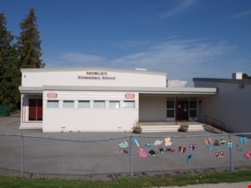
- In 1955 Morley Elementary School opened with 292 pupils, an indication of how quickly the residential areas around the Morley area were growing in the post-war period. Similar to other elementary schools built in Burnaby at the time, Morley was constructed on one level with classrooms in a line that could be added to as the need arose. Additions were made to the school in 1956, 1960 and 1969.
- Historic Neighbourhood
- Burnaby Lake (Historic Neighbourhood)
- Planning Study Area
- Morley-Buckingham Area
- Street Address
- 7355 Morley Street
- Street View URL
- Google Maps Street View
Images
Rosalie (Moore) Barrett Residence
https://search.heritageburnaby.ca/link/landmark498
- Repository
- Burnaby Heritage Planning
- Description
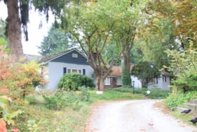
- The Rosalie (Moore) Barrett Residence is a one-storey ranch-style bungalow with a cross-gabled roofline, located on Sperling Avenue. It is located within the Deer Lake Park Heritage Precinct, and is adjacent to a related house, the Ethel Moore Residence, built the previous year.
- Associated Dates
- 1942
- Street View URL
- Google Maps Street View
- Repository
- Burnaby Heritage Planning
- Geographic Access
- Sperling Avenue
- Associated Dates
- 1942
- Description
- The Rosalie (Moore) Barrett Residence is a one-storey ranch-style bungalow with a cross-gabled roofline, located on Sperling Avenue. It is located within the Deer Lake Park Heritage Precinct, and is adjacent to a related house, the Ethel Moore Residence, built the previous year.
- Heritage Value
- This house is significant for its connection with first owner, Rosalie Barrett, the daughter of Ethel Hutchings Moore, who lived in the adjacent house at 5145 Sperling Avenue. A spacious modernist bungalow, it was constructed in 1942, and was designed by Rosalie Moore herself. Moore intended to build several houses on this property, but further development was curtailed due to wartime restrictions on domestic construction. The Rosalie (Moore) Barrett Residence is a testament to Deer Lake's continued popularity as a residential neighbourhood in the 1940s. Although Burnaby was serviced by a number of transportation links at the time, the increasing availability of automobiles provided improved access to outlying suburbs. Rising real estate prices in Vancouver and New Westminster attracted residents to this neighbourhood because of its relative affordability, central location and beautiful scenery.
- Defining Elements
- Key elements that define the heritage character of the Rosalie (Moore) Barrett Residence include its: - location within the Deer Lake Park Heritage Precinct - residential form, scale and massing as expressed by its one-storey height, rambling linear plan and cross-gabled roof - wood-frame construction with stucco siding and waney-edged boards in the gable peaks - red brick on the front façade and rough-cut granite at the base of the house - Modernist design as exemplified by the asymmetrical, linear plan with low pitched roof - internal granite chimney - original windows, including wooden-sash casement windows in double and triple-assembly with four-part, horizontal leading - original front door with glass block sidelights - associated landscape features such as granite gateposts, foundation plantings and mature coniferous trees
- Historic Neighbourhood
- Burnaby Lake (Historic Neighbourhood)
- Planning Study Area
- Morley-Buckingham Area
- Function
- Primary Historic--Single Dwelling
- Primary Current--Single Dwelling
- Community
- Deer Lake
- Cadastral Identifier
- P.I.D.006-082-696
- Boundaries
- The Rosalie (Moore) Barrett Residence is comprised of a single residential lot located at 5155 Sperling Avenue, Burnaby.
- Area
- 11291.44
- Contributing Resource
- Building
- Ownership
- Public (local)
- Documentation
- City of Burnaby Planning and Building Department, Heritage Site Files
- Street Address
- 5155 Sperling Avenue
- Street View URL
- Google Maps Street View
Images
Second Street Neighbourhood
https://search.heritageburnaby.ca/link/landmark826
- Repository
- Burnaby Heritage Planning
- Associated Dates
- 1955-2008
- Heritage Value
- Second Street had its origins in the 1910-1920 era and the Second Street Elementary School was built in 1928. Substantial new housing was built in the late 1940s and 1950s and infilling occurred during the 1960s and 1970s. By the 1980s, the neighbourhood was primarily a single family area with a small number of multi-family buildings.
- Historic Neighbourhood
- East Burnaby (Historic Neighbourhood)
- Planning Study Area
- Second Street Area
Images
Vancouver Heights Neighbourhood
https://search.heritageburnaby.ca/link/landmark666
- Repository
- Burnaby Heritage Planning
- Associated Dates
- 1925-1954
- Heritage Value
- Vancouver Heights remained an important residential and commercial centre in Burnaby throughout the 1925-1954 period. The area had its own Board of Trade and the North Burnaby Library was created to serve the residents. In 1949, the Hastings streetcars stopped running, but the area retained its reputation as one of the best shopping districts in the city.
- Historic Neighbourhood
- Vancouver Heights (Historic Neighbourhood)
- Planning Study Area
- Burnaby Heights Area
Images
Helen 'The Swinging Girl' Neon Sign
https://search.heritageburnaby.ca/link/landmark591
- Repository
- Burnaby Heritage Planning
- Description
- Commercial building.
- Associated Dates
- 1956
- Formal Recognition
- Heritage Designation, Community Heritage Register
- Other Names
- Helen's Childrens Wear Sign
- Street View URL
- Google Maps Street View
- Repository
- Burnaby Heritage Planning
- Other Names
- Helen's Childrens Wear Sign
- Geographic Access
- Hastings Street
- Associated Dates
- 1956
- Formal Recognition
- Heritage Designation, Community Heritage Register
- Enactment Type
- Bylaw No. 12771
- Enactment Date
- 19/04/2010
- Description
- Commercial building.
- Heritage Value
- While the building here is of some importance as the former North Burnaby municipal office, its primary importance is its delightful neon sign that has become a North Burnaby landmark. Helen Arnold opened Helen’s Childrens Wear shop in the building next door to the old Municipal offices in 1948. In 1955, when North Burnaby moved out, she moved into the vacated building. As part of the renovations, Helen enlisted the assistance of her good friend Jimmy Wallace, owner of Vancouver’s Wallace Neon Company, to create a new sign for her expanded business. One of the company’s designers, Reeve Lehman, created the swinging neon girl that was installed in 1956. Designed in two parts, one section of the sign is cloud shaped and reads ‘Helen’s’ while the other section is a moving representation of a little girl on a swing. The sign is nine feet six inches high and nine feet wide, and the lower section is animated with an internal motor and gears. It immediately became a landmark on Hastings Street, and recently the sign’s design fame has spread far and wide as one of the best surviving examples of kinetic neon art in North America.
- Locality
- Vancouver Heights
- Historic Neighbourhood
- Vancouver Heights (Historic Neighbourhood)
- Planning Study Area
- Willingdon Heights Area
- Community
- Burnaby
- Names
- Helen's Childrens Wear
- Street Address
- 4142 Hastings Street
- Street View URL
- Google Maps Street View
Images
Trans Mountain Pipeline Company
https://search.heritageburnaby.ca/link/landmark685
- Repository
- Burnaby Heritage Planning
- Geographic Access
- Shellmont Street
- Associated Dates
- 1953
- Heritage Value
- On March 21, 1951 the Parliament of Canada granted the Trans Mountain Oil Pipe Line Company a charter. By May of the following year, the Corporation of Burnaby gave final reading to Bylaw No. 3203, which resulted in the conveyance of land in DL 142, 143 and 144 (Burnaby Mountain site) to the Trans Mountain Oil Pipe Line Company. Construction of the Burnaby Mountain tank farm was completed in October of 1953 and the site became operational as the first shipment of oil reached Trans Mountain’s Burnaby Terminal.
- Planning Study Area
- Lake City Area
- Street Address
- 8099 Shellmont Street
- Street View URL
- Google Maps Street View
Images
Aubrey Elementary School
https://search.heritageburnaby.ca/link/landmark785
- Repository
- Burnaby Heritage Planning
- Geographic Access
- Stratford Avenue
- Associated Dates
- 1959
- Heritage Value
- Aubrey Avenue School was built in 1959 to help alleviate the increased enrolment at other North Burnaby schools due to the development of new subdivisions such as Brentwood, Capitol Hill and Westridge. Additions to the original structure were made in 1962, 1963, 1964, 1967 and 1972.
- Planning Study Area
- Parkcrest-Aubrey Area
- Street Address
- 1075 Stratford Avenue
- Street View URL
- Google Maps Street View
Images
Big Bend Neighbourhood
https://search.heritageburnaby.ca/link/landmark840
- Repository
- Burnaby Heritage Planning
- Associated Dates
- 1955-2008
- Heritage Value
- The Big Bend Neighbourhood in Burnaby maintained its status as an important agricultural area in the City in the years following 1955 and it also solidified its role as a prime industrial and commercial district. In 1972, the Big Bend Development Plan was adopted by Council and soon thereafter, approximately 620 acres of land were incorporated into the Agricultural Land Reserve. These lands have been set aside for agricultural and limited recreation purposes. By the 2000s, 160 acres of land were considered highly productive agricultural areas, and over 400 acres of land had been secured as parkland, including the Fraser Foreshore Park. The area also developed large commercial and industrial districts including those at Marine Way/Boundary, the Glenlyon Estates, Riverfront Business Park, Burnaby Business Park, and Glenwood Industrial Estates.
- Historic Neighbourhood
- Fraser Arm (Historic Neighbourhood)
- Planning Study Area
- Big Bend Area
Images
Fraser Arm Neighbourhood
https://search.heritageburnaby.ca/link/landmark708
- Repository
- Burnaby Heritage Planning
- Associated Dates
- 1925-1954
- Heritage Value
- By the late 1920s, the Fraser Arm Neighbourhood in Burnaby was developing into an industrial and manufacturing district. In 1931, the Canadian National Railway built a bridge over the Fraser River from Burnaby to Lulu Island and advertised that over 30 industries were currently operating along the North Fraser. Along with industries, this district remained an important agricultural area for the Lower Mainland. Chinese market gardens continued to develop and thrive and in 1926, the Vancouver Sun estimated that that Chinese farms in the Lower Fraser Valley then supplied 90 per cent of all green vegetables consumed in the Vancouver market area.
- Historic Neighbourhood
- Fraser Arm (Historic Neighbourhood)
- Planning Study Area
- Big Bend Area
Images
Glenwood School
https://search.heritageburnaby.ca/link/landmark842
- Repository
- Burnaby Heritage Planning
- Geographic Access
- Marine Drive
- Associated Dates
- 1956
- Heritage Value
- Glenwood Elementary School was built in 1956 to replace Riverway East School. Additions to the school were made in 1966 and 1969. Decreasing enrolment led to the school closure by 1980, but it was re-opened 1994.
- Historic Neighbourhood
- Fraser Arm (Historic Neighbourhood)
- Planning Study Area
- Clinton-Glenwood Area
- Street Address
- 5787 Marine Drive
- Street View URL
- Google Maps Street View
Images
Lochdale Neighbourhood
https://search.heritageburnaby.ca/link/landmark790
- Repository
- Burnaby Heritage Planning
- Associated Dates
- 1955-2008
- Heritage Value
- Despite the rapid growth witnessed in Burnaby in the post-war years, the Lochdale Neighbourhood was characterised as a close-knit primarily residential community. Although a commercial zone developed along Sperling and Hastings, single-family, duplex and multi-family homes were the primary buildings in the area. Basement suites and student accommodation also flourished in this neighbourhood after the creation of Simon Fraser University on Burnaby Mountain.
- Historic Neighbourhood
- Lochdale (Historic Neighbourhood)
- Planning Study Area
- Lochdale Area
Images
McPherson Park Junior High School
https://search.heritageburnaby.ca/link/landmark710
- Repository
- Burnaby Heritage Planning
- Associated Dates
- 1951-1993
- Street View URL
- Google Maps Street View
- Repository
- Burnaby Heritage Planning
- Geographic Access
- Rumble Street
- Associated Dates
- 1951-1993
- Heritage Value
- In 1950, the Burnaby School Inspector reported: "the recent development of a number of large housing projects and the continuing growth of new homes in settled areas are compelling the Board to consider a building program of major proportions...now under construction, including McPherson Park with 21 classrooms." Enrolment in its first year was 686 students. In the late 1980s and early 1990s, junior high schools were replaced with expanded secondary schools encompassing grades 7 through 12; as a result, McPherson Park Junior High was closed and Burnaby South Secondary School opened.
- Historic Neighbourhood
- Alta Vista (Historic Neighbourhood)
- Planning Study Area
- Clinton-Glenwood Area
- Street Address
- 5455 Rumble Street
- Street View URL
- Google Maps Street View

