Narrow Results By
Subject
- Accidents - Automobile Accidents 1
- Buildings 2
- Buildings - Commercial 1
- Buildings - Commercial - Drive-In Theatres 1
- Buildings - Commercial - Hotels and Motels 1
- Buildings - Commercial - Restaurants 1
- Buildings - Heritage 1
- Buildings - Residential 1
- Buildings - Residential - Houses 1
- Buildings - Residential - Seniors Housing 1
- Buildings - Schools 2
- Celebrations - Centennial 1
East Burnaby School (Edmonds Street School)
https://search.heritageburnaby.ca/link/landmark735
- Repository
- Burnaby Heritage Planning
- Geographic Access
- Canada Way
- Associated Dates
- 1894
- Heritage Value
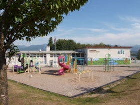
- One of the first tasks of Burnaby's Municipal Government upon its incorporation was to lobby for a public school in Burnaby. By 1893, land on Douglas Road near Edmonds was donated and the new school was built in 1893. The one-room school opened on January 22, 1894 with 29 students under the charge of teacher, Ethel LePage. The School has been known as the Burnaby School (until1896), and then East Burnaby School from 1896 to 1907 and finally, Edmonds Street School.
- Historic Neighbourhood
- Edmonds (Historic Neighbourhood)
- Planning Study Area
- Edmonds Area
- Street Address
- 7376 Canada Way
- Street View URL
- Google Maps Street View
Images
West Burnaby School (aka Kingsway West School)
https://search.heritageburnaby.ca/link/landmark727
- Repository
- Burnaby Heritage Planning
- Geographic Access
- Kingsway
- Associated Dates
- 1896
- Heritage Value
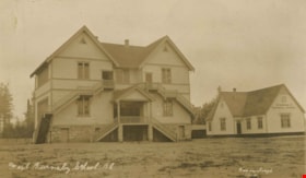
- West Burnaby School was to be Burnaby's second public school and it served the children who lived along the tram line and Vancouver Road (Kingsway).
- Historic Neighbourhood
- Central Park (Historic Neighbourhood)
- Planning Study Area
- Maywood Area
- Street View URL
- Google Maps Street View
Images
Burnaby South High School Cenotaph & Memorial Tennis Courts
https://search.heritageburnaby.ca/link/landmark547
- Repository
- Burnaby Heritage Planning
- Description
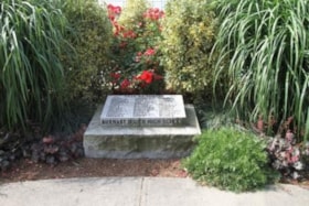
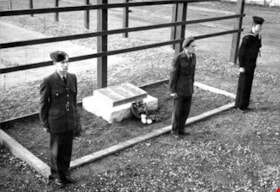
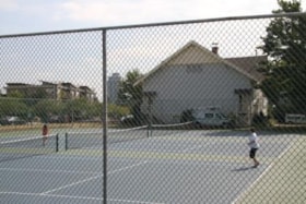
- This memorial comprises a cenotaph and three tennis courts: the former a monument of British Columbia granite inscribed with the names of fifty-one students of Burnaby South High School who lost their lives in the Second World War; and the latter a living memorial to these former students.
- Associated Dates
- 1948
- Formal Recognition
- Heritage Designation, Community Heritage Register
- Street View URL
- Google Maps Street View
- Repository
- Burnaby Heritage Planning
- Geographic Access
- Southoaks Crescent
- Associated Dates
- 1948
- Formal Recognition
- Heritage Designation, Community Heritage Register
- Enactment Type
- Bylaw No. 9807
- Enactment Date
- 23/11/1992
- Description
- This memorial comprises a cenotaph and three tennis courts: the former a monument of British Columbia granite inscribed with the names of fifty-one students of Burnaby South High School who lost their lives in the Second World War; and the latter a living memorial to these former students.
- Heritage Value
- This memorial is important for its spiritual, symbolic, and cultural associations for the former students of Burnaby South High School, and for all youth in the community. The cenotaph is of personal significance to the families of those who lost their lives. The unusual combination of cenotaph and living memorial - the tennis courts - represents a rare statement of a community's commitment to not allow the sacrifice of its youth to be forgotten by providing an active facility which draw people to the place on a regular basis rather than just on occasions of remembrance. As such it is an important symbol of a humanitarian ethic. In combination with the Kingsway East School, now rehabilitated as the Alan Emmott Centre, this memorial represents a valuable haven of green-space and recreation in the high-density urban development that now surrounds it.
- Defining Elements
- Key elements that define the heritage character of the Burnaby South High School Cenotaph & Memorial Tennis Courts include the: - location of the cenotaph adjacent to the living memorial - spatial association of this memorial and the remaining school building - physical fabric of both the granite monument and the tennis courts
- Historic Neighbourhood
- Edmonds (Historic Neighbourhood)
- Planning Study Area
- Kingsway-Beresford Area
- Function
- Primary Current--Public Feature
- Primary Historic--Public Feature
- Community
- Burnaby
- Cadastral Identifier
- P.I.D. No. 016-367-154 Legal Description: Lot 1, District Lot 96, Group 1 New Westminster District, Plan 86581
- Boundaries
- Burnaby South High School Cenotaph & Memorial Tennis Courts is comprised of a single municipally-owned property located at 6650 Southoaks Crescent, Burnaby.
- Area
- 6,070.00
- Contributing Resource
- Building
- Landscape Feature
- Structure
- Ownership
- Public (local)
- Documentation
- Heritage Site Files: PC77000 20. City of Burnaby Planning and Building Department, 4949 Canada Way, Burnaby, B.C., V5G 1M2
- Street Address
- 6650 Southoaks Crescent
- Street View URL
- Google Maps Street View
Images
Seaforth Schoolhouse
https://search.heritageburnaby.ca/link/landmark541
- Repository
- Burnaby Heritage Planning
- Description
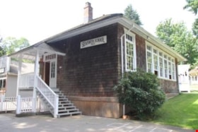
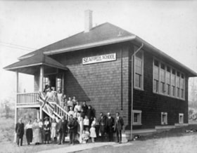
- The Seaforth Schoolhouse is a one-storey wood-frame rectangular plan building with a projecting entry porch, located in the Burnaby Village Museum.
- Associated Dates
- 1922
- Formal Recognition
- Heritage Designation, Community Heritage Register
- Repository
- Burnaby Heritage Planning
- Geographic Access
- Deer Lake Avenue
- Associated Dates
- 1922
- Formal Recognition
- Heritage Designation, Community Heritage Register
- Enactment Type
- Bylaw No. 8148
- Enactment Date
- 03/01/1984
- Description
- The Seaforth Schoolhouse is a one-storey wood-frame rectangular plan building with a projecting entry porch, located in the Burnaby Village Museum.
- Heritage Value
- The heritage value of the Seaforth Schoolhouse lies in its representation of a one-room school once located in one of the city’s rural districts. The school was constructed due to the demand of increasing population after the First World War, in what was then known as the Lozells District, so isolated at the time that parents were concerned about the danger to their children from wild bears and cougars that roamed the area. The school was named after its sponsor, the Seaforth Chapter of the Imperial Order of Daughters of the Empire. Bowman and Cullerne, the architects for the Burnaby School Board, designed the one room schoolhouse. It was constructed by local contractor, Alphonse J. Toebaert, following the standards of British Columbia public school architecture, which specified the plan and orientation of the building. It indicates the values and the design control of school boards of the time, and the central role of the provincial government in setting educational standards. The heritage value of this school also lies in its interpretive value within the Burnaby Village Museum. The site is an important cultural feature for the interpretation of Burnaby’s heritage to the public, illustrating the changes in the local school system over time. The school was moved to Burnaby Village Museum in 1983, and was opened to the public after extensive restoration in 1987. Both the interior and exterior have been restored and interpreted to the date of original construction. The North Vancouver School Board donated most of the early desks, and the remainder of the interior artifacts are from the museum’s own collection.
- Defining Elements
- Key elements that define the heritage character of the Seaforth Schoolhouse include its: - rectangular plan - hipped roof with cedar shingle cladding - hipped-roof entry porch - typical school fenestration of the era, with a bank of double-hung 6-over-6 wooden-sash windows on one facade - cedar shingle cladding - original and authentic interior elements such as interior mouldings, blackboards and desks
- Locality
- Deer Lake Park
- Historic Neighbourhood
- Burnaby Lake (Historic Neighbourhood)
- Planning Study Area
- Morley-Buckingham Area
- Organization
- Seaforth Chapter of the Imperial Order of Daughters of the Empire
- Burnaby School Board
- Burnaby Village Museum
- Architect
- Bowman and Cullerne
- Builder
- Alphonse J. Toebaert
- Function
- Primary Historic--One-Room School
- Primary Current--Museum
- Community
- Burnaby
- Cadastral Identifier
- P.I.D. No. 011-030-356 Legal Description: Parcel 1, District Lot 79 and District Lot 85, Group 1, New Westminster District, Reference Plan 77594
- Boundaries
- Burnaby Village Museum is comprised of a single municipally-owned property located at 6501 Deer Lake Avenue, Burnaby.
- Area
- 38,488.63
- Contributing Resource
- Building
- Landscape Feature
- Structure
- Ownership
- Public (local)
- Documentation
- Heritage Site Files: PC77000 20. City of Burnaby Planning and Building Department, 4949 Canada Way, Burnaby, B.C., V5G 1M2
- Street Address
- 6501 Deer Lake Avenue
Images
Aubrey Elementary School
https://search.heritageburnaby.ca/link/landmark785
- Repository
- Burnaby Heritage Planning
- Geographic Access
- Stratford Avenue
- Associated Dates
- 1959
- Heritage Value
- Aubrey Avenue School was built in 1959 to help alleviate the increased enrolment at other North Burnaby schools due to the development of new subdivisions such as Brentwood, Capitol Hill and Westridge. Additions to the original structure were made in 1962, 1963, 1964, 1967 and 1972.
- Planning Study Area
- Parkcrest-Aubrey Area
- Street Address
- 1075 Stratford Avenue
- Street View URL
- Google Maps Street View
Images
Douglas Road School
https://search.heritageburnaby.ca/link/landmark573
- Repository
- Burnaby Heritage Planning
- Description
- School building.
- Associated Dates
- 1928
- Other Names
- Douglas Road Elementary School
- Street View URL
- Google Maps Street View
- Repository
- Burnaby Heritage Planning
- Other Names
- Douglas Road Elementary School
- Geographic Access
- Canada Way
- Associated Dates
- 1928
- Description
- School building.
- Heritage Value
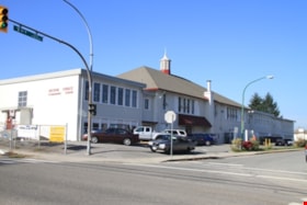
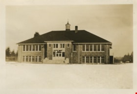
- The Douglas Road School was originally established as a two-room school in 1908 on this site, and later expanded to four classrooms. Anticipating rapid settlement of this district, the School Board purchased two acres adjoining the old building. Two of the four rooms were designed to become one large auditorium suitable for special events and public gatherings, with seating for two hundred people. The classically-influenced school has been altered with new windows and extended with additional wings, but has retained its original red-brick veneer, tan-brick quoins and bellcast octagonal roof ventilator. Designed by McCarter & Nairne, the school was built by contractor A.S. Perry. McCarter & Nairne, who also designed the Second Street School, were the Burnaby School Board architects at this time. John Y. McCarter (1886-1981) and George Nairne (1884-1953) formed their partnership in 1921 after serving overseas during the First World War. The partners began designing houses and small apartment buildings, and their commissions included Vancouver’s first skyscraper, the Marine Building (1928-30).
- Locality
- Burnaby Lake
- Historic Neighbourhood
- Burnaby Lake (Historic Neighbourhood)
- Planning Study Area
- Douglas-Gilpin Area
- Architect
- McCarter & Nairne
- Subjects
- Buildings - Heritage
- Buildings - Schools
- Street Address
- 4861 Canada Way
- Street View URL
- Google Maps Street View
Images
Douglas Road School
https://search.heritageburnaby.ca/link/landmark754
- Repository
- Burnaby Heritage Planning
- Geographic Access
- Canada Way
- Associated Dates
- 1908
- Heritage Value
- This school was the fifth to open in Burnaby and was initially known as Lake View School. In 1913, names of Burnaby Schools were changed to reflect their location and thus Lake View became Douglas Road. The first building on the site was torn down in the 1950s but the main building, which was constructed in 1928, remains although it had additions and renovations done in 1950, 1954, 1960, 1961, 1967 and 1973.
- Historic Neighbourhood
- Burnaby Lake (Historic Neighbourhood)
- Planning Study Area
- Douglas-Gilpin Area
- Street Address
- 4861 Canada Way
- Street View URL
- Google Maps Street View
Images
Jesse Love House
https://search.heritageburnaby.ca/link/landmark540
- Repository
- Burnaby Heritage Planning
- Description
- The Jesse Love House is a vernacular example of a late Victorian-era wood-frame farmhouse with later Arts and Crafts alterations and additions, that has been relocated to the Burnaby Village Museum. This two-storey house has an L-shaped plan, with a compound gabled roof, overhanging eaves and a lar…
- Associated Dates
- 1893
- Formal Recognition
- Heritage Designation, Community Heritage Register
- Other Names
- Jesse & Martha Love Farmhouse
- Street View URL
- Google Maps Street View
- Repository
- Burnaby Heritage Planning
- Other Names
- Jesse & Martha Love Farmhouse
- Geographic Access
- Deer Lake Avenue
- Associated Dates
- 1893
- Formal Recognition
- Heritage Designation, Community Heritage Register
- Enactment Type
- Bylaw No. 9807
- Enactment Date
- 23/11/1992
- Description
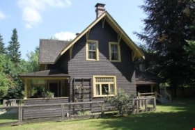
- The Jesse Love House is a vernacular example of a late Victorian-era wood-frame farmhouse with later Arts and Crafts alterations and additions, that has been relocated to the Burnaby Village Museum. This two-storey house has an L-shaped plan, with a compound gabled roof, overhanging eaves and a large wraparound verandah.
- Heritage Value
- The value of the Jesse Love House lies in its comprehensive representation of an early Burnaby farmhouse, and the typical additive growth of a home as the resident family prospered. Jesse Love (1849-1928) and his wife Martha Love (1858-1920) moved to Burnaby in 1893 with their family to start a fruit ranch and market garden on Cumberland Road in the East Burnaby district. Jesse Love was actively involved in community affairs, serving on the Burnaby School Board and also as a District Councillor in 1901 and from 1904-07. The original house was constructed by local builder George Salt and consisted of an entrance hall, dining room, lean-to kitchen, master bedroom and several rooms upstairs. As the family grew and prospered, additions were made to the house including a parlour, more bedrooms upstairs, and a large permanent kitchen. Jesse Love was actively involved in community affairs, and the kitchen became a local gathering spot for political discussion and civic organizations. The verandah, exterior shingle cladding, large windows, running water and electricity were eventually added as well. The heritage value for this house also lies in its interpretive value within the Burnaby Village Museum. The site is an important cultural feature for the interpretation of Burnaby’s heritage to the public. The house was moved to the Burnaby Village Museum in 1988 and both the interior and exterior were restored and interpreted to their 1925 period, including reproduction wallpaper.
- Defining Elements
- The character defining features of the Jesse Love House include its: - irregular form and massing - compound gable roof with cedar shingle cladding - Craftsman-style exterior features such as a shingled exterior and triangular eave brackets - multi-paned double-hung 2-over-2 wooden-sash windows; casement window assemblies with transoms in the Living Room - large wrap-around verandah - interior features such as pressed tin ceilings, original wallpapers and cedar panelled kitchen - reproduction Arts and Crafts parlour document wallpaper and border
- Locality
- Deer Lake Park
- Historic Neighbourhood
- Burnaby Lake (Historic Neighbourhood)
- Planning Study Area
- Morley-Buckingham Area
- Organization
- Burnaby Village Museum
- Builder
- George Salt
- Function
- Primary Current--Museum
- Primary Historic--Single Dwelling
- Community
- Burnaby
- Cadastral Identifier
- P.I.D. No. 011-030-356 Legal Description: Parcel 1, District Lot 79 and District Lot 85, Group 1, New Westminster District, Reference Plan 77594
- Boundaries
- Burnaby Village Museum is comprised of a single municipally-owned property located at 6501 Deer Lake Avenue, Burnaby.
- Area
- 38,488.63
- Contributing Resource
- Building
- Landscape Feature
- Structure
- Ownership
- Public (local)
- Documentation
- Heritage Site Files: PC77000 20. City of Burnaby Planning and Building Department, 4949 Canada Way, Burnaby, B.C., V5G 1M2
- Street Address
- 6501 Deer Lake Avenue
- Street View URL
- Google Maps Street View
Images
Kingsway East School
https://search.heritageburnaby.ca/link/landmark546
- Repository
- Burnaby Heritage Planning
- Description
- The Kingsway East School is a two-storey wood-frame Arts and Crafts styled building. The school, and the adjacent cenotaph and memorial tennis courts, comprise Burnaby South Memorial Park.
- Associated Dates
- 1913
- Formal Recognition
- Heritage Designation, Community Heritage Register
- Other Names
- Alan Emmott Centre
- Street View URL
- Google Maps Street View
- Repository
- Burnaby Heritage Planning
- Other Names
- Alan Emmott Centre
- Geographic Access
- Southoaks Crescent
- Associated Dates
- 1913
- Formal Recognition
- Heritage Designation, Community Heritage Register
- Enactment Type
- Bylaw No. 9807
- Enactment Date
- 23/11/1992
- Description
- The Kingsway East School is a two-storey wood-frame Arts and Crafts styled building. The school, and the adjacent cenotaph and memorial tennis courts, comprise Burnaby South Memorial Park.
- Heritage Value
- This school structure completed in 1913, the oldest surviving public education building in the city, was intended to be the auditorium and gymnasium for Burnaby’s first high school. However, because of the 1913 recession and the outbreak of the First World War, it was utilized as the Kingsway East Elementary School for the Edmonds District until 1921. Burnaby South High School opened here in 1922, and after it relocated this building was used for a variety of school purposes until it became redundant. The school was rehabilitated for community purposes in 2002-03 and renamed the Alan Emmott Centre to honor a former Mayor of Burnaby. The impressive scale of the Kingsway East School is indicative of the relative size of the community and its growing demand for schooling at the time of construction, illustrating the value that early community residents placed on education. Built to plans of the Burnaby School Board architect, Joseph Henry Bowman (1864-1943), it also indicates the individual values and design control exercised by the school board during this era. It is also significant for its Arts and Crafts style, allied to the typical Craftsman residential vocabulary, which was employed locally for school buildings of the Edwardian era. By using a common architectural vocabulary, this allowed the institution to reflect the values and aspirations of the local community. The Arts and Crafts style also demonstrated an allegiance to British educational antecedents and a demonstration of loyalty to the Mother Country.
- Historic Neighbourhood
- Edmonds (Historic Neighbourhood)
- Planning Study Area
- Kingsway-Beresford Area
- Function
- Primary Historic--Primary School
- Community
- Burnaby
- Cadastral Identifier
- P.I.D. No. 016-367-154 Legal Description: Lot 1, District Lot 96, Group 1 New Westminster District, Plan 86581
- Boundaries
- The Kingsway East School is comprised of a single municipally-owned property located at 6650 Southoaks Crescent, Burnaby.
- Area
- 6,070.00
- Contributing Resource
- Building
- Landscape Feature
- Structure
- Ownership
- Public (local)
- Documentation
- Heritage Site Files: PC77000 20. City of Burnaby Planning and Building Department, 4949 Canada Way, Burnaby, B.C., V5G 1M2
- Street Address
- 6650 Southoaks Crescent
- Street View URL
- Google Maps Street View
Images
Lakeview Elementary School
https://search.heritageburnaby.ca/link/landmark834
- Repository
- Burnaby Heritage Planning
- Geographic Access
- Mayfield Street
- Associated Dates
- 1958
- Heritage Value
- The Burnaby School Inspector's report of 1955 estimated that by 1960, the total enrolment in Burnaby would go up by over 8000 pupils. As a result, new schools needed to be built to manage this increase, Lakeview being only one of many. Lakeview opened in 1958 with 193 students. Additions to the school were made in 1965 and 1969.
- Historic Neighbourhood
- Burnaby Lake (Historic Neighbourhood)
- Planning Study Area
- Lakeview-Mayfield Area
- Street Address
- 7777 Mayfield Street
- Street View URL
- Google Maps Street View
Images
McPherson Park Junior High School
https://search.heritageburnaby.ca/link/landmark710
- Repository
- Burnaby Heritage Planning
- Associated Dates
- 1951-1993
- Street View URL
- Google Maps Street View
- Repository
- Burnaby Heritage Planning
- Geographic Access
- Rumble Street
- Associated Dates
- 1951-1993
- Heritage Value
- In 1950, the Burnaby School Inspector reported: "the recent development of a number of large housing projects and the continuing growth of new homes in settled areas are compelling the Board to consider a building program of major proportions...now under construction, including McPherson Park with 21 classrooms." Enrolment in its first year was 686 students. In the late 1980s and early 1990s, junior high schools were replaced with expanded secondary schools encompassing grades 7 through 12; as a result, McPherson Park Junior High was closed and Burnaby South Secondary School opened.
- Historic Neighbourhood
- Alta Vista (Historic Neighbourhood)
- Planning Study Area
- Clinton-Glenwood Area
- Street Address
- 5455 Rumble Street
- Street View URL
- Google Maps Street View
Second Street School
https://search.heritageburnaby.ca/link/landmark638
- Repository
- Burnaby Heritage Planning
- Description
- School building.
- Associated Dates
- 1928
- Street View URL
- Google Maps Street View
- Repository
- Burnaby Heritage Planning
- Geographic Access
- 2nd Street
- Associated Dates
- 1928
- Description
- School building.
- Heritage Value
- The Second Street School was originally established at this location as a two-room schoolhouse in 1913 to relieve the overcrowding of Edmonds School during the pre-First World War building boom. The old school was converted into an auditorium when this handsome school building was constructed in 1928. The new school, built by local contractors Ward-Leverington Ltd., included four classrooms, a library, a room for the principal, and a room for the teachers. The original brick façade has been retained although it has been painted; other intact original features include the bellcast octagonal roof ventilator and the protruding front entrance. The Burnaby School Board architect at this time was the talented firm of McCarter & Nairne, who also designed the Douglas Road School. John Y. McCarter (1886-1981) and George Nairne (1884-1953) formed their partnership in 1921 after serving overseas during the First World War. The partners began designing houses and small apartment buildings, and larger commissions soon followed, including Vancouver’s first skyscraper, the Marine Building (1928-30).
- Locality
- East Burnaby
- Historic Neighbourhood
- East Burnaby (Historic Neighbourhood)
- Planning Study Area
- Second Street Area
- Architect
- McCarter & Nairne
- Area
- 15777.66
- Contributing Resource
- Building
- Street Address
- 7502 2nd Street
- Street View URL
- Google Maps Street View
Images
Thomas & Margaret Coldicutt Residence
https://search.heritageburnaby.ca/link/landmark647
- Repository
- Burnaby Heritage Planning
- Description
- Residential building.
- Associated Dates
- 1911
- Street View URL
- Google Maps Street View
- Repository
- Burnaby Heritage Planning
- Geographic Access
- 6th Street
- Associated Dates
- 1911
- Description
- Residential building.
- Heritage Value
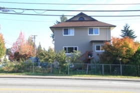
- This house was built by Thomas Davis Coldicutt (1879-1970) and Margaret Jane Coldicutt, pre-eminent local citizens. Thomas Coldicutt was born in Birmingham and arrived in Canada in 1900, finding success in the steamboat industry. In 1902, he married Margaret Jane Styler who had been born in Redditch, Worcester, England, and in 1908 they settled in East Burnaby–some of the first pioneers to the area–and established a fruit farm. Thomas had a successful real estate, insurance and brokerage business, and was elected as a councillor for East Burnaby in 1909. He was also active in civic, political and social circles in Burnaby and became president of the Burnaby Board of Trade. "East Burnaby is booming and the signs of prosperity that may be seen on every hand. Most of these are substantial dwellings, such as effect a permanent improvement to the countryside. Among those whose homes have been completed, or on the point of completion may be mentioned. Councillor Coldicutt, who has built himself a habitation on Second Avenue at a cost of $4,000. (The British Columbian, 1911). In 1913, Coldicutt sold his original farm described as “the show place of Burnaby” to the Burnaby School Board for the development of Second Street School and this house was moved from Second Street and Sixteenth Avenue to this site. It has been extensively altered, but retains its original form, scale and massing.
- Locality
- East Burnaby
- Historic Neighbourhood
- East Burnaby (Historic Neighbourhood)
- Planning Study Area
- Edmonds Area
- Area
- 557.42
- Contributing Resource
- Building
- Ownership
- Private
- Street Address
- 7510 6th Street
- Street View URL
- Google Maps Street View
Images
Interview with Barry Jones by Kathy Bossort December 9, 2015 - Track 4
https://search.heritageburnaby.ca/link/oralhistory667
- Repository
- City of Burnaby Archives
- Date Range
- 1975-1996
- Length
- 0:11:00
- Summary
- This portion of the interview is about Barry Jones’ talking briefly about serving as a trustee on the Burnaby Board of Education from 1975 to 1985 and as NDP MLA from 1986 to 1996, before describing his limited role in the dispute between the City of Burnaby and SFU over control and ownership of la…
- Repository
- City of Burnaby Archives
- Summary
- This portion of the interview is about Barry Jones’ talking briefly about serving as a trustee on the Burnaby Board of Education from 1975 to 1985 and as NDP MLA from 1986 to 1996, before describing his limited role in the dispute between the City of Burnaby and SFU over control and ownership of land on Burnaby Mountain. He talks about how the dispute was resolved and some of the terms in the agreement.
- Date Range
- 1975-1996
- Length
- 0:11:00
- Names
- Burnaby School Board
- Simon Fraser University
- Rankin, Lee A.
- Burnaby Mountain Conservation Area
- Geographic Access
- Burnaby Mountain Conservation Area
- Interviewer
- Bossort, Kathy
- Interview Date
- December 9, 2015
- Scope and Content
- Recording is of an interview with Barry Jones conducted by Kathy Bossort. Barry Jones was one of 23 participants interviewed as part of the Community Heritage Commission’s Burnaby Mountain Oral History Project. The interview is mainly about Barry Jones talking about his home and the conservation area on Burnaby Mountain, and about the negotiations that resulted in the agreement between Simon Fraser University and the City of Burnaby in 1995. He talks about the building of Burnaby Mountain Parkway and its link to the 1995 agreement, and about his experiences with Trans Mountain tank farm and pipeline. He also talks about his education and career as teacher, school board trustee and politician.
- Biographical Notes
- Barry Jones was born 1940 in Princeton, BC. His father moved the family to a home on Georgia Street in North Burnaby in 1944 where Barry grew up. He attended UBC majoring in mathematics and chemistry, and unable to find work in his field, taught two years in northern BC. He liked teaching and returned to school, enrolling in education at the newly opened Simon Fraser University in 1965. He taught one year at Moscrop Secondary School in Burnaby and finished his 25 year teaching career in Coquitlam. Barry served ten years as a Burnaby School board trustee, and then ten years as North Burnaby MLA (NDP) beginning in 1986, serving five years in Official Opposition and five years in government under then-premier Mike Harcourt. During his time in government, Barry Jones successfully lobbied for freedom of information legislation. He also played a role in resolving the dispute between SFU and Burnaby over control and ownership of land on Burnaby Mountain and in creating the Burnaby Mountain Conservation Area in 1995. He continues to live on Burnaby Mountain in a home he bought in 1971.
- Total Tracks
- 7
- Total Length
- 1:06:23
- Interviewee Name
- Jones, J. Barry
- Interview Location
- City of Burnaby City Hall law libary
- Interviewer Bio
- Kathy Bossort is a retired archivist living in Ladner, BC. She worked at the Delta Museum and Archives after graduating from SLAIS (UBC) in 2001 with Masters degrees in library science and archival studies. Kathy grew up in Calgary, Alberta, and, prior to this career change, she lived in the West Kootenays, earning her living as a cook for BC tourist lodges and work camps. She continues to be interested in oral histories as a way to fill the gaps in the written record and bring richer meaning to history.
- Collection/Fonds
- Community Heritage Commission Special Projects fonds
- Media Type
- Sound Recording
Audio Tracks
Track four of interview with Barry Jones
Track four of interview with Barry Jones
https://search.heritageburnaby.ca/media/hpo/_Data/_Archives_Oral_Histories/_Unrestricted/MSS196-015/MSS196-015_Track_4.mp3Interview with Bill Gruenthal
https://search.heritageburnaby.ca/link/museumdescription19636
- Repository
- Burnaby Village Museum
- Date
- [1950-2023] (interview content), interviewed 31 Jul. 2023
- Collection/Fonds
- Burnaby Village Museum fonds
- Description Level
- Item
- Physical Description
- 2 sound recordings (wav) (74 min., 37 sec.) + 1 sound recording (mp3) (74 min., 37 sec.)
- Scope and Content
- Item consists of a recording of an oral history interview with Bill Gruenthal conducted by Burnaby Village Museum Registrar, Eric Damer on July 31 2023. 00:00:00 – 00:27:01 Bill Gruenthal provides details on his family background, his early life experiences, how he got into the insurance business,…
- Repository
- Burnaby Village Museum
- Collection/Fonds
- Burnaby Village Museum fonds
- Series
- Museum Oral Histories series
- Subseries
- Many Voices Project Interviews subseries
- Description Level
- Item
- Physical Description
- 2 sound recordings (wav) (74 min., 37 sec.) + 1 sound recording (mp3) (74 min., 37 sec.)
- Material Details
- Interviewer: Eric Damer Interviewee: Bill Gruenthal Location of Interview: Burnaby Village Museum Interview Date: July 31, 2023 Total Number of tracks: 1 Total Length of all Tracks: 01:14:37 Digital master recordings (wav) were recorded onto two separate audio tracks, edited and merged together and converted to mp3 for access on Heritage Burnaby
- Scope and Content
- Item consists of a recording of an oral history interview with Bill Gruenthal conducted by Burnaby Village Museum Registrar, Eric Damer on July 31 2023. 00:00:00 – 00:27:01 Bill Gruenthal provides details on his family background, his early life experiences, how he got into the insurance business, his knowledge and interest in Judaism, places that he and his wife lived before moving to Burnaby, family life in Burnaby and his political involvement in running for the Burnaby school board. 00:27:02 – 00:42:50 Bill Gruenthal talks about the Burquest Jewish Community Association, it’s background and his involvement, experiences of discrimination in his career, a brief history of the Jewish people and some cultural traditions. 00:42:51 – 00:56:04 Bill Gruenthal mentions some of the charities that he supports including Burnaby Hospital, his volunteer work within the community and community organizations including the Nikkei Place Foundation and shares more details on his insurance career. 00:56:05 – 01:14:37 Bill Gruenthal shares information about his Burnaby neighbourhood and Jewish funeral customs and provides his impressions of new development at Brentwood, Burnaby Council and other development projects in Burnaby.
- History
- Interviewee biography: Bill Gruenthal was born in the British Mandate of Palestine, now Israel, in 1935 after his parents had fled Germany in advance of the then worsening political situation. Bill’s father died in 1942; some years later his mother remarried to an Irish-born senior civil servant in that government. He had a difficult and somewhat dangerous job. Soon after marriage, the family, including Bill’s older brother, Martin, immigrated to Canada in January 1947 on the strength of his step-father’s British Passport. They traveled via New York, where Bill’s uncle and his family resided and who put up the family. Later that month, the parents travelled by CP rail from Montreal to Vancouver, followed by Bill and his brother in March 1947 who travelled from New York to White Rock on an American railroad. While passing through the Fraser Valley Bill’s parents took an interest in Silverdale, a small hamlet west of Mission where the four eventually settled. Bill finished High School in Mission and soon joined the insurance industry. Bill connected with the Jewish Community in Vancouver where he met his soon-to-be wife. Upon marriage they were transferred to Calgary; after five years suffering its cold weather they were transferred back to Vancouver. They settled in Burnaby in 1966 as an affordable neighbourhood with easy access to his office downtown Vancouver. Outside work, Bill helped raise his family of three daughters who all graduated Burnaby High School (Alpha). They joined Temple Sholom in Vancouver, and he volunteered and still volunteers for a number of non-profits, including The Jewish Museum and Archives and Nikkei Place Foundation (Burnaby). He was an early long-term supporter and a past president of Burquest Jewish Community Association, mostly involving persons from Burnaby, New Westminster, and the Tri-Cities area (hence the name). He ran for political office in Burnaby in 1976 but was not elected. He delivers food in Burnaby for the Food Bank and is a donor to many worthy causes including Burnaby General Hospital. Interviewer biography: Eric Damer is a Burnaby Village Museum Interpreter, Museum Registrar, Researcher and Blacksmith. Eric pounded hot steel for the first time in 1977 in junior high. Fifteen years later, he joined Burnaby Village Museum where he has smithed for three decades. He also provides historical research for museum exhibits and special projects. Outside the museum, Eric is a social historian with a special interest in educational history.
- Creator
- Burnaby Village Museum
- Subjects
- Migration
- Persons - Jewish Canadians
- Transportation
- Transportation - Rail
- Religions - Judaism
- Cemeteries
- Organizations
- Elections
- Names
- Gruenthal, Bill
- Gruenthal, Noemi Yadlow
- O'Connor, Herta Ingrid Gruenthal
- O'Connor, John
- Burquest
- Jacobson, Max Alec
- Temple Shalom
- Brentwood Shopping Centre
- Brentwood Park School
- Alpha Secondary School
- Burnaby School Board
- Responsibility
- Damer, Eric
- Accession Code
- BV023.16.14
- Access Restriction
- No restrictions
- Reproduction Restriction
- No known restrictions
- Date
- [1950-2023] (interview content), interviewed 31 Jul. 2023
- Media Type
- Sound Recording
- Planning Study Area
- Brentwood Area
- Notes
- Title based on contents of item
- Transcription available
Documents
Audio Tracks
Interview with Bill Gruenthal, [1950-2023] (interview content), interviewed 31 Jul. 2023
Interview with Bill Gruenthal, [1950-2023] (interview content), interviewed 31 Jul. 2023
https://search.heritageburnaby.ca/media/hpo/_Data/_BVM_Sound_Recordings/Oral_Histories/2023_0016_0014_003.mp3Interview with Lee Rankin by Kathy Bossort December 2, 2015 - Track 2
https://search.heritageburnaby.ca/link/oralhistory643
- Repository
- City of Burnaby Archives
- Date Range
- 1963-2009
- Length
- 0:10:40
- Summary
- This portion of the interview is about Lee Rankin talking about why he chose a career in politics and what kept him interested being a Burnaby councillor for 22 years. He tells the story about the land swap that he helped engineer with the School Board that enabled the building of the new Burnaby S…
- Repository
- City of Burnaby Archives
- Summary
- This portion of the interview is about Lee Rankin talking about why he chose a career in politics and what kept him interested being a Burnaby councillor for 22 years. He tells the story about the land swap that he helped engineer with the School Board that enabled the building of the new Burnaby South Secondary School. He relates that this experience in the late 1980s would become key in finding a resolution for the City/SFU dispute. He talks about the positions held by the university and the City over land ownership and control on Burnaby Mountain. Rezoning for Discovery Park and the 1964 Simon Fraser Townsite Master Plan (1964) are discussed.
- Date Range
- 1963-2009
- Length
- 0:10:40
- Geographic Access
- Burnaby Mountain Conservation Area
- Interviewer
- Bossort, Kathy
- Interview Date
- December 2, 2015
- Scope and Content
- Recording is of an interview with Lee Rankin conducted by Kathy Bossort. Lee Rankin was one of 23 participants interviewed as part of the Community Heritage Commission’s Burnaby Mountain Oral History Project. The interview is mainly about Lee Rankin’s involvement in finding a resolution to the dispute between the City of Burnaby and Simon Fraser University over land ownership and control on Burnaby Mountain. He talks about the origin of the dispute, the positions taken by the two sides, the key people who brought about a resolution, and the main features of the agreement between the City, SFU and the province of BC. He talks about how the agreement met SFU’s goals, fostered trust between the City and university, and removed uncertainty from protecting parkland on Burnaby Mountain.
- Biographical Notes
- Lee Rankin was born in 1953 in Vancouver. He attended SFU 1973-78, completing his BA degree in 1985. He earned his law degree at UBC in 1988, was called to the Bar in 1989, and practiced in immigration and refugee law. Lee has lived in Burnaby since 1976 and was a member of Burnaby Council for 22 years, from 1983-1999 and 2002-2008. His particular interests as a Councillor were in community planning, housing and environment. Among other duties and accomplishments as Councillor, Lee served as chair of the Simon Fraser Liaison Committee and was involved in the negotiations with the province and SFU that resulted in the university returning more than 800 acres of land to the City, which was dedicated as part of the Burnaby Mountain Conservation Area. He has also served on the GVRD, volunteers as a coach for team sports in Burnaby, and has served on numerous community and business associations and committees. Lee is married to Ragini Venkat Rankin and has one son Henry.
- Total Tracks
- 8
- Total Length
- 1:50:35
- Interviewee Name
- Rankin, Lee A.
- Interview Location
- Lee Rankin's home in Burnaby
- Interviewer Bio
- Kathy Bossort is a retired archivist living in Ladner, BC. She worked at the Delta Museum and Archives after graduating from SLAIS (UBC) in 2001 with Masters degrees in library science and archival studies. Kathy grew up in Calgary, Alberta, and, prior to this career change, she lived in the West Kootenays, earning her living as a cook for BC tourist lodges and work camps. She continues to be interested in oral histories as a way to fill the gaps in the written record and bring richer meaning to history.
- Collection/Fonds
- Community Heritage Commission Special Projects fonds
- Media Type
- Sound Recording
Audio Tracks
Track two of interview with Lee Rankin
Track two of interview with Lee Rankin
https://search.heritageburnaby.ca/media/hpo/_Data/_Archives_Oral_Histories/_Unrestricted/MSS196-014/MSS196-014_Track_2.mp3Interview with Ron Burton by Kathy Bossort November 16, 2015 - Track 1
https://search.heritageburnaby.ca/link/oralhistory615
- Repository
- City of Burnaby Archives
- Date Range
- 1954-2015
- Length
- 0:08:52
- Summary
- This portion of the interview is about Ron Burton’s memories about his childhood, education and career. He talks about the sports he enjoyed growing up, getting his first mountain bike in 1980, and first experiences riding on Burnaby Mountain. He also talks about his work as a Burnaby school truste…
- Repository
- City of Burnaby Archives
- Summary
- This portion of the interview is about Ron Burton’s memories about his childhood, education and career. He talks about the sports he enjoyed growing up, getting his first mountain bike in 1980, and first experiences riding on Burnaby Mountain. He also talks about his work as a Burnaby school trustee.
- Date Range
- 1954-2015
- Length
- 0:08:52
- Geographic Access
- Burnaby Mountain Conservation Area
- Interviewer
- Bossort, Kathy
- Interview Date
- November 16, 2015
- Scope and Content
- Recording is of an interview with Ron Burton conducted by Kathy Bossort. Ron Burton was one of 23 participants interviewed as part of the Community Heritage Commission’s Burnaby Mountain Oral History Project. The interview is mainly about the founding, goals, and activities of the Burnaby Mountain Biking Association as told by one of the founders and President of the club, Ron Burton, and about the development of mountain biking and trail construction on Burnaby Mountain, both prior to and after the creation of the conservation area in 1995/96. Ron Burton also talks about his childhood, his work as a Burnaby school trustee, and the sports and recreational activities he has enjoyed on the mountain.
- Biographical Notes
- Ron Burton was born in Burnaby in 1954 to Fred and Shirley Burton. He grew up in East Vancouver and attended Hastings Elementary and Gladstone Secondary schools. He worked on the waterfront for Viterra, became a member of the Grain Workers Union and joined the NDP in 1972. He and his wife moved to Burnaby’s Vancouver Heights in 1982 and Forest Grove in 1988. He has served as a Board of Education Trustee in the Burnaby School District since first being elected in 1987, currently serving as Board Chair. Ron is founder and President of the Burnaby Mountain Biking Association and an active rider on Burnaby Mountain since 1988. The Association was founded in 2000, registering as a society in 2005, with the goals to build sustainable trails on Burnaby Mountain, to provide education about trail riding, and to advocate for and improve the image of mountain biking. Under Ron’s leadership the Association has successfully recruited members and formed a cooperative relationship with Burnaby’s Parks staff and with other park trail users.
- Total Tracks
- 6
- Total Length
- 1:01:32
- Interviewee Name
- Burton, Ronald C. "Ron"
- Interview Location
- Meeting room at the Burnaby School District office
- Interviewer Bio
- Kathy Bossort is a retired archivist living in Ladner, BC. She worked at the Delta Museum and Archives after graduating from SLAIS (UBC) in 2001 with Masters degrees in library science and archival studies. Kathy grew up in Calgary, Alberta, and, prior to this career change, she lived in the West Kootenays, earning her living as a cook for BC tourist lodges and work camps. She continues to be interested in oral histories as a way to fill the gaps in the written record and bring richer meaning to history.
- Collection/Fonds
- Community Heritage Commission Special Projects fonds
- Media Type
- Sound Recording
Audio Tracks
Track one of interview with Ron Burton
Track one of interview with Ron Burton
https://search.heritageburnaby.ca/media/hpo/_Data/_Archives_Oral_Histories/_Unrestricted/MSS196-010/MSS196-010_Track_1.mp3Interview with Ron Burton by Kathy Bossort November 16, 2015 - Track 2
https://search.heritageburnaby.ca/link/oralhistory616
- Repository
- City of Burnaby Archives
- Date Range
- 1980-2015
- Length
- 0:09:21
- Summary
- This portion of the interview is about Ron Burton’s description of mountain biking on Burnaby Mountain in the 1980’s and 1990’s and trail building on SFU lands prior to the land transfer in 1995/96. He talks about the guidelines used for trail building, and the uncertainty about what impact the lan…
- Repository
- City of Burnaby Archives
- Summary
- This portion of the interview is about Ron Burton’s description of mountain biking on Burnaby Mountain in the 1980’s and 1990’s and trail building on SFU lands prior to the land transfer in 1995/96. He talks about the guidelines used for trail building, and the uncertainty about what impact the land transfer from SFU to Burnaby would have on biking in the new conservation area. He also talks about forming the Burnaby Mountain Biking Association in 2000, its goals, fund raising, and members.
- Date Range
- 1980-2015
- Length
- 0:09:21
- Names
- City of Burnaby Parks, Recreation and Cultural Services
- Burnaby Mountain Conservation Area
- Simon Fraser University
- Burnaby Mountain Biking Association
- Subjects
- Geographic Features - Parks
- Geographic Features - Trails
- Sports - Cycling
- Organizations - Societies and Clubs
- Persons - Volunteers
- Geographic Access
- Burnaby Mountain Conservation Area
- Interviewer
- Bossort, Kathy
- Interview Date
- November 16, 2015
- Scope and Content
- Recording is of an interview with Ron Burton conducted by Kathy Bossort. Ron Burton was one of 23 participants interviewed as part of the Community Heritage Commission’s Burnaby Mountain Oral History Project. The interview is mainly about the founding, goals, and activities of the Burnaby Mountain Biking Association as told by one of the founders and President of the club, Ron Burton, and about the development of mountain biking and trail construction on Burnaby Mountain, both prior to and after the creation of the conservation area in 1995/96. Ron Burton also talks about his childhood, his work as a Burnaby school trustee, and the sports and recreational activities he has enjoyed on the mountain.
- Biographical Notes
- Ron Burton was born in Burnaby in 1954 to Fred and Shirley Burton. He grew up in East Vancouver and attended Hastings Elementary and Gladstone Secondary schools. He worked on the waterfront for Viterra, became a member of the Grain Workers Union and joined the NDP in 1972. He and his wife moved to Burnaby’s Vancouver Heights in 1982 and Forest Grove in 1988. He has served as a Board of Education Trustee in the Burnaby School District since first being elected in 1987, currently serving as Board Chair. Ron is founder and President of the Burnaby Mountain Biking Association and an active rider on Burnaby Mountain since 1988. The Association was founded in 2000, registering as a society in 2005, with the goals to build sustainable trails on Burnaby Mountain, to provide education about trail riding, and to advocate for and improve the image of mountain biking. Under Ron’s leadership the Association has successfully recruited members and formed a cooperative relationship with Burnaby’s Parks staff and with other park trail users.
- Total Tracks
- 6
- Total Length
- 1:01:32
- Interviewee Name
- Burton, Ronald C. "Ron"
- Interview Location
- Meeting room at the Burnaby School District office
- Interviewer Bio
- Kathy Bossort is a retired archivist living in Ladner, BC. She worked at the Delta Museum and Archives after graduating from SLAIS (UBC) in 2001 with Masters degrees in library science and archival studies. Kathy grew up in Calgary, Alberta, and, prior to this career change, she lived in the West Kootenays, earning her living as a cook for BC tourist lodges and work camps. She continues to be interested in oral histories as a way to fill the gaps in the written record and bring richer meaning to history.
- Collection/Fonds
- Community Heritage Commission Special Projects fonds
- Media Type
- Sound Recording
Audio Tracks
Track two of interview with Ron Burton
Track two of interview with Ron Burton
https://search.heritageburnaby.ca/media/hpo/_Data/_Archives_Oral_Histories/_Unrestricted/MSS196-010/MSS196-010_Track_2.mp3Interview with Ron Burton by Kathy Bossort November 16, 2015 - Track 3
https://search.heritageburnaby.ca/link/oralhistory617
- Repository
- City of Burnaby Archives
- Date Range
- 2000-2015
- Length
- 0:11:04
- Summary
- This portion of the interview is about Ron Burton’s description of how volunteers participate in maintaining trails on Burnaby Mountain in cooperation with City staff, which are organized as four Trail Days per year. He talks about the relationship between Burnaby Mountain Biking Association and th…
- Repository
- City of Burnaby Archives
- Summary
- This portion of the interview is about Ron Burton’s description of how volunteers participate in maintaining trails on Burnaby Mountain in cooperation with City staff, which are organized as four Trail Days per year. He talks about the relationship between Burnaby Mountain Biking Association and the Parks department, the role the BMBA plays in educating its members, and the challenge biking’s “extreme” image has presented.
- Date Range
- 2000-2015
- Length
- 0:11:04
- Names
- City of Burnaby Parks, Recreation and Cultural Services
- Burnaby Mountain Conservation Area
- Burnaby Mountain Biking Association
- Subjects
- Geographic Features - Parks
- Geographic Features - Trails
- Sports - Cycling
- Organizations - Societies and Clubs
- Geographic Access
- Burnaby Mountain Conservation Area
- Interviewer
- Bossort, Kathy
- Interview Date
- November 16, 2015
- Scope and Content
- Recording is of an interview with Ron Burton conducted by Kathy Bossort. Ron Burton was one of 23 participants interviewed as part of the Community Heritage Commission’s Burnaby Mountain Oral History Project. The interview is mainly about the founding, goals, and activities of the Burnaby Mountain Biking Association as told by one of the founders and President of the club, Ron Burton, and about the development of mountain biking and trail construction on Burnaby Mountain, both prior to and after the creation of the conservation area in 1995/96. Ron Burton also talks about his childhood, his work as a Burnaby school trustee, and the sports and recreational activities he has enjoyed on the mountain.
- Biographical Notes
- Ron Burton was born in Burnaby in 1954 to Fred and Shirley Burton. He grew up in East Vancouver and attended Hastings Elementary and Gladstone Secondary schools. He worked on the waterfront for Viterra, became a member of the Grain Workers Union and joined the NDP in 1972. He and his wife moved to Burnaby’s Vancouver Heights in 1982 and Forest Grove in 1988. He has served as a Board of Education Trustee in the Burnaby School District since first being elected in 1987, currently serving as Board Chair. Ron is founder and President of the Burnaby Mountain Biking Association and an active rider on Burnaby Mountain since 1988. The Association was founded in 2000, registering as a society in 2005, with the goals to build sustainable trails on Burnaby Mountain, to provide education about trail riding, and to advocate for and improve the image of mountain biking. Under Ron’s leadership the Association has successfully recruited members and formed a cooperative relationship with Burnaby’s Parks staff and with other park trail users.
- Total Tracks
- 6
- Total Length
- 1:01:32
- Interviewee Name
- Burton, Ronald C. "Ron"
- Interview Location
- Meeting room at the Burnaby School District office
- Interviewer Bio
- Kathy Bossort is a retired archivist living in Ladner, BC. She worked at the Delta Museum and Archives after graduating from SLAIS (UBC) in 2001 with Masters degrees in library science and archival studies. Kathy grew up in Calgary, Alberta, and, prior to this career change, she lived in the West Kootenays, earning her living as a cook for BC tourist lodges and work camps. She continues to be interested in oral histories as a way to fill the gaps in the written record and bring richer meaning to history.
- Collection/Fonds
- Community Heritage Commission Special Projects fonds
- Media Type
- Sound Recording
Audio Tracks
Track three of interview with Ron Burton
Track three of interview with Ron Burton
https://search.heritageburnaby.ca/media/hpo/_Data/_Archives_Oral_Histories/_Unrestricted/MSS196-010/MSS196-010_Track_3.mp3Interview with Ron Burton by Kathy Bossort November 16, 2015 - Track 4
https://search.heritageburnaby.ca/link/oralhistory618
- Repository
- City of Burnaby Archives
- Date Range
- 2000-2015
- Length
- 0:08:23
- Summary
- This portion of the interview is about Ron Burton’s description of mountain bikers’ care of the mountain environment and how the various park stakeholders work together and communicate concerns.
- Repository
- City of Burnaby Archives
- Summary
- This portion of the interview is about Ron Burton’s description of mountain bikers’ care of the mountain environment and how the various park stakeholders work together and communicate concerns.
- Date Range
- 2000-2015
- Length
- 0:08:23
- Names
- Burnaby Parks, Recreation and Cultural Services Department
- Burnaby Mountain Biking Association
- Stoney Creek Environment Committee
- Stoney Creek Environmental Working Group
- Subjects
- Geographic Features - Parks
- Planning
- Geographic Access
- Burnaby Mountain Conservation Area
- Interviewer
- Bossort, Kathy
- Interview Date
- November 16, 2015
- Scope and Content
- Recording is of an interview with Ron Burton conducted by Kathy Bossort. Ron Burton was one of 23 participants interviewed as part of the Community Heritage Commission’s Burnaby Mountain Oral History Project. The interview is mainly about the founding, goals, and activities of the Burnaby Mountain Biking Association as told by one of the founders and President of the club, Ron Burton, and about the development of mountain biking and trail construction on Burnaby Mountain, both prior to and after the creation of the conservation area in 1995/96. Ron Burton also talks about his childhood, his work as a Burnaby school trustee, and the sports and recreational activities he has enjoyed on the mountain.
- Biographical Notes
- Ron Burton was born in Burnaby in 1954 to Fred and Shirley Burton. He grew up in East Vancouver and attended Hastings Elementary and Gladstone Secondary schools. He worked on the waterfront for Viterra, became a member of the Grain Workers Union and joined the NDP in 1972. He and his wife moved to Burnaby’s Vancouver Heights in 1982 and Forest Grove in 1988. He has served as a Board of Education Trustee in the Burnaby School District since first being elected in 1987, currently serving as Board Chair. Ron is founder and President of the Burnaby Mountain Biking Association and an active rider on Burnaby Mountain since 1988. The Association was founded in 2000, registering as a society in 2005, with the goals to build sustainable trails on Burnaby Mountain, to provide education about trail riding, and to advocate for and improve the image of mountain biking. Under Ron’s leadership the Association has successfully recruited members and formed a cooperative relationship with Burnaby’s Parks staff and with other park trail users.
- Total Tracks
- 6
- Total Length
- 1:01:32
- Interviewee Name
- Burton, Ronald C. "Ron"
- Interview Location
- Meeting room at the Burnaby School District office
- Interviewer Bio
- Kathy Bossort is a retired archivist living in Ladner, BC. She worked at the Delta Museum and Archives after graduating from SLAIS (UBC) in 2001 with Masters degrees in library science and archival studies. Kathy grew up in Calgary, Alberta, and, prior to this career change, she lived in the West Kootenays, earning her living as a cook for BC tourist lodges and work camps. She continues to be interested in oral histories as a way to fill the gaps in the written record and bring richer meaning to history.
- Collection/Fonds
- Community Heritage Commission Special Projects fonds
- Media Type
- Sound Recording
Audio Tracks
Track four of interview with Ron Burton
Track four of interview with Ron Burton
https://search.heritageburnaby.ca/media/hpo/_Data/_Archives_Oral_Histories/_Unrestricted/MSS196-010/MSS196-010_Track_4.mp3
