Narrow Results By
Creator
- British Columbia Underwriters' Association 7
- Burnaby School Board 1
- Burnaby Village Museum 15
- Burnaby Village Museum - City of Burnaby 1
- Burnett, Geoffrey K. 1
- Canadian Broadcasting Corporation 1
- City Map and White Print Co. 1
- Debbie Liang 2
- Digney, Andy 3
- Gordon, Roth 1
- Government of British Columbia - Department of Lands and Works 1
- Government of British Columbia - Department of Mines and Resources 1
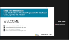
Since Time-Immemorial: A Look at the Rich Culture of Coast Salish Peoples and its Role at the Museum
https://search.heritageburnaby.ca/link/museumdescription18876
- Repository
- Burnaby Village Museum
- Date
- 20 Sep. 2022
- Collection/Fonds
- Burnaby Village Museum fonds
- Description Level
- Item
- Physical Description
- 1 video recording (mp4) (97 min., 15 sec.) : digital, col., sd., stereo ; 29 fps
- Scope and Content
- Item consists of a video recording of a live Zoom webinar hosted by Burnaby Village Museum Indigenous Education Programmer, Nicole Preissl. The webinar is titled "Since Time-Immemorial: A Look at the Rich Culture of Coast Salish Peoples and its Role at the Museum". The webinar is the third in a ser…
- Repository
- Burnaby Village Museum
- Collection/Fonds
- Burnaby Village Museum fonds
- Description Level
- Item
- Physical Description
- 1 video recording (mp4) (97 min., 15 sec.) : digital, col., sd., stereo ; 29 fps
- Material Details
- Host: Nicole Preissl
- Presenters: Carleen Thomas
- Date of Presentation: Tuesday, September 20, 2022. 7:00 pm - 8:00 pm
- Total Number of tracks: 1
- Total Length of all tracks: 97 min., 15 sec.
- Recording Device: Zoom video communication platform
- Original recording of 97 min., 15 sec. was edited to 88 min., 50 sec. for viewing on Heritage Burnaby
- Scope and Content
- Item consists of a video recording of a live Zoom webinar hosted by Burnaby Village Museum Indigenous Education Programmer, Nicole Preissl. The webinar is titled "Since Time-Immemorial: A Look at the Rich Culture of Coast Salish Peoples and its Role at the Museum". The webinar is the third in a series of six webinars presented in partnership by Burnaby Village Museum and Burnaby Public Library. The live webinar was also made available on the Burnaby Village Museum's facebook page. Community members were invited to participate by bringing questions during the interactive online sessions. In this webinar both Nicole Preissl and guest Carleeen Thomas make presentations. The webinar opens with an introduction by Nicole Preissl. Nicole shares her own Indigenous lineage and background; her educational background and experiences while a student at Emily Carr University; her interest in Indigenous materials practices and her role and experiences as Indigenous Education Programmer at the Burnaby Village Museum along with her ideas and goals for the future. Nicole supports her presentation with a slide show presentation regarding the evolution of the Indigenous Learning House on the site of the Burnaby Village Museum and the many transformations that it has gone through. Nicole shares her vision that is helping to transform the space further into a more inviting, learning and creative space for visitors and Indigenous peoples. Nicole also highlights the work that she’s been involved with to further develop educational programming and partnerships on site and her work to further develop the Indigenous Matriarch’s garden and the cedar grove area to include more Indigenous plants. Carleen provides information on the history of the Tsleil-Waututh Nation “People of the Inlet” and highlights information on land mapping that was created by the Nation during the Land Treaty process in 1980s; the many negative impacts to the Tsleil-Waututh Nation from contact and colonization; findings from archaeological investigations done in the Tsleil-Waututh territory that record village sites, seasonal camps and pictographs; stories associated with the Tsleil-Waututh Nation’s oral histories including the double-headed serpent; the impacts of contact and development including industrial logging; the many other challenges that the Tsleil-Waututh Nation have faced and the vision and goals for the future. Carleen describes many photographs of people and places in the presentation and provides important stories and oral histories that have been passed down through her family and nation for generations. Following the presentations Nicole and Carleen answer questions from the attendees and comment further on the information that they've shared.
- History
- Nicole Preissl is Stó:lo from Leq'á:mel First Nation as well as having ancestry from the Sḵwx̱wú7mesh First Nation and sq̓əc̓iy̓aɁɬ təməxʷ (Katzie) First Nation. On her mother's side she is third generation Canadian Settler with European Heritage. Nicole has a Bachelor of Arts Degree from Emily Carr University with a Major in Design and has been the Burnaby Village Museum Indigenous Education Programmer since 2022. Carleen Thomas is a Tsleil-Waututh Nation (TWN) member, elder, and current Special Projects Manager for the Treaty, Lands, and Resources department. She is the first Indigenous chancellor at Emily Carr University of Art and Design; educator; former TWN council member of 16 years; has chaired and been a representative on countless committees; and most significantly, grandmother of five amazing grandchildren. Carleen Thomas plays a vital role in her community and is a highly motivated and hardworking individual. Thomas obtained a Bachelors of Education from UBC and has deeply rooted knowledge of her culture and people. Carleen sites her grandparents: Hereditary Chief John L. George & Lillian “Dolly” George and her maternal Grandmother Caroline Thomas (nee: Joseph) as some of her key influences in life. Their teachings, unconditional love, and most of all, patience in guiding and preparing Carleen will last a lifetime. She has created a lasting mark for her family, community and for future generations of Indigenous, Coast Salish and Tsleil-Waututh families.
- Creator
- Burnaby Village Museum
- Subjects
- Indigenous peoples - British Columbia
- Indigenous peoples - British Columbia - Food
- Indigenous peoples - British Columbia - First contact with Europeans
- Indigenous peoples - British Columbia - Social life and customs
- Indigenous peoples - British Columbia - Art
- Indigenous peoples - British Columbia - Languages
- Indigenous peoples - Canada - , Treatment of
- Indigenous peoples - Indian Territory
- Plants
- Indigenous peoples - British Columbia - Rites and ceremonies
- Indigenous peoples - Canada - Government relations
- Indigenous peoples
- Names
- Burnaby Village Museum
- Preissl, Nicole
- Thomas, Carleen
- Sḵwx̱wú7mesh Nation
- Tsleil-Waututh Nation
- Accession Code
- BV022.27.3
- Date
- 20 Sep. 2022
- Media Type
- Moving Images
- Notes
- Title based on contents of item
Images

Video
Since Time-Immemorial: A Look at the Rich Culture of Coast Salish Peoples and its Role at the Museum, 20 Sep. 2022
Since Time-Immemorial: A Look at the Rich Culture of Coast Salish Peoples and its Role at the Museum, 20 Sep. 2022
https://search.heritageburnaby.ca/media/hpo/_Data/_BVM_Moving_Images/2022_0027_0003_002.mp4
Stepping over the barrier: Expanding Diversity at the Burnaby Village Museum
https://search.heritageburnaby.ca/link/museumdescription18877
- Repository
- Burnaby Village Museum
- Date
- 22 Sep. 2022
- Collection/Fonds
- Burnaby Village Museum fonds
- Description Level
- Item
- Physical Description
- 1 video recording (mp4) (91 min., 5 sec.) : digital, col., sd., stereo ; 29 fps
- Scope and Content
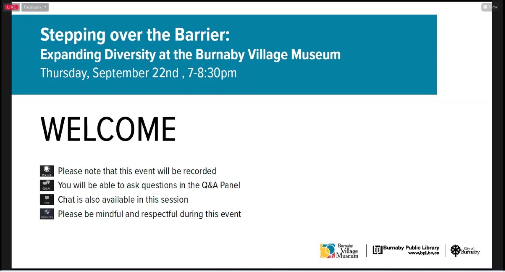
- Item consists of a video recording of a live Zoom webinar hosted by Burnaby Village Museum Curator, Jane Lemke with presentations and discussions by Megan Innes, Dr. Sharanjit Kaur Sandhra and Denise Fong. The webinar is titled "Stepping over the barrier: Expanding Diversity at the Burnaby Village…
- Repository
- Burnaby Village Museum
- Collection/Fonds
- Burnaby Village Museum fonds
- Description Level
- Item
- Physical Description
- 1 video recording (mp4) (91 min., 5 sec.) : digital, col., sd., stereo ; 29 fps
- Material Details
- Host: Jane Lemke
- Presenters: Meagan Innes; Dr. Sharanjit Kaur Sandhra; Denise Fong
- Date of Presentation: Tuesday, September 22, 2022. 7:00 pm - 8:00 pm
- Total Number of tracks: 1
- Total Length of all tracks: 91 min., 5 sec.
- Recording Device: Zoom video communication platform
- Original recording of 91 min., 5 sec.was edited to 79 min., 2 sec. for viewing on Heritage Burnaby
- Scope and Content
- Item consists of a video recording of a live Zoom webinar hosted by Burnaby Village Museum Curator, Jane Lemke with presentations and discussions by Megan Innes, Dr. Sharanjit Kaur Sandhra and Denise Fong. The webinar is titled "Stepping over the barrier: Expanding Diversity at the Burnaby Village Museum". The webinar is the fourth in a series of six webinars presented in partnership by Burnaby Village Museum and Burnaby Public Library. The live webinar was also made available on the Burnaby Village Museum's facebook page. Community members were invited to participate by bringing questions during the interactive online sessions. In this webinar speakers and host discuss what it takes to bring more diverse stories into the Burnaby Village Museum and explore the history of discriminatory practices and museological trends at the Burnaby Village Museum and other museums. Speakers highlight recent projects taking place at Burnaby Village Museum to ensure that other diverse stories of communities are being represented and told. Speakers each provide a ten minute presentation followed by discussions. The first speaker in the webinar is Meagan Innes. When talking about place, Meagan talks about her ancestral ties to certain places including the site where Burnaby Village Museum now stands and what it means to her Indigenous ancestors. Meagan shares stories from her grandfather John Cordocedo of the Sḵwx̱wú7mesh Nation and how her grandfather, her great grandfather and ancestors have lived, hunted, gathered and traveled on this land. Meagan talks about the work that she’s been involved with at the Burnaby Village Museum including the development of the Indigenous Learning House, the Matriarch’s Garden, the Indigenous History in Burnaby Resource Guide and development of Indigenous educational programing and projects. Meagan reflects on the collaboration and relationships that have developed during this work with Indigenous artists and Indigenous knowledge keepers. The second speaker in the webinar is Dr. Sharanjit Kaur Sandhra “Sharn”. Sharn's presentation is titled “From Orientalism and Colonialism to hope and future possibility”. Sharn speaks of her personal experience visiting the Burnaby Village Museum’s Chinese herbalist exhibit with her son and his school in 2019. Sharn expresses the racist impressions that she witnessed from the young students who visited the exhibit and her reaction re-visiting the exhibit in 2021 after the exhibit was revitalized. Sharn describes the much more positive aspects of the revitalized exhibit which transformed it from “Nostalgic Colonialism” to a place of meaningful belonging for racialized communities that includes faces and personal stories. Sharn looks forward to being a part of Burnaby’s next venture which looks at the history of Burnaby’s South Asian Canadian Community and shares some of her research while working on this project. The third speaker in the webinar is Denise Fong. Denise’s presentation is titled “Chinese Canadian History in Burnaby”. Denise provides some background regarding her work as a researcher working for the City of Burnaby. Denise takes us on a journey of her research in compiling non white experiences in Burnaby as well as uncovering personal stories from Burnaby families living and working in Burnaby. Denise points out discriminatory practices within Burnaby including the Chinese and Japanese Exclusion Bylaw in 1892 and the history of Chinese immigration to Canada including the Chinese Head Tax. Denise reflects on her own work, the work of students from UBC and volunteers from the Chinese Canadian History Advisory committee in building relationships with Chinese Canadian families within Burnaby to obtain stories and family records. Denise points out the various projects that these relationships and research have contributed to including; Heritage interpretive plaques installed at the Riverway Golf Course and in the Big Bend area of Burnaby, an award winning exhibit at Burnaby Village Museum “Across the Pacific”, new Chinese Canadian resources available on “Heritage Burnaby”, the revitalization of the Chinese Herbalist shop exhibit “Way Sang Yuen Wat Kee and Co.” at Burnaby Village Museum, the Chinese Market Garden at Burnaby Village Museum, the creation of a "Burnaby Farm Tour" map highlighting Chinese farms in the Big Bend area and a publication titled "Chinese Canadian History in Burnaby Resource Guide". Following the presentations, host Jane Lemke enters a conversation with Dr. Sharanjit Kaur Sandhra and Denise Fong. Jane intiates the conversations with questions regarding further work that is necessary for Burnaby Village Museum and other museums to move forward in readdressing the narratives beyond white colonial settler perspectives to include stories of marginalized and racialized people who are under represented and often forgotten.
- History
- Jane Lemke has worked in various museums in the Lower Mainland and has been the Curator at Burnaby Village Museum since 2019. Her educational background includes a Master of Arts degree in History and a Master of Museum Studies degree. Her research focus has been on trauma and memory and its role in shaping Canadian identity. She loves sharing memories and stories of Burnaby with the public. Jane sits on the Council of the BC Museums Association and is the Chair of the BC Museums Association Professional Development and Education Committee.
- Meagan Innes is from Xwmélts'tstn úxwumixw (Capilano Village). She is a Sḵwx̱wú7mesh First Nation Educator and a multidisciplinary Artist. Meagan completed her Masters of Education around examining connection to place, kinship and to spén´em (plant) s7ek_w’í7tel (siblings) pén´em (plant things). She is an emerging artist who is waking up her Ancestral skills and practicing the ways of her Ancestors. She is exploring reshaping pedagogy to embody traditional ways of knowing and being, more specifically Sḵwx̱wú7mesh traditional ways of learning, knowing and being. She had recently completed the First Nations Language Program at Simon Fraser University to become a Sḵwx̱wú7mesh langauge speaker which is the language of her Ancestors.
- Dr. Sharanjit Kaur Sandhra (Sharn) is Coordinator of the South Asian Studies Institute at the University of the Fraser Valley, co-curator of exhibits at the Sikh Heritage Museum, located in the National Historic Site Gur Sikh Temple in Abbotsford, BC, and a sessional faculty in the Department of History at UFV. Sharn’s PhD looks at the affective experiences of racialized museum visitors through a critical race theory lens. She’s a passionate activist, building bridges between community and academia through museum work. She is a past member of the BC Museums Association, and currently a Director with the Pacific Canada Heritage Centre - Museum of Migration.
- Denise Fong is a historical researcher with the City of Burnaby and Ph.D. candidate at the University of British Columbia. Her research focuses on Chinese Canadian identity and meaning making in heritage spaces. Since 2009, Denise has coordinated a number of historical research and public history projects, including SFU’s From C to C: Chinese Canadian Stories of Migration and UBC’s Chinese Canadian Stories: Uncommon Histories from a Common Past. She co-curated two award-winning Chinese Canadian exhibitions locally — Burnaby Village Museum’s Across the Pacific exhibition and the Chinese Canadian Museum of BC/Museum of Vancouver’s A Seat at the Table exhibition. She is a UBC Public Scholar and currently serves as the research director for UBC's Initiative for Student Teaching and Research in Chinese Canadian Studies
- Creator
- Burnaby Village Museum
- Subjects
- Indigenous peoples
- Indigenous peoples - British Columbia
- Indigenous peoples - British Columbia - Food
- Indigenous peoples - British Columbia - First contact with Europeans
- Indigenous peoples - British Columbia - Social life and customs
- Indigenous peoples - British Columbia - Art
- Indigenous peoples - British Columbia - Languages
- Indigenous peoples - Canada - , Treatment of
- Plants
- Persons - Chinese Canadians
- Persons - South Asian Canadians
- Buildings - Civic - Museums
- Social Issues - Racism
- Names
- Burnaby Village Museum
- Fong, Denise
- Innes, Meagan
- Sḵwx̱wú7mesh Nation
- Sandhra, Sharanjit Kaur "Sharn" Dr.
- Responsibility
- Lemke, Jane
- Accession Code
- BV022.27.4
- Date
- 22 Sep. 2022
- Media Type
- Moving Images
- Notes
- Title based on contents of item
Images
Video
Stepping over the barrier: Expanding Diversity at the Burnaby Village Museum, 22 Sep. 2022
Stepping over the barrier: Expanding Diversity at the Burnaby Village Museum, 22 Sep. 2022
https://search.heritageburnaby.ca/media/hpo/_Data/_BVM_Moving_Images/2022_0027_0004_002.mp4
Weaving and Learning through Art
https://search.heritageburnaby.ca/link/museumdescription15668
- Repository
- Burnaby Village Museum
- Date
- 11 May 2021
- Collection/Fonds
- Burnaby Village Museum fonds
- Description Level
- Item
- Physical Description
- 1 video recording (mp4) (76 min., 47 sec.) : digital, col., sd., stereo ; 29 fps
- Scope and Content
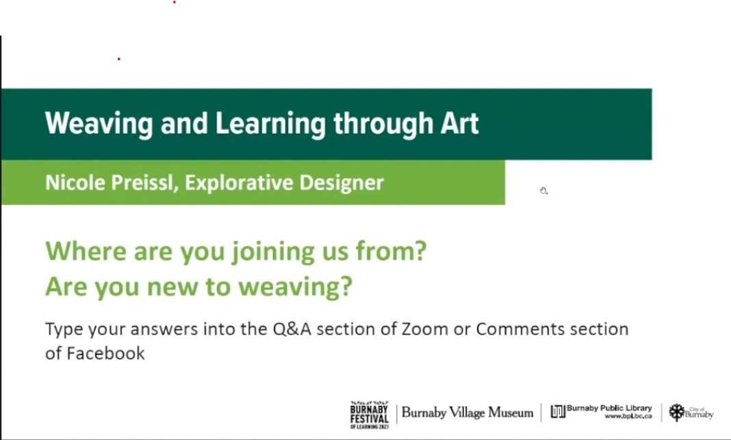
- Item consists of a video recording of a live Zoom webinar hosted by Burnaby Village Museum Assistant Curator, Kate Petrusa. The webinar is titled "Weaving and Learning through Art" and is presented by Nicole Preissl, Explorative Designer of Sḵwx̱wú7mesh and Stó:lō decent. The Zoom webinar is the f…
- Repository
- Burnaby Village Museum
- Collection/Fonds
- Burnaby Village Museum fonds
- Description Level
- Item
- Physical Description
- 1 video recording (mp4) (76 min., 47 sec.) : digital, col., sd., stereo ; 29 fps
- Material Details
- Presenter: Nicole Preissl
- Host: Kate Petrusa
- Date of Presentation: Tuesday, May 11, 7:00 pm - 8:15 pm
- Total Number of tracks: 1
- Total Length of all tracks: min., sec.
- Recording Device: Zoom video communication platform
- Recording Note: Film was edited from it's original recorded version (90 min., 05 sec.) to edited version (76 min., 47 sec.) for public viewing on Heritage Burnaby.
- Scope and Content
- Item consists of a video recording of a live Zoom webinar hosted by Burnaby Village Museum Assistant Curator, Kate Petrusa. The webinar is titled "Weaving and Learning through Art" and is presented by Nicole Preissl, Explorative Designer of Sḵwx̱wú7mesh and Stó:lō decent. The Zoom webinar is the fifth in a series of six "Neighbourhood Speaker series" webinars exploring a range of topics shared by Indigenous speakers and knowledge keepers that were presented and made available to the public between April 27 and May 12, 2021. The live webinar was also made available on the Burnaby Village Museum's facebook page. Community members were invited to participate by bringing questions during the interactive online session. Nicole supports her presentation with slides and provides a hands on demonstration on weaving. Prior to the webinar, participants were offered materials that were prepared and made available from Burnaby Village Museum. In this interactive webinar, Nicole Preissl, explores the importance of plants within Coast Salish culture and demonstrates the traditional technique of rope-making. In the first part of her presentation, Nicole provides examples of indigenous plants and trees that grow in British Columbia and shares information on thier historical and cultural significance, medicinal and edible properties and how to identify them. Nicole also shares her own experiences and appreciation for natural materials and provides examples of her artwork. In the second half of Nicole's presentation participants are invited to join her demonstration in learning basic weaving techniques. Nicole provides two hands-on demonstrations to follow, one with yarn and one with iris leaves. During and follwing the presentation, Nicole Preissl takes questions from the audience that are moderated by the host, Kate Petrusa.
- History
- Nicole Preissl is an explorative designer who uses natural materials to influence her work. From both Sḵwx̱wú7mesh and Stó:lō decent, she began introducing traditional artistic customs into her practice as a means of connecting to her culture. In her art practice she uses natural fibres and materials to create textile based designs. Her areas of interest are natural plant dyes, weaving Coast Salish style garments and using raw hide to create thought provoking design pieces.
- Creator
- Burnaby Village Museum
- Subjects
- Indigenous peoples - British Columbia - Social life and customs
- Indigenous peoples - British Columbia
- Indigenous peoples - British Columbia - Art
- Plants
- Plants - Flowers
- Plants - Trees
- Indigenous peoples - British Columbia - Baskets
- Indigenous peoples - Implements
- Indigenous peoples - Clothing
- Responsibility
- Petrusa, Kate
- Accession Code
- BV021.17.5
- Access Restriction
- No restrictions
- Reproduction Restriction
- No known restrictions
- Date
- 11 May 2021
- Media Type
- Moving Images
- Notes
- Title based on content of video recording
Images
Video
Weaving and Learning through Art, 11 May 2021
Weaving and Learning through Art, 11 May 2021
https://search.heritageburnaby.ca/media/hpo/_Data/_BVM_Moving_Images/2021_0017_0005_002.mp4
Map of South Western Part of British Columbia
https://search.heritageburnaby.ca/link/museumdescription8688
- Repository
- Burnaby Village Museum
- Date
- 1897
- Collection/Fonds
- Burnaby Village Museum Map collection
- Description Level
- Item
- Physical Description
- 1 map : col. ink on paper ; 68 x 88 cm
- Scope and Content
- Item consists of a "MAP OF THE SOUTH-WESTERN PART OF BRITISH COLUMBIA”. Map identifies geographic land districts of New Westminster District; Coast District; Lillooet District; Yale District, Kamloops Division, Yale Division and districts on Vancouver Island. Map also includes the northern portions…
- Repository
- Burnaby Village Museum
- Collection/Fonds
- Burnaby Village Museum Map collection
- Description Level
- Item
- Physical Description
- 1 map : col. ink on paper ; 68 x 88 cm
- Material Details
- Scale [1:633600]
- Scope and Content
- Item consists of a "MAP OF THE SOUTH-WESTERN PART OF BRITISH COLUMBIA”. Map identifies geographic land districts of New Westminster District; Coast District; Lillooet District; Yale District, Kamloops Division, Yale Division and districts on Vancouver Island. Map also includes the northern portions of the State of Washington below the 49th parallel.
- Publisher
- The Colonist Litho Victoria B.C.
- Responsibility
- Martin, George Bohun
- Accession Code
- BV993.12.12
- Access Restriction
- No restrictions
- Reproduction Restriction
- No known restrictions
- Date
- 1897
- Media Type
- Cartographic Material
- Scan Resolution
- 600
- Scan Date
- 2023-08-17
- Notes
- Transcribed title
- Scale equals 1 inch to 10 miles
- "Compiled and drawn by direction of the Honouable G.B. Martin, Chief Commissioner of Lands and Works, Victoria, B.C."
- Signed by Surveyor General "Tom Kains"
Zoomable Images

![Highways map of British Columbia, Alberta and adjacent states, [1930] thumbnail](/media/hpo/_Data/_BVM_Cartographic_Material/1977/1977_0037_0187_001.jpg?width=280)
Highways map of British Columbia, Alberta and adjacent states
https://search.heritageburnaby.ca/link/museumdescription9668
- Repository
- Burnaby Village Museum
- Date
- [1930]
- Collection/Fonds
- Burnaby Village Museum Map collection
- Description Level
- Item
- Physical Description
- 1 map : col. lithographic print ; both sides ; 89.5 x 58 cm, folded to 11.5 x 20 cm
- Scope and Content
- Double sided road map published by Imperial Oil, Ltd. and featuring the main travelled highway routes of British Columbia, Alberta and the Northwestern-most states of the United States of America. The map is a colour lithograph. The main map is green, with the highways highlighted in red. The litho…
- Repository
- Burnaby Village Museum
- Collection/Fonds
- Burnaby Village Museum Map collection
- Description Level
- Item
- Physical Description
- 1 map : col. lithographic print ; both sides ; 89.5 x 58 cm, folded to 11.5 x 20 cm
- Material Details
- Scale 1 inch = 20 miles
- A.R. THOMSON / CHIEF CARTOGRAPHER
- Scope and Content
- Double sided road map published by Imperial Oil, Ltd. and featuring the main travelled highway routes of British Columbia, Alberta and the Northwestern-most states of the United States of America. The map is a colour lithograph. The main map is green, with the highways highlighted in red. The lithograph was created in Canada by Rolph Clark Stone Ltd in Toronto. The opposite side of the map features inset maps of the following: the Trans-Canada Highway, the highway between Prince Rupert and Prince George, the highway through the Canadian Rockies, and the highway through the Peace River District. Small city plan maps of highways through major cities, as well as advertisements for Imperial Oil products, are also found on the opposite side of the main map. This map is one of four produced by Imperial Oil that covered the most populated areas of Canada from coast to coast and paralleled Imperial Oil's distribution service.
- Creator
- Thomson, A.R.
- Publisher
- Imperial Oil Limited
- Accession Code
- HV977.37.187
- Access Restriction
- No restrictions
- Reproduction Restriction
- No known restrictions
- Date
- [1930]
- Media Type
- Cartographic Material
- Scan Resolution
- 600
- Scan Date
- 2023-11-10
- Notes
- Title based on content of map
Zoomable Images
![Highways map of British Columbia, Alberta and adjacent states, [1930] thumbnail](/media/hpo/_Data/_BVM_Cartographic_Material/1977/1977_0037_0187_003_seadragon/1977_0037_0187_003.jpg?w=280)


Sketch map of the Province of British Columbia showing mining divisions
https://search.heritageburnaby.ca/link/museumdescription18946
- Repository
- Burnaby Village Museum
- Date
- 1907
- Collection/Fonds
- Burnaby Village Museum Map collection
- Description Level
- Item
- Physical Description
- 1 map : col. lithographic print on paper ; 52 x 59 cm
- Scope and Content
- Item consists of a map titled "Sketch map of the Province of / British Columbia / Showing Mining Divisions"; "Department of Mines, / Victoria, 1907". Map includes wagon roads and trails and geographic disticts.
- Repository
- Burnaby Village Museum
- Collection/Fonds
- Burnaby Village Museum Map collection
- Description Level
- Item
- Physical Description
- 1 map : col. lithographic print on paper ; 52 x 59 cm
- Material Details
- Scale not determinable
- Scope and Content
- Item consists of a map titled "Sketch map of the Province of / British Columbia / Showing Mining Divisions"; "Department of Mines, / Victoria, 1907". Map includes wagon roads and trails and geographic disticts.
- Accession Code
- HV977.37.172
- Access Restriction
- No restrictions
- Reproduction Restriction
- No known restrictions
- Date
- 1907
- Media Type
- Cartographic Material
- Scan Resolution
- 600
- Scan Date
- 2023-08-17
- Notes
- Title based on contents of map
- Stamp on verso of map reads: "Compliments of Vancouver Tourist Bureau"
Zoomable Images


Bringing Visibility to the Land: A Tsleil-Waututh Perspective on Community Building
https://search.heritageburnaby.ca/link/museumdescription15665
- Repository
- Burnaby Village Museum
- Date
- 27 Apr. 2021
- Collection/Fonds
- Burnaby Village Museum fonds
- Description Level
- Item
- Physical Description
- 1 video recording (mp4) (47 min., 39 sec.) : digital, col., sd., stereo ; 29 fps
- Scope and Content
- Item consists of a video recording of a live Zoom webinar hosted by Burnaby Village Museum Curator, Jane Lemke. The webinar is titled "Bringing Visibility to the Land: A Tsleil-Waututh Perspective on Community Building" and is presented by Michelle George, Tsleil-Waututh Nation Cultural and Technic…
- Repository
- Burnaby Village Museum
- Collection/Fonds
- Burnaby Village Museum fonds
- Description Level
- Item
- Physical Description
- 1 video recording (mp4) (47 min., 39 sec.) : digital, col., sd., stereo ; 29 fps
- Material Details
- Presenters: Michelle George
- Host: Jane Lemke
- Date of Presentation: Tuesday, April 27, 7:00 pm - 8:00 pm
- Total Number of tracks: 1
- Total Length of all tracks: 47 min., 39 sec.
- Recording Device: Zoom video communication platform
- Recording Note: Film was edited from it's original recorded version (63 min., 29 sec.) to edited version (47 min., 39 sec.) for public viewing on Heritage Burnaby
- Scope and Content
- Item consists of a video recording of a live Zoom webinar hosted by Burnaby Village Museum Curator, Jane Lemke. The webinar is titled "Bringing Visibility to the Land: A Tsleil-Waututh Perspective on Community Building" and is presented by Michelle George, Tsleil-Waututh Nation Cultural and Technical Specialist. The Zoom webinar is the first in a series of six "Neighbourhood Speaker series" webinars exploring a range of topics shared by Indigenous speakers and knowledge keepers that were presented and made available to the public between April 27 and May 12, 2021. The live webinar was also made available on the Burnaby Village Museum's facebook page. Community members were invited to participate by bringing questions during the interactive online sessions. In this webinar, Michelle George explores the importance of bringing Tsleil-Waututh ways of knowing/knowledge of the land to Burnaby. She grounds her talk with her experience of working with the Burnaby Village Museum on producing the Indigenous History of Burnaby Resource Guide, an award-winning illustrated educational guide. Michelle also speaks to some of the devastating experiences that the Tsleil-Waututh Nation and Indigenous Peoples have suffered since Colonial Settlement and how her Nation has begun to grow in a changing environment. In segments of her talk, Michelle refers to a map titled "Tsleil-Waututh Nation Consultation Area". Following the presentation, Michelle George answers questions from the audience that are moderated by the host, Jane Lemke.
- History
- Michelle George is a member of the Tsleil-Waututh Nation (TWN) and currently works as a Tsleil-Waututh Nation Cultural and Technical Specialist for the Treaty, Lands and Resources (TLR) Department. She participates in various projects for the TWN government and community, focusing on Tsleil-Waututh Governance and Community. The goals that she carries in her work are to make sure Tsleil-Waututh culture is included and considered in these Nation-level projects, as well as within the reviews done on external projects within the TWN Consultation area. She has been a member of both the Tsleil-Waututh Land Code Committee and Land Use Planning group. Michelle is also a First Nations Health Authority Traditional Knowledge Keeper, and a past-Elected Councilor for Tsleil-Waututh Nation. Michelle also provides guest lectures at Simon Fraser University, Langara College, and the BC Institute of Technology.
- Creator
- Burnaby Village Museum
- Subjects
- Indigenous peoples - British Columbia
- Indigenous peoples - Canada - Government relations
- Indigenous peoples - British Columbia - Languages
- Indigenous peoples - Canada - , Treatment of
- Indigenous peoples - British Columbia - First contact with Europeans
- Names
- Burnaby Village Museum
- Burnaby Public Library
- George, Michelle
- Tsleil-Waututh Nation
- George, Chief Daniel "Dan"
- Responsibility
- Lemke, Jane
- Geographic Access
- Burrard Inlet
- Accession Code
- BV021.17.1
- Access Restriction
- No restrictions
- Reproduction Restriction
- No known restrictions
- Date
- 27 Apr. 2021
- Media Type
- Moving Images
- Notes
- Title based on contents of video recording
Images

Video
Bringing Visibility to the Land: A Tsleil-Waututh Perspective on Community Building, 27 Apr. 2021
Bringing Visibility to the Land: A Tsleil-Waututh Perspective on Community Building, 27 Apr. 2021
https://search.heritageburnaby.ca/media/hpo/_Data/_BVM_Moving_Images/2021_0017_0001_002.mp4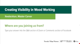
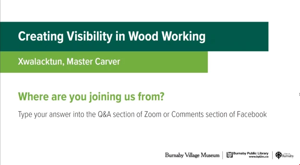
Creating Visibility in Wood Working
https://search.heritageburnaby.ca/link/museumdescription15667
- Repository
- Burnaby Village Museum
- Date
- 6 May 2021
- Collection/Fonds
- Burnaby Village Museum fonds
- Description Level
- Item
- Physical Description
- 1 video recording (mp4) (50 min., 03 sec.) : digital, col., sd., stereo ; 29 fps
- Scope and Content
- Item consists of a video recording of a live Zoom webinar hosted by Burnaby Village Museum curator, Jane Lemke. The webinar is titled "Creating Visibility in Wood Working" and is presented by Xwalacktun, OBC, Master Carver of the Sḵwx̱wú7mesh Nation. The Zoom webinar is the fourth in a series of si…
- Repository
- Burnaby Village Museum
- Collection/Fonds
- Burnaby Village Museum fonds
- Description Level
- Item
- Physical Description
- 1 video recording (mp4) (50 min., 03 sec.) : digital, col., sd., stereo ; 29 fps
- Material Details
- Presenter: Xwalacktun
- Host: Jane Lemke
- Date of Presentation: Thursday, May 6, 7:00 pm - 8:00 pm
- Total Number of tracks: 1
- Total Length of all tracks: 50 min., 03 sec.
- Recording Device: Zoom video communication platform
- Recording Note: Film was edited from it's original recorded version (66 min., 53 sec.) to edited version (50 min., 03 sec.) for public viewing on Heritage Burnaby.
- Scope and Content
- Item consists of a video recording of a live Zoom webinar hosted by Burnaby Village Museum curator, Jane Lemke. The webinar is titled "Creating Visibility in Wood Working" and is presented by Xwalacktun, OBC, Master Carver of the Sḵwx̱wú7mesh Nation. The Zoom webinar is the fourth in a series of six "Neighbourhood Speaker series" webinars exploring a range of topics shared by Indigenous speakers and knowledge keepers that were presented and made available to the public between April 27 and May 12, 2021. The live webinar was also made available on the Burnaby Village Museum's facebook page. Community members were invited to participate by bringing questions during the interactive online sessions. In this webinar, viewers join Xwalacktun as he tours his studio, sharing the tools and processes of carving. Xwalacktun shares photographs detailing the long process of turning a twelve foot-tall tree into a house post for his recently completed installation in the Diamond Family Courtyard of Vancouver General Hospital. At the beginning of the presentation, Xwalacktun shares a welcome song from the late Chief Cie Baker. Following the presentation, Xwalacktun takes questions from the audience that are moderated by the host, Jane Lemke.
- History
- Xwalacktun (born Rick Harry) is a Sḵwx̱wú7mesh Nation artist whose works are recognized internationally. He was given his name by his father, a Hereditary Chief from the Seymour Creek area. From 1978 to 1982, Xwalacktun attended Emily Carr University of Art and Design in Vancouver, BC, and graduated with a degree in sculpture. Xwalacktun is a recipient of the Queen Elizabeth II Diamond Jubilee Medal and the Order of British Columbia (O.B.C.) for his many contributions to various communities. Xwalacktun is an accomplished artist in wood, paper, stone, glass and metals and his work can be seen around the Lower Mainland region. Xwalacktun's biography can also be found on his website: www.xwalacktun.ca
- Subjects
- Indigenous peoples - British Columbia
- Indigenous peoples - British Columbia - Art
- Indigenous wood-carving - Totem poles
- Indigenous peoples - British Columbia - Rites and ceremonies
- Indigenous peoples - Implements
- Accession Code
- BV021.17.4
- Access Restriction
- No restrictions
- Reproduction Restriction
- No known restrictions
- Date
- 6 May 2021
- Media Type
- Moving Images
- Notes
- Title based on content of video recording The following link was shared at the end of the presentation: Xwalacktun’s website: https://www.xwalacktun.ca/
Images
Video
Creating Visibility in Wood Working, 6 May 2021
Creating Visibility in Wood Working, 6 May 2021
https://search.heritageburnaby.ca/media/hpo/_Data/_BVM_Moving_Images/2021_0017_0004_002.mp4
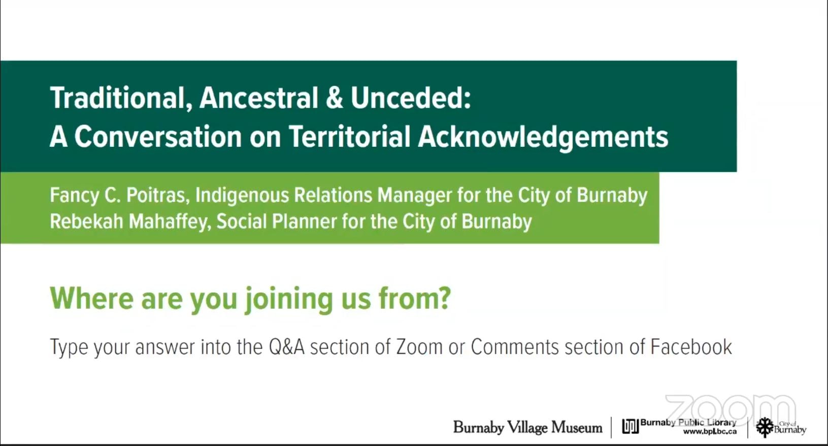
Traditional, Ancestral & Unceded: A Conversation on Territorial Acknowledgements
https://search.heritageburnaby.ca/link/museumdescription15664
- Repository
- Burnaby Village Museum
- Date
- 29 Apr. 2021
- Collection/Fonds
- Burnaby Village Museum fonds
- Description Level
- Item
- Physical Description
- 1 video recording (mp4) (87 min., 17 sec.) : digital, col., sd., stereo ; 29 fps
- Scope and Content
- Item consists of a video recording of a live Zoom webinar hosted by Burnaby Village Museum curator, Jane Lemke. The webinar is titled "Traditional, Ancestral & Unceded: A Conversation on Territorial Acknowledgements" and is presented by Fancy Poitras, Indigenous Relations Manager for the City of Bu…
- Repository
- Burnaby Village Museum
- Collection/Fonds
- Burnaby Village Museum fonds
- Description Level
- Item
- Physical Description
- 1 video recording (mp4) (87 min., 17 sec.) : digital, col., sd., stereo ; 29 fps
- Material Details
- Presenters: Fancy Poitras and Rebekah Mahaffey
- Host: Jane Lemke
- Date of Presentation: Thursday, April 29, 7:00 pm - 8:30 pm
- Total Number of tracks: 1
- Total Length of all tracks: 87 min., 17 sec.
- Recording Device: Zoom video communication platform
- Recording Note: Film was edited from it's original recorded version (95 min., 34 sec.) to edited version (87 min., 17 sec.) for public viewing on Heritage Burnaby. This live recording experienced technical difficulties with the viewer window during the first few minutes of the presentation. This is resolved at 15:36.
- Scope and Content
- Item consists of a video recording of a live Zoom webinar hosted by Burnaby Village Museum curator, Jane Lemke. The webinar is titled "Traditional, Ancestral & Unceded: A Conversation on Territorial Acknowledgements" and is presented by Fancy Poitras, Indigenous Relations Manager for the City of Burnaby and Rebekah Mahaffey, Social Planner for the City of Burnaby. The Zoom webinar is the second in a series of six "Neighbourhood Speaker series" webinars exploring a range of topics shared by Indigenous speakers and knowledge keepers that were presented and made available to the public between April 27 and May 12, 2021. The live webinar was also made available on the Burnaby Village Museum's facebook page. Community members were invited to participate by bringing questions during the interactive online sessions. The webinar opens with host, Jane Lemke providing a Land Acknowlegement "The land on which Burnaby now sits is the ancestral and unceded homelands of the hən̓q̓əmin̓əm and Sḵwx̱wú7mesh speaking peoples". Jane explains that providing a land acknowledgement is part of the City of Burnaby's official policy and that the land is on the shared territory of many Nations including the sq̓əc̓iy̓aɁɬ təməxʷ (Katzie), Kway-quit-lum, Kwantlen, ʷməθkʷəy̓əm (Musqueam), Sḵwx̱wú7mesh, and Tsleil-Waututh Nations. Understanding the definitions of language groups, Nations, shared territory and many of the importance words form a basis of the subject matter for this webinar. Fancy Poitras and Rebekah Mahaffey enter a discussion exploring this topic while posing thought provoking questions to each other. As Burnaby's Indigenous Relations Manager, Fancy Poitras conveys her own experiences and knowledge while providing historical references and recommendations for further educational resources around territorial land acknowledgment. Following their discussion, Fancy and Rebekah take questions from the audience that are moderated by the host, Jane Lemke.
- History
- Fancy Poitras was hired as the City of Burnaby's first Indigenous Relations Manager in 2021. Prior to her role, she worked for the First Nations Health Authority for more than five years, first as a Senior Policy Analyst, then as the Manager and Acting Director of Strategic Policy; throughout her time with FNHA, she worked on an extensive portfolio of health and wellness, and service design and delivery issues, including primary care, cancer, seniors and elders. Fancy has a Master’s degree in Public Policy and a Post-Baccalaureate Diploma in Social Policy Issues from Simon Fraser University, and a Bachelor of Arts in Political Science from University of Alberta. Fancy is a member of Mikisew Cree First Nation, Treaty 8 territory, and she grew up primarily in the Northwest Territories. Rebekah Mahaffey (she, her, hers) is a Social Policy Planner at the City of Burnaby. She is a settler on these lands, and is of mixed French-Scottish-Irish ancestry. She grew up in Indonesia, Libya and England and has called the west coast home for almost 15 years. Rebekah has degrees in International Development, Art History and Urban Planning. In her work she focuses on inter-culturalism, access and inclusion, anti-racism, and working with Burnaby’s 2SLGBTQQIA community. When not at work, she enjoys hiking, reading, and listening to podcasts. She lives in Vancouver with her young child.
- Creator
- Burnaby Village Museum
- Subjects
- Indigenous peoples - British Columbia
- Indigenous peoples - Canada - Government relations
- Indigenous peoples - British Columbia - Languages
- Indigenous peoples - Canada - , Treatment of
- Responsibility
- Lemke, Jane
- Accession Code
- BV021.17.2
- Access Restriction
- No restrictions
- Reproduction Restriction
- No known restrictions
- Date
- 29 Apr. 2021
- Media Type
- Moving Images
- Notes
- Title based on contents of video recording The following links wereshared at the end of the presentation:
- My Conversations with Canadians by Lee Maracle: https://bookhugpress.ca/shop/ebooks/essays-ebooks/conversations-with-canadians-by-lee-maracle/
- 21 Things You May Not Know About the Indian Act by Bob Joseph: https://www.ictinc.ca/books/21-things-you-may-not-know-about-the-indian-act
- CBC documentary series 8th Fire: https://www.cbc.ca/firsthand/blog/8th-fire-wabs-walk-through-history ‘Whose Land’ App: https://apps.apple.com/ca/app/whose-land/id1350310353
- “Unreserved” Podcast, Episode: January 20, 2019, ‘Hayden King’: https://www.cbc.ca/radio/unreserved/redrawing-the-lines-1.4973363/i-regret-it-hayden-king-on-writing-ryerson-university-s-territorial-acknowledgement-1.4973371
- Guidelines for Indigenous Territory Acknowledgement http://www.burnaby.ca/Assets/Burnaby+Interagency/Guidelines+for+Indigenous+Territory+Acknowledgement.pdf
- United Nations Declaration on the Rights of Indigenous Peoples: https://www.un.org/development/desa/indigenouspeoples/declaration-on-the-rights-of-indigenous-peoples.html
- Truth and Reconciliation Commission Calls to Action: http://trc.ca/assets/pdf/Calls_to_Action_English2.pdf
- Missing and Murdered Indigenous Women and Girls Calls for Justice: https://www.mmiwg-ffada.ca/wp-content/uploads/2019/06/Calls_for_Justice.pdf
Images
Video
Traditional, Ancestral & Unceded: A Conversation on Territorial Acknowledgements, 29 Apr. 2021
Traditional, Ancestral & Unceded: A Conversation on Territorial Acknowledgements, 29 Apr. 2021
https://search.heritageburnaby.ca/media/hpo/_Data/_BVM_Moving_Images/2021_0017_0002_002.mp4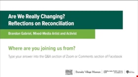
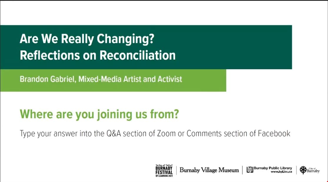
Are we really changing? Reflections on Reconciliation
https://search.heritageburnaby.ca/link/museumdescription15669
- Repository
- Burnaby Village Museum
- Date
- 12 May 2021
- Collection/Fonds
- Burnaby Village Museum fonds
- Description Level
- Item
- Physical Description
- 1 video recording (mp4) (91 min., 26 sec.) : digital, col., sd., stereo ; 29 fps
- Scope and Content
- Item consists of a video recording of a live Zoom webinar hosted by Burnaby Village Museum Curator, Jane Lemke. The webinar is titled "Are We Really Changing? Reflections on Reconciliation" and is presented by Brandon Gabriel, visual arts from the Kwantlen First Nation. The Zoom webinar is the sixt…
- Repository
- Burnaby Village Museum
- Collection/Fonds
- Burnaby Village Museum fonds
- Description Level
- Item
- Physical Description
- 1 video recording (mp4) (91 min., 26 sec.) : digital, col., sd., stereo ; 29 fps
- Material Details
- Presenter: Brandon Gabriel
- Host: Jane Lemke
- Date of Presentation: Wednesday, May 12, 7:00 pm - 8:30 pm
- Total Number of tracks: 1
- Total Length of all tracks: min., sec.
- Recording Device: Zoom video communication platform
- Recording Note: Film was edited from it's original recorded version (92 min., 31 sec.) to edited version (91 min., 26 sec.) for public viewing on Heritage Burnaby.
- Scope and Content
- Item consists of a video recording of a live Zoom webinar hosted by Burnaby Village Museum Curator, Jane Lemke. The webinar is titled "Are We Really Changing? Reflections on Reconciliation" and is presented by Brandon Gabriel, visual arts from the Kwantlen First Nation. The Zoom webinar is the sixth in a series of six "Neighbourhood Speaker Series" webinars exploring a range of topics shared by Indigenous speakers and knowledge keepers that were presented and made available to the public between April 27 and May 12, 2021. The live webinar was also made available on the Burnaby Village Museum's facebook page. Community members were invited to participate by bringing questions and comments during the interactive online sessions. In this webinar, Brandon supports his presentation with slides and explores the following questions; If we have not changed the way we introduce ourselves to each other and this land then what are we reconciling?" and "If resource exploitation, racism and colonization continue today, how can we change?" Brandon Gabriel, mixed-media artist and activist, looks back at some highlights of his twenty seven year artistic journey and shares what you can do to tackle reconciliation in your own life. Brandon presents counter narratives speaking to the importance of: Land; Languages; Colonial Annihilation and Indigenous Resurgence. Brandon pauses half way through his presentation to ask and reflect on the question "How far back do you know your ancestors on your mother's side?". While listeners are reflecting, Brandon shares a recording of Dennis Leon of Kwantlen First Nation performing the song “True Love”. Following this, Brandon takes questions from the audience and comments on the importance of matriarchal lineage in indigenous culture. In the second half of the presentation, Brandon talks about his own art and shares examples of Indigenous artists work including: Bill Reid, Zacharias Kunuk, Marianne Nicholson; Brian Jungan and Rebecca Bellmore. Following the presentation, Brandon Gabriel takes questions from the audience that are moderated by the host, Jane Lemke.
- History
- Brandon Gabriel is an award winning, and Internationally recognized visual artist from the Kwantlen First Nation, in unceded Fort Langley B.C. Brandon was educated at Kwantlen Polytechnic University (1999-2003) and at Emily Carr University of Art and Design (2003-2006). Brandon has over twenty seven years of professional experience as a designer, wood carver, mixed media sculptor, graphic designer, illustrator, and educator. He has exhibited works in the United Kingdom, Hong Kong, South America, the USA, and across Canada.
- Creator
- Burnaby Village Museum
- Subjects
- Indigenous peoples - British Columbia
- Indigenous peoples - British Columbia - Art
- Indigenous peoples - Canada - Government relations
- Indigenous peoples - Canada - , Treatment of
- Responsibility
- Lemke, Jane
- Accession Code
- BV021.17.6
- Access Restriction
- No restrictions
- Reproduction Restriction
- No known restrictions
- Date
- 12 May 2021
- Media Type
- Moving Images
- Notes
- Title based on content of video recording The following link was shared at the end of the presentation: Kwantlen First Nation: https://www.kwantlenfn.ca/
Images
Video
Are we really changing? Reflections on Reconciliation, 12 May 2021
Are we really changing? Reflections on Reconciliation, 12 May 2021
https://search.heritageburnaby.ca/media/hpo/_Data/_BVM_Moving_Images/2021_0017_0006_002.mp4
Municipality of Burnaby - Volume XV and Volume XVIII
https://search.heritageburnaby.ca/link/museumdescription8680
- Repository
- Burnaby Village Museum
- Date
- May 1927
- Collection/Fonds
- Burnaby Village Museum Map collection
- Description Level
- File
- Physical Description
- 4 plans on 4 sheets : col. lithographic prints ; 63.5 x 53.5 cm folded to 53 x 31.5 cm
- Scope and Content
- File consists of four pages of plans removed from a bound book containing a series of fire insurance plans of the Municipality of Burnaby. The first two pages are numbered "A" and "B" and are key plans from "GREATER VANCOUVER B.C. / VOLUME XV / Surveyed _ May 1927 / MUNICIPALITY OF / BURNABY", "PLA…
- Repository
- Burnaby Village Museum
- Collection/Fonds
- Burnaby Village Museum Map collection
- Description Level
- File
- Physical Description
- 4 plans on 4 sheets : col. lithographic prints ; 63.5 x 53.5 cm folded to 53 x 31.5 cm
- Material Details
- Scales [1:1200] and [1:6000]
- Scope and Content
- File consists of four pages of plans removed from a bound book containing a series of fire insurance plans of the Municipality of Burnaby. The first two pages are numbered "A" and "B" and are key plans from "GREATER VANCOUVER B.C. / VOLUME XV / Surveyed _ May 1927 / MUNICIPALITY OF / BURNABY", "PLAN DEPT. FIRE BRANCH _ B.C. INSURANCE UNDERWRITERS ASSN.". Key Plan "B" covers plans: 1505; 1506; 1512 to 1516; 1540 to 1544; 1550 to 1557 and District Lots: 129 to 132; 135 to 138; 205 to 208 and 215 to 218. Key Plan "A" covers plans: 1501 to 1504; 1507 to 1511; 1517 to 1525; 1531 to 1539; 1545 to 1550 and District Lots: 116 to 127 and 186 to 189. Plan "1806" is part of "GREATER VANCOUVER B.C. / VOLUME XVIII / Municipality of Burnaby / May, 1927" and covers District Lot 153. Plan "1807" is from "GREATER VANCOUVER B.C. / VOLUME XVIII / Municipality of Burnaby / May, 1927" and covers District Lots: 99,149 and 152.
- Responsibility
- British Columbia Underwriters' Association
- Accession Code
- HV972.111.2
- Access Restriction
- No restrictions
- Reproduction Restriction
- May be restricted by third party rights
- Date
- May 1927
- Media Type
- Cartographic Material
- Historic Neighbourhood
- Vancouver Heights (Historic Neighbourhood)
- Lochdale (Historic Neighbourhood)
- Capitol Hill (Historic Neighbourhood)
- Central Park (Historic Neighbourhood)
- Alta Vista (Historic Neighbourhood)
- Planning Study Area
- Burnaby Heights Area
- Sperling-Broadway Area
- Lochdale Area
- Parkcrest-Aubrey Area
- Westridge Area
- Willingdon Heights Area
- Capitol Hill Area
- Maywood Area
- Marlborough Area
- Scan Resolution
- 400
- Scan Date
- 2021-11-18
- Notes
- Title based on content of plans
- Scales are measured 1 inch = 100 feet and 1 inch = 500 feet
- See also BV987.1.70d for revised versions of plans
Zoomable Images


Municipality of Burnaby - Volume XVIII and Volume XIX
https://search.heritageburnaby.ca/link/museumdescription8683
- Repository
- Burnaby Village Museum
- Date
- May 1927
- Collection/Fonds
- Burnaby Village Museum Map collection
- Description Level
- File
- Physical Description
- 2 plans on 2 sheets : col. lithographic prints ; 63.5 x 53.5 cm folded to 53 x 31.5 cm
- Scope and Content
- File consists of two pages of plans removed from a bound book containing a series of fire insurance plans of the Municipality of Burnaby. Plan "1832" is from "GREATER VANCOUVER B.C. / VOLUME XVIII / Municipality of Burnaby / May, 1927" and covers District Lots: 98 and 28. Plan "K" is part of a key …
- Repository
- Burnaby Village Museum
- Collection/Fonds
- Burnaby Village Museum Map collection
- Description Level
- File
- Physical Description
- 2 plans on 2 sheets : col. lithographic prints ; 63.5 x 53.5 cm folded to 53 x 31.5 cm
- Material Details
- Scale [1:1200] to [1:6000]
- Scope and Content
- File consists of two pages of plans removed from a bound book containing a series of fire insurance plans of the Municipality of Burnaby. Plan "1832" is from "GREATER VANCOUVER B.C. / VOLUME XVIII / Municipality of Burnaby / May, 1927" and covers District Lots: 98 and 28. Plan "K" is part of a key plan "GREATER VANCOUVER B.C. / Surveyed VOLUME XIX May 1927 / MUNICIPALITY OF / BURNABY / PLAN DEPT. British Columbia Ins. Underwriters Association / FIRE BRANCH / KEY PLAN", "Scale 500 FT = 1 INCH / FOR REPORT SEE VOL. XV" covering plans: 1901 to 1914 and District Lots: 161; 164 to 167; 155c; 155; 172 and 173.
- Responsibility
- British Columbia Underwriters' Association
- Accession Code
- HV972.111.5
- Access Restriction
- No restrictions
- Reproduction Restriction
- May be restricted by third party rights
- Date
- May 1927
- Media Type
- Cartographic Material
- Historic Neighbourhood
- East Burnaby (Historic Neighbourhood)
- Central Park (Historic Neighbourhood)
- Fraser Arm (Historic Neighbourhood)
- Alta Vista (Historic Neighbourhood)
- Planning Study Area
- Windsor Area
- Marlborough Area
- Second Street Area
- Big Bend Area
- Sussex-Nelson Area
- Scan Resolution
- 400
- Scan Date
- 2021-11-18
- Notes
- Title based on content of plans
- See also BV987.1.70d for revised versions of plans
- Scale is measured 1 inch = 500 feet
Zoomable Images


Municipality of Burnaby - Volume XVI and Volume XVII
https://search.heritageburnaby.ca/link/museumdescription8684
- Repository
- Burnaby Village Museum
- Date
- May 1927
- Collection/Fonds
- Burnaby Village Museum Map collection
- Description Level
- File
- Physical Description
- 4 plans on 4 sheets : col. lithographic prints ; 63.5 x 53.5 cm folded to 53 x 31.5 cm
- Scope and Content
- File consists of four pages of plans removed from a bound book containing a series of fire insurance plans of the Municipality of Burnaby. Page "D" is titled: "GREATER VANCOUVER B.C. / VOLUME XVI / Surveyed _ May 1927 / MUNICIPALITY OF / BURNABY / PLAN DEPT. FIRE BRANCH _ B.C. INSURANCE UNDERWRITE…
- Repository
- Burnaby Village Museum
- Collection/Fonds
- Burnaby Village Museum Map collection
- Description Level
- File
- Physical Description
- 4 plans on 4 sheets : col. lithographic prints ; 63.5 x 53.5 cm folded to 53 x 31.5 cm
- Material Details
- Scale [1:1200] and [1:6000]
- Scope and Content
- File consists of four pages of plans removed from a bound book containing a series of fire insurance plans of the Municipality of Burnaby. Page "D" is titled: "GREATER VANCOUVER B.C. / VOLUME XVI / Surveyed _ May 1927 / MUNICIPALITY OF / BURNABY / PLAN DEPT. FIRE BRANCH _ B.C. INSURANCE UNDERWRITERS ASSN." / KEY PLAN". Plans covered in this "Key Plan" are numbered 1601 to 1626, 1632 and 1651 covering District Lots: 15; 31; 100 to 102; 114; 141 to 144; 147 and 148; 209 to 214. Plan "E" is part of "GREATER VANCOUVER B.C. / VOLUME XVII / Municipality of Burnaby / May 1927" and covers plans: 1701 to 1705; 1711 to 1715; 1723 to 1727; 1729 to 1733; 1737 to 1742 and District Lots: 68 to 74; 80 to 84; 32 to 35 and 38 to 39. Plan marked "F" is a key plan titled: "GREATER VANCOUVER B.C. / VOLUME XVII / Surveyed _ May 1927 / MUNICIPALITY OF / BURNABY and covers plans: 1706 to 1710; 1716 to 1722; 1734 and 1735; 1743 to 1752 and District Lots: 42 to 44; 59; 75 to 80; 83 to 87; 89 to 93 and 130. Plan "1729" is part of "GREATER VANCOUVER B.C. / VOLUME XVII / Municipality of Burnaby / May 1927" and covers District Lots 34 and 35.
- Responsibility
- British Columbia Underwriters' Association
- Accession Code
- HV972.111.6
- Access Restriction
- No restrictions
- Reproduction Restriction
- May be restricted by third party rights
- Date
- May 1927
- Media Type
- Cartographic Material
- Historic Neighbourhood
- Barnet (Historic Neighbourhood)
- Burquitlam (Historic Neighbourhood)
- Central Park (Historic Neighbourhood)
- Burnaby Lake (Historic Neighbourhood)
- Broadview (Historic Neighbourhood)
- Planning Study Area
- Burnaby Mountain Area
- Lyndhurst Area
- Lake City Area
- Cascade-Schou Area
- Garden Village Area
- Douglas-Gilpin Area
- Oakalla Area
- Scan Resolution
- 400
- Scan Date
- 2021-11-18
- Notes
- Title based on content of plans
- See also BV987.1.70d for revised versions of plans
- Scale is measured 1 inch = 500 feet
Zoomable Images


Municipality of Burnaby - Volume XV, Volume XVI, Volume XVII, Volume XVIII
https://search.heritageburnaby.ca/link/museumdescription8685
- Repository
- Burnaby Village Museum
- Date
- May 1927
- Collection/Fonds
- Burnaby Village Museum Map collection
- Description Level
- File
- Physical Description
- 4 plans on 4 sheets : col. lithographic prints ; 63.5 x 53.5 cm folded to 53 x 31.5 cm
- Scope and Content
- File consists of four pages of plans removed from a bound book containing a series of fire insurance plans of the Municipality of Burnaby. Plan "1531" is part of "GREATER VANCOUVER B.C. / VOLUME XV / Municipality of Burnaby / May 1927" and covers District Lots: 116 and 117. Key Plan "C" is part of …
- Repository
- Burnaby Village Museum
- Collection/Fonds
- Burnaby Village Museum Map collection
- Description Level
- File
- Physical Description
- 4 plans on 4 sheets : col. lithographic prints ; 63.5 x 53.5 cm folded to 53 x 31.5 cm
- Material Details
- Scale [1:600] and [1:1200]
- Scope and Content
- File consists of four pages of plans removed from a bound book containing a series of fire insurance plans of the Municipality of Burnaby. Plan "1531" is part of "GREATER VANCOUVER B.C. / VOLUME XV / Municipality of Burnaby / May 1927" and covers District Lots: 116 and 117. Key Plan "C" is part of "GREATER VANCOUVER B.C. / VOLUME XVI / Municipality of Burnaby / May 1927" and covers plans 1623 to 1651 and District Lots: 1 and 2; 4; 6; 8; 10 to 14; 25; 27; 40; 56 to 58; 88 and 89. Plan "1738" is part of "GREATER VANCOUVER B.C. / VOLUME XVII / Municipality of Burnaby / May 1927" and covers District Lots: 34 and 35. Key plan "G" is part of "GREATER VANCOUVER B.C. / VOLUME XVIII / Municipality of Burnaby / May 1927" and covers plans: 1801 to 1813; 1823; 1824; 1833 to 1838; 1841 to 1853 and District Lots: 32; 93; 94; 97 to 99; 149; 150; 152; 155 to 159; 161 to 164.
- Responsibility
- British Columbia Underwriters' Association
- Accession Code
- HV972.111.7
- Access Restriction
- No restrictions
- Reproduction Restriction
- May be restricted by third party rights
- Date
- May 1927
- Media Type
- Cartographic Material
- Historic Neighbourhood
- Central Park (Historic Neighbourhood)
- Fraser Arm (Historic Neighbourhood)
- Alta Vista (Historic Neighbourhood)
- Broadview (Historic Neighbourhood)
- Vancouver Heights (Historic Neighbourhood)
- Burquitlam (Historic Neighbourhood)
- East Burnaby (Historic Neighbourhood)
- Edmonds (Historic Neighbourhood)
- Lozells (Historic Neighbourhood)
- Planning Study Area
- Clinton-Glenwood Area
- Marlborough Area
- Maywood Area
- Windsor Area
- Big Bend Area
- Garden Village Area
- Willingdon Heights Area
- West Central Valley Area
- Cariboo-Armstrong Area
- Lyndhurst Area
- Cameron Area
- Lake City Area
- Edmonds Area
- Second Street Area
- Sperling-Broadway Area
- Lakeview-Mayfield Area
- Scan Resolution
- 400
- Scan Date
- 2021-11-18
- Notes
- Title based on content of plans
- See also BV987.1.70d for revised versions of plans
- Scale is measured 1 inch = 500 feet
Zoomable Images

Municipality of Burnaby - Volume XV, Volume XVI, Volume XVII, Volume XVIII, May 1927
Zoom into Image

Municipality of Burnaby- Volume XV and Volume XVIII
https://search.heritageburnaby.ca/link/museumdescription8686
- Repository
- Burnaby Village Museum
- Date
- May 1927
- Collection/Fonds
- Burnaby Village Museum Map collection
- Description Level
- File
- Physical Description
- 4 plans on 4 sheets : col. lithographic prints ; 63.5 x 53.5 cm folded to 53 x 31.5 cm
- Scope and Content
- File consists of four pages of plans removed from a bound book containing a series of fire insurance plans of the Municipality of Burnaby. Plan "1520" is part of "GREATER VANCOUVER B.C. / VOLUME XV / Municipality of Burnaby / May 1927" and covers District Lots: 121 and 187. Plann "1521" is part of …
- Repository
- Burnaby Village Museum
- Collection/Fonds
- Burnaby Village Museum Map collection
- Description Level
- File
- Physical Description
- 4 plans on 4 sheets : col. lithographic prints ; 63.5 x 53.5 cm folded to 53 x 31.5 cm
- Material Details
- Scale [1:600] and [1:1200]
- Scope and Content
- File consists of four pages of plans removed from a bound book containing a series of fire insurance plans of the Municipality of Burnaby. Plan "1520" is part of "GREATER VANCOUVER B.C. / VOLUME XV / Municipality of Burnaby / May 1927" and covers District Lots: 121 and 187. Plann "1521" is part of "GREATER VANCOUVER B.C. / VOLUME XV / Municipality of Burnaby / May 1927" and covers District Lots: 121 and 187. Key plan "H" reads: "GREATER VANCOUVER B.C. / VOLUME XVIII / Surveyed _ May 1927 / MUNICIPALITY OF / BURNABY" and covers plans: 1813 to 1822; 1824 to 1832; 1839; 1840; 1853 to 1865 and District Lots: 28; 30; 53; 90 to 93; 95 to 97; 155a; 155b; 155c; 159; 160; 171 to 173. Plan "1801" is part of "GREATER VANCOUVER B.C. / VOLUME XVIII / Municipality of Burnaby / May 1927" and covers District Lot 153.
- Responsibility
- British Columbia Underwriters' Association
- Accession Code
- HV972.111.8
- Access Restriction
- No restrictions
- Reproduction Restriction
- May be restricted by third party rights
- Date
- May 1927
- Media Type
- Cartographic Material
- Historic Neighbourhood
- Fraser Arm (Historic Neighbourhood)
- Vancouver Heights (Historic Neighbourhood)
- East Burnaby (Historic Neighbourhood)
- Edmonds (Historic Neighbourhood)
- Planning Study Area
- Marlborough Area
- Kingsway-Beresford Area
- Windsor Area
- Big Bend Area
- Clinton-Glenwood Area
- Burnaby Heights Area
- Edmonds Area
- Stride Avenue Area
- Scan Resolution
- 400
- Scan Date
- 2021-11-18
- Notes
- Title based on content of plans
- See also BV987.1.70d for revised versions of plans
- Scale is measured 1 inch = 500 feet
Zoomable Images

![Survey and Subdivision plans in New Westminster District Group 1 and Group 2 – Vancouver, ʷməθkʷəy̓əm (Musqueam) Indian Reserve, Burnaby, Surrey
, [1910-1911] thumbnail](/media/hpo/_Data/_BVM_Cartographic_Material/1977/1977_0093_0017_001.jpg?width=280)
Survey and Subdivision plans in New Westminster District Group 1 and Group 2 – Vancouver, ʷməθkʷəy̓əm (Musqueam) Indian Reserve, Burnaby, Surrey
https://search.heritageburnaby.ca/link/museumdescription6986
- Repository
- Burnaby Village Museum
- Date
- [1910-1911]
- Collection/Fonds
- Burnaby Village Museum Map collection
- Description Level
- File
- Physical Description
- 9 plans : 4 plans : blueprint ink on paper + 4 plans : black ink on paper + 1 plan : graphite on paper mounted on 2 sides of cardboard 76 x 102 cm
- Scope and Content
- File consists of a large board of three survey plans in New Westminster District Group 1 mounted on one side and six survey and subdivision plans of District Lot 85, New Westminster District Group 1 mounted on the other side. Side A: 1. Plan : blueprint on paper ; 30.5 x 80 cm. Title reads: "Fras…
- Repository
- Burnaby Village Museum
- Collection/Fonds
- Burnaby Village Museum Map collection
- Description Level
- File
- Physical Description
- 9 plans : 4 plans : blueprint ink on paper + 4 plans : black ink on paper + 1 plan : graphite on paper mounted on 2 sides of cardboard 76 x 102 cm
- Material Details
- Scales vary (One chain equals 792 inches)
- Indexed number on tape on edge of board reads "17"
- Scope and Content
- File consists of a large board of three survey plans in New Westminster District Group 1 mounted on one side and six survey and subdivision plans of District Lot 85, New Westminster District Group 1 mounted on the other side. Side A: 1. Plan : blueprint on paper ; 30.5 x 80 cm. Title reads: "Fraser River Bridge / Plan of South Approach". Plan covers area of land north of the Fraser River and Great Northern Railway with approach for a bridge running through the "ʷməθkʷəy̓əm (Musqueam) Indian Reserve" (ʷməθkʷəy̓əm (Musqueam) First Nation) and lots marked as Dominion Government and the east half of Lot 2 identified as "C. F. Brown" "Plan 851". Plan is identified as "Plan 851 / traced / Mar. 17, 1911". (Geographic location in Vancouver) Scale: 100 feet = 1 inch, Signed by Albert J. Hill / P.L.S." 2. Plan : blueprint on paper ; 36.5 x 35 cm (no title). Includes three plans of lots on the east and west sides of North Road. Note on bottom of blueprint reads: "I.E.B. McKay Surveyor General - hereby certify / that this is a correct tracing from the field / notes of the Royal Engineers on file in the / Lands Department / E.B. McKay (signature) / Surveyor General / Victoria B.C. April 11th 1911" . Plan in top left titled "Page 11 / Vol. 1. / R.E. Notes" covers District Lots east of North Road including Lot 5, Lot 7, Lot 41, Lot 9 and Lot 107 in Coquitlam. Plan in top right corner titled "Page 17 / Vol. 1. / R.E. Notes" covers District Lots east of North Road including Lot 104, Lot 54, Lot 105, Lot 55, Lot 106, Lot 9 and Lot 107 in Coquitlam and Port Moody. Plan in lower left corner titled "Page 15 / Vol. 1 / R.E. Notes" covers District Lots west of North Road including Lot 147, Lot 148, Lot 100, Lot 15 in Burnaby. 3. Plan : blue print on paper ; 29.5 x 41.5 cm. (no formal title). Plan of the North 1/2 of Section 18. Plan covers area in the "North 1/2 of Sec.18 B.5 N RGE 1 W" and "Sec. 18 B.5 N. RGE 1 W" bordered by Section 7, Section 13, Section 17 and Section 19. Bon Accord Road runs through Sec. 18. The plan is signed by surveryor "I.H. Neville Smith... C.E.B.C.L.S. / Mar. 26th 1910" and signed by "Ludwig Pillath". (Geographic location: Surrey) Side B: 1. Plan : blueprint on paper ; 43.5 x 49.5 cm. Title reads: "Plan / of Subdivision / of a Portion / of / Lot 85 / Group One / New Westminster District. Plan covers portion of land east of Deer Lake and Pole Line Road (Sperling Avenue) and south of Hastings Road in District Lot 85 in Burnaby with section 4 and a portion of section 2 coloured in red. Plan is signed by "Albert J. Hill, B.C.L.S." Plan is initialed by: "RB" [sic] (in blue pencil crayon) Scale: 4 chains = 1 inch 2. Plaln : black black ink on linen ; 39 x 37 cm. Title reads: "L.C. Hill's Property, / Burnaby". Plan covers a triangular portion of land east of Pole Line Road (Sperling Avenue) and south of Hastings Road in District Lot 85 in Burnaby. Plan is intitaled by "RB" [sic] (in blue pencil crayon). Scale: 3 chains = 1 mile 3. Plan : graphite on paper ; 23 x 17 cm. Title reads: "Portion of Lot 85 / Gr.1". Plan covers portion of land north east of Deer Lake and west of Pole Line Road (now Sperling Avenue) in District Lot 85 in Burnaby. Plan is stamped in red ink: "Albert J. Hill, Civil Engineer". Plan is initialed by: "RB" [sic] (in blue pencil crayon). Scale: 1 chain = 1 inch 4. Plan : black ink on linen ; 16 x 19 cm. Title reads: "Lot 85". Plan covers the intersection of Pole Line Road (Sperling Avenue) and Hastings Road at the north west section of District Lot 79 and District Lot 85 in Burnaby. Plan is stamped: "A.J. Hill, Civil Engineer" with identitifed in blue pencil crayon. 5. Plan : black ink on paper ; 28.5 x 37 cm. (no formal title) Plan covers an area of land, west of Pole Line Road (Sperling Avenue) and south of Deer Lake in District Lot 85 in Burnaby. Plan is initialed by: "RB" [sic] (in blue pencil crayon) 6. Plan : black ink on paper ; 21 x 34 cm (no formal title). Plan covers an area of land, west of Pole Line Road (Sperling Avenue) and south of Deer Lake in District Lot 85 in Burnaby. Plan is initialed by: "RB" [sic] (in blue pencil crayon)
- Accession Code
- HV977.93.17
- Access Restriction
- No restrictions
- Reproduction Restriction
- No known restrictions
- Date
- [1910-1911]
- Media Type
- Cartographic Material
- Historic Neighbourhood
- Burnaby Lake (Historic Neighbourhood)
- Burquitlam (Historic Neighbourhood)
- Planning Study Area
- Morley-Buckingham Area
- Douglas-Gilpin Area
- Scan Resolution
- 600
- Scan Date
- 2023-06-26
- Notes
- Title based on contents of file
- Scale is measured in chains and feet. (One chain equals 792 inches).
- The term "Lot" also refers to a "District Lot”
- Some plans are stamped: "Albert J. Hill, Civil Engineer / and / Provincial Land Surveyor, / New Westminster, / B.C." and intialed: "RB" [sic]
Zoomable Images
![Survey and Subdivision plans in New Westminster District Group 1 and Group 2 – Vancouver, ʷməθkʷəy̓əm (Musqueam) Indian Reserve, Burnaby, Surrey
, [1910-1911] thumbnail](/media/hpo/_Data/_BVM_Cartographic_Material/1977/1977_0093_0017_003_seadragon/1977_0093_0017_003.jpg?w=280)
Survey and Subdivision plans in New Westminster District Group 1 and Group 2 – Vancouver, ʷməθkʷəy̓əm (Musqueam) Indian Reserve, Burnaby, Surrey , [1910-1911]
Zoom into Image
![Survey and Subdivision plans in New Westminster District Group 1 & Group 2 - Port Moody, Surrey
, [1898-1910] thumbnail](/media/hpo/_Data/_BVM_Cartographic_Material/1977/1977_0093_0073_001.jpg?width=280)
Survey and Subdivision plans in New Westminster District Group 1 & Group 2 - Port Moody, Surrey
https://search.heritageburnaby.ca/link/museumdescription7042
- Repository
- Burnaby Village Museum
- Date
- [1898-1910]
- Collection/Fonds
- Burnaby Village Museum Map collection
- Description Level
- File
- Physical Description
- 10 plans : graphite and ink on paper and linen; various sizes mounted on 2 sides of cardboard 76 x 102 cm
- Scope and Content
- File consists of a large board with four plans in New Westminster District mounted on one side and six plans mounted on the other side. Side A: 1. Plan : black ink and graphite on paper ; 46.5 x 37.5 cm. Title reads: "Bon Accord Hatchery / Sec 6 B5N R1W". Signed by Albert J. Hill P.L.S. August 1…
- Repository
- Burnaby Village Museum
- Collection/Fonds
- Burnaby Village Museum Map collection
- Description Level
- File
- Physical Description
- 10 plans : graphite and ink on paper and linen; various sizes mounted on 2 sides of cardboard 76 x 102 cm
- Material Details
- Scales vary (One chain equals 792 inches)
- Indexed number on tape on edge of board reads "73"
- Scope and Content
- File consists of a large board with four plans in New Westminster District mounted on one side and six plans mounted on the other side. Side A: 1. Plan : black ink and graphite on paper ; 46.5 x 37.5 cm. Title reads: "Bon Accord Hatchery / Sec 6 B5N R1W". Signed by Albert J. Hill P.L.S. August 12, 1903. Plan covers land identified as Section 6, Section 7, Located along the south shore of the Fraser River in Port Mann (Geographic location: Surrey). 2. Plan : black ink and graphite on paper ; 36 x 31 cm. Title reads: "Survey of Portions of Sec. 20 B5N R2W". Plan is stamped in red ink: "Albert J. Hill, Civil Engineer". Scale 4 chains = 1 inch. 3. Plan : black ink on linen ; 14 x 23 cm. Title reads:"Port Moody". Plan covers sections in Lot 191 (District Lot 191) bordered by Burrard Inlet to the west and Lot 235 and Lot 233 to the south. Streets identified include Water Street, Beauregard Street, Yonge Street, Clinton Street and Oxford Street. 4. Plan: graphite and ink on paper ; 43.5 x 64.5 cm. Title reads: "Sketch Plan Approved by Council [sic] / _[sic]1898". (No identifying geographic landmarks provided) Side B: 1. Plan : graphite on paper ; 53.5 x 31 cm. Title reads: "Plan of Lot 13, Gr. II, N.W. Dist". Sketch plan covers area along the Fraser River in District Lot 13, New Westminster District, Group 2. District Lot 13 is bordered by District Lot 14 (to the west) and Lot 12 (to the east). Natural geographic features within District Lot 13 are noted as "dense brush and fallen timber / sallal / rough spruce and cedar / swamp / fine alder / sallal / fine alder bottom land / fine brook". Scale: 3 chains = 1 inch (Geographic location: Surrey) 2. Plan : black ink on paper ; 50.5 x 34.5 cm. Title reads: "Indian Reserve / Opposite / New Westminster". Plan covers area on the south shore of the Fraser River in New Westminster District Group 2 in an area known as Brownsville. Lots are identified as District Lots 1, 2, 3, 4, 18, 17 and 8 and Sections A and B. Two areas of land are noted as "Indian Reserve"; one 6.3 acre parcel and one 104.25 acre parcel, both within District Lot 1. Note on plan reads: "N.B. this plan shows reserves and adjacent properties as they are on the ground". (Geographic location: Surrey) 3. Plan : black and col. ink on paper ; 19.5 x 31.5 cm. Title reads: "Bon Accord Road". Plan shows elevation. "Average section 10 feet = 1 inch". Plan is stamped in red ink: "Albert J. Hill, Civil Engineer and Provincial Land Surveyor, New Westminster, B.C." (Geographic location: Surrey) 4. Plan : black and col. ink on linen ; 16.5 x 25.5 cm. (no formal title) Plan covers area of Section 35, south of Yale Wagon Road and east of Quible Road. Plan is signed by "Albert J. Hill / B.C.L.S." (Geographic location: Surrey) 5. Plan: black and col. ink on linen ; 22.5 x 22.5 cm. (no formal title) Plan covers area between Yale Road and Townline Road in Surrey. Scale: 4 chains = 1 inch. Plan is signed by Albert J. Hill B.C.L.S. [190-] (Geographic location: Surrey) 6. Plan : graphite on paper ; 24 x 54 cm. (no formal title) Plan covers sectioned areas along Bon Accord Road. Sections are identified as " Sec. 8 / T.F. Patterson"; "Sec. 9 / Russell"; "Elliott_Burnett_Crean / Sec. 16"; "Dom. Govt. / Sec. 17". (Geographic location: Surrey, beneath the Port Mann bridge)
- Names
- ʷməθkʷəy̓əm (Musqueam)
- Accession Code
- HV977.93.73
- Access Restriction
- No restrictions
- Reproduction Restriction
- No known restrictions
- Date
- [1898-1910]
- Media Type
- Cartographic Material
- Scan Resolution
- 600
- Scan Date
- 2023-06-26
- Notes
- Title based on contents of file
- Note re plan 2B: The sight of Brownsville was also the former site of the Qayqayt First Nation and one of the main summer villages of the Kwantlen and ʷməθkʷəy̓əm (Musqueam) peoples
Zoomable Images
![Survey and Subdivision plans in New Westminster District Group 1 & Group 2 - Port Moody, Surrey
, [1898-1910] thumbnail](/media/hpo/_Data/_BVM_Cartographic_Material/1977/1977_0093_0073_003_seadragon/1977_0093_0073_003.jpg?w=280)
Survey and Subdivision plans in New Westminster District Group 1 & Group 2 - Port Moody, Surrey , [1898-1910]
Zoom into Image
![Survey and Subdivision plans in New Westminster District Group 2 - Surrey, Delta
, [1898-1910] thumbnail](/media/hpo/_Data/_BVM_Cartographic_Material/1977/1977_0093_0078_001.jpg?width=280)
Survey and Subdivision plans in New Westminster District Group 2 - Surrey, Delta
https://search.heritageburnaby.ca/link/museumdescription7047
- Repository
- Burnaby Village Museum
- Date
- [1898-1910]
- Collection/Fonds
- Burnaby Village Museum Map collection
- Description Level
- File
- Physical Description
- 10 plans : graphite and ink on paper and linen; various sizes mounted on 2 sides of cardboard 76 x 102 cm
- Scope and Content
- File consists of a large board with four plans in New Westminster District mounted on one side and six plans mounted on the other side. Side A: 1. Plan : black ink on paper with colour (no formal title). Plan covers area in New Westminster District, Group 2 situated along the south shore of the …
- Repository
- Burnaby Village Museum
- Collection/Fonds
- Burnaby Village Museum Map collection
- Description Level
- File
- Physical Description
- 10 plans : graphite and ink on paper and linen; various sizes mounted on 2 sides of cardboard 76 x 102 cm
- Material Details
- Scales vary
- Indexed number on tape on edge of board reads "78"
- Scope and Content
- File consists of a large board with four plans in New Westminster District mounted on one side and six plans mounted on the other side. Side A: 1. Plan : black ink on paper with colour (no formal title). Plan covers area in New Westminster District, Group 2 situated along the south shore of the Fraser River identified as "Indian Reserve / Turner 1868" situated in District Lot 1 between District Lot 2 identified as "Mohun's Line" and "Herring's Line" bordered by lots B and A. Includes note "see plan of subdivision of Lots 3 & 4 Gr. 2". (Geographic location: Surrey) 2. Plan : graphite on paper ; Title reads: "B5N R2W, Sec.26_Sec. 28 / Sec. 35_Sec.36". Plan covers a 60 acre parcel in Sec. 35 with Yale wagon road to the south. Scale: 6 chains = 1 inch (Geographic location: Surrey) 3. Plan : black ink on paper ; Title reads: "Survey for Proposed Highway in Indian Reserve Surrey". Plan covers area of land to the northwest of Lot 2 along the shore of the Fraser River and identfies route of proposed highway, proposed tramway as well at the Great Northern Railway and bridge. Scale: 2 chains = 1 inch 4. Plan : black ink on red lined graphing paper ; Title reads: "Sketch Plan Showing Section of Great Northern R. of W. at Point of Crossing of Proposed Ditch". Plan covers area of Lot 2 in New Westminster District, Group 2. (Surrey) Scale: 1 inch = 5 feet. (Geographic location: Surrey) Side B: 1. Plan : black ink on paper ; Title reads: "Plan of Subdivision of a Portion of Section 13, TP2, Surrey Municipality, New Westminster District, B.C.". Plan covers land bordered by Coast Meridian Road (to the east), Bose Road (to the south) and Pike Road (to the west). Surveyed for D.S. Bayners, Nov. 24, 1908. Scale: 5 chains= 1 inch 2. Plan : black ink on linen with colour ; Title reads: "Traverse of the Waterline in front of Lots 3 and 4, Group 2, New Westminster District with G.N. Railway Right of Way". Plan covers area along the southern shore of the Fraser River with a road crossing the Great Northern Railway and leading to a wharf. Scale: 100 feet = 1 inch (Geographic location: Surrey) 3. Plan : black ink on paper ; Title reads: "Survey of the South Boundary of Sec. 12, Township 2, New Westminster District". Plan covers area south of Bose Road and west of Coast Meridean Road and north of McClellen Road. Scale: 400 feet = 1 inch. Sec.12 (Geographic location: Surrey) 4. Plan : graphite on paper ; Title reads: "Plan of Subdivisioin of a part of S.E. 1/4 of Sec. 7, TP 8". Plan covers area of Section 7 in New Westminster District, Group 2, Township 8. Streets are identified running through lot including, Langley Ave., Robinson Ave, Melrose Ave., Hawthorne Ave., Broadway, Bond Ave., Mable Ave., Breene Ave. and McLelland Ave. and Clover Valley Road. Scale: 200 feet = 1 inch. Note in black ink reads: See Bd. 166 for blue print. (Geographic location: Surrey) 5. Plan : graphite on linen ; Title reads: "Sec.20, B5N R2W". Plan covers area north of Yale Road and is subdivided into parts identified as A, B, C, D, E, and unknown. (Geographic location: Surrey) 6. Plan : black ink and graphite on paper ; (no formal title) Plan covers lots surveyed along Ladner Road identified as A, B and Lots 13, 12 and 11. [Geographic location: Delta]
- Accession Code
- HV977.93.78
- Access Restriction
- No restrictions
- Reproduction Restriction
- No known restrictions
- Date
- [1898-1910]
- Media Type
- Cartographic Material
- Scan Resolution
- 600
- Scan Date
- 2023-06-26
- Notes
- Title based on contents of file
- Note re plans 1A & 3A: The sight of Brownsville was also the former site of the Qayqayt First Nation and one of the main summer villages of the Kwantlen and ʷməθkʷəy̓əm (Musqueam) peoples
- Scale is measured in chains and feet. (One chain equals 792 inches)
Zoomable Images
![Survey and Subdivision plans in New Westminster District Group 2 - Surrey, Delta
, [1898-1910] thumbnail](/media/hpo/_Data/_BVM_Cartographic_Material/1977/1977_0093_0078_003_seadragon/1977_0093_0078_003.jpg?w=280)
Survey and Subdivision plans in New Westminster District Group 2 - Surrey, Delta , [1898-1910]
Zoom into Image
![Survey and Subdivision plans in New Westminster District Group 1 & Group 2 - Maple Ridge, Surrey, ʷməθkʷəy̓əm (Musqueam), [190-] thumbnail](/media/hpo/_Data/_BVM_Cartographic_Material/1977/1977_0093_0082_001.jpg?width=280)
Survey and Subdivision plans in New Westminster District Group 1 & Group 2 - Maple Ridge, Surrey, ʷməθkʷəy̓əm (Musqueam)
https://search.heritageburnaby.ca/link/museumdescription7051
- Repository
- Burnaby Village Museum
- Date
- [190-]
- Collection/Fonds
- Burnaby Village Museum Map collection
- Description Level
- File
- Physical Description
- 10 plans : graphite and ink on paper and linen; various sizes mounted on 2 sides of cardboard 76 x 102 cm
- Scope and Content
- File consists of a large board with five plans in New Westminster District (Group 1 & Group 2) mounted on one side and five plans in New Westminster District (Group 2) mounted on the other side. Side A: 1.Plan : black ink on paper ; 48.5 x 33 cm. Title reads: "Plan of / The Subdivision of / The /…
- Repository
- Burnaby Village Museum
- Collection/Fonds
- Burnaby Village Museum Map collection
- Description Level
- File
- Physical Description
- 10 plans : graphite and ink on paper and linen; various sizes mounted on 2 sides of cardboard 76 x 102 cm
- Material Details
- Scales vary (One chain equals 792 inches)
- Indexed number on tape on edge of board reads "82"
- Scope and Content
- File consists of a large board with five plans in New Westminster District (Group 1 & Group 2) mounted on one side and five plans in New Westminster District (Group 2) mounted on the other side. Side A: 1.Plan : black ink on paper ; 48.5 x 33 cm. Title reads: "Plan of / The Subdivision of / The / S.E. 1/4 of S.W.1/4 / Sec.35, TP. 2 / N.W.DIST." Scale 200 feet = 1 inch Stamp in red ink on plan reads: "Albert J. Hill, M.A., / Civil Engineer / And / Provincial Land Surveyor, / New Westminster, / B.C." Annotation in blue crayon reads "RB_also Board 81" (Geographic location: Surrey) 2. Plan : black ink on linen ; 40 x 32 cm. Title reads: "Subdivision / of / N.W. 1/4 of Section 19, Group 2 (crossed out to read "Township 2) / New Westminster District , B.C." Sudivision includes lots in Section 19 to the east of Mud Bay Road. Stamp in red ink on plan reads: "Albert J. Hill, M.A., / Civil Engineer / And / Provincial Land Surveyor, / New Westminster, / B.C." Scale: 5 Chains = 1 Inch (Geographic location: Surrey) 3. Plan : graphite on paper ; 37.5 x 21.5 cm. Title reads:"Portion of Lot 51, Group 2, New Westminster District". Scale: 500 feet = 1 inch. (Geographic location: Surrey) 4. Plan : graphite on paper ; 24 x 17 cm. Title reads: "Lot 401, G1" Includes area identified as "Brickyard" Scale: 3 chains = 1 inch. Annotation in blue crayon reads: "Lot 401 GR. 1_RB" (Geographic location: Maple Ridge) 5. Plan : ink on paper ; 58.5 x 36.5 cm. Title reads: "Sketch plan / of / Cloverdale and Vicinity / from Nicomekl River / to McLellan Road". Plan identifies lot owners and land marks as; Robinson, Cloverdale Hotel and station, I.B. Fisher, D.W. McKenzie, A. Milton, T. Shannon, Johnson, O. Gummitt, F. Shannon, Murphy, D. McKenzie, J. Armstrong, W. Bell, R. Ludlow, J. Appel. Includes directional and natural flow of water in ditches and collecting basin. Annotation in blue pencil reads: "Sec. 5 Twp". (Geographic locaiton: Surrey) Side B: 1. Plan : black ink on linen ; 24 x 33 cm. Title reads: "Prop Outfall from River Road" (in blue crayon with initials RB). Plan refers to the proposed outfall of water from River Road to Fraser River and running through Lots 1, 2, B & A. Plan includes route of the proposed bridge approach on the south shore of the Fraser River. (Geographic location: Surrey) 2. Plan : black ink on linen ; 22.5 x 22.5 cm. Title reads: "Plan / of Proposed Outfall / from / River Road / to / Fraser River" Annotation in blue crayon reads: "Prop outfall from River Rd." and is initialed "RB". Scale: 132 feet = 1 inch. (Geographic location: Surrey) 3. Plan : black ink on paper ; 45 x 56 cm. Title reads: "Plan of South Half Sec.18, TP1 / Surrey Municipality". Plan includes subdivision of lots in Section 18, Township 1, bordered by Semiamu Bay [sic] (Semiahmoo Bay) to the west. (Geographic location: Surrey) 4. Plan : black ink on paper ; 45 x 30 cm. Title reads: "Plan of the / Subdivision of the / S.E. 1/4 Sec. 2, TP.7. / N.W.D." Subdivided lots north of the International Boundary are identified with names: "Rodgers, Fish & Hayward and Reid" Scale 5 chains = 1 inch. Stamp in blue ink reads: "I, ALBERT J. HILL / a British Columbia Land Surveyor, certify..." Signed by "Albert J. HIll. B.C.L.S." (Geographic location: Surrey) 5. Plan : black ink on linen ; 22.5 x 22.5 cm. Title reads: "ʷməθkʷəy̓əm (Musqueam) Ind. Res" (in blue crayon). Plan refers to an area of land on the south shore of the Fraser River in District Lot 1, identified as "ʷməθkʷəy̓əm (Musqueam) Indian Reserve" in Group 2, New Westminster District. Scale: I inch = 4 chains (Geographic location: Surrey)
- Creator
- Hill, Albert James
- Names
- ʷməθkʷəy̓əm (Musqueam)
- Accession Code
- HV977.93.82
- Access Restriction
- No restrictions
- Reproduction Restriction
- No known restrictions
- Date
- [190-]
- Media Type
- Cartographic Material
- Scan Resolution
- 600
- Scan Date
- 2023-06-26
- Notes
- Title based on contents of file
Zoomable Images
![Survey and Subdivision plans in New Westminster District Group 1 & Group 2 - Maple Ridge, Surrey, ʷməθkʷəy̓əm (Musqueam), [190-] thumbnail](/media/hpo/_Data/_BVM_Cartographic_Material/1977/1977_0093_0082_003_seadragon/1977_0093_0082_003.jpg?w=280)
Survey and Subdivision plans in New Westminster District Group 1 & Group 2 - Maple Ridge, Surrey, ʷməθkʷəy̓əm (Musqueam), [190-]
Zoom into Image
![Survey and Subdivision plans in New Westminster District Group 2 - Surrey, ʷməθkʷəy̓əm (Musqueam) Indian Reserve, [190-] thumbnail](/media/hpo/_Data/_BVM_Cartographic_Material/1977/1977_0093_0086_001.jpg?width=280)
Survey and Subdivision plans in New Westminster District Group 2 - Surrey, ʷməθkʷəy̓əm (Musqueam) Indian Reserve
https://search.heritageburnaby.ca/link/museumdescription7055
- Repository
- Burnaby Village Museum
- Date
- [190-]
- Collection/Fonds
- Burnaby Village Museum Map collection
- Description Level
- File
- Physical Description
- 12 plans : graphite and ink on paper and linen; various sizes mounted on 2 sides of cardboard 76 x 102 cm
- Scope and Content
- File consists of a large board with twelve plans (six plans mounted on each side). All plans are located in New Westminster District, Group 2, covering geographic areas within Surrey. Side A: 1. Plan : black ink on paper ; 20.5 x 57.5 cm. Title reads: "Extension of Tram Line / Hospital to Distill…
- Repository
- Burnaby Village Museum
- Collection/Fonds
- Burnaby Village Museum Map collection
- Description Level
- File
- Physical Description
- 12 plans : graphite and ink on paper and linen; various sizes mounted on 2 sides of cardboard 76 x 102 cm
- Scope and Content
- File consists of a large board with twelve plans (six plans mounted on each side). All plans are located in New Westminster District, Group 2, covering geographic areas within Surrey. Side A: 1. Plan : black ink on paper ; 20.5 x 57.5 cm. Title reads: "Extension of Tram Line / Hospital to Distillery St." Scales: Hor: 100 feet = 1 inch; Vert: 20 feet = 1 inch. tram line, hospital to distillery street; 2. Plan : black ink on linen ; 55 x 46.5 cm. (no title). Plan covers New Westminster District, Group 2, Lots 1,2, 3,4, A and B and the ʷməθkʷəy̓əm (Musqueam) Indian Reserve (1868).along the south shore of the Fraser River opposite City of New Westminster. Portion of land is highlighted in blue along the west border of the "ʷməθkʷəy̓əm (Musqueam) Indian Reserve" and between Lot 2 and Lot 1 and survey lines identified as "Mohun's Line" and Hill's Line. Stamp in red ink on plan reads: "Albert J. HIll, M.A. / Civil Engineer / and Provincial Land Surveyor / New Westminster / B.C." (Geographic location: Surrey also formerly known as Brownsville) 3. Plan : black ink on paper ; 34.5 x 23 cm. Title reads: "Lot 51, Gr.2" (in blue crayon). Plan covers area in New Westminster, Group 2, District Lot 51, north of Mud Bay with the Victoria Terminal Railway and Great Northern Railway lines identified. (Geographic location: Surrey) 4. Plan : graphite on paper ; 16.5 x 18 cm. Title reads: "Sec.20, B5N R2W" (underlined in blue crayon). Sketch plan covers and area in New Westmninster District, Group 2. Plan includes initials "RB" in blue crayon. Scale: 5 chains = 1 inch (Geographic location: Surrey) 5. Plan : graphite on paper with annotations in black ink ; 17 x 21 cm. Title reads: "N.W.1/4 Sec.12 TP2" (in blue crayon). Plan covers an area in New Westminster District Group 2 in Section 12, south of Bose Road. Identifying land marks include names: "Bose", "Smith" and "Church Land" Scale: 8 chains = 1 inch (Geographic location: Surrey) 6. Plan : graphite on paper ; 38 x 26.5 cm. (no title) Sketch plan covers areas in Lot 1 and Lot 2 with land identified as "Dominion Government". (could be survey for ʷməθkʷəy̓əm (Musqueam) Indian Reserve) (Geographic location: Surrey also formerly known as Brownsville) Side B: 1. Plan: black ink on paper ; 53.5 x 38 cm. Title reads:"Plan of Subdivision / of / Section 27, / Block 5 North, Range 2 West / New Westminster District". Scale: 4 chains = 1 inch. Includes area subdivided into 18 lots, south of Hjorth Road (104th Avenue) and west of Quible Road with Yale Road running through. Note in blue crayon reads: See also Bd.93) (Geographic location: Surrey) 2. Plan : black ink on paper ; 35 x 28 cm. Title reads: "Plan / of / Block A - L387A / Surrey". Scale: 2 chains = 1 inch. Annotaion in blue crayon reads: "Blk A / Lot 387a_Gr. 2". Plan covers New Westminster District Group 2, Block A, Lot 387 A, south of Parsons Slough and east of Latimer Road (192nd Street). Stamp in red ink on plan reads: "Albert J. HIll, M.A. / Civil Engineer / and Provincial Land Surveyor / New Westminster / B.C." (Geographic location: Surrey) 3. Plan : black ink on linen ; 50 x 42 cm. Title reads: Plan / of part of / Campbell River / running through / the South portion / of N.E. 1/4, Section 8, / Tp. 7, East of Coast Meridian / also / Showing location / of Shingle Mill and Dam". Scale: 100 feet = 1 inch. Plan covers the area in New Westminster District, Township 7, Section 8 with Hall's Prairie Road (184th Street) running through and intersecting with Campbell River. Vegetation, buildings, bridge, shingle mill are identified. (Geographic location: Surrey) 5. Plan : black ink on linen ; 21.5 x 16.5 cm. Title reads: "Sec.32, B5N R2W". Scale: 10 chains = 1 inch. Signed by "Albert J. Hill / B.C.L.S. / Dec. 23, 1908". Note on survey reads: "No actual survey / 40 ac. surveyed". (Geographic location: Surrey) 6. Plan : graphite on paper ; 22 x 15.5 cm. Title reads: "Position 'A5' Subjects / by _McKenzie" [Geographic location: Surrey]
- Creator
- Hill, Albert James
- Names
- ʷməθkʷəy̓əm (Musqueam)
- Accession Code
- HV977.93.86
- Access Restriction
- No restrictions
- Reproduction Restriction
- No known restrictions
- Date
- [190-]
- Media Type
- Cartographic Material
- Scan Resolution
- 600
- Scan Date
- 2023-06-26
- Notes
- Title based on contents of file
- Numeric stamp on edge of board reads: "86"
Zoomable Images
![Survey and Subdivision plans in New Westminster District Group 2 - Surrey, ʷməθkʷəy̓əm (Musqueam) Indian Reserve, [190-] thumbnail](/media/hpo/_Data/_BVM_Cartographic_Material/1977/1977_0093_0086_003_seadragon/1977_0093_0086_003.jpg?w=280)
Survey and Subdivision plans in New Westminster District Group 2 - Surrey, ʷməθkʷəy̓əm (Musqueam) Indian Reserve, [190-]
Zoom into Image