Narrow Results By
Decade
- 2020s 71
- 2010s 132
- 2000s
- 1990s 354
- 1980s 372
- 1970s 569
- 1960s 346
- 1950s 419
- 1940s 384
- 1930s 365
- 1920s 314
- 1910s
- 1900s 119
- 1890s 42
- 1880s 12
- 1870s 12
- 1860s 12
- 1850s 10
- 1840s 5
- 1830s 3
- 1820s 3
- 1810s 3
- 1800s 3
- 1790s 2
- 1780s 2
- 1770s 2
- 1760s
- 1750s 2
- 1740s 2
- 1730s 2
- 1720s 2
- 1710s 2
- 1700s 2
- 1690s 2
- 1680s 2
- 1670s 1
- 1660s 1
- 1650s 1
- 1640s 1
- 1630s 1
- 1620s 1
- 1610s 1
- 1600s 1
Person / Organization
- Adams, G. 2
- Allen, James Charles 1
- Ancient Order of United Workmen of British Columbia 2
- Anderson, Dr. W.H.B. 2
- Ansdell, Elsie Brown-John 3
- Apps, Ed 1
- Arora, Maninder 1
- Babey, Beverley 1
- Baker, Ronald J. "Ron" 2
- Bayntun, Charmaine "Sherrie" Yanko 4
- BC Society of Model Engineers (BCSME) 6
- Beckett, A. 1

Lake City Neighbourhood
https://search.heritageburnaby.ca/link/landmark793
- Repository
- Burnaby Heritage Planning
- Associated Dates
- 1955-2008
- Heritage Value
- When Simon Fraser University opened in 1965, approximately sixteen industrial properties had been developed in the Lake City Industrial Park. In addition, significant tracts of land in the western portion had been pre-cleared and graded in anticipation of additional development, while most of the eastern half remained forested. Some of the early companies to locate in the area were Nabob Foods, Volkswagen Canada, British Columbia Television Broadcasting, Simpson Sears, and H.Y. Louie Company Limited. Both Imperial Oil and Shell Oil established petroleum storage and distribution facilities in the area. Initially a heavy industrial area, by 1979, single family neighbourhoods south of Lougheed Highway and west of Eagle Creek had been largely developed. By the mid1980's, the Burnaby 200 multi-family development along Forest Grove Drive had also been completed.
- Planning Study Area
- Lake City Area
Images


Ocean View Burial Park - Landscape
https://search.heritageburnaby.ca/link/landmark629
- Repository
- Burnaby Heritage Planning
- Description
- Cemetery site.
- Associated Dates
- 1919
- Street View URL
- Google Maps Street View
- Repository
- Burnaby Heritage Planning
- Geographic Access
- Imperial Street
- Associated Dates
- 1919
- Description
- Cemetery site.
- Heritage Value
- Burnaby’s landmark Ocean View Burial Park was British Columbia’s first non-sectarian cemetery created as a for-profit business enterprise. Organized by a group of local investors headed by Lieut. Col. G.H. Dorrell, the Ocean View Cemetery Company offered a place for burials that was not owned or associated with a civic government, religious or fraternal organization. The cemetery’s design was the vision of Albert F. Arnold, an officer of the Canadian Financiers Trust Company, who was “...always depressed by the lack of beauty in so many places of internment and inevitable neglect that finally reduced them to long-grassed places of unhappy memories.” One local newspaper described the landscape of the cemetery: "The design includes ornamental trees and shrubs, beautiful flower beds and smooth winding walks and drives, with a total absence of the usual somewhat ostentatious reminders of the harvest garnered by the grim reaper."
- Locality
- Alta Vista
- Historic Neighbourhood
- Alta Vista (Historic Neighbourhood)
- Planning Study Area
- Suncrest Area
- Architect
- Albert F. Arnold
- Area
- 359280.00
- Contributing Resource
- Landscape Feature
- Ownership
- Private
- Street Address
- 4000 Imperial Street
- Street View URL
- Google Maps Street View
Images


R.M. Edgar House
https://search.heritageburnaby.ca/link/landmark543
- Repository
- Burnaby Heritage Planning
- Description
- The R.M. Edgar House is a particularly large wood-frame Craftsman-inspired bungalow on the south shore of Deer Lake, built as a family estate home. It has a symmetrical front elevation, a deep wrap-around verandah, and a pyramidal roof with massive dormers on each face. Set on a large lot and isola…
- Associated Dates
- 1912
- Formal Recognition
- Heritage Designation, Community Heritage Register
- Other Names
- Robert McBeth & Maude Edgar Residence
- Repository
- Burnaby Heritage Planning
- Other Names
- Robert McBeth & Maude Edgar Residence
- Geographic Access
- Deer Lake Drive
- Associated Dates
- 1912
- Formal Recognition
- Heritage Designation, Community Heritage Register
- Enactment Type
- Bylaw No. 9807
- Enactment Date
- 23/11/1992
- Description
- The R.M. Edgar House is a particularly large wood-frame Craftsman-inspired bungalow on the south shore of Deer Lake, built as a family estate home. It has a symmetrical front elevation, a deep wrap-around verandah, and a pyramidal roof with massive dormers on each face. Set on a large lot and isolated from its neighbours, the house is surrounded by a manicured naturalistic landscape.
- Heritage Value
- The R.M. Edgar House represents an alternative reading of the aesthetic and lifestyle values of those who settled on these lakeside estates in the early twentieth century. By comparison with the grand mansions, set in formally landscaped gardens, on the north shore of Deer Lake, the R.M. Edgar House demonstrates a reverence for the natural, wooded environs, and a deliberate orientation near a stream running through the property. The house is important for its connection with Robert McBeth Edgar, not only a successful and wealthy businessman (partner in the real estate firm Hampton and Edgar) but also an active supporter of the Liberal party, Dominion Returning Officer for Vancouver, and Burnaby Councillor for six years; his contribution to Burnaby and British Columbia was far-reaching and significant. The house illustrates the desire for a simpler lifestyle and retreat into nature of those who settled on the south shore of Deer Lake and also this community's attraction for those of an artistic temperament. Maude Edgar was a poet and broadcaster; and the Edgar's daughter - Ann, known as 'Bebe' - was an accomplished sculptress. This was the first house built on the south shore of Deer Lake.
- Defining Elements
- Key elements that define the heritage character of the R.M. Edgar House include its: - overall bungalow massing and its location facing Deer Lake and backing onto a wilderness of Douglas Fir and moss-covered rocks, with a stream running through the site - remnants of the original landscaping such as the box hedge, rockeries and granite retaining walls - the surrounding naturalistic landscape augmented by ornamental cedars, maples, and rhododendrons - square floor plan with a deep enclosed verandah under a prominent broad hipped roof - symmetrical gable dormers - internal brick chimneys, including one at the centre peak of the roof - Craftsman-influenced exterior with such characteristics as: woodwork brackets on the square verandah pillars; deep overhanging roof eaves; and exposed rafter tails - multiple-assembly 12-paned casement wooden-sash windows in the dormers with 6-paned transoms - rustic Arts and Crafts interior with such items as Douglas fir paneling and large granite fireplace in the Drawing Room
- Locality
- Deer Lake Park
- Historic Neighbourhood
- Burnaby Lake (Historic Neighbourhood)
- Planning Study Area
- Morley-Buckingham Area
- Function
- Primary Current--Single Dwelling
- Primary Historic--Estate
- Community
- Burnaby
- Cadastral Identifier
- P.I.D. No. 001-178-024 and P.I.D. No. 001-178-016 Legal Description: Parcel 'D' (Explanatory Plan 4272) District Lot 85, Group 1, New Westminster District and Parcel 'W' (Explanatory Plan 255) District Lot 85, Group 1, New Westminster District
- Boundaries
- The R.M. Edgar House is comprised of a single municipally-owned property located at 6450 Deer Lake Drive, Burnaby.
- Area
- 11,661.30
- Contributing Resource
- Building
- Landscape Feature
- Ownership
- Public (local)
- Documentation
- Heritage Site Files: PC77000 20. City of Burnaby Planning and Building Department, 4949 Canada Way, Burnaby, B.C., V5G 1M2
- Street Address
- 6450 Deer Lake Drive
Images


Sperling Avenue School
https://search.heritageburnaby.ca/link/landmark744
- Repository
- Burnaby Heritage Planning
- Geographic Access
- Sperling Avenue
- Associated Dates
- 1914
- Heritage Value
- The Sperling Avenue School was opened in 1914 to service the growing community around the B.C. Electric Company's Pole Line Road (Sperling Avenue). This school replaced the one-room Duthie schoolhouse.
- Historic Neighbourhood
- Lochdale (Historic Neighbourhood)
- Planning Study Area
- Sperling-Broadway Area
- Street Address
- 2200 Sperling Avenue
- Street View URL
- Google Maps Street View
Images


St. Stephen's Anglican Church
https://search.heritageburnaby.ca/link/landmark765
- Repository
- Burnaby Heritage Planning
- Geographic Access
- Cameron Street
- Associated Dates
- 1913
- Heritage Value
- The site of St. Stephen's Anglican Church is one of the historic landmarks of old Burquitlam. Originally this was part of the Alexander and Ethel Evans farm, Saint Phillians. Initial services for the church were held in the Evans home and later in the Burquitlam school. Alexander Evans donated this site to the Anglican Church in trust with the wish that it become a future church and consecrated ground for a family burial plot. In 1913, the parish raised the funds to build the first church. St. Stephen's was consecrated by Bishop de Pencier on September 28, 1913.
- Historic Neighbourhood
- Burquitlam (Historic Neighbourhood)
- Planning Study Area
- Lyndhurst Area
- Street Address
- 9887 Cameron Street
- Street View URL
- Google Maps Street View
Images


Taylor Park Elementary School
https://search.heritageburnaby.ca/link/landmark847
- Repository
- Burnaby Heritage Planning
- Geographic Access
- Mission Avenue
- Associated Dates
- 2004
- Heritage Value
- Taylor Park Elementary School was opened in 2004 with 240 students from kindergarten to grade three (with older students attending Stride Avenue Community School). By 2006, Taylor Park had been designated as its own school and extended its classes from kindergarten through grade six.
- Historic Neighbourhood
- Edmonds (Historic Neighbourhood)
- Planning Study Area
- Stride Hill Area
- Street Address
- 7590 Mission Avenue
- Street View URL
- Google Maps Street View
Images

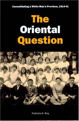
The Oriental question : consolidating a white man's province, 1914-41
https://search.heritageburnaby.ca/link/museumlibrary1414
- Repository
- Burnaby Village Museum
- Author
- Roy, Patricia, 1939-
- Publication Date
- c2003
- Call Number
- 971.1004951 ROY
- Repository
- Burnaby Village Museum
- Collection
- Reference Collection
- Material Type
- Book
- ISBN
- 0774810114
- 0774810106
- Call Number
- 971.1004951 ROY
- Author
- Roy, Patricia, 1939-
- Place of Publication
- Vancouver
- Publisher
- UBC Press
- Publication Date
- c2003
- Physical Description
- 334 p. : ill. ; 24 cm.
- Library Subject (LOC)
- Chinese--British Columbia--History
- Japanese--British Columbia--History
- British Columbia--Race relations
- British Columbia--Politics and government
- British Columbia--Emigration and immigration--History
- British Columbia--Emigration and immigration--Economic aspects
- Immigrants--British Columbia--History
- Notes
- Second in a proposed set of 3 vols. beginning with A white man's province.
- Includes bibliographical references and index.

The triumph of citizenship : the Japanese and Chinese in Canada, 1941-67
https://search.heritageburnaby.ca/link/museumlibrary1415
- Repository
- Burnaby Village Museum
- Author
- Roy, Patricia, 1939-
- Publication Date
- c2007
- Call Number
- 971.1004951 ROY
- Repository
- Burnaby Village Museum
- Collection
- Reference Collection
- Material Type
- Book
- ISBN
- 9780774813815
- 9780774813808
- Call Number
- 971.1004951 ROY
- Author
- Roy, Patricia, 1939-
- Place of Publication
- Vancouver, BC
- Publisher
- UBC Press
- Publication Date
- c2007
- Physical Description
- vii, 390 p. : ill., map ; 24 cm.
- Library Subject (LOC)
- Chinese--British Columbia--History
- Japanese--British Columbia--History
- British Columbia--Race relations
- British Columbia--Politics and government
- British Columbia--Emigration and immigration--History
- British Columbia--Emigration and immigration--Economic aspects
- Immigrants--British Columbia--History
- Notes
- Includes bibliographical references (p. 318-377) and index.
- Limited edition of 400 copies.
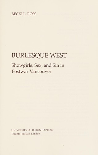
Burlesque West : showgirls, sex, and sin in postwar Vancouver
https://search.heritageburnaby.ca/link/museumlibrary1435
- Repository
- Burnaby Village Museum
- Author
- Ross, Becki, 1959-
- Publication Date
- c2009
- Call Number
- 792.7 ROS
- Repository
- Burnaby Village Museum
- Collection
- Reference Collection
- Material Type
- Book
- ISBN
- 9780802096463
- 9780802096982
- 0802096980
- 0802096468
- Call Number
- 792.7 ROS
- Author
- Ross, Becki, 1959-
- Place of Publication
- Toronto
- Publisher
- University of Toronto Press
- Publication Date
- c2009
- Physical Description
- xix, 373 p., [8] p. of plates : ill. (some col.) ; 23 cm.
- Library Subject (LOC)
- Burlesque (Theater)--British Columbia--Vancouver--History
- Stripteasers--British Columbia--Vancouver--History
- Showgirls--British Columbia--Vancouver--History
- Nightlife--British Columbia--Vancouver--History
- Vancouver (B.C.)--History
- Notes
- Includes bibliographical references (p. [297]-333) and index.
![Allan Rock at BCIT campaign event, [2000] thumbnail](/media/hpo/_Data/_Archives_Images/_Unrestricted/535/535-1684-1.jpg?width=280)
Allan Rock at BCIT campaign event
https://search.heritageburnaby.ca/link/archivedescription95884
- Repository
- City of Burnaby Archives
- Date
- [2000]
- Collection/Fonds
- Burnaby NewsLeader photograph collection
- Description Level
- File
- Physical Description
- 3 photographs (tiff) : col.
- Scope and Content
- File contains photographs of Federal Health Minister Allan Rock speaking with nursing students during a campaign event at BCIT. Photographs show close-ups of Rock and one of the nursing students asking a question, as well as a photograph of Rock speaking as attendees look on in the background.
- Repository
- City of Burnaby Archives
- Date
- [2000]
- Collection/Fonds
- Burnaby NewsLeader photograph collection
- Physical Description
- 3 photographs (tiff) : col.
- Description Level
- File
- Record No.
- 535-1684
- Access Restriction
- No restrictions
- Reproduction Restriction
- No restrictions
- Accession Number
- 2018-12
- Scope and Content
- File contains photographs of Federal Health Minister Allan Rock speaking with nursing students during a campaign event at BCIT. Photographs show close-ups of Rock and one of the nursing students asking a question, as well as a photograph of Rock speaking as attendees look on in the background.
- Subjects
- Elections
- Officials - Elected Officials
- Media Type
- Photograph
- Photographer
- Bartel, Mario
- Notes
- Title based on caption
- Collected by editorial for use in a November 2000 issue of the Burnaby NewsLeader
- Caption from metadata for 535-1684-1: "Federal Health Minister Allan Rock speaks with nursing students during a campaign stop at BCIT."
- Caption from metadata for 535-1684-2: "Federal Health Minister Allan Rock addresses nursing students at BCIT, during an election campaign stop."
- Caption from metadata for 535-1684-3: "Michelle Marisi, a nurse at Vancouver General, studying critical care, raises her concerns with federal Health Minister, Allan Rock."
- Geographic Access
- Willingdon Avenue
- Street Address
- 3700 Willingdon Avenue
- Planning Study Area
- Douglas-Gilpin Area
Images
![Allan Rock at BCIT campaign event, [2000] thumbnail](/media/hpo/_Data/_Archives_Images/_Unrestricted/535/535-1684-1.jpg)
A synopsis of the British pharmacopoeia preparations : designed for the use of pharmaceutical and medical students
https://search.heritageburnaby.ca/link/museumlibrary5885
- Repository
- Burnaby Village Museum
- Edition
- 10th ed.
- Publication Date
- c1916
- c1893
- Call Number
- 615.11 HEE 1916
- Repository
- Burnaby Village Museum
- Collection
- Special Collection
- Material Type
- Book
- Accession Code
- BV988.68.13
- Call Number
- 615.11 HEE 1916
- Edition
- 10th ed.
- Place of Publication
- Toronto
- Publisher
- Chas. F. Heebner
- Publication Date
- c1916
- c1893
- Printer
- University of Toronto Press
- Physical Description
- 109 p. ; 20 cm.
- Inscription
- inside front cover: "The J.F. Hartz Co. Limited" [paper sticker label] "Medical Books Toronto" inside front page: "2.00" [handwritten in pencil] "Druggist and Stationer" [purple ink stamp] "G.S. Wood, Phan.B." "Prince George, B.C."
- Library Subject (LOC)
- Pharmacopoeias--Great Britain
- Medicine--Formulae, receipts, prescriptions
- Notes
- Includes index.
- Author full name: Heebner, Chas. F. (Charles Frederick), 1859-1933.
![Aventis Biotech Challenge at BCIT, [2001] thumbnail](/media/hpo/_Data/_Archives_Images/_Unrestricted/535/535-2264.jpg?width=280)
Aventis Biotech Challenge at BCIT
https://search.heritageburnaby.ca/link/archivedescription96642
- Repository
- City of Burnaby Archives
- Date
- [2001]
- Collection/Fonds
- Burnaby NewsLeader photograph collection
- Description Level
- Item
- Physical Description
- 1 photograph (tiff) : col.
- Scope and Content
- Photograph of high school student Sophie Lee holding up a slug balanced on a test tube during the Aventis Biotech Challenge at the British Columbia Institute of Technology.
- Repository
- City of Burnaby Archives
- Date
- [2001]
- Collection/Fonds
- Burnaby NewsLeader photograph collection
- Physical Description
- 1 photograph (tiff) : col.
- Description Level
- Item
- Record No.
- 535-2264
- Access Restriction
- No restrictions
- Reproduction Restriction
- No restrictions
- Accession Number
- 2018-12
- Scope and Content
- Photograph of high school student Sophie Lee holding up a slug balanced on a test tube during the Aventis Biotech Challenge at the British Columbia Institute of Technology.
- Media Type
- Photograph
- Photographer
- Bartel, Mario
- Notes
- Title based on caption
- Collected by editorial for use in an April 2001 issue of the Burnaby NewsLeader
- Caption from metadata: "Sophie Lee, a student at Sir Winston Churchill Secondary School in Vancouver, keeps her eyes on a slug balanced on a test tube of slug slime. Sophie and her lab partner, Iris Liu, were studying the sticky properties of slug slime for the Aventis Biotech Challenge, at BCIT. The Challenge is held to generate interest in biotechnology amongst budding scientists from area high schools, who work on their projects under the guidance of expert biotechnologists."
- Geographic Access
- Willingdon Avenue
- Street Address
- 3700 Willingdon Avenue
- Planning Study Area
- Douglas-Gilpin Area
Images
![Aventis Biotech Challenge at BCIT, [2001] thumbnail](/media/hpo/_Data/_Archives_Images/_Unrestricted/535/535-2264.jpg)

B.C.E.R. Video: Then and now
https://search.heritageburnaby.ca/link/museumlibrary5926
- Repository
- Burnaby Village Museum
- Collection
- Reference Collection
- Material Type
- Moving Images
- Accession Code
- BV013.27.21
- Call Number
- 388.46 TRA VR Ver 1
- Place of Publication
- Vancouver
- Publisher
- Transit Museum Society
- Publication Date
- c2004
- Physical Description
- 1 videodisc (128 min, 43 sec.) : sd., col. ; 4 3/4 in
- Library Subject (LOC)
- Street-railroads
- Electric railroads
- Transportation
- Geographic Access
- Vancouver
- Notes
- Original footage shot on 16mm film in the early 1950's by Ken Hodgsen.
- Summary : Historical film footage of Lower Mainland trams on their various routes as well as an excursion train. Film footage is part of the B.C. Transit Centennial and includes a voice over commentary by Frank Horn and Vic Sharman. Frank worked as a motorman on the BC Electric Railway. The trams are shown travelling through Vancouver, Burnaby, New Westminster, Surrey, North Delta, Langley, Abbotsford, and Chilliwack. The excursion train was filmed in Washington State, U.S.A. The narrators give commentary, describing the routes, landmarks of the past and present, the various kinds of trams and buses seen, drivers’ protocols, and historical information.
- Produced by David Asselin, President, Transit Musem Society
- Cover on verso of DVD case includes photos with description: "Here are three instructors... Vic Sharman, Frank Horne & Don Bellamy for the Downtown Historic Railway (D.H.R.) Who have all had previous experience driving interurbans in the Vancouver area in the 1940's & 1950's"
- Contact Burnaby Village Museum to view video.
Images

![BCIT campus radio, [2004] thumbnail](/media/hpo/_Data/_Archives_Images/_Unrestricted/535/535-1762.jpg?width=280)
BCIT campus radio
https://search.heritageburnaby.ca/link/archivedescription96011
- Repository
- City of Burnaby Archives
- Date
- [2004]
- Collection/Fonds
- Burnaby NewsLeader photograph collection
- Description Level
- Item
- Physical Description
- 1 photograph (tiff) : col.
- Scope and Content
- Photograph of Jen Bacus, a radio broadcast student and staff at the new BCIT campus radio station CFML, standing inside a recording booth next to a light that reads "On Air."
- Repository
- City of Burnaby Archives
- Date
- [2004]
- Collection/Fonds
- Burnaby NewsLeader photograph collection
- Physical Description
- 1 photograph (tiff) : col.
- Description Level
- Item
- Record No.
- 535-1762
- Access Restriction
- No restrictions
- Reproduction Restriction
- No restrictions
- Accession Number
- 2018-12
- Scope and Content
- Photograph of Jen Bacus, a radio broadcast student and staff at the new BCIT campus radio station CFML, standing inside a recording booth next to a light that reads "On Air."
- Subjects
- Telecommunication Tools and Equipment - Radios
- Persons - Students
- Buildings - Schools - Universities and Colleges
- Media Type
- Photograph
- Photographer
- Bartel, Mario
- Notes
- Title based on caption
- Collected by editorial for use in a January 2004 issue of the Burnaby NewsLeader
- Caption from metadata: "BCIT's campus radio station, CFML, is about to go on the air, over the air, as the station has been approved for an FM license by the CRTC. Once the station has secured space on a broadcast tower, it will be able to be heard all over Burnaby, New Westminster, parts of Vancouver and Coquitlam. Jen Bacus is a radio broadcast student, and the station's marketing and promotions director."
- Geographic Access
- Willingdon Avenue
- Street Address
- 3700 Willingdon Avenue
- Historic Neighbourhood
- Burnaby Lake (Historic Neighbourhood)
- Planning Study Area
- Douglas-Gilpin Area
Images
![BCIT campus radio, [2004] thumbnail](/media/hpo/_Data/_Archives_Images/_Unrestricted/535/535-1762.jpg)

BCIT "Fawlty Towers" event
https://search.heritageburnaby.ca/link/archivedescription95722
- Repository
- City of Burnaby Archives
- Date
- [2001]
- Collection/Fonds
- Burnaby NewsLeader photograph collection
- Description Level
- File
- Physical Description
- 2 photographs (tiff) : col.
- Scope and Content
- File contains photographs of students participating in BCIT's annual "Fawlty Towers" competition. Photographs depict students taping index cards together to form towers inside of a gymnasium.
- Repository
- City of Burnaby Archives
- Date
- [2001]
- Collection/Fonds
- Burnaby NewsLeader photograph collection
- Physical Description
- 2 photographs (tiff) : col.
- Description Level
- File
- Record No.
- 535-1580
- Access Restriction
- No restrictions
- Reproduction Restriction
- No restrictions
- Accession Number
- 2018-12
- Scope and Content
- File contains photographs of students participating in BCIT's annual "Fawlty Towers" competition. Photographs depict students taping index cards together to form towers inside of a gymnasium.
- Media Type
- Photograph
- Photographer
- Bartel, Mario
- Notes
- Title based on caption
- Collected by editorial for use in a January 2001 issue of the Burnaby NewsLeader
- Caption from metadata for 535-1580-1: "Davy Chang, a management systems student at BCIT, works on his team's entry in the school's annual "Fawlty Towers" competition. Teams of students were given 90 minutes to see who could design and build the tallest structure, using only cardboard index cards and masking tape."
- Caption from metadata for 535-1580-2: "Forestry students Jocelyn Waldbrook and Kara Epp assemble the walls of what will become their team's tower at BCIT's annual Fawlty Towers competition. Teams of students were given 90 minutes to design and build the tallest tower, using only cardboard index cards and masking tape."
- Geographic Access
- Willingdon Avenue
- Street Address
- 3700 Willingdon Avenue
- Planning Study Area
- Douglas-Gilpin Area
Images

![BCIT Open House, [2000] thumbnail](/media/hpo/_Data/_Archives_Images/_Unrestricted/535/535-2150-1.jpg?width=280)
BCIT Open House
https://search.heritageburnaby.ca/link/archivedescription96526
- Repository
- City of Burnaby Archives
- Date
- [2000]
- Collection/Fonds
- Burnaby NewsLeader photograph collection
- Description Level
- File
- Physical Description
- 2 photographs (tiff) : b&w and col.
- Scope and Content
- File contains photographs of BCIT's annual Open House. Photographs depict robotics/automation students Colin Harraway and Colin Wilson demonstrating a machine that makes battery cells, and Will Dirksen demonstrating confined space rescue with classmate Philip Nishikihama as part of BCIT's occupatio…
- Repository
- City of Burnaby Archives
- Date
- [2000]
- Collection/Fonds
- Burnaby NewsLeader photograph collection
- Physical Description
- 2 photographs (tiff) : b&w and col.
- Description Level
- File
- Record No.
- 535-2150
- Access Restriction
- No restrictions
- Reproduction Restriction
- No restrictions
- Accession Number
- 2018-12
- Scope and Content
- File contains photographs of BCIT's annual Open House. Photographs depict robotics/automation students Colin Harraway and Colin Wilson demonstrating a machine that makes battery cells, and Will Dirksen demonstrating confined space rescue with classmate Philip Nishikihama as part of BCIT's occupational health and safety program.
- Media Type
- Photograph
- Photographer
- Bartel, Mario
- Notes
- Title based on caption
- Collected by editorial for use in an April 2000 issue of the Burnaby NewsLeader
- Caption from metadata for 535-2150-1: "Colin Harraway and Colin Wilson, students in the robotics/automation program at BCIT demonstrate the machine they built to make battery cells, at the school's annual Open House."
- Caption from metadata for 535-2150-2: "Will Dirksen demonstrates confined space rescue with his "victim," Philip Nishikihama, in BCIT's occupational health and saftety program, at the school's annual open house."
- Geographic Access
- Willingdon Avenue
- Street Address
- 3700 Willingdon Avenue
- Historic Neighbourhood
- Burnaby Lake (Historic Neighbourhood)
- Planning Study Area
- Douglas-Gilpin Area
Images
![BCIT Open House, [2000] thumbnail](/media/hpo/_Data/_Archives_Images/_Unrestricted/535/535-2150-1.jpg)
![BCIT solar energy demonstration home, [2001] thumbnail](/media/hpo/_Data/_Archives_Images/_Unrestricted/535/535-1578.jpg?width=280)
BCIT solar energy demonstration home
https://search.heritageburnaby.ca/link/archivedescription95720
- Repository
- City of Burnaby Archives
- Date
- [2001]
- Collection/Fonds
- Burnaby NewsLeader photograph collection
- Description Level
- Item
- Physical Description
- 1 photograph (tiff) : col.
- Scope and Content
- Photograph of Ljubisav Stamenic inside the attic of BCIT's solar energy demonstration home. He is standing near the multiple panels of solar cells.
- Repository
- City of Burnaby Archives
- Date
- [2001]
- Collection/Fonds
- Burnaby NewsLeader photograph collection
- Physical Description
- 1 photograph (tiff) : col.
- Description Level
- Item
- Record No.
- 535-1578
- Access Restriction
- No restrictions
- Reproduction Restriction
- No restrictions
- Accession Number
- 2018-12
- Scope and Content
- Photograph of Ljubisav Stamenic inside the attic of BCIT's solar energy demonstration home. He is standing near the multiple panels of solar cells.
- Media Type
- Photograph
- Photographer
- Bartel, Mario
- Notes
- Title based on caption
- Collected by editorial for use in a January 2001 issue of the Burnaby NewsLeader
- Caption from metadata: "Ljubisav Stamenic, of BCIT, checks out the solar photovoltaic cells in the attic of the school's solar energy demonstration house. The solar energy is converted into electricity which is then fed back into the power grid connected to the house."
- Geographic Access
- Willingdon Avenue
- Street Address
- 3700 Willingdon Avenue
- Planning Study Area
- Douglas-Gilpin Area
Images
![BCIT solar energy demonstration home, [2001] thumbnail](/media/hpo/_Data/_Archives_Images/_Unrestricted/535/535-1578.jpg)
![BCIT solar home construction, [2000] thumbnail](/media/hpo/_Data/_Archives_Images/_Unrestricted/535/535-2104.jpg?width=280)
BCIT solar home construction
https://search.heritageburnaby.ca/link/archivedescription96480
- Repository
- City of Burnaby Archives
- Date
- [2000]
- Collection/Fonds
- Burnaby NewsLeader photograph collection
- Description Level
- Item
- Physical Description
- 1 photograph (tiff) : col.
- Scope and Content
- Photograph of construction worker Jas Chohan checking the level of a foundation wall for a new prefabricated solar home at BCIT. Other pieces of the home on transport trucks are visible in the background.
- Repository
- City of Burnaby Archives
- Date
- [2000]
- Collection/Fonds
- Burnaby NewsLeader photograph collection
- Physical Description
- 1 photograph (tiff) : col.
- Description Level
- Item
- Record No.
- 535-2104
- Access Restriction
- No restrictions
- Reproduction Restriction
- No restrictions
- Accession Number
- 2018-12
- Scope and Content
- Photograph of construction worker Jas Chohan checking the level of a foundation wall for a new prefabricated solar home at BCIT. Other pieces of the home on transport trucks are visible in the background.
- Media Type
- Photograph
- Photographer
- Bartel, Mario
- Notes
- Title based on caption
- Collected by editorial for use in a March 2000 issue of the Burnaby NewsLeader
- Caption from metadata: "Jas Chohan checks the level on a foundation wall being built at BCIT for a new prefabricated solar home, which is being delivered in pieces in the background."
- Geographic Access
- Willingdon Avenue
- Street Address
- 3700 Willingdon Avenue
- Historic Neighbourhood
- Burnaby Lake (Historic Neighbourhood)
- Planning Study Area
- Douglas-Gilpin Area
Images
![BCIT solar home construction, [2000] thumbnail](/media/hpo/_Data/_Archives_Images/_Unrestricted/535/535-2104.jpg)

B.C. Provincial Police Stories, volume 2
https://search.heritageburnaby.ca/link/museumlibrary1290
- Repository
- Burnaby Village Museum
- Author
- Clark, Cecil, 1899-
- Publication Date
- c2000
- Call Number
- 364.1 CLA
- Repository
- Burnaby Village Museum
- Collection
- Reference Collection
- Material Type
- Book
- ISBN
- 0919214754
- Call Number
- 364.1 CLA
- Author
- Clark, Cecil, 1899-
- Place of Publication
- Surrey, B.C.
- Publisher
- Heritage House
- Publication Date
- c2000
- Physical Description
- 141 p. : ill.

Boundary Road and Park Avenue station
https://search.heritageburnaby.ca/link/archivedescription36670
- Repository
- City of Burnaby Archives
- Date
- 1912 (date of original), copied 1992
- Collection/Fonds
- Burnaby Historical Society fonds
- Description Level
- Item
- Physical Description
- 1 photograph : b&w ; 10.1 x 14.9 cm print
- Scope and Content
- Photograph of Boundary Road, Park Avenue Interurban station, and the surrounding area, looking north from Kingsway. The Coburn house, built in 1906, is at the top of the hill on the right, current address 5170 Boundary Road.
- Repository
- City of Burnaby Archives
- Date
- 1912 (date of original), copied 1992
- Collection/Fonds
- Burnaby Historical Society fonds
- Subseries
- Burnaby Centennial Anthology subseries
- Physical Description
- 1 photograph : b&w ; 10.1 x 14.9 cm print
- Description Level
- Item
- Record No.
- 315-025
- Access Restriction
- No restrictions
- Reproduction Restriction
- No known restrictions
- Accession Number
- BHS1994-04
- Scope and Content
- Photograph of Boundary Road, Park Avenue Interurban station, and the surrounding area, looking north from Kingsway. The Coburn house, built in 1906, is at the top of the hill on the right, current address 5170 Boundary Road.
- Media Type
- Photograph
- Notes
- Title based on contents of photograph
- Annotation at bottom of photograph reads; "Boundary Rd and Park Ave Station"
- Geographic Access
- Boundary Road
- Kingsway
- Historic Neighbourhood
- Central Park (Historic Neighbourhood)
- Planning Study Area
- Garden Village Area
Images
