
Alfred & Ruth MacLeod Cottage
https://search.heritageburnaby.ca/link/landmark503
- Repository
- Burnaby Heritage Planning
- Description
- Located atop a hill on the southern shore of picturesque Deer Lake, the Alfred and Ruth MacLeod Cottage is a one and one-half storey, wood-frame, rustic Arts and Crafts-style bungalow. The cottage is well-maintained, but has been altered through the enclosure of much of its original wraparound vera…
- Associated Dates
- 1913
- Repository
- Burnaby Heritage Planning
- Geographic Access
- Deer Lake Drive
- Associated Dates
- 1913
- Description
- Located atop a hill on the southern shore of picturesque Deer Lake, the Alfred and Ruth MacLeod Cottage is a one and one-half storey, wood-frame, rustic Arts and Crafts-style bungalow. The cottage is well-maintained, but has been altered through the enclosure of much of its original wraparound verandah. Its sits on the brow of a steep slope, with panoramic views north to Deer Lake.
- Heritage Value
- The Alfred and Ruth MacLeod Cottage is valued as a significant example of the early development of summer estates in Burnaby, specifically in the Deer Lake neighbourhood, that attracted residents from the burgeoning cities of New Westminster and Vancouver. Access to the area was facilitated by the construction of the Burnaby Lake Interurban tramline, which opened in June 1911. This modest, rustic cottage illustrates the desire for a simple country lifestyle and retreat into nature of those who settled on the south shore of Deer Lake. While the grand mansions on the north shore of Deer Lake are set in formally landscaped gardens, the informality of this cottage demonstrates reverence for its natural, wooded surroundings, oriented towards views of Deer Lake. The Alfred and Ruth MacLeod Cottage is important for its connection with prominent New Westminster insurance and real estate broker, Alfred W. MacLeod, and his wife, Ruth. The MacLeods had recently constructed a large city home, and built this cottage as a summer residence in 1913. In 2005, the Alfred and Ruth MacLeod Cottage was purchased by the City of Burnaby and today constitutes part of the Deer Lake Park Heritage Precinct, which is Burnaby's most significant collection of historic sites.
- Defining Elements
- Key elements that define the heritage character of the Alfred and Ruth MacLeod Cottage include its: - secluded setting on the brow of a steep hill on the southern shore of Deer Lake, with expansive views of Deer Lake to the north - residential form, scale and massing as expressed by its one and one-half storey rectangular plan, side-gabled roof, hipped roof over original verandah and two shed dormers - associated landscape features such as mature coniferous and deciduous trees surrounding the property
- Historic Neighbourhood
- Burnaby Lake (Historic Neighbourhood)
- Planning Study Area
- Morley-Buckingham Area
- Function
- Primary Historic--Single Dwelling
- Primary Current--Single Dwelling
- Cadastral Identifier
- P.I.D.000-708-038
- Boundaries
- The Alfred and Ruth MacLeod Cottage is comprised of a single residential lot located at 6466 Deer Lake Drive, Burnaby.
- Area
- 13354.63
- Contributing Resource
- Building
- Ownership
- Public (local)
- Documentation
- City of Burnaby Planning and Building Department, Heritage Site Files
- Street Address
- 6466 Deer Lake Drive
Images


Andy Johnson House
https://search.heritageburnaby.ca/link/landmark515
- Repository
- Burnaby Heritage Planning
- Description
- The Andy Johnson House is a large, one and one-half storey plus above-ground basement wood-frame mansion on a rubble-stone granite foundation with a red terra cotta pantile roof and an octagonal corner turret. The building stands in a prominent location on a corner lot on Kingsway, one of Burnaby’s…
- Associated Dates
- 1912
- Formal Recognition
- Community Heritage Register
- Other Names
- Andrew M. & Margaret Johnson House 'Glenedward'
- Street View URL
- Google Maps Street View
- Repository
- Burnaby Heritage Planning
- Other Names
- Andrew M. & Margaret Johnson House 'Glenedward'
- Geographic Access
- Kingsway
- Associated Dates
- 1912
- Formal Recognition
- Community Heritage Register
- Enactment Type
- Council Resolution
- Enactment Date
- 26/05/2003
- Description
- The Andy Johnson House is a large, one and one-half storey plus above-ground basement wood-frame mansion on a rubble-stone granite foundation with a red terra cotta pantile roof and an octagonal corner turret. The building stands in a prominent location on a corner lot on Kingsway, one of Burnaby’s main transportation and commercial corridors, and stands adjacent to the Burlington Square Development.
- Heritage Value
- The Andy Johnson House 'Glenedward' is a valued representation of a prominent upper middle-class family dwelling from the pre-First World War era. Andrew M. Johnson (1861-1934), an early Vancouver pioneer, and his wife Margaret built this house in 1912, in an imposing style favoured by the newly wealthy of the prewar boom period. Born in Norway, Andrew Johnson arrived in Vancouver just months after the Great Fire of 1886 and went into partnership with J. (Ollie) Atkins in a transportation company that became the Mainland Transfer Company, eventually the largest of its kind in Vancouver. Johnson also operated Burnaby's historic Royal Oak Hotel, once located on the opposite corner from his estate. Additionally, the Andy Johnson House is significant for the high-quality design and construction of both the house and its landscaped setting. Designed in the British Arts and Crafts style, the house exhibits a rare degree of opulence in building materials, including imported terra cotta roof tiles, oak and walnut interior millwork, and stained glass manufactured by the Royal City Glass Company. The rubble-stone foundations and perimeter walls were obtained from two massive granite glacial erratic boulders found on the property. The house has been relocated closer to the corner, but the encircling stone walls, the gate posts and gates manufactured by the Westminster Iron Works and some of the original plantings have been retained. A grouping of three giant Sequoias, other mature deciduous trees and massings of shrubbery indicate the type of landscape setting considered appropriate for an estate house in the early years of the twentieth century.
- Defining Elements
- Key elements that define the heritage character of the Andy Johnson House include its: - corner location on Kingsway at Royal Oak Avenue - residential form, scale and massing as expressed by the one and one-half storey height, above-ground basement, octagonal corner turret and rectangular plan - British Arts and Crafts details such as the use of natural indigenous materials, half-timbering in the gables and dormers, picturesque roofline, cedar shingle siding, extended eaves, native granite rubble-stone foundation with red-coloured mortar, and granite piers and chimneys - additional exterior features such as the central front entrance, elaborate wrap-around verandah, porte-cochere and balcony at second storey lighted with original cast iron electric lanterns - red terra cotta pantile roof cladding - fenestration, such as double-hung 1-over-1 wooden-sash windows with stained glass and leaded lights in the upper sash - original interior features such as fireplaces, wainscoting finished with oak and walnut millwork, and three-quarter sawn oak flooring - associated landscape features including three giant Sequoias. granite walls, granite gate posts and wrought iron gates
- Historic Neighbourhood
- Central Park (Historic Neighbourhood)
- Planning Study Area
- Marlborough Area
- Builder
- J.C. Allen
- Function
- Primary Historic--Single Dwelling
- Primary Current--Eating or Drinking Establishment
- Community
- Burnaby
- Cadastral Identifier
- 003-004-538
- Boundaries
- The Andy Johnson House is comprised of a single residential lot located at 5152 Kingsway, Burnaby
- Area
- 1424.21
- Contributing Resource
- Building
- Ownership
- Private
- Street Address
- 5152 Kingsway
- Street View URL
- Google Maps Street View
Images


Arthur Long Residence
https://search.heritageburnaby.ca/link/landmark560
- Repository
- Burnaby Heritage Planning
- Description
- Residential building.
- Associated Dates
- 1912
- Street View URL
- Google Maps Street View
- Repository
- Burnaby Heritage Planning
- Geographic Access
- Stanley Street
- Associated Dates
- 1912
- Description
- Residential building.
- Heritage Value
- Arthur Long, of the Water Rights Office of Victoria, purchased this land from neighbour Henry Ramsay, and built this beautiful Arts and Crafts styled home. The house appears to have many similarities to the neighbouring Ramsay House, which was designed by Vancouver architect R. Mackay Fripp. The house has retained its original complex gabled roof, triangular eave brackets and horizontal siding.
- Locality
- Burnaby Lake
- Historic Neighbourhood
- Burnaby Lake (Historic Neighbourhood)
- Planning Study Area
- Lakeview-Mayfield Area
- Ownership
- Private
- Street Address
- 7828 Stanley Street
- Street View URL
- Google Maps Street View
Images


"Atkinson" sign painting up to now : a complete manual of the art of sign painting, contains ninty [sic] six designs or layouts and accompanying color notes, seventy five alphabets embracing all standard styles, their modifications and alternates, comprehensive text covering all practical phases of the art, for every day reference in the shop
https://search.heritageburnaby.ca/link/museumlibrary433
- Repository
- Burnaby Village Museum
- Author
- Atkinson, Frank H., 1871-
- Publication Date
- c1915
- Call Number
- 667.9
- Repository
- Burnaby Village Museum
- Collection
- Special Collection
- Material Type
- Book
- Accession Code
- BV988.67.6
- Call Number
- 667.9
- Author
- Atkinson, Frank H., 1871-
- Place of Publication
- Chicago
- Publisher
- Frederick J. Drake & Co.
- Publication Date
- c1915
- Physical Description
- 356 p. : ill. : 24 x 30 cm.
- Library Subject (LOC)
- Alphabets
- Sign painting
- Notes
- Includes index.
Century readings for a course in English literature
https://search.heritageburnaby.ca/link/museumlibrary3119
- Repository
- Burnaby Village Museum
- Collection
- Special Collection
- Material Type
- Book
- Accession Code
- HV972.165.87
- Call Number
- 820.8 CUN
- Contributor
- Cunliffe, John William, 1865-1946
- Pyre, James Francis Augustin, 1871-1934
- Young, Karl, 1879-1943
- Place of Publication
- New York
- Publisher
- The Century Co.
- Publication Date
- 1919
- Physical Description
- 1025, clxxvii p., 23cm.
- Inscription
- Top end paper left section: "W 74" [handwritten in blue ink, crossed out in black ink] Top end paper middle section: "L.J. McRae" "Arts' 23" [handwritten in black ink] Top end paper right section: "Sept /19" [handwritten in blue ink] Notes handwritten in black ink on 2 pages of lined paper adhered to front fly leaves.
- Library Subject (LOC)
- English literature
- Notes
- Edited and annotated by J.W. Cunliffe, J.F.A. Pyre, Karl Young.
- Includes index.

Daniel & Amelia Mowat House
https://search.heritageburnaby.ca/link/landmark570
- Repository
- Burnaby Heritage Planning
- Description
- Residential building.
- Associated Dates
- 1913
- Formal Recognition
- Heritage Designation, Community Heritage Register
- Street View URL
- Google Maps Street View
- Repository
- Burnaby Heritage Planning
- Geographic Access
- Beresford Street
- McKay Avenue
- Associated Dates
- 1913
- Formal Recognition
- Heritage Designation, Community Heritage Register
- Enactment Type
- Bylaw No. 13058
- Enactment Date
- 12/03/2012
- Description
- Residential building.
- Heritage Value
- This home was built by Daniel Mowat (1848-1923) and Amelia Mary Mowat (née Hoy, 1848-1923). Daniel originally worked as a merchant, and was operating a chicken farm at this location as early as 1908, and later a goat ranch. It is one of Burnaby’s few two-storey Arts and Crafts residences. The generous proportions of the house, its broad, medium-pitched, front-gabled roof and symmetrical design serve as further features. Additionally, the house boasts a high degree of integrity, retaining its original shingle wall cladding, half-timbered gables and original windows – a combination of casement windows with stained glass transoms and double-hung windows with square, multi-paned upper sashes.This house is located adjacent to what was once the Central Park interurban rail line, operated by the B.C. Electric Company, which conveniently connected this area of Burnaby to Vancouver. The arrival of this commuter line in 1892 led to the suburban development of this area of Burnaby.
- Locality
- Central Park
- Historic Neighbourhood
- Central Park (Historic Neighbourhood)
- Planning Study Area
- Maywood Area
- Contributing Resource
- Building
- Ownership
- Private
- Street Address
- 6368 McKay Avenue
- Street View URL
- Google Maps Street View
Images


David Graybill Residence
https://search.heritageburnaby.ca/link/landmark571
- Repository
- Burnaby Heritage Planning
- Description
- Residential building.
- Associated Dates
- 1913
- Street View URL
- Google Maps Street View
- Repository
- Burnaby Heritage Planning
- Geographic Access
- Eton Street
- Associated Dates
- 1913
- Description
- Residential building.
- Heritage Value
- Built by David Graybill in 1913, this house is a unique example of a two-storey Arts and Crafts house. The visor roofs, which shield the upper storey windows, and the second storey balcony, which was incorporated into the ground floor verandah roof, add to the house’s character and remain its most notable decorative features. Other defining features are the wide, overhanging eaves with triangular eave brackets. Though the wooden siding has been covered with asbestos shingles–an easily-reversible alteration–the house remains in highly original condition.
- Locality
- Vancouver Heights
- Historic Neighbourhood
- Vancouver Heights (Historic Neighbourhood)
- Planning Study Area
- Burnaby Heights Area
- Ownership
- Private
- Street Address
- 3757 Eton Street
- Street View URL
- Google Maps Street View
Images


Dictionnaire illustré de la langue française
https://search.heritageburnaby.ca/link/museumlibrary3179
- Repository
- Burnaby Village Museum
- Author
- Larousse, Pierre, 1817-1875
- Edition
- Rev. and enl. ed.
- Publication Date
- c1914
- Call Number
- 443 LAR
- Repository
- Burnaby Village Museum
- Collection
- Special Collection
- Material Type
- Book
- Accession Code
- HV972.165.147
- Call Number
- 443 LAR
- Edition
- Rev. and enl. ed.
- Author
- Larousse, Pierre, 1817-1875
- Contributor
- Augé, Claude, 1854-1924
- Augé, Paul, 1881-1951
- Place of Publication
- London
- Publisher
- J. M. Dent & Sons Limited
- Publication Date
- c1914
- Physical Description
- 876 p. : ill. ; 16 cm.
- Inscription
- inside front cover: "W101" crossed out [handwritten in ink] inside front cover page: "F.J. McRae 1926"[handwritten in ink] crossed out "John Swanson Arts '28" [handwritten in ink]
- Library Subject (LOC)
- French language--Dictionaries
- French language
- Notes
- "Edition refondue et augmentee sous la direction de Claude Auge et Paul Auge."
- English title: "Illustrated dictionary of the French language".
- Auge´, Claude, 1854-1924. (revising editor)
- Auge´, Paul, 1881-1951. (revising editor)

Dr. James Farish House
https://search.heritageburnaby.ca/link/landmark574
- Repository
- Burnaby Heritage Planning
- Description
- Residential building.
- Associated Dates
- 1912
- Street View URL
- Google Maps Street View
- Repository
- Burnaby Heritage Planning
- Geographic Access
- Cambridge Street
- Associated Dates
- 1912
- Description
- Residential building.
- Heritage Value
- This house was constructed as an investment rental property by Nova Scotia-born Dr. James Collins Farish (1866-1952). Farish was a Vancouver physician and surgeon and an eye, ear, nose & throat specialist; he retired in 1941 after fifty years of practice. In 1903, he married his first wife, Annie Gower Revely (died 1922). His second wife, Ella Jean Morrison (1887-1953) was originally from Winslow, Quebec. With its hipped roof and gabled projections, this house displays the typical elements of the Edwardian era domestic architecture. Features such as exposed rafter tails, paired square porch columns and bracketed bay windows display the emerging influence of the Arts and Crafts style. The ground floor windows are excellent examples of the multiple assemblies of casement, fixed and transom windows favoured during the era. A recent restoration project has extensively altered the original appearance and character of this impressive home.
- Locality
- Vancouver Heights
- Historic Neighbourhood
- Vancouver Heights (Historic Neighbourhood)
- Planning Study Area
- Burnaby Heights Area
- Area
- 566.71
- Contributing Resource
- Building
- Ownership
- Private
- Street Address
- 3774 Cambridge Street
- Street View URL
- Google Maps Street View
Images


Edmonds Baptist Church
https://search.heritageburnaby.ca/link/landmark575
- Repository
- Burnaby Heritage Planning
- Description
- Church building.
- Associated Dates
- 1912
- Street View URL
- Google Maps Street View
- Repository
- Burnaby Heritage Planning
- Geographic Access
- Walker Avenue
- Associated Dates
- 1912
- Description
- Church building.
- Heritage Value
- Beautifully designed in an Arts and Crafts idiom, this church features a textural mix of finishes including lapped siding and stucco and half timbering in the gables. The British Columbian reported in July 1912 that: "The Baptists of Edmonds will possess a fine and well planned church when the building now commenced is ready for occupation. The architects are J.P. Matheson and Son, of Vancouver, and the contractors, Muttitt and Bell, of New Westminster. The entrance porch fronts Edmonds Road and the west side faces Vancouver Road. It will have a capacity for 272 sittings, spacious aisles and choir platform besides various rooms for Baptistery, vestry and robing apartments."
- Locality
- Edmonds
- Historic Neighbourhood
- Edmonds (Historic Neighbourhood)
- Planning Study Area
- Richmond Park Area
- Architect
- J.P. Matheson & Son
- Builder
- Muttitt and Bell
- Area
- 1471.58
- Contributing Resource
- Building
- Ownership
- Private
- Names
- Matheson, John
- Street Address
- 7135 Walker Avenue
- Street View URL
- Google Maps Street View
Images


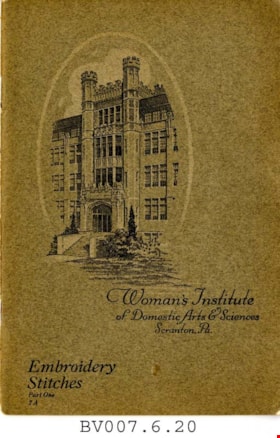
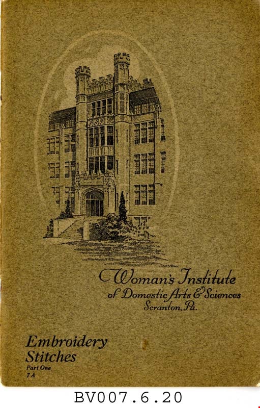
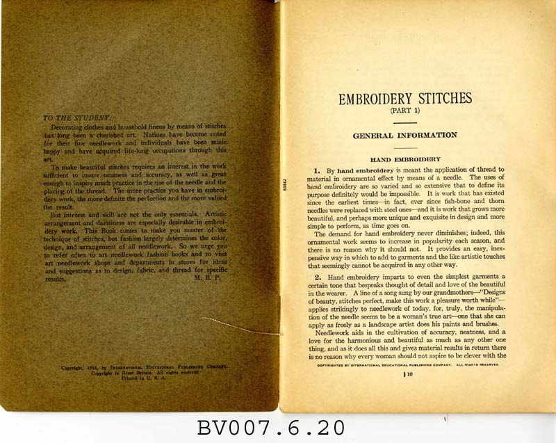
Embroidery stitches, part 1
https://search.heritageburnaby.ca/link/museumlibrary5006
- Repository
- Burnaby Village Museum
- Collection
- Special Collection
- Material Type
- Book
- Accession Code
- BV007.6.20
- Call Number
- 746.5 PIC
- Place of Publication
- Scranton, Pa.
- Publisher
- Woman's Institute of Domestic Arts and Sciences
- Publication Date
- 1921
- c1916
- Physical Description
- 44 p. : ill. : 23 cm.
- Library Subject (LOC)
- Embroidery--Study and teaching
- Stitches (Sewing)
- Subjects
- Documentary Artifacts - Booklets
- Object History
- Home sewing course used by Burnaby residents in the 1920's
- Notes
- Part 1 of 2
Images
The English poets : selections with critical introductions, vol. iv : Wordsworth to Tennyson
https://search.heritageburnaby.ca/link/museumlibrary1850
- Repository
- Burnaby Village Museum
- Collection
- Special Collection
- Material Type
- Book
- Accession Code
- HV983.76.25
- Call Number
- 821.8 WAR
- Edition
- Students ed.
- Place of Publication
- New York
- Publisher
- Macmillan
- Publication Date
- 1914
- Physical Description
- xv, 828 p. ; 20 cm.
- Inscription
- Spine: "PR 1173 W 3 - 4 Cop. 4" [written in white ink] Front endpapers: "Library of the University of British Columbia Accession No. 93926 Call no. PR 1173 W3" [printed in black ink on paper label; accession and call numbers handwritten in black ink] "J.W. Brown" [written in black ink] "F.C. Walker 405" [written in pencil] "discard" [written in pencil] "WA Thompson UBC Arts '23" [written and crossed out in blue ink] "John S. Burton 2312 St. Catherines Vancouver, B.C." [written in blue ink] "Fair [?] 3438X, Arts '24 U.B.C." [written in blue ink] Back endpaper: Notes handwritten in blue ink, black ink, and pencil. Throughout book: Study notes and markings highlighting pasages of text, written in blue ink, black ink, and pencil.
- Library Subject (LOC)
- English poetry
- Notes
- "A general introduction by Matthew Arnold"
- "edited by Thomas Humphrey Ward"
- Includes index.

Ernest & Katherine Hermon Residence
https://search.heritageburnaby.ca/link/landmark577
- Repository
- Burnaby Heritage Planning
- Description
- Residential building.
- Associated Dates
- 1911
- Street View URL
- Google Maps Street View
- Repository
- Burnaby Heritage Planning
- Geographic Access
- Yale Street
- Associated Dates
- 1911
- Description
- Residential building.
- Heritage Value
- Mr. Ernest Bolton Hermon, of the prominent engineering firm Hermon & Burwell, built this residence, and he and his wife, Katherine, lived here until 1935. The British Columbian described this home as “…a splendid mansion …which cost in the neighbourhood of $15,000.” Hermon was born into a Dutch family in Ontario in 1863, and moved to British Columbia in 1886. This is one of only three examples of the work of Samuel Maclure in Burnaby and is an outstanding example of his firm’s typical British Arts and Crafts style designs. Samuel Maclure (1860-1929) was known for his British Arts and Crafts style with meticulous attention paid to functional and beautiful interiors that utilized native wood combined with luxurious imported fittings. He was a leading exponent of the Art and Crafts design movement, and established a sophisticated local variation of residential architecture. Maclure’s Vancouver office, in association with his partner Cecil Croker Fox (1879-1916), received some sixty residential commissions between 1909-1915 as a result of the booming local economy and subsequent development of new residential districts. This partnership lasted until when Fox was killed overseas in active service during the First World War.The house has received some alterations, including stucco and brick being added to the lower floor, but it has retained its original form and massing including its symmetrical design, hipped roof and second floor half timbering.
- Locality
- Vancouver Heights
- Historic Neighbourhood
- Vancouver Heights (Historic Neighbourhood)
- Planning Study Area
- Burnaby Heights Area
- Architect
- Maclure & Fox
- Area
- 1133.42
- Contributing Resource
- Building
- Ownership
- Private
- Street Address
- 3870 Yale Street
- Street View URL
- Google Maps Street View
Images


F.J. Hart Estate 'Avalon'
https://search.heritageburnaby.ca/link/landmark542
- Repository
- Burnaby Heritage Planning
- Description
- The F.J. Hart Estate, 'Avalon,' is comprised of 5.26 hectares of lakefront property now located within Deer Lake Park, an Arts and Crafts/Tudor Revival styled mansion and an associated later outbuilding. The mansion is now operated as the Hart House Restaurant.
- Associated Dates
- 1912
- Formal Recognition
- Heritage Designation, Community Heritage Register
- Other Names
- Hart House, Rosedale Gardens, Frederick John & Alice Hart Estate
- Street View URL
- Google Maps Street View
- Repository
- Burnaby Heritage Planning
- Other Names
- Hart House, Rosedale Gardens, Frederick John & Alice Hart Estate
- Geographic Access
- Deer Lake Avenue
- Associated Dates
- 1912
- Formal Recognition
- Heritage Designation, Community Heritage Register
- Enactment Type
- Bylaw No. 9807
- Enactment Date
- 23/11/1992
- Description
- The F.J. Hart Estate, 'Avalon,' is comprised of 5.26 hectares of lakefront property now located within Deer Lake Park, an Arts and Crafts/Tudor Revival styled mansion and an associated later outbuilding. The mansion is now operated as the Hart House Restaurant.
- Heritage Value
- 'Avalon' and its estate grounds are important as an illustration of the cultural, aesthetic, and lifestyle values of the wealthy families that settled in the Deer Lake area early in the twentieth century. These values were predominantly those of elegant country living and leisure pursuits. The estate is important for its connection with wealthy land developer Frederick John Hart (1868-1945), who was not only instrumental in the creation of subdivisions which promoted Deer Lake as an exclusive residential development for successful families in the New Westminster and Vancouver area, but was also an influential member of this new suburban community and of the emerging municipality of Burnaby. Hart had a wide range of business, civic, and political interests: his real-estate company managed many of the land sales in the area and numerous other large developments throughout the region; he was an entrepreneurial businessman associated with a number of companies important to the economic development of the area and British Columbia; and he was a 'public spirited citizen' and an alderman for the City of New Westminster. The architectural style of ‘Avalon’ set the tone for many of the grand mansions in the adjacent residential development - British Arts and Crafts in derivation, with eclectic details, particularly Tudor precedents. Designed for Hart and his wife Alice Chapman Hart (1867-1935) by Burnaby architect Frank William Macey (1863-1935), the use of references to Tudor England illustrates the relevance and importance to the residents of the area of a strong and visible connection with Britain. The first resident architect in Burnaby, Macey was born and trained in England where he was well-respected for having published two standard texts for the architectural profession. He settled in Burnaby in the first decade of the twentieth century and obtained a number of commissions from prominent businessmen who were building grand homes in the new community of Deer Lake. He designed mostly in the British Arts and Crafts style and introduced the use of rough-cast stucco for building exteriors, a characteristic for which he was renowned, and of which ‘Avalon’ is an excellent example.
- Defining Elements
- Key elements that define the heritage character of 'Avalon' include its: - estate in its entirety: house, grounds, landscape features and garage outbuilding - complex asymmetrical massing - side gable roof punctuated with massive cross gables at the front and rear and open gable ends - exterior features of the house such as the rough-cast stucco with mock-Tudor timbering; cobble-stone facings; square tower with mock battlements - multiple-assemblies of wooden-sash casement windows - tall, prominent corbelled brick chimneys - grand interior spaces and fittings: particularly the entrance hall with its carved stone fireplace; the main staircase; panelled wainscotting; Tudor-arched windows; and fireplaces with original tile surrounds
- Locality
- Deer Lake Park
- Historic Neighbourhood
- Burnaby Lake (Historic Neighbourhood)
- Planning Study Area
- Morley-Buckingham Area
- Architect
- Frank William Macey
- Function
- Primary Current--Eating or Drinking Establishment
- Primary Historic--Estate
- Community
- Burnaby
- Cadastral Identifier
- P.I.D. No. 002-764-431 Legal Description: Lot 6 Except: Firstly: Part on Reference Plan 14874 and Secondly: Part subdivided by Plan 77594, District Lot 85, Group 1, New Westminster District, Plan 11109
- Boundaries
- 'Avalon' is comprised of a single municipally-owned property located at 6664 Deer Lake Avenue, Burnaby.
- Area
- 18,792.29
- Contributing Resource
- Building
- Landscape Feature
- Ownership
- Public (local)
- Other Collection
- Burnaby Village Museum, Collection: Hart Photograph Albums
- Documentation
- Heritage Site Files: PC77000 20. City of Burnaby Planning and Building Department, 4949 Canada Way, Burnaby, B.C., V5G 1M2
- Street Address
- 6664 Deer Lake Avenue
- Street View URL
- Google Maps Street View
Images


Geoffrey & Kathleen Burnett Residence
https://search.heritageburnaby.ca/link/landmark582
- Repository
- Burnaby Heritage Planning
- Description
- Residential building.
- Associated Dates
- 1914
- Formal Recognition
- Heritage Designation, Community Heritage Register
- Street View URL
- Google Maps Street View
- Repository
- Burnaby Heritage Planning
- Geographic Access
- Canada Way
- Associated Dates
- 1914
- Formal Recognition
- Heritage Designation, Community Heritage Register
- Enactment Type
- Bylaw No. 13841
- Enactment Date
- 28/05/2018
- Description
- Residential building.
- Heritage Value
- With its long, narrow plan and hipped, cross-gabled roof, this impressive residence was designed for local surveyor and civil engineer Geoffrey Kirby Burnett, who married Kathleen Wallen (1888-1978) in 1916. It was designed by New Westminster architects R.W. Coventry Dick & Son. Beautifully conceived in the British Arts and Crafts style, it features a steeply-gabled roof over the side entry porch, with square timber columns. Other decorative details include half timbering in the gables, first storey casement windows with leaded transom lights and decorative window hoods on the side elevation.
- Locality
- Edmonds
- Historic Neighbourhood
- Edmonds (Historic Neighbourhood)
- Planning Study Area
- Richmond Park Area
- Architect
- R.W. Coventry Dick & Son
- Area
- 903.70
- Contributing Resource
- Building
- Ownership
- Private
- Street Address
- 7037 Canada Way
- Street View URL
- Google Maps Street View
Images


George & Mary Buxton Residence
https://search.heritageburnaby.ca/link/landmark583
- Repository
- Burnaby Heritage Planning
- Description
- Residential building.
- Associated Dates
- c.1912
- Street View URL
- Google Maps Street View
- Repository
- Burnaby Heritage Planning
- Geographic Access
- Buxton Street
- Associated Dates
- c.1912
- Description
- Residential building.
- Heritage Value
- George Searby Buxton (1867-1955), an English-born carpenter, built this Arts and Crafts dwelling and resided here with his wife and local teacher Mary Isabel Buxton (née Nattriss, 1865-1941). George and Mary are both buried in the picturesque St. Helen’s Anglican Church cemetery in Surrey. The house retains this style’s characteristic elements such as half-timbering, an oriel window and turned verandah supports, as well as its distinctive windows, which are casements in the lower portion of the frame and a fixed multi-paned sash in the upper. The original siding has been covered with a later coat of stucco. The house survives in well-maintained condition.
- Locality
- Central Park
- Historic Neighbourhood
- Central Park (Historic Neighbourhood)
- Planning Study Area
- Marlborough Area
- Area
- 868.85
- Contributing Resource
- Building
- Ownership
- Private
- Street Address
- 4807 Buxton Street
- Street View URL
- Google Maps Street View
Images


Greenwood Residence
https://search.heritageburnaby.ca/link/landmark555
- Repository
- Burnaby Heritage Planning
- Description
- Residential building.
- Associated Dates
- c.1911
- Other Names
- Albert & Emma Greenwood Residence
- Street View URL
- Google Maps Street View
- Repository
- Burnaby Heritage Planning
- Other Names
- Albert & Emma Greenwood Residence
- Geographic Access
- Victory Street
- Associated Dates
- c.1911
- Description
- Residential building.
- Heritage Value
- Typical of the Arts and Crafts style, this house has a front gabled roof with triangular eave brackets and a front verandah with twinned square columns on tapered piers. It is notable for its stained glass windows and early ‘ripple’ float glass. Asbestos shingles were at one point added over the original siding, but are being removed by the owner, exposing the cedar shingles. The house is believed to have been built and occupied by Albert and Emma Greenwood.
- Locality
- Alta Vista
- Historic Neighbourhood
- Alta Vista (Historic Neighbourhood)
- Planning Study Area
- Sussex-Nelson Area
- Ownership
- Private
- Street Address
- 4569 Victory Street
- Street View URL
- Google Maps Street View
Images


H.D. Morrison House
https://search.heritageburnaby.ca/link/landmark521
- Repository
- Burnaby Heritage Planning
- Description
- The H.D. Morrison House is a tall, two and one-half storey plus basement wood-frame Edwardian era residence, with an eclectic combination of Arts and Crafts stylistic elements. It is now located adjacent to a large multi-family residential building in the Vancouver Heights neighbourhood of North Bu…
- Associated Dates
- 1912
- Formal Recognition
- Heritage Designation, Community Heritage Register
- Other Names
- Harrison D. Morrison House
- Street View URL
- Google Maps Street View
- Repository
- Burnaby Heritage Planning
- Other Names
- Harrison D. Morrison House
- Geographic Access
- Albert Street
- Associated Dates
- 1912
- Formal Recognition
- Heritage Designation, Community Heritage Register
- Enactment Type
- Bylaw No. 10626
- Enactment Date
- 22/09/1997
- Description
- The H.D. Morrison House is a tall, two and one-half storey plus basement wood-frame Edwardian era residence, with an eclectic combination of Arts and Crafts stylistic elements. It is now located adjacent to a large multi-family residential building in the Vancouver Heights neighbourhood of North Burnaby.
- Heritage Value
- The H.D. Morrison House is valued for its association with the initial speculative development phase of the Vancouver Heights neighbourhood, initiated during the Edwardian era as a high-class residential subdivision. Building contractor Harrison D. Morrison built this house as a rental property in 1912, at the height of the land speculation boom prior to the First World War. Buyers in the neighbourhood were obligated by the developer, G.F. and J. Galt Limited, to build houses worth a minimum of $3,500 at a time when the average house price was $1,000. Additionally, the H.D. Morrison House is a typical example of builders' houses of the time period, distinguished by the unique stacked balconies on the front facade. It was one of the surviving landmark residences built between 1909 and 1914 during the first development boom in Vancouver Heights.
- Defining Elements
- Key elements that define the heritage character of the H.D. Morrison House include its: - location on a south-facing slope in the Vancouver Heights neighbourhood of North Burnaby - residential form, scale and massing as exemplified by its symmetrical two and one-half storey plus basement height, front gabled roof and rectangular plan - vernacular Arts and Crafts style elements such as the exposed roof beams and rafter tails, decorative scalloped shingles in the front gable and decorative brackets - main floor full open front verandah on the front facade with two stacked balconies above, all detailed with square columns, scroll-cut brackets and overhanging roof eaves - bowed balustrade on main floor verandah - boxed eaves with scroll-cut brackets - recessed top floor gable treatment - cladding, including lapped wooden siding at the main floor and cedar shingles on the second floor and in the gable ends, with decorative diamond-cut shingles in the front gable end - front entry door with incised design, dentil detail and rectangular glass inset, with glassed sidelights - irregular fenestration: double-hung 1-over-1 wooden-sash windows; and three part casement window on main floor front facade, with diamond-shaped leaded lights in double transom above - corbelled red brick internal chimney
- Historic Neighbourhood
- Vancouver Heights (Historic Neighbourhood)
- Planning Study Area
- Burnaby Heights Area
- Function
- Primary Historic--Single Dwelling
- Primary Current--Multiple Dwelling
- Community
- Burnaby
- Cadastral Identifier
- 003-318-371
- Boundaries
- The H.D. Morrison House is comprised of a single residential lot located at 3765 Albert Street, Burnaby.
- Area
- 2263
- Contributing Resource
- Building
- Ownership
- Private
- Street Address
- 3765 Albert Street
- Street View URL
- Google Maps Street View
Images


Henry & Elsa Ramsay Residence
https://search.heritageburnaby.ca/link/landmark592
- Repository
- Burnaby Heritage Planning
- Description
- Residential building.
- Associated Dates
- 1912
- Street View URL
- Google Maps Street View
- Repository
- Burnaby Heritage Planning
- Geographic Access
- Stanley Street
- Associated Dates
- 1912
- Description
- Residential building.
- Heritage Value
- This house was built for Henry Ramsay and his wife, Elsa Kirby (née Burnett), who were married at Holy Trinity Cathedral in New Westminster in 1910. Henry was a real estate agent, originally from Newcastle-on-Tyne, England. Beautifully designed in the Arts and Crafts style, it follows the ideals of the movement in the use of native materials. The wooden construction includes timber porch and roof brackets. The roofline is of a notably low pitch. English-born architect Robert Mackay Fripp (1858-1917) had a varied career working at various times in England, New Zealand and Los Angeles. Fripp found the opportunity in British Columbia to promote his passion for British Arts and Crafts aesthetics through a series of residential and institutional commissions. The Ramsay Residence was built at the height of the Arts and Crafts movement, and Fripp’s output during this period was prolific; his residential designs ranged from modest California bungalows to stately Tudor Revival homes in Shaughnessy, Point Grey and Kerrisdale. This elegant house was built by contractor C.G. Bowden.
- Locality
- Burnaby Lake
- Historic Neighbourhood
- Burnaby Lake (Historic Neighbourhood)
- Planning Study Area
- Lakeview-Mayfield Area
- Architect
- Robert Mackay Fripp
- Area
- 1211.15
- Contributing Resource
- Building
- Ownership
- Private
- Street Address
- 7864 Stanley Street
- Street View URL
- Google Maps Street View
Images


Home sphere of child life ... Child life. Part one--Child activities in art and industry; Part two--stories of great industries ...
https://search.heritageburnaby.ca/link/museumlibrary2591
- Repository
- Burnaby Village Museum
- Collection
- Special Collection
- Material Type
- Book
- Accession Code
- HV975.106.4
- Call Number
- 649.102 LEW Copy 1
- Place of Publication
- Valparaiso, Ind.
- Publisher
- Lewis E. Myers and Company
- Publication Date
- c1910
- Physical Description
- 96 p. : illus. ; 25 cm.
- Library Subject (LOC)
- Child development
- Child Study movement
- Notes
- "A plan to promote the culture of work and play among children in the home." -- title page
- Part one, Child activities in art and industry -- Part two, Stories of great industries.
- Copy 1 of 2